
My idea was to base a two-day walk around the Settle-Carlisle Railway that runs through the Yorkshire Dales and the North Pennines. This is one of the most famous and scenic rail routes in the UK, and I’d been wanting to take a journey on it for some time. By taking a train to one of the stations on the Settle-Carlisle line, I could get into the heart of the Yorkshire Dales without needing a car. I could then walk into the Dales for an overnight camp in an attractive, remote spot, with the possibility of some great stargazing. The next day I’d walk to another station on the Settle-Carlisle line to catch a train towards home. After some research, I decided that I would head to Ribblehead station in Ribblesdale and then walk over the moor to Nethergill Farm campsite in Langstrothdale. The following day I’d carry on down Langstrothdale as far as the hamlet of Beckermonds, where I’d turn west to traverse the Greenfield valley, go over Birkwith Moor, and then along the Pennine Way to Horton-in-Ribblesdale station. It seemed like a good plan, but, as can happen, things did not go entirely as I had hoped.

The trains that run to Carlisle on the Settle-Carlisle Railway start in Leeds (which seems slightly confusing but is convenient as Leeds is a mainline station). On one of Leeds Station’s smaller platforms, a crowd made up of walkers heading for the Dales and those simply going to work, home, or elsewhere mingled as they waited for the train doors to open. I was surprised by how many people were taking this route on a weekday, and that the old diesel train we were standing next to was only two carriages long. There was a burst of activity and restrained manoeuvring as the doors opened and people vied for the best seats. I quickly secured a space for my bag, and a seat by a window for myself, and settled in for the journey.
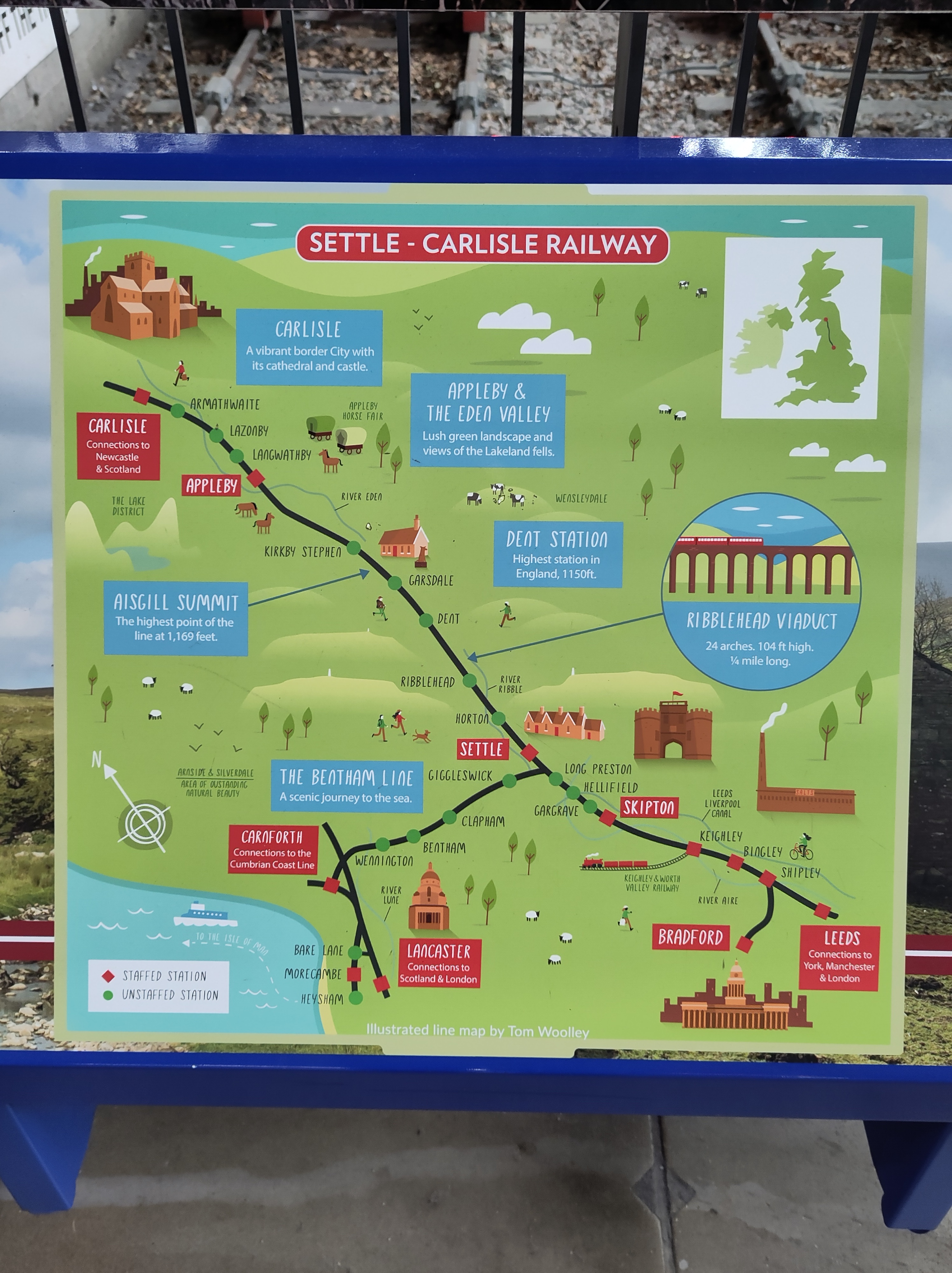
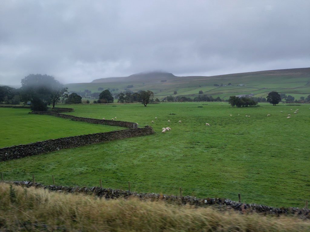
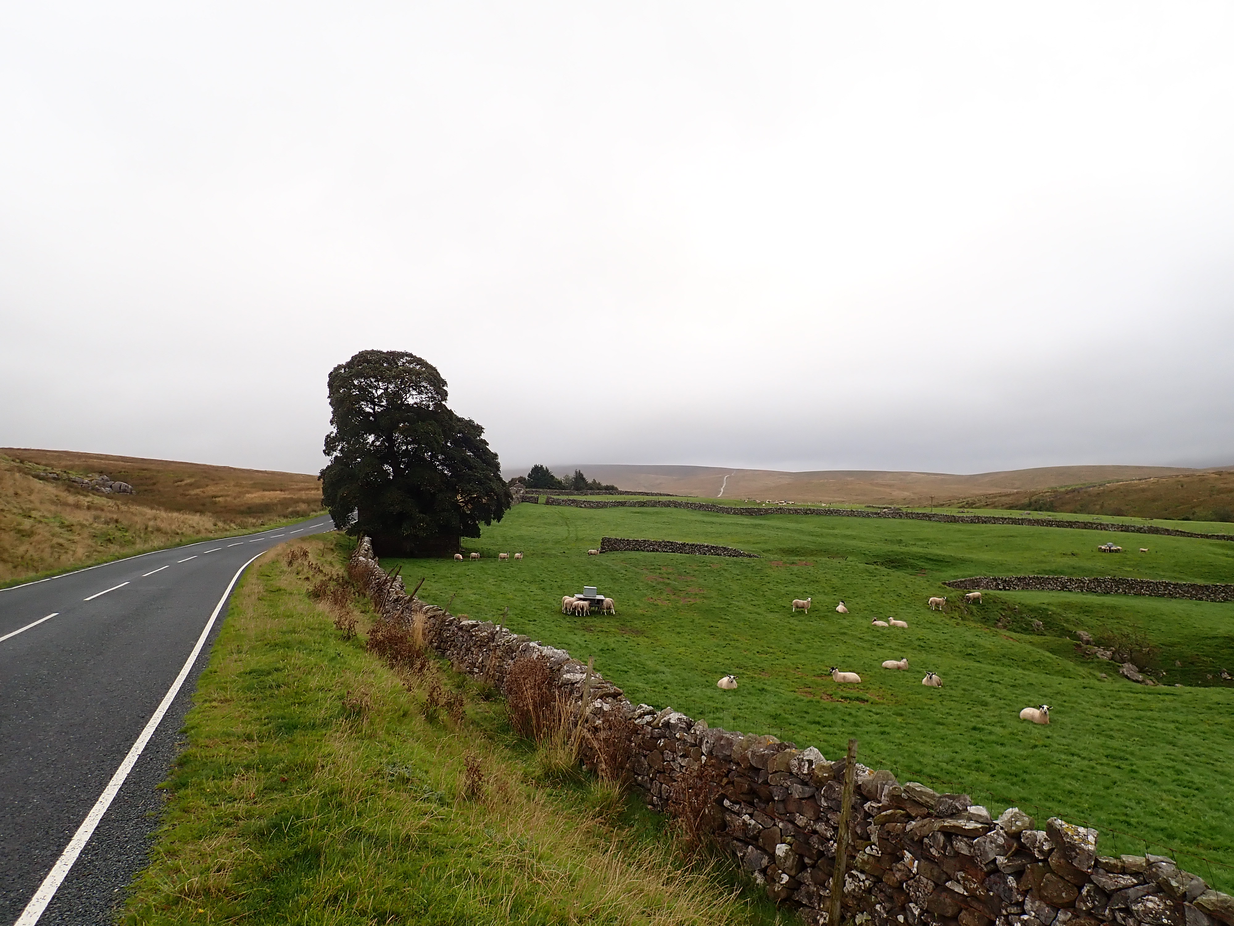
The Settle-Carlisle Railway was fantastic. There is an amazing variety of interesting and attractive things to see as the train heads through Yorkshire. The sights included old mills, green pastoral valleys, rivers, small towns, sheep grazing in fields bounded by drystone walls, moorland, limestone pavement and outcrops, and the peak of Pen-y-Ghent.

When I stepped onto the platform at Ribblehead there was low cloud, light rain, and a strong, cold wind. Looking along the length of the platform, I could see the slopes of Whernside, partly obscured by cloud. Despite the somewhat bleak weather, I was excited and eager to get going. I crossed the tracks and exited the station to walk down to the road.
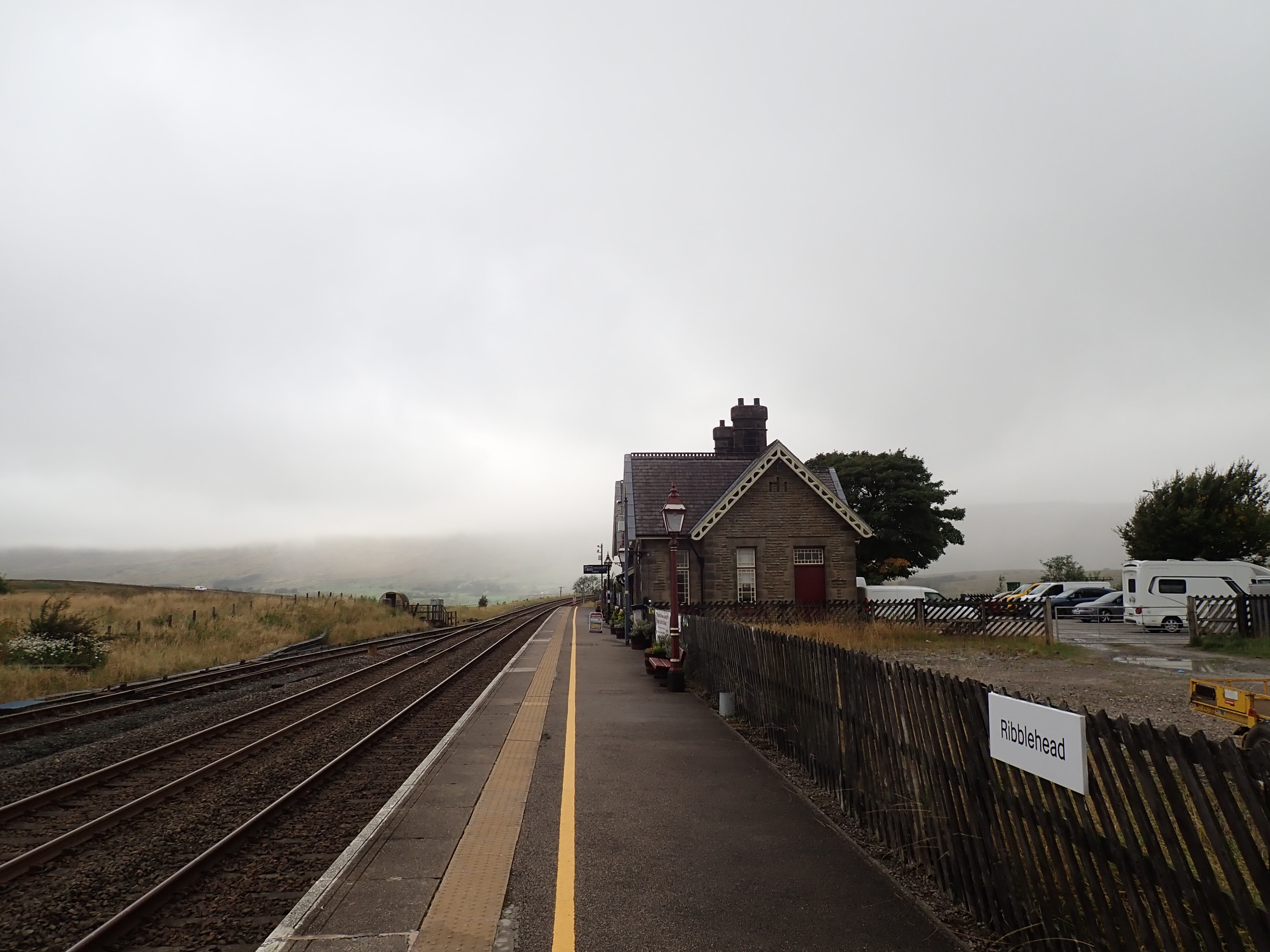
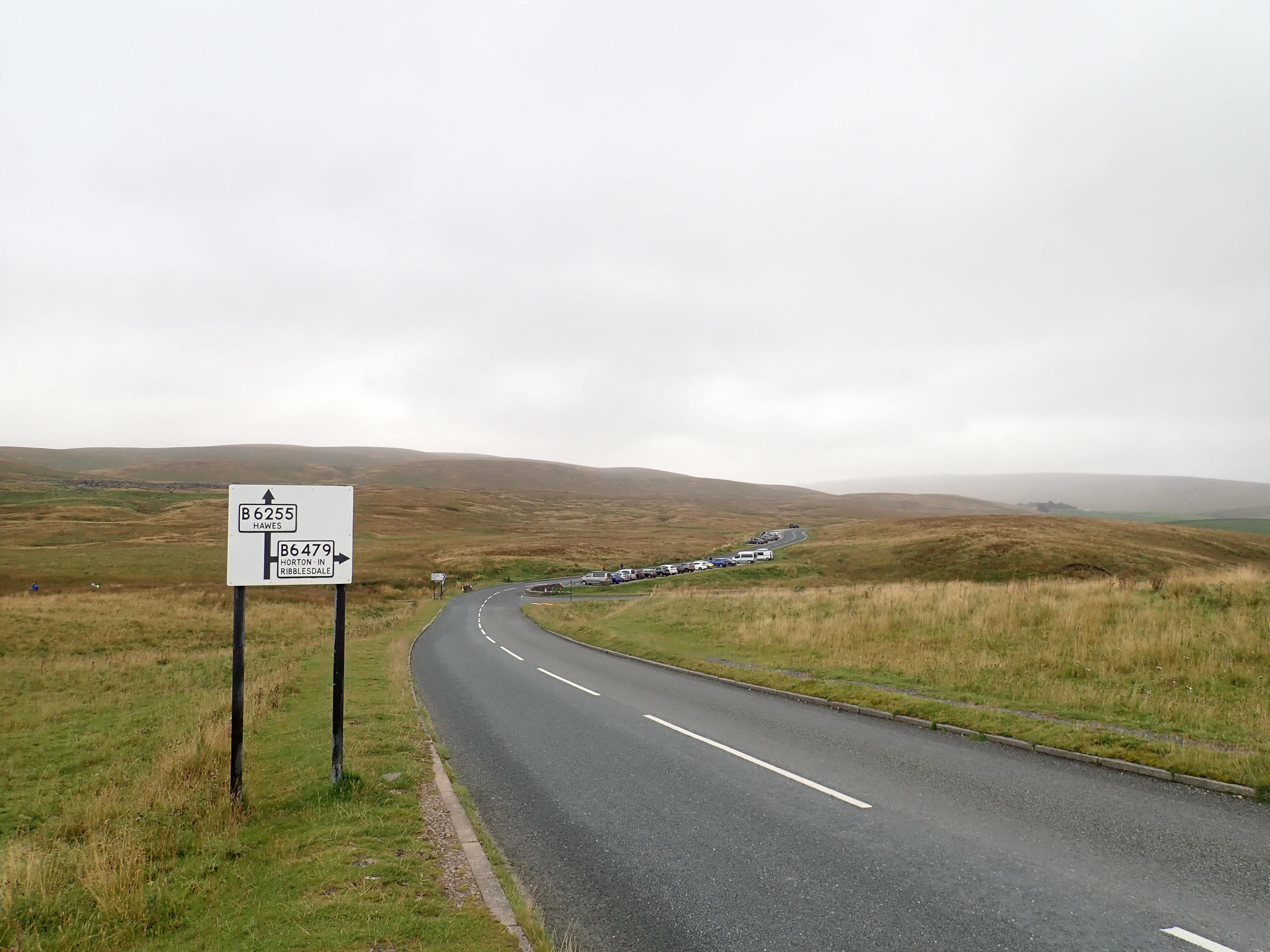
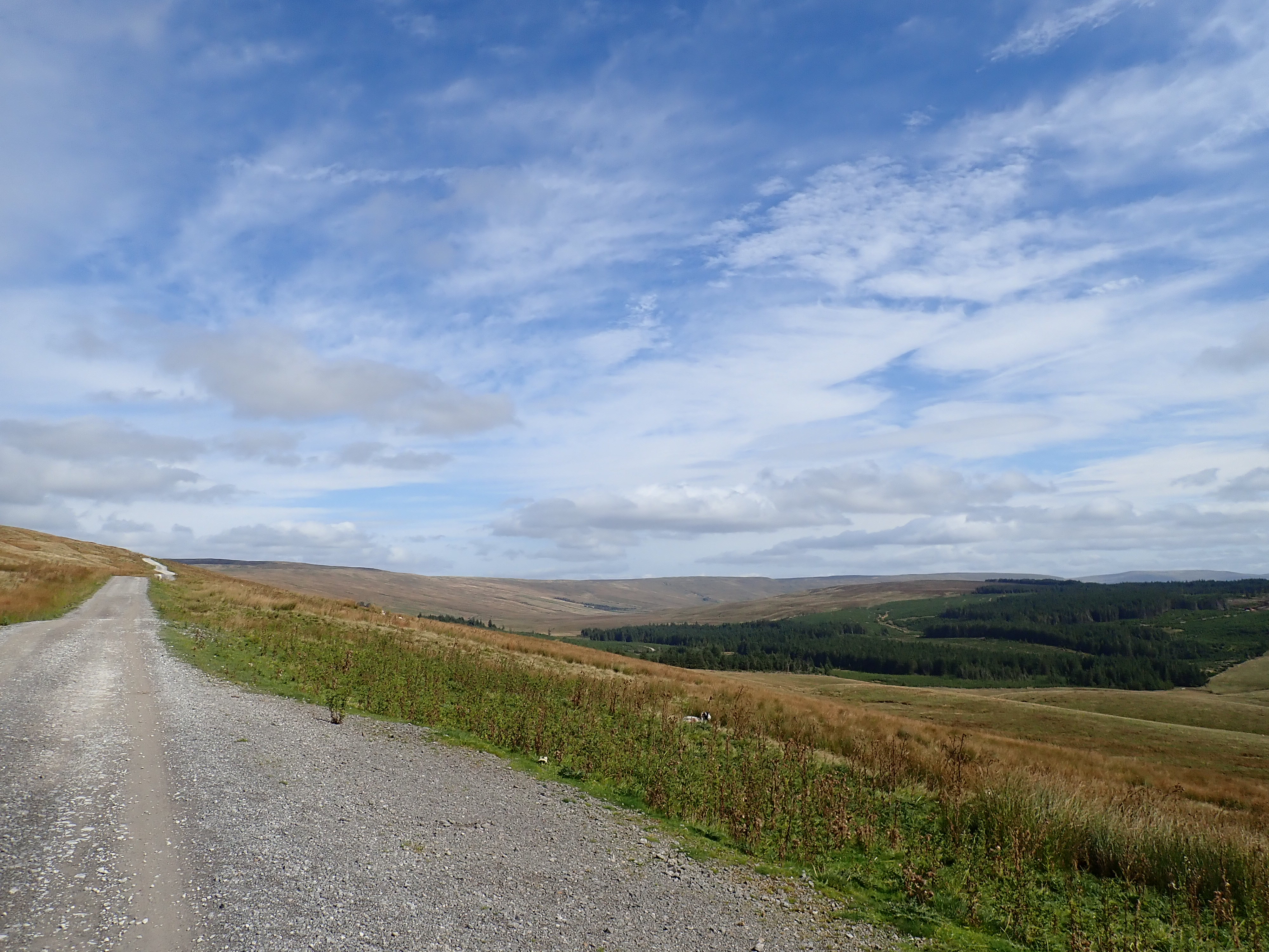
This was the part of my walk that I thought was likely to be the most uninteresting and might even be unpleasant. This is because the most direct and straightforward way to get to the other side of Ribblesdale was to walk along Blea Moor Road (the B6255). It’s a relatively busy road and drivers tend to take it quickly. Thankfully, it was straightforward to walk on the verge and most drivers gave me extra space. As the cloud began to lift, I could also enjoy views of the impressive Ribblehead Viaduct, Ingleborough, and down Ribblesdale. Although the walk seemed longer than it probably was, I eventually stepped off the Blea Moor Road onto a substantial track heading up onto Cam Fell.


This track follows the course of a Roman Road and is part of the Dales Way, and I’d be following the Dales Way all the way to Nethergill Farm. The 78-mile (126km) Dales Way runs from Ilkley to Bowness-on-Windermere. I walked the length of it 20 years ago with my Dad, but hadn’t walked this section of it since then. Being back on the Dales Way brought back fond memories. When I had been there two decades ago, I’d walked over this moor in cloud and light rain. This time I was pleased and surprised by the sights I got as the clouds broke up and the sun shone down. There were stunning views of Ingleborough, Whernside, Ribblesdale, and a grand sweep of moorland around me.

A convoy of Landrovers swept past me as I continued along Cam Fell. Later, there were prolonged barrages of shotgun blasts, and I saw red flags being waved on the moors.
There’s a forestry plantation that runs across the head of Langstrothdale here, and it was as I came close to it that I made a navigation error. When I was back home and tried to work out what had gone wrong, I found that the map that I had been using was 15 years old and didn’t include tracks running to, and through, Cam Woodlands. My mistake had been to take one of these tracks down from the moor instead of continuing along the Dales Way for a bit longer, and then descending. It was a frustrating, confusing, and time-consuming mistake. In the end, it was a gamekeeper in a passing Landrover who kindly pointed out how to correct my error.
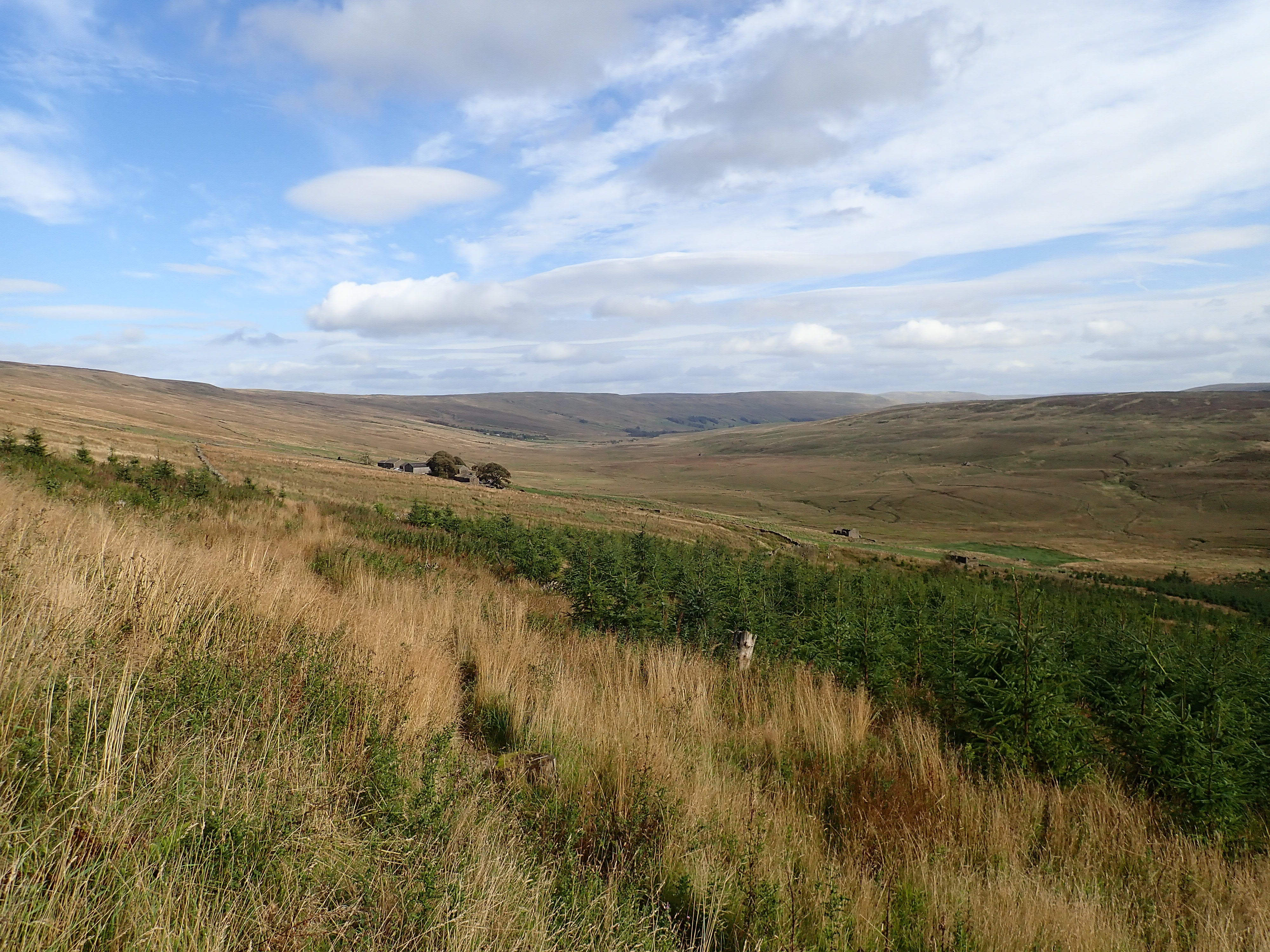
Once back on the Dales Way, I headed across the soggy moorland of Cam Pasture to the farm buildings of Cam Houses. Many of the Landrovers I’d seen earlier had been parked here and I’m guessing it was used as a base for the shooting. I followed the Dales Way between the farm buildings until I went through a gate to join a track that headed down Langstrothdale. Sitting by this gate, and looking very out-of-place, was a bright orange old snowcat. This was a Snow-Trac, a personal tracked vehicle that (so it says on Wikipedia) a design engineer for a Swedish farm equipment company called Lars Larsson invented in 1954 to take him and his brother on winter fishing trips. They were manufactured in Sweden between 1957 and 1981 (with some being manufactured in Scotland). I remembered this vehicle being here 20 years ago. I thought it looked in remarkably good condition, bearing in mind its age and that it was parked in the open. My guess is that it’s in full working order, and I imagined the fun someone must have running this Snow-Trac around the dale when there is deep snow.

Tracks and sometimes indistinct paths led me along the dale until I stepped onto a rough track at Swarthgill farm. I was feeling tired by this point and was glad that I could see Nethergill Farm in the distance. The dale looked pretty in golden sunlight, but I’d reached the point where I would be happy to stop.


Nethergill Farm is flanked by trees and sits on a gently rising slope a few hundred metres from a beck as it runs along the bottom of the dale. One end of the old stone buildings is the “nature barn” – an area for campers, with a kitchen, toilet, seating area, and internet. Outside this are a couple of picnic tables. Campers are allowed to pitch anywhere in the fields in front of the farm, and I was tempted by the idea of pitching nearer Oughtershaw Beck. However, the forecast was for rain and strong winds, so I pitched near the picnic tables in the hope that the nearby walls would give me some shelter.
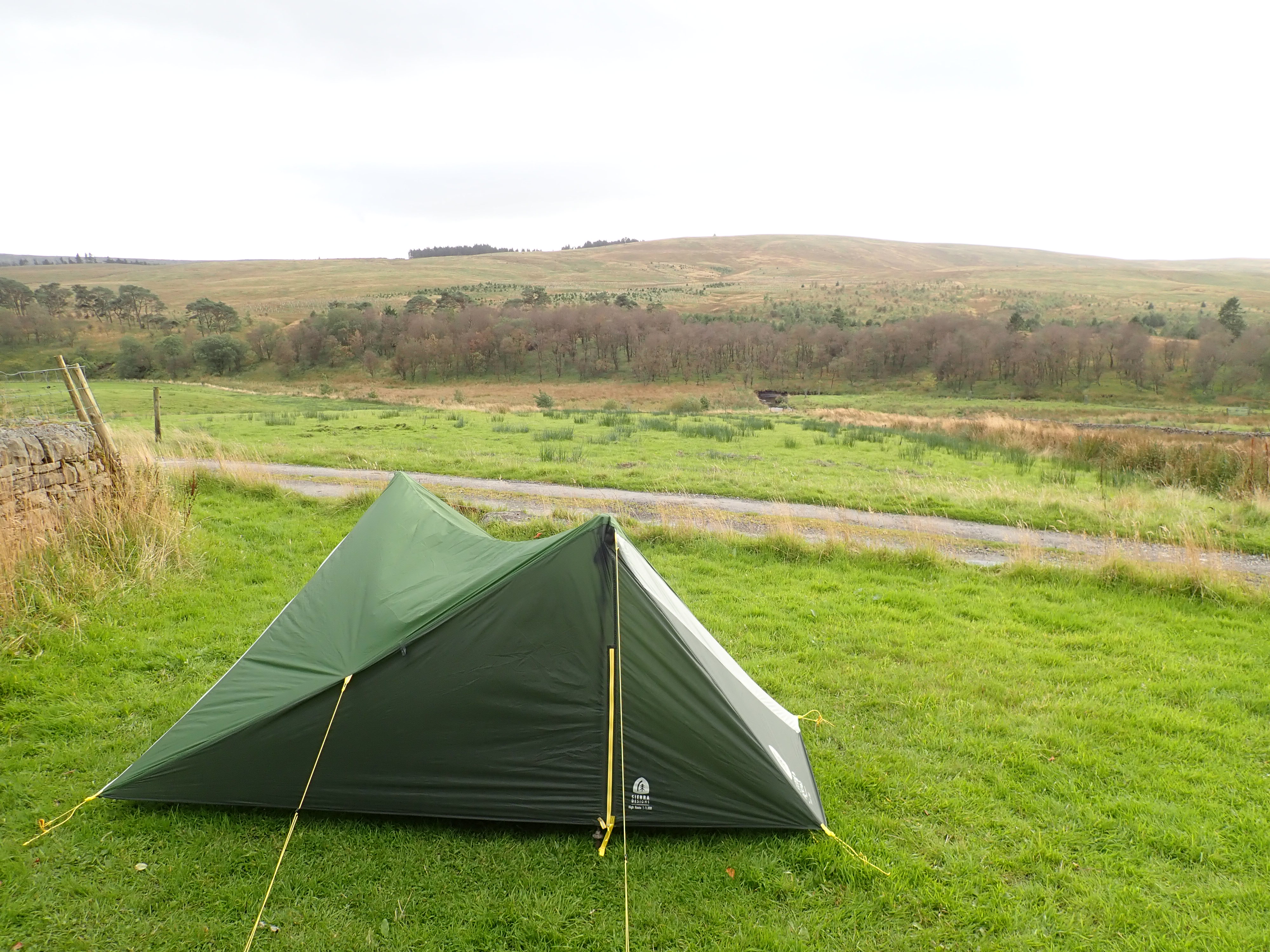
A couple of the farm’s chickens came to investigate as I cooked my dinner. They were amusing company, and I was happy to be there. However, the weather was slowly deteriorating, and I was a bit apprehensive about what the night would be like. Any hope of stargazing was certainly gone. By the time I zipped myself into my sleeping bag, my tent was being roughly shaken by the wind and its walls were drumming with rain. I didn’t think I was going to get much sleep.
To be continued…
UPDATE: 8 October 2024 – I’ve now written a post that continues and concludes the story of this walk. It can be read here.

I remember years ago me and my Dad being dropped off by my mother (I think in Barbondale) and us walking over that track to Ribblehead. Glad there’s weren’t any animal-killers on it the day we did it!
It’s a good route, but I did find the firing slightly disconcerting at times.
I was reviewing my comment this morning in bed – I don’t think we can have been dropped off at Barbondale as I’m sure that would bring us out the wrong side of Whernside for that route. Perhaps we were somewhere around Foxup or something when we started off…
Dear Robin,
I really enjoyed the photos, as always – and the Snow-Trac was a surprise. It was smaller than I expected, & looked as though it was a Lego design! Great fun. Thanks again for sharing the expedition, it really is a breath of fresh air.
Love, Diana
Interestingly I got massive Playmobil vibes….
Update soon on whether then tent stayed up please Robin!
Thank you.
The impression I have is that the Snow-Trac was conceived as a car that can go on deep snow and that this explains its small size. I agree that it makes it look a bit like a toy. Incidentally, Matchbox did make a toy of the Snow-Trac.
Best wishes,
Robin