
I’d enjoyed my wild camp near Malham. It had been in a fantastic setting and had gone well. I’d pitched my little tent and had my dinner in golden sunshine, under a blue sky. My mood wasn’t dampened by the clouds that formed as the sun began to set, nor by the wind growing stronger and colder. I simply accepted that I wouldn’t be doing any stargazing that evening, and went to bed early. Yet in the early hours of the next day, I woke up to find my tent full of silver light. I peeked out to see a full moon shining through in an opening in fast-moving black clouds. When the moon sank out of sight, I zipped my tent up against a raw wind and huddled back in my sleeping bag. A few hours later, I opened the tent again to find a low, slate-grey sky and a dank, sharp wind. This day was going to be different from the sunshine, crags and valleys of the first day of this walk.
My route away from Malham followed the track of Mastiles Lane for several miles across the moors. Mastiles Lane’s long history dates back roughly 2,000 years to when it was a Roman road. In mediaeval times Mastiles Lane connected a grange at Kilnsey to Fountains Abbey’s lands in the Yorkshire Dales. Wool was an important source of income for the Abbey, and Mastiles Lane was used to move the Abbey’s sheep to and from summer pastures on the moors. While only the stretch from Kilnsey to Malham is called Mastiles Lane, the monastic route continued north-west towards Fountains Abbey’s estates in the Lake District. Mastiles Lane returned to prominence in the 18th century when it was a significant droving route for cattle being brought south from Scotland.
Not far from Gordale Beck and near Low Stone Bank, Mastiles Lane passes through the centre of a Roman marching camp. It was built at the end of the 1st century AD, and I’ve found a couple of different explanations of why it was built. The first is that it was built during a campaign undertaken by Quintus Petillius Cerialis, Governor of Britain, to put down a rebellion by the Brigantes (the tribe who lived across most of northern Britain at that time). The second explanation is that it was built during the campaign of a later Governor, Gnaeus Julius Agricola, that conquered most of northern Britain. Whichever is true, this marching camp covers an impressive 8.2 hectares (just over 20 acres). Marching camps such as this were usually built by the legionaries at the end of a day’s march so that they had somewhere secure to spend the night. Roman marching camps like this one were rectangular. They consisted of a ditch, inside of which was an earthen bank topped with a palisade made of wooden stakes. They had between one and four entrances, and these were often given additional defensive works. The legionaries would sleep inside the camp in leather tents. To facilitate building these marching camps, the standard equipment for a legionary included trenching tools and wooden stakes. This was in addition to the weapons, armour, water, food, etc that they would have to carry on their march. All of this for a short encampment made my wild camping kit look very lightweight and low effort.
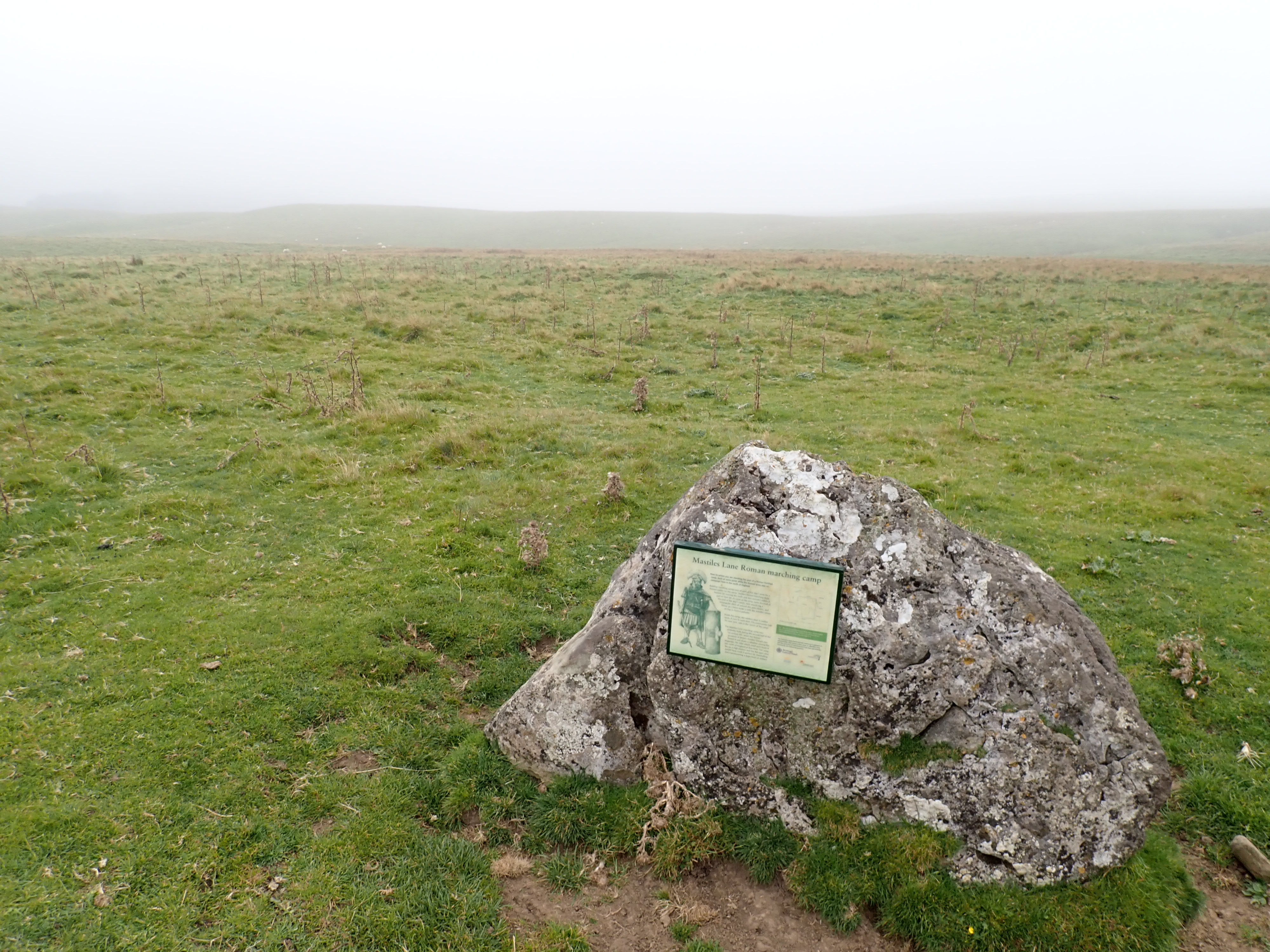
Close to the information board for Mastile Lane Roman marching camp is the stone base for a wayside cross. Like Nappa Cross which I had walked past the day before, this cross was erected in the medieval period to guide travellers over the moors and to reinforce the Christian faith among passersby. However, unlike Nappa Cross, this cross base is on the ground, and no one has added a new shaft to it.

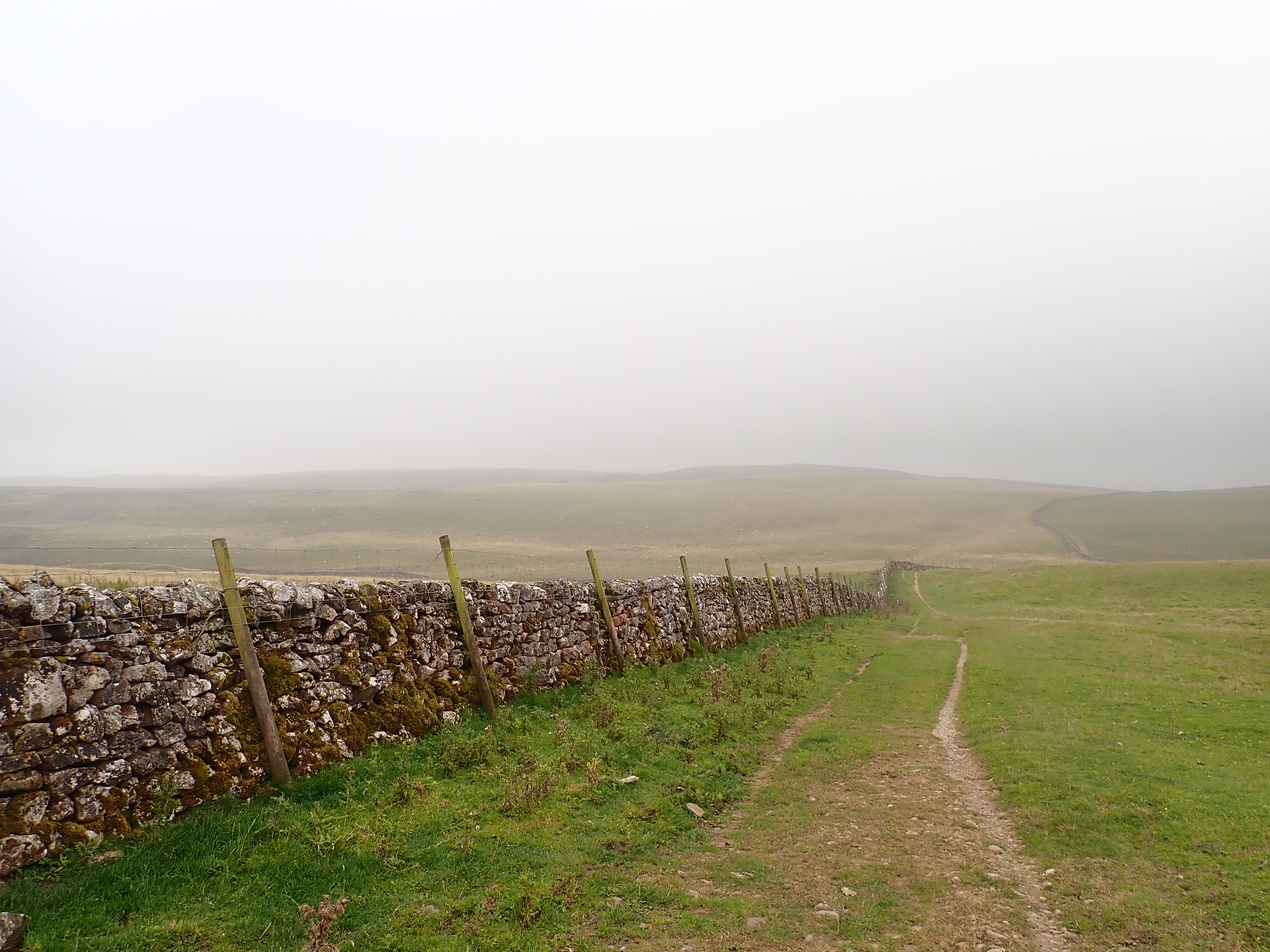
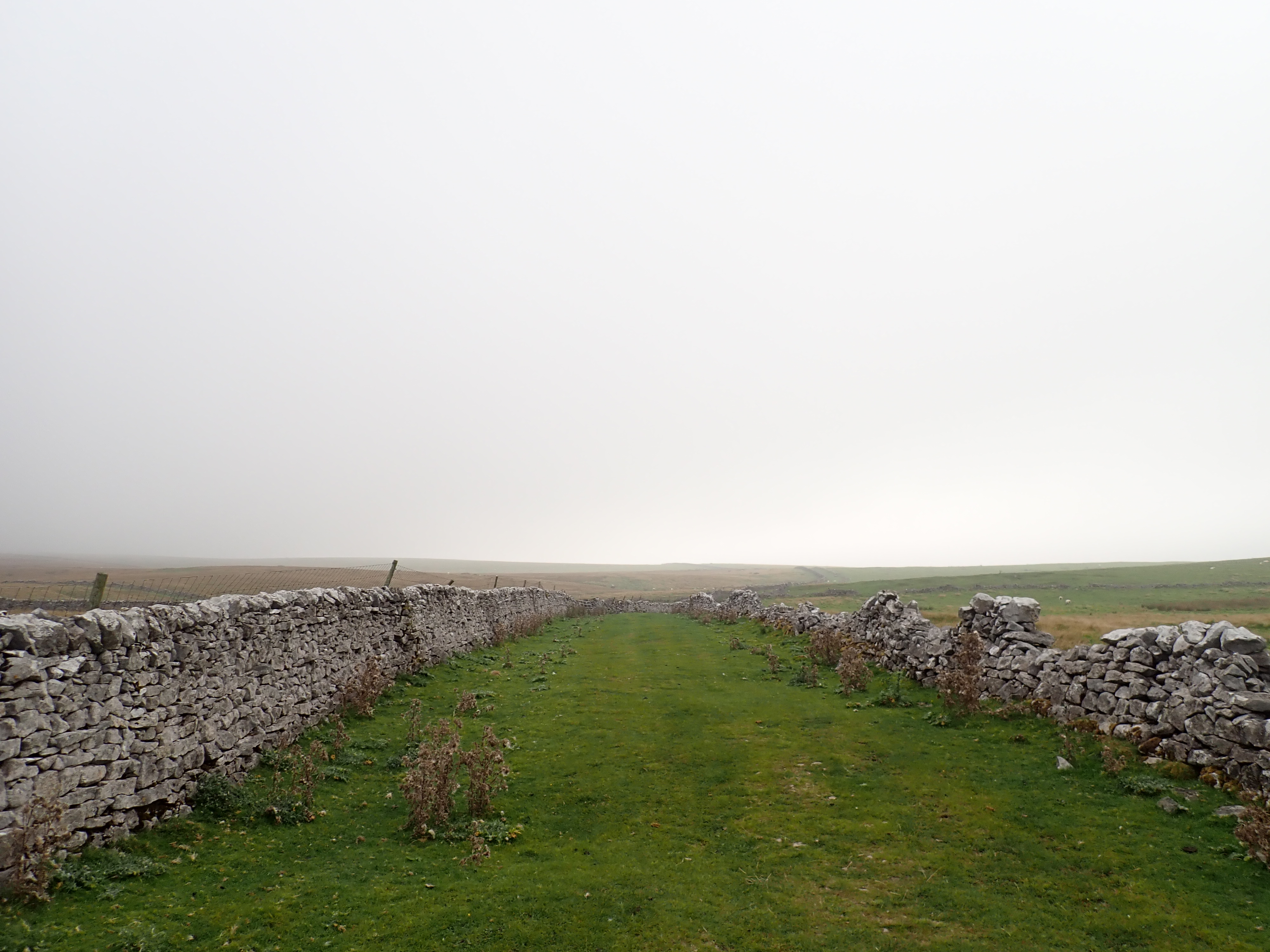
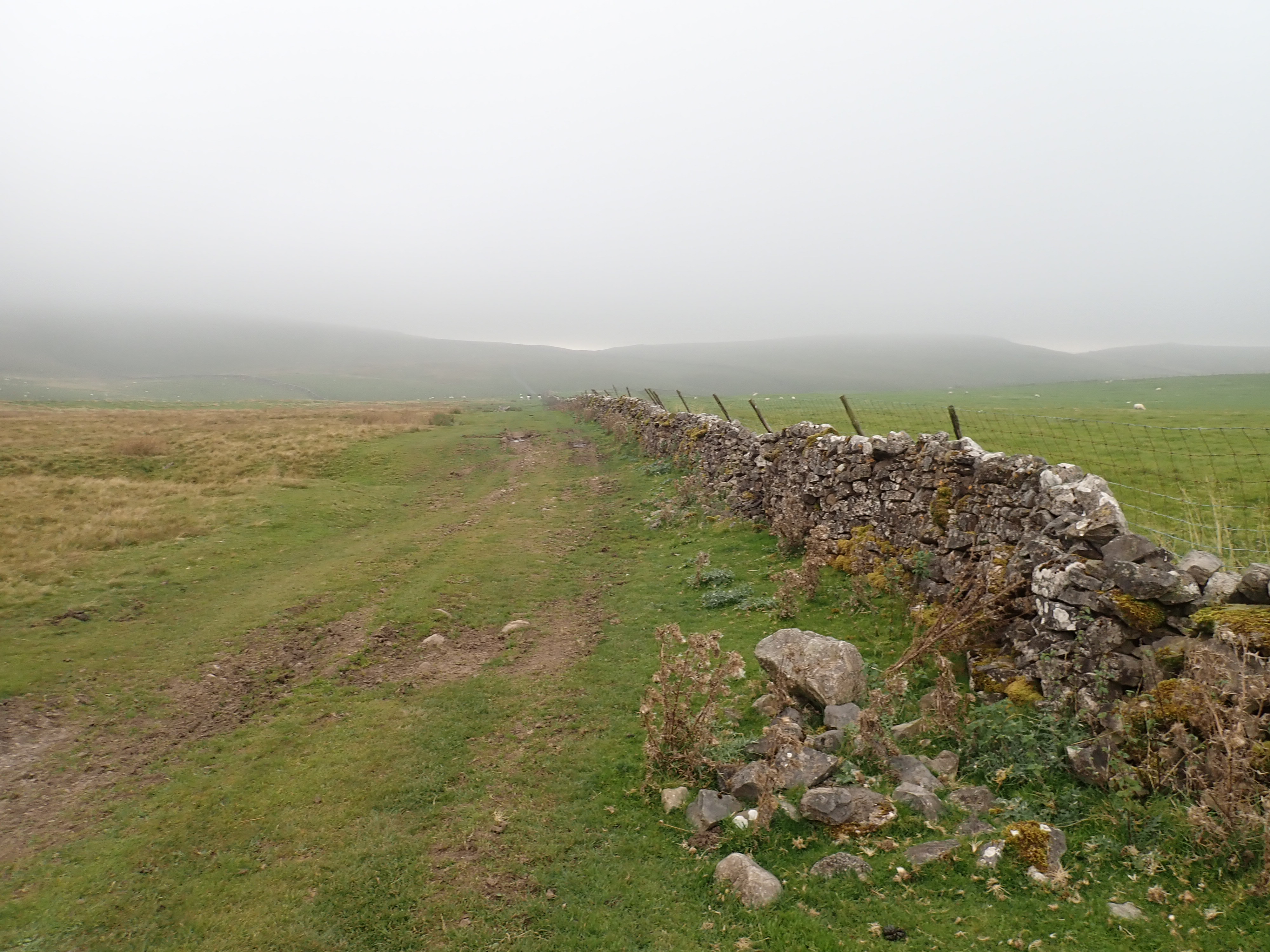
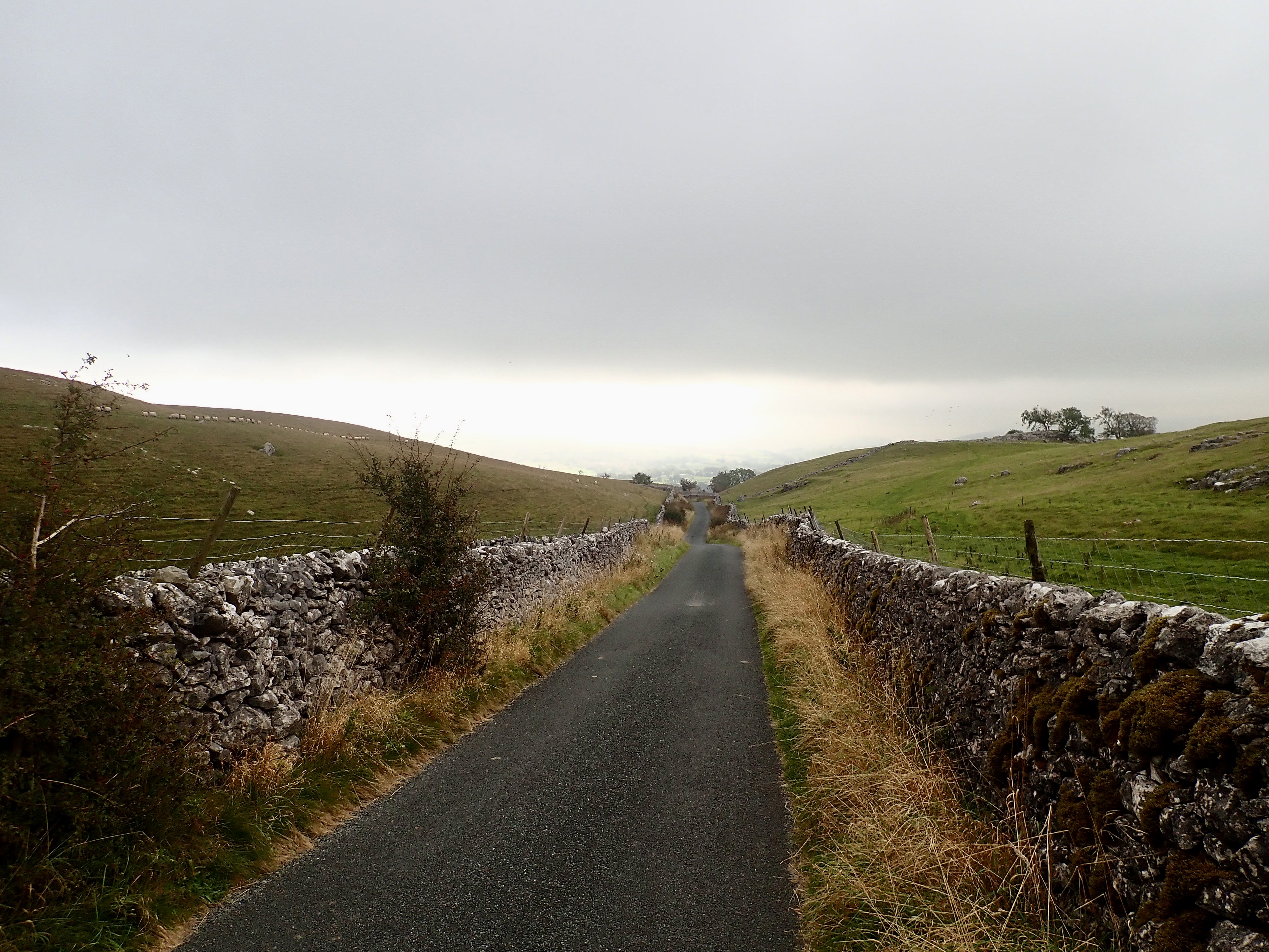
As you’d expect from a Roman road, Mastiles Lane takes a straight line over the rolling moors east of Malham. As I walked along it, I passed rough moorland and pastures with herds of sheep and cows. Grey clouds hung low in the distance and a chilly wind encouraged me to keep moving. I didn’t see another person the whole time I walked along Mastiles Lane, and this made me feel that I was somewhere more remote than I was.
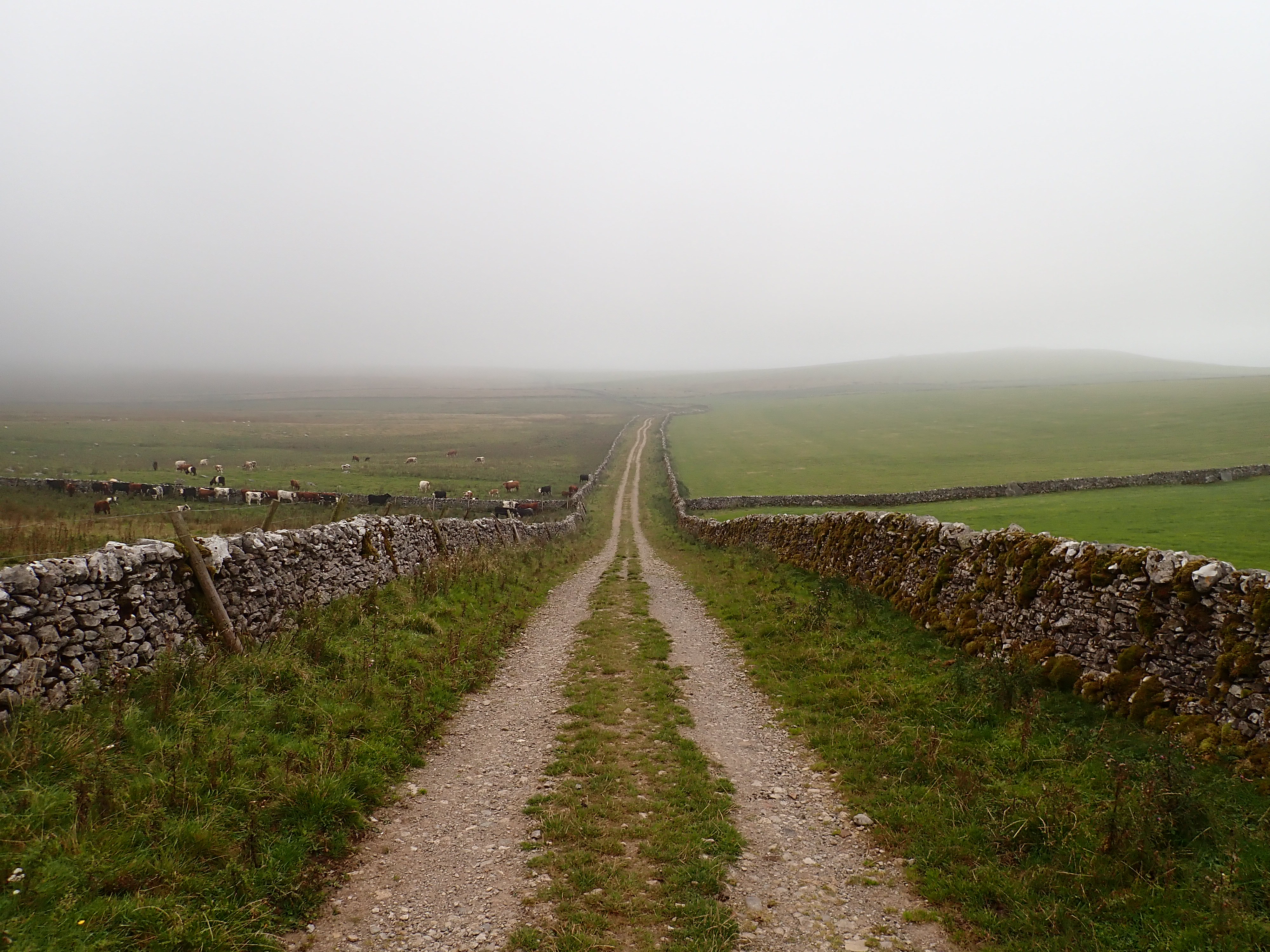
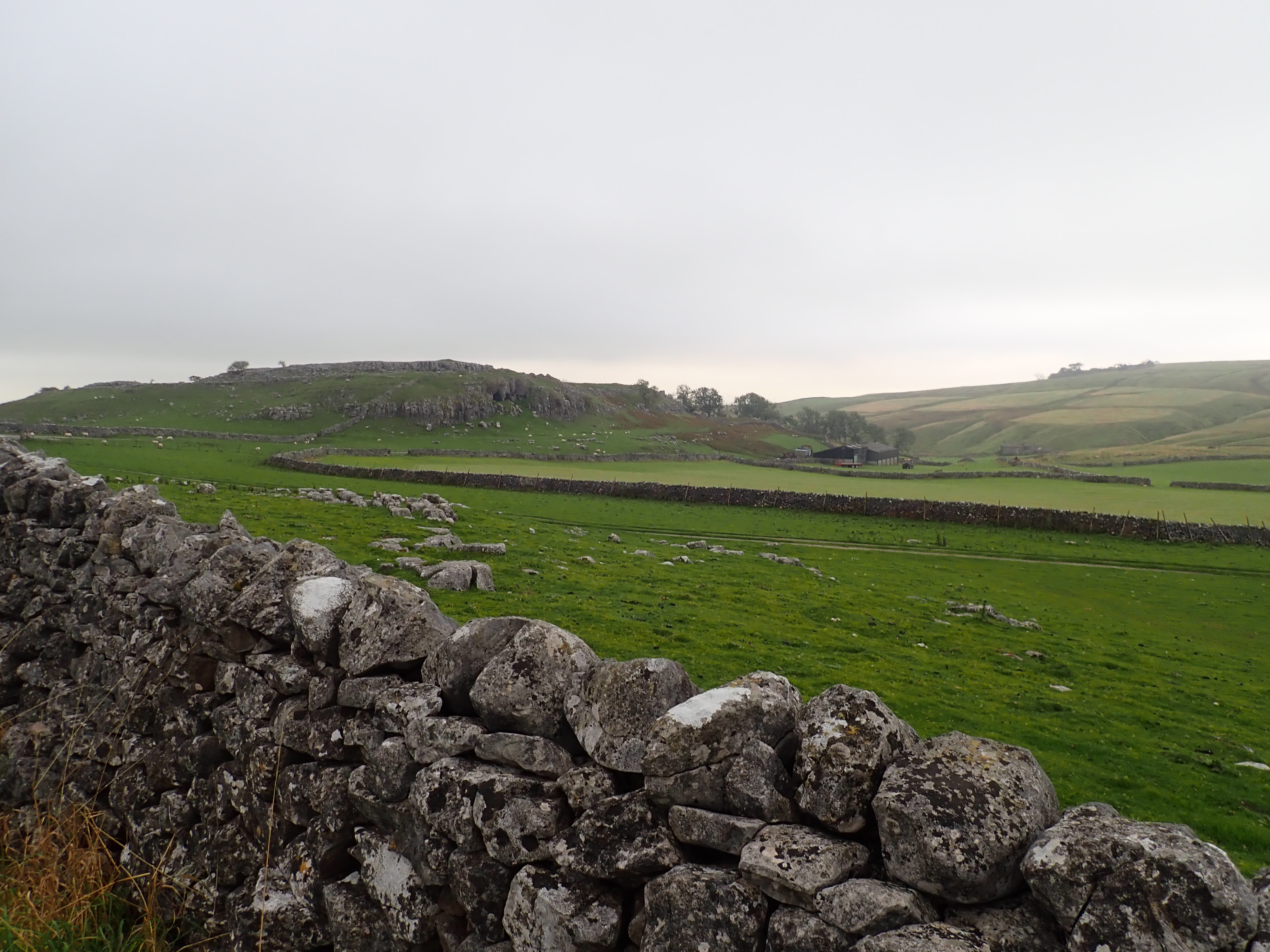
For most of its length, Mastiles Lane is either followed by a single drystone wall or is bounded by two drystone walls. I was intrigued by the large stones that occasionally made up the base of these walls. The way in which smaller stones had been carefully placed around these boulders to ensure a continuous wall looked like works of art. I couldn’t remember having seen drystone wall built this way before and so looked this technique up when I got home.

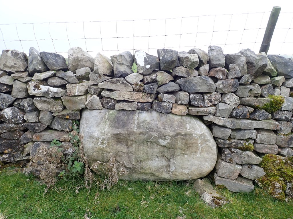
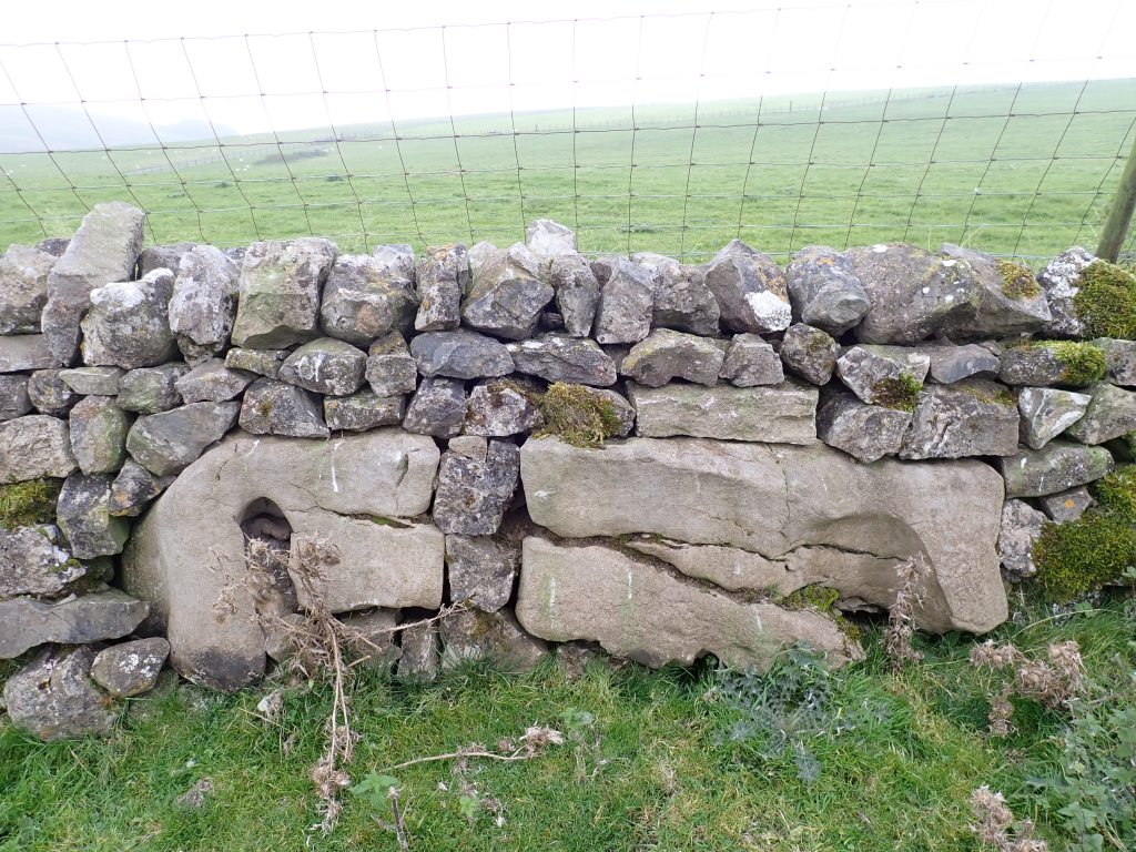
I learned that large, upright stones or slabs built into the lower part of a wall like this are called orthostats. The presence of orthostats in the drystone walls along Mastiles Lane indicates that these walls were built in the late medieval or early post-medieval period. As it was too difficult at the time to move such large stones without mechanical assistance, it was apparently usual to leave them in place and change the line of the wall to incorporate them. Basically, the builders didn’t move the stone to the wall, they moved the wall to the stone. However, the orientation, placement, and even stacking of some of these orthostats on Mastiles Lane makes me suspect that the builders must have put in the considerable effort needed to move some of them.
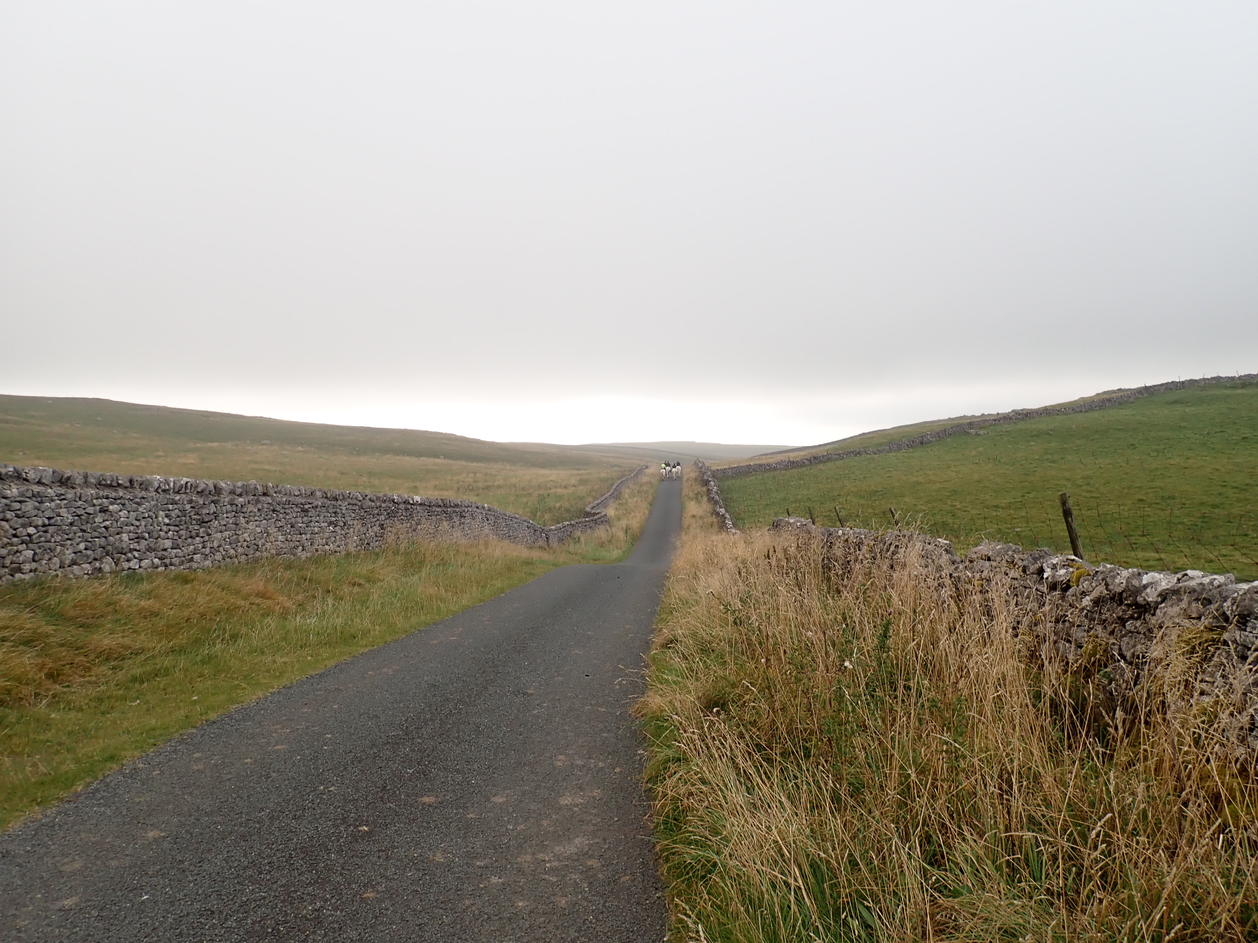
Eventually, I reached some dilapidated farm sheds at a wall junction where Tommy High Pasture meets Tommy Low Pasture and turned off Mastiles Lane towards Grassington. A group of horse riders who had been coming along Mastiles Lane in the other direction turned onto the same track not long after me, and we ended up shadowing each other for the next couple of kilometres. As we came a herd of cows, both the riders and I did a wide detour over the moor to avoid coming between the cows and their calves.
The occasionally rutted and muddy track we were on took a straight line down into a small valley. It then climbed steeply up the ridge on the other side by a rough road to reach Malham Moor. While the limestone outcrops around the Moor made the landscape feel a bit wilder, the well-maintained road that I joined at the crest of the ridge somehow made me feel like I’d left the remoteness behind.
At a crossroads with a footpath, the horse riders turned off the road and broken into a gallop towards Kilnsey. Not long after I saw the impressive, double arches of the entrance to Height Cave in a small, rocky hill just to the south of the road. My map shows that this cave is on access land, and so I was amused to see a hand painted sign on the gate to the nearby farm stating that there was an access exemption.
As I followed the road through an attractive little valley, I was pleased to see Wharfedale in bright sunshine in the distance. The road descended steeply as it twisted through rocky woodland, and then it rose and dropped again as it curved around Round Hill. As I came to the floor of the dale, I turned onto another lane to pass cottages at Skirethorns that looked so pretty and perfect that they could have featured in a tourist advert for the Yorkshire Dales.
The moors felt a long way behind as I crossed Spiredale Beck, stepped onto pavement, and followed it past houses with well-maintained gardens. In what felt like a very short time, I was at the main road that runs along Wharfedale and at the outskirts of the village of Threshfield. I was feeling a mixture of happy at having completed my walk, and sad that it was nearly over.
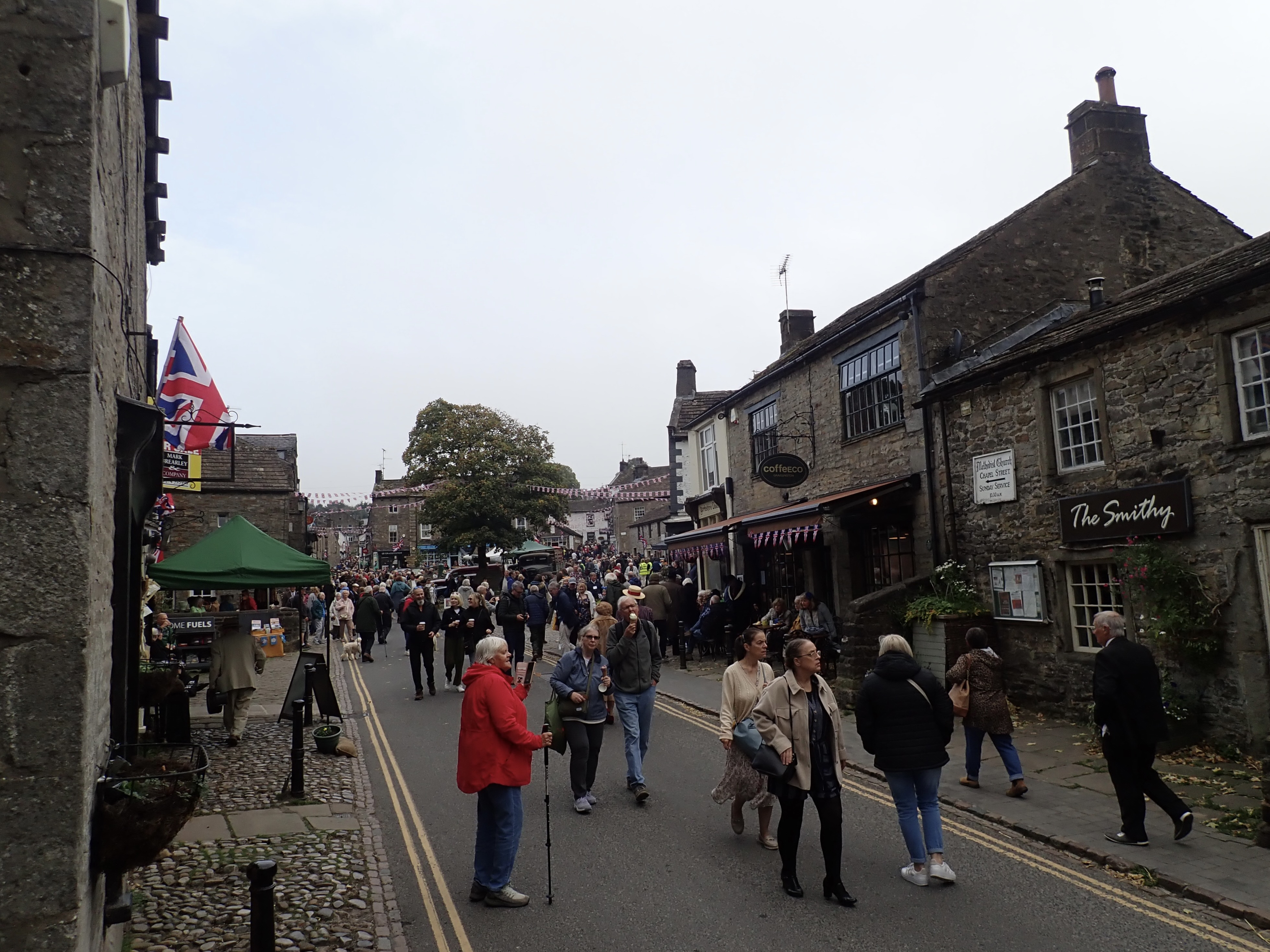
As I walked through Threshfield towards the bridge over the Wharfe, a World War 2 Jeep shot past. Making my way through Grassington, I saw people in vintage clothing and old military uniforms walking through the crowds. The village was decked out in Union Jack bunting and there were more vintage vehicles parked around. The end of my walk had coincided with Grassington’s 1940’s festival. It was fun, if slightly surreal, to walk through this as I headed to the bus station at the National Park Visitor Centre and the bus that would be the start of my journey home.

Nice moorland walking there – I must have walked at least some of those lanes but can’t remember now. I think I’d have ignored the ‘access exemption’ and nipped to see the cave.
It was. A good place to get away from it on the moors.
The cave looked interesting.
Dry stone walls are fascinating aren’t they, the history them and the men that built them
They are indeed.
I know a little about them from what I’ve read and having been involved in building a drystone wall once. However, I’m interested in knowing more. I occasionally think it’s something I’d like to do a course in, but I suspect (regretfully) that it’s one of those things I’ll probably not get around to. In the meantime, I’ll admire their construction, variety, and (the sometimes surprising) places where people have been able to build them.
That’s interesting that you’ve been involved in building one, I’m not too sure my back would last long if I were to try!
Well, it was a while ago. If I tried again, I think my back would be alright, but I’d need to be careful with my knees.
I walked a small section of Mastiles lane, passing the roman camp as well on our way to Malham Tarn from Lee gate. This was because Gordale Scar was frozen and I didn’t fancy the ice climb so we headed around the road. The lane was lovely and does have a wilder feeling than Malham and the tarn further on
That sounds like a glorious walk to do in the winter. Gordale Scar must have been impressive coated in ice. The moor must also have been dramatic.
Trying to get near to the waterfall was very difficult, as you turn the last corner to see the waterfall the floor was an ice rink with rocks sticking up through the ice. We manage to slither near to take a photo or two but the climb was not for us with the snow around it as well
Pretty, dramatic, and dangerous at the same time. I can understand why you didn’t go any further.
Hi Robin,
This is an invitation to join me on a zoom call to talk about climbing. It would be recorded and posted on my blog/substack/email list.
I’m looking for opportunities to reach more climbers. I’m a psychotherapist and climber and I’m trying to get climbers more into their heads. Among other things, I’m part of the AAC’s Climbers Grief Fund but I have not yet worked with any clients on grief, mostly just frustration, climbing, prosperity, and mental health.
I now work to understand all that i did and I think climbers should give more thought to that. You can see all the complicated things I do at my website, and you can listen to my interviews listed on this page: https://www.mindstrengthbalance.com/lincoln-stoller
LMK, thanks. – LS
Hi,
Sorry for the delay in replying.
Thank you for the invitation, but I’m afraid that’s it’s not my thing and I’ll need to decline.
Kind regards,
Robin