
I had the idea for this walk when I was studying a map of Nidderdale, trying to work out an interesting walk that both went somewhere I had not been before and which might be suitable for a day with a weather forecast of constant rain. I noticed a footpath running along a section of the embankment of the disused Nidd Valley Railway, and wondered if it would be possible to do a walk that followed as much of this old railway line as was possible.
The Nidd Valley Railway opened in May 1862 and ran along Nidderdale in the Yorkshire Dales. This branch line started at Ripley Junction on the Harrogate to Ripon Line, and finished 18.5km (11.4 miles) later at Pateley Bridge in the middle of the dale. It was a single-track railway line with a turntable in Pateley Bridge to turn the engines around for the return journey. Pateley Bridge was also where the Nidd Valley Railway met the Nidd Valley Light Railway, which carried cargo and passengers further up the dale for the construction of the reservoirs in Upper Nidderdale.
In addition to providing this vital transport link for the building of these reservoirs, the Nidd Valley Railway brought coal, grain, and construction materials into the dale. On the return journey it took out linen, lead, limestone, and milk. The Nidd Valley Railway also transported gritstone slabs and blocks from Scot Gate Ash Quarry (AKA Scotgate Ash Quarry) on the slopes of the moor to the north of Pateley Bridge. This quarry was a source of Delph Stone; a particularly strong gritstone that was used in the platforms of Scarborough, York, Holyhead, London Victoria, and London Paddington stations. It was also used in the National Gallery in London and the Station Hotel in York. A couple of years ago I did an interesting walk that went up to the remains of Scot Gate Ash Quarry via the incline of the disused tramway that took this stone down to Pateley Bridge station.

When the Nidd Valley Light Railway closed in 1936 with the completion of the reservoirs, there was a reduction in passengers and freight on the Nidd Valley Railway. Competition from a bus service linking Harrogate to Pateley Bridge further reduced passenger numbers. This resulted in the closure of the line, with the last passenger train running in March 1951 and the last goods service running in October 1964.
This wasn’t entirely the end of the story of the Nidd Valley Railway. In 2013, the Nidderdale Greenway walking and cycle way was opened along a section of the disused Harrogate to Ripon Line and the section of the Nidd Valley Railway between Ripley Junction (not far from the village of Nidd) and the A61 outside the village of Ripley. There has been feasibility work done on extending the Nidderdale Greenway to Pateley Bridge, using the route of the Nidd Valley Railway as much as possible.
The challenge with my idea for a walk along some of this route was that much of the route of the railway line is on private land (often farmland) which is not open access. There are also few public footpaths that follow the disused railway line (presumably because allowing a footpath along what would have been an active railway line would have been quite dangerous). The footpath that had caught my attention when I was studying the map does go along the line of the Nidd Valley Railway as it passes through Low Hall Wood. This is part of the section of the line that sits roughly between Glasshouses and Swarcliffe and which ran on the south side of the River Nidd. Looking along this southern section of the line, I noticed on the map that there was a footpath that runs parallel to the disused railway line for quite a way and so decided to focus my walk in this area.
My plan was to start the walk in the village of Glasshouses and then follow the route of the Nidd Valley Railway as closely as I could to where it comes near to the River Nidd between Dacre Banks and Darley. An inevitable issue with using a rail line as the basis for a walk is that it makes the walk linear. Therefore, to minimise the amount of my return journey that would be retracing my steps, I decided to follow the River Nidd as much as possible on my way back. I had followed some of this route when I walked the fourth stage of the Nidderdale Way between Bewerley and Birstwith a couple of years ago, and so knew it to be very pleasant.
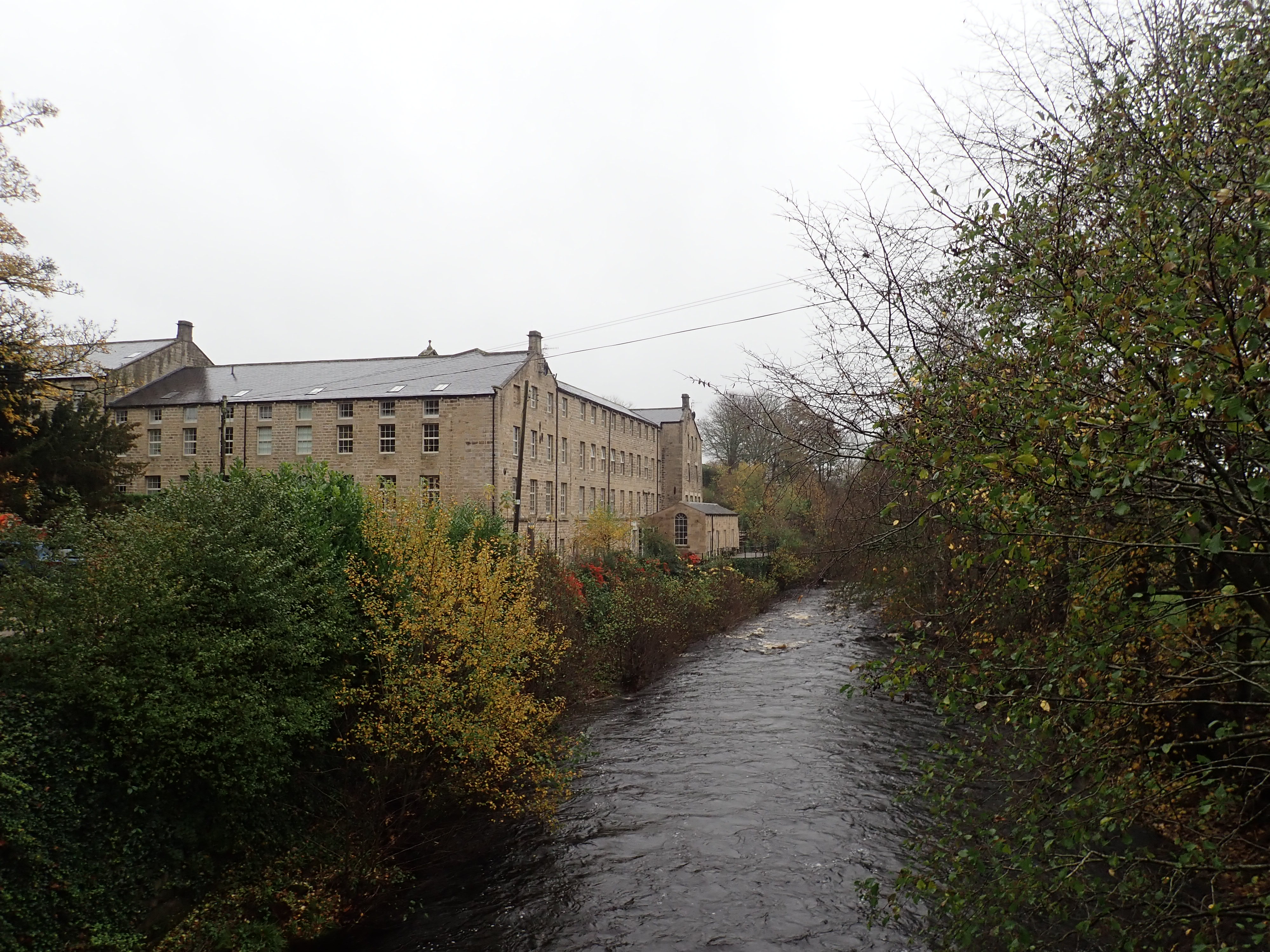
I parked by Glasshouses Mill, a substantial Grade II listed building next to the River Nidd. The mill had been built in the 19th century and closed in 1972. A few years ago, it had been converted into apartments as well as mews and townhouse style homes.
The forecast had been right about the incessant rain that was falling out of dull, grey, low clouds. I crossed the swollen Nidd by Glasshouses Bridge and turned to walk up a small lane heading down the dale.
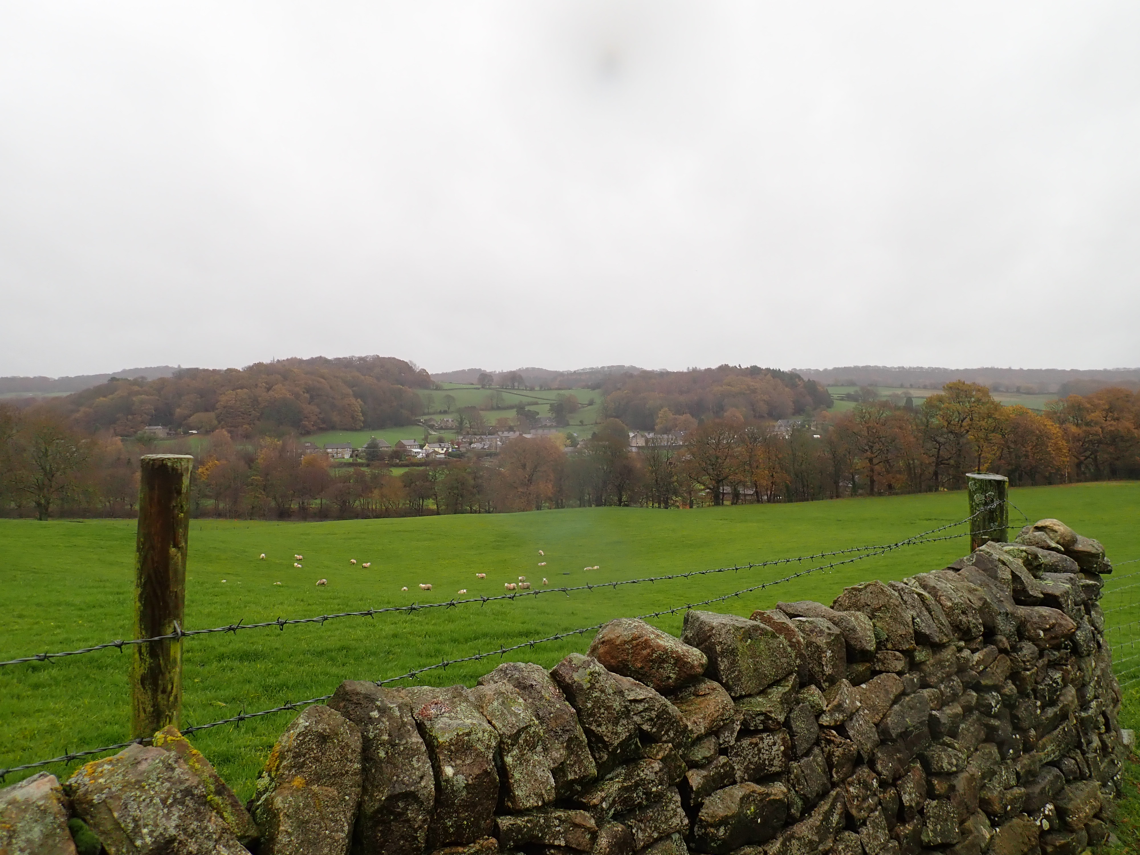
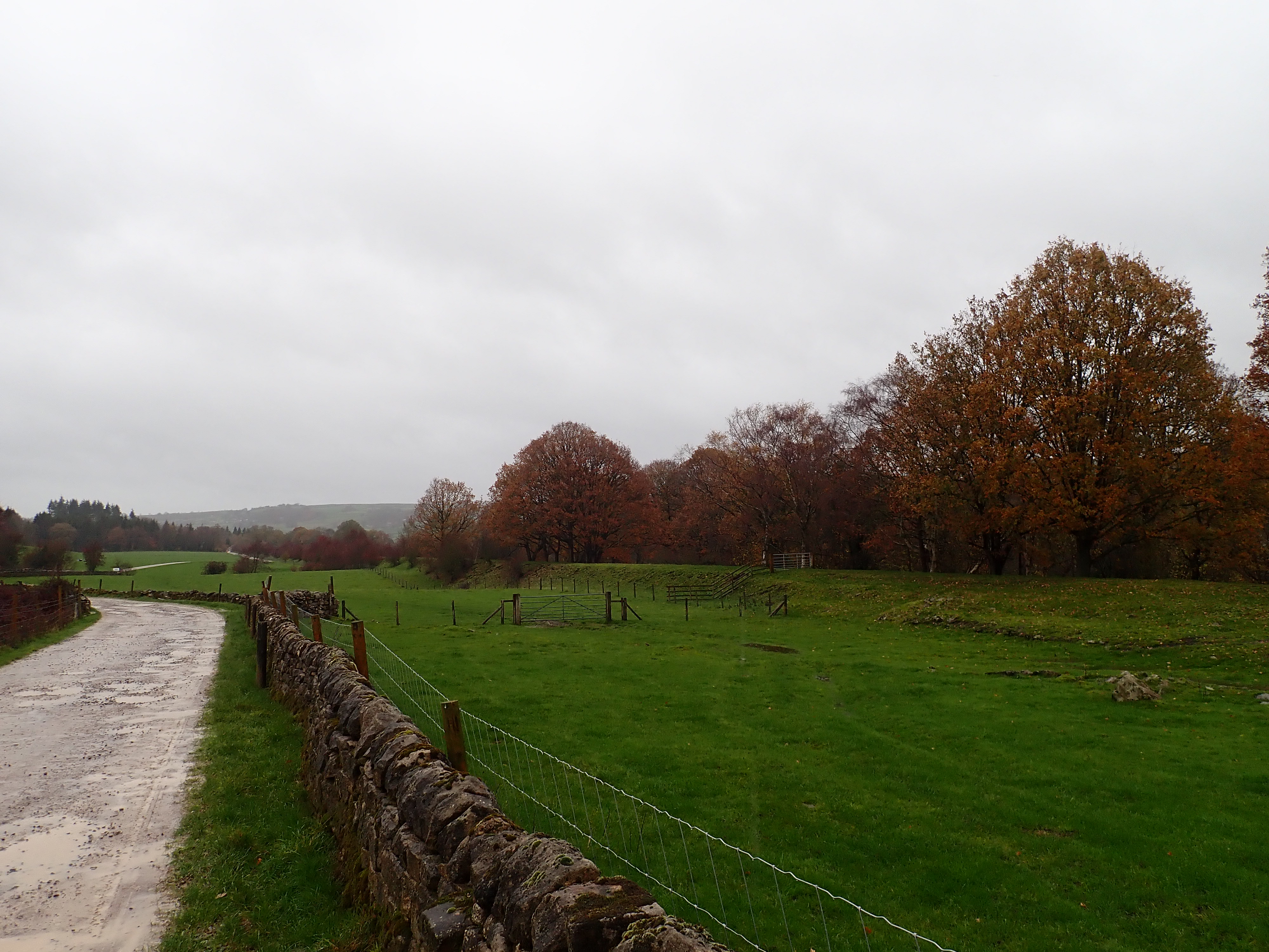
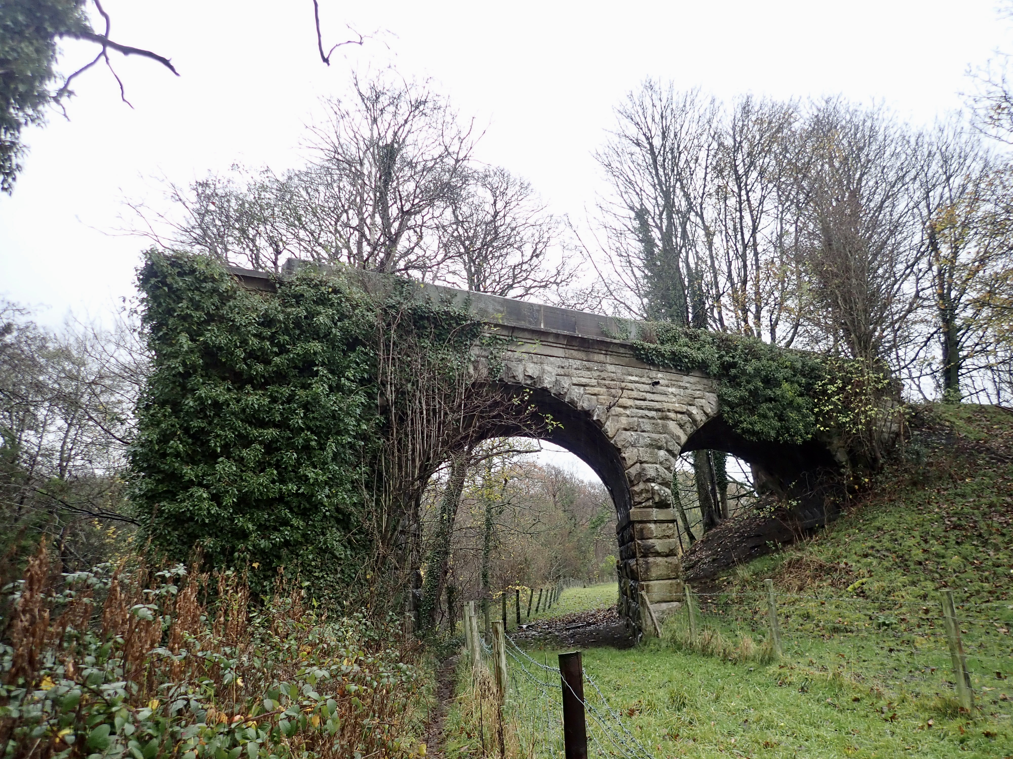
The lane rose up the side of the dale and then curved past the entrance to Harewell Woods Farm. It then became more of a track as it traversed above sheep pastures. At a point where the track came close to trees and a drop down to the Nidd, I could see in the distance the remains of a viaduct over the river and the embankment of the Nidd Valley Railway heading along the valley. There were good views across the dale from here, including towards Brimham Rocks, but the rain gave the views a grey, washed-out look.

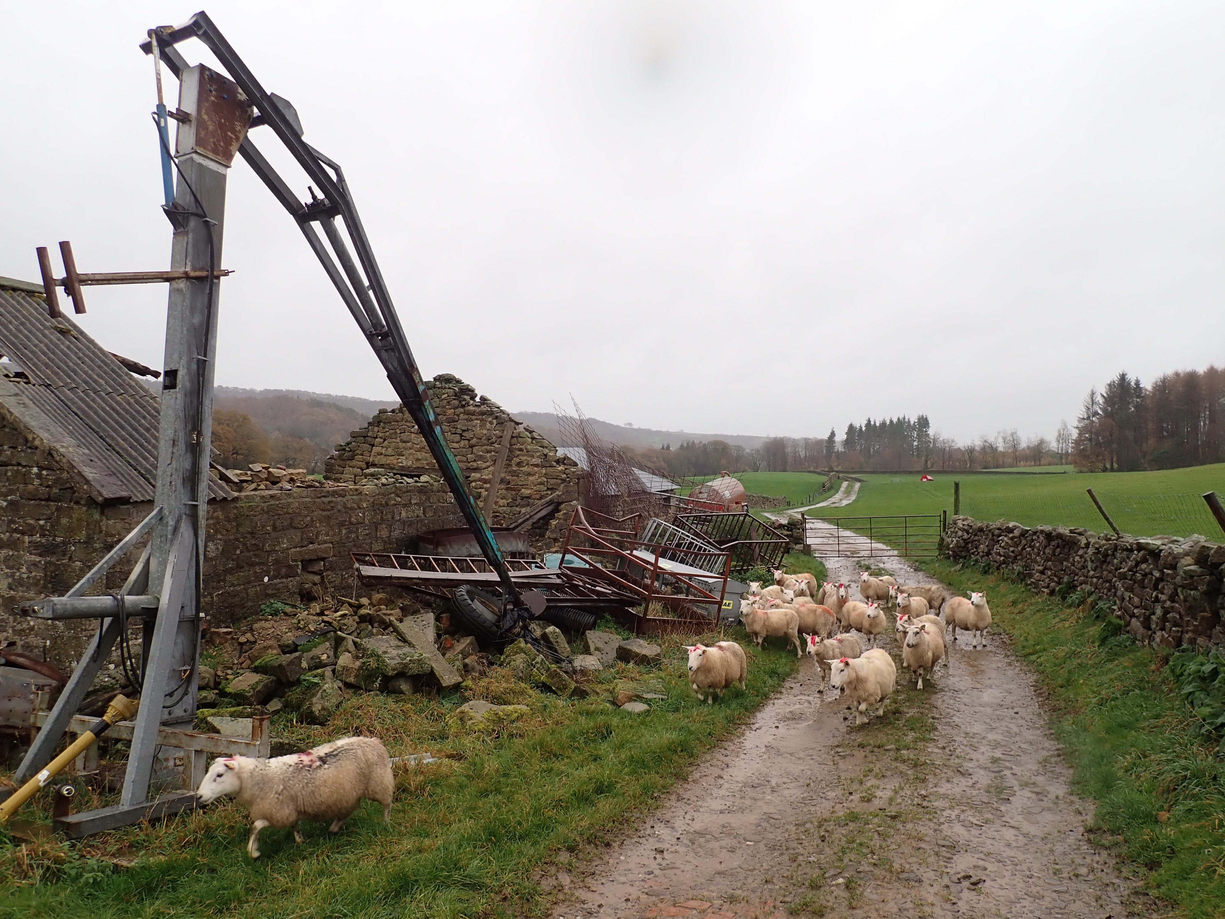
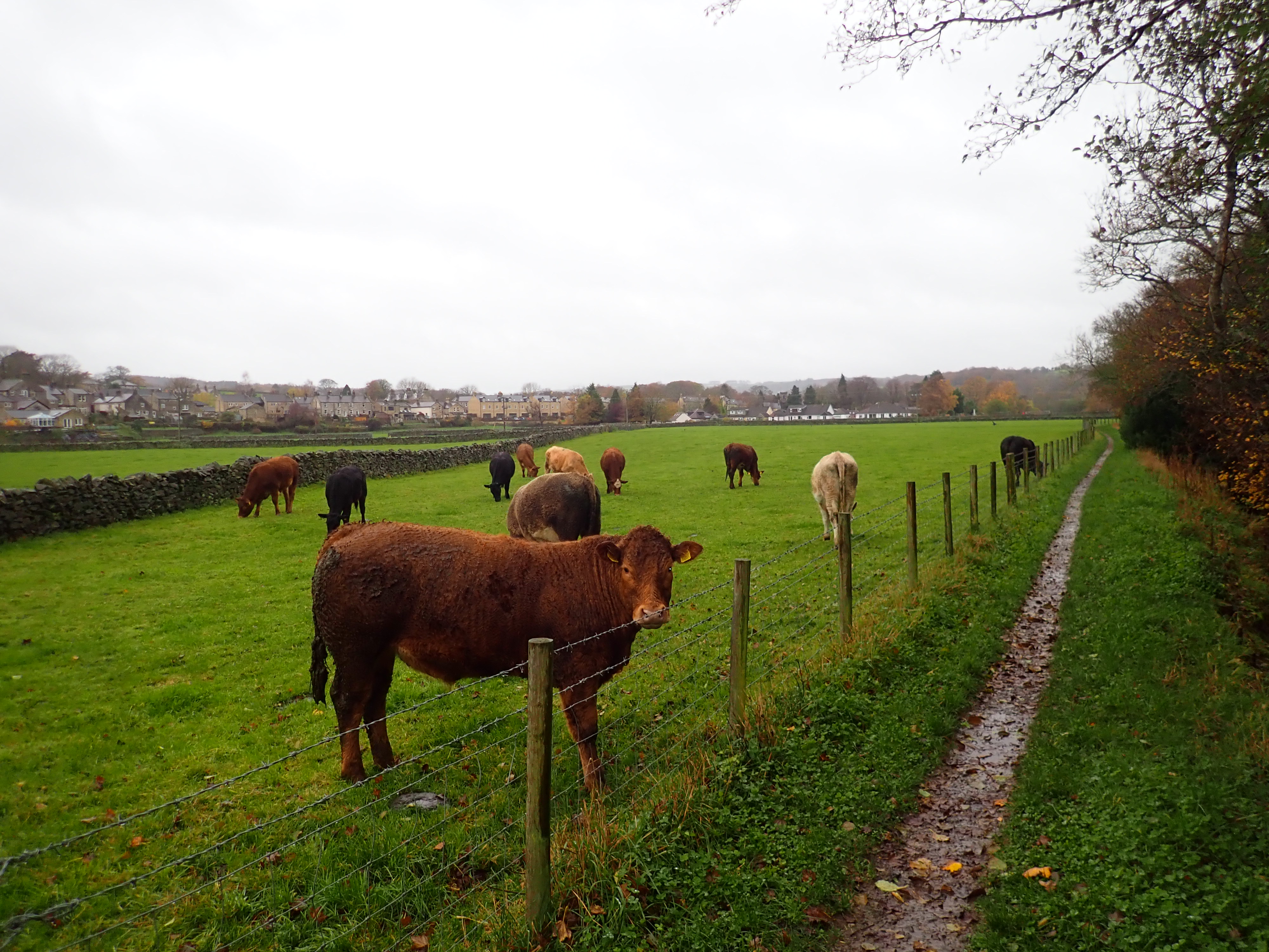
This track took me to Harewell Hall, where modern farm buildings sit next to a grand, 17th century stone house. I crossed the muddy yard to go through a kissing gate and down a lane enclosed by drystone walls. There was a small herd of sheep stuck between the walls and gates of this little lane, and I wondered if they had all managed to escape from a neighbouring field or had been put in the lane for some reason. The sheep looked at me for a while as if they were pleased to have company, and I slowly walked past to avoid spooking them.
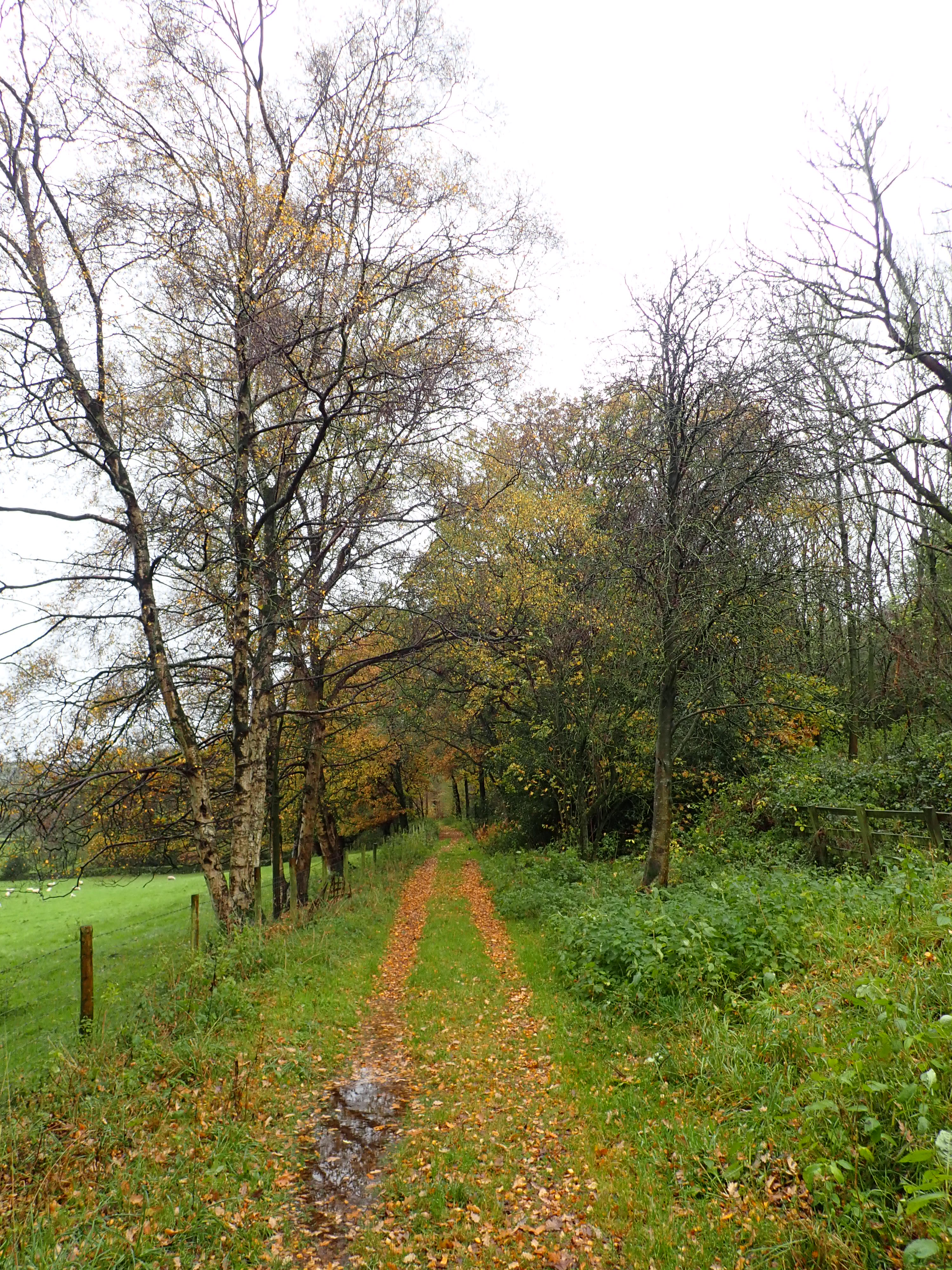
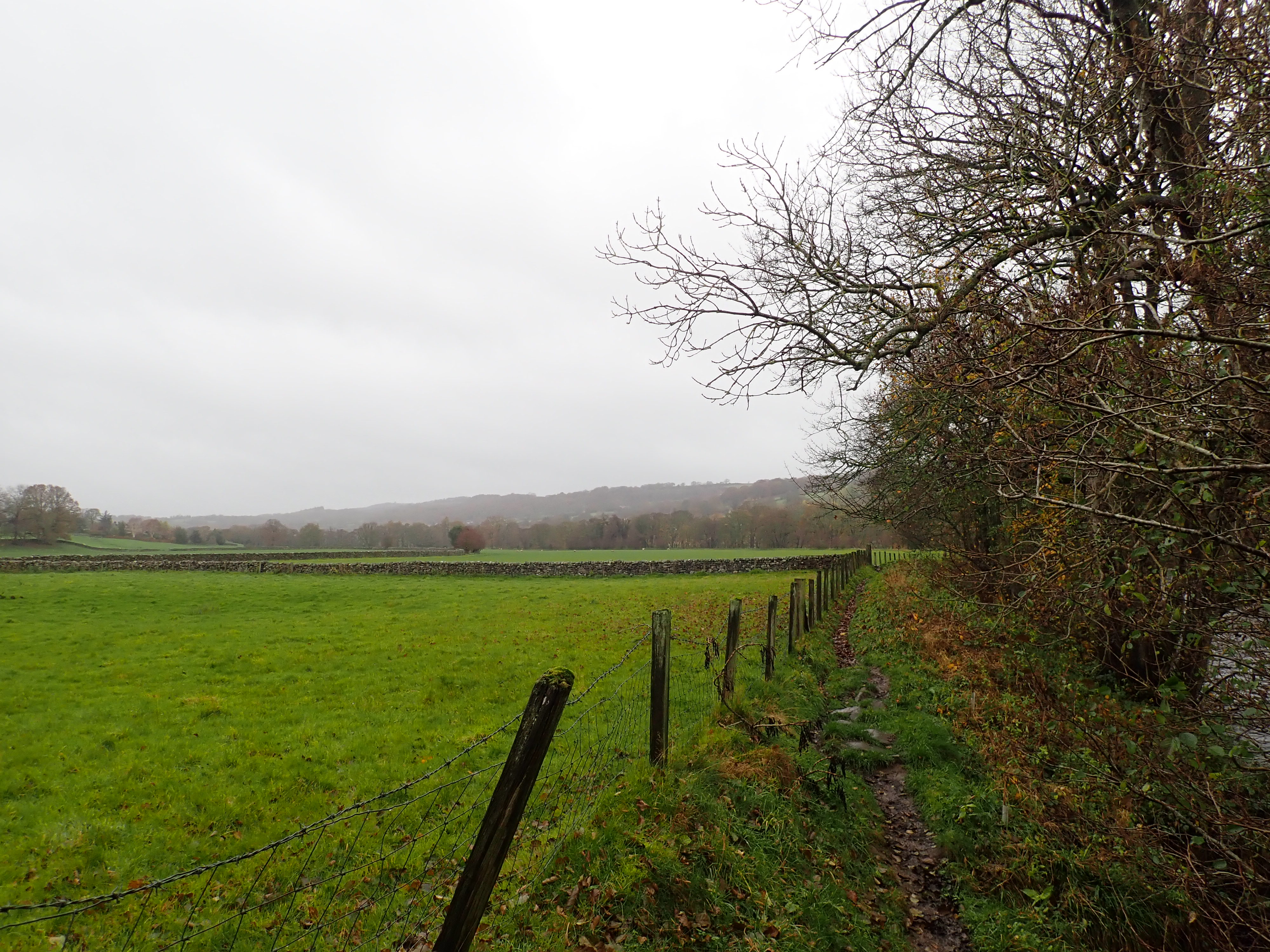
My footpath carried on down the dale. My map showed that the line of the Nidd Valley Railway was running parallel to me a little further down the slope, but I couldn’t see any sign of it. However, when I got to Lead Wath Wood I could make out through the trees what looked like a bridge over a beck. This was the point on the walk where I first came to the old railway line, but it was far from obvious. The flat ground that had been the track bed many years ago now had on it a sawmill and a cottage. It was only when I came to the edge of the wood that the line became clear as an embankment ran arrow-straight away from me across the fields.


I followed a track that kept close to this embankment for about half a kilometre to where the embankment and track then curved to cross each other. The line of the railway carried on along a tree-lined cutting through a small hill.

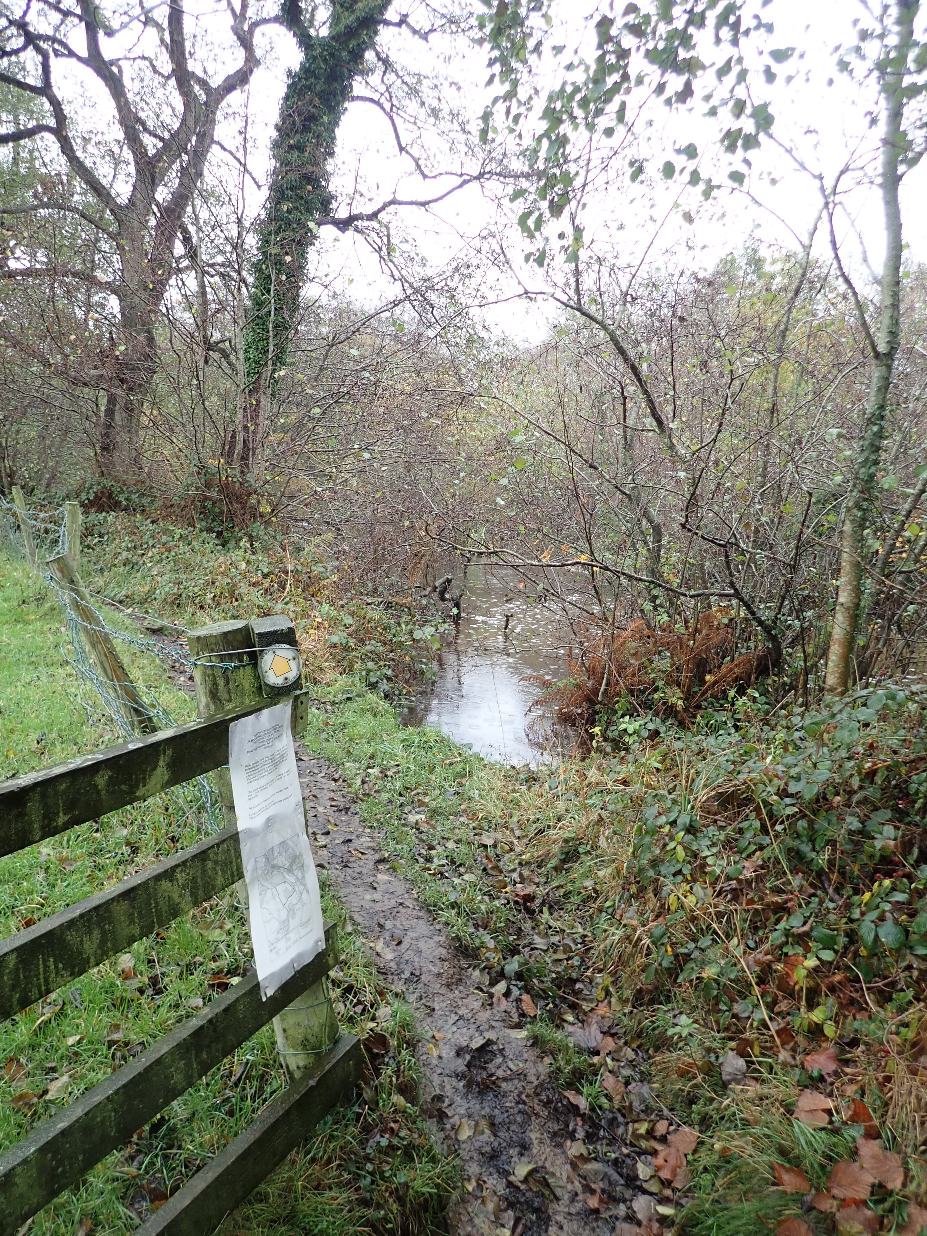
The track I was following continued on to pass Holy Trinity Church, run behind a line of terraced houses, and emerge on the main road through Dacre Banks. I walked past old and new stone cottages until I took a lane past the village pub. The footpath I needed was not straightforward to find as it passed close to cottages and had hard to spot signs. However, I eventually managed to find my way to a stone stile into a pasture, where I walked uphill to rejoin the line of the Nidd Valley Railway.


This was the section of the dismantled railway line that I could walk along, and which had attracted me to this route. It traversed the side of the dale to the farm at Low Hall, where the route of the old railway line crossed the entrance to the farmyard and then went into Low Hall Wood. The walk along an embankment through these woods was lovely and my favourite part of the day. The woods were peaceful, and there were still some colourful leaves on the trees and scattered on the ground. I also saw three sika deer, who looked back at me for a minute or two before gently bounding off.

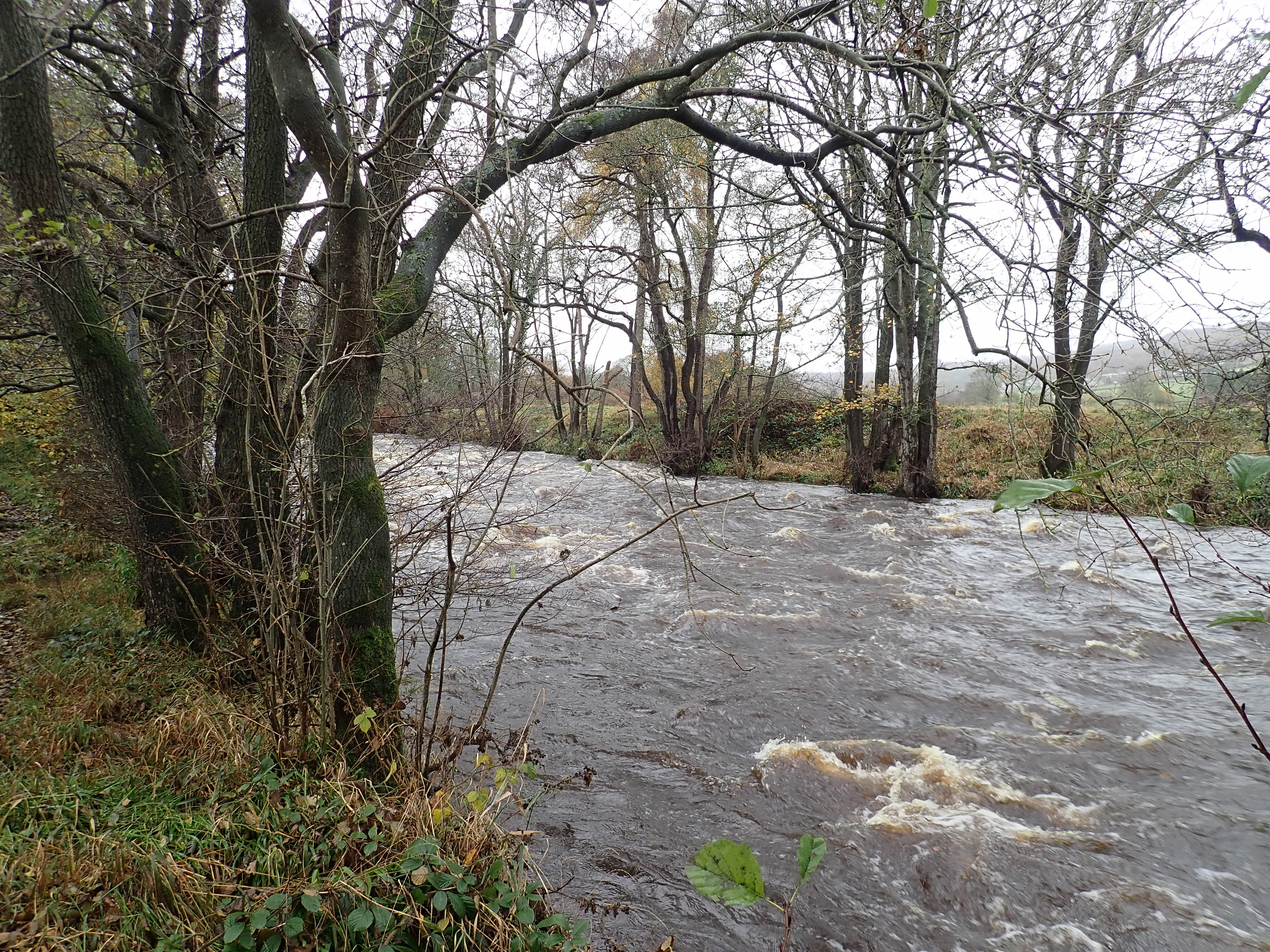
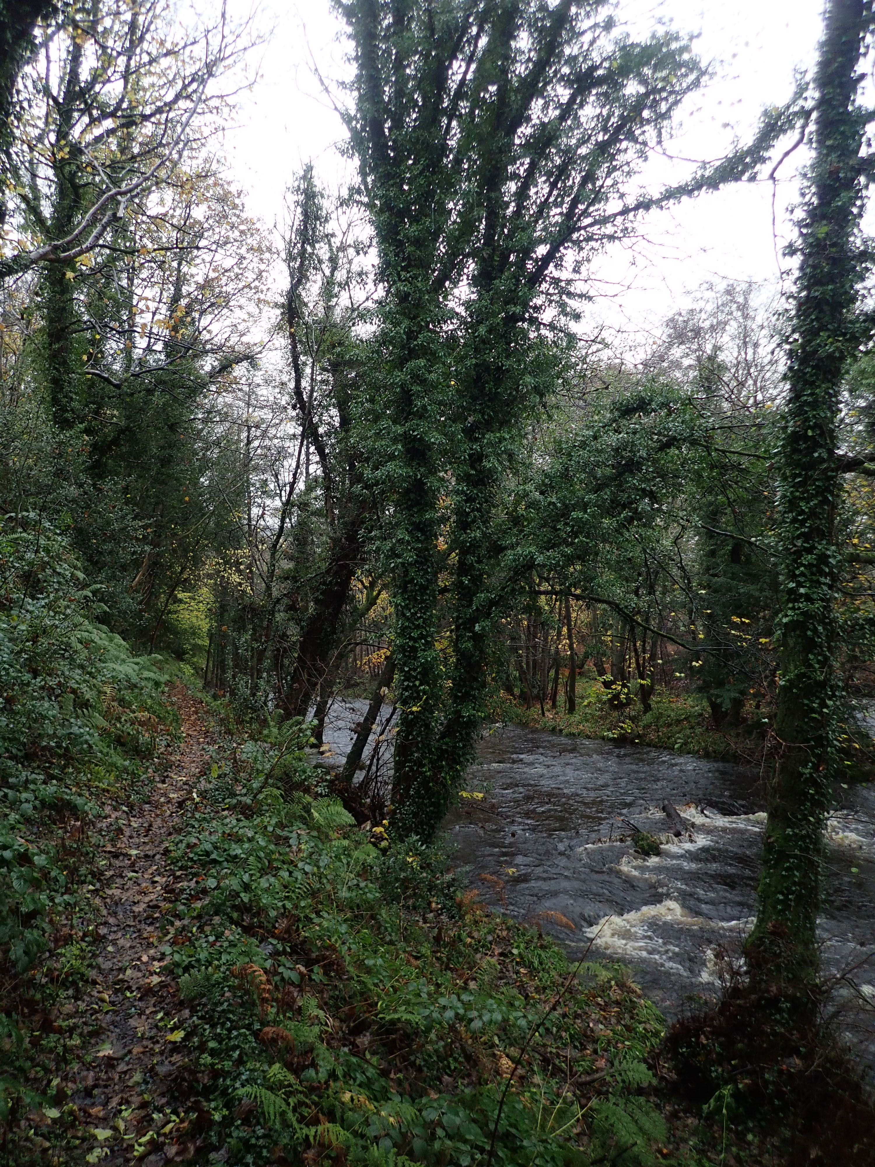
Not long after leaving Low Hall Wood, I walked down a slope to join the path running along the River Nidd. This narrow path hugged the gap between the river and the fields.

When I had walked this path when doing the Nidderdale Way, it had been summer and the river gently flowed over the stones. Now it swept past the bases of the trees and flooded the path in a couple of places. I really enjoyed walking along this path and hearing the roar of the patches of white water.
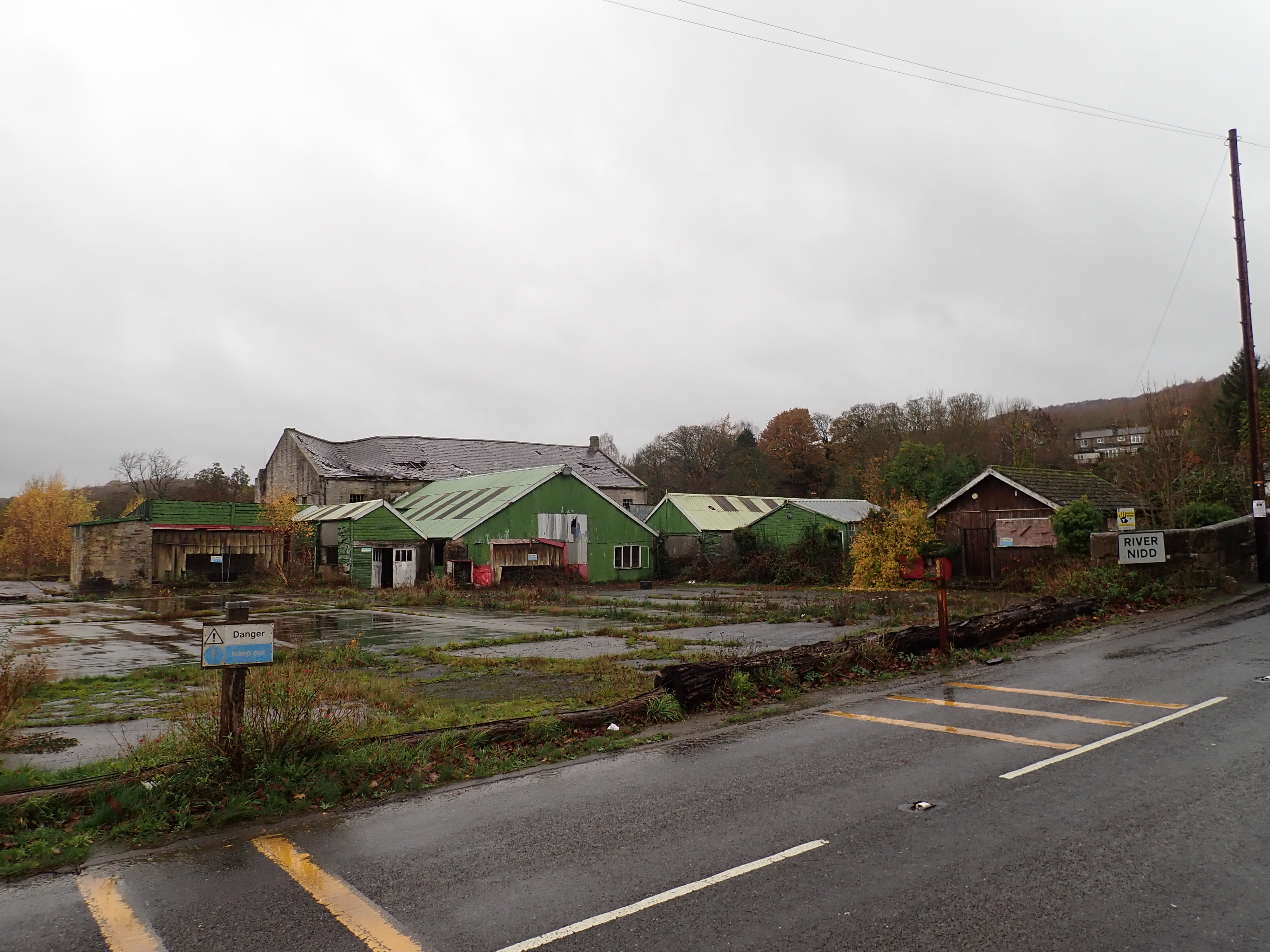
The path went past the Dacre Banks tennis club and then onto Summer Bridge by a flight of stone steps and a narrow gap in the bridge’s wall. The closed Nidd Valley Sawmills on the other side of the road looked even more derelict than when I was last here. Its roof seemed to be slowly collapsing, and the whole place looked sad in the rain.
To continue to keep close to the Nidd, I took a footpath around the perimeter of the sawmill’s grounds. Unfortunately, on returning to the Nidd I found a sign stating that the footpath ahead had been closed due to sections of it falling into the river. I therefore had to take a path uphill beside a beck to return to the track I had been on earlier. I then retraced my route to the sawmill at Lead Wath Wood.
My hope was that somewhere around Lead Wath Wood I would find a way to get back down to the path running along the river. While it did look like there might be a path, a sign warned that this was private land and was for the use of the local angling club. Slightly disappointed, I went back the way I had come to Harewell Hall.
My next idea for how to get back to the River Nidd was to take a path that ran along the edge of a field not far beyond Harewell Hall. Unfortunately, the map was unclear as to exactly how this path met the riverside path. After being a bit confused and a little annoyed, I climbed over a gate with an arrow sign on it that seemed to imply that this was where the two paths joined. I then took a slight detour downstream to look at the ruined viaduct I had seen earlier.
The path back to Glasshouses became slightly wild, a little bit treacherous, and beautiful as it passed a small island in the river. The River Nidd then curved before passing the local sewage works. A pipe that seemed to come from the works gushed brown water into the river.
It was then a gentle and pleasant walk across pastures back to Glasshouses Bridge.
Although I had a few issues with the route and it rained constantly, following the course of the Nidd Valley Railway was interesting, and I enjoyed seeing some of the brilliant sights of Nidderdale.

A valiant effort to follow the old railway.
Looking downstream, the line of the rail from Dacre into Ripon is clear on the map. Another project for you?
Thank you.
It’s certainly possible to carry on walking close to the railway line until a little way after Darley. I did that stretch when walking the Nidderdale Way, and it’s an attractive walk. After that, very little of the line is publicly accessible before the Nidderdale Greenway stretch starts outside Ripley. The one accessible part is upstream of Birstwith. I might visit that at some point because it’s near an old mill and a toll bridge that I’m interested in seeing.
That does look an interesting walk – I don’t envy you the wet conditions though – especially underfoot! What on earth is that metalwork thing in the trapped sheep? It looks like part of a Martian Tripod out of War of the Worlds!
I think your photos are nice in this due to the wet weather – I think it always gives a clean look to photos…
It wasn’t too bad. It was certainly a lot less muddy than I thought it might have been considering how much it had been raining.
I really don’t know what that thing is. It does look a bit like it’s responsible for the destruction of the building. Part of the reason I took the photo was that I was interested by the contrast between the intrigued, calm sheep and the chaos of the ruined building and assorted pieces of farm equipment.
I agree that you can get good, interesting photos in the rain. The one issue I have with it is trying to keep the lens free of water. You can see in one of the photos in this post that I didn’t succeed and there’s a drop of water visible.
I just try to point the camera down slightly in the rain – but I still sometimes get spots on the lens…
I try to be quick taking the photo, but it doesn’t always work.
That sounds like quite the adventure! I’m not sure I would have loved the rain, but the photos are pretty. 🙂
It was a good little adventure. I’m pleased that you liked the photos.