
Rain, or the threat of it, is a big part of the life of an English rock climber. A fair amount of time is spent planning how to avoid rain, waiting for rain to stop, finding somewhere that it isn’t raining or just being rained on. In 2012, I seemed to spend far more time than usual in this dance with the rain and so wanted somewhere for my honeymoon in November where I could climb without having to worry too much about rain driving me off the crag. Gran Canaria, the biggest of the Canary Islands, was the destination my wife and I settled on.
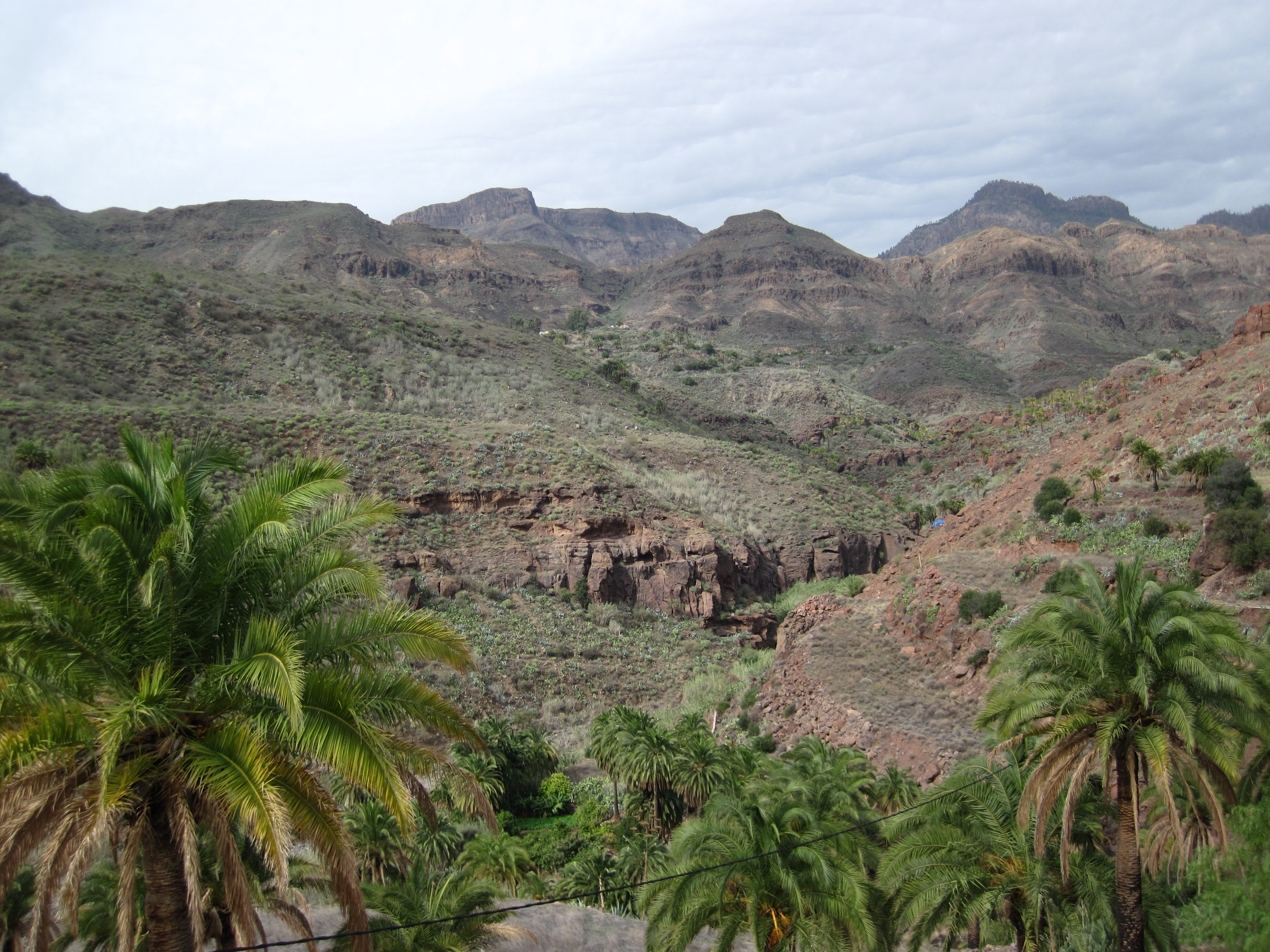
By being off the coast of North Africa, Gran Canaria has a warm climate that is prevented from being too hot by the trade winds that blow in off the Atlantic. During the time I was there, the temperature varied between 23C to 29C and could be pretty humid. The rock is volcanic and made up of strata formed by eruptions and eroded into a rugged, mountainous interior with canyons (barranco) fanning out from the centre like the spokes of a wheel. In the west, these mountains meet the sea, while in the south and east they fade into broken, rocky terrain with cacti. The south is drier and has huge tourist resorts by the beaches. The north is a bit wetter, and is greener as a result, with larger urban areas. The mountains in the centre act as a buffer between these areas and among the peaks there seems to be a different climate that allows there to be pine forests. It’s this variety of landscapes that leads to Gran Canaria being called a continent in miniature.
The mountains and climate meant it seemed like a good bet for a honeymoon with some rock climbing. Our trip to Gran Canaria did deliver with some great climbs on hot days and I’d recommend it to other European climbers looking for some winter climbing. However, be aware that it’s not always dry. I got a bit unlucky with the weather and found myself doing my rain dance at times.
The guidebook
The sport climbing guidebook is Gran Canaria; Guia de Escalada Deportiva and it has descriptions of over 750 routes, over 50 sectors and 15 crags. It has brief descriptions of the different climbing areas together with short directions on how to get to them and simple maps showing the locations of each sector (i.e. rock face or buttress). There are lots of colour topo photos of the routes, but few written descriptions of the climbs. The descriptions that are in the book can be no more than a few words or a single sentence. The text is in both Spanish and English.
You just have to study this guidebook to see that most of the climbing on Gran Canaria is in the 6a to 7c range, with the number of lower grade and top-end climbs more limited. Thankfully for me, most of these lower grade climbs are concentrated in a handful of venues and so it was these venues that I aimed to climb at while on Gran Canaria. Unfortunately, circumstances didn’t quite allow me to do as much as I would like and I only got to go to three climbing venues – Sorrueda, Fataga and Barranco de Moya.
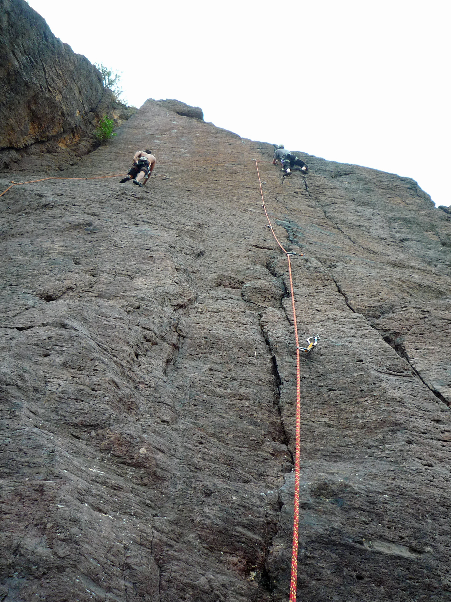
Sorrueda
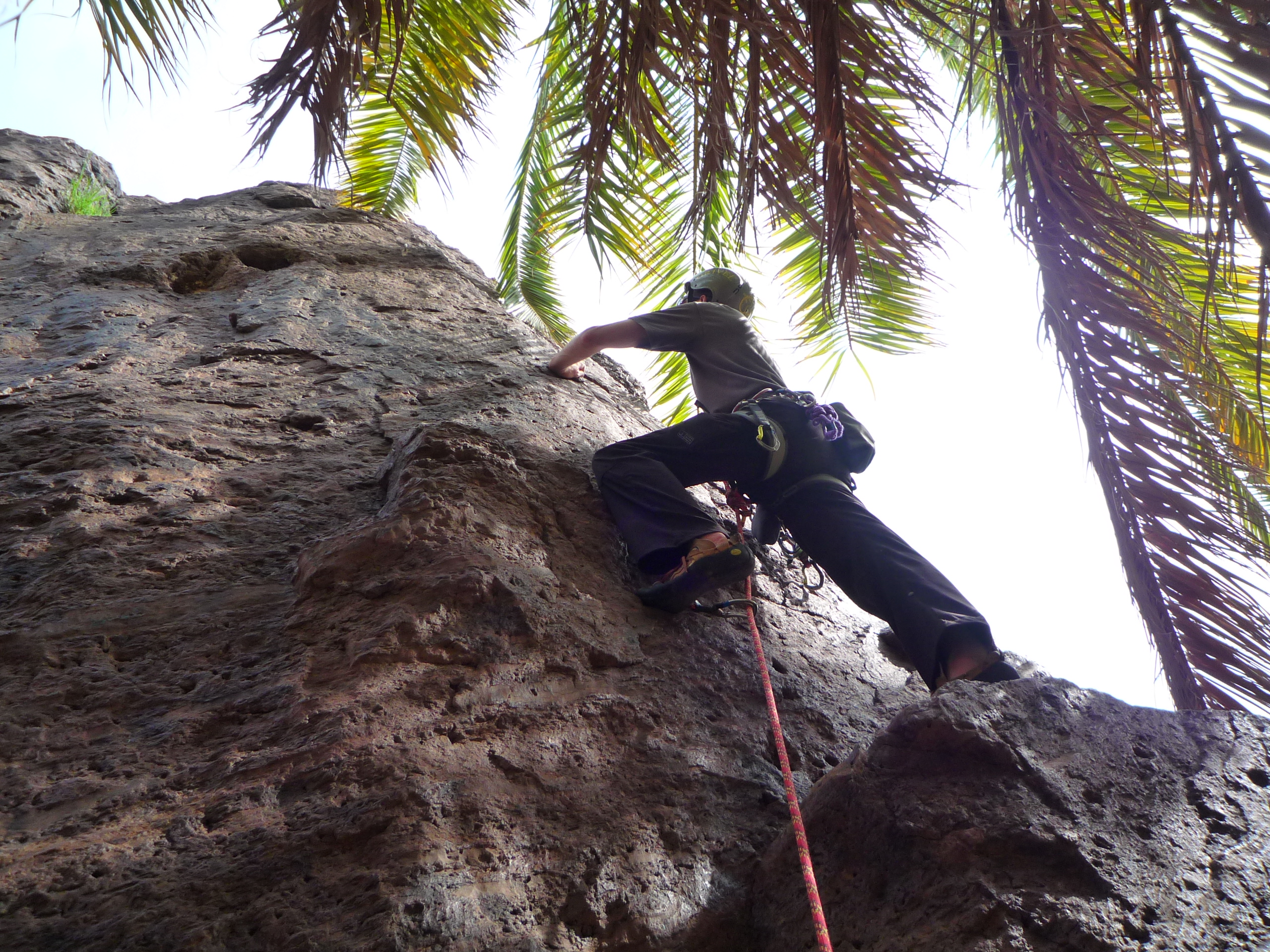
Sorrueda is a series of rock faces that along the bottom of a barranco towards the centre of Gran Canaria. The rock faces follow the line of a streambed, with big stands of reeds and palm trees. These reeds are so high that they hide many of the rock faces from view until you are almost standing right next to them. This can give some of the climbs a more private feel, helped by the fact that Sorrueda is secluded, quiet and very rural.
An odd, and somewhat worrying, thing about Sorrueda is the large number of spent shotgun shells littering the ground. I guess it’s popular for hunting as well as climbing – two activities you don’t normally see together.
The approach
To get to Sorrueda from the south coast of Gran Canaria, drive towards Santa Lucia de Tirajana on the GC65. Turn off the GC65 onto the GC651 to La Sorrueda. Follow this for 1.5km, passing a striking cemetery with whitewashed walls. Then turn right onto the narrow road that leads to La Sorrueda. After a few minutes you reach the grey cobbled square of this small village. If you don’t want to risk your car on the track that carries on down the barranco, then park here and walk. The track curves around the side of the hill, gently descending, before turning left and leading to an area where people seem to park.
 To get to the crags, you walk straight on, downhill, to the dry streambed at the base of the valley. A rough path then turns right to head upstream. Occasional white crosses painted on rocks guide the way.
The climbing
I found the climbing at Sorrueda challenging and a bit under-graded. Although there are often finger pockets and some sharp cracks, most of the climbing I did was on small holds and smears. This led to a few worrying moments, but it probably helped improve my climbing. The nature of the rock forced me to search the rock for any small feature I could use, think through sequences of moves and be deliberate in my movements. The climbing I was doing was fairly low grade, but it didn’t feel it.
Another odd thing about Sorrueda is that quite a few of the climbs don’t have names. My favourite of the routes I climbed there is nameless and is just number 13 in the guidebook. It was a fairly steep slap rising out of the stream. The route begins and ends by edging and smearing on small holds, but for most of the way the route follows a narrow finger crack. It’s got a great setting and it’s really engaging.
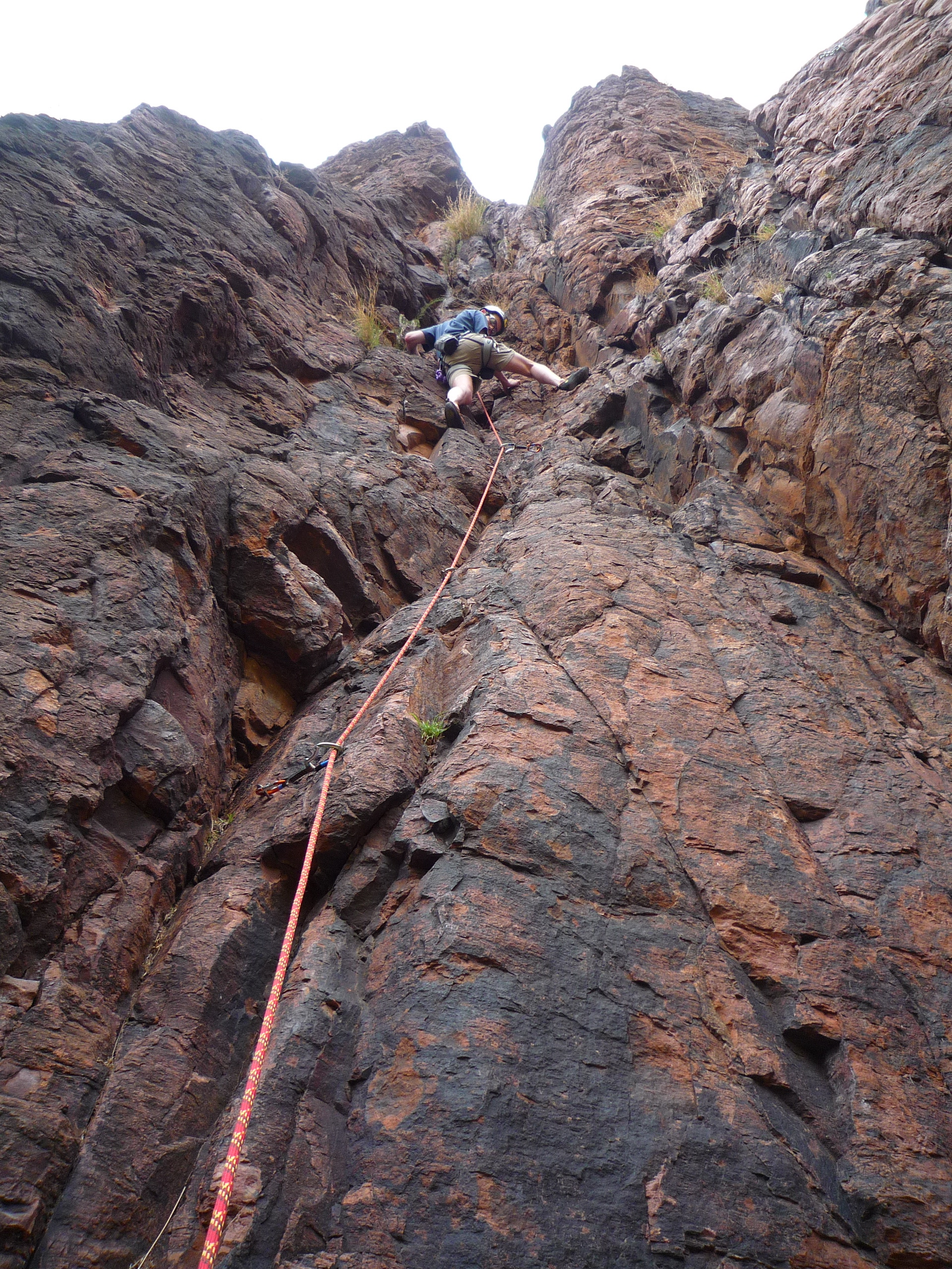
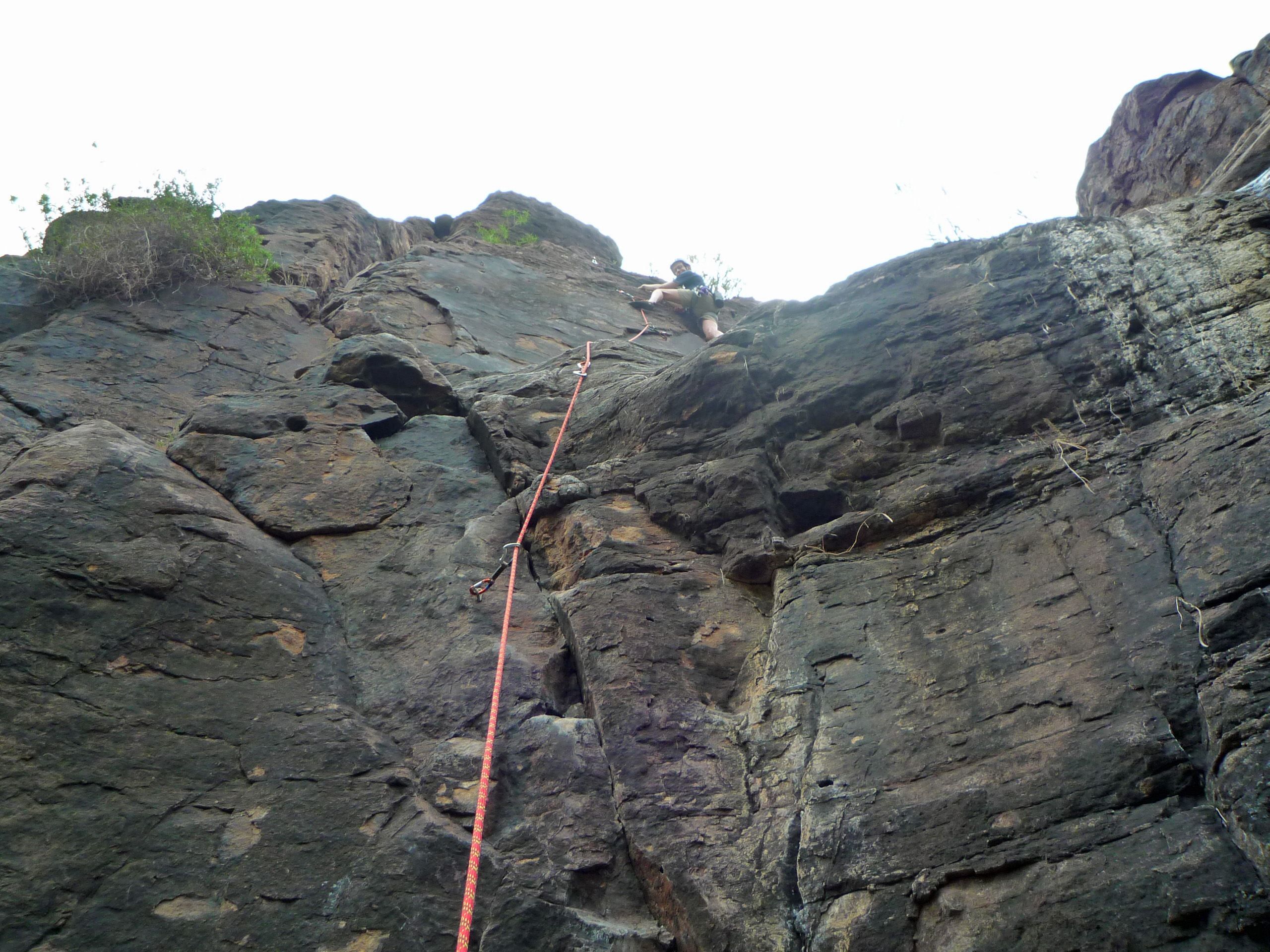
Fataga
Fataga is a long rock edge that makes up one side of a barranco near the pretty village of the same name. The edge starts next to a dam and follows the edge of the barranco as it widens out into a V-shape. A small watercourse / aquaduct runs from the dam along the bottom of this edge. This means that the first moves of the climbs start with you standing on the watercourse.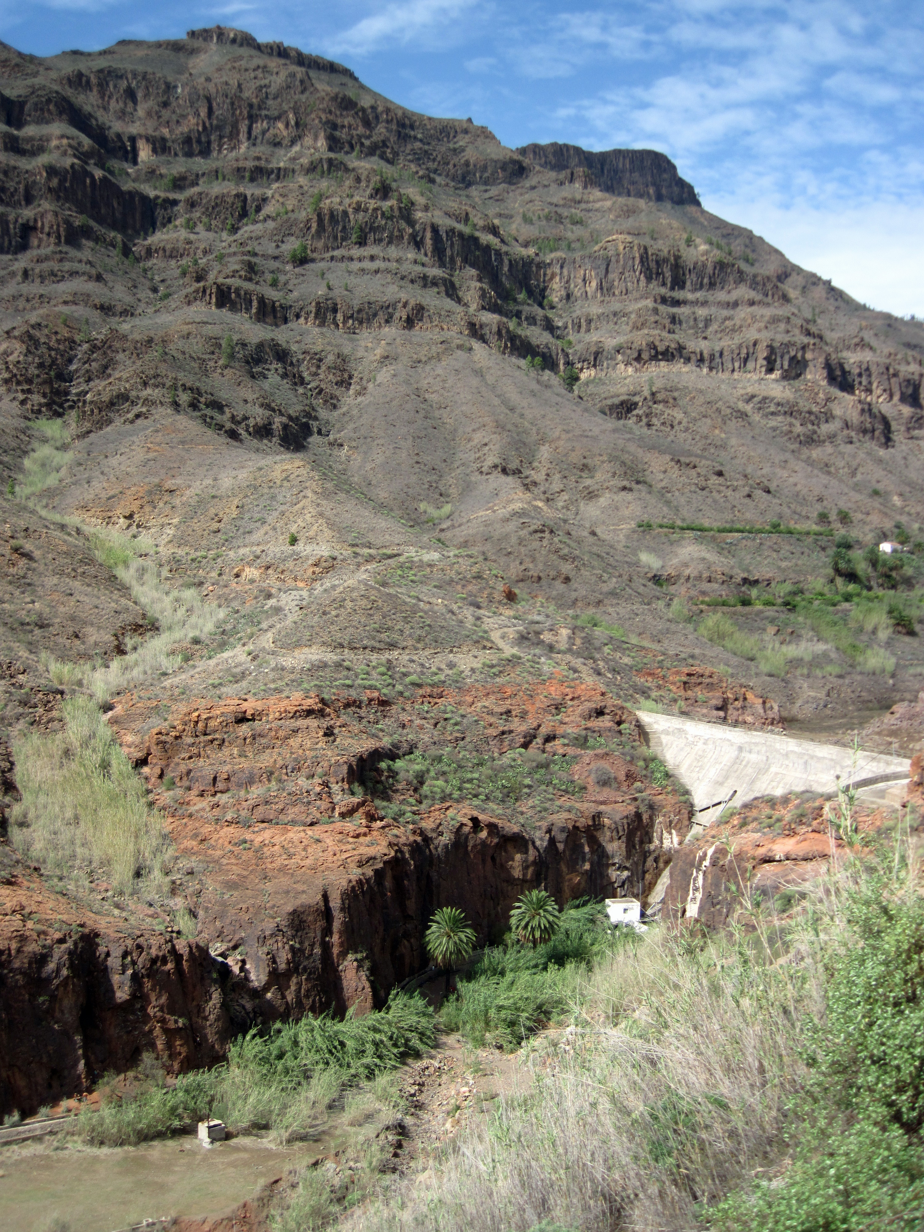
Although only about a ten minute walk from the road, Fataga feels out of the way. The reeds that shelter the bases of many of the climbs, and the odd palm tree, increase the relaxed feel of the place. The only real noises are the grunts, groans and calls of climbers. There are a few of these as Fataga is a justifiably popular venue.
The approach
It’s pretty straightforward to get to Fataga. From the tourist resort of Maspalomas on the south coast, drive north on the GC60. When you are about a 1km outside the town of Fataga, there is a dirt layby on the left hand side of the road as the road curves right. Park here and then follow a track that descends down the barranco. At a building there are some steps that take you down to the dam that cuts across the barranco. Go down and walk over the dam. On the other side a series of steps take you down to the floor of the barranco and the start of the climbing.

The climbing
There is almost every type of climbing feature you can think of in the ochre, volcanic rock of Fataga. There are cracks, finger pockets, positive and sloping edges, rounded holds, crimpy holds and sections of blank face. This makes for interesting variety between climbs and even on a single climb. It feels more positive and enjoyable to climb than Sorrueda. It feels correctly graded too. Another positive feature of Fataga is that there is a reassuring number and spacing of bolts.

Most of the climbs at Fataga are in the 6-7 range, so there isn’t a huge amount to keep a lower-grade climber occupied. However, there is certainly enough for one gentle day and I really enjoyed the climbs I did there. La Pachorra del Caidero was particularly fun and interesting. It was basically a climb of two halves. The first half starts with a sequence of balancy moves before moving up a broken crack. It then moves left around some blocks to a large ledge. The second half has a choice of either going up the left or right edges of a vertical, clear face. I found the right line more interesting, with a big crack and odd jug for the hands and the right foot, while my left foot smeared on blank rock. It probably had more variety of moves concentrated in a few metres than any other climb I’ve done.
Barranco de Moya
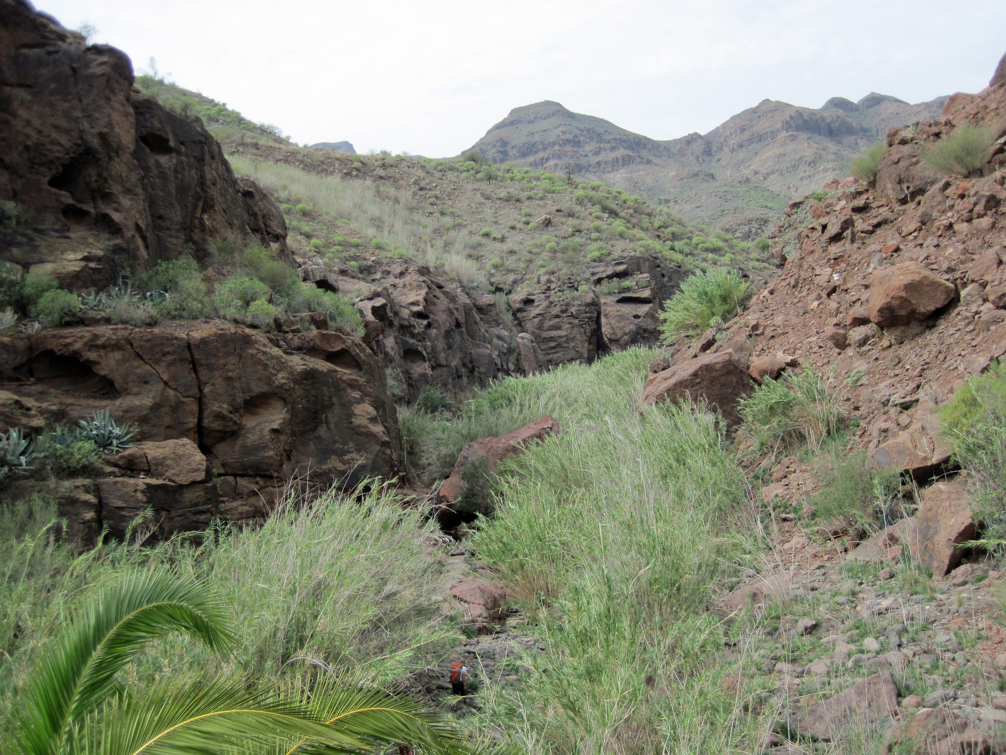
The Barranco de Moya has a clustering of rock faces along the base of a canyon in the north of Gran Canaria. I was interested in climbing at Barranco de Moya because it has a good selection of routes in the lower grades. It also looked like a relaxed, pretty place to climb. In the end, I didn’t do a single route there.

It didn’t help that the nearby section of the GC2 motorway had been completely rebuilt since the guidebook had been written. This means that the turn-off described in the guidebook no longer exists. If you want to get to Barranco de Moya now you get off the GC2 at junction 15, near San Andres, and follow the minor road that traverses the coastline. The other option is to head for the Cenobio de Valeron ancient site (signposted from the GC2) and then continue on the road that runs past Cenobio de Valeron until you reach Barranco de Moya. Yet the real access issue is getting to the routes inside the barranco.
The guidebook says about Barranco de Moya that “after rainy days, some of the routes could be unreachable because of the leaking water through their bases.” As an English climber, I might have read this overly optimistically. If I didn’t set out to a crag because of a bit of water draining off the rock, then I’d probably have far fewer climbing days than I do. Yet, the description in the guidebook doesn’t really do justice to what it’s like trying to climb at Barranco de Moya after some rain. This is what I was trying to do as it had rained the day before and fairly heavily on the morning that I headed up Barranco de Moya.
The access route follows a path on the right hand side of the barranco for about 500m. It then requires you to walk for a few hundred metres along a water channel elevated above the stream that runs down the barranco. I’m guessing that this water channel is only passable in dry weather because it was completely full of water when I went. After precariously balancing along the top of the narrow wall of the water channel for about 75m, my wife and I decided better of the whole thing and retreated.

I’m pretty disappointed about not being able to climb at Barranco de Moya, but it’s clearly not a place to climb after rain and it may have to be a place for another time. Hopefully, there will be another climb as I think there is still some routes I want to explore on Gran Canaria.
Further information
Gran Canaria Guru
This website provides an overview of rock climbing and bouldering locations on the island as well as links to further information.
Climb Europe
The Climb Europe website has an overview of climbing on Gran Canaria, including a map showing the main venues.
Climbing on Gran Canaria
This is an article by Pat Littlejohn of ISM on trad climbing on Gran Canaria.
Climbing shops
I only found two climbing shops when on Gran Canaria and they were both in the main city of Las Palmas. However, there may be more shops I’m not aware of.
Mandala Climb
Calle Alfredo Calderon 70
Las Palmas de Gran Canaria
928 249 809
Perojo
Calle Perojo 27
Las Palmas de Gran Canaria
928 366 754
You can read my post about the vie ferrate on Gran Canaria here.

An informative blog; I enjoyed it. I think the water channel might be an:- “Acequia – Of Arabic origin, the Spanish acequia refers to a ditch or irrigation canal.”
Thanks.
Acequia is definitely my new word for the day.
Robin
Another thoroughly enjoyable read about the climbing on Gran Canaria and the Severe Climber ‘s honeymoon. Makes me want to revisit Gran Canaria, take up climbing again and have a second honeymoon.
Thanks.
I’m really pleased that you enjoyed the post.
I hope you have a chance to get back to climbing and Gran Canaria is well worth a visit.
Best wishes,
Robin
I could do with a bit of that myself just now!
Thanks for the post
Charles
I know what you mean. I’ve been back in the cold, wet UK for a month now and it would be great to get some climbing in the sun.
Glad you liked the post.
Best wishes,
Robin
Enjoyed your post on climbing in Gran Canarias. I’ve just got back from there after a weeks climbing – will be posting on bowlandclimber soon. Shame you didn’t get into Baranca de Moya, [we didn’t use the aqueduct but kept to the base of the gorge] the climbing was good on several buttresses. see pics in post when up.
John
Thanks John. I’m glad you liked the post.
I look forward to seeing the pics of you climbing in Baranca de Moya (I’m a bit envious you got to climb there). It’s good to know that you can just walk up the base of the gorge to get to the routes as it was a river when I was there.
Best wishes,
Robin
Awesome post. I really enjoyed it. Thanks
Thanks – I’m pleased you liked it.