
I didn’t get any sleep. Strong winds had pummelled my little tent all night while rain had beaten down on it. The noise and the violent movement of the tent walls were too much, and sleep didn’t come. By about 5am, I was wondering if I might as well get up. After about another half an hour of procrastinating about getting out of my warm sleeping bag, I managed to motivate myself to start getting ready for the second day of my walk. Apart from a navigation mistake, the first day had been enjoyable. Despite my lack of sleep and the longer distance I would have to go, I was optimistic about this second day of walking. Unfortunately, this would turn out not to be the best start to a day of walking and this morning involved the main challenges of my two-day trip.
This was my first time using this one-person tent, and I learnt some hard lessons about how best to put it to use. I’d slightly misjudged the direction the wind would come from overnight when I pitched the tent, and this meant that the wind hit it on one of its vertical walls more than I would have liked. Throughout the night, this wall moved in and out with the gusts of wind. It did this to such an extent that its bottom edge flipped over the top of my walking boots. In the morning, as I opened the tent’s inner on my way to getting out, I discovered that my boots had been sitting in the open and acting like buckets. The next time I used this tent, I put my boots in a different part of its small porch and didn’t have a problem. However, on this morning, I tipped the water out of my boots, put my feet into dry socks, slipped my feet into my wet boots, and headed for the shelter of the nature barn.
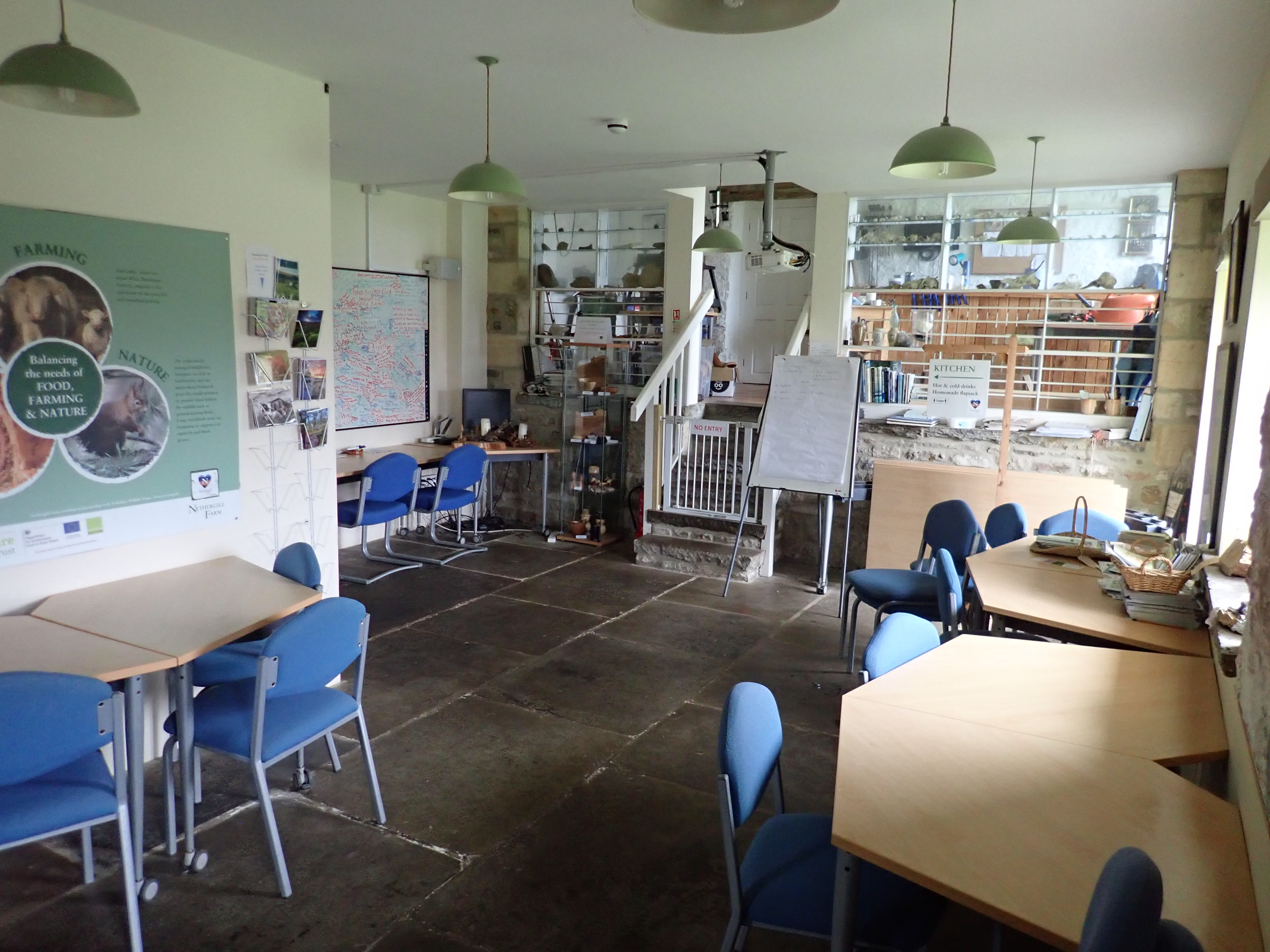
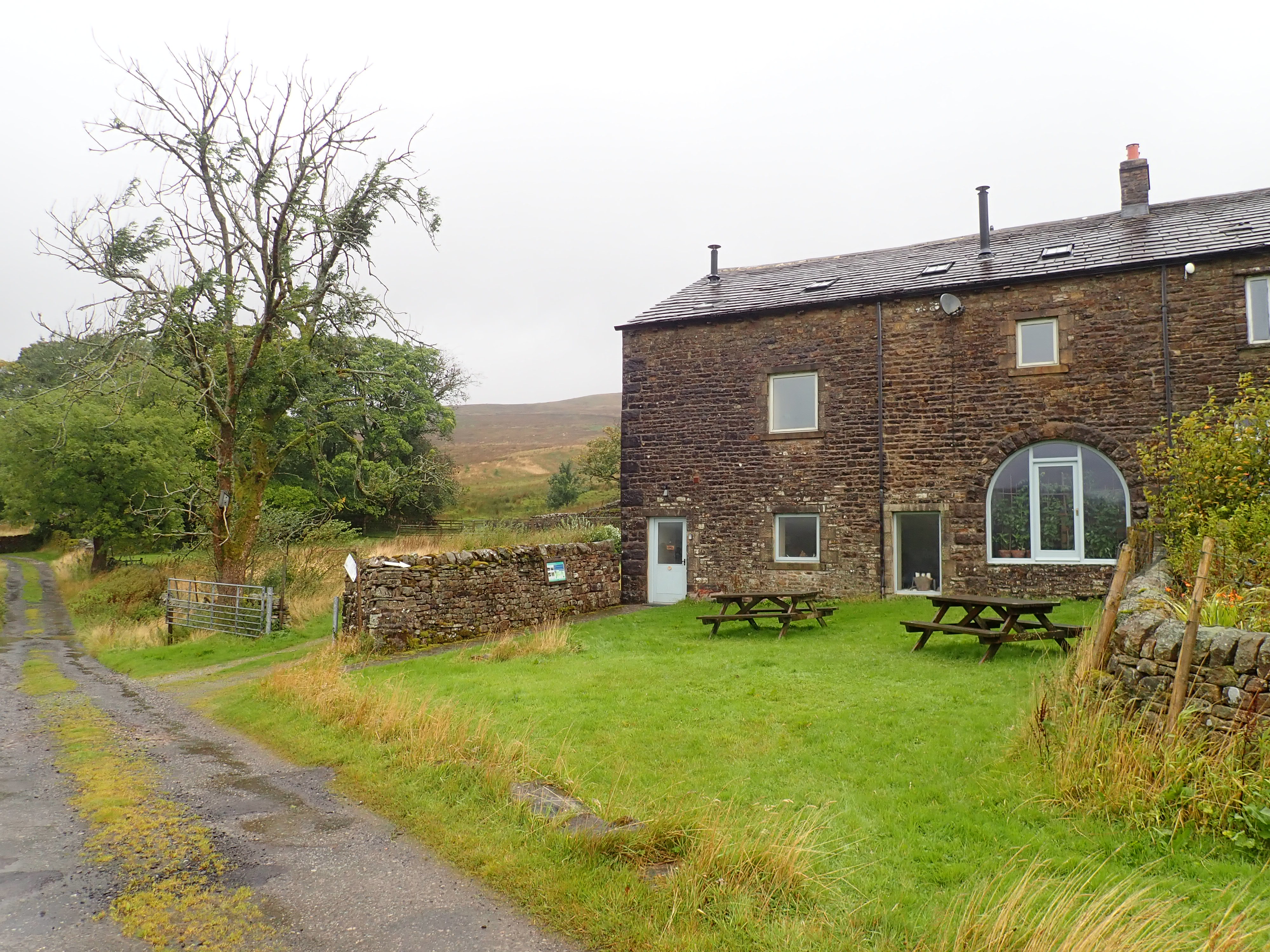
I also learned how much my new tent depended on good peg placement and someone lying in it for its stability in strong winds. No matter how hard I had tried moving them around, all the pegs had hit rocks when I’d pitched the tent. This meant that they were all only about half-way into the ground. I’d been a bit worried about this as I lay in my shuddering tent, but was pleased that it was still up by the time the sun rose. However, I had a lingering doubt about the tent’s stability and so, while my coffee was brewing, looked out of the window to check on it. The pegs on the windward side of the tent had popped out of the ground, and half of the tent had collapsed. I rushed out into the lashing rain to grab the contents of the tent and ferry them to the nature barn. I then quickly collapsed the rest of the tent, bundled it into my arms, and carried it inside. It proved to be very useful to have this building to retreat to.
I had my coffee and breakfast in my damp socks, packed up, and headed out into the lashing rain.

My route initially followed the Dales Way down Langstrothdale. A forceful wind at my back pushed me forward while torrential rain swept down the valley. The farm track I was walking along was almost drowning in puddles, and Oughtershaw Beck off to my side was full to the brim. I was enjoying myself. The dramatic weather was making the morning more interesting. I was also getting used to having wet feet, and I was feeling content at being on the move in such lovely scenery.

The farm track became a single-lane road at the stone cottages of Oughtershaw. I followed this steadily uphill as Oughtershaw Beck flowed downhill through a narrow and deep tree-lined valley it had carved into the dale. It was a pretty landscape to walk through. As I reached the highest point of the road, I could see the hamlet of Beckermonds and the next part of my route in the distance.
The upper part of Langstrothdale forks, with the valley I had been walking through containing Oughtershaw Beck and the other fork containing Green Field Beck. The confluence of these two becks at Beckermonds marks the start of the River Wharfe. It was also the point at which I turned to follow the Green Field Beck fork and left the Dales Way behind.
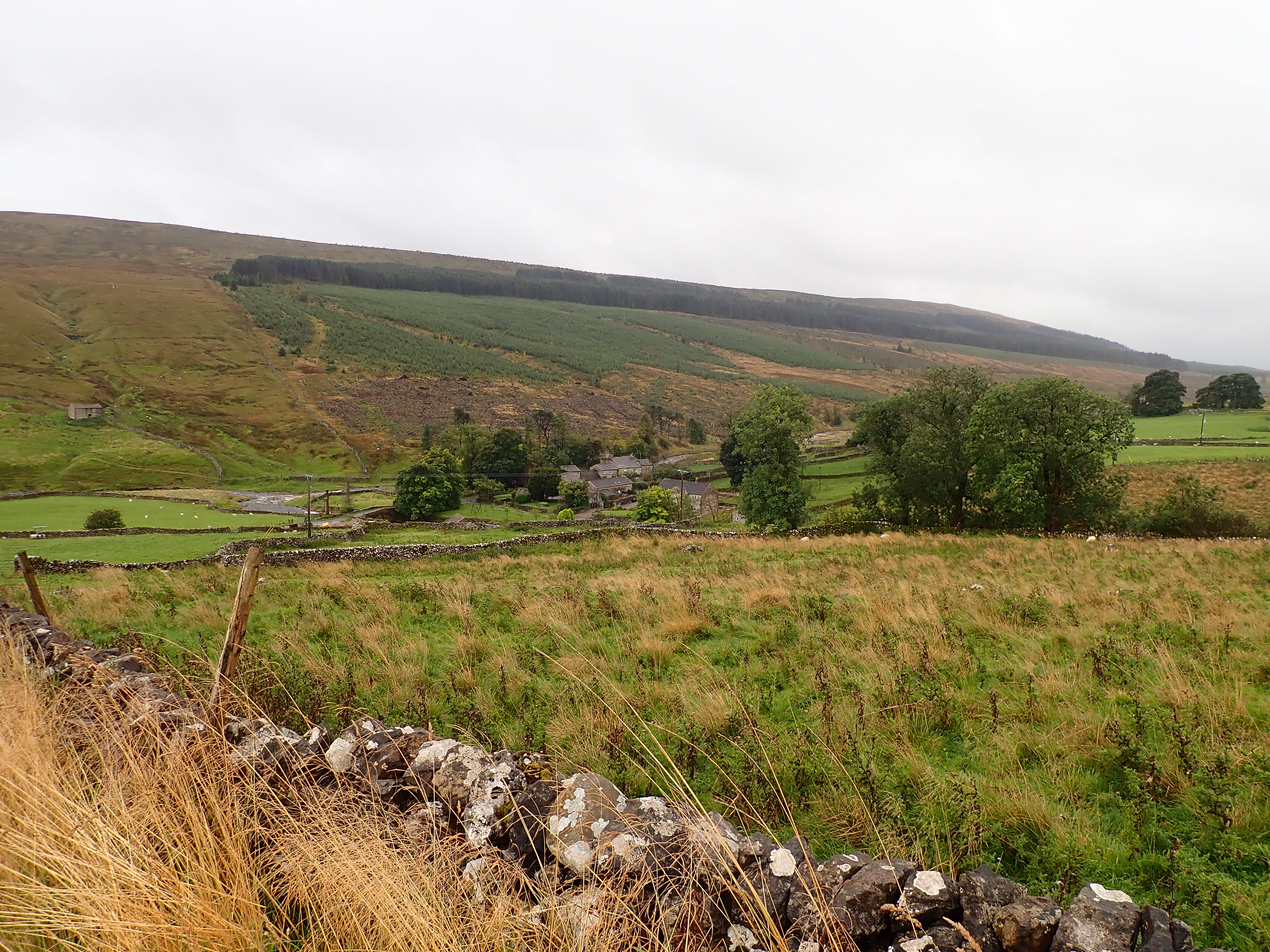
I turned west at a T-junction to go along a road between attractive farm buildings and past the holiday cottages of Beckermonds. It was here that the wind and rain went from being at my back to being in my face. Unfortunately, it stayed that way as I slowly walked along the valley.

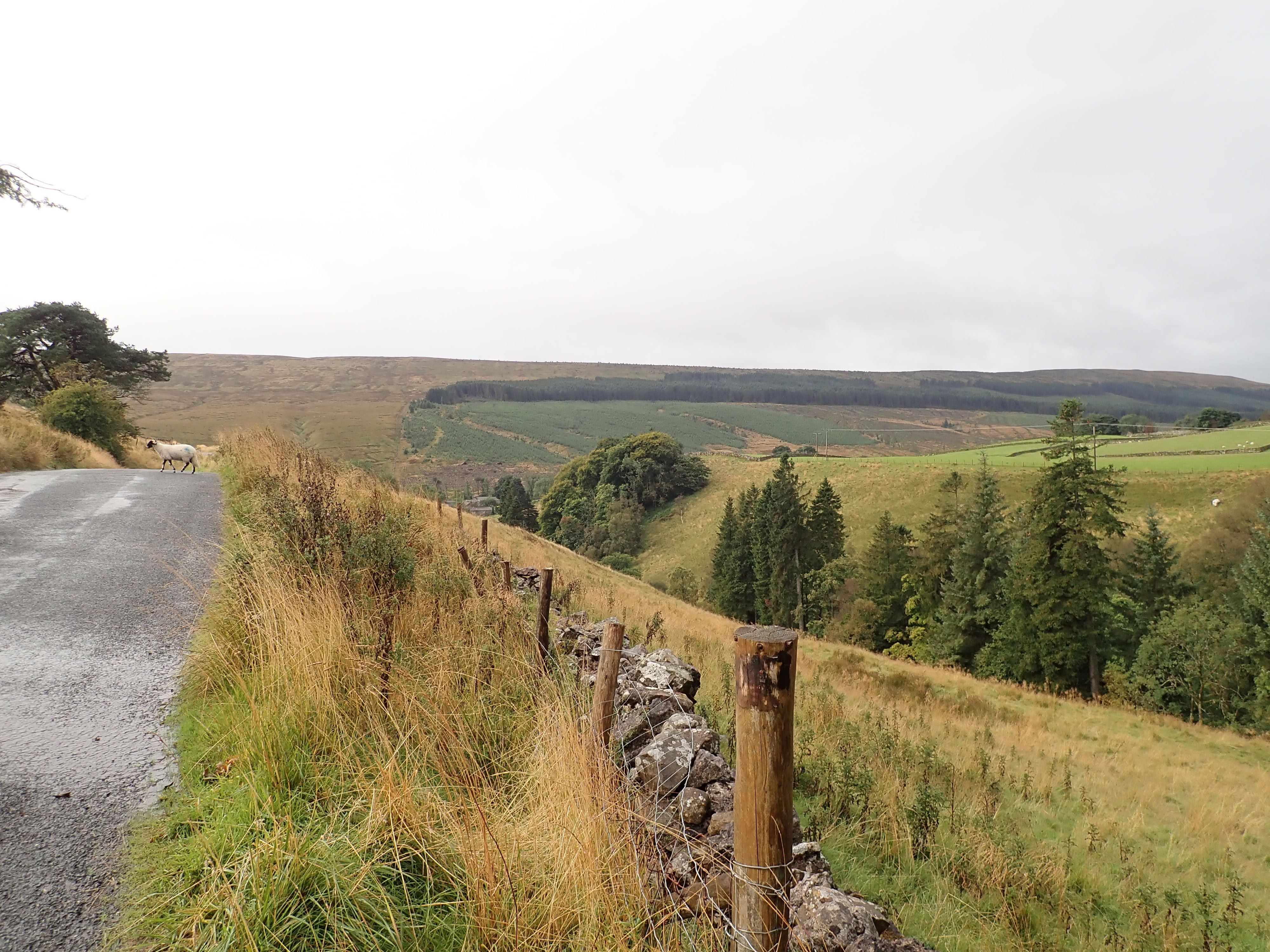
The Greenfield valley is a mix of conifer plantation, pasture, limestone pavement, and fields of long, golden grass. A single, well-maintained road gently climbs up the valley, and a beck runs down it that pauses at one point to form a series of small reservoirs. This area is apparently the geographical centre of the Yorkshire Dales National Park, but it’s sparsely populated, and feels remote. The planting in the 1970s of Greenfield Forest, and Cam Woodlands where I had been the day before, was apparently controversial because of concerns that the plantations would change the National Park’s character (see here for further information). The massed conifers certainly give it a different feel from other parts of the Dales, but I still found Greenfield pleasant and quiet.

Unfortunately, I found the constant headwind wearing. By the time I got to the farmhouse at High Green Field, I felt that I’d walked twice the distance and for three times as long as I had. At High Green Field, the road became a track that entered the conifer plantation. I perked up at this point as the rain stopped and the sun began to come out. I also enjoyed coming to a lovely meadow of golden grass that was bordered by conifers. A stream ran through the meadow and there was a small, stone bridge over it.

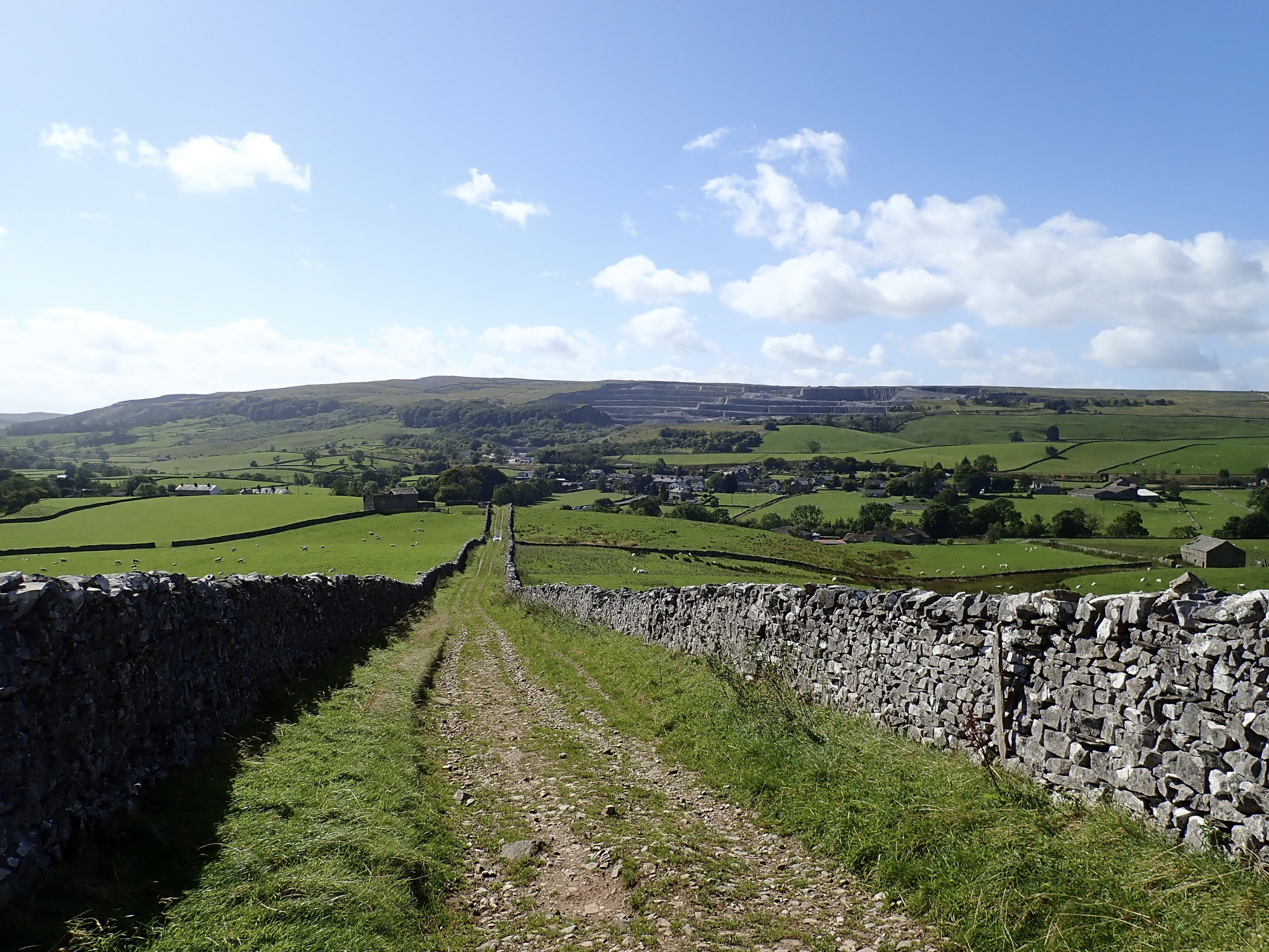
The change in weather and the sights from this point on made a good walk into a fantastic one. There was warm sunshine, blue skies, and a biting wind as I took the track through the wood to the edge of Low Birkwith Moor. Here I passed through a gate to a flooded ford and a waterlogged footpath. I was feeling happy as I crossed the moor to join the Pennine Way, and then followed it down Ribblesdale. The Pennine Way traverses the eastern slope of the dale, passing interesting limestone formations and a succession of what looked like the rocky entrances to potholes. There were wide views over the dale to Ingleborough and Whernside, while tall grass waved in the sun. The heavy rain had left puddles and little streams everywhere, but I didn’t mind splashing through them in my soaked boots.


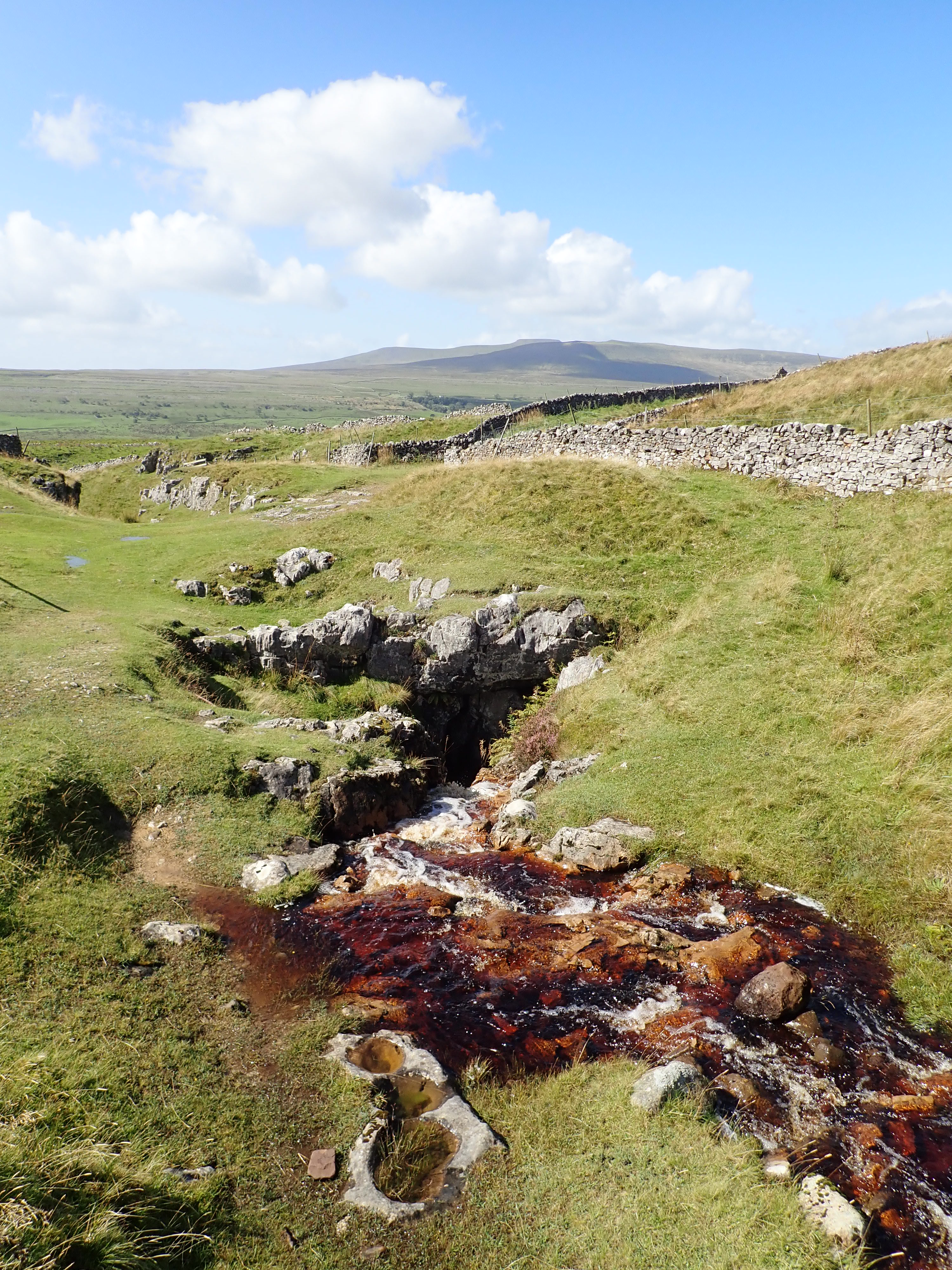
Horton-in-Ribblesdale came into view in the bottom of the dale, with the grey tiers of Horton Quarry cut into the hill above. I then came to the eye-catching little valley in which sits Sell Gill Holes. I stopped for a while to watch tea-coloured water flow down the stream and then disappear over a waterfall into the cave.
The track I was following went down and across the dale between drystone walls, curving to take a straight last leg into Horton-in-Ribblesdale. I came into the village near the closed Crown Hotel and the bridges over the River Ribble. Feeling satisfied that I’d finished my two-day walk, and that it had been so wonderful, I headed over the Ribble and up the hill to the train station for my journey home.


Was the New Inn at Horton closed altogether or just closed at that time of day? I ask as we quite often use it to wait for the train after doing Penyghent and the like.
I cringed at the full-of-water boots tale!
Photos always look nice after rain – and often during. Somehow the landscape always looks clean and washed!
I’m sorry. I’ve just done some checking and realised that I’ve got my pubs mixed up. It was The Crown Hotel. I’ll correct the post.
After a while I stopped noticing that my feet were wet. However, I think wet boots would have been an issue if the walk had been over more days.
I think that rain does clean the air of pollution. So it’s nature’s way of giving itself a wash and making the world fresh again. I agree that it certainly makes for better views.
I’ve found the origin of my error about the name of the pub.
My (new) OS map has the word “New Inn” next to the buildings that include The Crown Hotel and the blue pub symbol. I assumed that “New Inn” must be the name of the pub. However, I now realise that OS 1:25k maps don’t usually include the names of pubs. While I’m pleased that I worked out where I went wrong, I am now puzzled as to what “New Inn” on this map actually refers to.
yes, that is a bit of a puzzler!
Oh yes, and Sell Gill Holes had a notice near them for quite a few years about a missing Chinese tourist girl – they thought she’d ended up down there. I always think about her whenever I visit them.
That’s really sad.
I can see how someone might fall in.
I will think of her too the next time I am there.
Your walk across the moor sounds very much like mine when I did the Dales Way some years back. And I too made good use of that nature barn whilst soaked to the skin! 😀
I had a very rainy day when I did the Dales Way too, but thankfully not so bad that I got soaked to the skin. I hope it didn’t spoil your enjoyment of the walk.
That barn is conveniently placed for sheltering from the weather.
It was my own fault for not packing overtrousers, my daughter was far more sensible and had hers! Yes that place was a Godsend.