
Simon’s Seat is a large outcrop of millstone grit in a commanding position on the edge of Barden Fell. I’d been to Simon’s Seat a couple of times before and was mulling over walking up it again. It occurred to me that I’d never approached Simon’s Seat from the north via the pretty hamlet of Skyreholme. As I looked over my map, I realised that if I walked up Barden Fell from that direction, then I could extend my walk into a loop so that it also took in Trollers Gill. This is a fantastic limestone gorge and one of my favourite places in the Yorkshire Dales. I was excited about trying this walk out and, although the weather was not the best when I came to do this walk, it was still a good day in great scenery.
My walk began at the large layby that is insight of Stump Cross Caverns on the B6265. Cars and trucks shot past as I walked along the verge for a couple of minutes, until I got to the wooden gate at Dry Gill. I went through this to the relative quiet of a shallow valley with a rocky streambed. A stony track took me down the valley before turning to gently climb the moor by a track labelled Black Hill Road on my map. As I slowly walked up the track, I enjoyed seeing the remnants of the snows from a couple of weeks earlier. The snows stood out as white patches dotted around the landscape and as lines following the course of drystone walls. The white snow stood out brightly in the hazy, low, grey cloud.
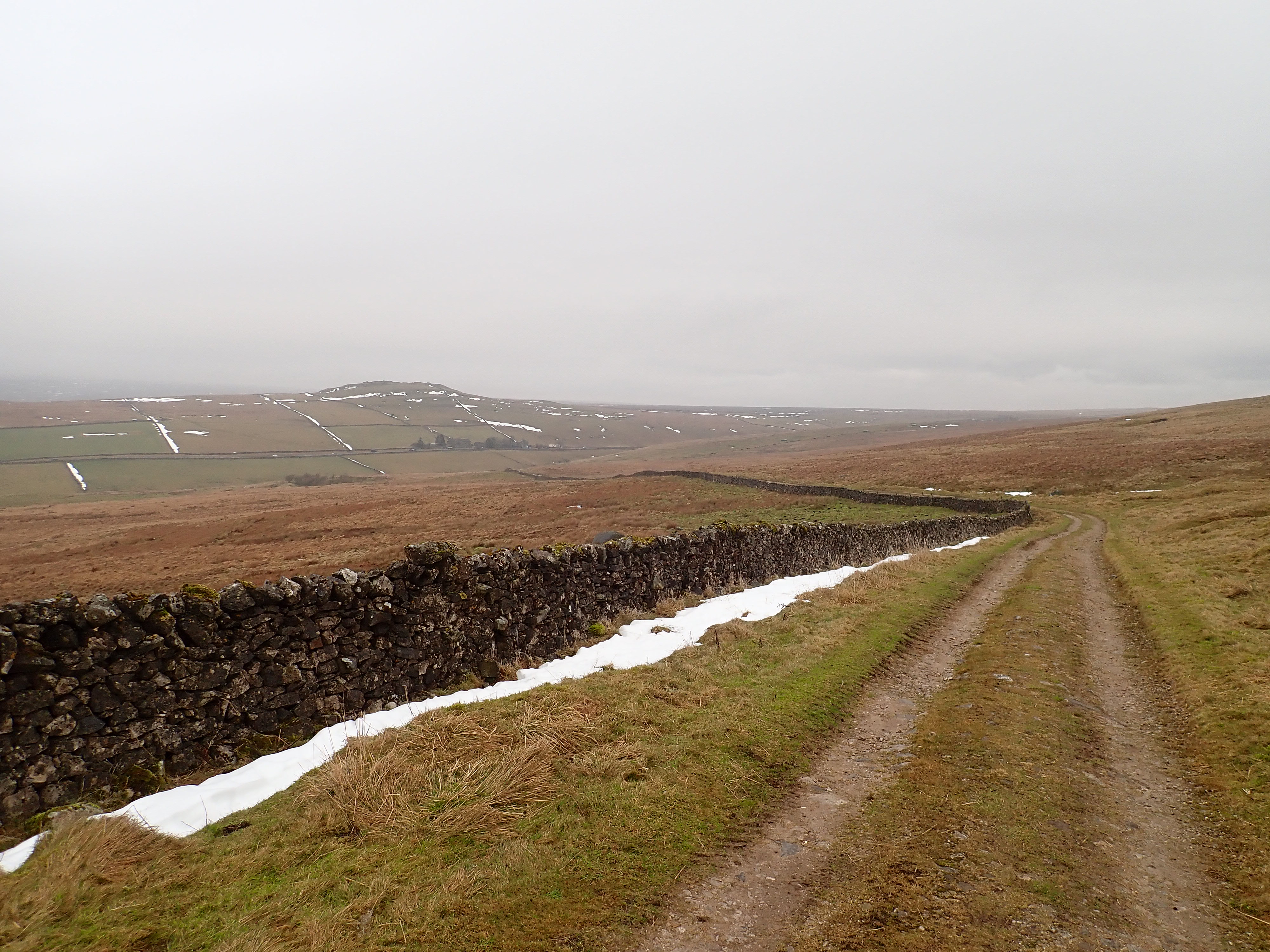
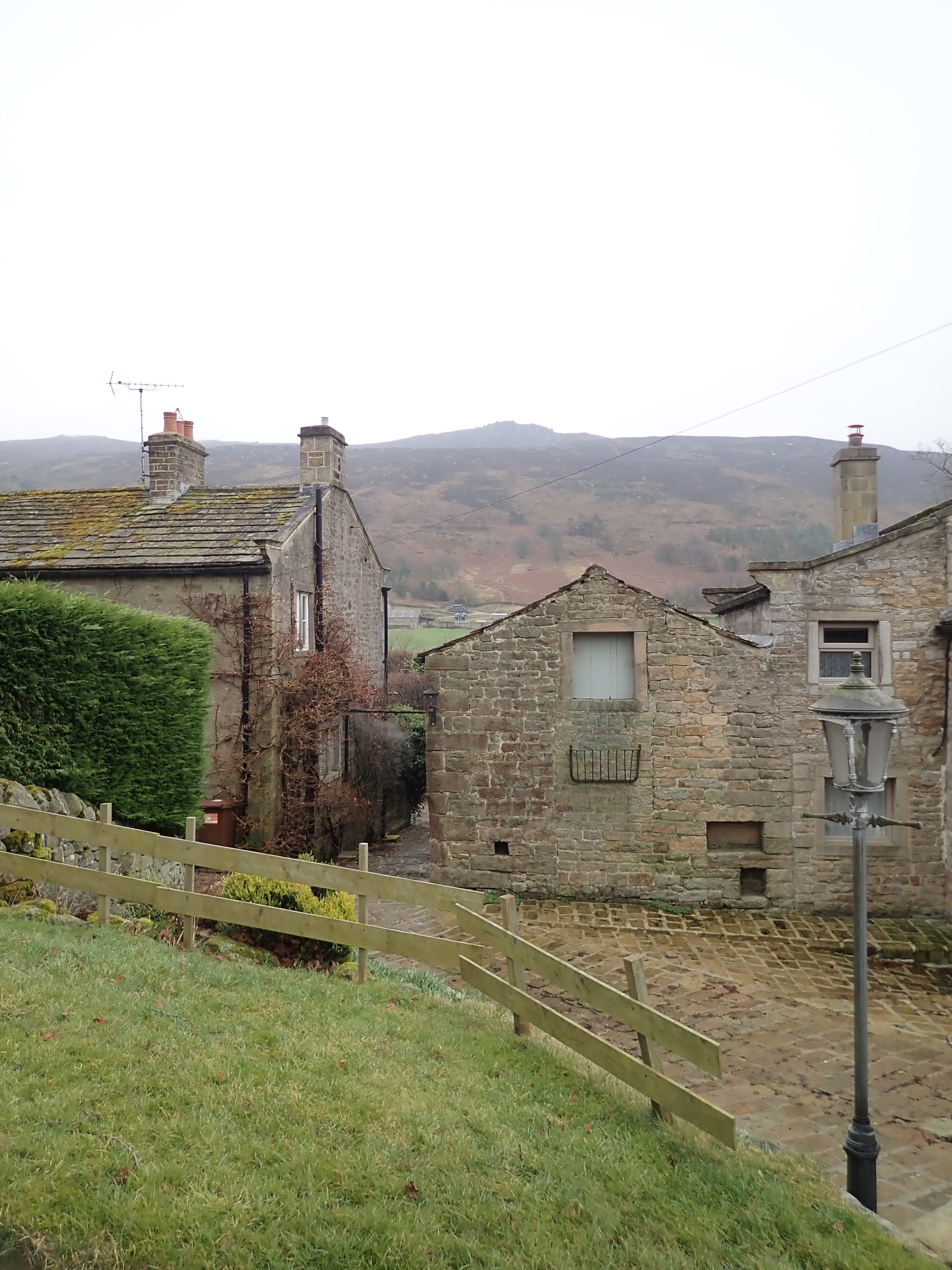
I felt the chilly wind less as the track steadily climbed to the rounded top of the moor. There was a good view of the steep slope of Barden Fell in the distance, with Simon’s Seat gradually coming out of the cloud. I followed the track as it curved downhill, first one way and then the other, until it turned into a metalled road. Despite the haze, I enjoyed the views across Wharfedale as I walked down to the farms and cluster of stone cottages at High Skyreholme. This attractive hamlet is spread across the side of a small valley opposite Barden Fell. Its interesting name means bright water-meadow in Old Norse.


The public footpath to the other side of the valley goes through a yard and between two cottages at High Skyreholme. I always feel self-conscious and a little uncomfortable when I take footpaths that go so close to someone’s home. I don’t want to accidentally stray off the path, and so take extra care studying my map and looking for signposts. Thankfully, there were several footpath signs to reassure me, and I followed these until I left the cottages behind to cross a field and then take a small bridge over Blands Beck.
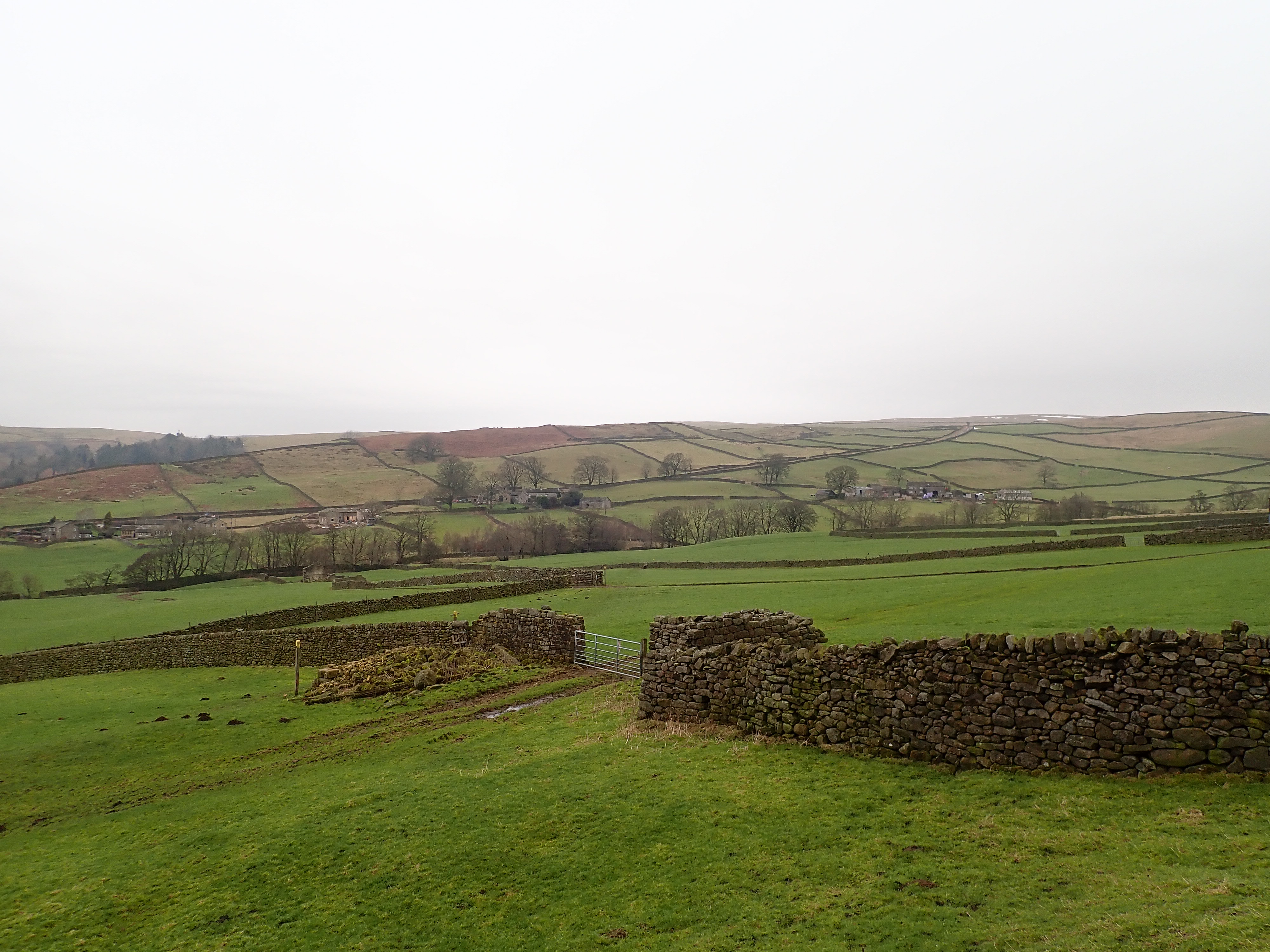
The fields on the other side of the beck didn’t have an obvious path, but someone had helpfully painted the tops of the signposts yellow. I followed these until I joined Howgill Lane as it traversed the side of the valley. A couple of minutes’ walk along the lane brought me to a sturdy wooden gate and the permissive path up the side of Barden Fell.
This muddy and rocky path made its way up a slope of heather, brown bracken, and sporadic trees by a series of switchbacks. There were points where it seemed that the path and the drainage channels for the fell were the same thing. Even on this grey day, there were fantastic views of Wharfedale.

An air raid style siren sound twice in the distance when I was about halfway up the slope. I realised that there must be blasting at a nearby quarry, and waited for the sound of the explosion. Instead, I heard the short, deep rumbling noise of collapsing rock.

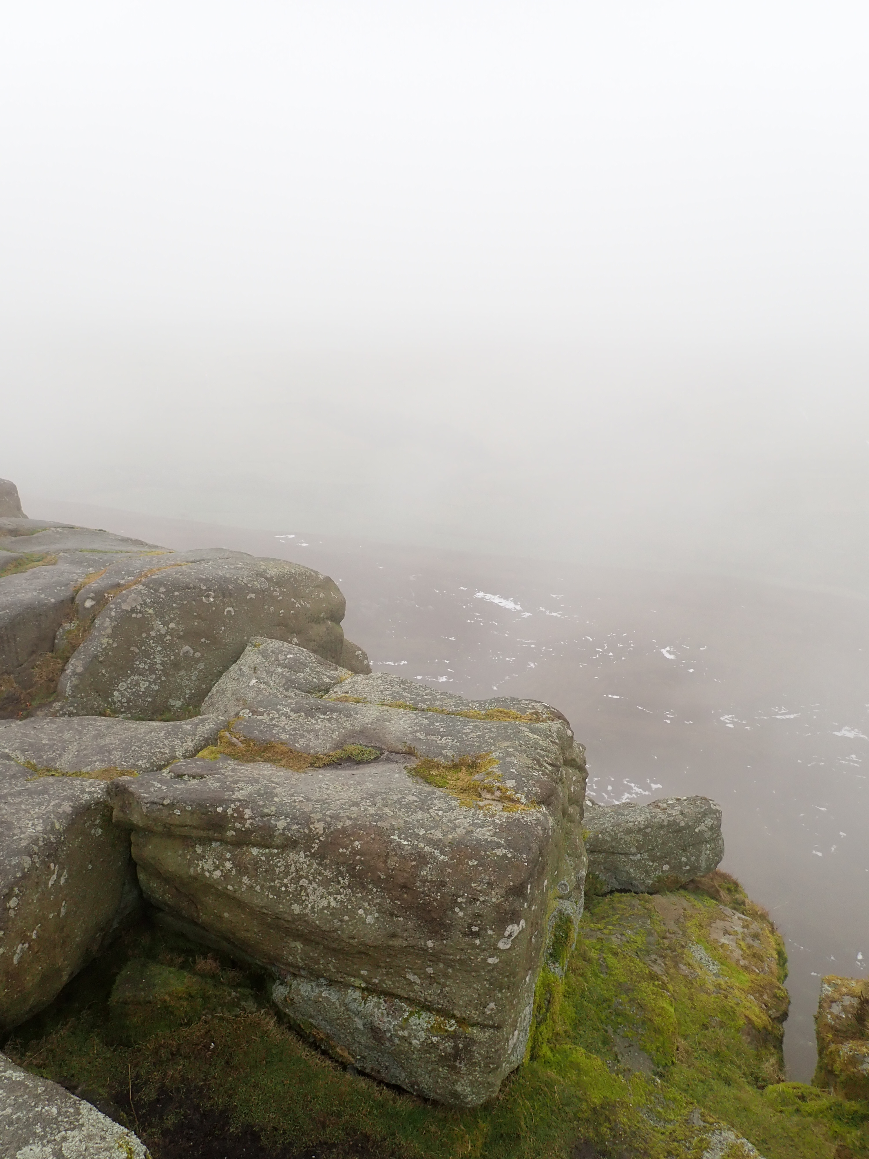
As I climbed higher, the washed-out silhouette of Simon’s Seat became visible on the skyline, and I started coming across partially frozen earth and patches of snow. The rough path changed to substantial slabs of stone carefully laid out through the heather. I followed these as they curved up the slope and then to the side of the gritstone blocks and faces of Simon’s Seat.

The low cloud wrapped Simon’s Seat in a damp, melancholy haze and light rain. It contrasted with the brilliant white of the slowly melting rime that encrusted some of the heather and grasses as well as one small pine tree. I stopped to admire the rime as I picked my way over the haphazard rocks and up to the trig point.
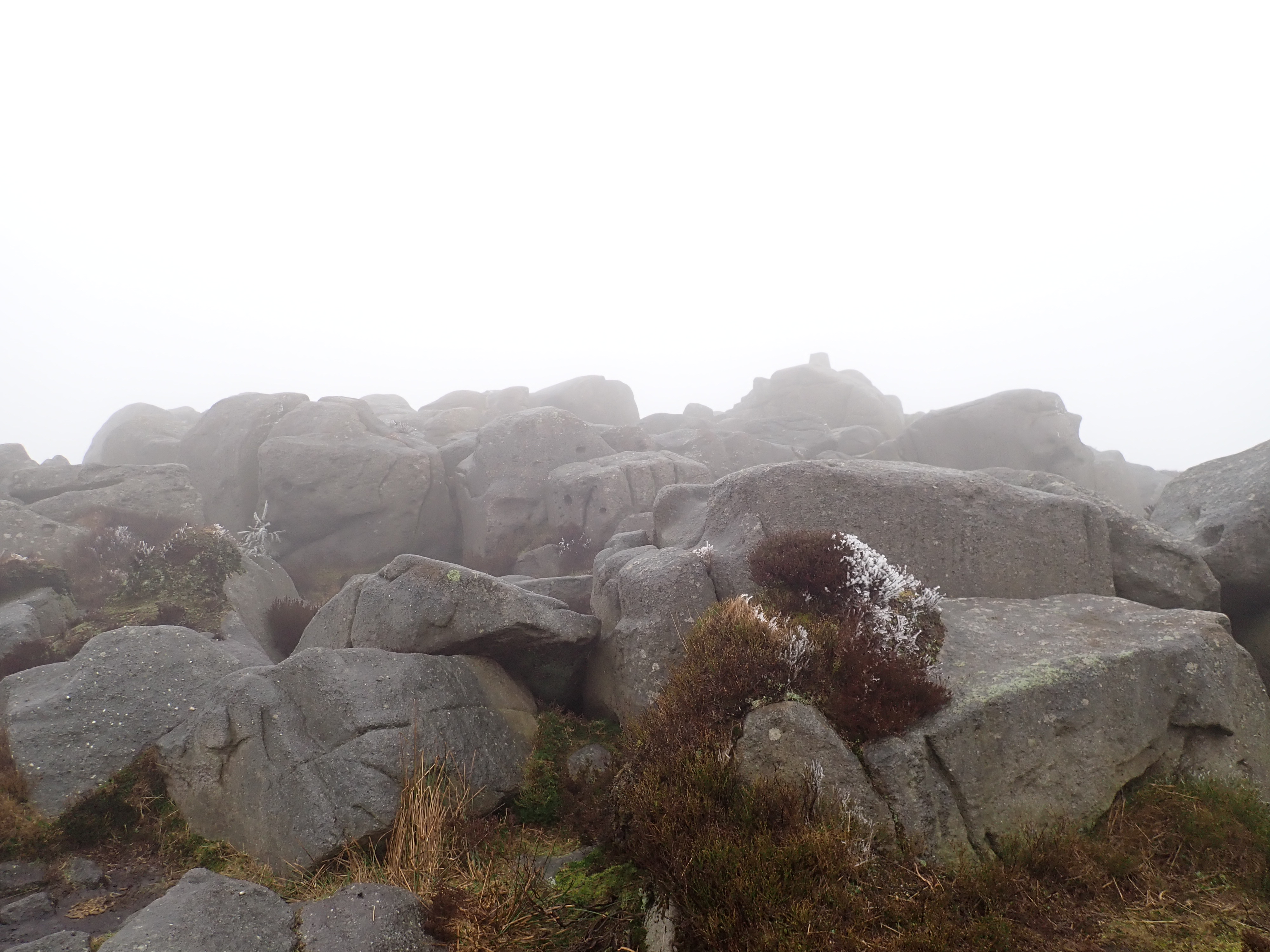
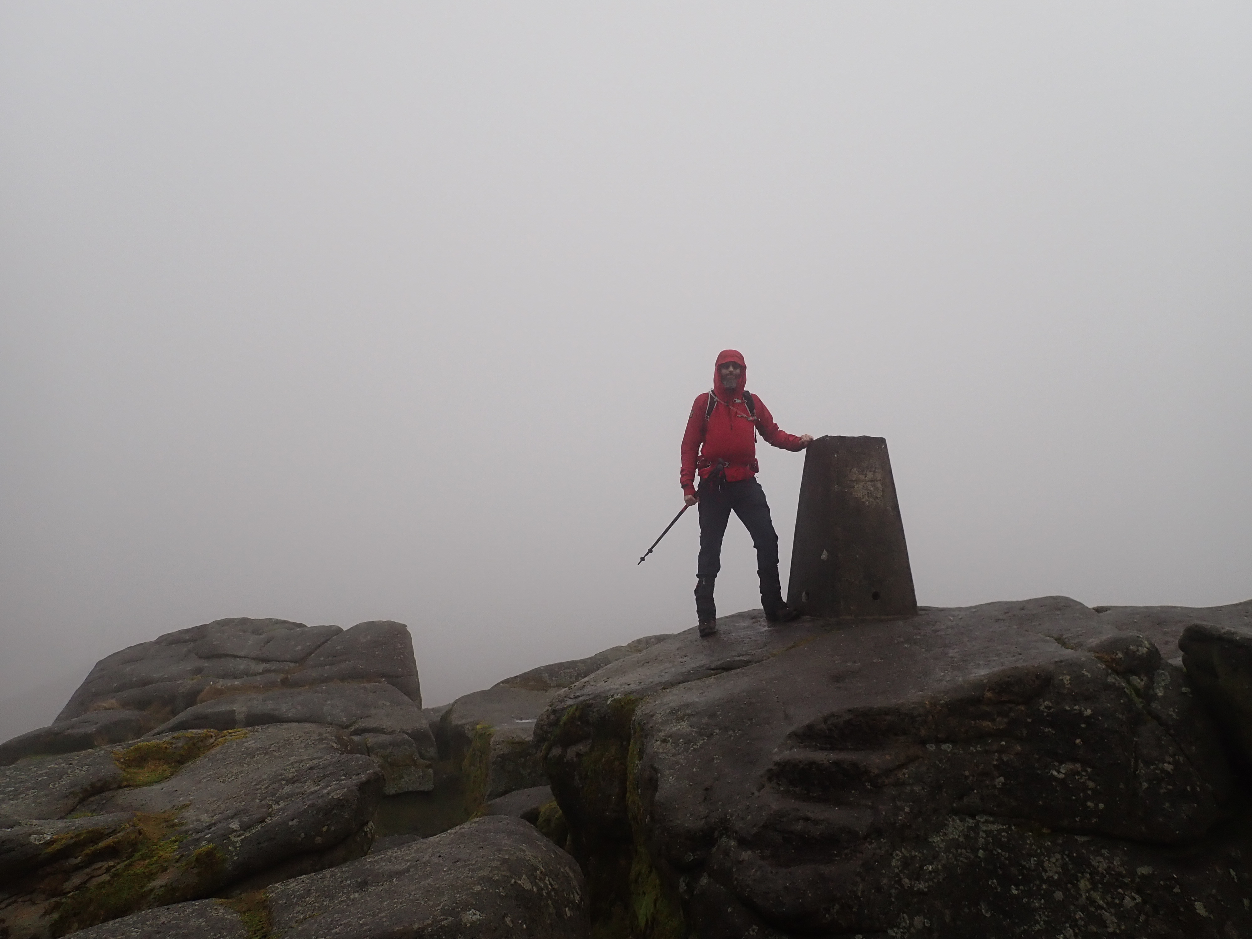
Simon’s Seat is famous for its views, but they unfortunately stayed hidden behind the cloud while I was on the summit. So instead of admiring the view of Wharfedale over lunch, I sat and enjoyed watching a pair of grouse having a conversation, and looking at the interesting shapes of the gritstone.
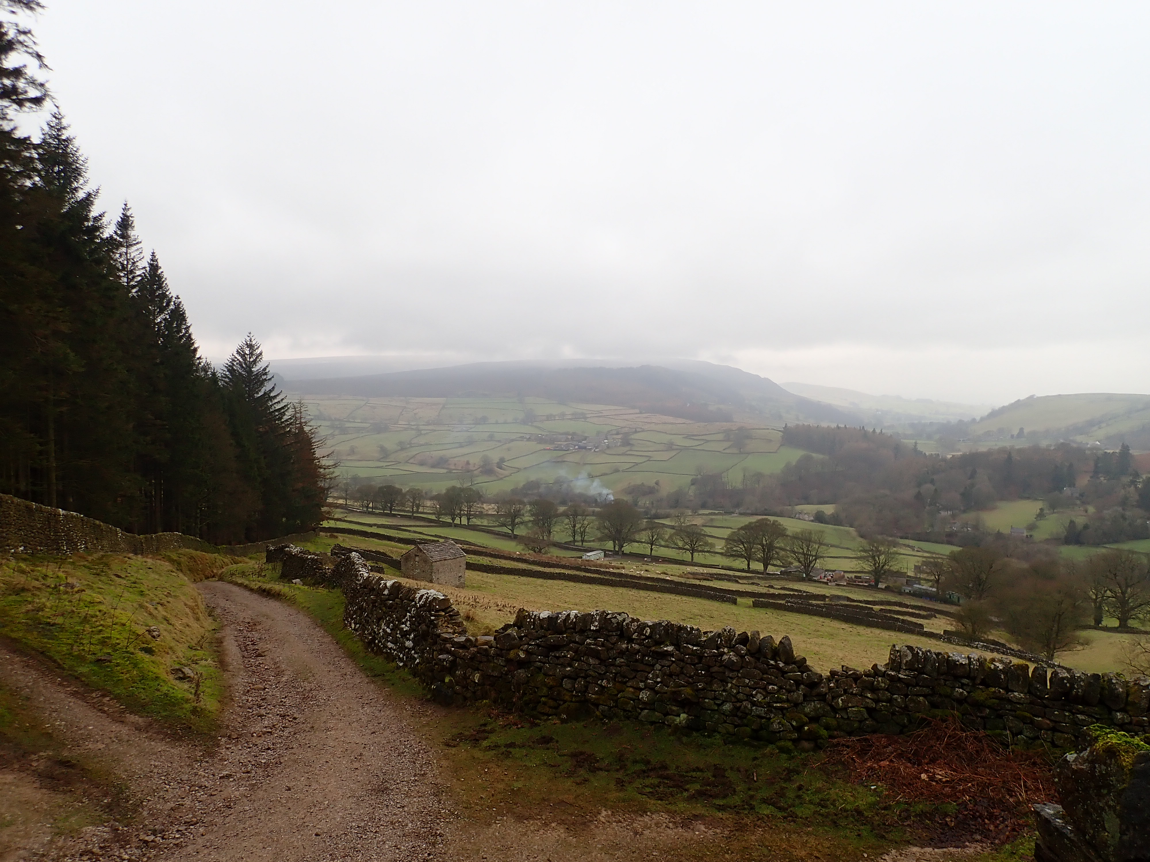
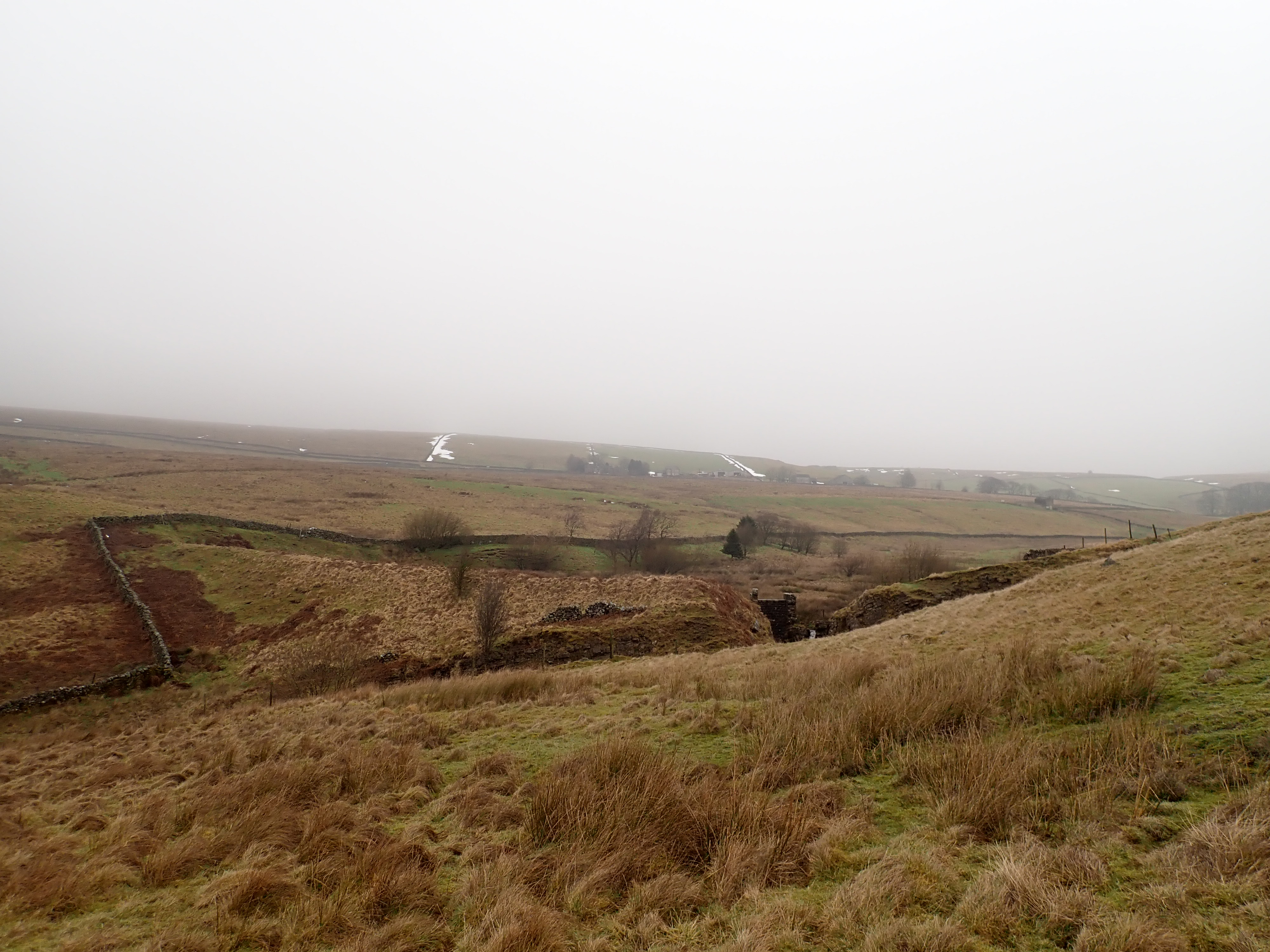
Despite the dreary weather, I was having a good time and cheerfully set off over the moor along another stone slab path. I slowly descended the fell until Wharfedale hazily came into view and I left the stone slabs behind. After following a drystone wall for a few minutes, I went through a gate to follow a track downhill through a thick, atmospheric pine wood. I exited the wood to a grand, sweeping (but still cloudy) view of Wharfedale. The track carried on down to the tiny hamlet of Howgill, where I rejoined Howgill Lane and followed it until I came to a footpath that branched off in the direction of Skyreholme.


I took a muddy path across pastures down to Fir Beck and then on to the hamlet. Skyreholme used to have a cotton and calico mill, and I wondered if the first house that I came to was the remains of that mill. It sat atop a giant, square, black wall that rose from the beck and extended upstream in a series of tiers. These had been turned into an interesting garden with a small waterfall. Just beyond this, I crossed the beck by a little wooden bridge. I then climbed into a passage inside the walled bank and that went up by a series of twisting stairs. These brought me out among stone cottages. I then took the road up the valley to Middle Skyreholme. By a weir, and just before the entrance to Parcevall Hall, I turned to follow Skyreholme Beck into Trollersdale.
I was pleased to arrive in Trollersdale. It is a gorgeous little valley that feels peaceful and secluded. Skyreholme Beck meanders along the flat bottom of the dale, while its slopes have small limestone bluffs and patches of scree. There are clumps of woodland at one end, while some solitary trees, bracken and rush break up the grass that otherwise covers the valley. Coming in from the direction of Skyreholme, I passed the wall and greenhouse of Parcevall Hall Gardens and an old barn before walking up the remains of an earth dam. I’ve read that this was built to serve the mill in Skyreholme. A deep notch at one end of the dam lets the beck through.

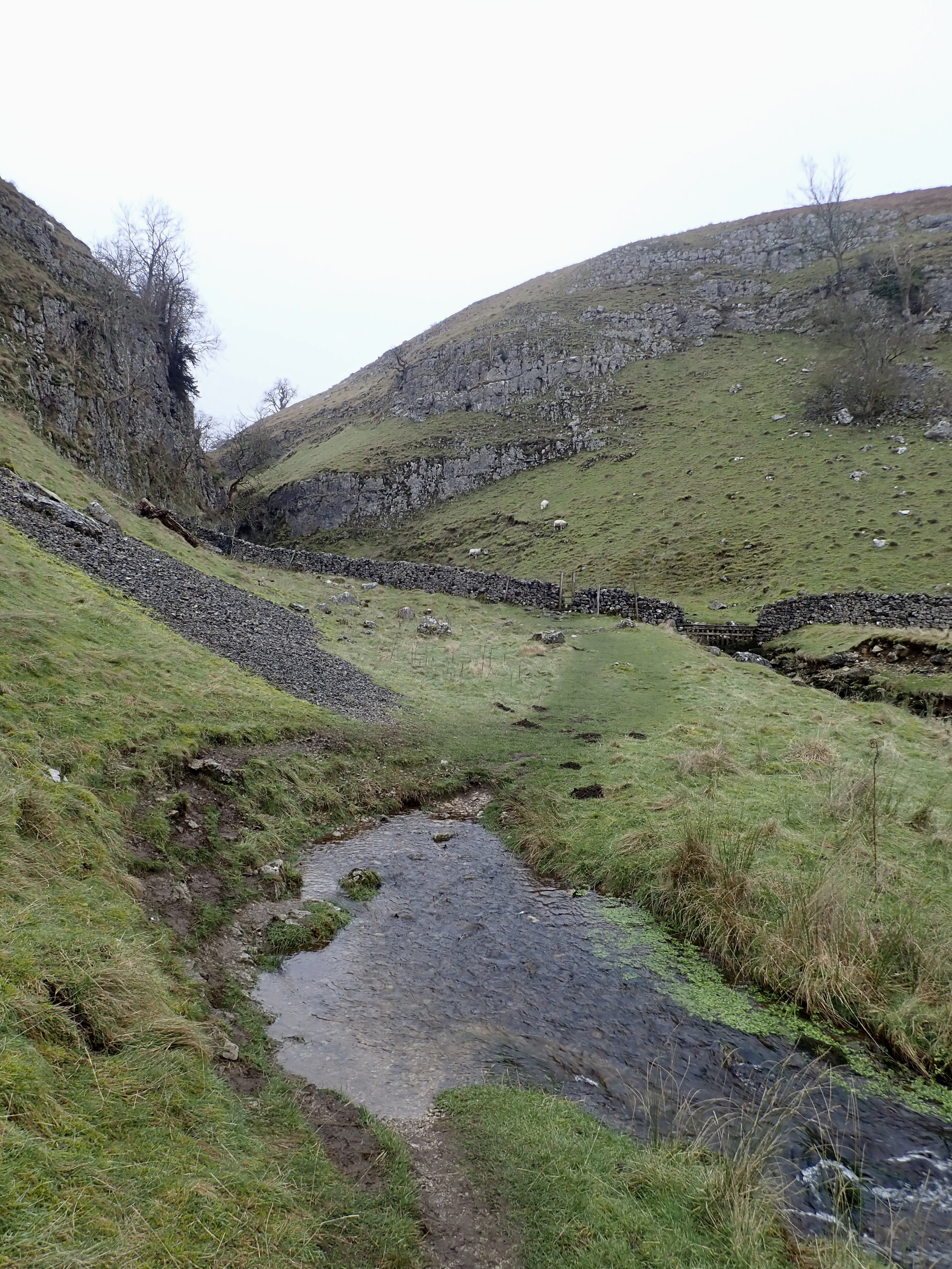
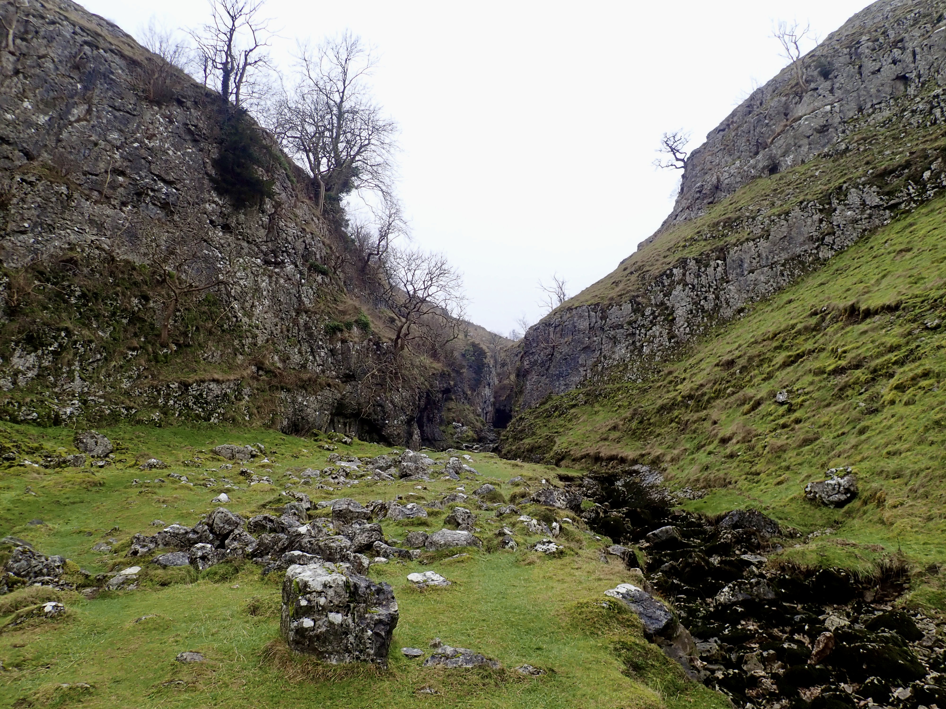
I enjoyed the short walk along the side of Trollersdale from the dam. At the point where the dale splits into three branches, I took the middle branch along the beck and towards Trollers Gill.

Before I got to Trollers Gill itself, I stepped around the small pool which is one of the two places where Skyreholme Beck abruptly reappears after having headed underground at the top of Trollers Gill. I then crossed a wall by a stile to start walking up the dry, rocky stream bed that is the floor of gorge. The beck comes back to the surface in the Gill during heavy rain and I could see a line of plant debris that suggested it had done this recently. The stream bed had been completely dry on my previous visits to Trollers Gill, but I had to take care on this visit because of the slick, wet limestone and green algae that often covered it.
According to local folklore, the Gill was once home to trolls. They would roll stones off the top of the gorge and on to people travelling along it. It’s these trolls that give Trollers Gill its name, which literally translates as “the troll’s arse.” This is because “Trollers” is an amalgamation of “troll” and a slight corruption of “ears” (the Old English word for arse or ass).
There is another folk tale associated with Trollers Gill. This is that the gorge is home to the Barguest (AKA the Barghest). This is a massive, spectral, black dog with huge teeth and claws. One look from the Barguest is said to turn someone into stone.
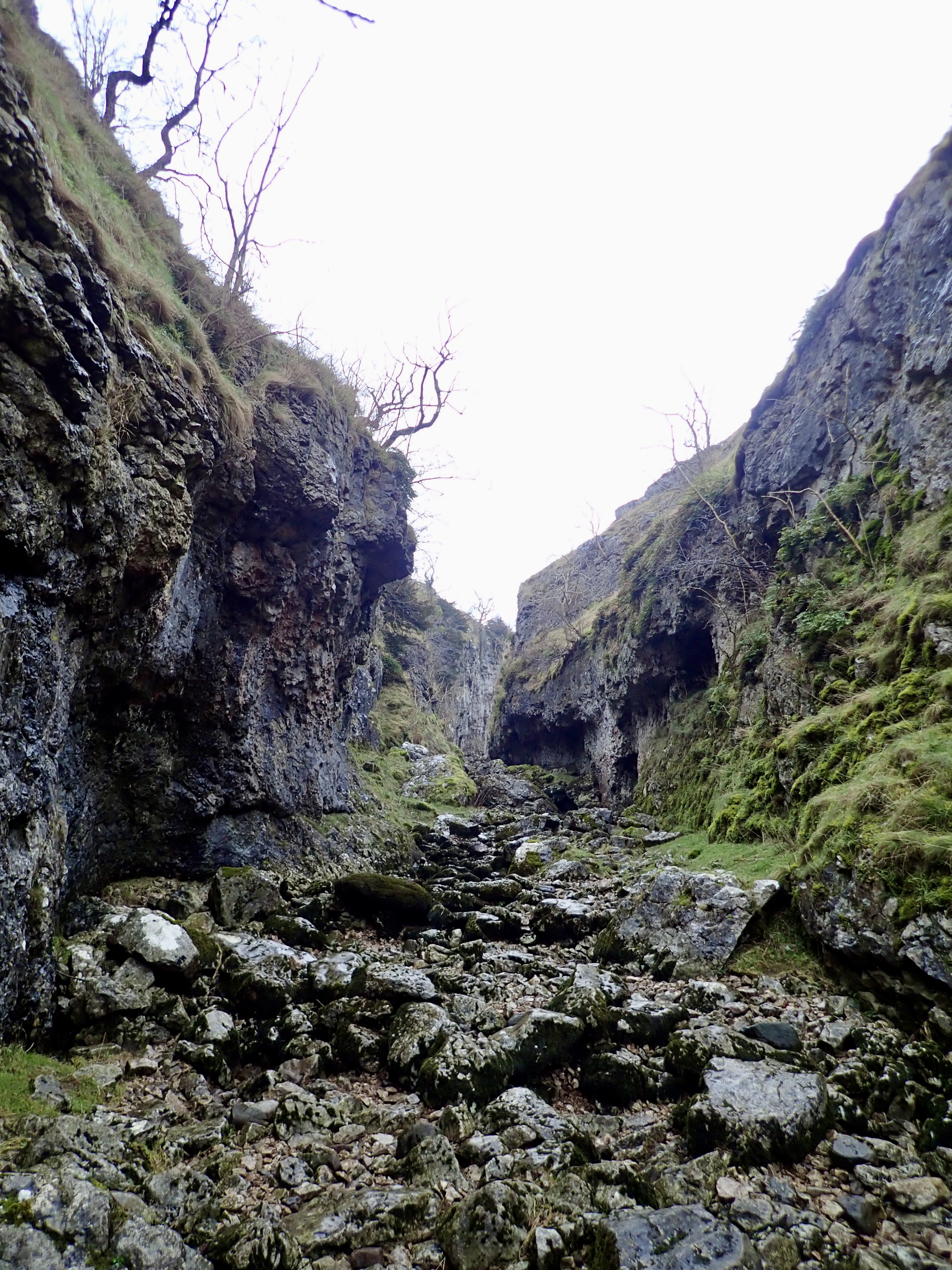
On that grey, dark day, it was easy to imagine something malevolent lurking in Trollers Gill. However, I enjoyed walking (and slipping) my way up that fascinating and ruggedly beautiful ravine.

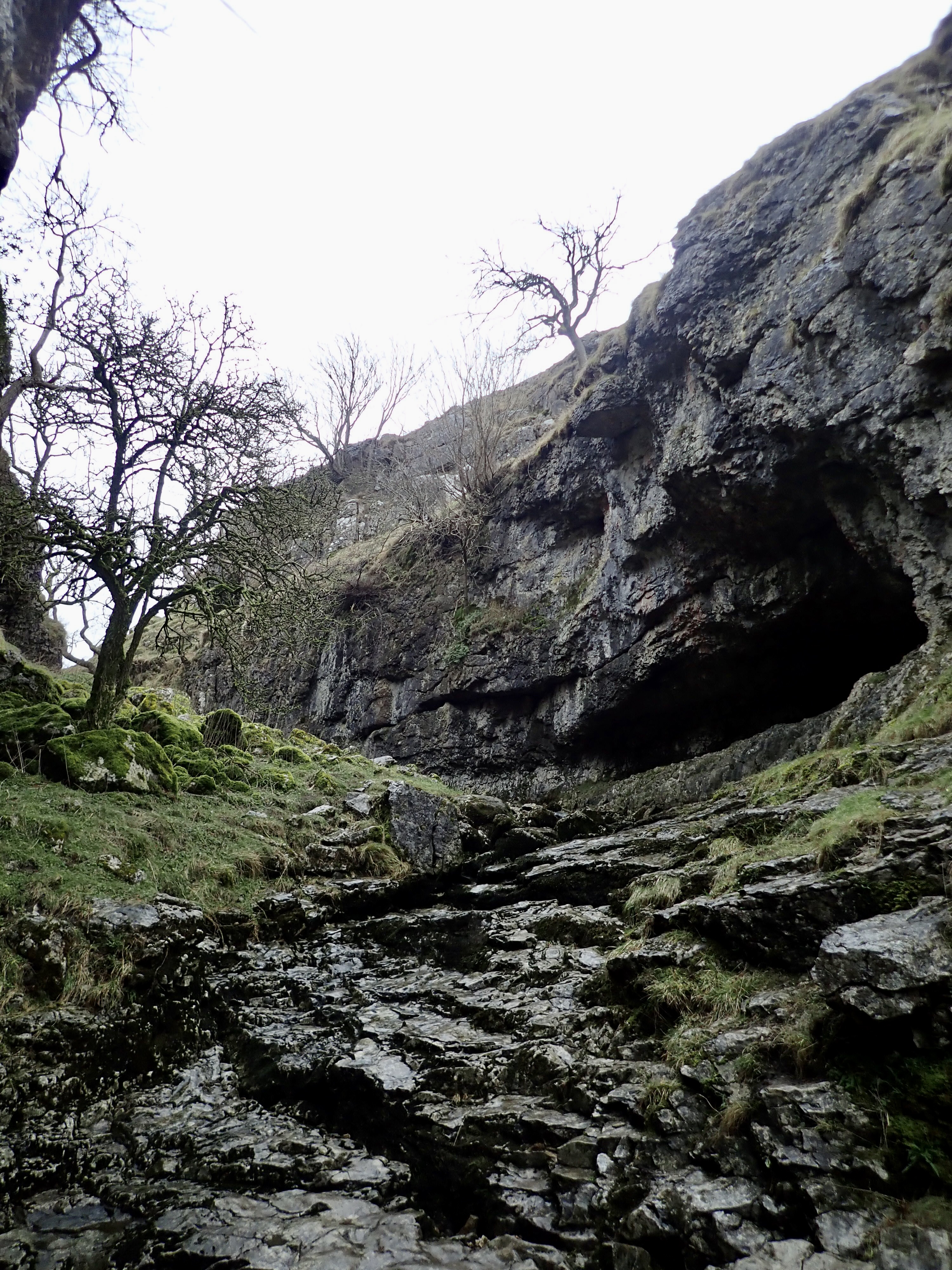
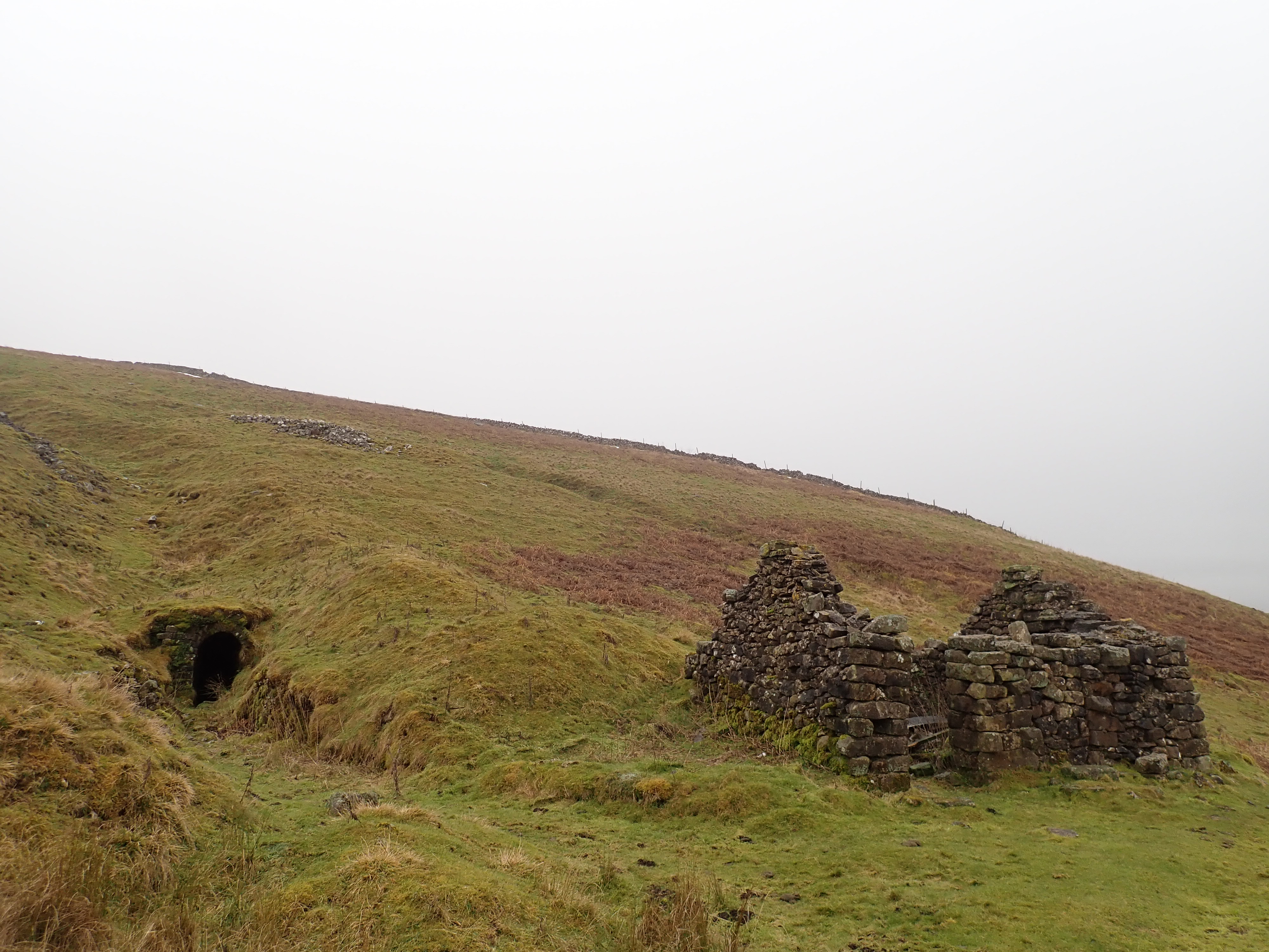
The gorge gives way to a pretty small valley with rocky and grassy sides. At this point, a little way up the valley wall to the right is an adit cut into solid limestone. I ventured down this neatly dug tunnel the last time I was here. It goes into the hillside for about 10 metres before ending abruptly. My guess is that the miners who made it were exploring for veins of lead, and abandoned the work when they found nothing.

I think that this upper section of the dale is almost as special as Trollers Gill. It’s attractive in a different sort of way but still has some of the roughness, and keeps that feeling of being in a wilder part of the Dales.


I carried on up the valley, carefully picking my way around and over the wet rocks by the beck, until I reached a little bridge. The path on the other side of the beck from this bridge joins up with the other main branch of the dale, but I kept on up the hill.
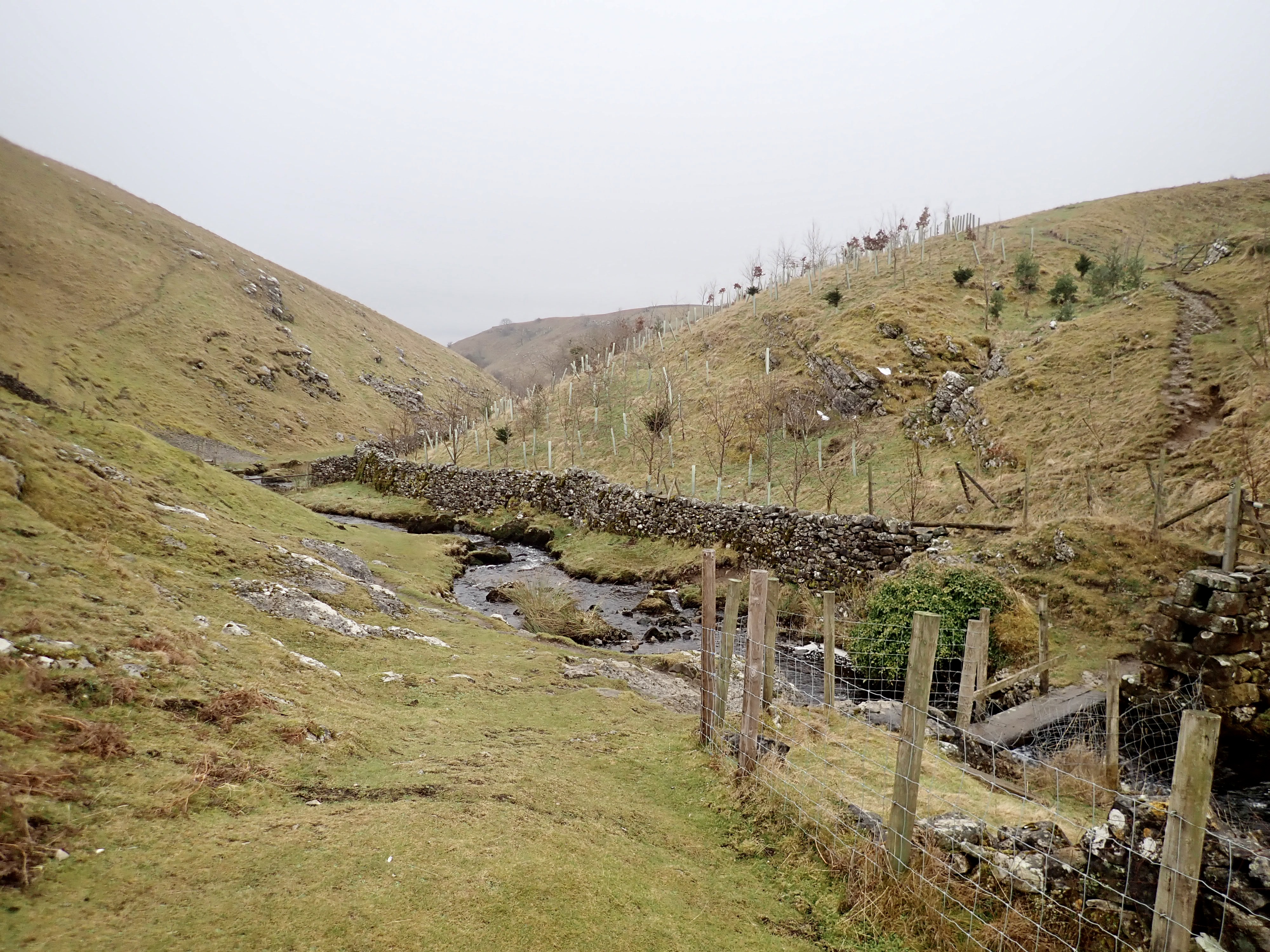
Just beyond the bridge are the remains of a lead mine. There are spoil heaps, a collapsing drystone building, an adit, and the remains of a dam made by a large earth bank and a broken stone wall through which the beck runs. I picked up the grassy track that starts by the building and followed it up and around the hillside.
This track brought me back to Black Hill Road, and I retraced my steps to my car.

I’ve always fancied that track taking off near Stump Cross but never did it. Also haven’t been into Trollers Gill since I was a young girl with my parents.
I think that slab path to and past Simons Seat must be fairly new as I used to go up there a lot and it was just the rough, stony, gravelly path when I was there.
How far was your walk?
Those slabs are an impressive feat on a moor.
I think I walked about 12.5 based on my rough plotting on a paper map. I’ve not plotted it in any mapping software to get a more accurate distance.
Those slabs are an expensive feat on a moor due to the helicopter costs involved! But yeah, someone must have had to put in some real effort with the size of those!
Definitely – getting all that stone in place must have been expensive. Something I find interesting about those paths is that they are built. It’s not just a case of the stone slabs being laid down like stepping stones – the builders went to the trouble of making a continuous path with steps. I imagine that adds to the costs as well.
The costs is probably the reason that the slabs only go so far along the fell.
Fantastic walking, love the look of Trollers gill and wish we had those slabbed paths down here on the moor, would make it easier across some of the boggier ground 😊
If you are ever up this way, then I would highly recommend Trollers Gill.
Those slabs are a relief to walk on after making your way through the mud, and they are probably a good way to deal with erosion too. Walking on them feels a little bit like cheating, but I can live with that.
ooof, that fog tho! I would have twisted an ankle at least twice!