
On the first day of a two-day walk in the Yorkshire Dales, I walked from Ribblehead to the summit of Whernside and then down the length of Whernside’s superlative SW ridge.
I was studying a map of the Yorkshire Dales a couple of years ago, looking for ideas for walks, when the SW ridge of Whernside caught my eye. This rounded ridge gradually descends from the summit of Whernside all the way to the outskirts of the village of Ingleton. It runs along one side of a small dale opposite the imposing mass of Ingleborough. When I did the Yorkshire Three Peaks many years ago, I had walked the start of this ridge before dropping off it after about a kilometre to descend to Chapel-le-Dale. If I had carried on going, I would have had miles of gentle walking over the moors and through the karst landscape of the Dales, all the while with sweeping views across the dales. I found the idea of walking along this ridge compelling, but I put this idea to one side because the most obvious ways to do it were either a long loop walk, or a linear walk with a car at each end, and these were not appealing. Last year, another way to walk the length of the SW ridge of Whernside occurred to me.

My idea was to extend the walk so that I did a two-day, skyline traverse of the small dale that runs from Ribblehead to Ingleton. I would take the Settle to Carlisle railway to Ribblehead Station and from there follow the well-used track up Whernside. From Whernside’s summit, I would follow the crest of the ridge all the way down to Twisleton Scar End, and then on to the camping and caravan park of Falls Park. After an overnight camp, I’d cross the dale and walk up Ingleborough. I’d then walk over the adjoining Simon Fell and Park Fell, before descending back to Ribblehead Station and my train home. This route would keep me high above the dale and so should deliver great views. A couple of months ago I put this idea into action. Unfortunately, as is sometimes the way, things did not go according to plan.
The start of my mini-adventure was the always brilliant train trip from Leeds to Ribblehead along the Settle to Carlisle line. I passed towns with buildings of weathered gritstone, former mills, green pastures enclosed by drystone walls, and old stations of stone with canopies of glass and painted cast iron. Nearer the end of my journey, the railway line followed Ribblesdale, close to the river Ribble, and with rounded peaks on both sides. The sky became depressingly grey and light rain began to fall as I passed moorland and limestone pavement, with Pen-y-Ghent in the distance. When I got off the train at Ribblehead, the top of Whernside was hidden by a haze of low cloud that dampened my expectations of seeing good views on my walk. Trying to be hopeful, I set off out of the station and down the track to the road.
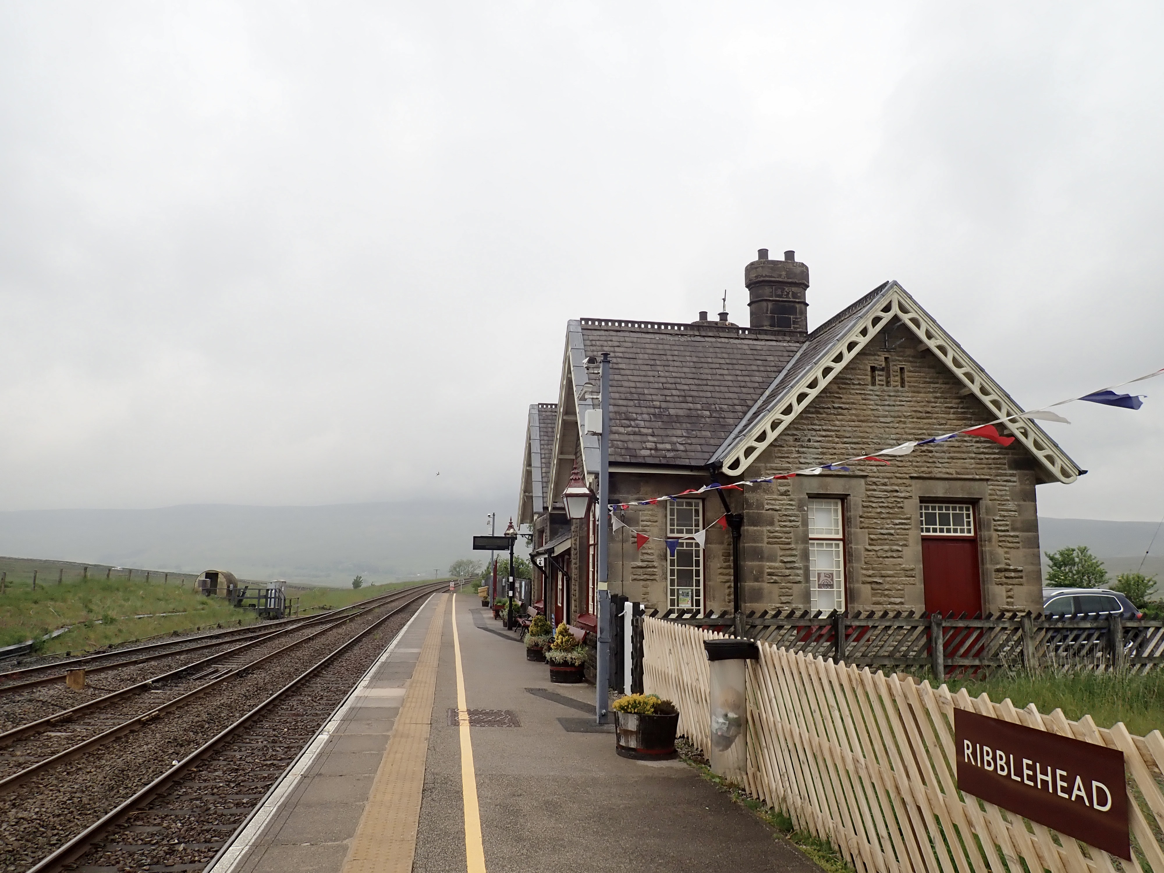
After walking along the road and past the pub, the magnificent and majestic sight of the Ribblehead Viaduct came into view. It’s an impressive construction made even more amazing by its location at the head of the dale, and I enjoyed admiring it as I walked past.

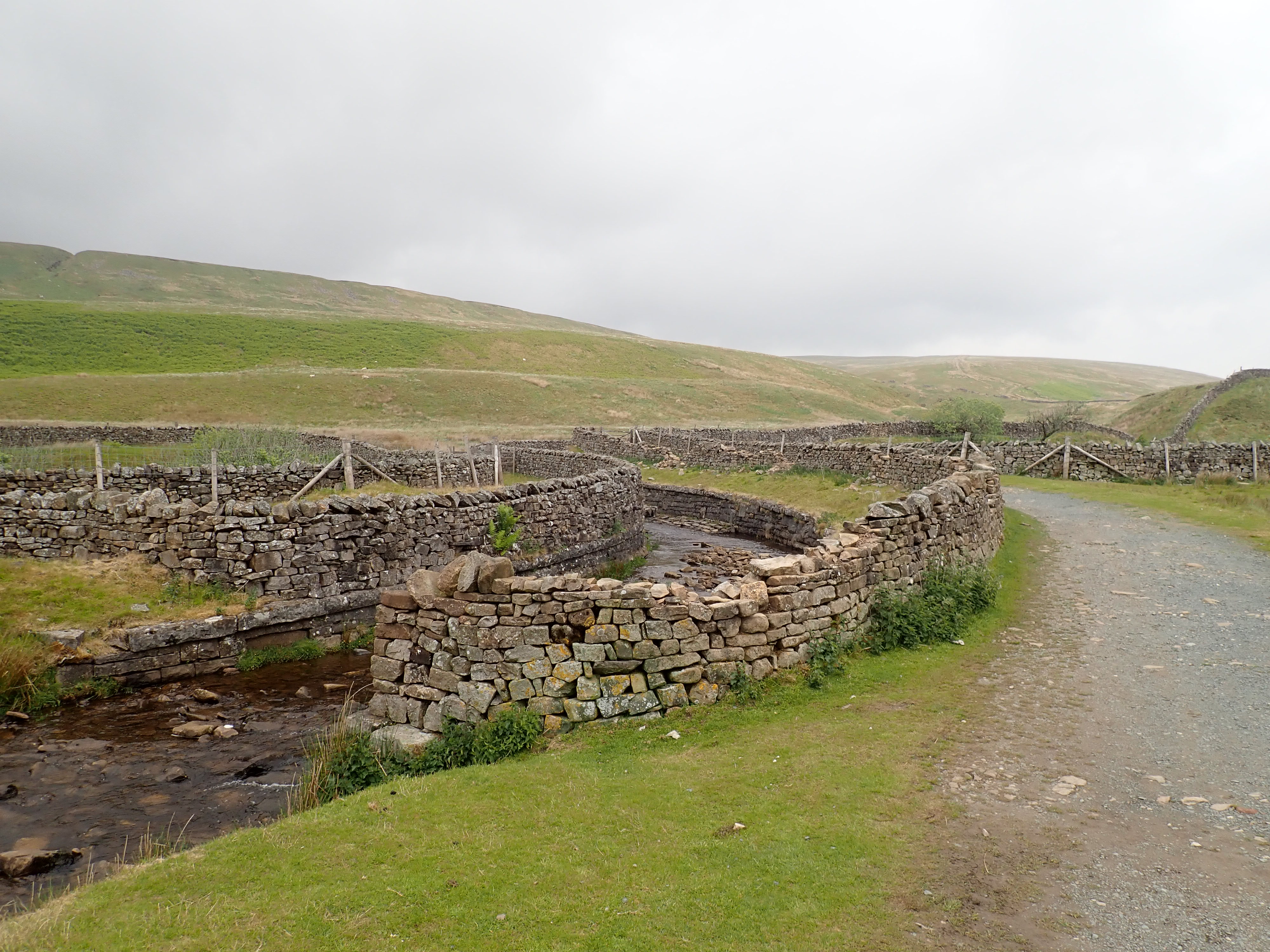
The substantial footpath to Whernside starts by following the Settle to Carlisle line over the moor, and it includes a few points of interest. This path passes a lovely, restored, vintage signal box next to a strange, dilapidated, box-shaped house that is strewn with rubbish. It then goes over Hare Gill by way of some hefty stepping stones before, a little further on, crossing Little Dale Beck by a wooden bridge. The path then passes over the Settle to Carlisle line via an aqueduct that also provides a crossing for Force Gill. This is one of my favourite sights on this walk. I like the elegance and simplicity of this piece of engineering, with the drystone walls that let the aqueduct blend into the landscape, the way the channel carrying the stream curves in an S-shape onto and off the bridge, and the stone steps in the channel that form mini waterfalls. The aqueduct also gives a great view down the line as it disappears into a tunnel beneath Blea Moor.


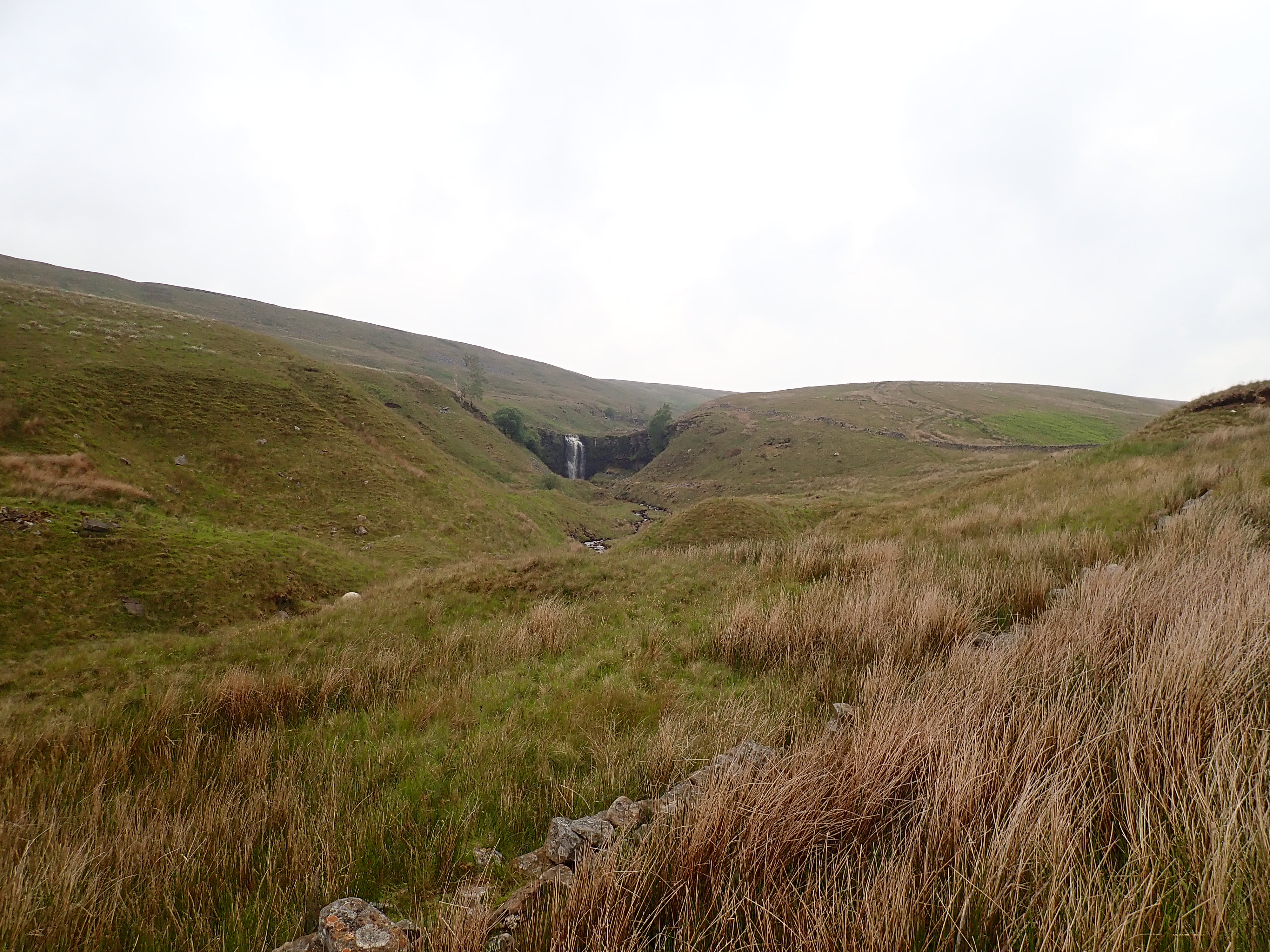
The path continues from here to climb Slack Hill by the Dales High Way before taking a sharp left to head to the North ridge of Whernside. Although the haze was obscuring the views, on this stretch of my walk I enjoyed seeing the waterfall on Force Gill and the white tufts of the cotton grass (AKA Eriophorum) on the moor.

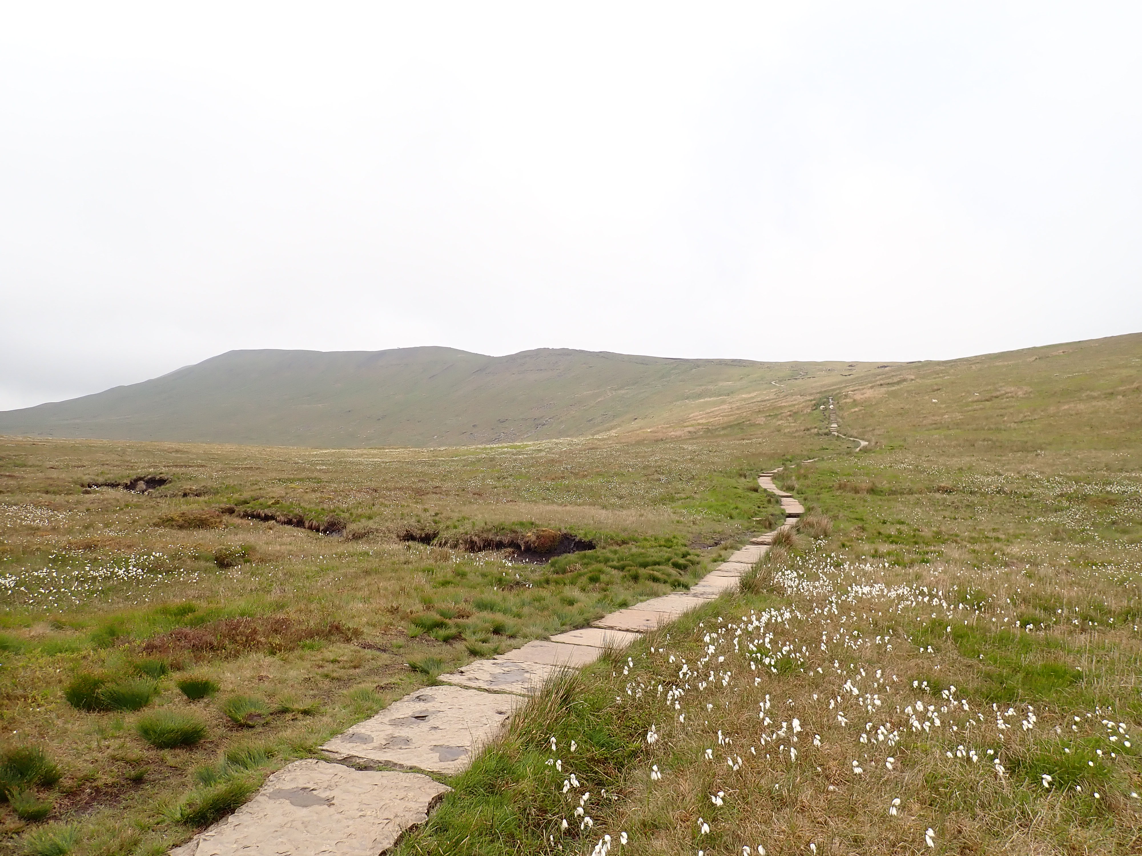
The summit of Whernside kept appearing and disappearing in cloud as I stepped around the puddles on a boggy section of moor. Patches of sun appeared as I reached a series of stone slabs. I had come here for the chance of a long walk with sweeping views over the Dales, and I was feeling more optimistic that I might get them. However, as I slowly made my way onto the ridge, the cloud descended. As I got higher, the weather got greyer and windier. The Ribblehead Viaduct was just visible through the haze while Ingleborough was a dark shadow in the distance. Despite this not being the weather I wanted, the views were gloomily atmospheric and walking along the ridge was interesting and gratifying.
The path ran up the ridge in the space between a steep drop and a robust drystone wall. When I reached the summit, I went over a stile in the wall to touch the crumbling trig point and was surprised to find that someone had left a single, white rose on top of it. I then headed back to the summit shelter to get out of the wind, to eat lunch and brew a coffee. I was pleased when the cloud occasionally lifted to give me obscure views of the Viaduct and Ribblesdale.


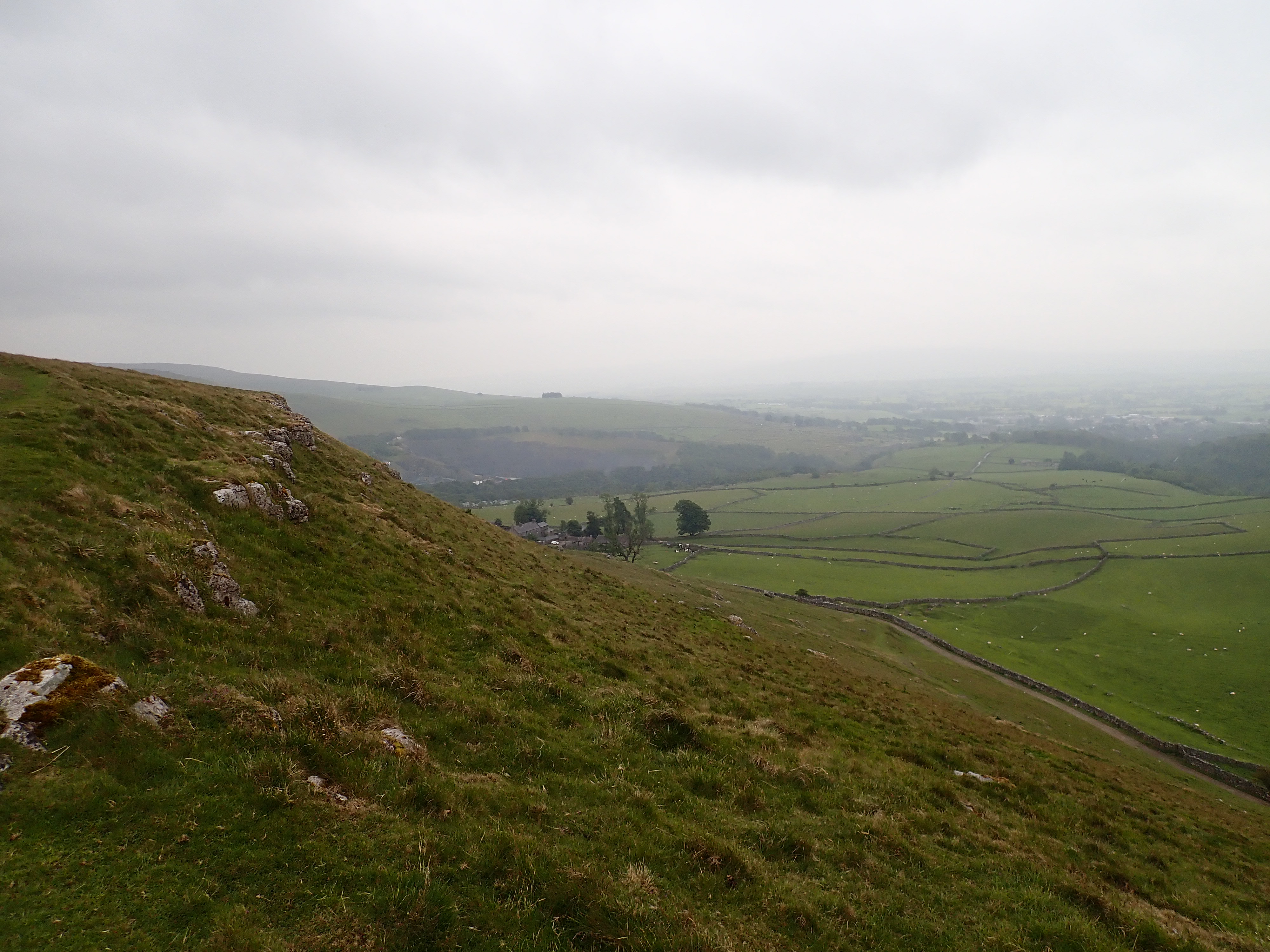
As I left the summit after lunch, I felt elated that I was finally walking down Whernside’s SW ridge after thinking about it for what seemed like a long time. I was a little disappointed that I was not getting the views I had hoped for, but what I could see was still great. My route was a roughly straight line down the ridge, handrailing a drystone wall almost all the way down. This was my favourite stretch of the walk; following the sweeping crest of the ridge as it headed into the distance, dividing one dale from the other, was fantastic. After the main path headed off to Chapel-le-Dale, my route also felt wilder. The path was simply worn into the grass, while the moor stretched out across the ridge, with cotton grass standing out against the greens and browns, and Ingleborough a dark shape sitting on the other side of the dale.


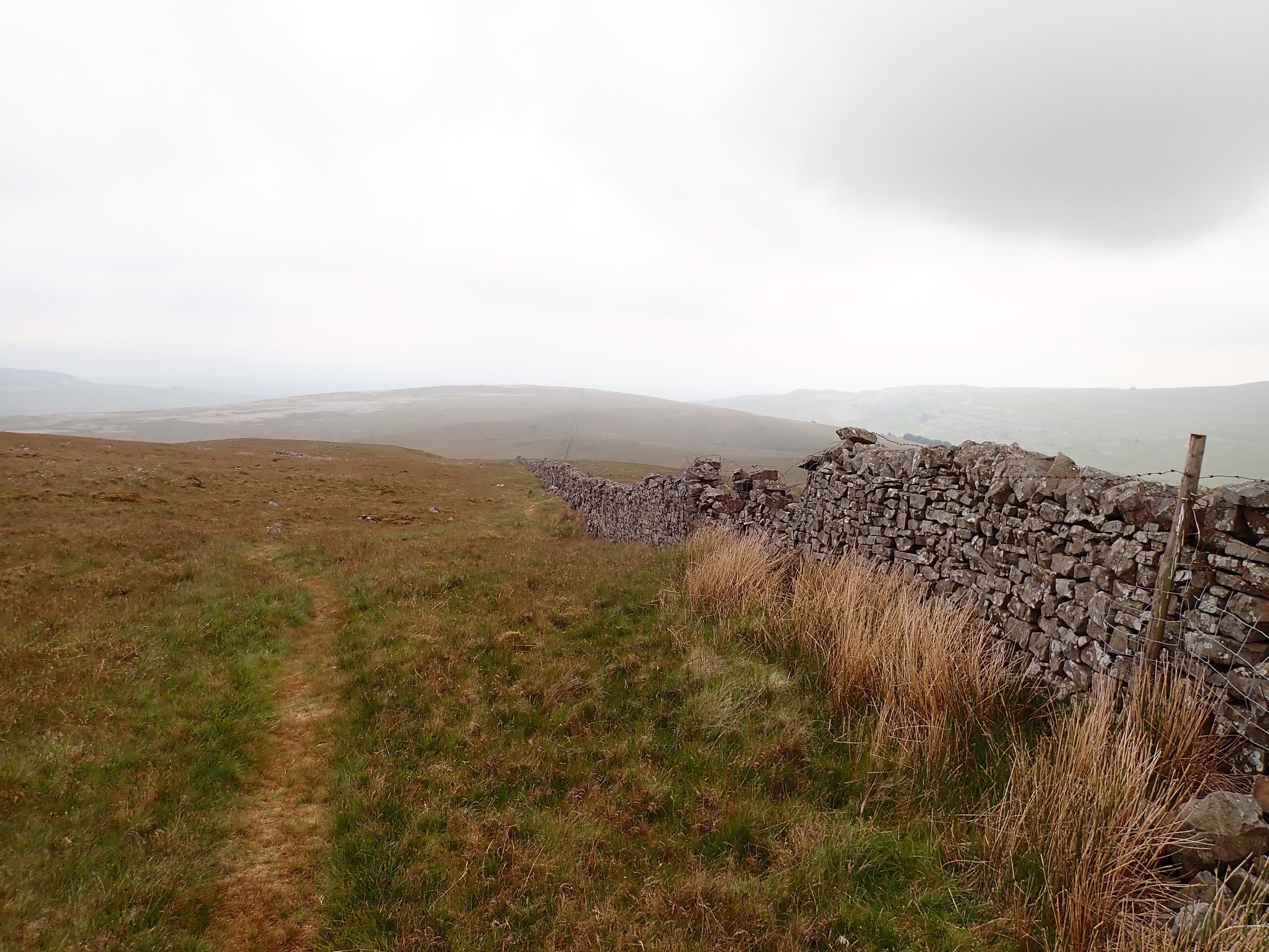

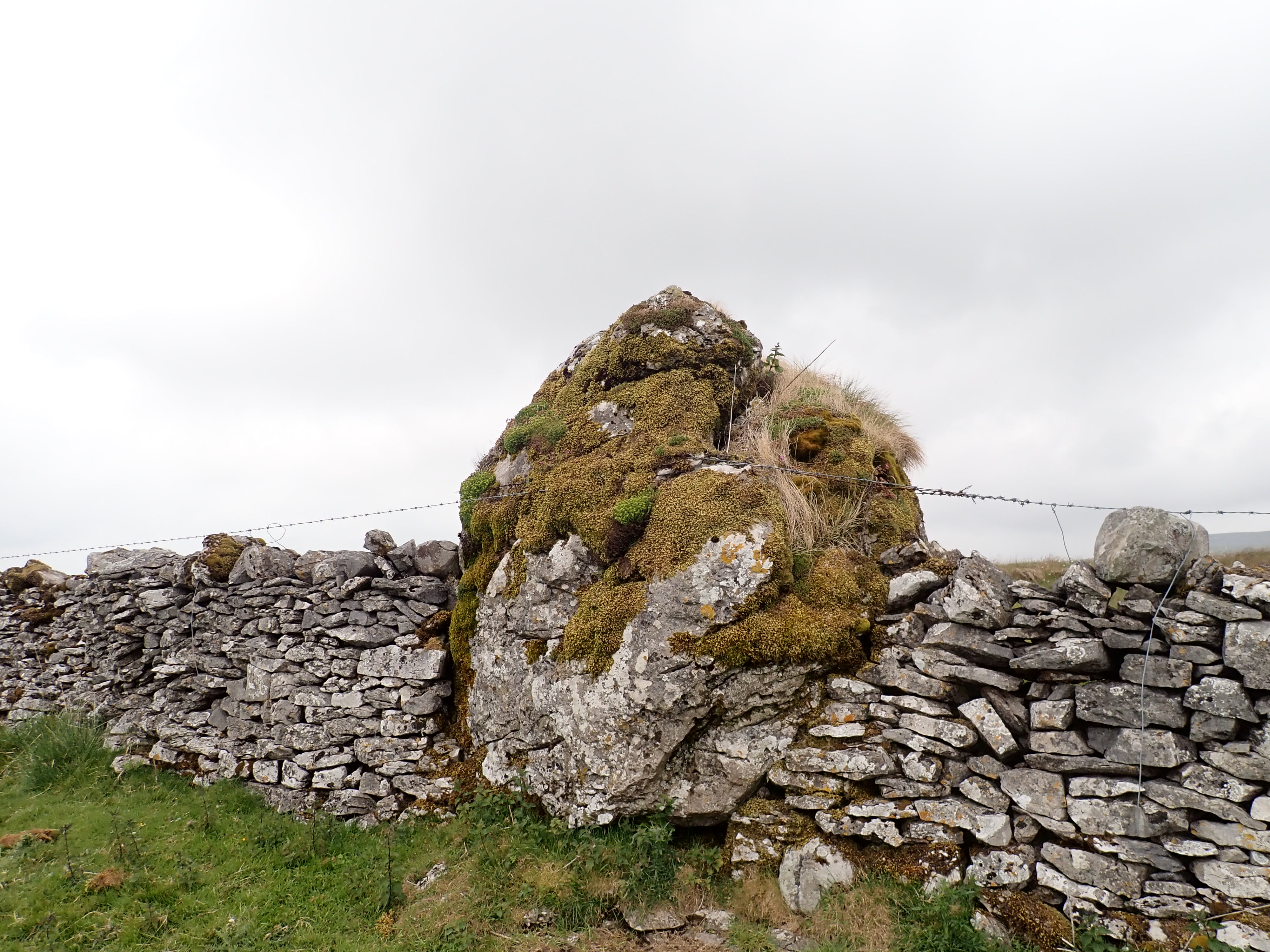
The ridge was covered in shake holes, many close to the path. As I got closer to the limestone pavement of Twisleton, there were boulders scattered across the moor with sheep slowly grazing between them. A particularly large boulder had been incorporated into the drystone wall, and it was an impressive sight. Patches of grass and thick moss covered its rugged top while barbed wire wrapped around it as if it were an errant troll that had needed to be restrained.

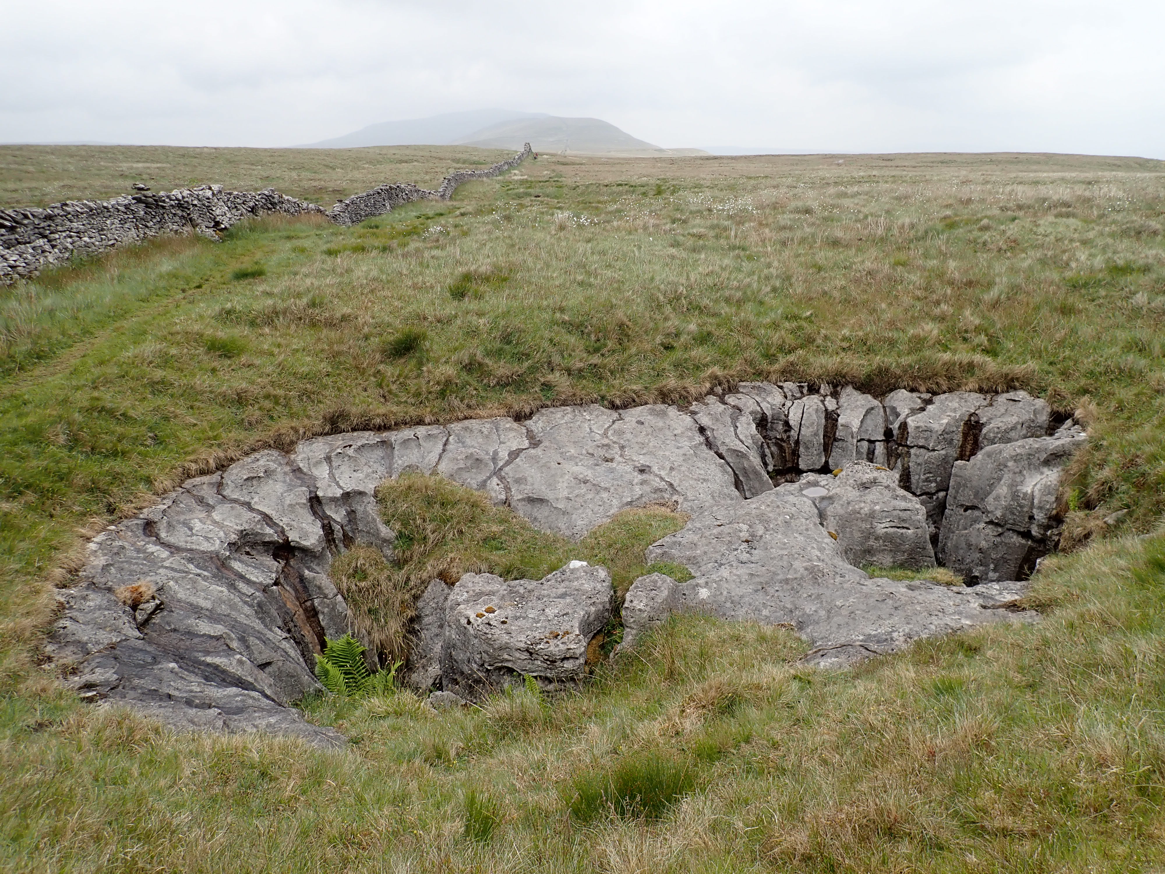
A little further on were two stunning, vertical pot holes, one on either side of the wall. It looked like the grass had been cut away to reveal these irregular shafts with their gouged sides. One pot hole even had a rowan tree growing out of it.

It started to rain as I reached the part of the ridge that was largely covered in limestone pavement. While I think limestone pavement is wonderous, it was probably the reason I lost my route and ended up following a sheep track for a while before having to backtrack to pick up the path as it veered away from the wall.

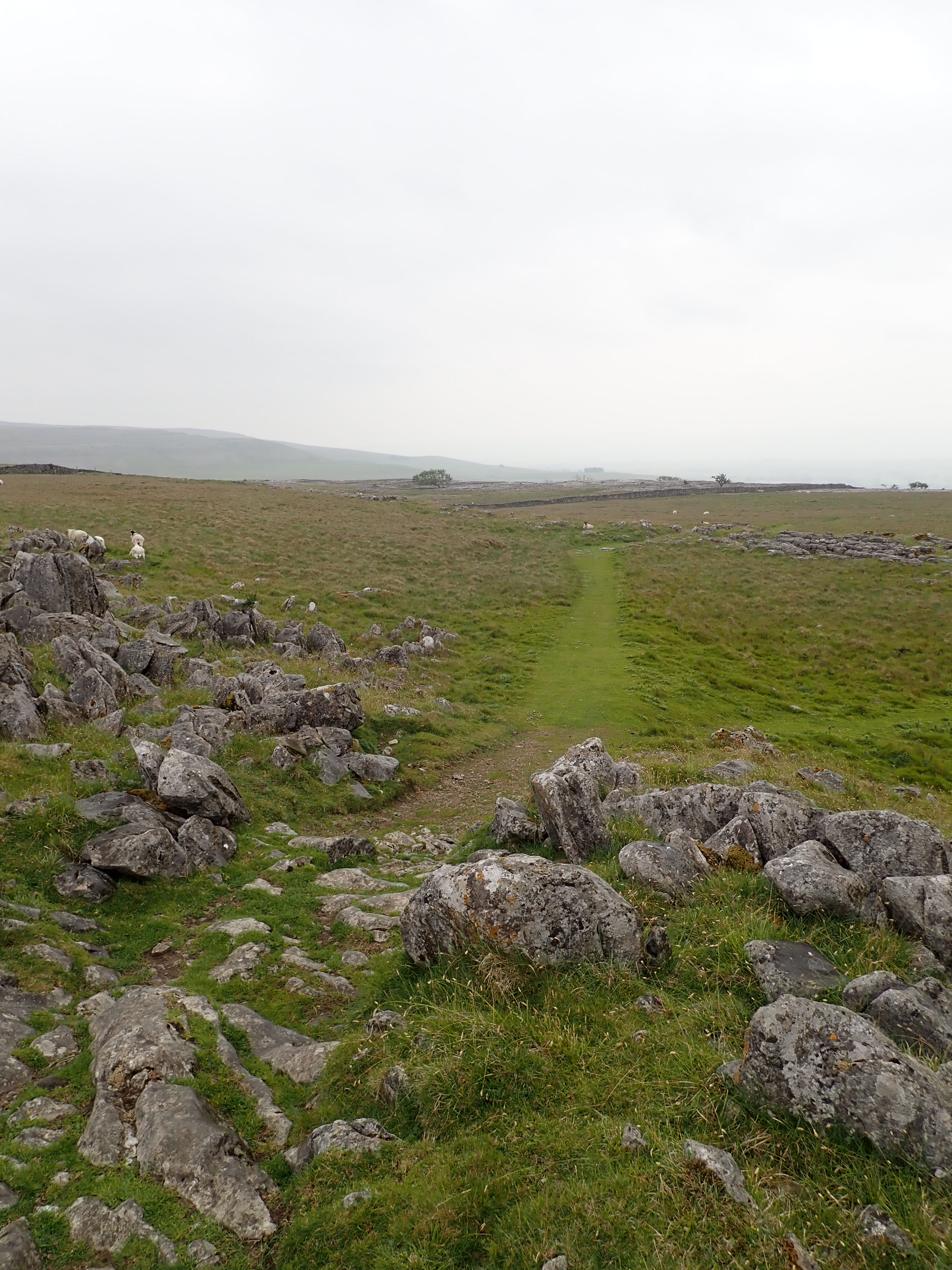
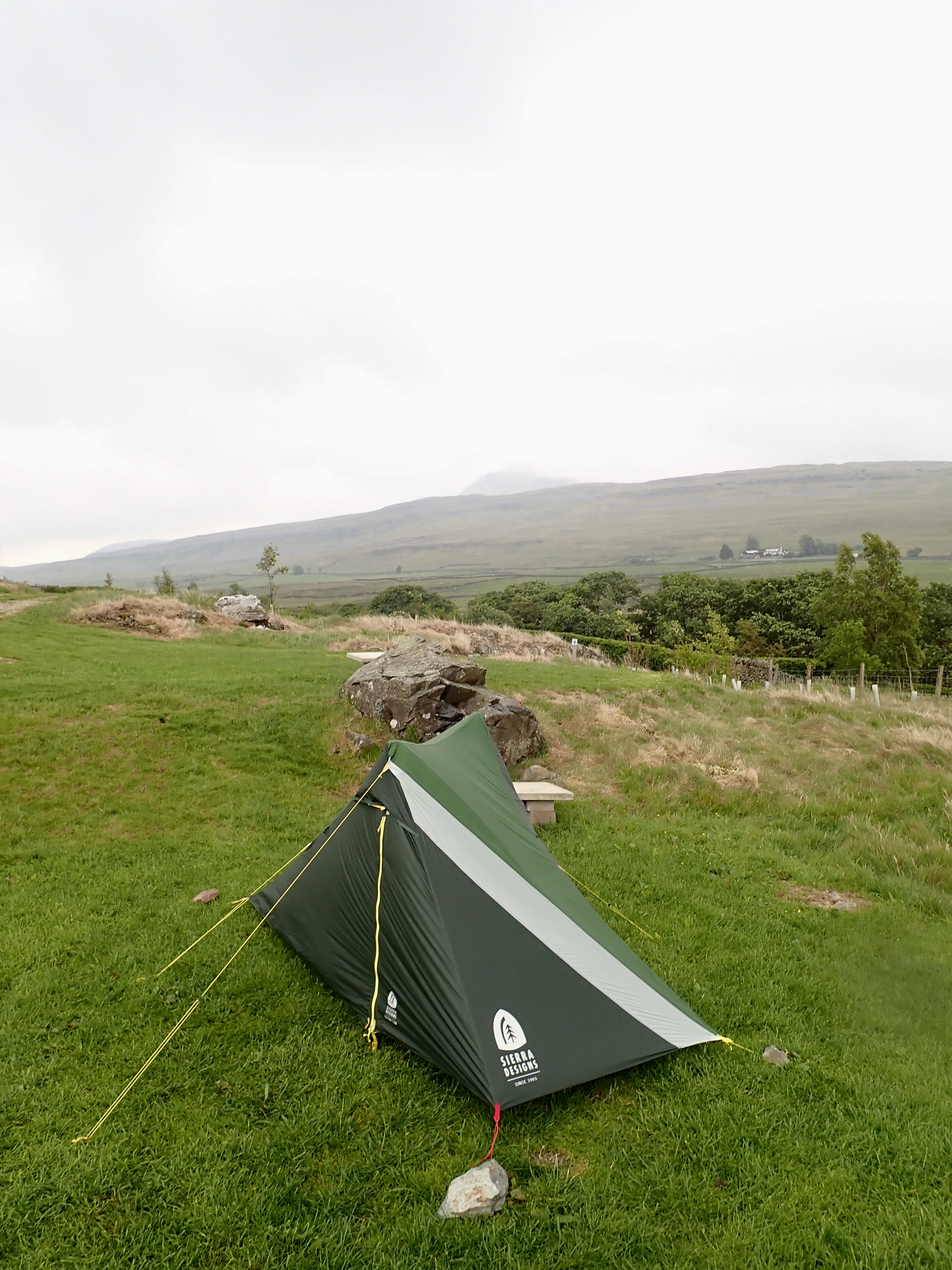
As I reached the end of the ridge, I could see fields criss-crossed by drystone walls stretching out to Ingleton and Ingleton Quarry in the distance. I followed the path as it switch-backed down the grassy slope of the ridge to join a track heading into the dale which took took me past the farm and cottages of Twisleton Hall. I was feeling tired by this point, so it was good to see the campsite sitting on the slopes of the dale below me. After a short walk through a pasture and across Oddie’s Lane, I checked in and wearily pitched my tent. I had a view of the summit of Ingleborough from my pitch, and when the sounds of the nearby quarry finished for the day, I could hear the roar of Beezley Falls away in the trees.
The rain conveniently held off until after I’d had dinner. As it got heavier and my leg muscles began to feel stiffer, I decided to go to bed early. At times in the night, I was woken by the sound of rain thundering down on my tent and dozily hoped it would not adversely affect the next day.
To be continued…
UPDATE: 26 August 2025 – I’ve now written a post that continues and concludes the story of this walk. It can be read here.

I often used to walk up that ridge and then down Oddie’s Lane. You realise that Twistleton is the home of the lovely Twistleton Scar below you – some of the best limestone climbing in the Dales?
Those fluted-edged holes are wonderful – I used to always go and have a good look at them – they always look superb.
I’d not realised that there was climbing so close. The limestone up there does look fantastic though, and so I can imagine that the climbing is good.
I’m a fan of those pot holes too – they’re absolutely brilliant.
Twistleton is a really long crag ranging from about 30 to 50 feet and with all grades on it. I used to love climbing there…