
Walking the second stage of the Nidderdale Way was a day of green fields, lush woods, caves, a disappearing river, moors, a castellated dam, and an abandoned village. It was brilliant. Even if you are not going to walk the whole Nidderdale Way, this loop through the upper part of the dale makes for a grand day.
The Nidderdale Way’s second stage goes up Nidderdale from Lofthouse, crosses Scar House Dam, and then heads over the moors to Middlesmoor. It’s 8.4 miles (13.6km) if you stick to the route. This section has the most ascent, and the highest point, on the Way. As Lofthouse and Middlesmoor are only about 2/3 of a mile (about 1km) apart, I drove to Lofthouse for the start of the walk and simply walked back to my car from Middlesmoor after I finished the stage. That extra distance, plus the detours I took to see interesting sights close to the Nidderdale Way, meant that I probably walked a little under 10 miles (roughly 16km) in total.

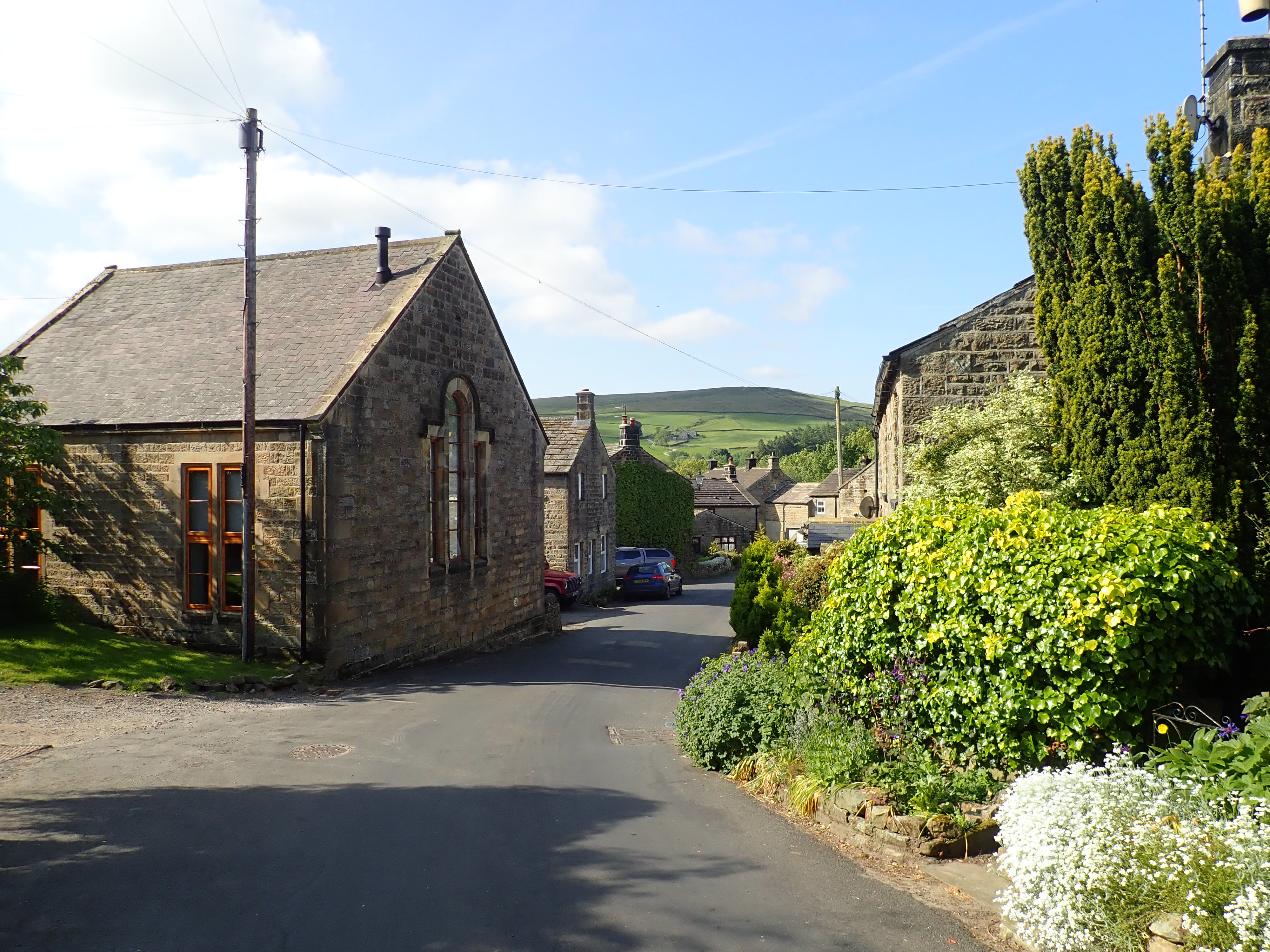
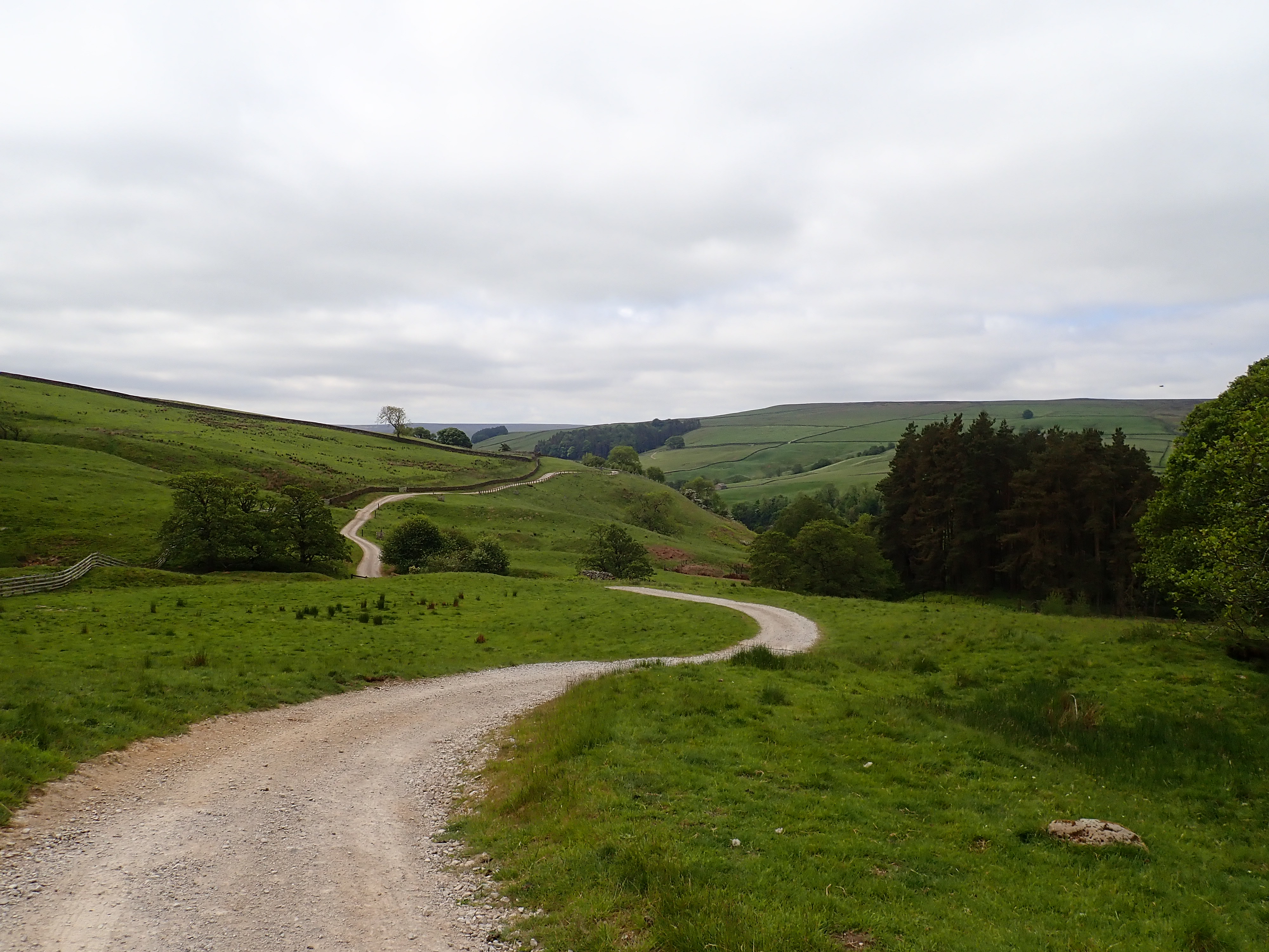
The Nidderdale Way leaves Lofthouse by climbing up the steep road that exits the top of the village, before breaking left onto Thrope Lane as it heads North up the dale. This grassy track passes through trees and fields as it goes along the East side of the valley, with the River Nidd occasionally visible below. It was quiet and pleasant walking.

My first day on the Nidderdale Way had been characterised by the smell and sight of wild garlic. Unfortunately, I only passed one area of wild garlic on this section. My day was instead characterised by lots of rabbits (including a great many wide-eyed kittens) who were so cautious that they scattered for their holes as soon as they saw me.
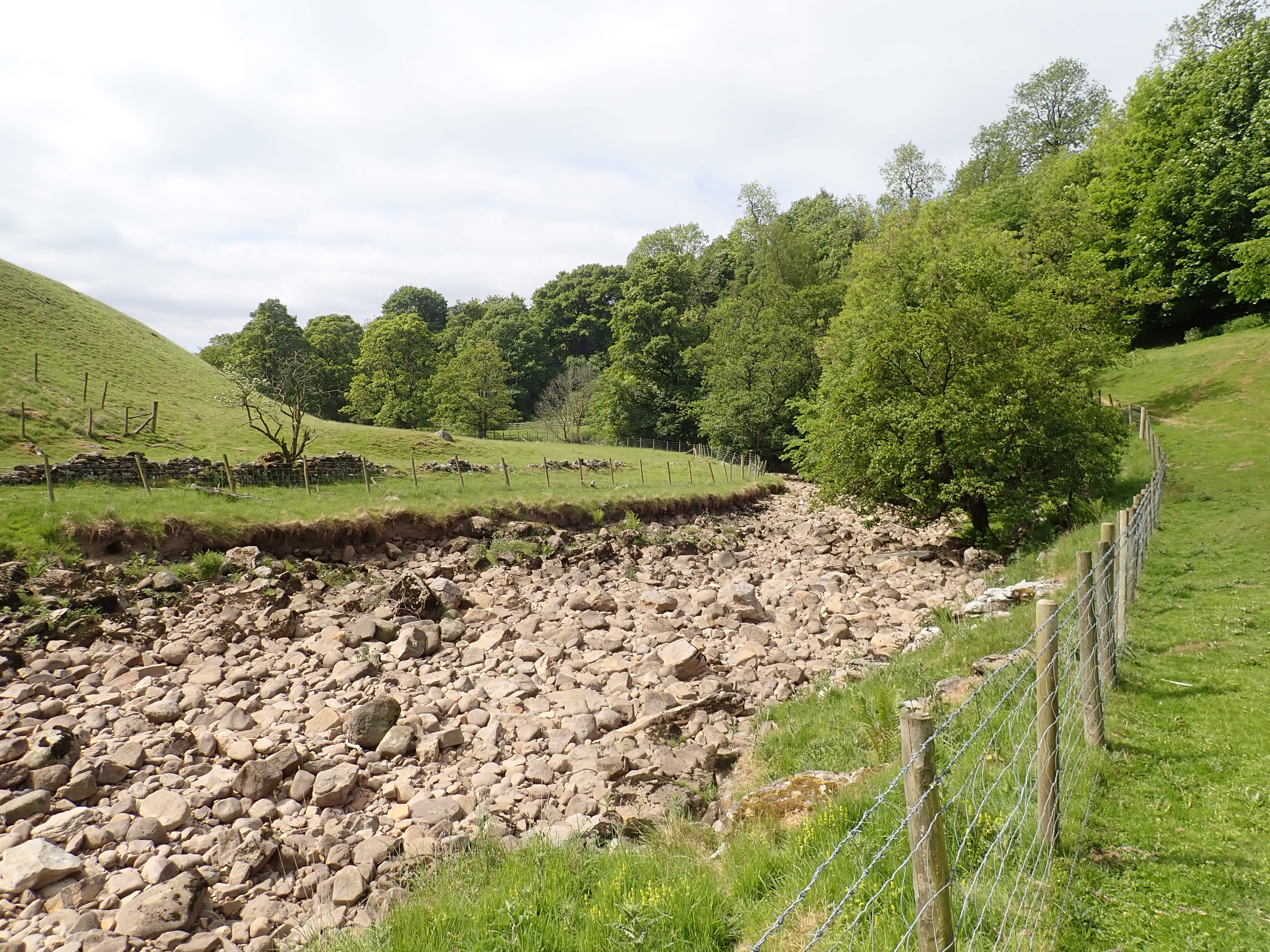
I passed through Thrope Farm (the site of a grange that had belonged to Fountains Abbey) before a slight walk downhill to the dry bed of the Nidd. The lack of water was due to the Nidd disappearing into sink holes by Manchester Hole higher up the dale. It then reappears three kilometres later at Nidd Heads, to the south of Lofthouse. After walking by the riverbed for a few minutes, I crossed the dusty, light grey rocks to the other bank at Dry Wath. It’s an apt name as wath is the Old Norse word for ford.

The Way then closely followed the riverbed until it went across a field to Limley Farm. This is where the Nidderdale Way climbs away from the bottom of the valley, and another footpath branches off to go by the riverbed to Goyden Pot and then on to Manchester Hole. I really wanted to see these two caves and so became frustrated when I couldn’t initially find the start of the footpath. My guidebook said –
“To detour for Goyden Pot (the entry point for Nidderdale’s largest cave system) go through a metal gate to the left of the derelict farmhouse on your left and walk along the west bank of the river.”
Rimmer, B. (2019) Nidderdale Way, Edinburgh: Rucksack Readers, p.32.
Unfortunately, in the years since this guidebook was written, the derelict farmhouse had been restored into a delightful-looking home. A LandRover and trailer parked across the wooden gate of the house’s yard also meant that I didn’t spot the footpath roundel sign on this gate until after quite a bit of wandering around. After overcoming my confusion and finding the path, I followed the dry riverbed until it came to an almost right-angle turn. I went through a metal gate in a fence and down a short slope to find the rectangular entrance to Goyden Pot hiding at the base of a small cliff. A pile of driftwood next to the entrance showed that there are times when water fills this riverbed.

While the riverbed between the sink holes by Manchester Hole and Nidd Heads is usually dry, if a large amount of water comes down the dale it can overwhelm these sinks. The excess water then travels above ground for a few hundred metres until it disappears underground again through the opening of Goyden Pot. With enough water flowing downstream, the Goyden Pot cave system can fill as well so that the Nidd flows both above and below ground down the dale and on to pass Lofthouse.
I had assumed that this only happened in periods of heavy rain. However, I’ve read that if Scar House Reservoir higher up Nidderdale is full, then a wind from a roughly westerly direction can create waves on the Reservoir that send water over the dam and then down the dale. Yorkshire Water also periodically conduct scour tests at Scar House Reservoir. These involve slowly opening and closing the outlet valve to check that the water level in the Reservoir can be lowered in an emergency. This can send enough water down Nidderdale to overcome the sinks by Manchester Hole and then see water carry on to Goyden Pot (a video on YouTube shows how quickly this water reaches Goyden Pot). This means that cavers/potholers need to check the scour testing schedule as well as the weather before going into this cave system to avoid suddenly finding themselves in a rapidly flooding cave.
The entrance to Goyden Pot has a slightly menacing atmosphere, and it’s easy to imagine some terrible creature emerging from it to feast on nearby sheep. However, I find caves and underground rivers fascinating rather than scary, and so carried on up the dale to investigate where the Nidd disappears underground.
I had imagined that the sink holes by Manchester Hole might look like holes into which the river would tumble down little waterfalls. The reality was both simpler and more wonderful. The Nidd flows over rocks and then, in the space of a little over a metre, the flow becomes less until it is gone. Standing next to this point in the river, I could hear the loud gurgle of the water flowing above ground and then a fainter, deeper sound of the water travelling below the rocks. As I slowly moved away from the river’s vanishing point, the gurgle grew fainter while I could hear more of the underground water. Then, after a few metres, the underground water fell silent.

I walked back down the riverbed for a short distance, onto the East bank, and over a couple of fences to reach the entrance to Manchester Hole. Looking down this vertical hole I was delighted to see the Nidd flowing along a muddy tunnel a few metres down.

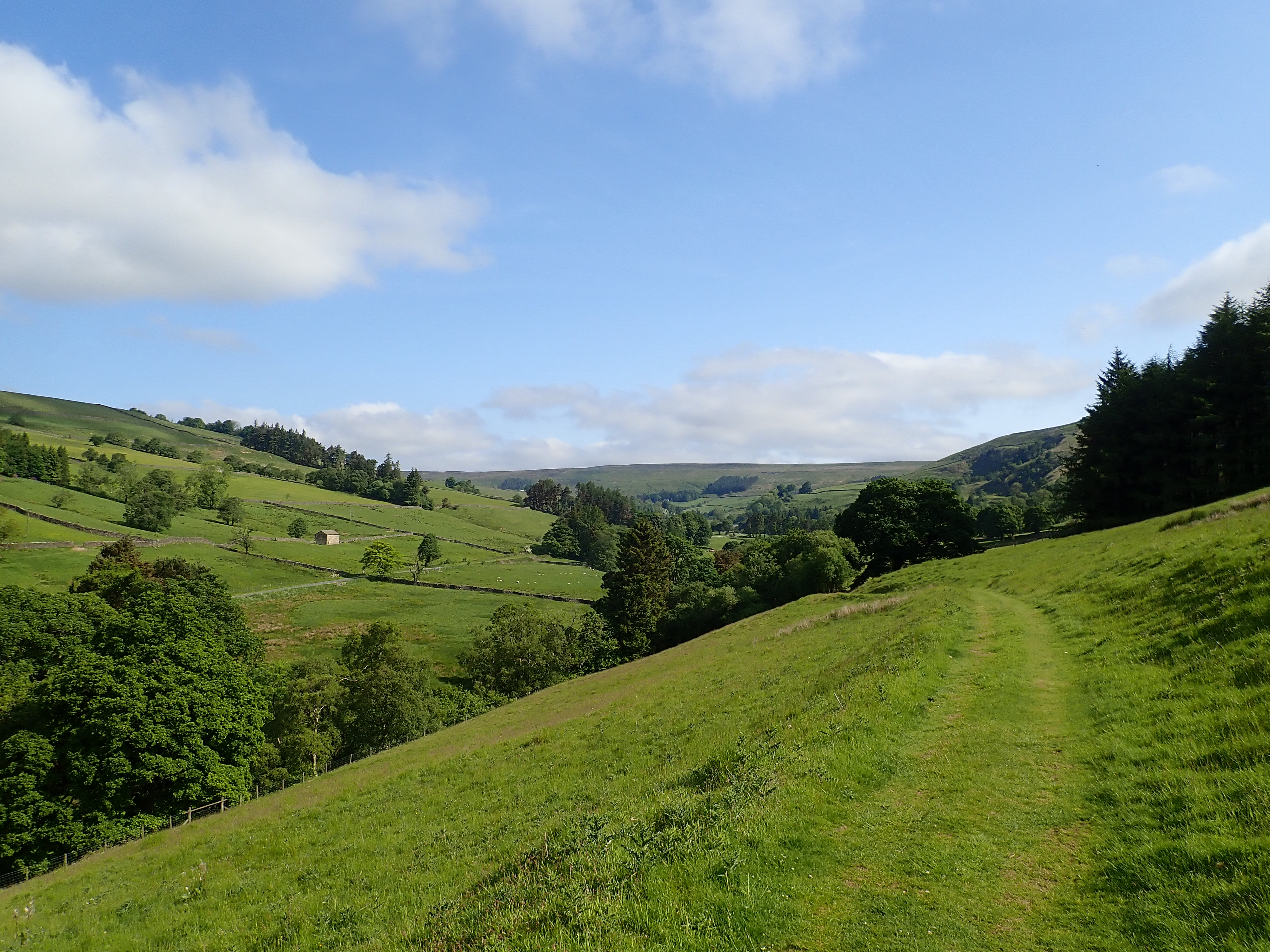
After my detour to the caves, I headed back to Limley Farm for a climb up the East side of the dale and then on to pass Thwaite House. This was the first of a series of houses that looked like they had started life as farm buildings before being converted into expensive houses with amazing views. From Thwaite House the Nidderdale Way followed a well-maintained track that traversed the dale as it turned sharply left to change from running North-South to East-West. I followed this track for about a mile and a half, enjoying the views along the dale and towards Scar House Dam.


At the wonderfully named Turnacar, I left the well-maintained track to follow rougher tracks a little further along the dale before I then turned to climb up onto the moor. The Way then took a track along the moor before going down to Scar House Reservoir.

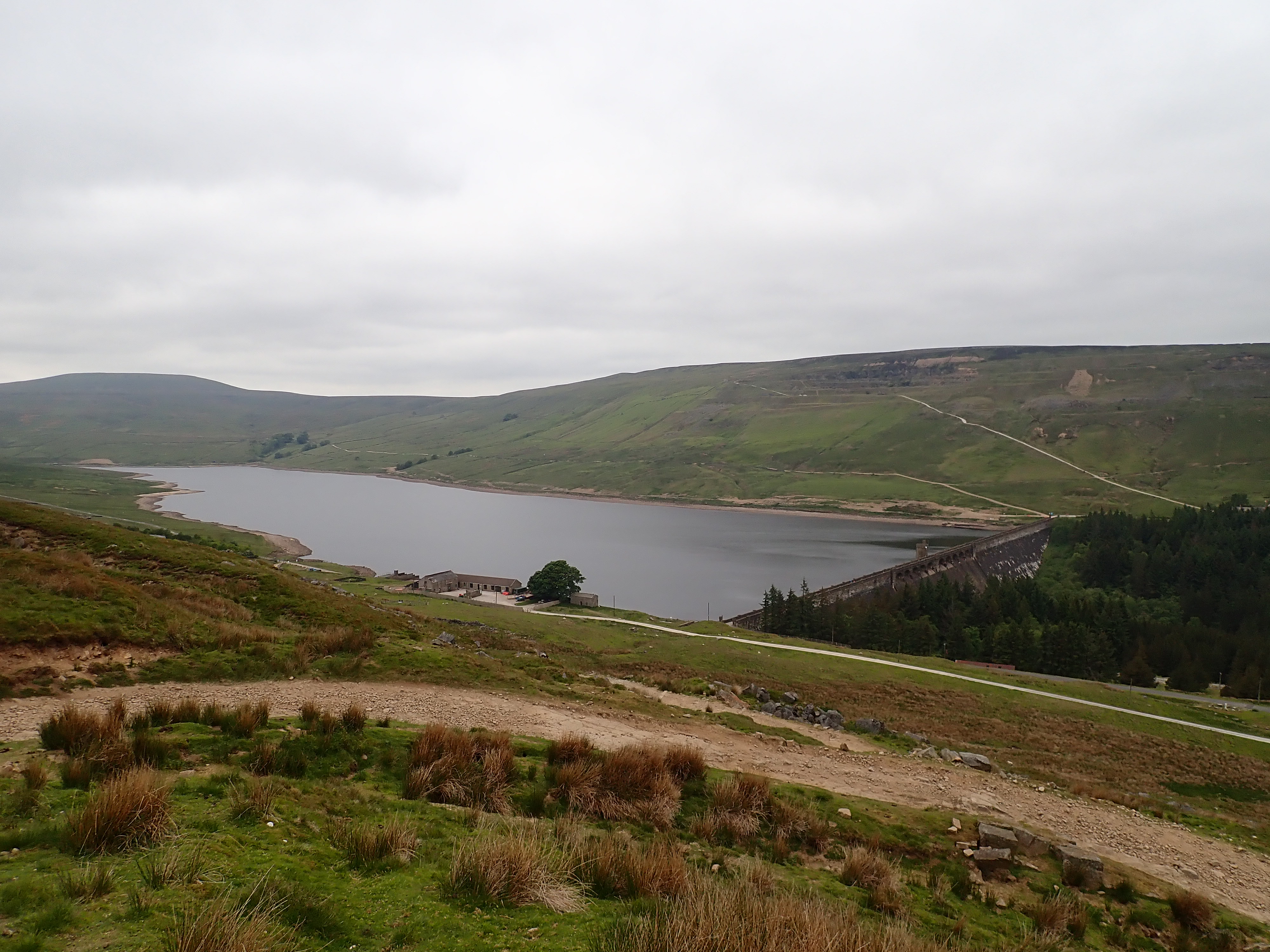
Scar House Reservoir was built between 1921 and 1936 by the Bradford Corporation to supply Bradford with water. At 233ft (71 metres) the dam was the highest in the UK at the time. The dam used around one million tons of concrete and stone, and you can see where this stone was quarried in the scooped scars on the edge of the moors on either side of the dam.

Scar House Dam is a wonderous mass of weathered stone with ramparts and turrets. The dam looks like it was constructed to both hold the water and to defend it from rampaging hordes. It’s home to large numbers of House Martins and they zipped above me as I walked over the dam.

I mentioned the Nidd Valley Light Railway that was used to supply the construction of the dam in my post on the first stage of the Nidderdale Way. The route of this Railway after Lofthouse is now the route of the road to the Reservoir, which I could clearly see as I walked the last stretch of the way to the dam. Since that post, I have found on the blog of the National Railway Museum some great old photos of the Nidd Valley Light Railway when it was in use, and of the dam being built.
The Nidderdale Way takes a right after crossing the dam, but I took a left as I was keen to see a remnant of its construction. This was the remains of Scar Village, a self-supported settlement built to house the workers building the dam and their families. I’ve seen references to over 1,000 people living in Scar Village, but also references to 1,250 people and even to 2,000. Their houses were apparently a lot better than many of the houses in the nearby towns and villages. They had hot and cold running water, electricity, and bathrooms with indoor toilets. Scar Village had a hospital, shops (including a fish and chip shop), a chapel, a concert hall and cinema, a recreation hall, library, post office, bank, a canteen, a tennis court, a school, and a bakery. There were dances every Saturday, evening classes, a football team, a cricket team, a literary society, and annual trips to Scarborough for the children. However, this community was only meant to last while the reservoir was being built.

People started to leave Scar Village from 1929 as the work on the dam got closer to completion, and the village was eventually abandoned in 1936. In 1937 its buildings were sold by auction. The canteen, for example, was transported to Darley in Lower Nidderdale to be used as its Memorial Hall. Most of what remains now are the concrete outlines of the buildings’ foundations, a few sets of concrete steps, a bit of broken concrete wall, and areas of flattened land such as the village high street. Somewhat bizarrely, the one building that is still standing is the cinema’s projection room. I found it both fascinating and haunting to see the remains of this community.

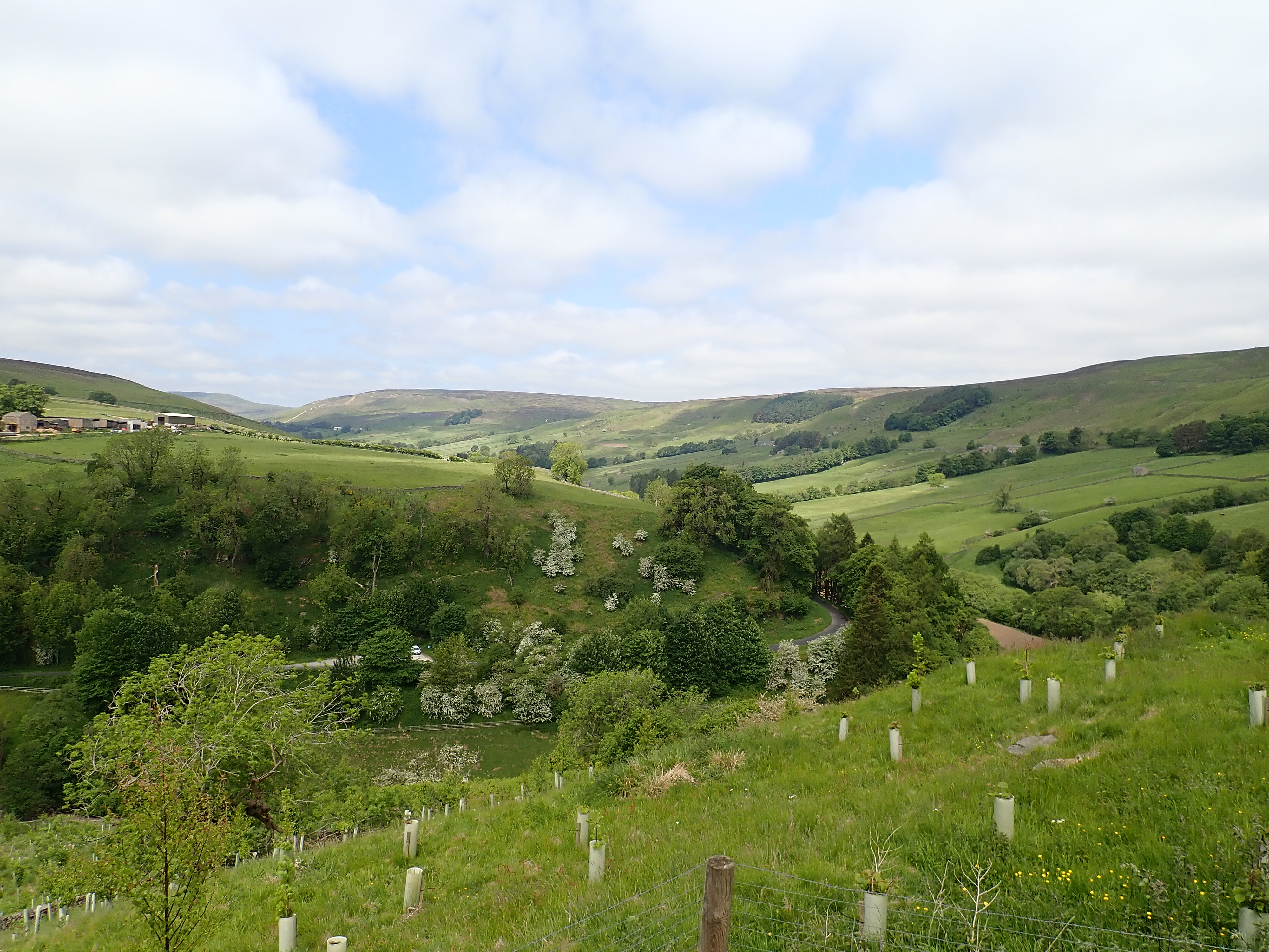
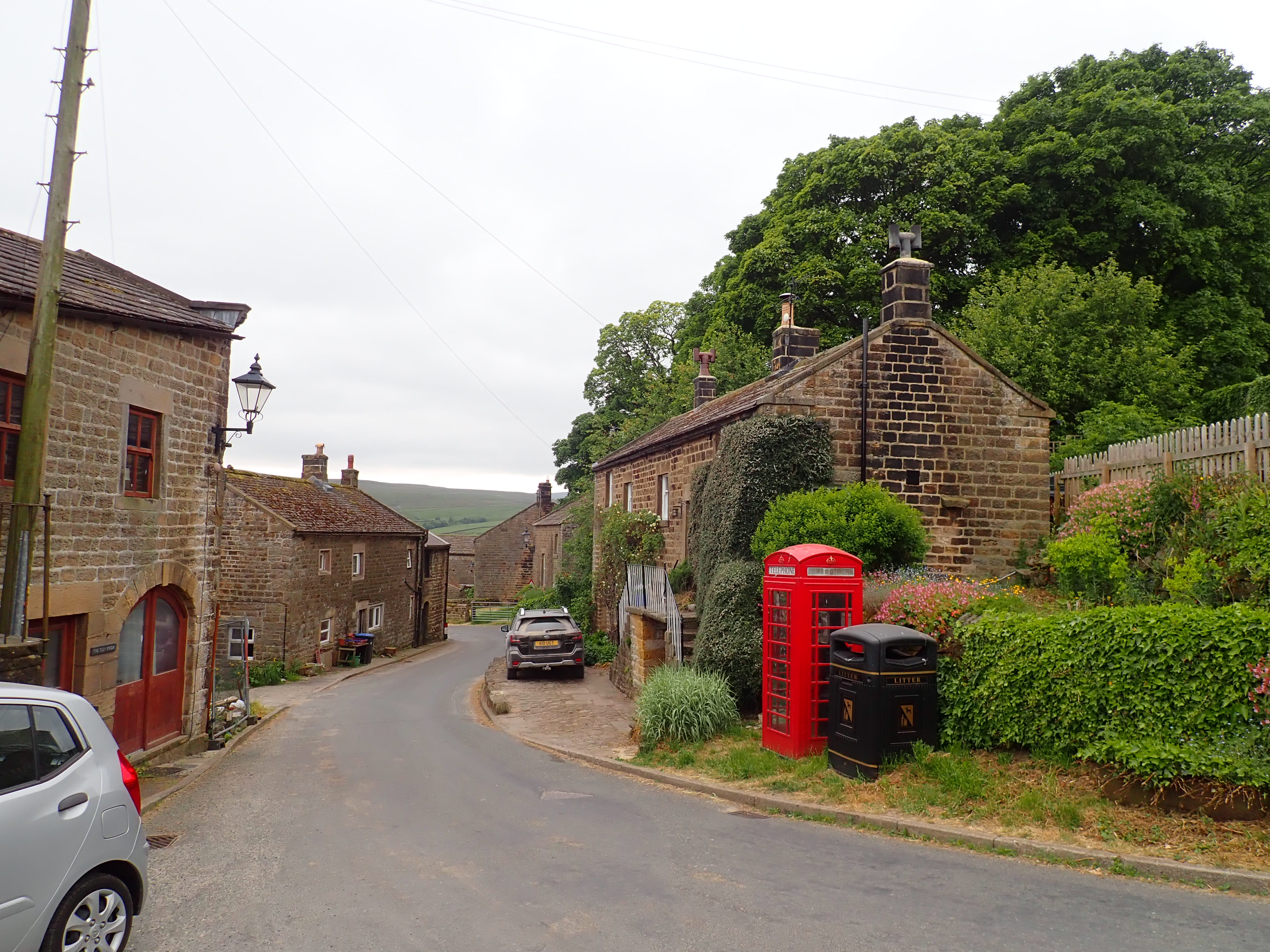
I headed back to the Nidderdale Way and turned away from the reservoir to follow a track up onto the moor. This track runs for about two and a half miles (just under 4km) to Middlesmoor. It first climbs steeply past rocks and a disused quarry before a gentle uphill to the high point of the Nidderdale Way at 1,425ft (434m). It was then a relaxing and very gradual descent to Middlesmoor, with views across the moor and to Gouthwaite Reservoir.Middlesmoor is the highest village in Nidderdale and there are stunning views down the dale from the churchyard of St Chad’s. After enjoying the view and a snack, I headed down the foothpath by the churchyard to then walk across meadows and through a mucky Halfway House farm to return to Lofthouse.


Really enjoyed this Robin! Splendid photograhs.
Love,
John
Thanks John. I’m pleased you liked it.
Best wishes,
Robin
Well that walk was certainly full of interest. I like to go and look at cave and pothole entrances – I’d even like to do a bit of caving or potholing but only the easy stuff – no severe squeezes and definitely no sumps!
And Scar Village sounds really interesting too.
It was great to have so many sights on a walk.
I’ve been caving a few times, and even done a squeeze in one. It was fun, but I prefer the easier caves too.