
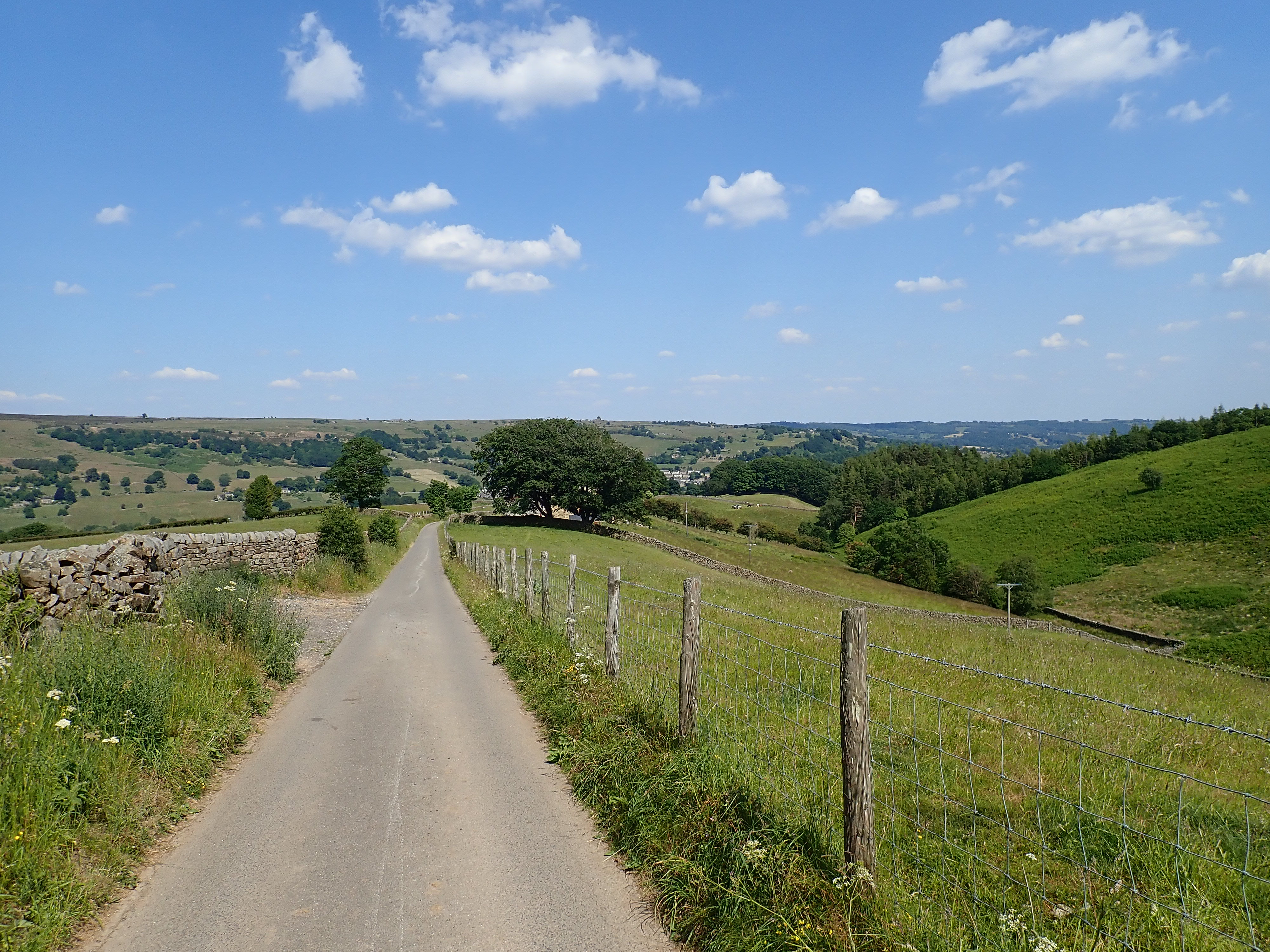
The third stage of the Nidderdale Way started with what must be one of the best views in the Yorkshire Dales, and took in hay meadows, rolling pastures, a pretty reservoir, a lovely valley, and the ruins of a lead mine. It was a gorgeous walk that an encounter with some irate cows couldn’t spoil.
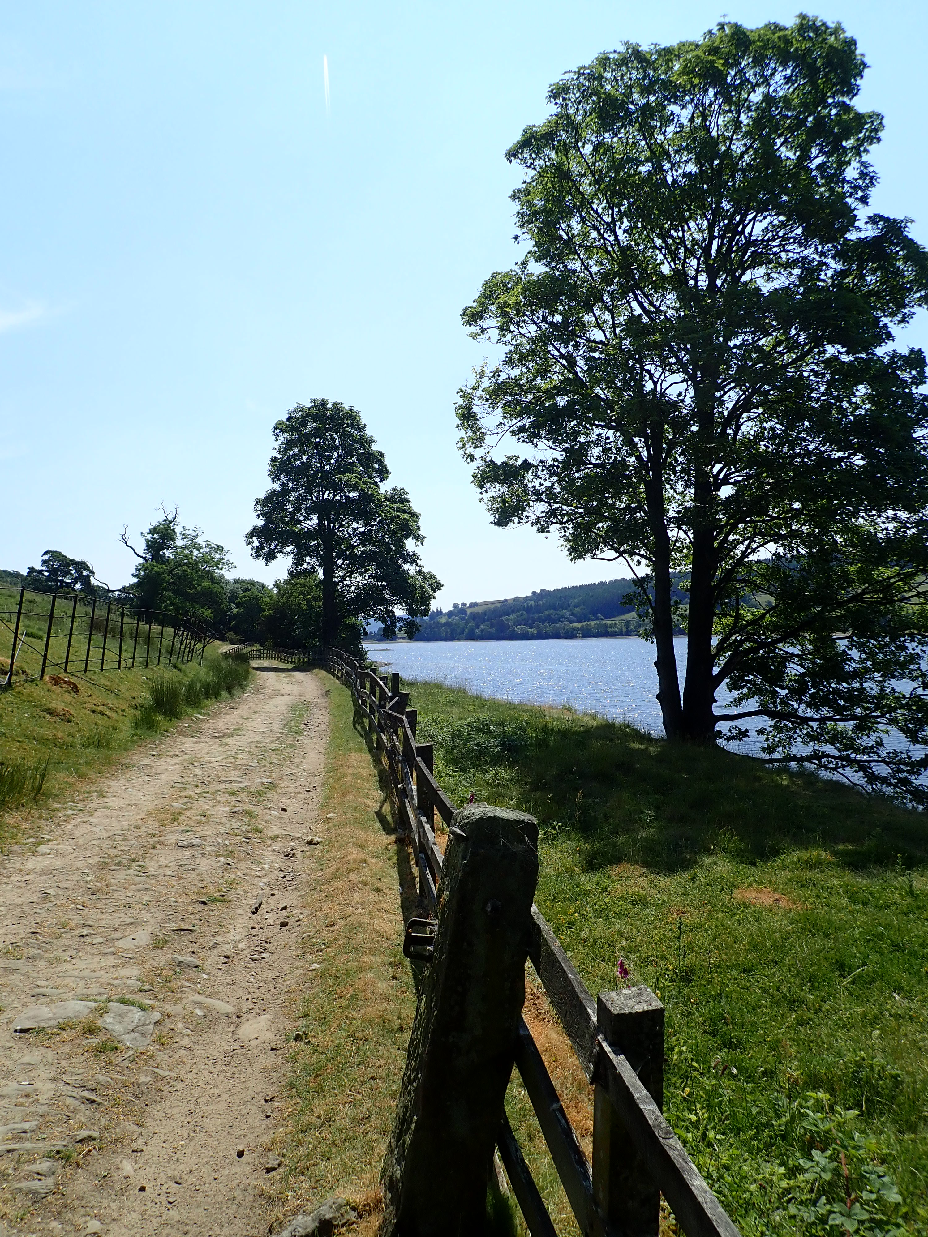
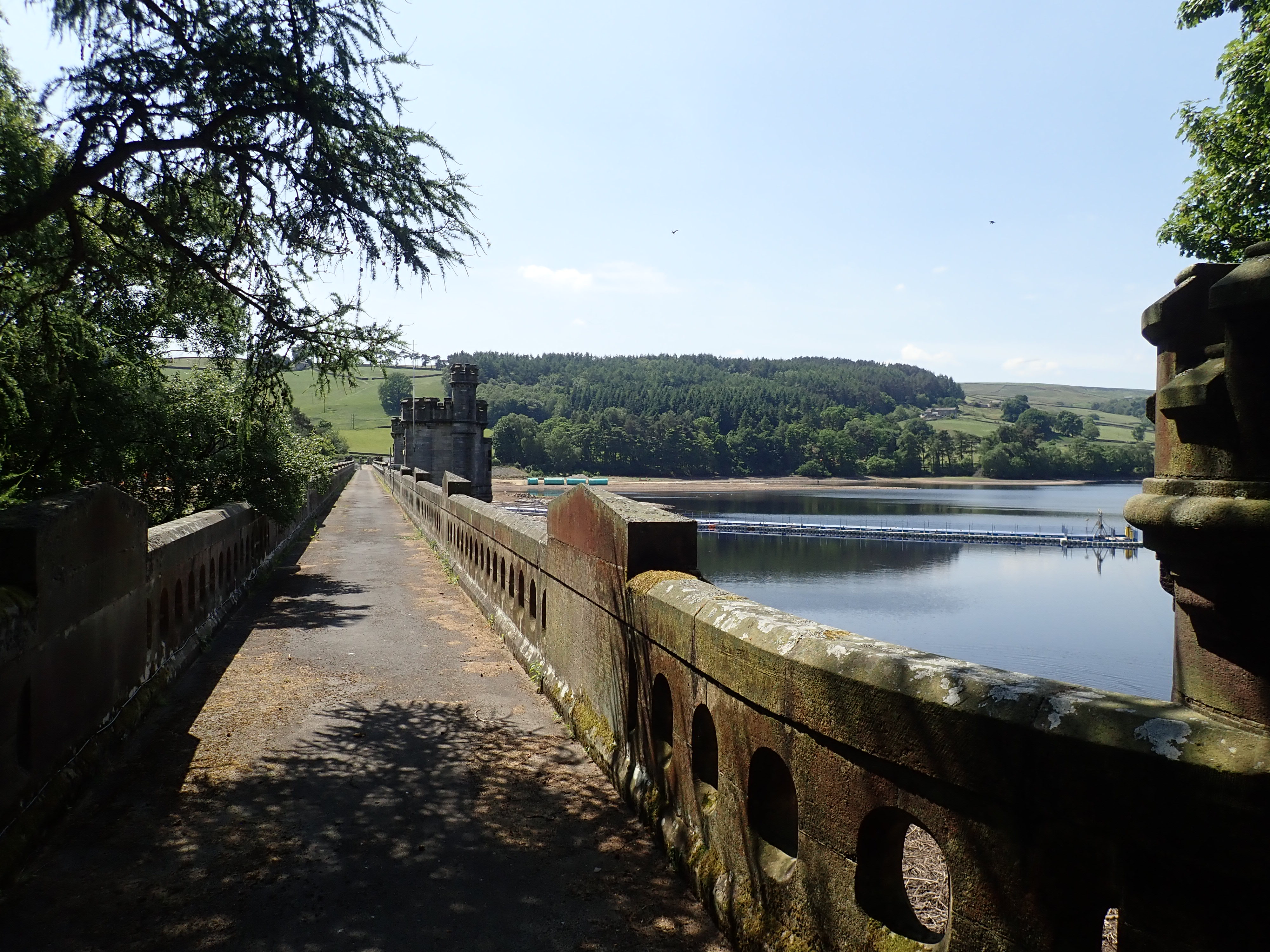
As I’m walking the Nidderdale Way in six stages, this section was the longest at 11.7 miles (18.8km). It starts in Middlesmoor, the highest village in Nidderdale. From there, the Way follows the West side of the dale as far as Ramsgill, before crossing to the East side to skirt Gouthwaite Reservoir. The original route of the Nidderdale Way followed the road along the West side of this reservoir. However, this was changed a few years ago because of concerns about the dangers of walking along the often busy, narrow, and surprisingly winding road. It’s worth noting, though, that some OS maps still show the original route.
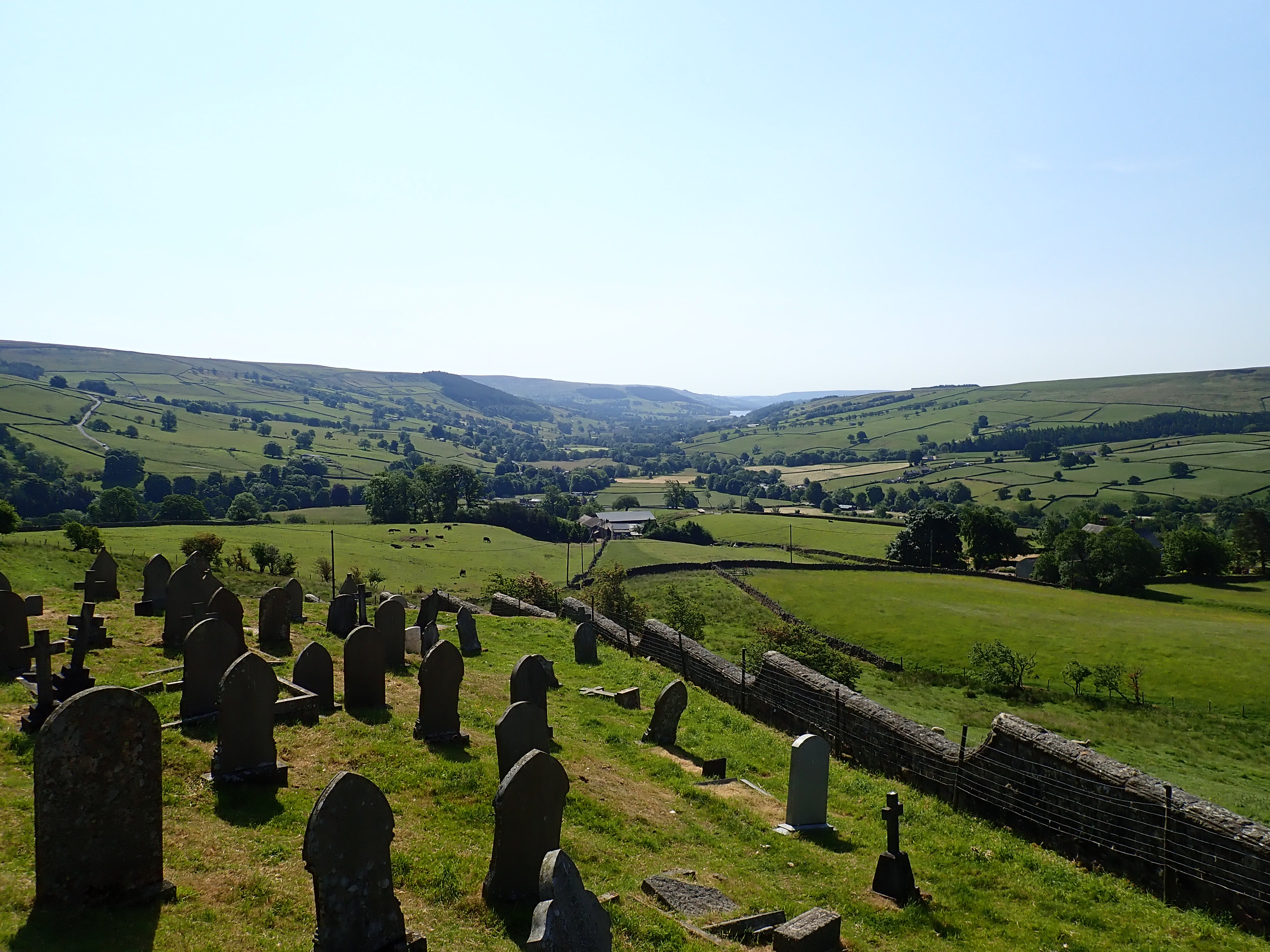
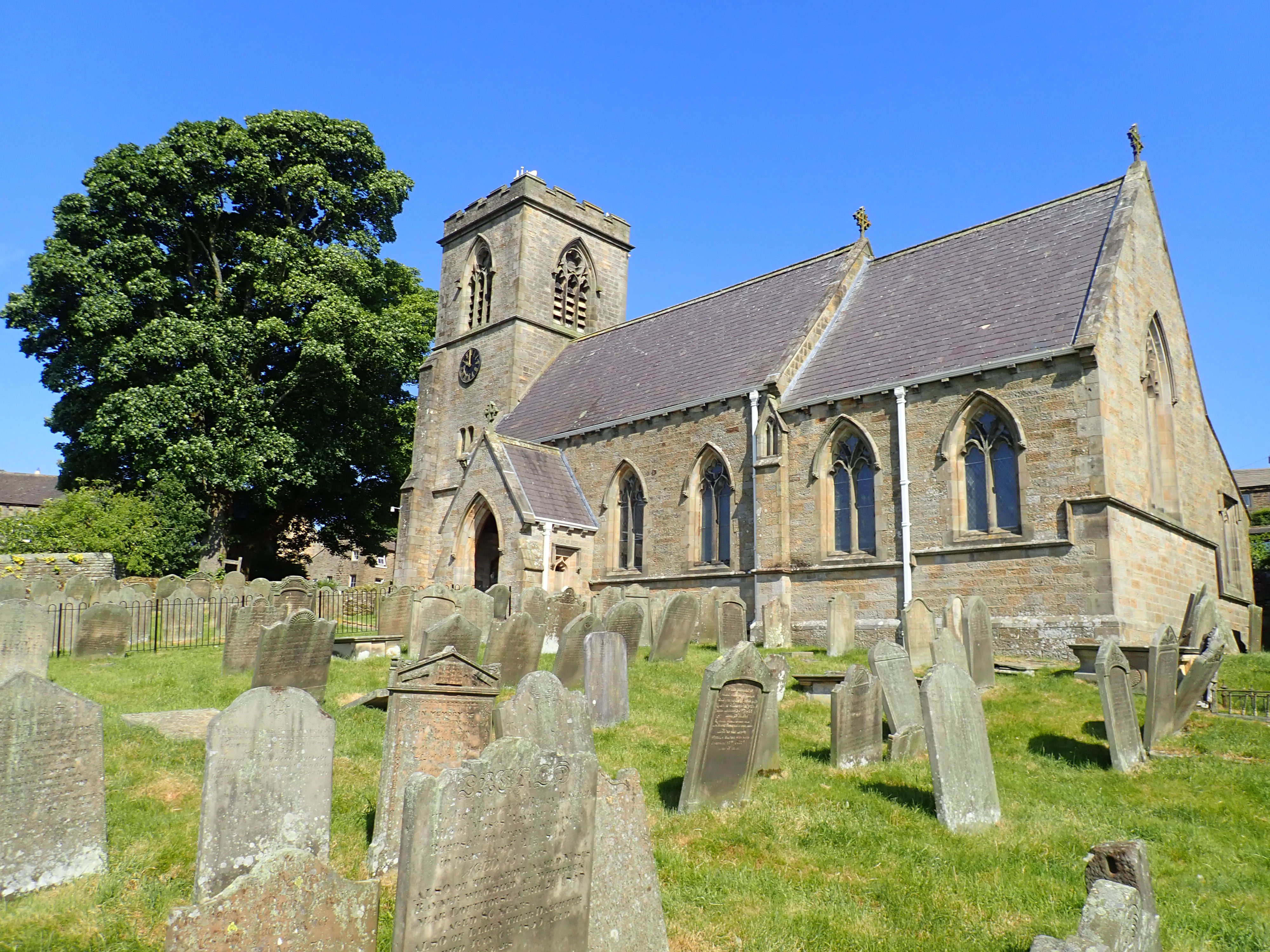
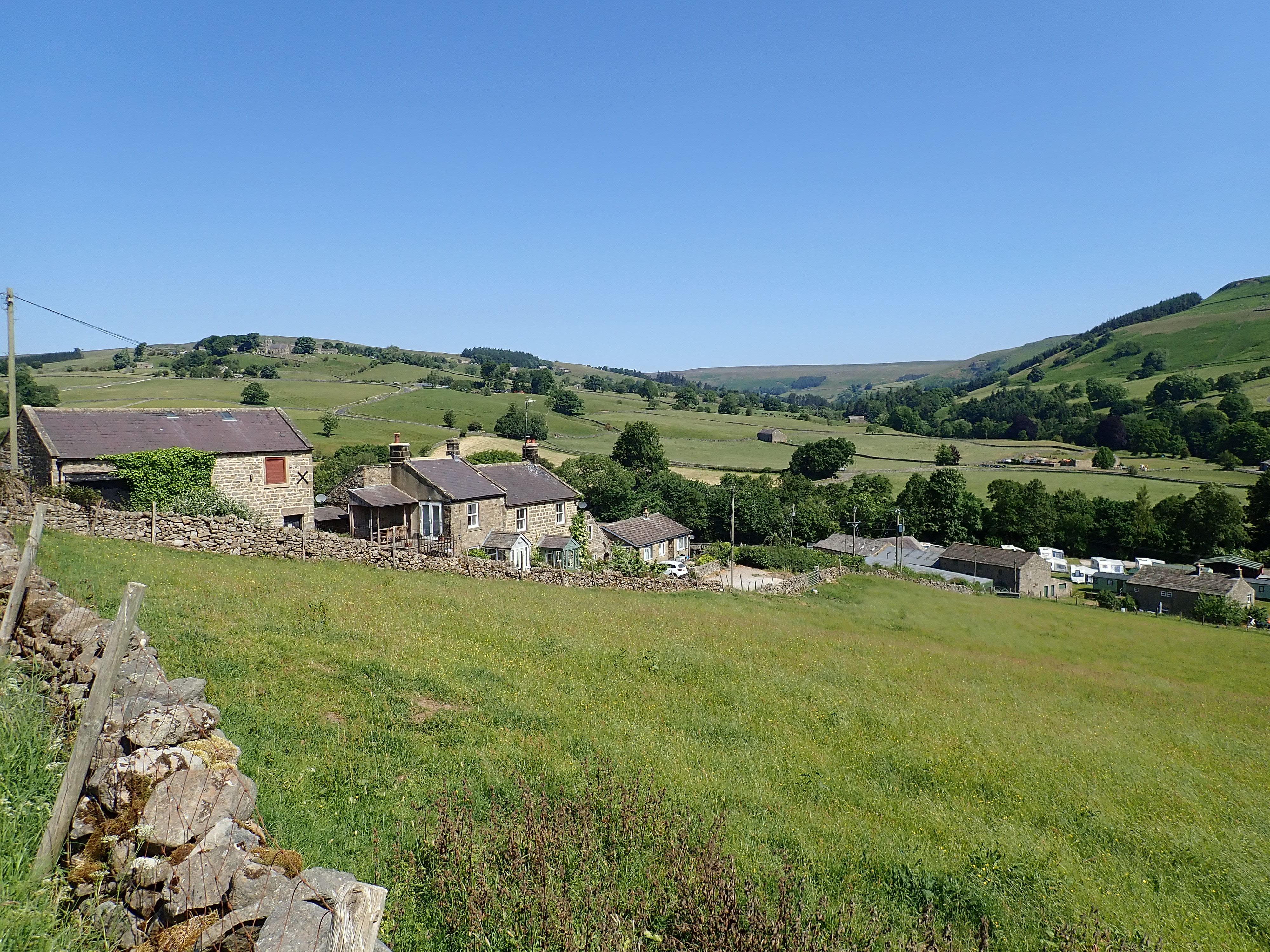
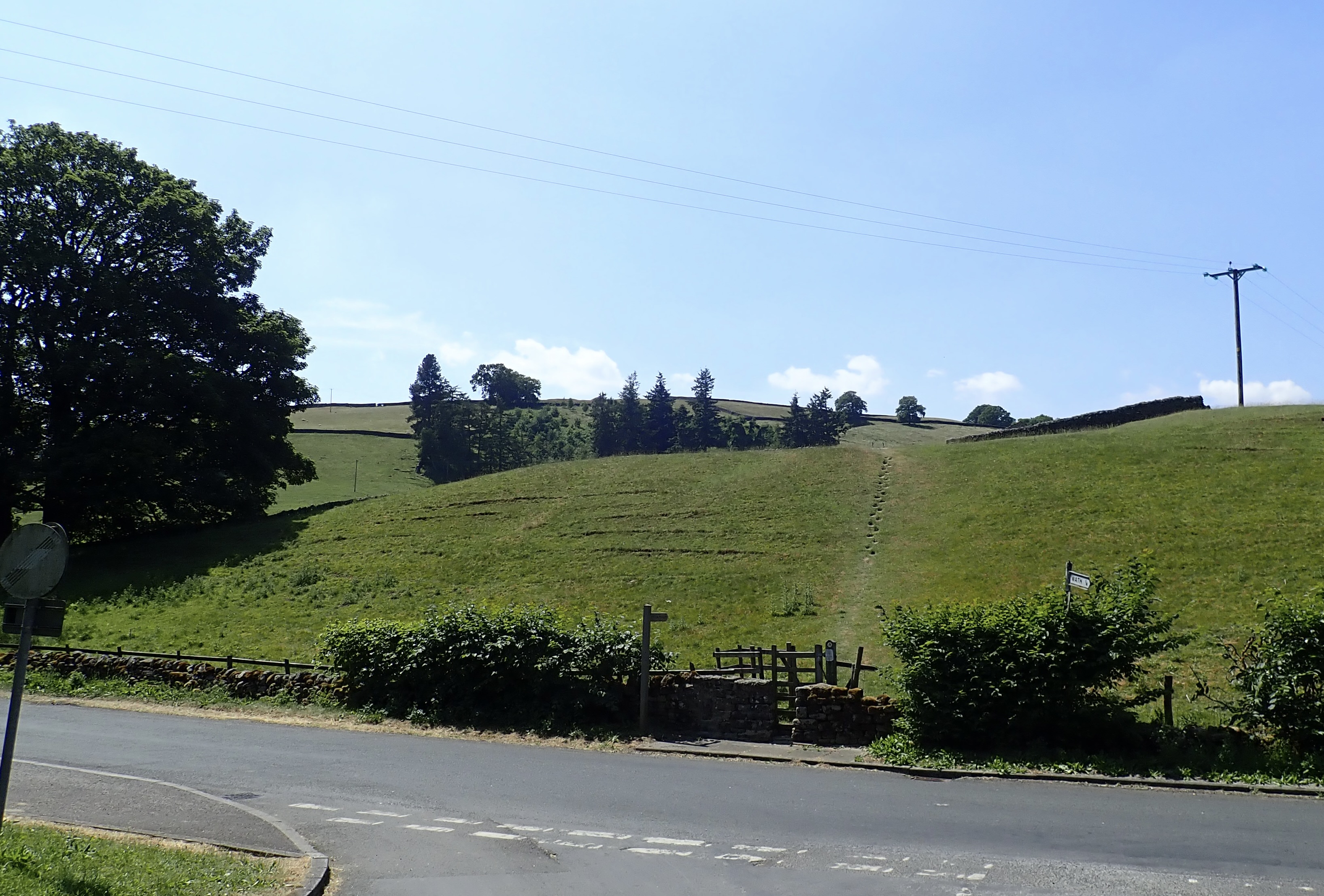
As a taxi drove me along this road to Middlesmoor, I felt glad that I was not going to be walking along this road in a few hours’ time. The taxi dropped me off outside The Crown Hotel in Middlesmoor, and I walked to the churchyard of St Chad’s to enjoy the view down the dale before setting off. I then left Middlesmoor by the road I had just travelled up. After a few minutes, I turned off the road to go downhill through meadows and pastures to the wooded How Stean Gorge.
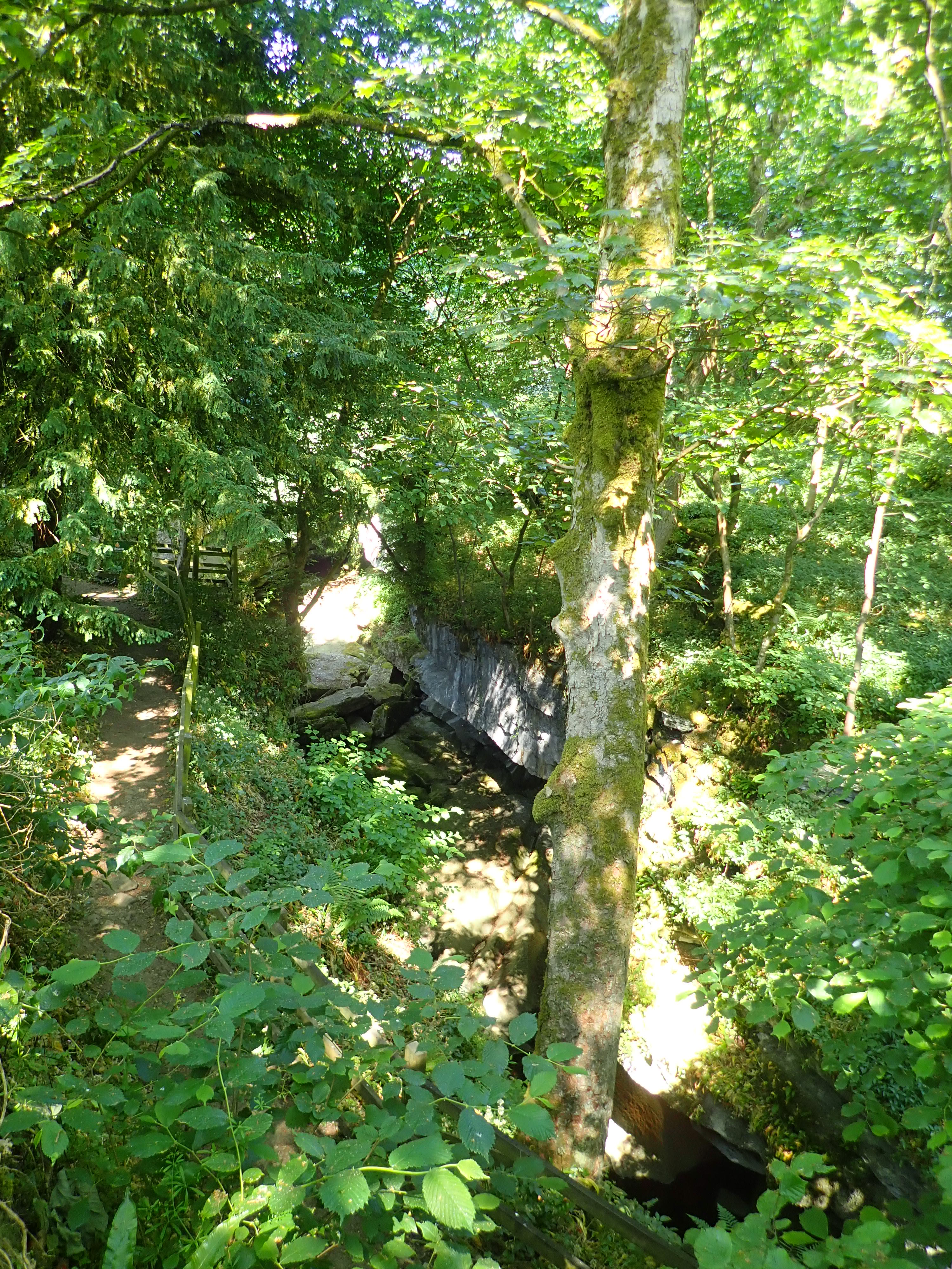
How Stean Gorge is a limestone ravine that is almost a kilometre long and up to 20 metres deep. It’s a product of river and glacial meltwater, and a Site of Special Scientific Interest. Running off the gorge is Tom Taylor’s Cave, a 180-metre-long tunnel that emerges in a campsite. Tom Taylor was a local highwayman. Legend has it that he used the cave to hide himself and his loot; however, the Nidderdale Way does not follow this route, but goes along the road that runs next to the ravine. How Stean Gorge is a visitor attraction that offers caving, a via ferrata, canyoning, and other activities. The Way passes its entrance and café, but I didn’t feel like I had the time to visit. I instead made do with free views of the gorge, obscured by trees, from the bridge over it and from the road.
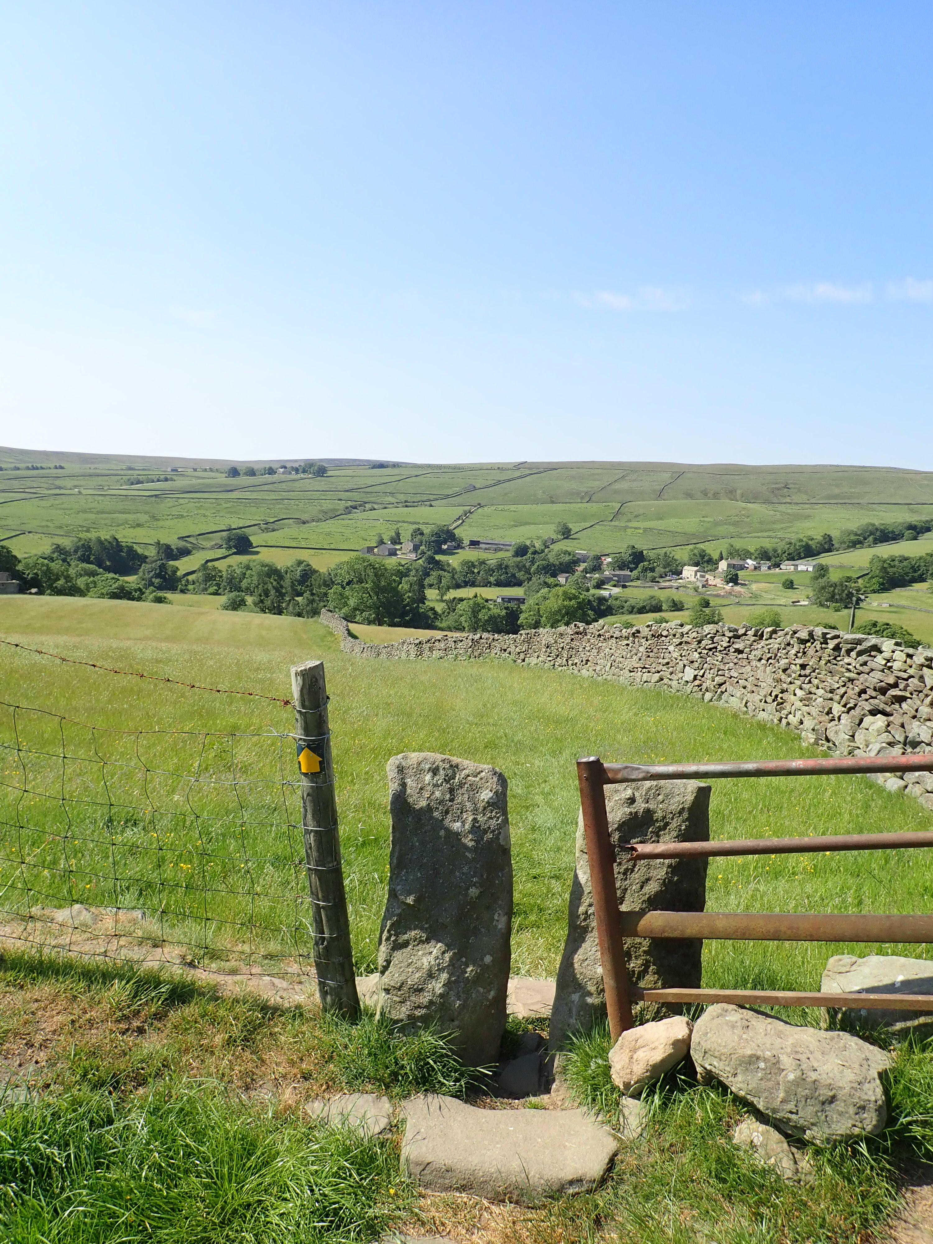
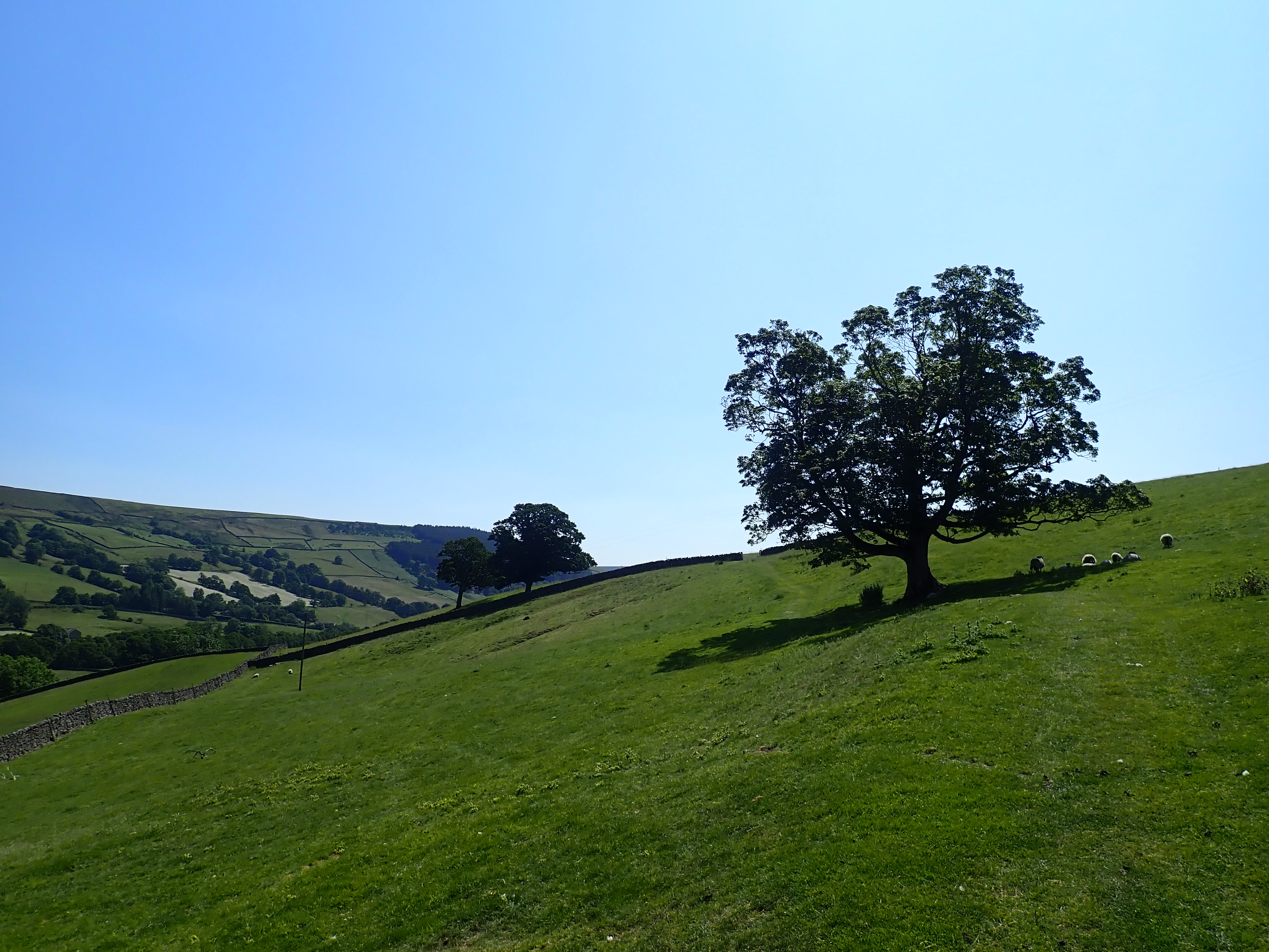
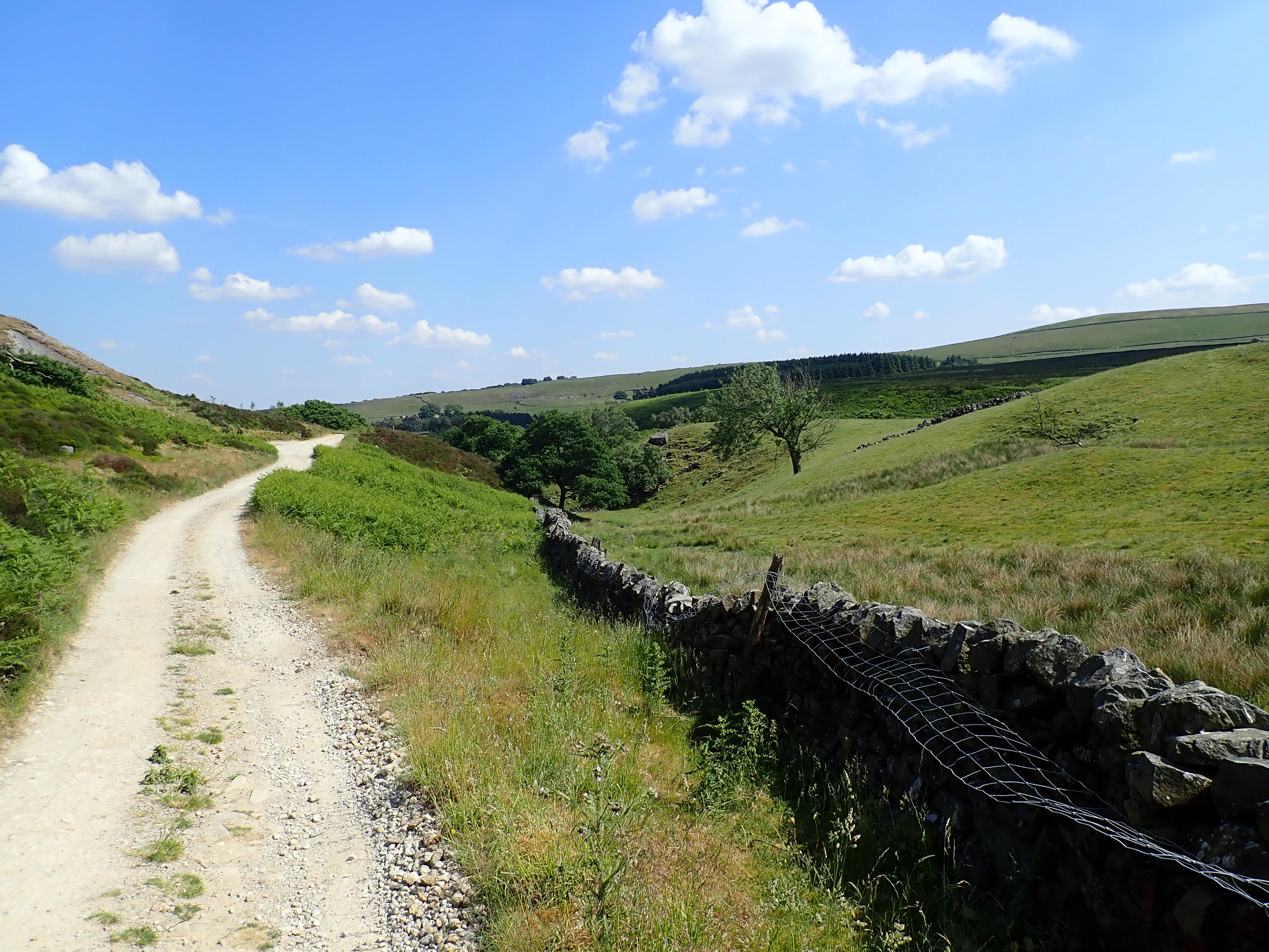
The Nidderdale Way then passes through Studfold Farm activity centre, before climbing up the side of the valley and traversing the West side of the dale to the village of Ramsgill. This was a pleasant walk of pastures with drystone walls, barns, and sporadic trees under which sheep sheltered from the sun.
As I got closer to a farm, I saw the farmer out on his quad bike with his Border Collie, rounding up stray sheep. He zipped into a field containing cows and their calves as I approached. His pursuit of a ewe and a lamb startled the cows, which ran out of his way while snorting aggressively. After only a minute or so, the farmer motored out of the field with the sheep in a cage on the back of the quad bike. With the farmer gone, the cows directed their ire at me. They gave me hard stares and loud snorts, jumped about, and then placed their front legs wide while lowering their heads. There was only a simple fence of barbed wire separating us, which the cows walked next to as they followed me along the length of the field. I was thankful that this slight fence was enough to deter them from coming for me as I walked on as steadily as I could.
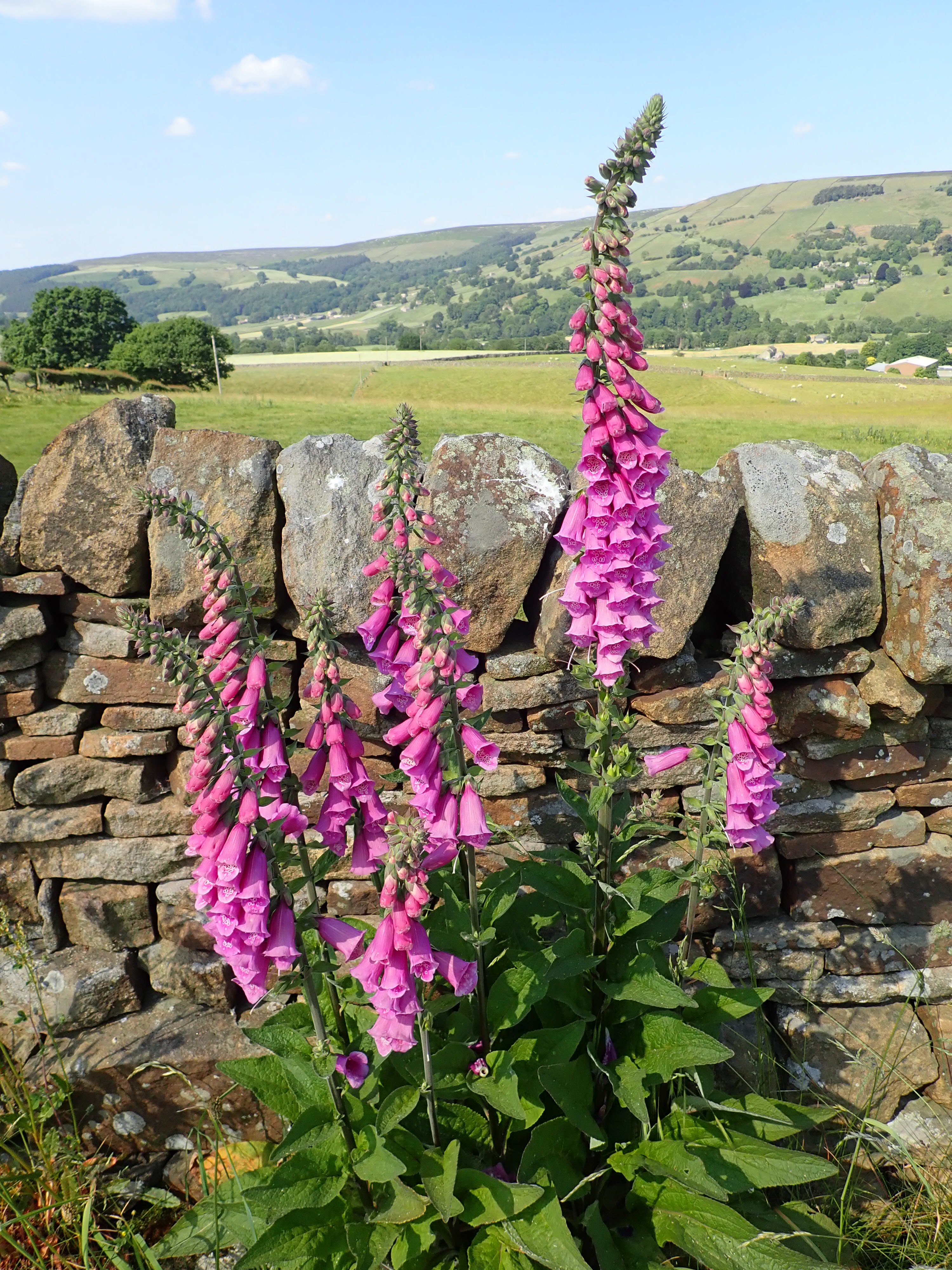
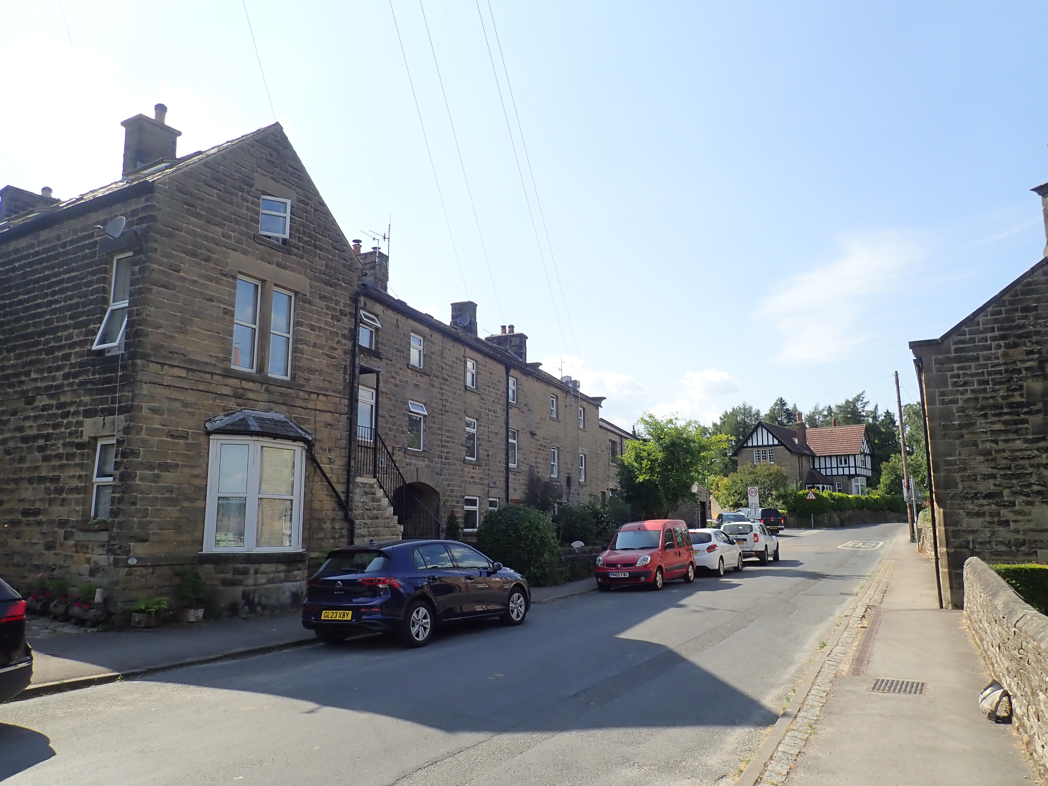
The track took me into Ramsgill, and I spent a few minutes looking around the village. I then went over the Nidd by a humpback bridge and walked across the valley to Bouthwaite. From there, I picked up a path that I had walked during my first day on the Nidderdale Way. This followed a road and then a track along the East side of Gouthwaite Reservoir. I didn’t mind retracing my steps as it’s a pretty walk, and going in the other direction gave me a different perspective on it. There had been bluebells along here a few weeks ago, but they had been replaced with pink Foxgloves. These grew along the verges of tracks and roads and were a pretty sight for the rest of the walk.


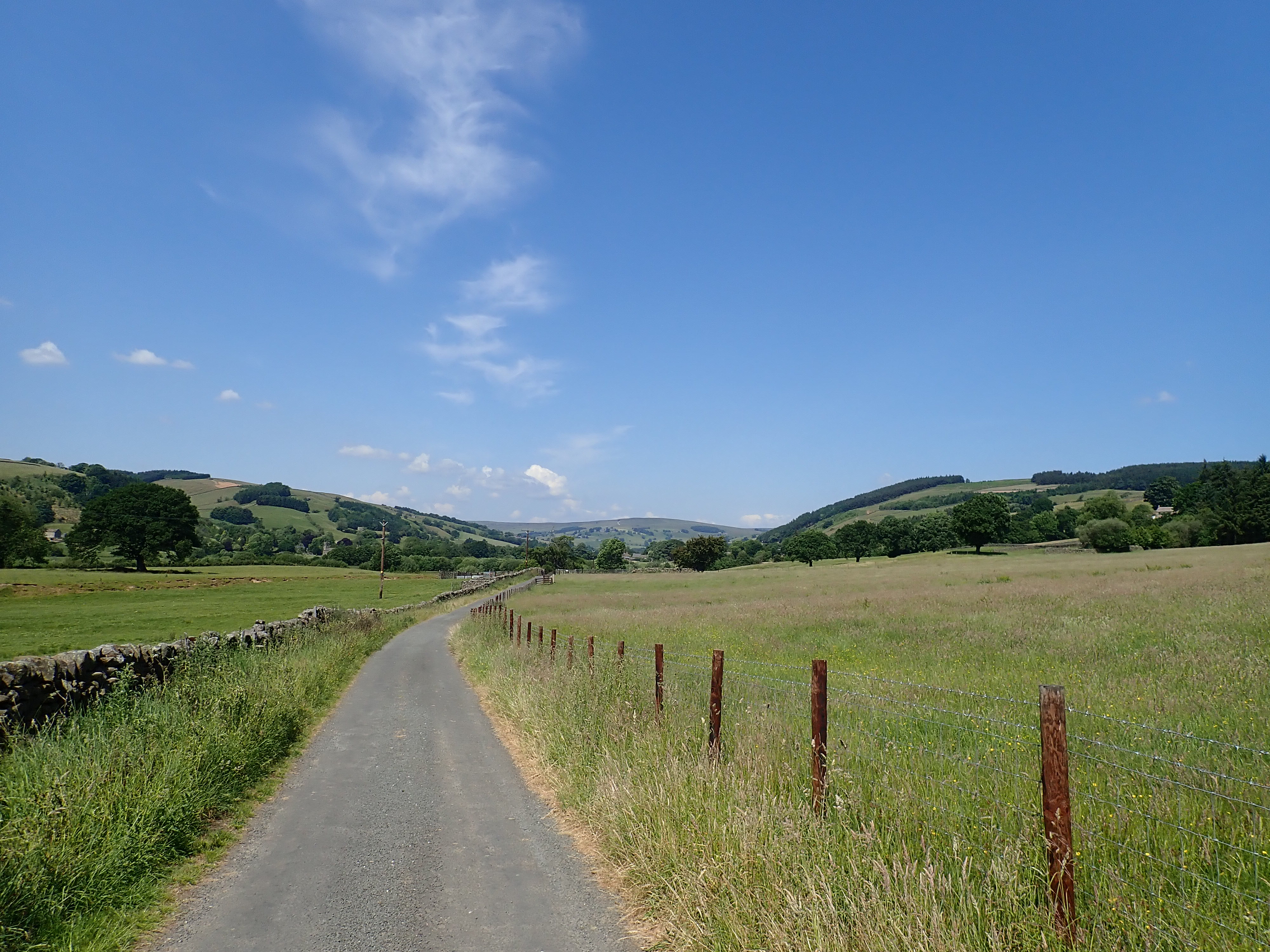
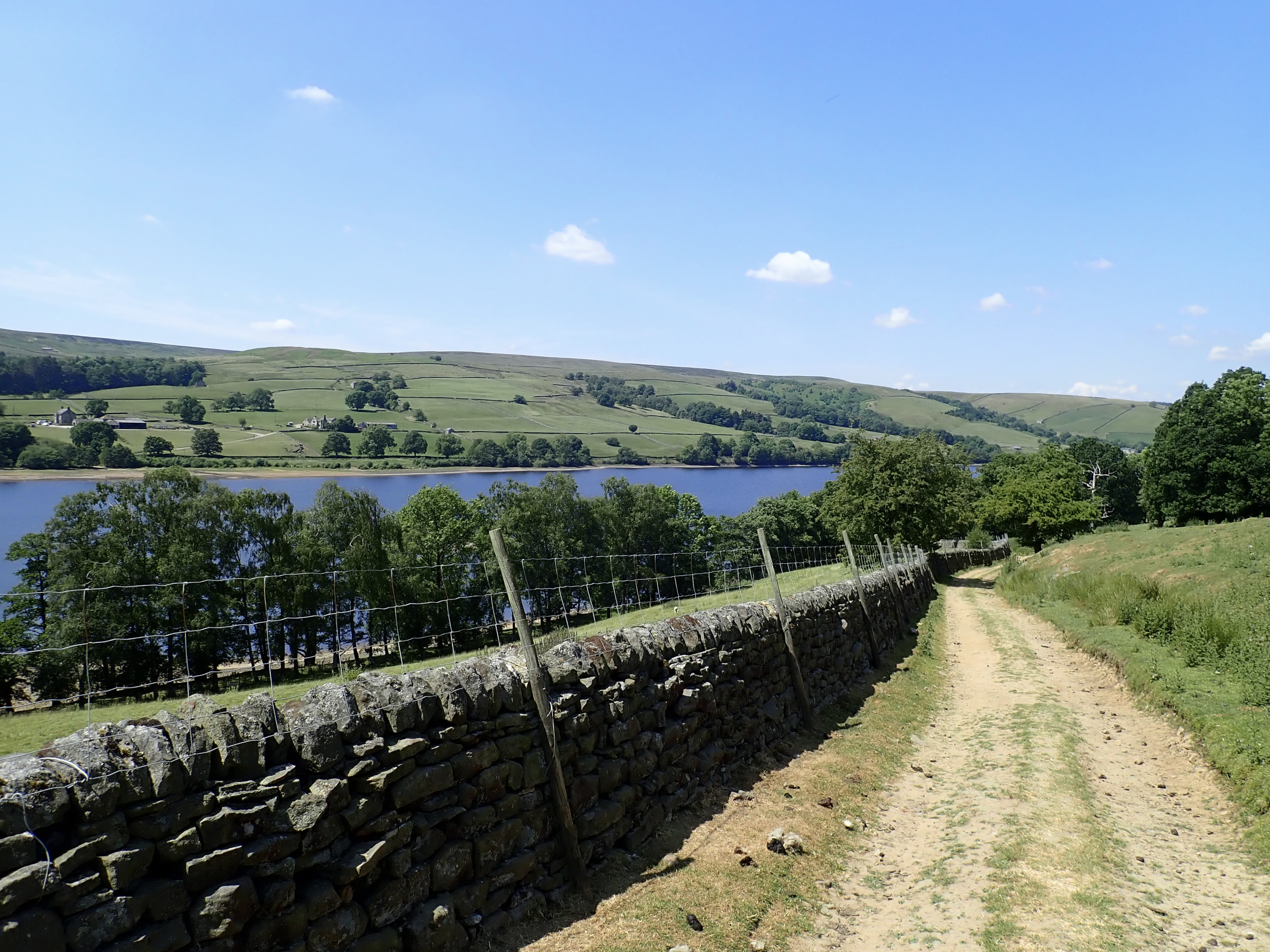
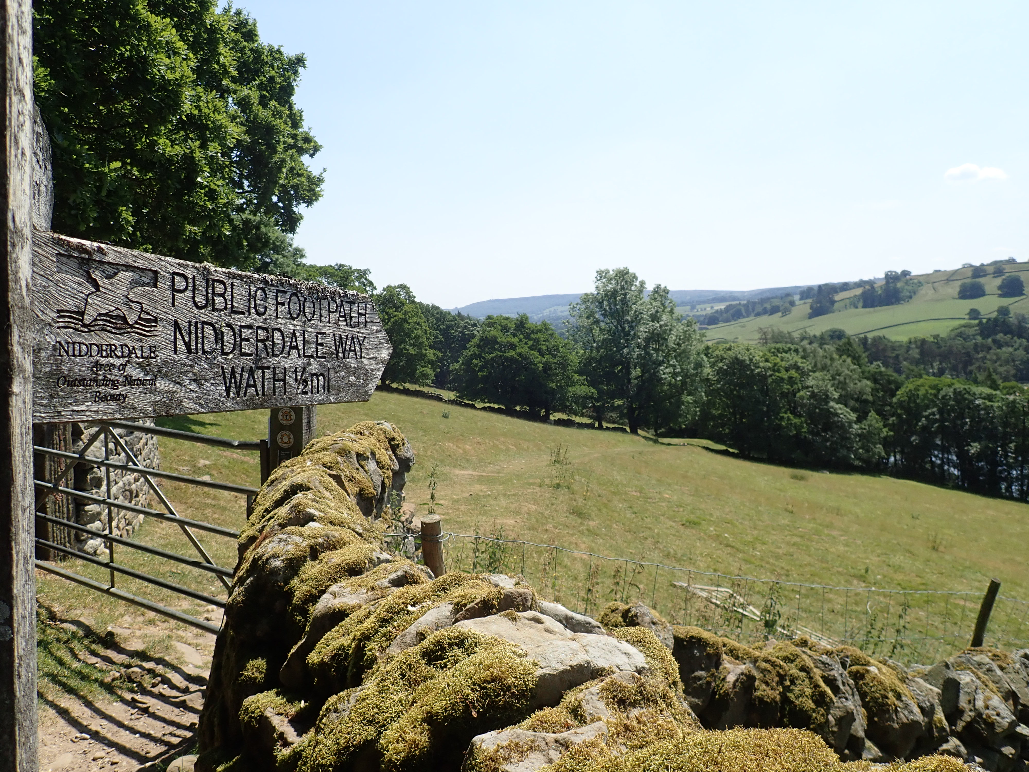
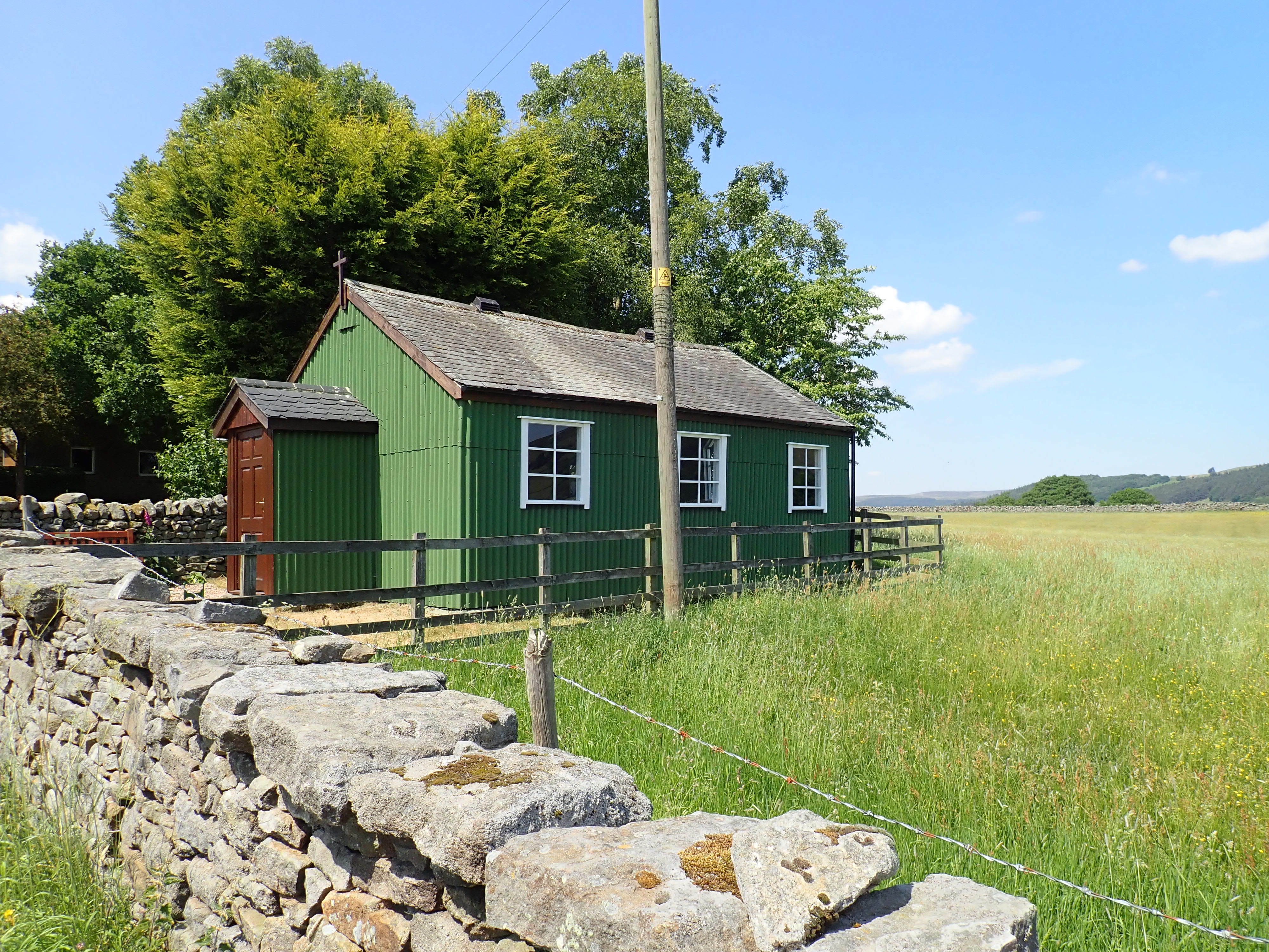
The Nidderdale Way carried on past Gouthwaite Dam and along the bank of the Nidd, before crossing the river by Wath. It then climbed steadily through pastures up the West side of the dale. I joined a road near Heathfield that took me past the attractive and tiny Tin Chapel. It’s around this point that the Nidderdale Way takes a large u-shaped detour into the hills. My guess is that the creators of the Nidderdale Way decided that a scenic route would be better than sending the Way directly along the dale to Pateley Bridge. I like their choice, as it’s a great scenic route.
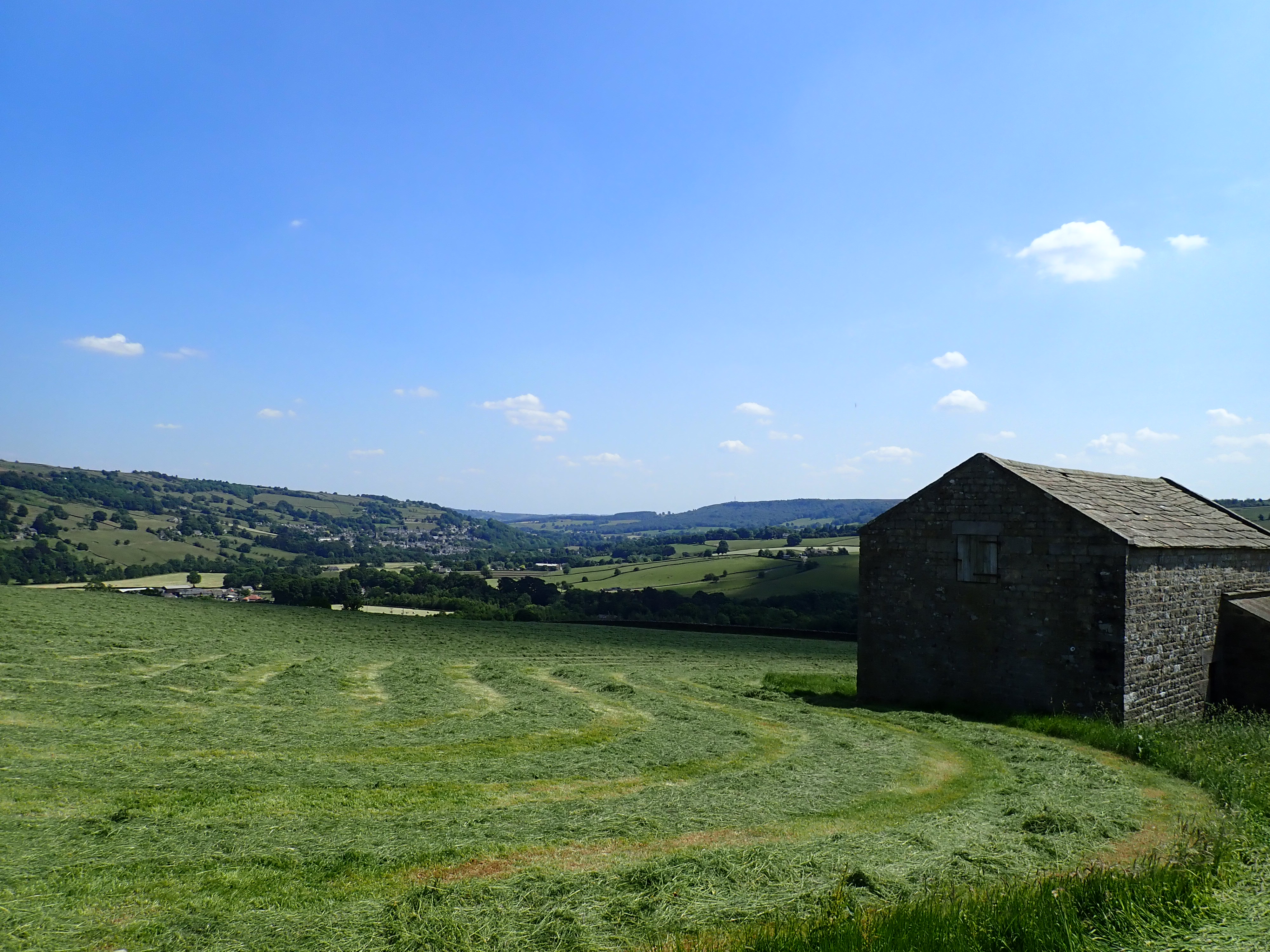
I first went up a ridge to a viewpoint overlooking the dale and fields with freshly cut hay waiting to be collected. I then went down the other side of the ridge, passing through hay meadows and close to a farm where the hay was being gathered into bales.
The Way then dropped down to a wooded valley and turned sharply to go up it by a road that became a track. This walk up the valley was initially an uninteresting traipse through a caravan park. However, it became a walk up a lovely valley with woods and a beck at the bottom.
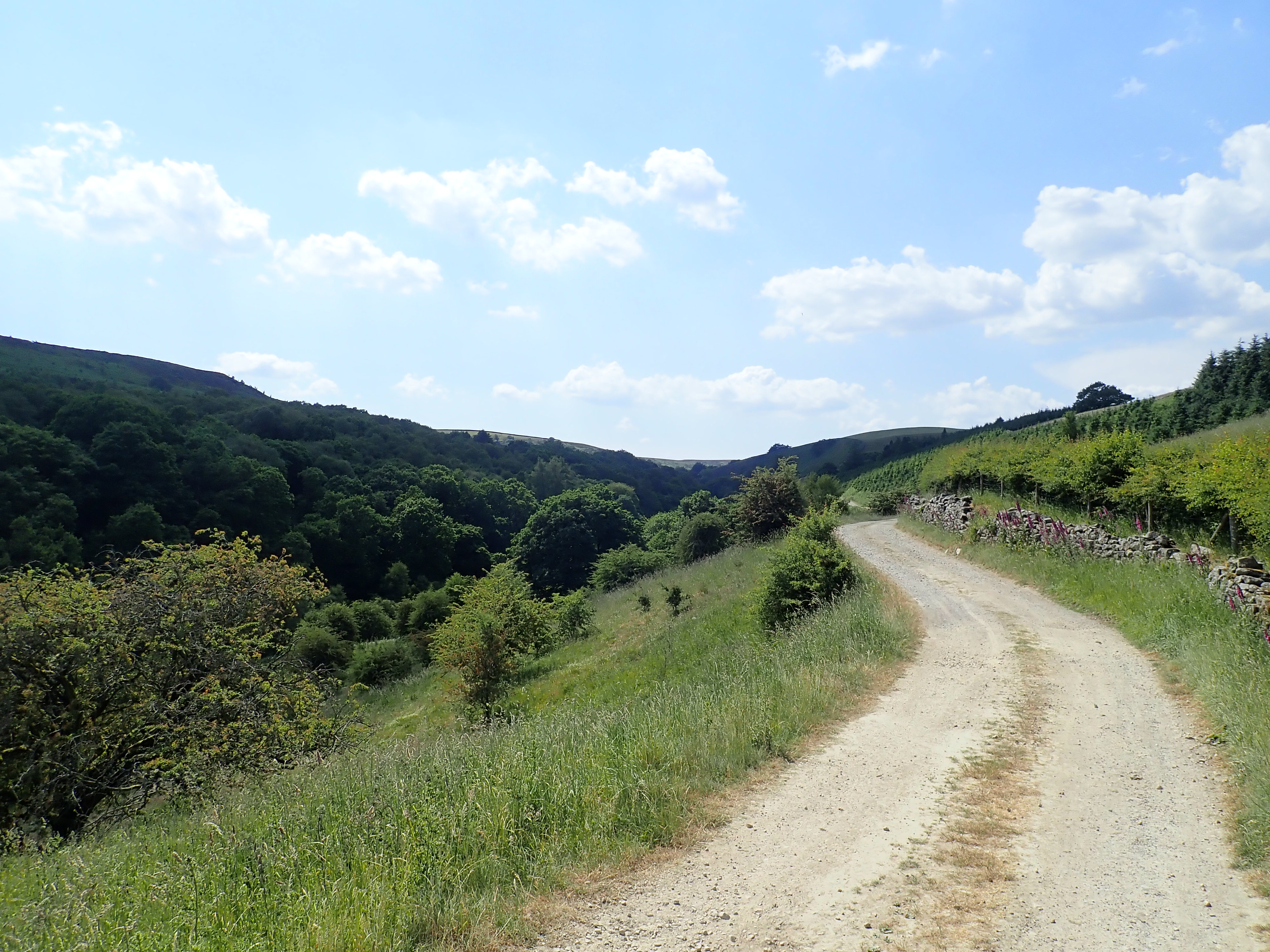
The track steadily climbed until I left it to go down the side of the valley to a wooden bridge. This took me over the beck and to the remains of the Prosperous and Providence lead mines.

There’s a long history of lead mining in the Greenhow area. It’s thought that the Romans mined here. In the 1100s, the monks of Byland and Fountains Abbeys were given rights to mine in this area by the Norman Barons. The Providence vein of lead that abuts the Prosperous mine was mined from at least 1225. However, there is apparently no specific record of the Prosperous lead mine until the first lease for the mine was granted in 1781. The Prosperous smelt mill was built on the site between 1785 and 1814 (I’ve found references to various dates for its construction).
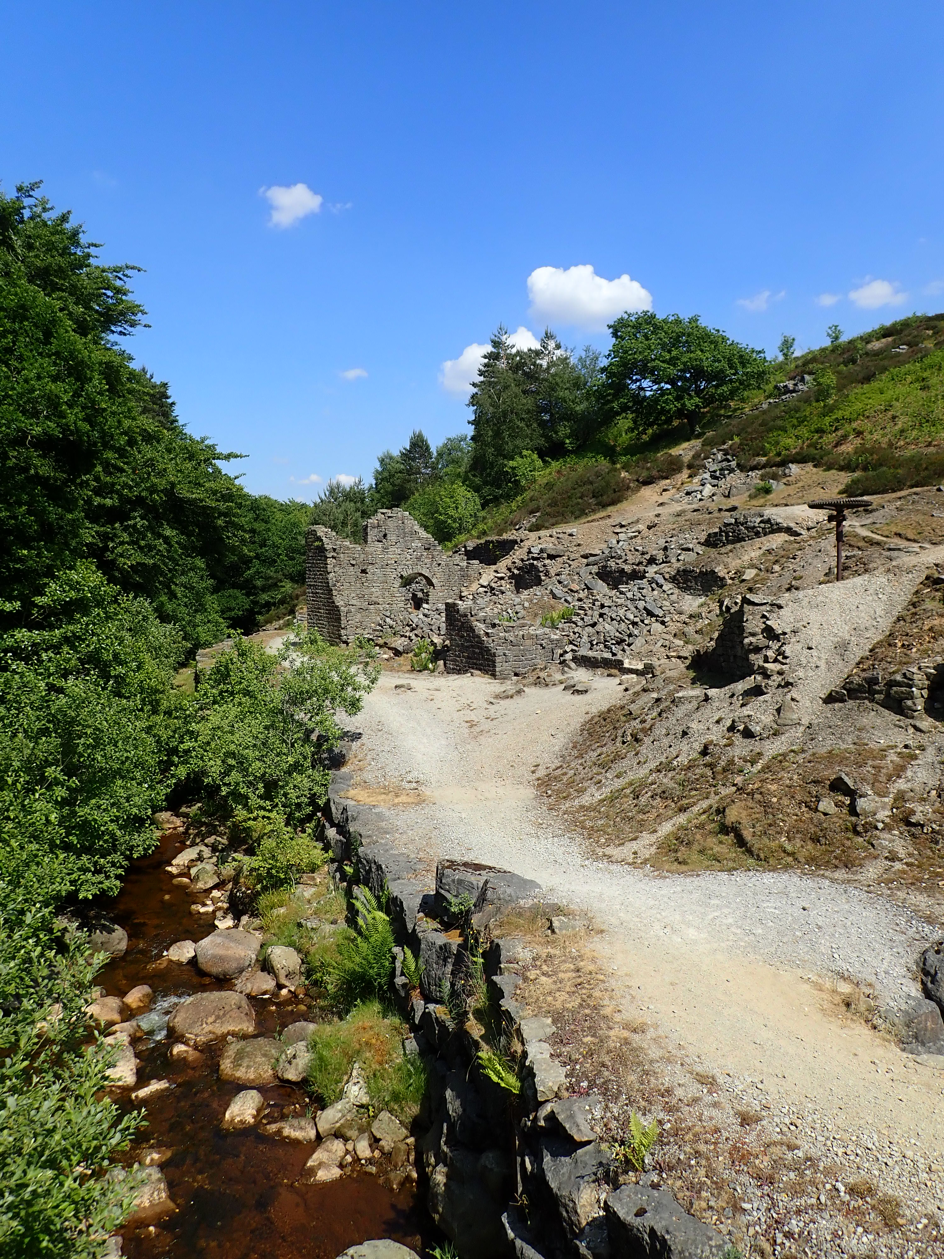
Ironically, the Prosperous lead mine did not always live up to its name. The profitability of the mine varied and it went through several different owners. The last company to hold the lease was the Bewerley United Lead and Barites Mining Company Limited. It ceased activities in 1889 and the site was abandoned. There were apparently trials to reopen the mines in 1967, but these efforts were unsuccessful.
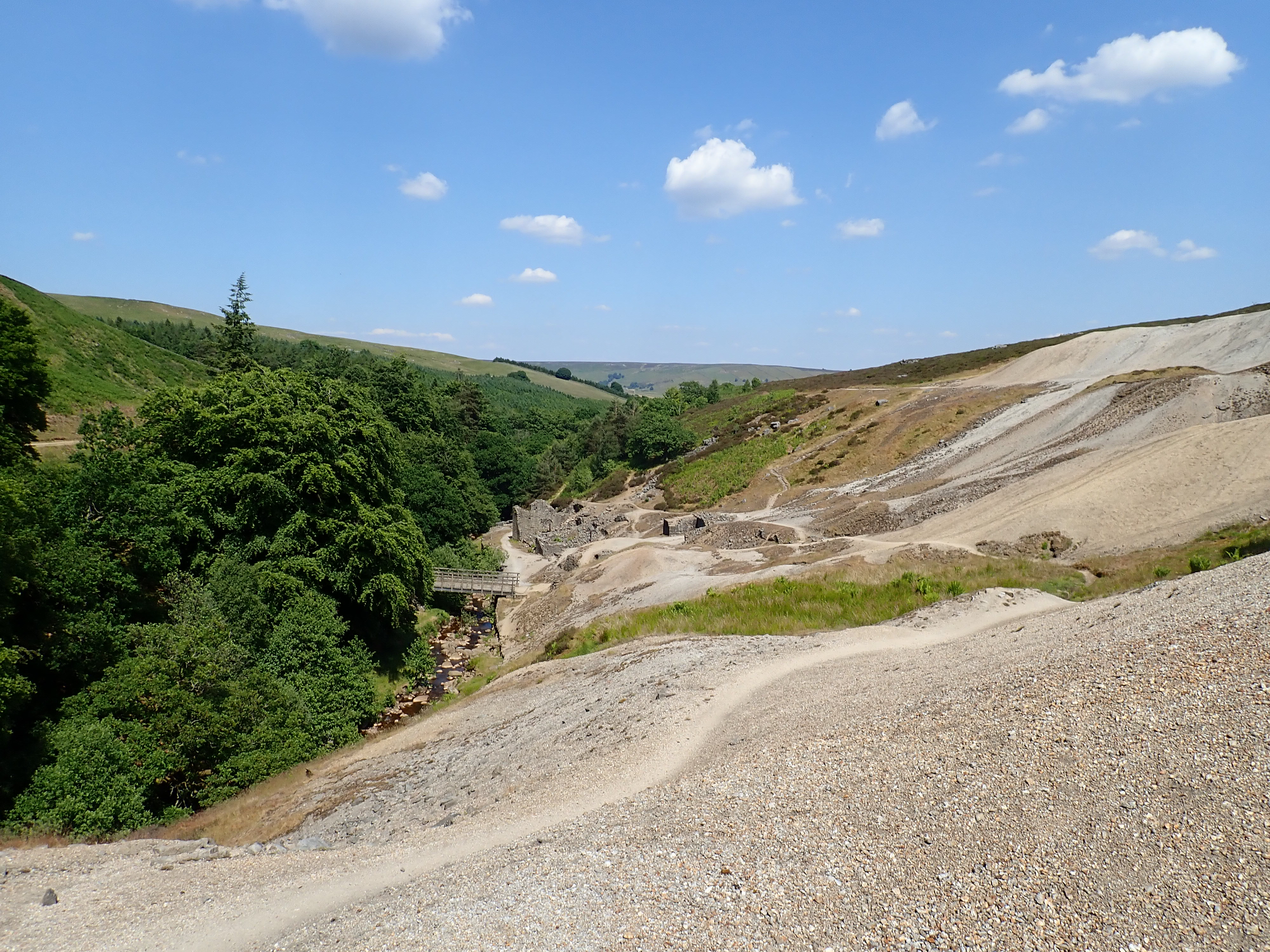
Large spoil heaps that seem to have been transported from the Moon, sections of sandstone wall, bits of rusty machinery, and the covered or filled-in shafts are all that remains of the mines. The most curious remnant is a vertical metal pole crowned with a large cog. Sitting among all that broken sandstone, it looked like a weird, rusted parasol perched on the dunes of a rocky beach. The reality is that it is part of the gearing for one of the pumps that drained the mine. This pump was driven by an underground waterwheel, and the rusted pole I could see was the top part of a mechanism that took the power provided by this waterwheel to machinery on the surface.
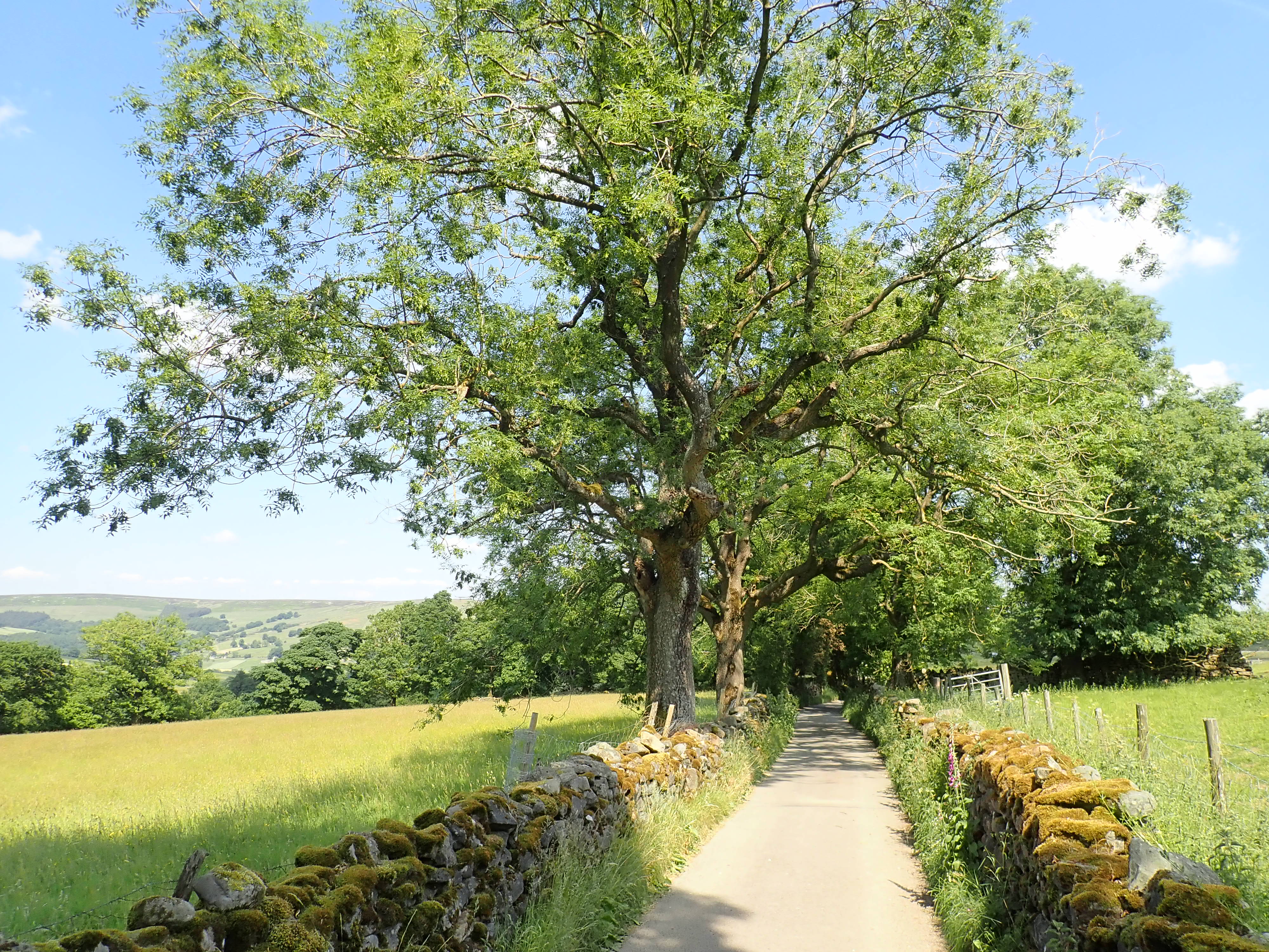
The mines are a fascinating, beautiful, and otherworldly places among the green hills. The Nidderdale Way wound through their spoil heaps, past the Prosperous and Providence shafts, to the crest of a ridge, then followed a track downhill to the valley of Brandstone Beck. After crossing the Beck by a stone bridge, the lane gently climbs to another ridge. I then followed this lane as the views of the countryside around expanded and Pateley Bridge gradually got closer. The lane passed some expensive-looking homes near Eagle Hall, before stopping at the B6265. A few minutes after crossing this busy road, I was in the village of Bewerley and half-way to completing the Nidderdale Way. Feeling good about how I had done, I walked the ten minutes to Pateley Bridge for an iced mocha and my trip home.
UPDATE: 3 March 2024 – I’ve returned to the remains of the Prosperous and Providence lead mines as part of a walk looking at the mining heritage of Nidderdale. My blog post on this walk includes more photos of the mines and of the Nidderdale Way.

That was a great day’s walk and your photos do it justice. Are many people using the Nidderdale Way? It is so varied and can easily be broken down into day stages as you are doing.
Is the ?York Arms in Ramsgill still a pub/hotel, I stayed there one night on a Six Dales Hike from Settle to Skipton on Swale. It was very upmarket then with lots of hunting/fishing types. I felt a bit out of place.
Thanks.
I’ve not met anyone else doing the Nidderdale Way so far. In fact, I’ve often gone for hours without seeing another walker, and didn’t see another walker all day on this stage. When I have seen other walkers it’s looked like they’ve set off for day walks from Pateley Bridge or from the car park at Scar House Reservoir. I did the first two stages on Sundays and this stage on a weekday, so I’m not sure that the day of the week I was walking explains the absence of other walkers. Of course, it could just be chance that I’ve not met anyone else doing the Nidderdale Way. It would be a shame if it’s not getting much use, because it is a fantastic walk.
The Yorke Arms is still a restaurant and hotel, and it does look a bit posh.
I’m sure there’s supposed to be the grave of an old miner by the main road at Greenhow and you’re supposed to stamp your clogs above him and shout hello to him. That’s what my mother used to tell me years ago anyway.
I like to see old mines and find them very interesting. A lot of people think they spoil the countryside but they’re part of the history of the place.
There used to be a Youth Hostel at Ramsgill which we used to stay at a lot (generally cycling with our parents). Not sure it’s there now.
Cows generally won’t actually bother you – and if they do run at you, you’re best to turn and square up to them – they are prey animals and actually scared of you and they tend to remember that as they get closer and you eyeball them and don’t move. If they do get too close, wave your arms aggressively at them and shout at them.
Another strategy which generally works is to stay by the initial stile and let them all run over and, once they’ve arrived and are stood wondering what to do, stroll calmly and slowly across the field.
That’s a good local custom. I’d not heard about the grave before, and so I did the usual thing and Googled it. There’s an interesting webpage about the grave at https://greenhow-hill.org.uk/people/other-people/john-kays-grave/ – the story has a sad ending.
I’ll remember that about cows. What I was trying to do when I met these cows was to just keeping going because I thought that they might interpret me stopping as being aggressive. I’ve never seen cows so agitated.
Thanks for the google result – I couldn’t remember the details but that’s what my mother used to tell me about.
The cows wouldn’t interpret you stopping and looking at them as offensive in any way, they just wouldn’t want to approach you. I get them to come up to me by imitating their huffing (to catch your smell) and looking away. They won’t approach closely if you’re looking directly at them.
Bulls are completely different – I avoid eye contact with them because they see that as a challenge. Having said that, all but dairy bulls (black and white) are too fat and lazy to bother chasing or attacking you – I’ve even known beef bulls to hide behind the herd of cows and peer around them at me from the back!
Thanks for the tips. Hopefully I won’t need them.
Best wishes,
Robin