
It was an inauspicious start to an amazing walk. Within the first few minutes of starting on the 54-mile (87km) Nidderdale Way, I was a bit lost. My guidebook had directed me to walk down Mill Lane in Pateley Bridge before passing “between houses to reach a footpath that signs you up a narrow alley along the backs of houses.” I was now wandering around the cul-de-sac of Mill Lane wondering where the Nidderdale Way had disappeared to. The large number of signs on houses and gates proclaiming “private”, “no right of way” and “no footpath” suggested that I was not the first person to get confused about where to go, and that the people who had come before me had decided the way to go was through someone’s garden. Luckily, I spotted a small footpath sign pointing to an inconspicuous, narrow alley partly obscured by greenery.

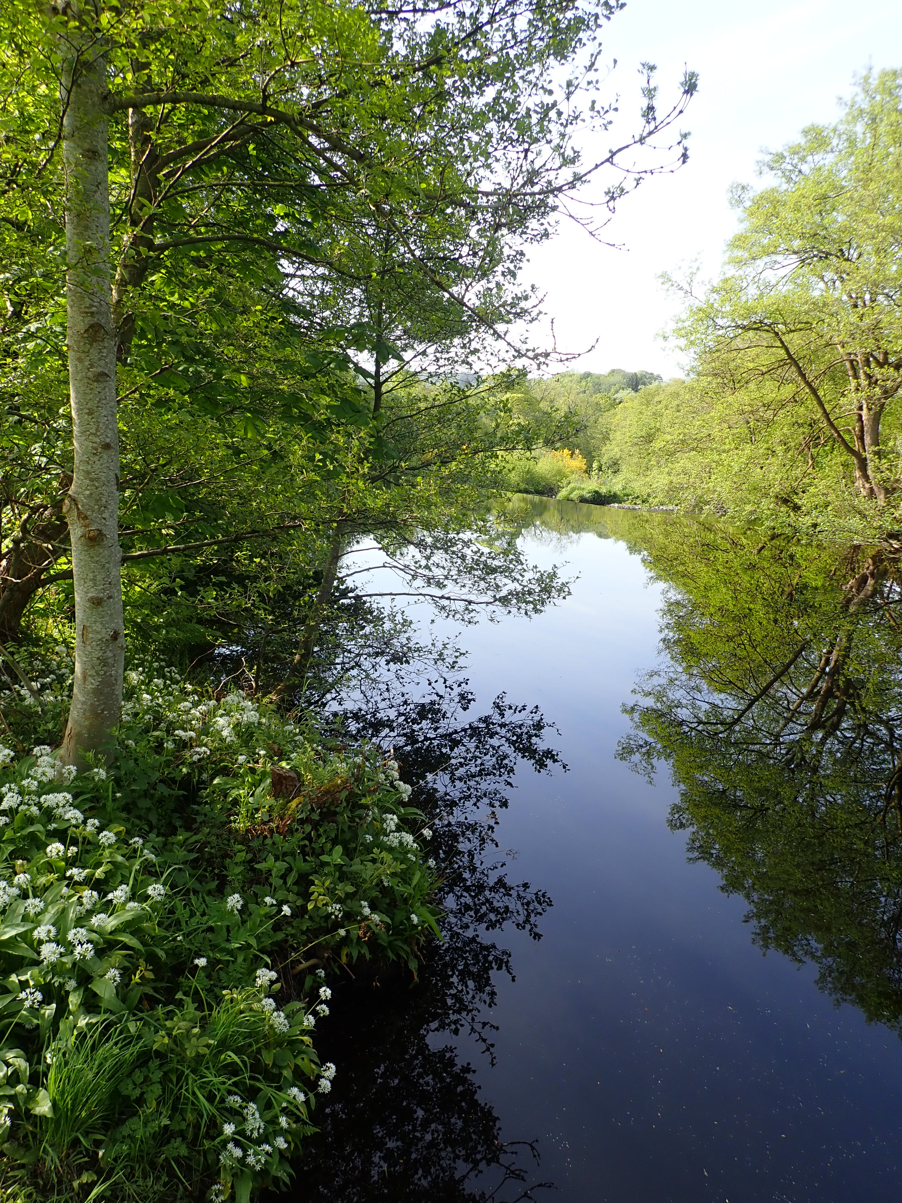
I followed this sign and went down a mud path that ran along the back of people’s gardens, with an ever-present smell of dog poo. After a couple of minutes, I left the alley behind to follow a path running by the tree-lined river, with the strong smell of wild garlic filling the air. I felt that the Nidderdale Way had really begun.
Nidderdale is the most eastern of the Yorkshire Dales. It’s not actually part of the Yorkshire Dales National Park but is an Area of Outstanding Natural Beauty. Nidderdale is an interesting and attractive mix of pasture, woodland, reservoirs, moorland, farms, and old villages. Flowing down the dale is the River Nidd. Its name means “brilliant” in Celtic. The Nidd starts on the slopes of Great Whernside before winding its way to join the River Ouse not far from York. Nidderdale also includes Ripley Castle as well as the dramatic rock formations of Guisecliff, How Stean Gorge, and Brimham Rocks. The only part of Nidderdale I had known for a long time was Brimham Rocks because I had been there many times to climb. It may be because it’s outside the National Park that I never thought to explore Nidderdale further. I suspect that I am not alone in this, as Nidderdale has a reputation for being quieter than the other dales. When I recently started looking at walking guidebooks for Nidderdale I realised that most of the walks in the area took in sections of the Nidderdale Way. At the same time, I’d been thinking about a walking or climbing project for 2023. Walking the Nidderdale Way therefore seemed like a project that would allow me to see the best of Nidderdale.

The Nidderdale Way is a long-distance walk devised in the 1980s. It is essentially a counter-clockwise circuit of the dale that starts and ends in the market town of Pateley Bridge, roughly in the middle of the valley. The Nidderdale Way can be done in four, five or six days. I had decided to walk it in six days to allow me to savour the route properly, and because I am not as fit as I used to be. I would also be doing the Nidderdale Way as a series of day-walks rather than in one push to allow me to fit the walking in around the other things in my life. My plan is to get to the start of each section, and home from the end of each section, using a mixture of driving, lifts, taxis, and buses.
The first stage of the Nidderdale Way goes along the East side of the dale from Pateley Bridge to Lofthouse. It’s the shortest stage at only 6.3 miles (10.1km). Getting to the start was a simple drive, but getting back to my car from Lofthouse would mean catching the Dalesbus number 821. This bus runs through Upper Nidderdale on Sundays and Bank Holidays from mid-May to mid-October. The slight challenge I faced was that it only goes through Lofthouse at 1pm and 4pm on its way back to Pateley Bridge. This meant keeping an eye on the clock as I walked and either an early start or a later start to avoid the chance of excessive waiting. I chose an early start.
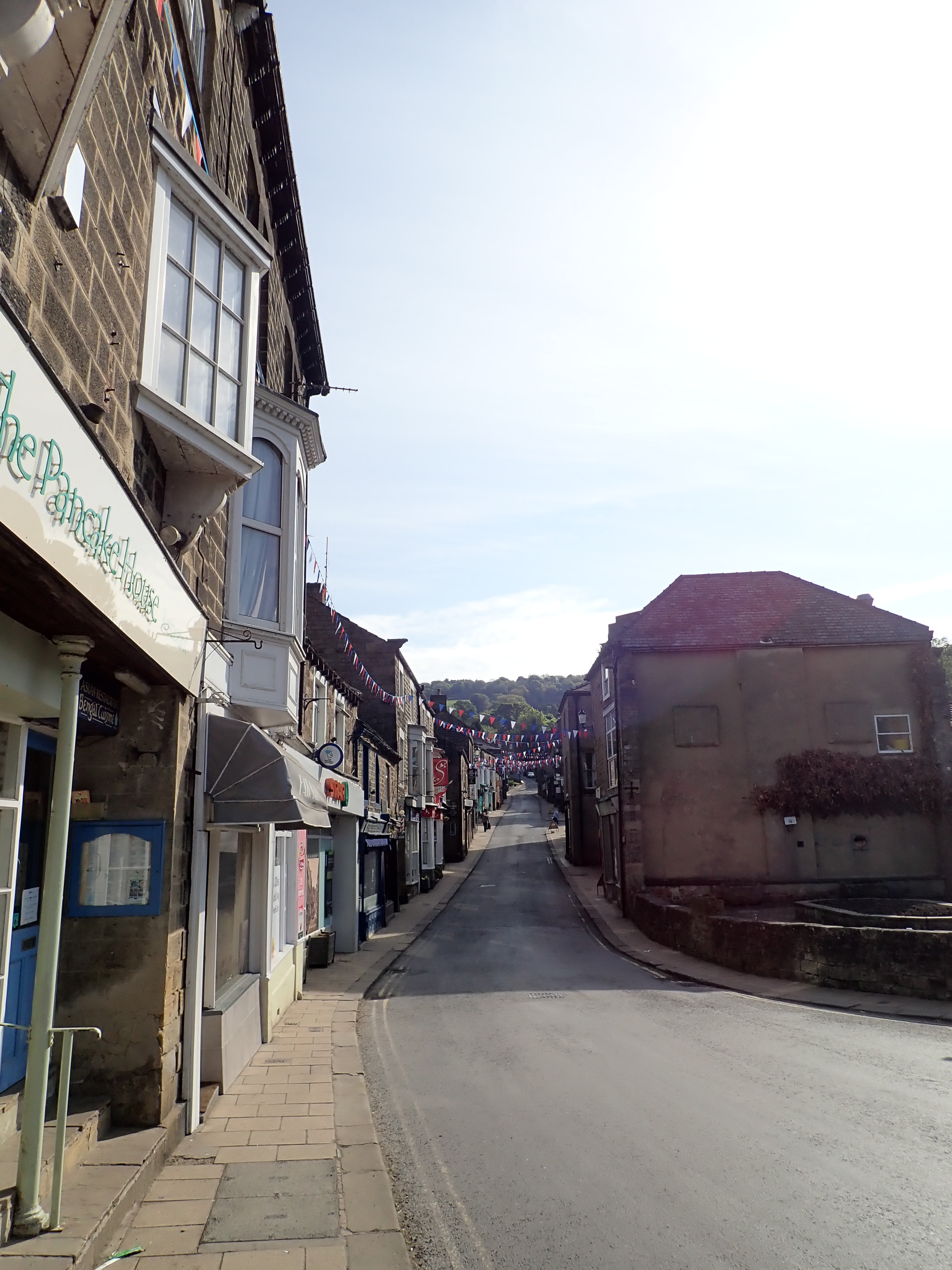
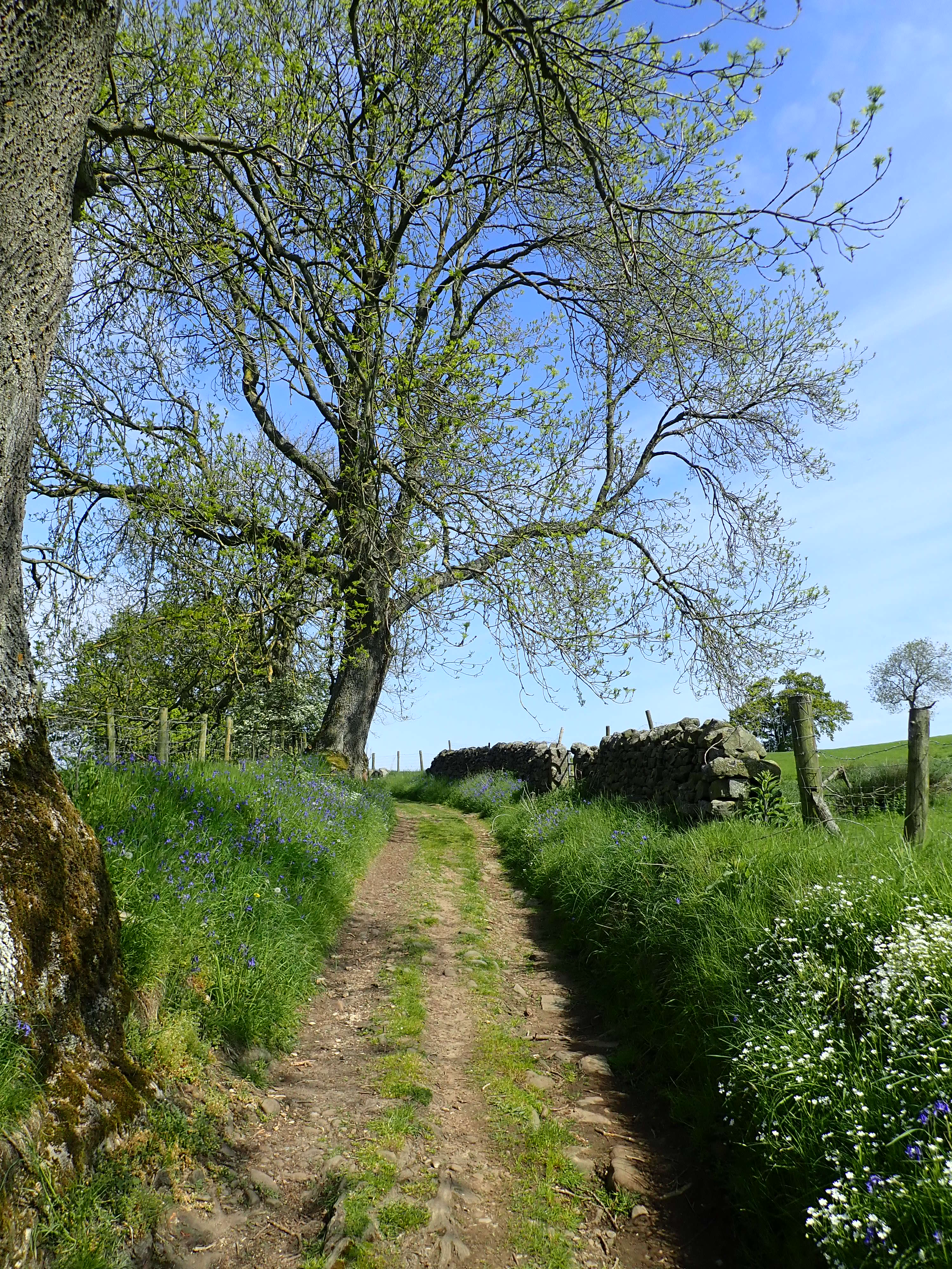
Pateley Bridge at 8:30 on a Sunday morning was very peaceful. This was good for me as it meant there was no one around to see me getting confused in a side street. Once I was past that, the Nidderdale Way was stunning. The first part closely followed the tree-lined Nidd through meadows and small woods. Among the trees were vast numbers of flowering wild garlic and patches of bluebells. The river was so still it looked like it wasn’t flowing at all, with its surface only disturbed by the occasional fish raising its head.

At the end of the woods near Low Green House, the Nidd curved away from the Nidderdale Way. The path now ran along the embankment on which the Nidd Valley Light Railway used to operate. This railway was opened in 1907 to transport people and materials up the dale for the building of the dams of Scar House and Angram reservoirs. The railway closed in 1936 when the reservoirs were completed. This stretch of the Nidderdale Way was never very far from this embankment, often running either on the embankment or next it. As I followed it towards the village of Wath, the embankment was framed by buttercups.

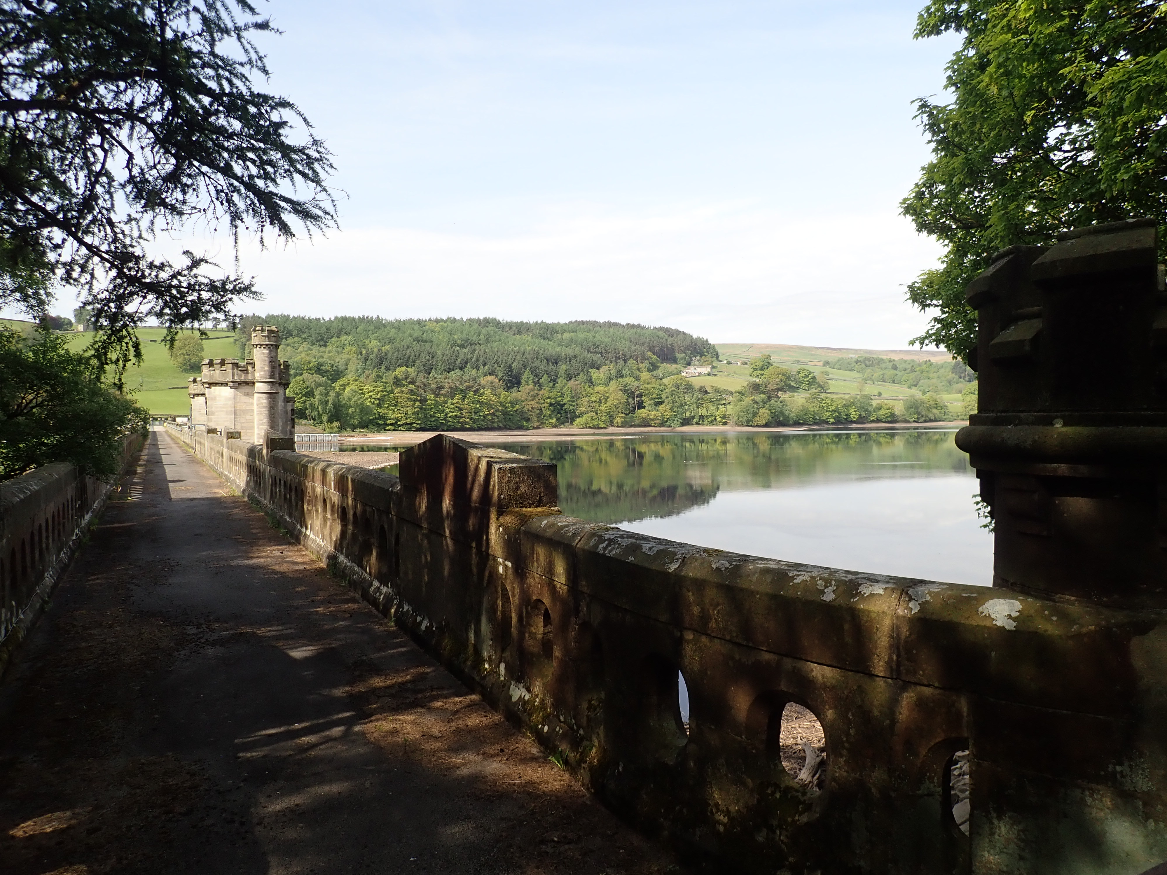
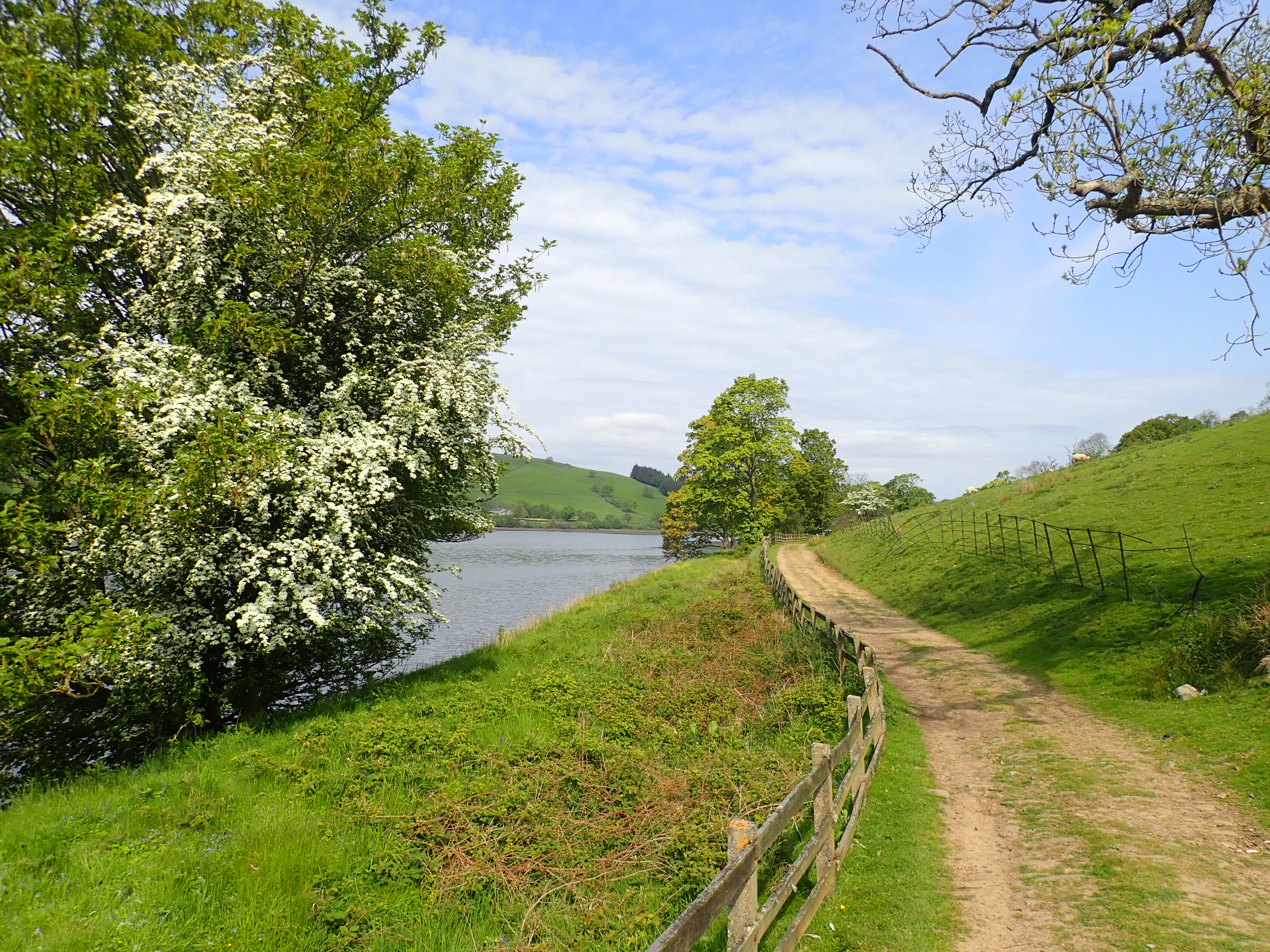
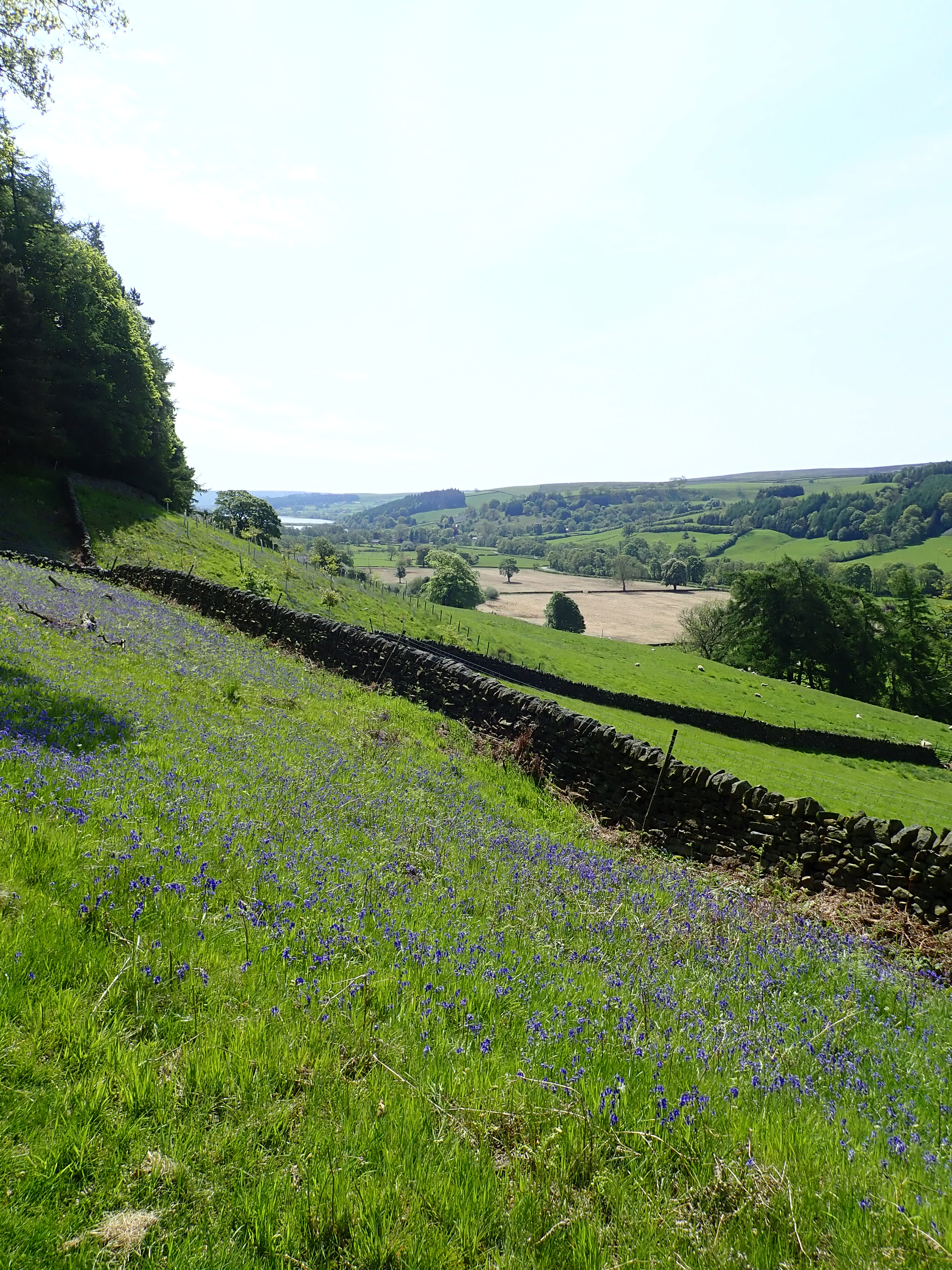
After rejoining the Nidd, I walked through meadows and woods before a slight climb took me past the stone dam of Gouthwaite Reservoir. The climb carried on to a lane and then gently descended to follow the reservoir for the rest of its length. Gouthwaite Reservoir is a compensation reservoir, meaning that its role is to maintain the flow of the Nidd in periods of dry or wet weather. It is also a nature reserve and Site of Special Scientific Interest. It’s a lovely place – nestled in the dale, fringed by trees, grasses and flowers, with geese and goslings on the water.


Between the 12th century and the Reformation in the 1530s, Upper Nidderdale was owned by Fountains Abbey and Bylands Abbey. The Cistercian monks from these abbeys built granges (farm houses with outbuildings such as barns) and had lay brothers and/or tenant farmers work the land. There are still many farms in Nidderdale with the word “grange” in their name, and I passed through the 14th century Bouthwaite Grange as the Nidderdale Way left the reservoir behind and moved up the side of the dale.

I could see as I’d been walking along the reservoir what looked like fields of light blue on the other side of the dale. I’d guessed that they might be bluebells but thought it strange that they would grow out in the open instead of in the cover of a wood. It was only after I’d walked beyond Bouthwaite that I came across a field on this side of the dale filled with bluebells standing proud in the bright sunshine. I simply did not know that bluebells could grow like that. There were even more on the other side of a wood on Longside (and the wood itself was full of bluebells too). An amazing thing about this walk was the sheer number of flowers I saw – more than I’ve ever seen on a walk in the UK.
As I went through fields on the last stretch of the walk, I passed the skeletal remains of a railway goods wagon. It was presumably a relic of the Nidd Valley Light Railway that had been left as a shelter for sheep, but its collapsed roof and many missing boards meant it was not fulfilling this function anymore.

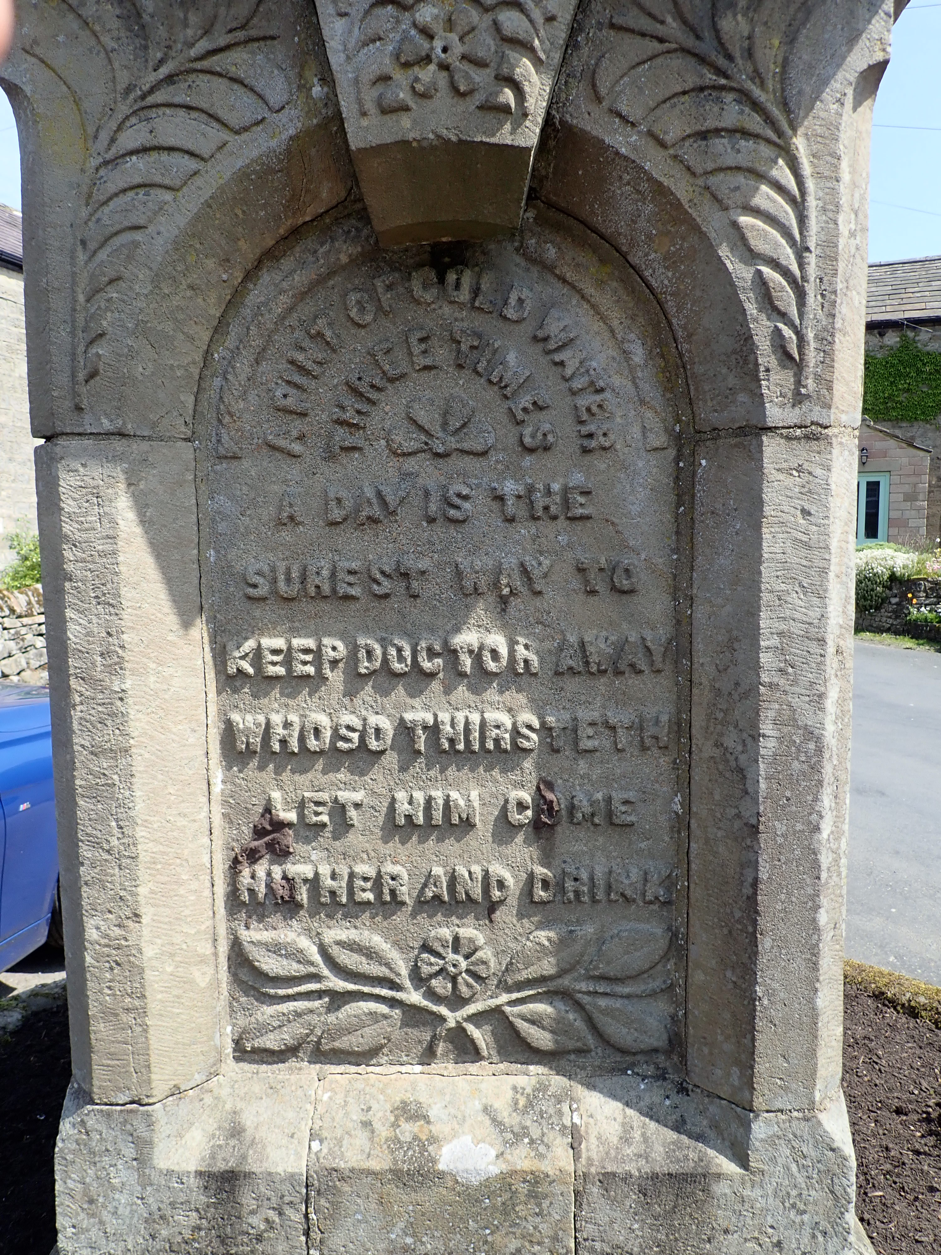
After a few more fields and a bit of road walking, I reached Lofthouse. I was pleased to make it with plenty of time before my bus was due. I used the spare time to look around the village, and liked reading the inscriptions singing the praises of cold water on the war memorial water fountain in the village’s centre. I then ate my lunch while sitting on a bench waiting for my bus. To my surprise, the bus was precisely on time. I enjoyed the views and listening to the bus driver make curt comments about other drivers not moving over enough as the bus zipped me back to Pateley Bridge. It was a great start to the Nidderdale Way.


Further information
The guidebook I have been using is the Nidderdale Way by Beth Rimmer.
Harvey Maps also publish a dedicated map to the Nidderdale Way. Although, I’ve not been using this as the entire route fits on the Ordnance Survey map 298.

. . . And gorgeous photos, too! Thank you –
Thanks Diana. All the best
Don’t worry – your start would have been exactly like that for me too! Bet the ramsons smelt lovely after the dog muck!
Thanks.
The ramsons were amazing to see and smell. It was a pleasant and dramatic change.
This made me remember the wonderful walks we did together – such good memories. I really liked the beautiful way you wrote – it actually brought tears to my eyes. I am so proud of you.
Lots of love, Dad x
>
Thanks Dad.
Those were fantastic walk . I’ve got great memories of them too, and going on a long distance walks like this brings back those fond memories.
With much love,
Robin
We all need a Dad comment on our blogs!
Good start to the ‘way’. When you unexpectedly find bluebells growing in the open it usually means that the area was historically wooded, apparently.
I did a variation of the Nidderdale Way back in December 1999, enjoyed it immensely.
Best of luck with your continuation.
That we do.
Thanks – that would make sense for why the bluebells were growing where they were. Surprising (and a shame) to have lost that much woodland though. I wonder how long the bluebells keep growing in a spot after the woodland has gone.