
The Nidderdale Way has many fascinating historical sites along its route, but this stage seemed to have more than the other stages I’ve walked. There was a castle, lovely villages, stocks, crosses, churches, and disused fishponds. All of this in a beautiful dale.

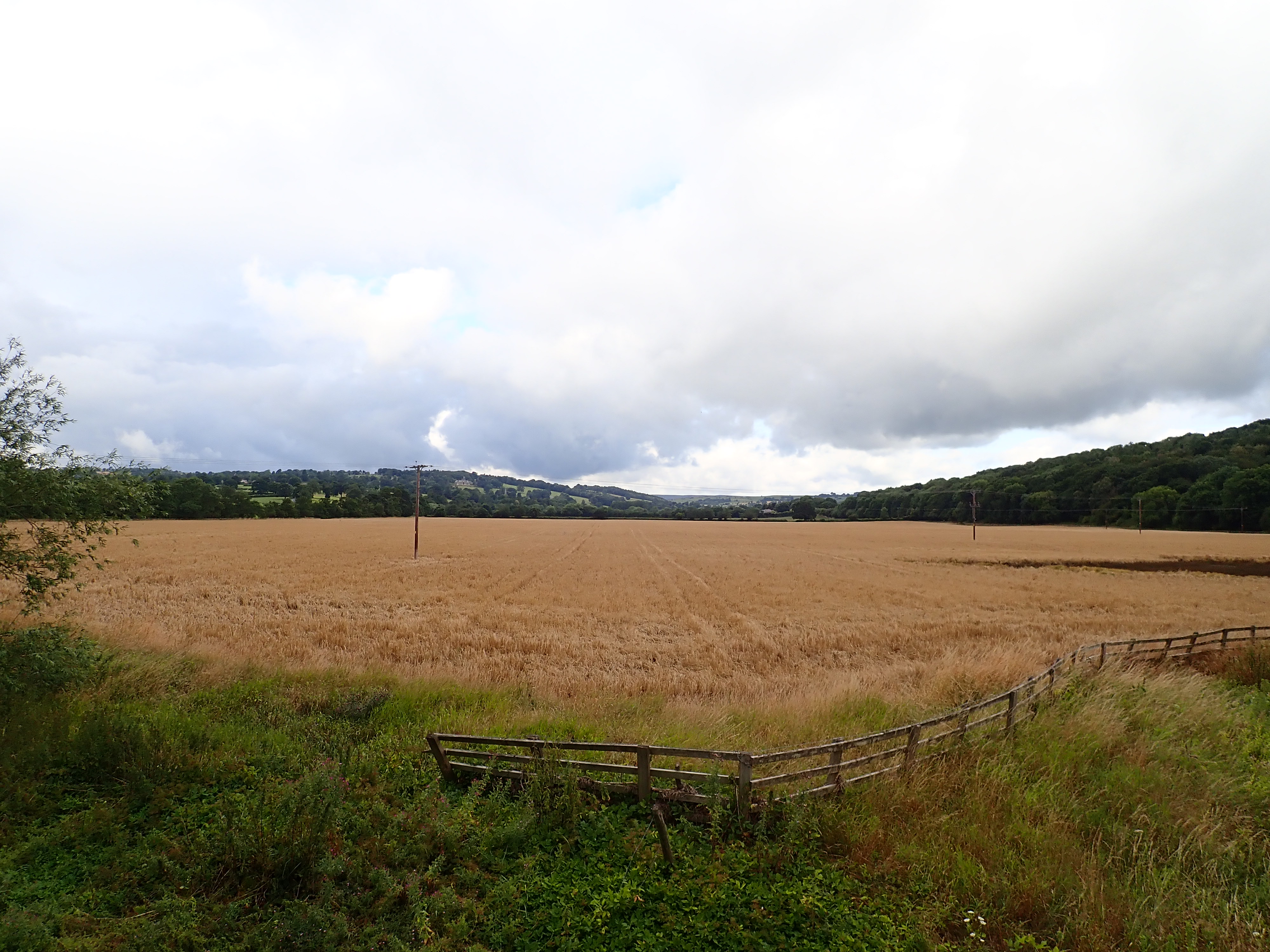
This fifth section of the Nidderdale Way runs from Birstwith to Shaw Mills, and is 8.4 miles (13.5km) long. The part of Nidderdale it goes through has a different character from the sections I’d walked before it. The dale is wider, and its sides lower and less steep. There are still meadows and pastures with cows and sheep, but there are also fields of corn. The route follows the River Nidd before crossing the dale to go into the gentle hills on its Northern side. It then makes an interesting diversion to the valley of Cayton Gill before turning to head West towards Pateley Bridge.
The start for this day’s walk was the point where the Nidderdale Way crosses Wreaks Road in Birstwith. Birstwith is a village that sits on both sides of the River Nidd. It was largely built by the Greenwood family in the 19th century. This wealthy, mill-owning family lived at Swarcliffe Hall on the hill overlooking Birstwith. The Hall is now occupied by the private Belmont Grosvenor School.

Getting to the start of the walk was relatively easy. I took the number 24 bus to Birstwith, and then walked down Wreaks Road, going past the attractive primary school and some pretty cottages.

From Wreaks Road, the Nidderdale Way follows an old millrace, which it then crosses by a metal bridge. The next few minutes are an unlikable walk around three-fourths of the perimeter of the modern Birstwith Mill, with its industrial buildings, stacks of pallets, and parked trucks.

After crossing the other end of the millrace, I thankfully left the factory behind to walk along a narrow, overgrown path by the River Nidd.

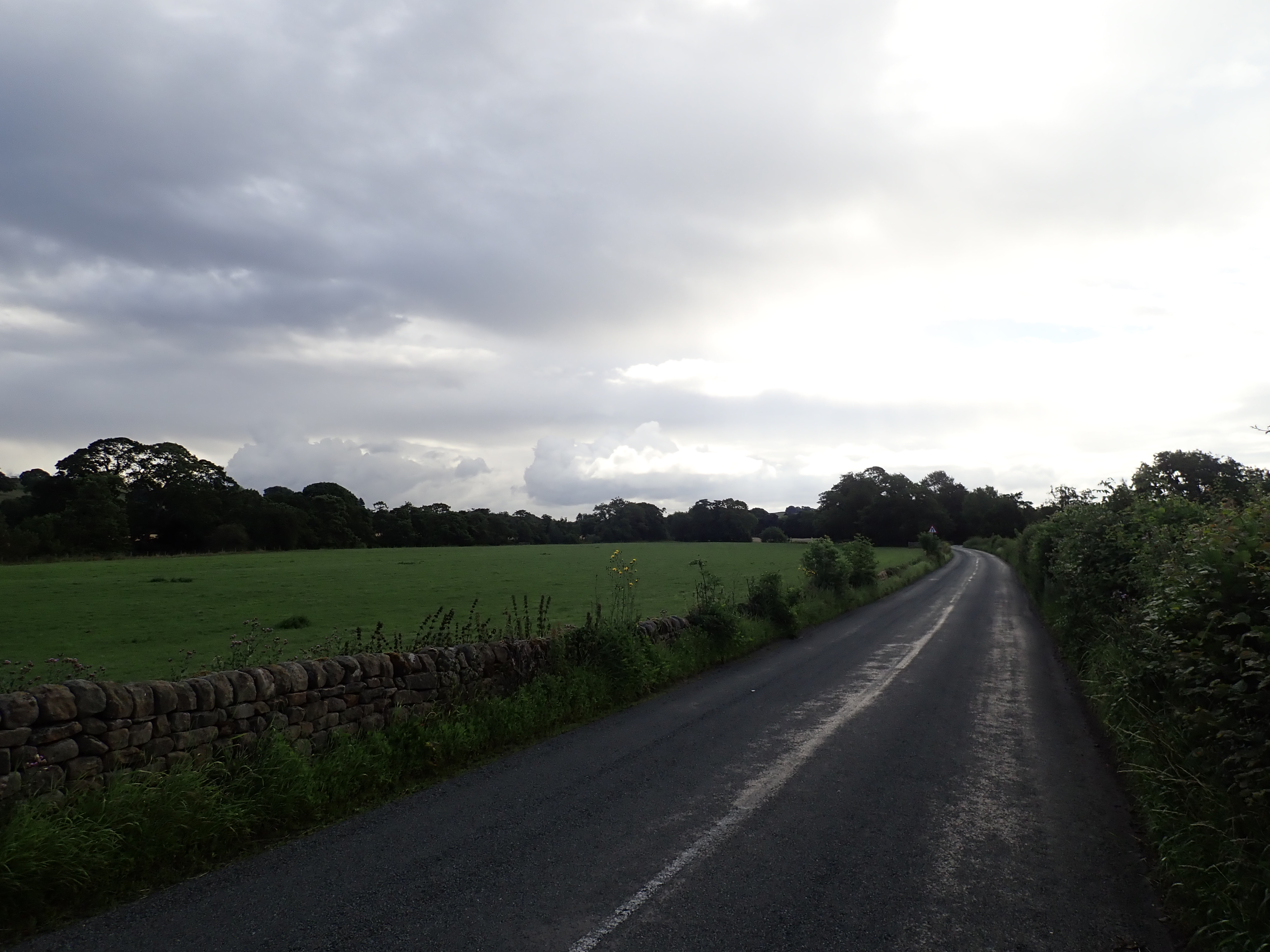
After a little while, the path breaks away from the river to head across a field to join a road. This was the first of two stretches of walking on relatively busy roads. I always feel uneasy walking on country roads because of the possibility of getting hit by a fast-moving car driven by someone being inattentive or aggressive. It was therefore a nice surprise to find all the drivers on these two road-walking stretches giving me plenty of space as they passed. Despite this, it still felt good to get off the road to follow an ancient stone-flagged path to the lovely Church of St Thomas a Becket in Hampsthwaite.

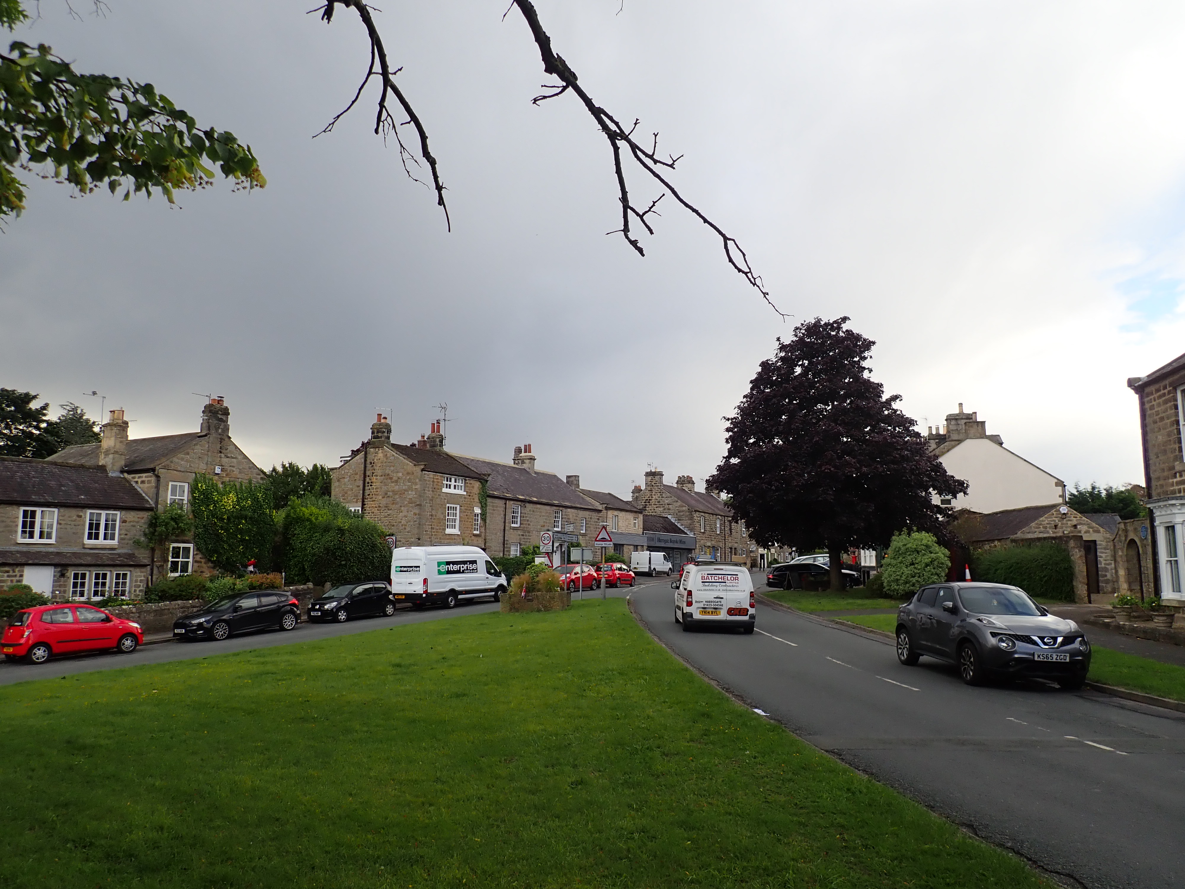
The Nidderdale Way takes the scenic route through Hampsthwaite. I went past ancient gravestones in the churchyard, before taking a right at the church door to go through an archway made by two trees, to arrive at the most ornate stile I’ve ever seen. The Nidderdale Way then goes over a field, and past lovely cottages and gardens to Hampsthwaite village green. It then loops around on itself to take the road past the lychgate for the church it has just left.

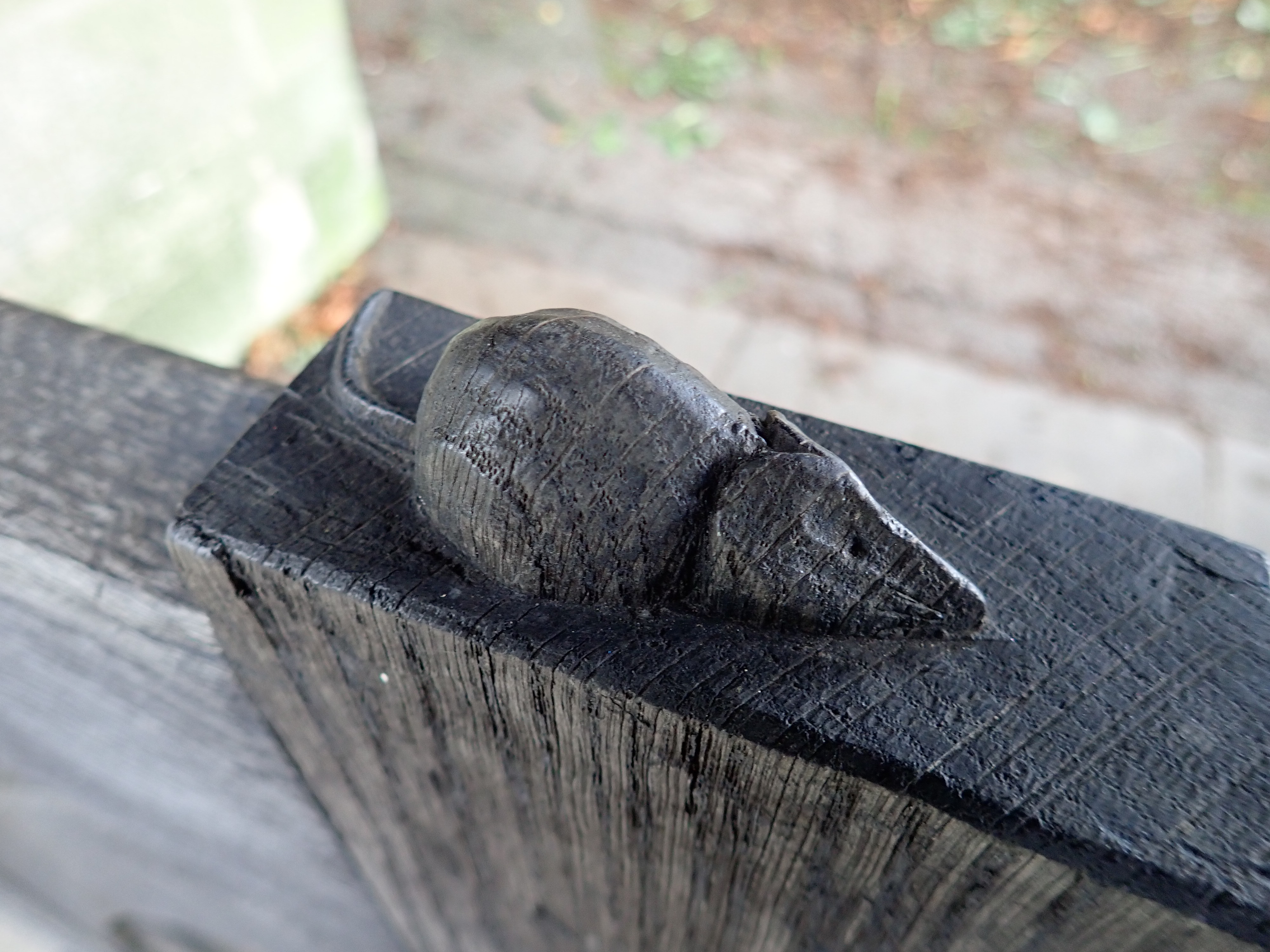
A lychgate is a roofed gateway to a churchyard. The name comes from “lych” or “lich”, which is the Old English or Saxon word for corpse. During the Middle Ages, the lychgate was the place where corpses were kept until the priest arrived for the funeral service. This could be a wait of a day or two, and the roof served to keep the rain off the body and the people who were keeping vigil over the corpse. The lychgate would also give shelter to the priest during the first part of the service. In addition, the lychgate is the main entrance to the churchyard. I’ve read that there is a wedding tradition in Yorkshire where local children tie the lychgate shut with string, and then only allow the newlyweds to pass after the groom has thrown them coins.

The lychgate at St Thomas a Becket Church in Hampsthwaite is special because it was built by the famed Yorkshire furniture craftsman and maker Robert Thompson. He is known as “the Mouseman” for signing his work with carvings of mice. There are several carved mice sitting on the top of the gate in the lychgate in Hampsthwaite. Although it is sad that these mice have been damaged, I still enjoyed seeing them.
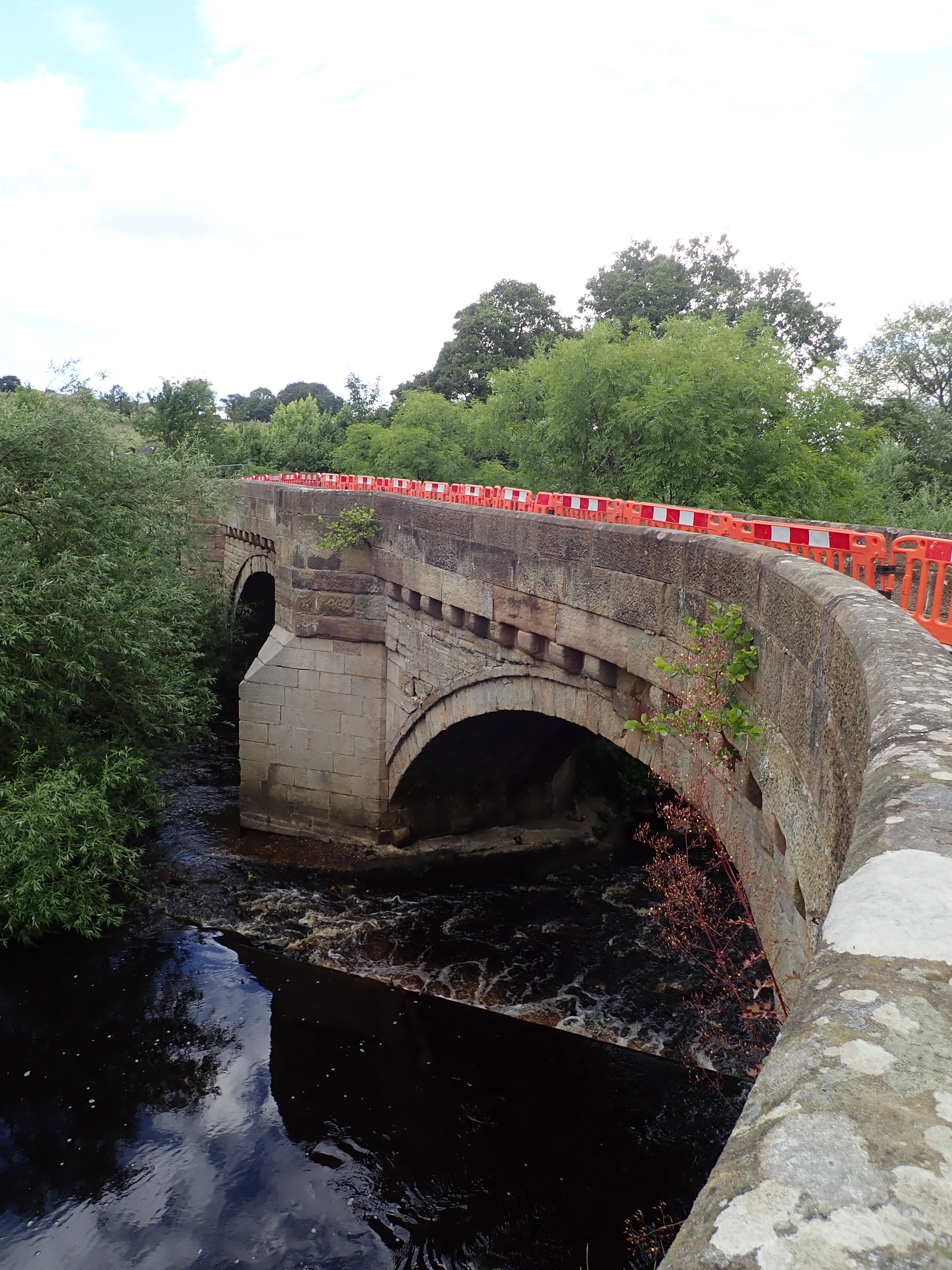
From St Thomas a Becket Church, I headed along the road to Hampsthwaite Bridge. This is an impressive stone structure built in 1640. There is a tale that the parapet of the bridge was raised in the 19th century after a pig that was being driven to market gained its freedom after diving over the edge of the bridge and into the Nidd. Unfortunately, about a month and a half before I walked over this bridge, a vehicle hit one of the parapets and caused fairly serious damage. There is now a crack between the parapet and the road surface (which it is apparently possible to look through to see the River Nidd below), as well as cracks in the parapet itself. The bridge was closed to vehicles, but open to pedestrians and bikes, when I went over it. However, if I had been a week later, the bridge would have been entirely closed for several weeks of repairs, and I would have had to cross the river back at Birstwith to detour along roads to get back to the Way.

After crossing the river, I headed through a pasture to go up the side of the dale and to the hamlet of Clint. I then took a short side-trip to see Clint’s old stocks and the base that was all that remained of its cross.

It’s in Clint that the Nidderdale Way starts to follow the course of the Nidderdale Greenway. This is the walking, cycling, and horse-riding trail that starts in Harrogate and largely takes the route of old train lines.

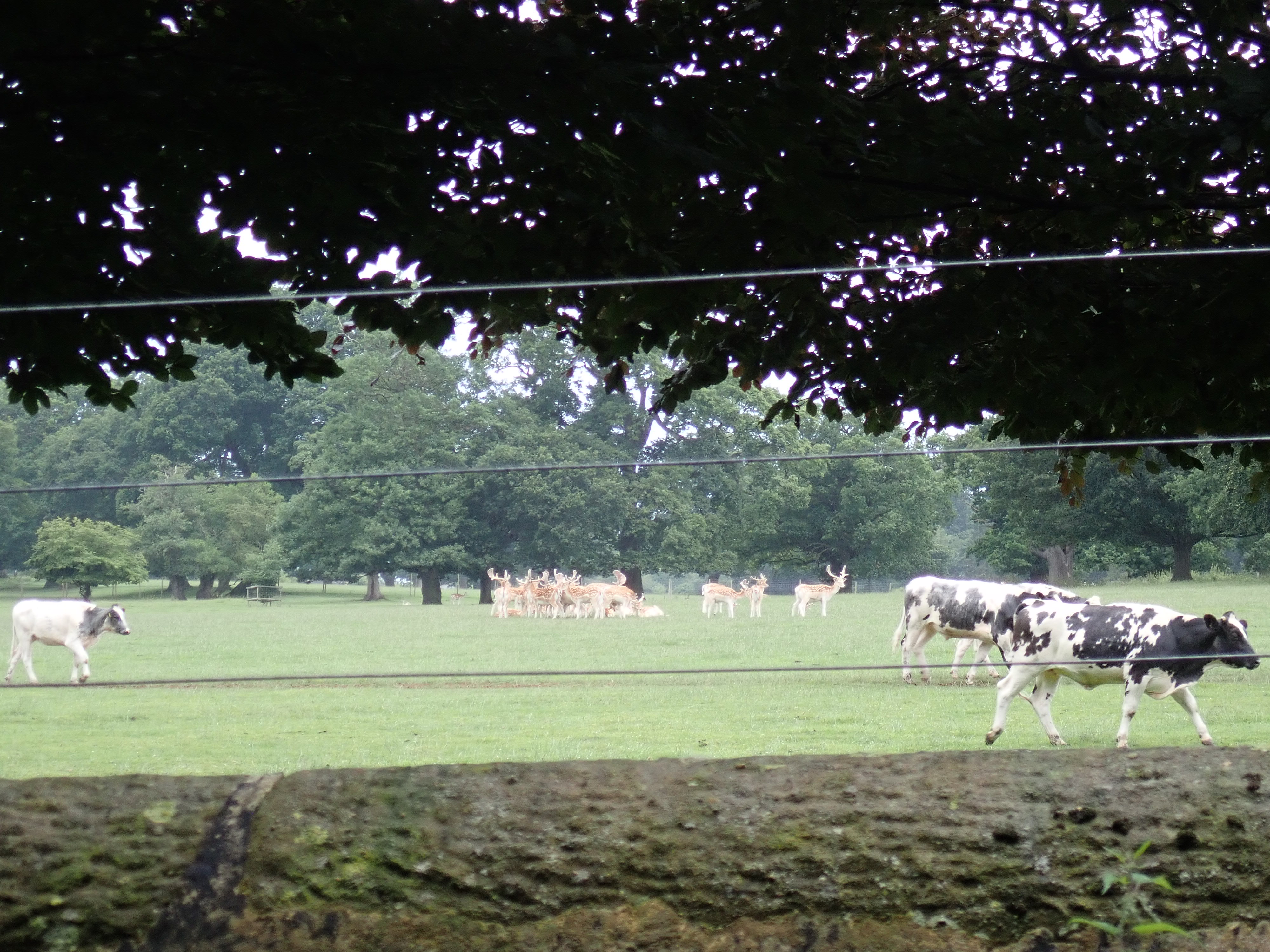
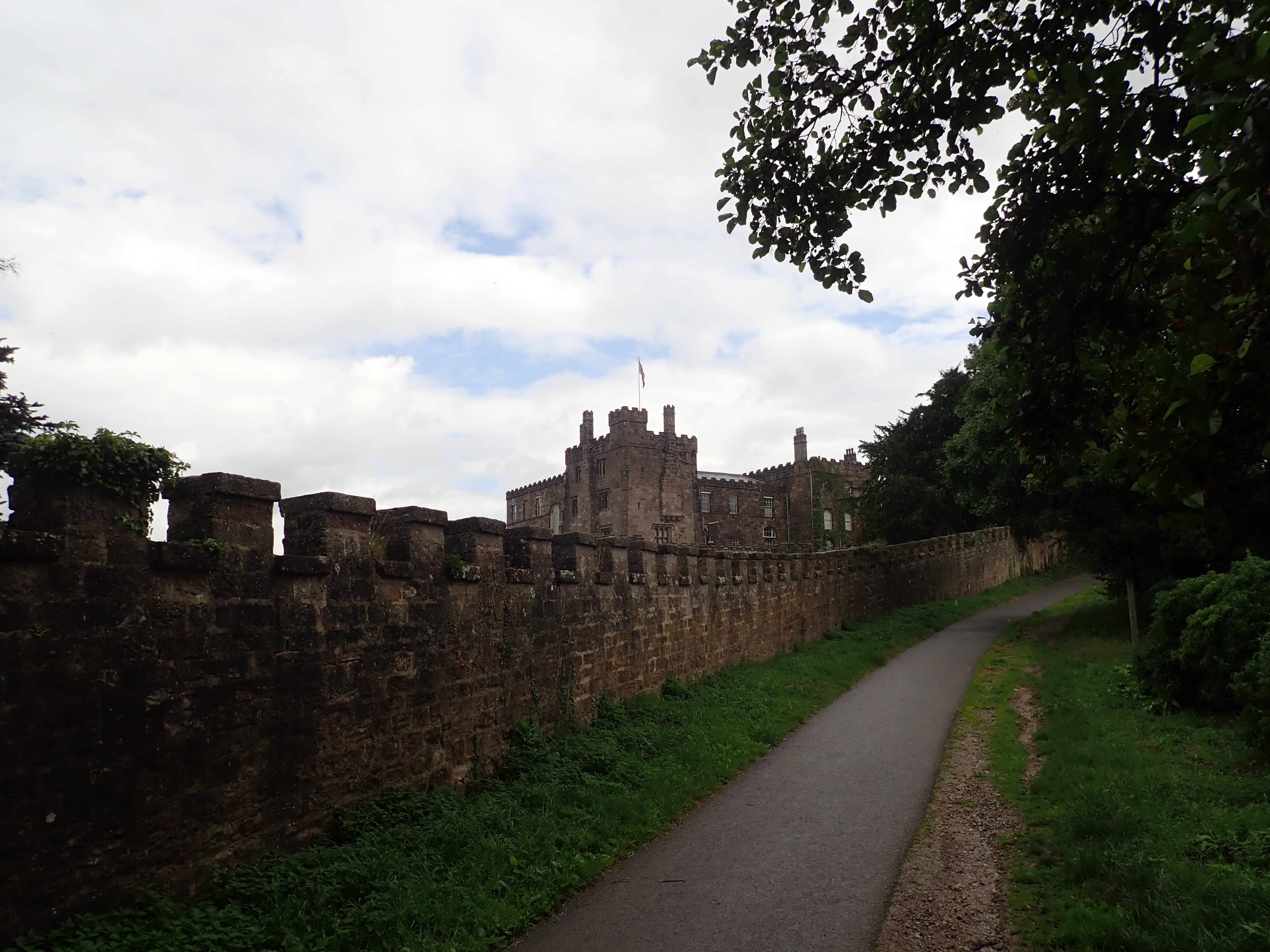
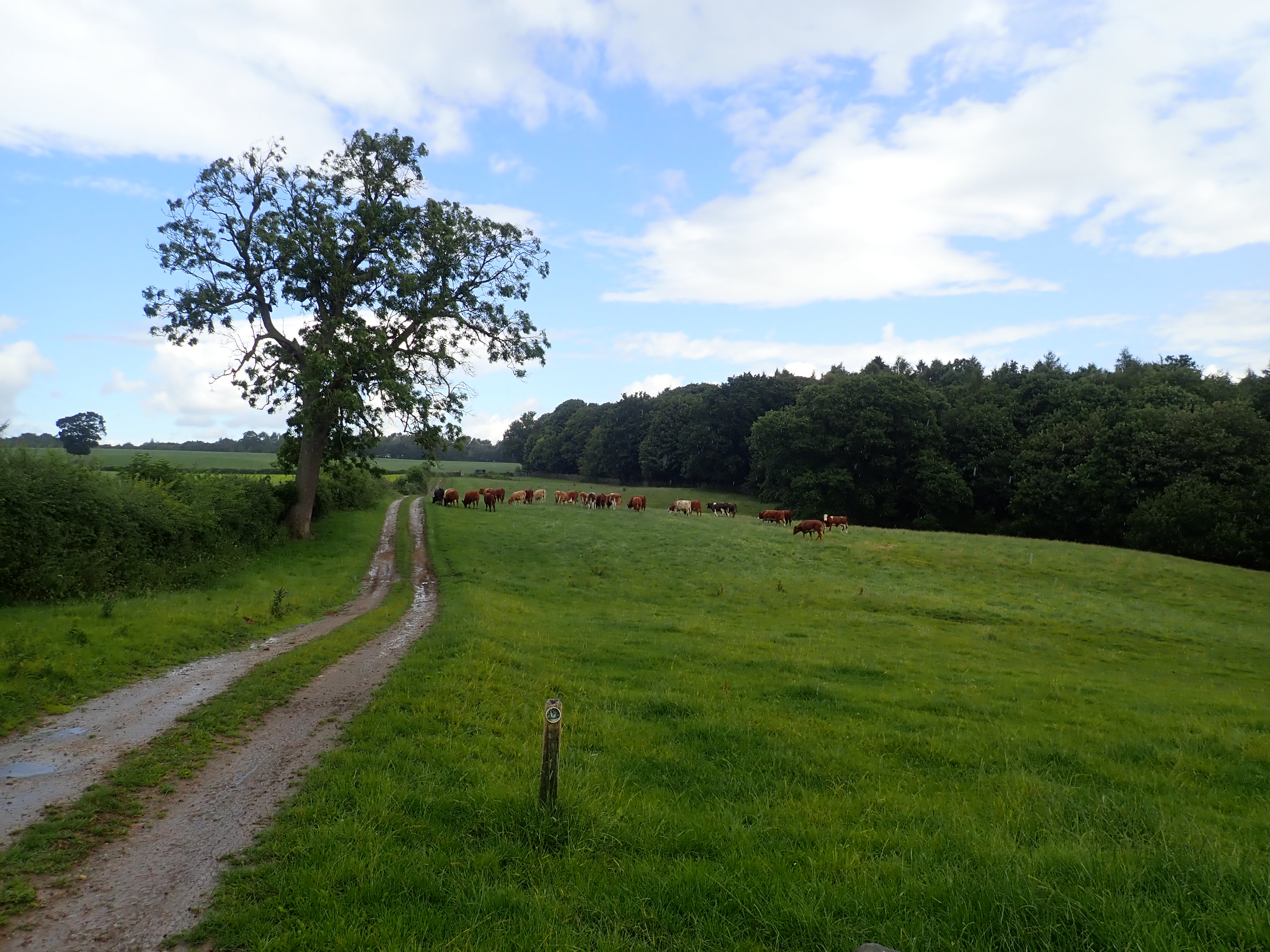
From Clint, the Nidderdale Way and Nidderdale Greenway go down a lane and then into Hollybank Wood. They climb steadily up through these pretty woods, before descending to run alongside Ripley Castle deer park. A herd of cows was noisily on the move past a herd of Fallow deer, who grouped themselves together evermore closely as the cows passed. The bucks’ antlers were impressive, and I enjoyed being able to see them from relatively close by.
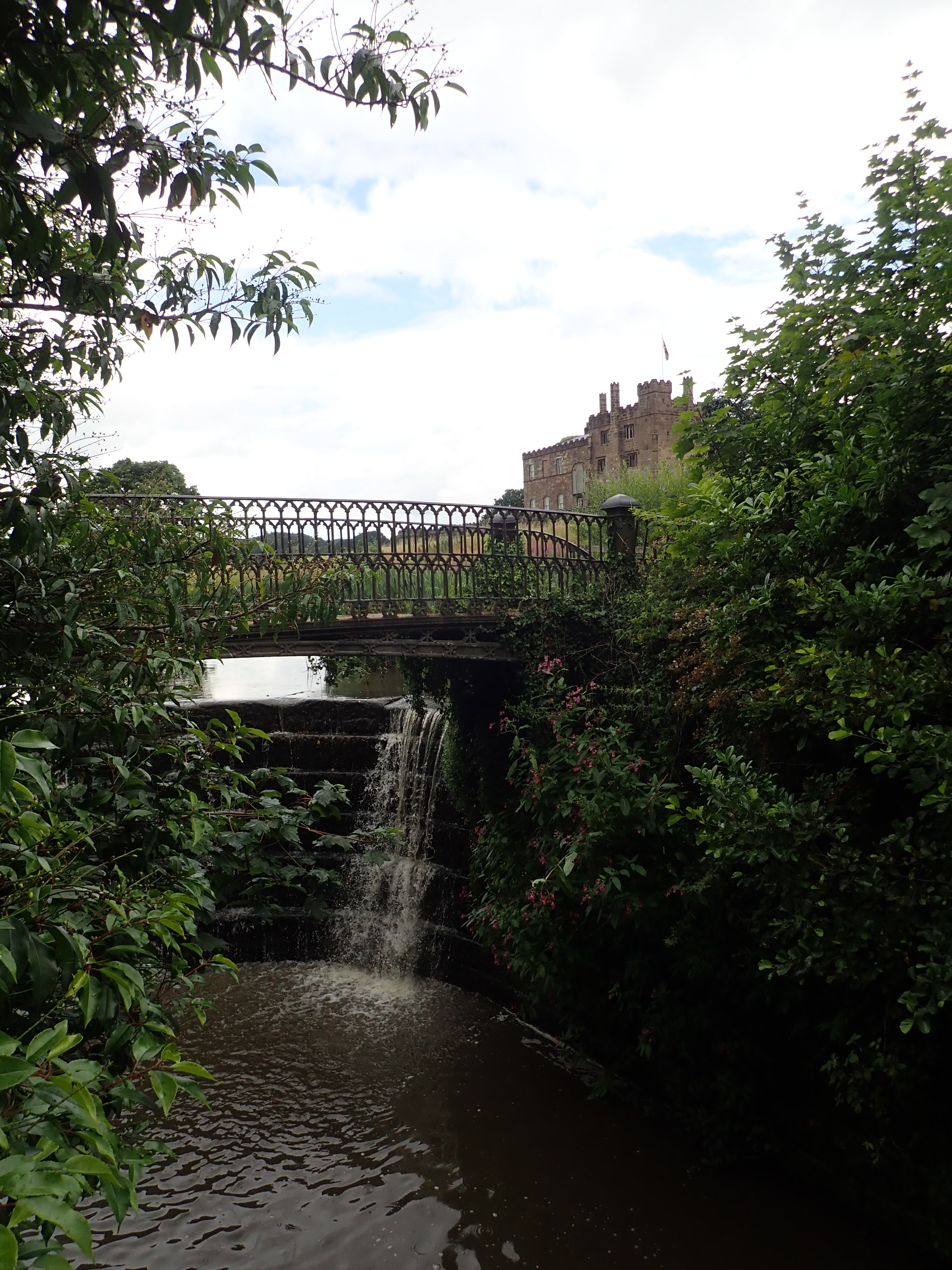
The light rain that had been following me since I entered the woods then began to become more and more incessant. It was hammering down by the time I walked next to the ramparts of Ripley Castle, passed the Castle gate, and into Ripley village.
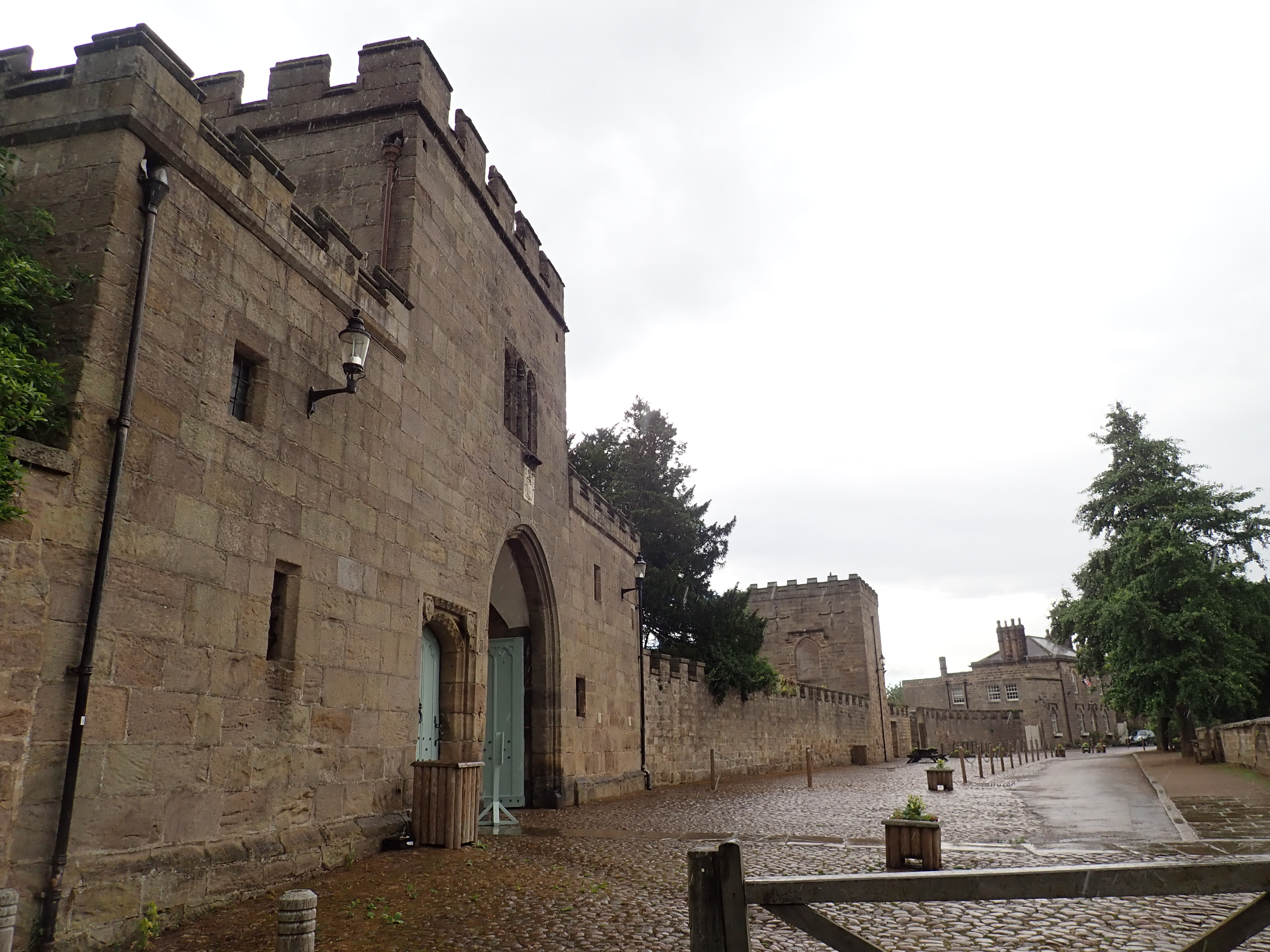
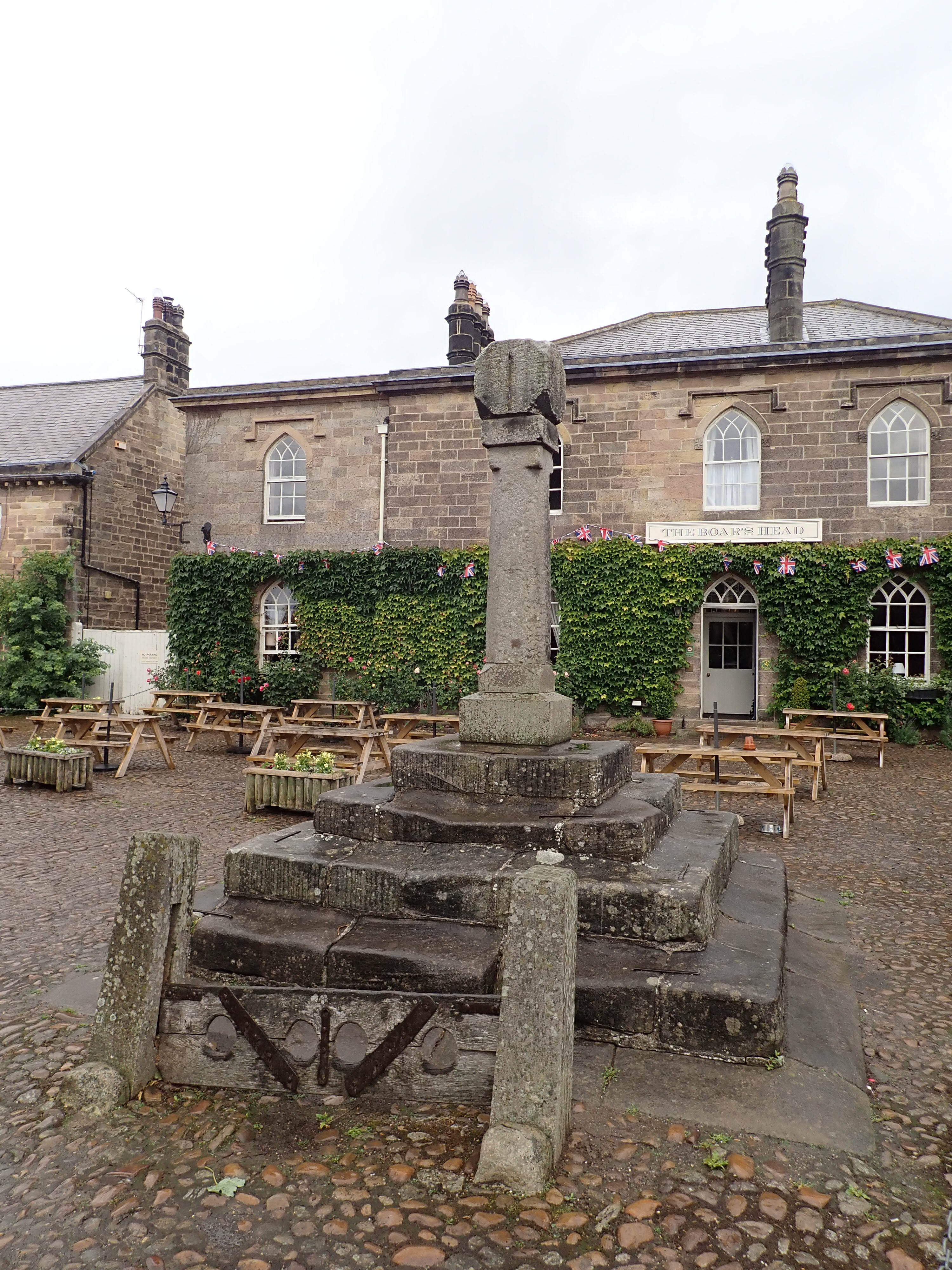
Ripley Castle has been the home of the Ingilby family for over 700 years. In the 14th century, Thomas Ingilby saved King Edward III from being gored by a wild boar while they were on a hunt. He was knighted as a reward, and the head of a boar became a symbol on his family crest. There is a statue of a boar in the village, and the local pub is named The Boar’s Head.

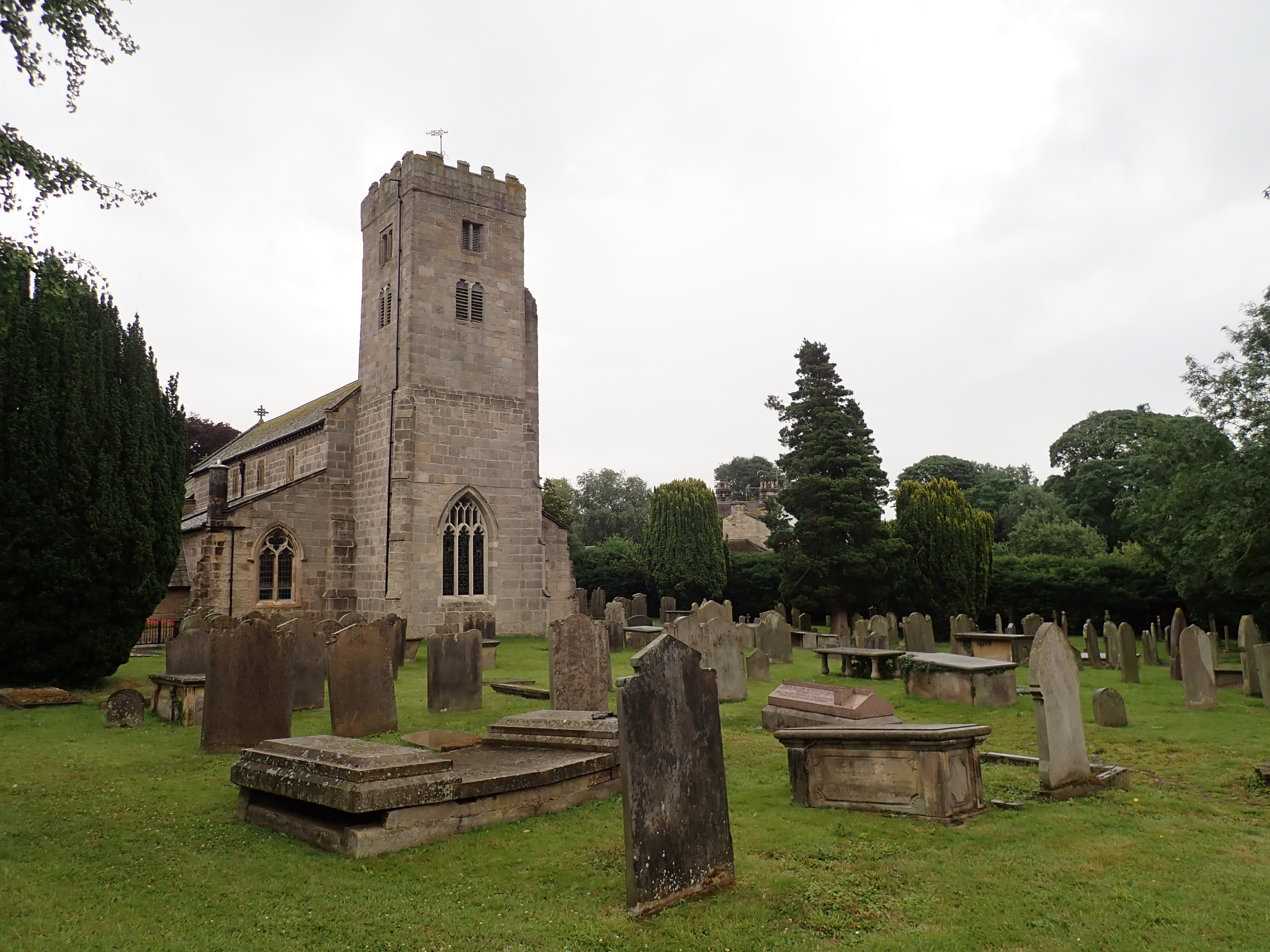
The gorgeous stone buildings of Ripley are relatively recent. In the 19th century, Sir William Amcotts-Ingilby demolished and rebuilt Ripley as a model village based on the style of villages in Alsace. Some parts of the older Ripley survived Sir William’s dramatic reform. The cross in the centre of the village has a 15th century base and an 18th century shaft, while the stocks are thought to be 18th century. The handsome All Saints Church was built in the 14th century by Sir Thomas Ingilby to replace an earlier chapel nearby that was suffering so badly from subsidence that it was known as the “Sinking Chapel”.

The Nidderdale Way goes through Ripley, over the busy B6165, and up the narrow Birthwaite Lane. It climbs up the hill to pass a point from which my guidebook said there are excellent views of Harrogate and the Vale of York, but the rain and cloud refused to let me really see them. I left the lane to follow a track, and then went through a field containing over twenty adolescent bulls. The bulls lined up next to the track to watch me intently as I walked by them.
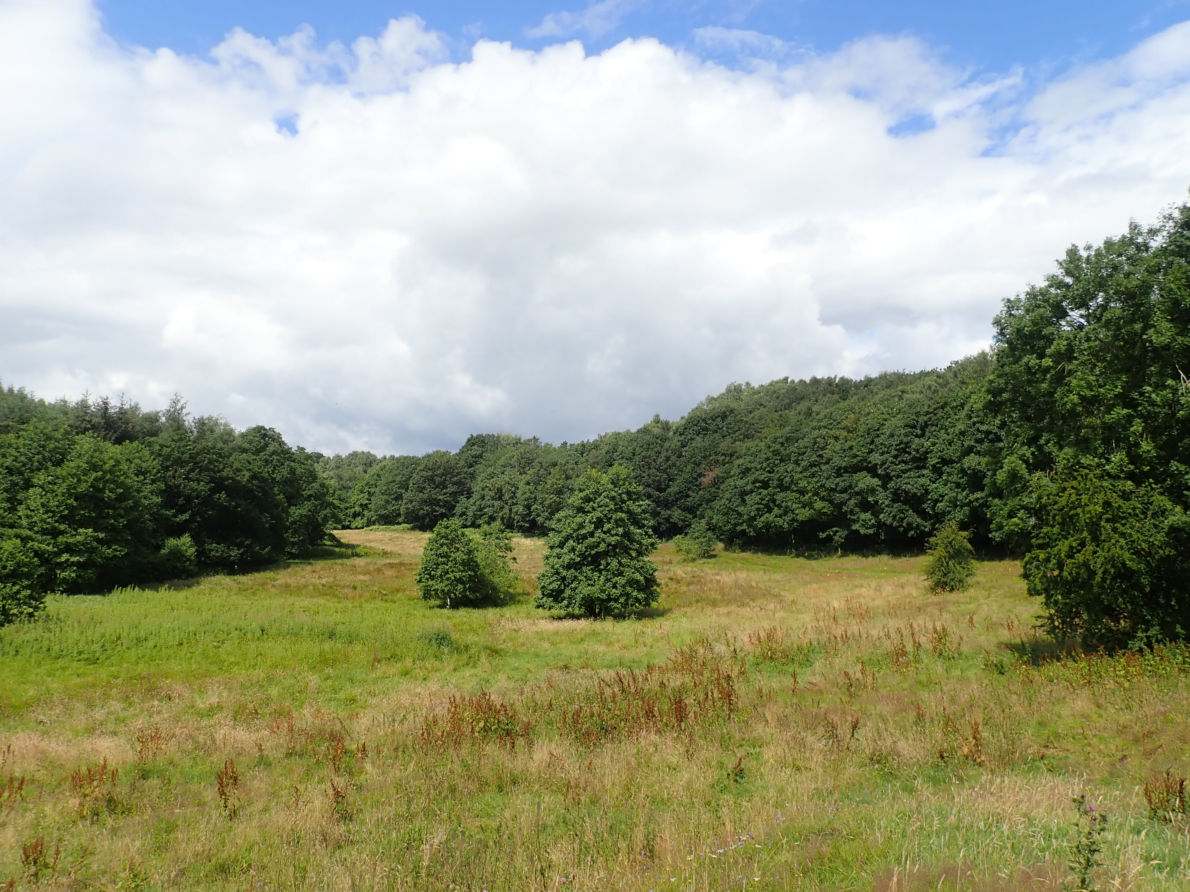
I then went through woods to the floor of the shallow valley of Cayton Gill. Hundreds of years ago, the monks of Fountains Abbey dammed Cayton Gill to create ponds in which to farm fish. It’s easy to imagine this looking at the wide, flat, and marshy valley bottom. This tranquil and pretty valley was my favourite part of this section of the Nidderdale Way. The valley is surrounded by woods from which there was a constant chorus of bird song, while the valley floor is covered by grasses and flowers, interspersed with trees. As I walked across the valley, the air became humid as the sun came out and warmed the rain-soaked grasses.

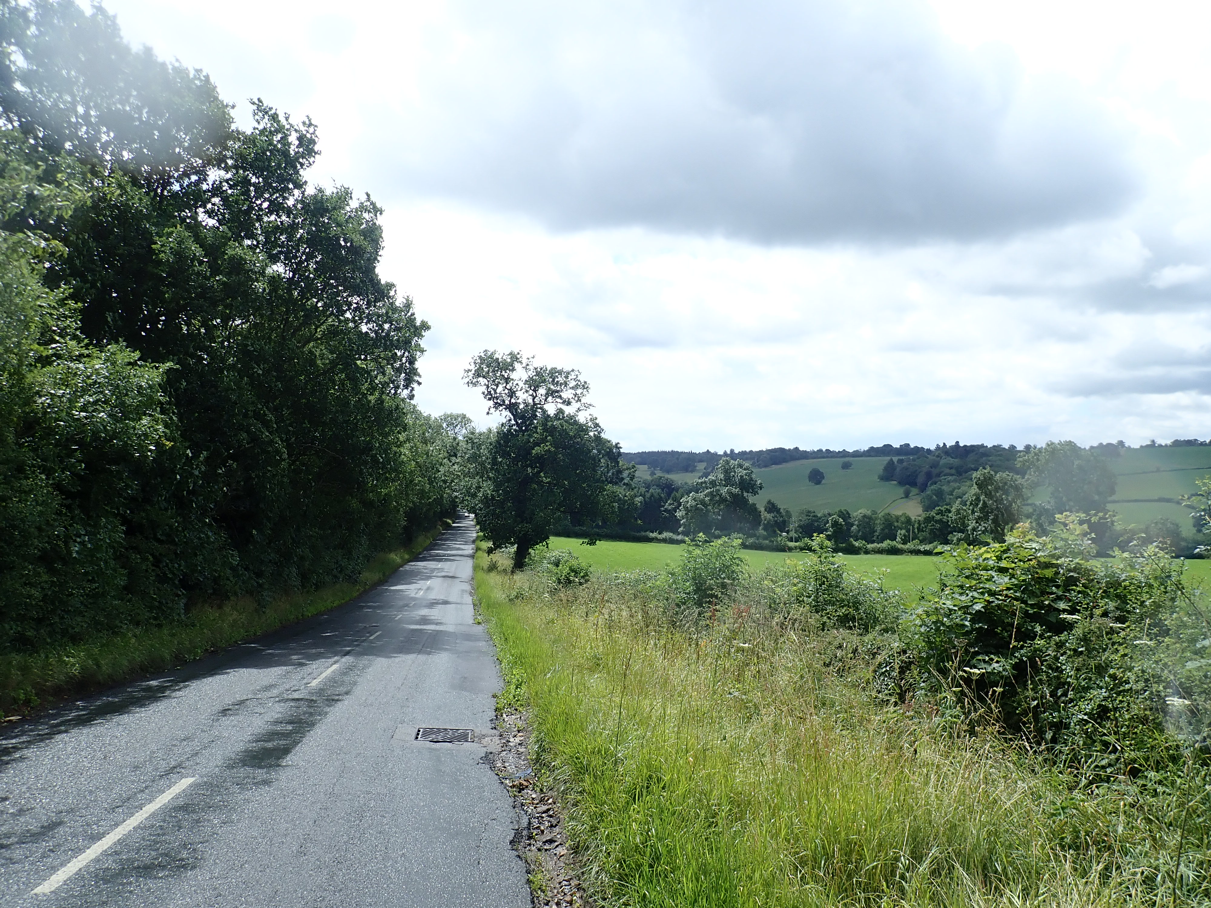
I followed the path along the valley’s East side before it turned sharply left to shadow a treeline. It then cut into the woods to pick up a track going uphill. The Nidderdale Way went along this track as it passed fields to a T-junction with Scarah Bank road. As the heavy rain started again, I took a left to follow this road as far as the access track for Low Kettle Spring farm.

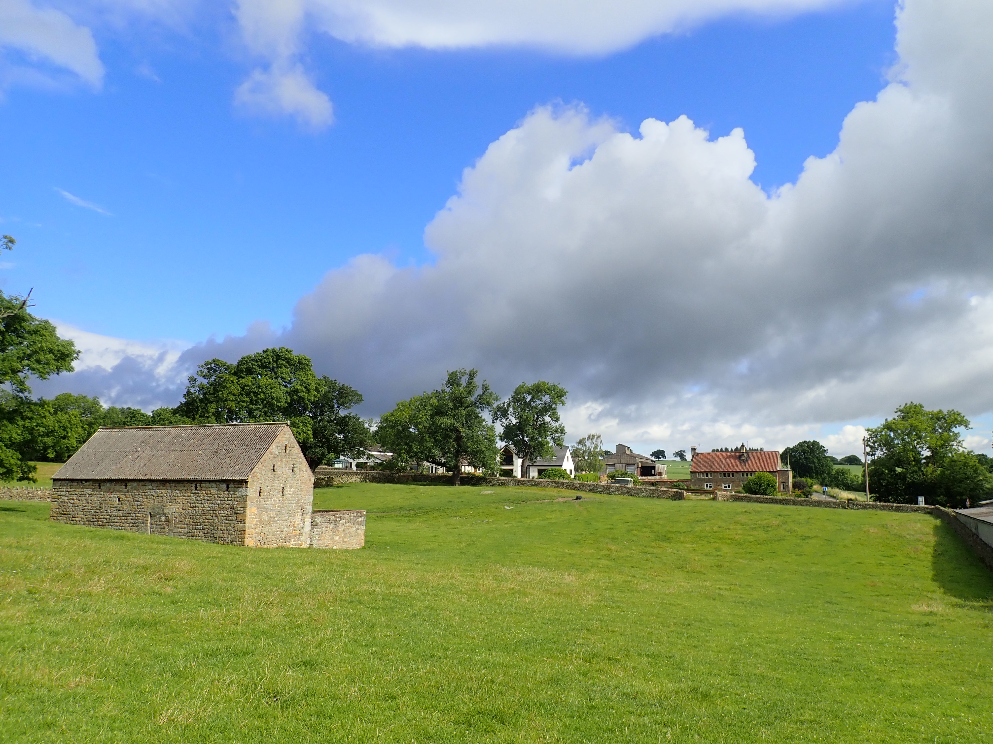
This walking along tracks and a road after I left Cayton Gill was quite boring. The only interesting bit was walking through the surprisingly clean Low Kettle Spring pig farm, with its loud cacophony of pig noises coming from large barns and Portapig cabins. After this, the Nidderdale Way became dull again as I walked along the very muddy track by High Kettle Spring farm. It was then a short and pleasant walk across fields to the attractive hamlet of Shaw Mills.


When I was planning my walk along the Nidderdale Way, I was sure that getting home from the end of this stage would be challenging. This is because Shaw Mills is a small and out of the way place. I couldn’t get a bus to it, nor could I easily walk from Shaw Mills to a bus stop. I was also concerned that taxi companies might not be keen on doing a pick-up from there. If I had been doing the Nidderdale Way as a four-day or five-day walk, then the penultimate stage would have ended in Ripley. It would have been easy enough to get a bus or taxi from there, and my plan of last resort was to walk back to Ripley to do just this. In the end, the biggest problem was poor mobile phone reception. I could hear the taxi dispatcher perfectly, but he could hardly hear me. The other issue was that the dispatcher insisted on my giving him either an address or a landmark to send the taxi to, and refused to accept that the sole bridge in Shaw Mills was a sufficient landmark. After reading to the dispatcher the name of the street I was standing next to, and giving him a random house number, a taxi was dispatched. It arrived surprisingly quickly, and I headed home, with just one more stage of the Nidderdale Way to go.
UPDATE: 3 March 2024 – I’ve seen more of Robert Thompson’s mice in Nidderdale, this time on the lychgate in Greenhow. The walk on which I visited this lychgate is described here.

You didn’t fancy trying the stocks then?
No, they looked a little small for me.
Thank you for all the photos to go with the text – I imagine them whilst reading, but there are always (pleasant!) surprises when they arrive. I shall miss this route when you finish it! Do you have the next one planned?
Thanks Diana.
It’s been a good walk. I haven’t decided what my next project might be yet, but have a few candidates to mull over.
Didn’t you get one of the fabulous and famous Ripley ice creams? We divert through Ripley when passing on the main road just to get one!
I’ve always loved those little carved mice!
No, it was raining hard as I passed through Ripley and so it wasn’t really ice cream weather. The ice cream would probably have been washed out of a soggy cone if I’d tried to eat one.
The mice are great. It’s such a brilliant way to for a craftsman to leave his mark.
ah yes – it would have been washed away. If you’re ever back there again though on a nicer day, it’s well worth getting one.