
This was a short walk through the rich geological landscape and mining heritage in the Greenhow area of Nidderdale which took in the modern Coldstones Quarry and the extensive remains of abandoned lead mines. It also involved visits to a giant work of art, a huge lime kiln, and a couple of Robert Thompson’s mice. This was a lovely walk, that was full of interesting sights, but which came with a worrying encounter.
I’d been through the Greenhow area many times, but I was curious to explore it further as I knew that there was a lot of its’ industrial heritage which I hadn’t seen. People have been extracting the geological wealth of this area for a long time; evidence that the Roman’s mined these hills comes from two lead ingots from around 81AD which were found locally. The Cistercian monks of Byland and Fountains Abbeys controlled lead mining around Greenhow from the 12th Century until the monasteries were dissolved in 1539, when the land passed to private owners. Sir Stephen Proctor gained the mining rights when he bought the Manor of Bewerley in 1597, and he built the first recorded smelt mill at Greenhow around 1606. Mining continued in the area until the 1890s, when increasing costs and falling prices brought lead mining to an end.
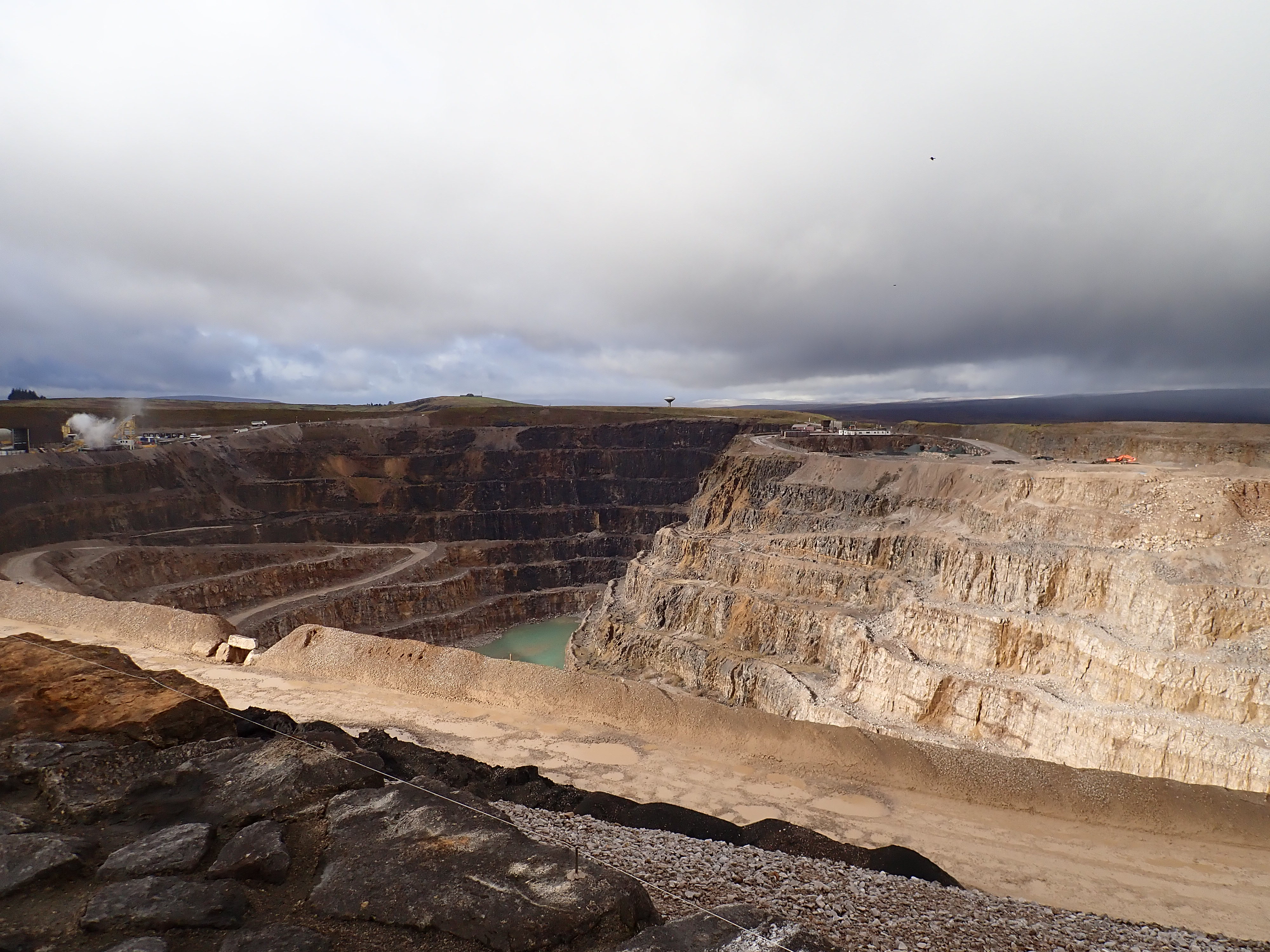
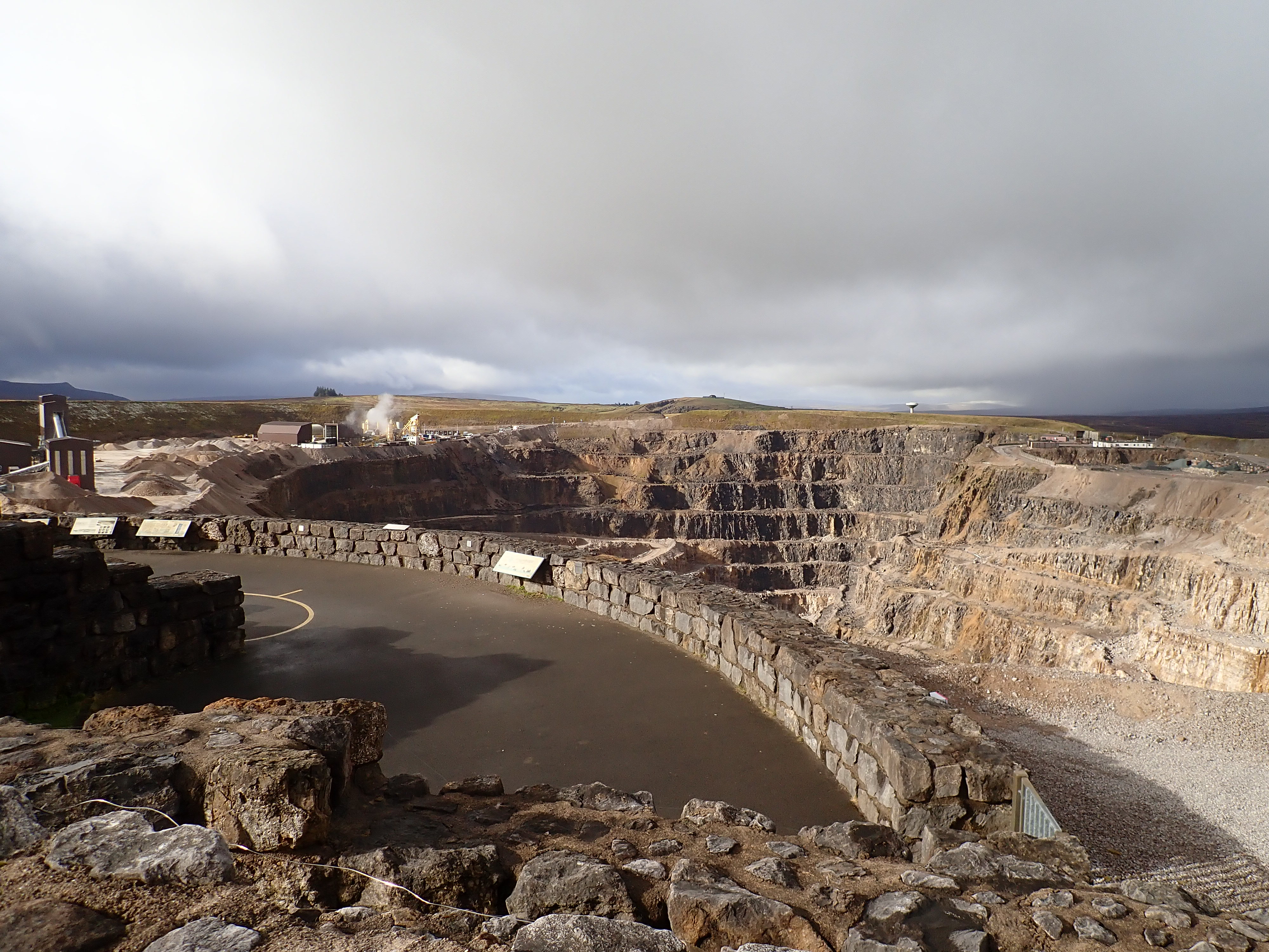
As well as lead, limestone has been quarried in Nidderdale for hundreds of years. This came from small quarries that have now closed, with the last limestone quarry in operation being the huge Coldstones Quarry on the edge of the dale near Greenhow. This covers approximately 30 hectares and produces an average of 600,000 tons of crushed rock aggregate a year. This is mostly used in concrete, asphalt, or as dry stone for such things as pipe bedding and foundations. Coldstones Quarry sits in the centre of a hill like a hole in the centre of a doughnut, which means that the quarry isn’t visible from the side. The best place to see Coldstones Quarry is from above, and this was just what I intended to do as I pulled into the carpark for The Coldstones Cut.
Thick cloud had limited the view when I had last visited The Coldstones Cut. This time, bright sunshine fighting for dominance with patchy clouds, and a sprinkling of new snow on the high moors, promised good views if I was fast enough to catch them. I hurriedly put on my boots and quickly walked up the track that ran across the hill. This brought me to The Coldstone Cut and gorgeous views across the dale.
The Coldstones Cut is a large artwork on the rim of Coldstones Quarry that was created by the artist Andrew Sabin and which opened in 2010. The Coldstones Cut is made up of thick limestone walls that lead you from the hillside to viewing platforms. It’s possible to debate what The Coldstones Cut resembles. From above, I think that it looks like a giant sword with an exaggerated cross-guard. However, when approached from the side, its commanding position and stone walls suggest castles and other fortifications.
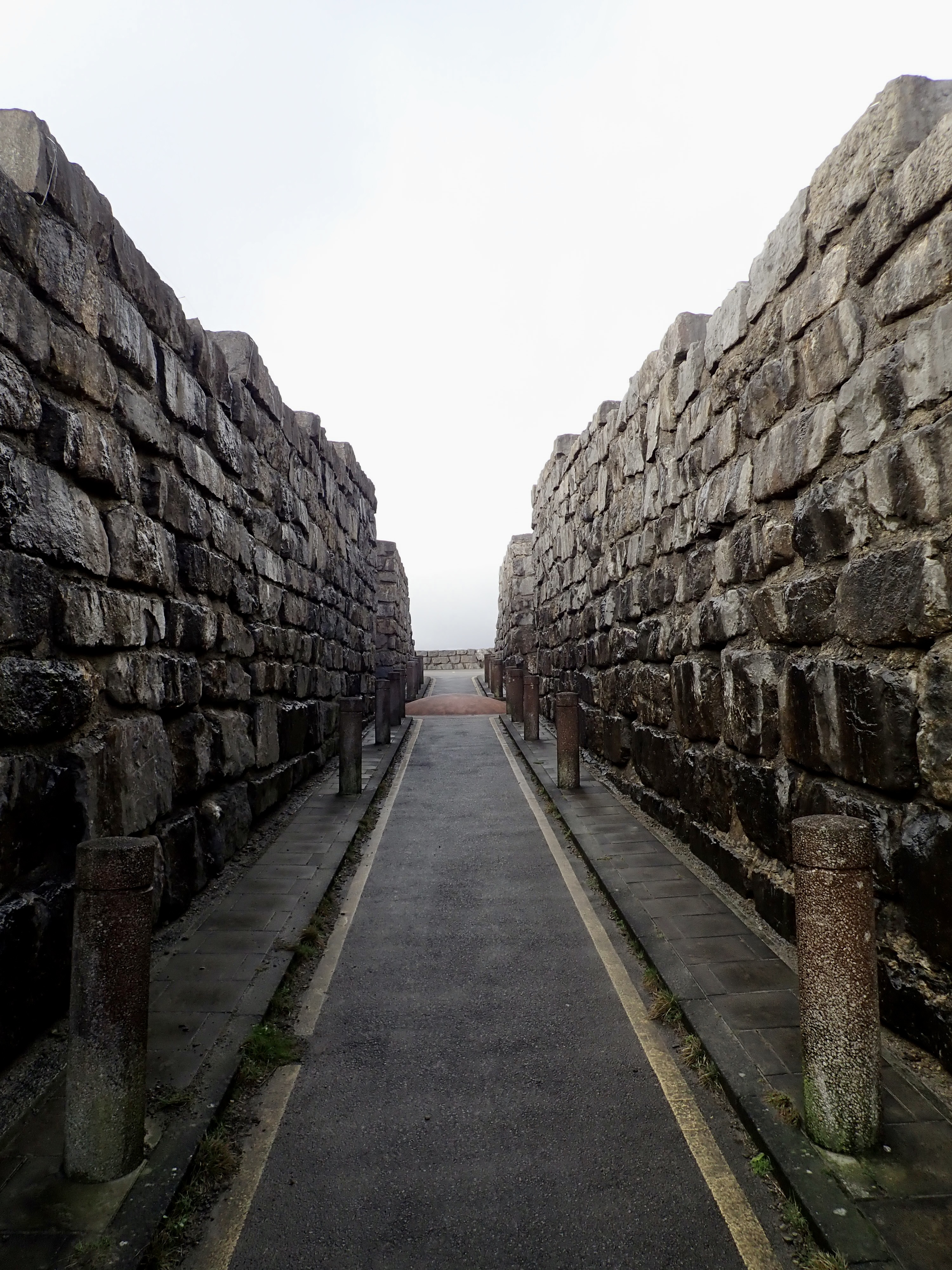
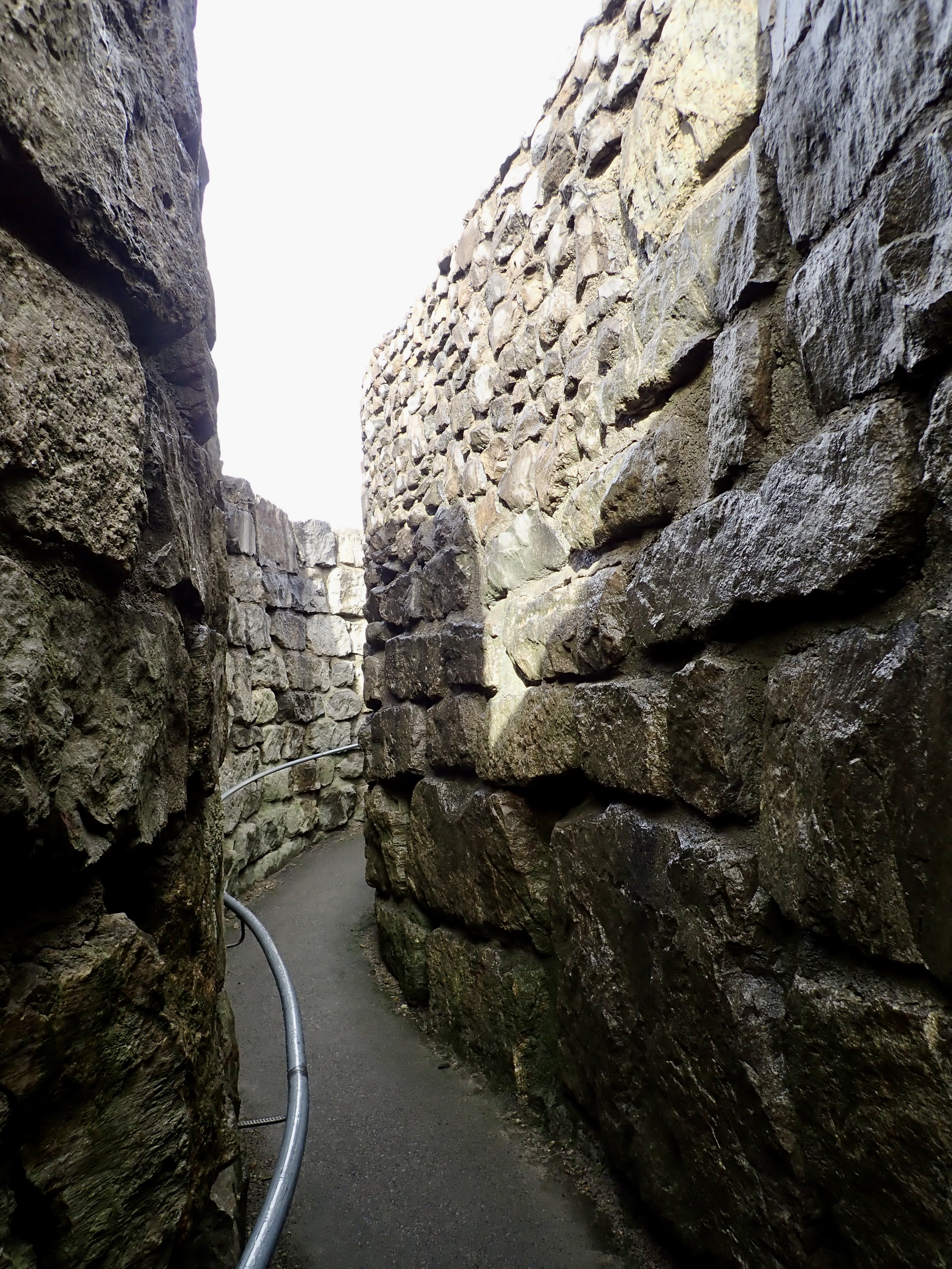
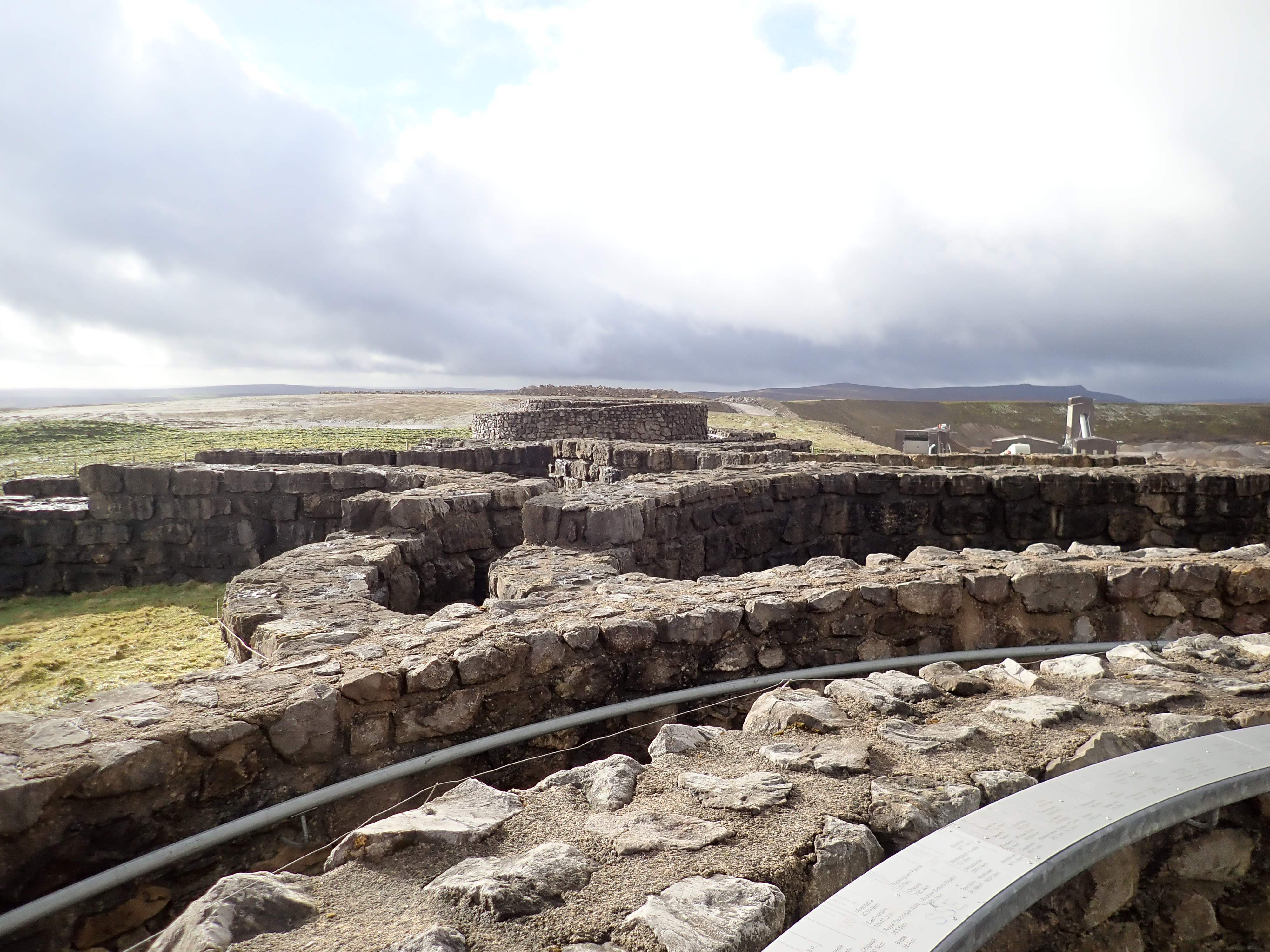
You enter The Coldstones Cut at the point of the sword, walking down a corridor where the walls gradually grow in height. Two further corridors head off in opposite directions from a central point, spiralling and gently climbing until they reach raised viewing platforms. At the hilt of the sword is a further semi-circular viewing platform that brings you to the edge of the quarry.
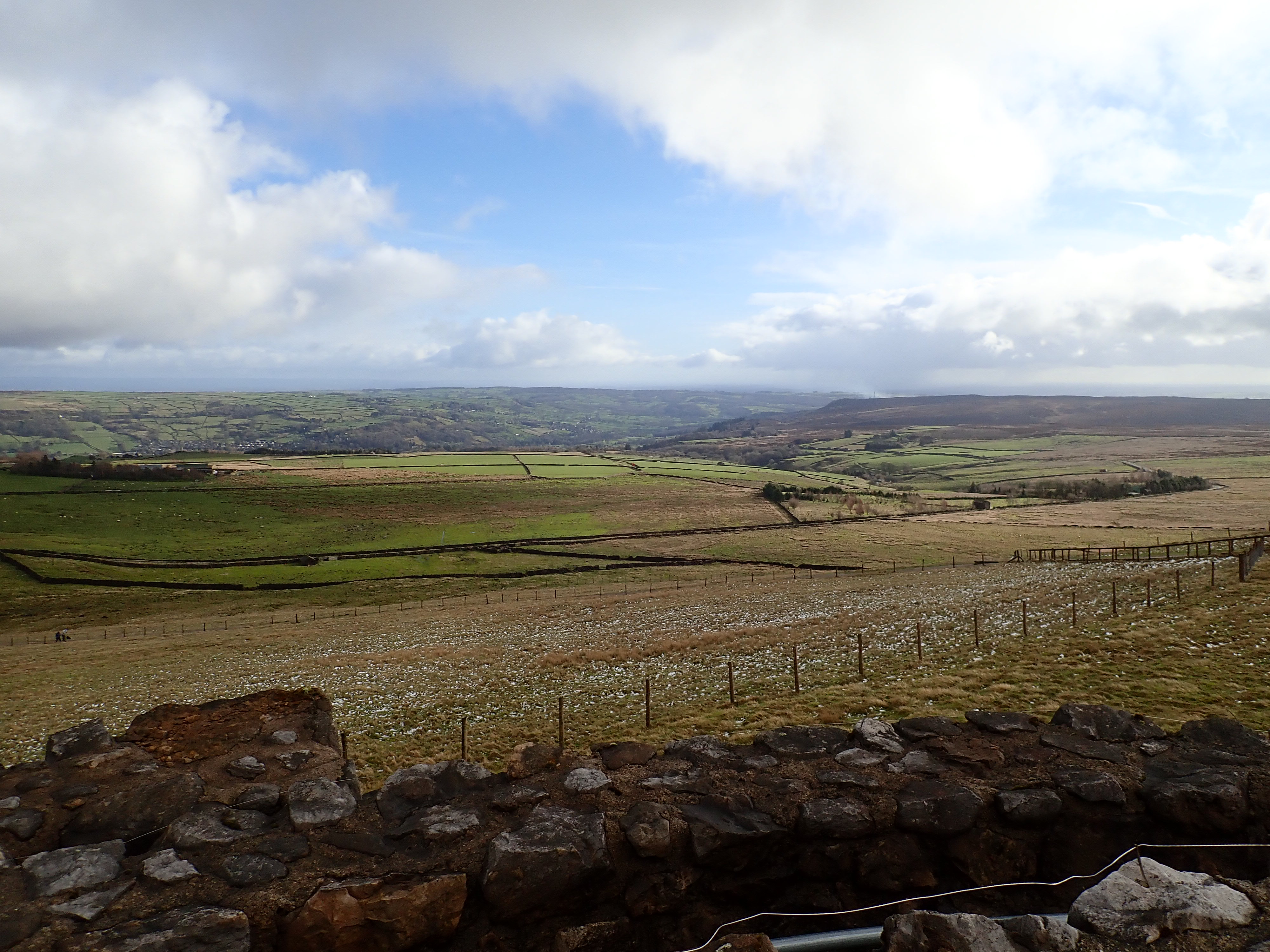
From the viewing platforms I could see Guisecliff, Summerbridge, Brimham Rocks, and Upper Nidderdale. In the other direction, bright sunlight brought into relief the black, grey, and yellow tiers of the quarry. Diggers and huge trucks moved around, while white smoke or steam rose from a plant on the quarry’s lip. In the distance, I could see snow covered peaks in the Yorkshire Dales National Park. I enjoyed the views for a while in a fierce and cold wind, before heading back to the carpark and on to another example of quarrying in Nidderdale.
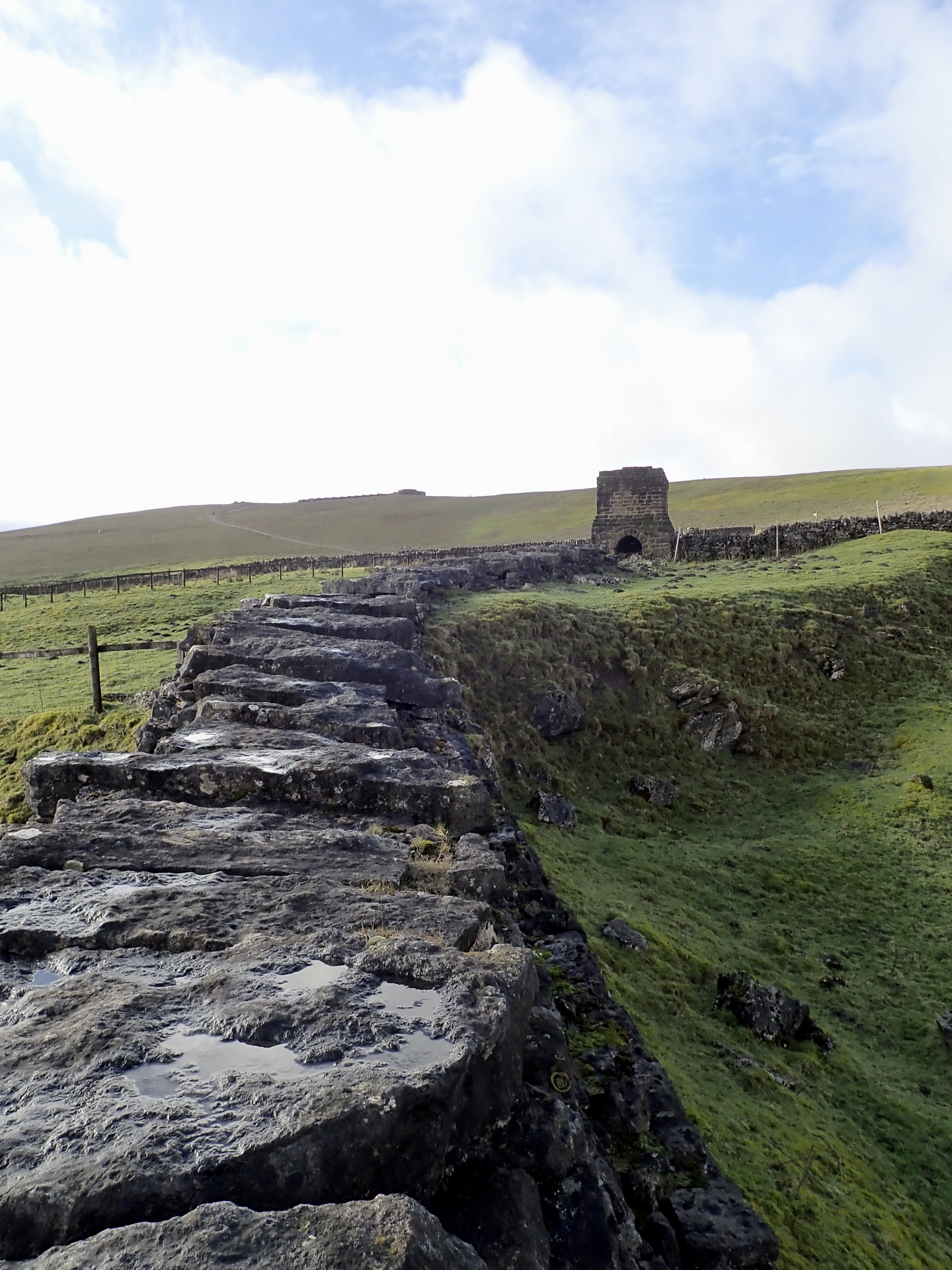
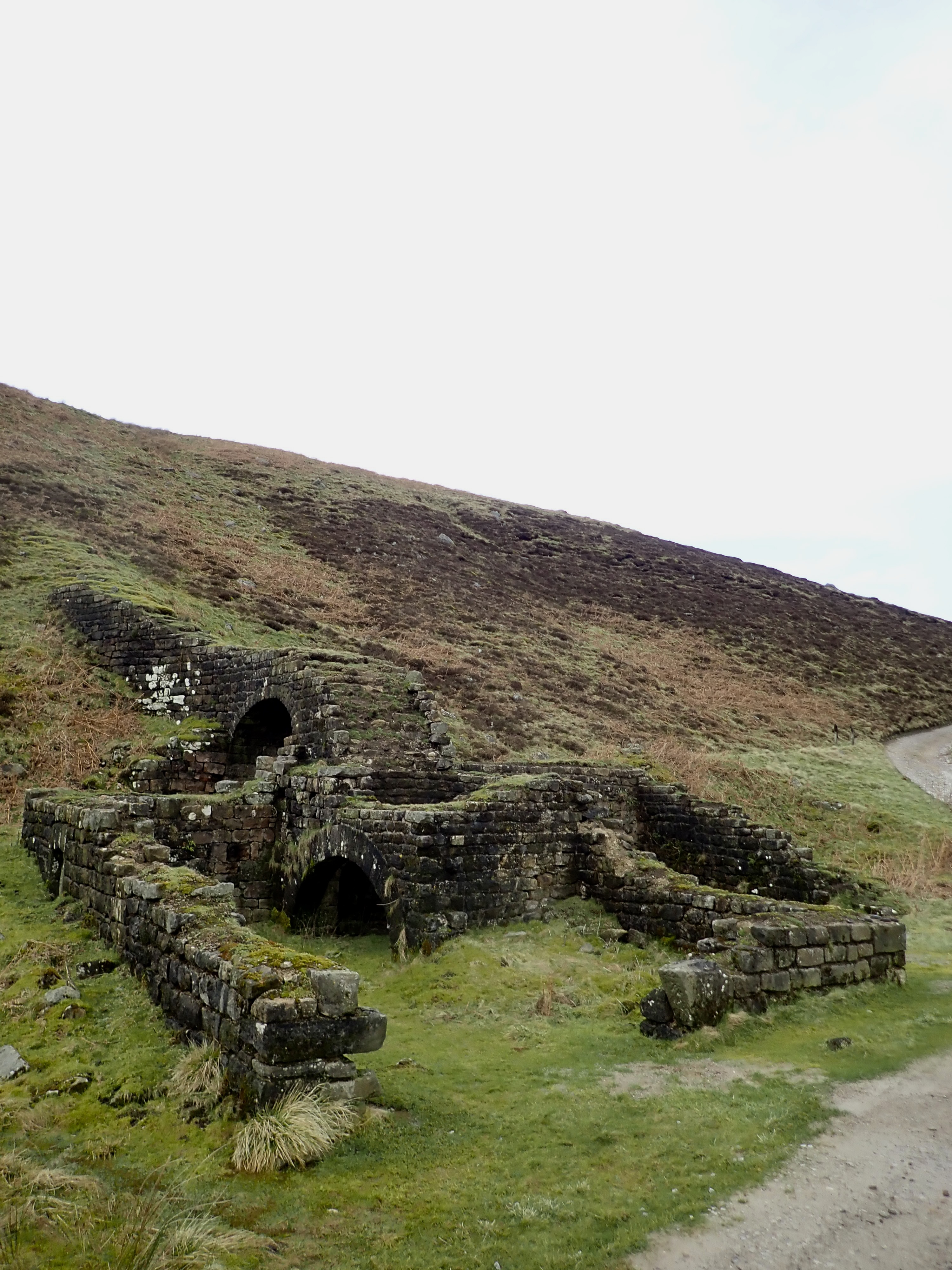
The Toft Gate Lime Kiln is a grand, rectangular building of limestone and gritstone blocks on the slope of the hill. A large arch supports a flue that runs up the hill from the furnace to a large, square chimney. This flue is striking for its length, and for its construction of walls of roughly cut stone capped by large stone blocks.
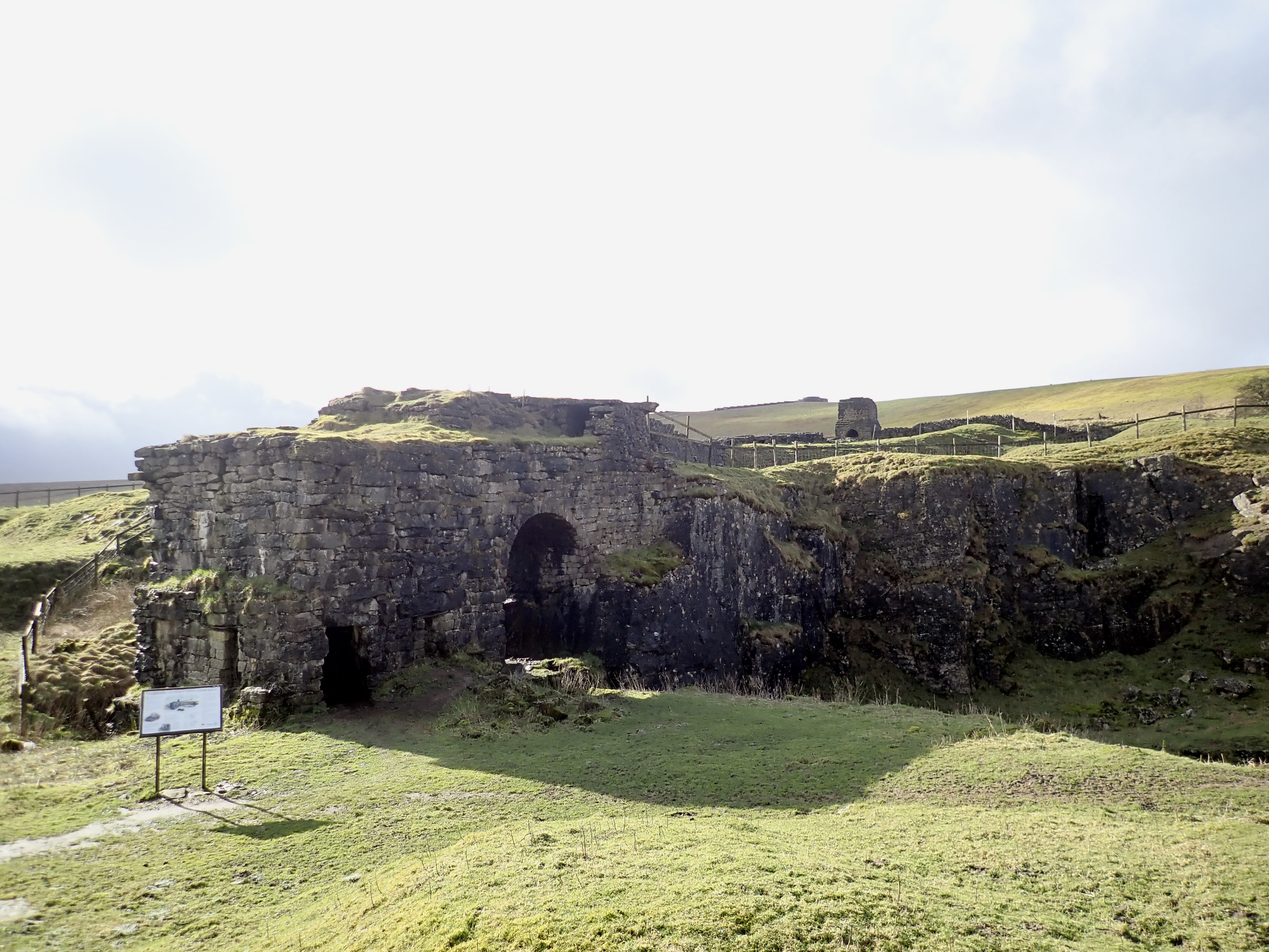
Toft Gate Lime Kiln was built around 1860 to turn limestone into quicklime for use as a fertiliser and in mortar. Pieces of limestone from the adjacent quarry would be loaded into a furnace through its roof. A cover was then placed over the furnace, so that fumes would flow into the flue. Limestone would be heated in the furnace to over 800 degrees Celsius to drive out carbon dioxide. The resulting quicklime would then be raked out from the base of the furnace and into pits. On the top of the kiln are the remains of four large bolts, and these may have secured a steam crane for moving the limestone and the quicklime. Toft Gate Lime Kiln is an impressive sight
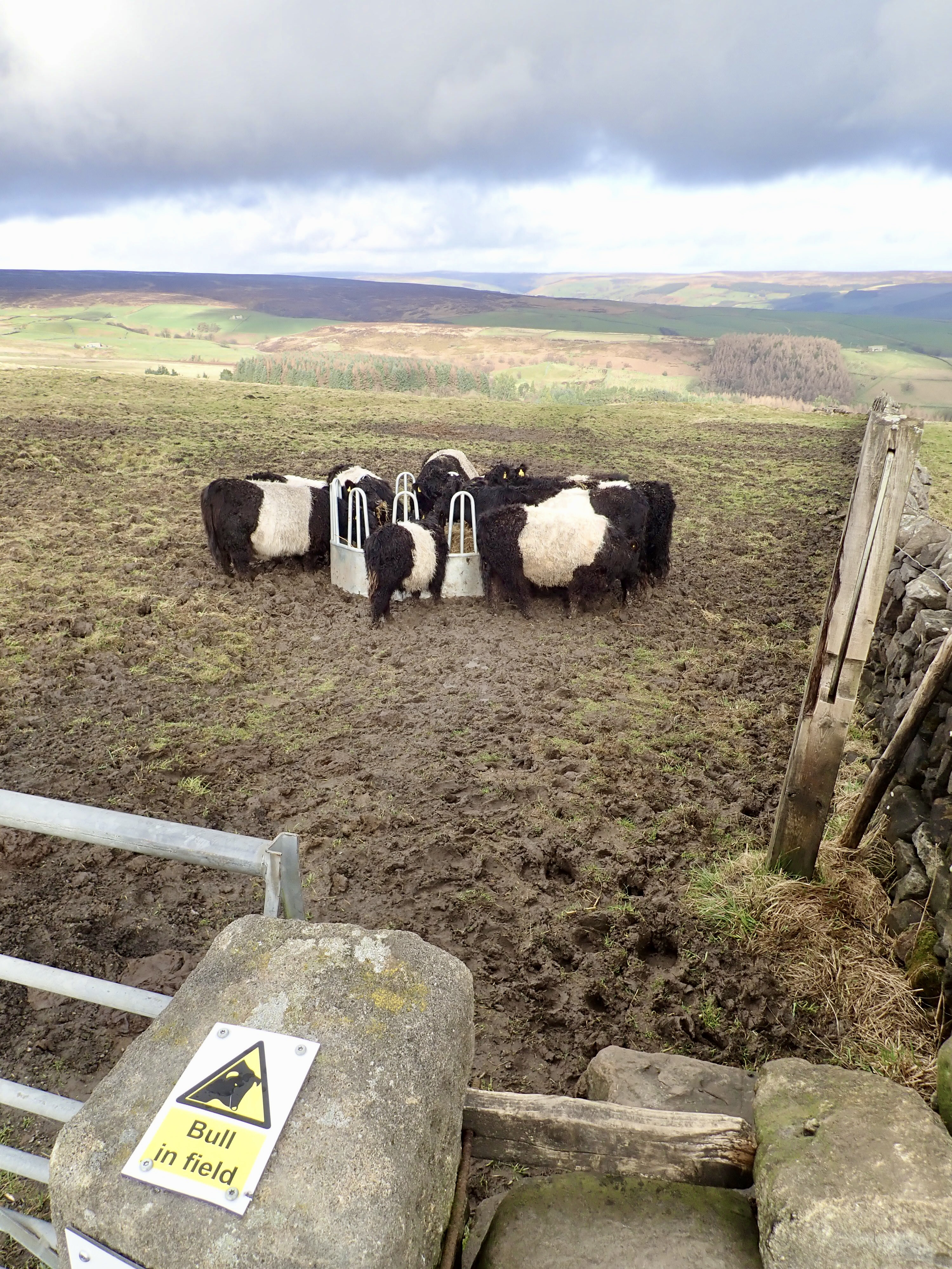
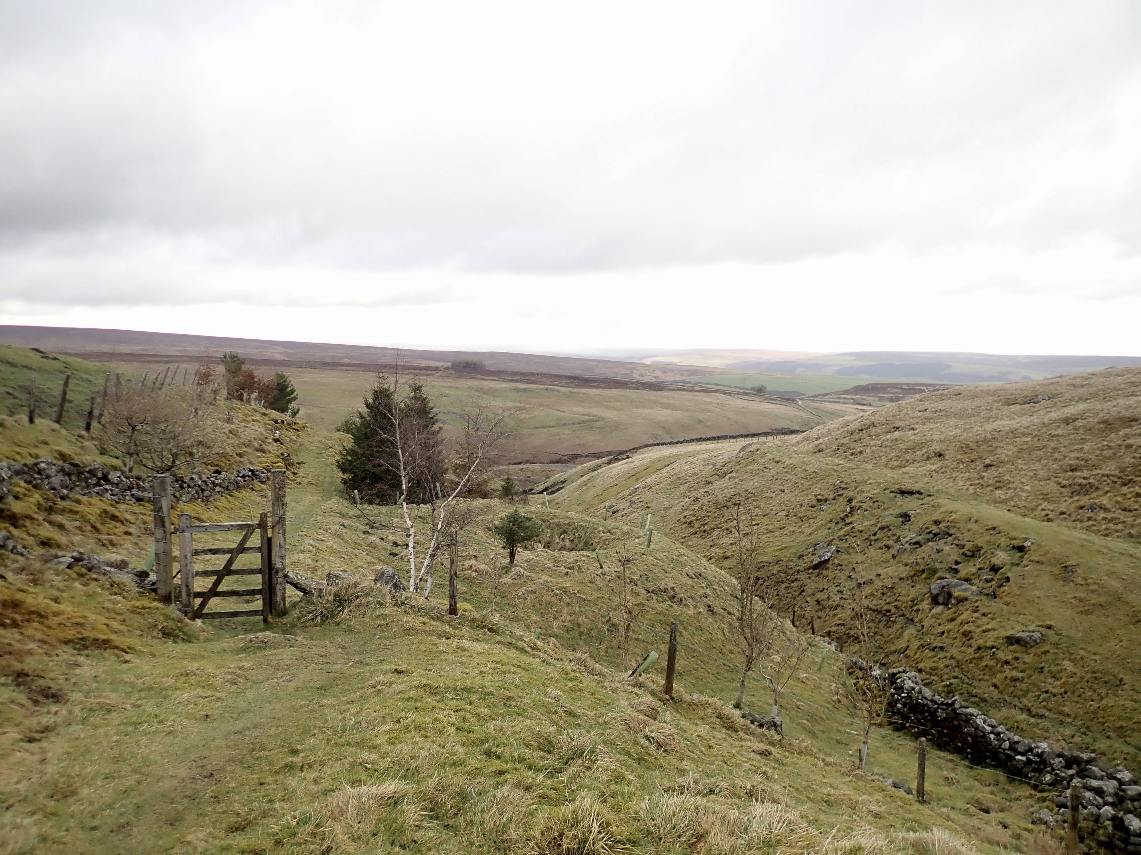
I left the Kiln to head over the road to start my walk proper at a stone stile. Screwed to this stile was a “bull in field” sign, and on the other side of the stile was a group of cows at a feeding station. The footpath ran between a wall and these cows. It was hard to see, from where I was, whether there was a bull in this group; but I could see what I thought were adolescent calves. This concerned me. There wasn’t much space between the wall and the cows, and I didn’t think I could easily make a run for it and/or jump over a wall if I had to because of the deep mud of the field. After mulling this over for a minute, I climbed over the stile and slowly walked forward. As I drew level with the feeding station, a cow stepped back and turned to stare at me. She snorted and stamped a hoof. I paused, and then slowly carried on walking. The cow took a step back, and I carried steadily on. I looked behind me once I was past them and saw a bull with a ring through its nose which lazily turned its head to look at me with a bored expression. It went back to eating and I went on walking down the field.
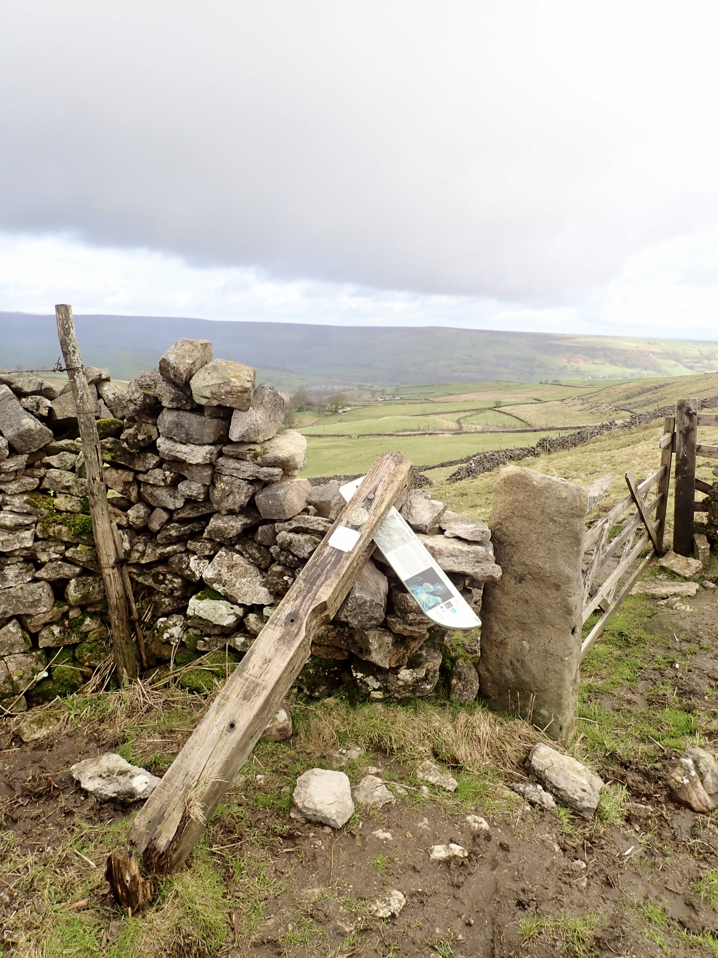
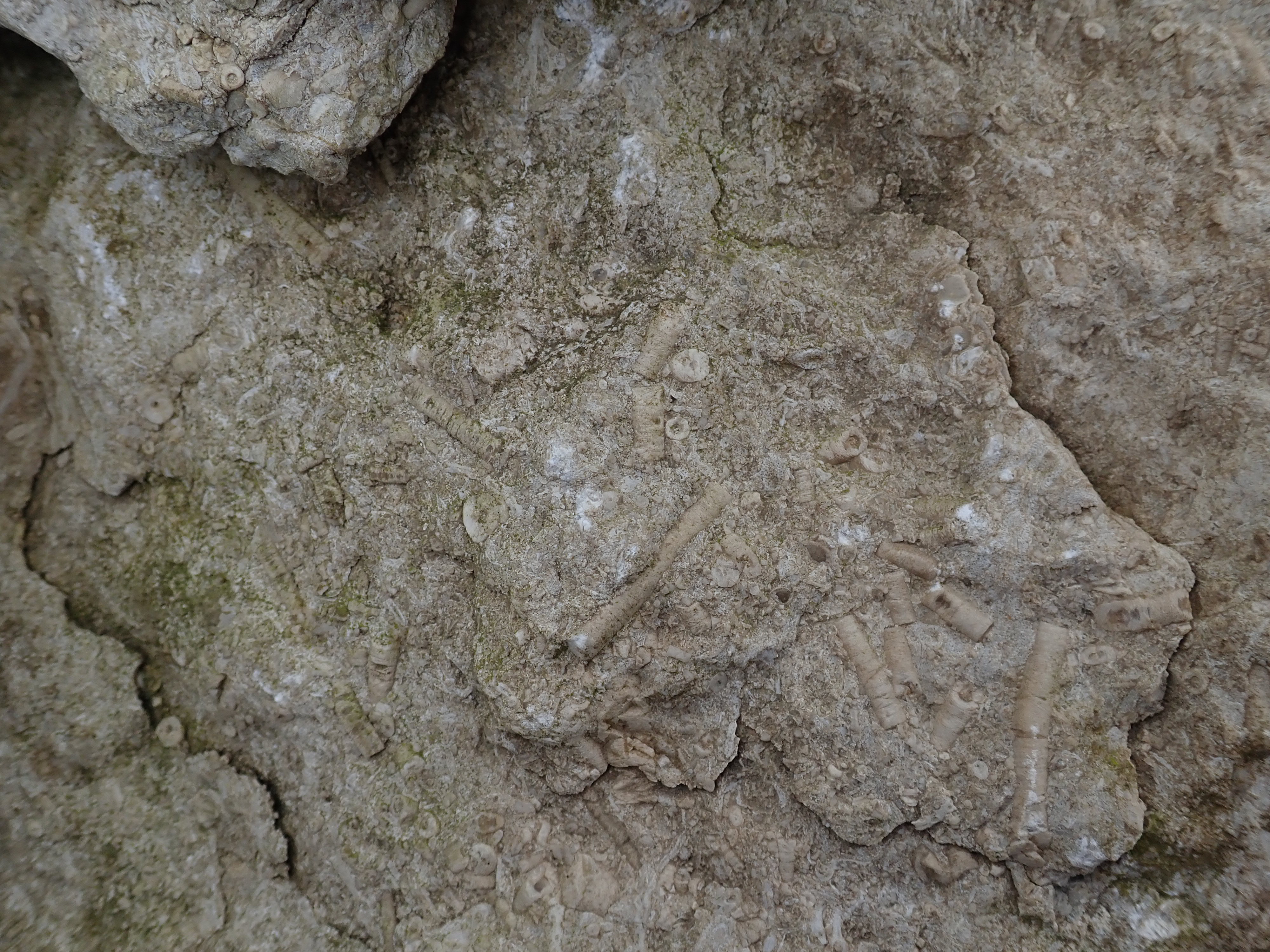
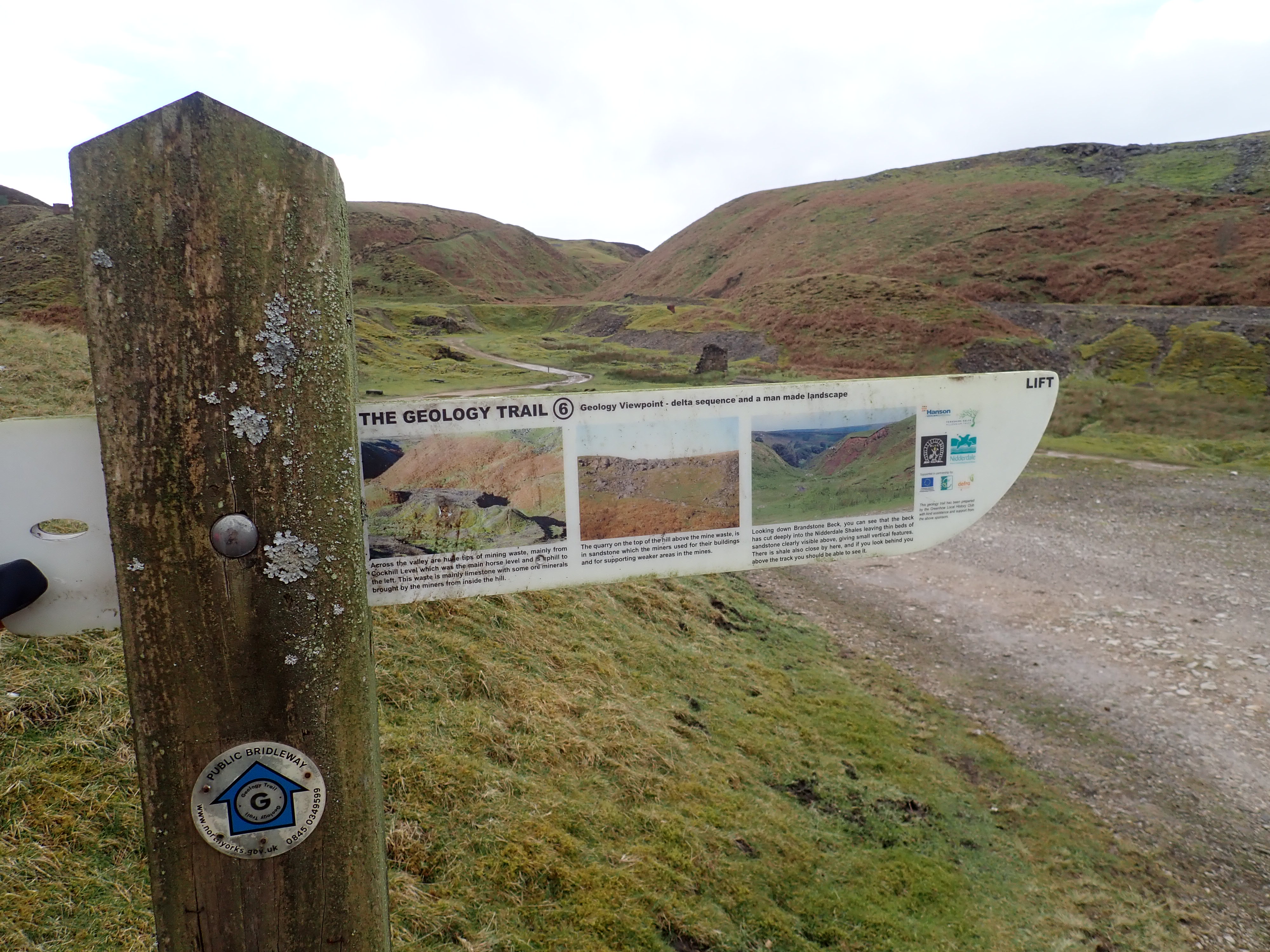
My walk followed a lot of the route of the Greenhow Geology Trail, including this first section. This trail takes in significant parts of the mining heritage around Greenhow, as well as highlighting interesting geological features. Around the trail there are information boards that fold into wooden fingerposts so that these white boards are not intrusive in the landscape. It’s a neat idea that I’ve not seen anywhere else. While the first of these signs that I came across had unfortunately fallen over, it still provided an interesting description of fossil Crinoids (a marine invertebrate that looks like a fern). The information board directed me to examples of these Crinoids in the stones in the neighbouring drystone wall, and I enjoyed having a look at them.
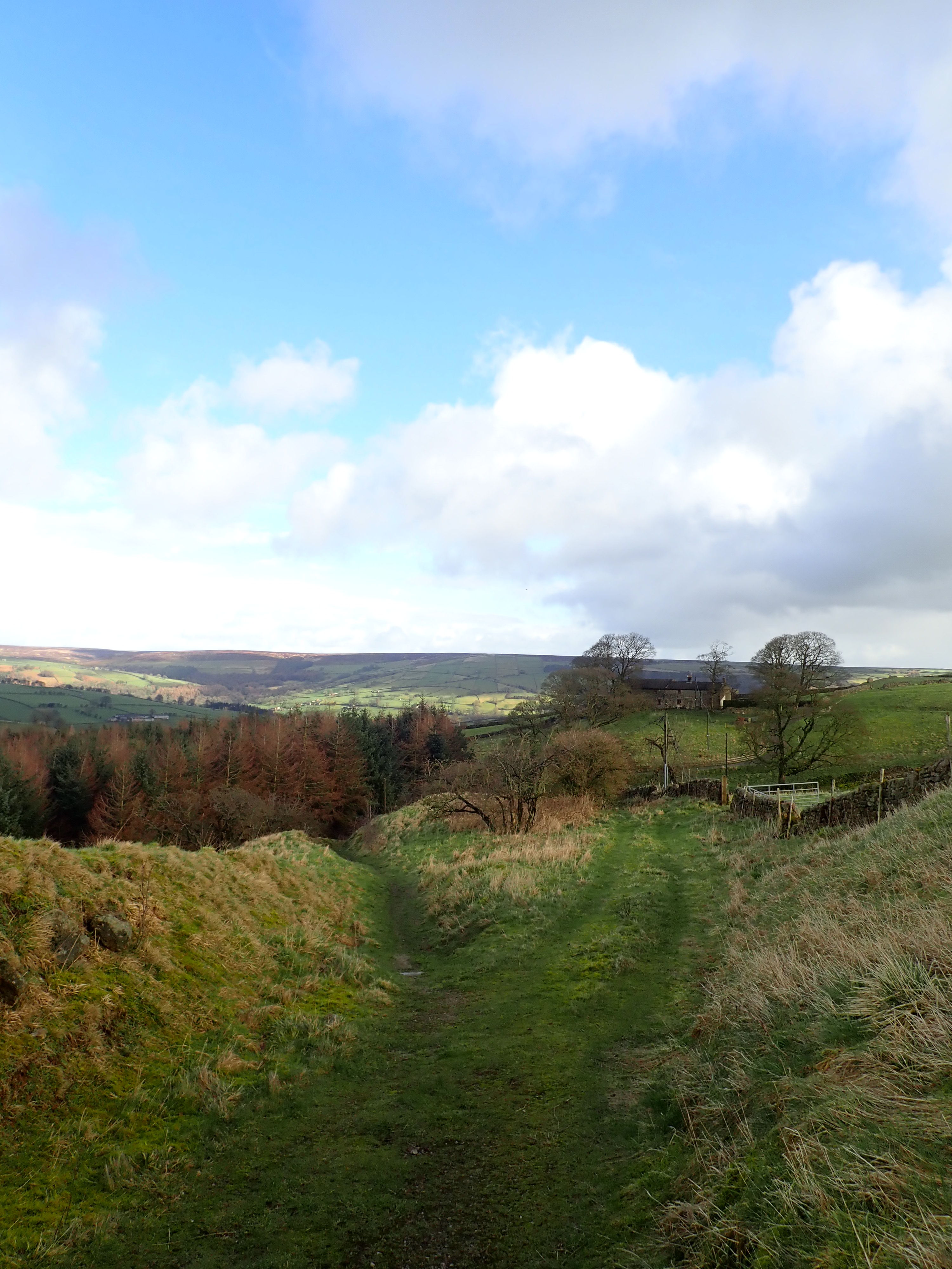
The path went downhill through a couple of fields, before arriving at a road. I then followed this as it gently descended and traversed a small, pretty valley of fields and woods. The road turned into a track by some cottages, and I then headed down to a junction by a stream, which was where I started to follow a section of the Nidderdale Way that I’d walked last year. It was nice to be back on the Way, and interesting to walk the route in the opposite direction and at a different time of year.
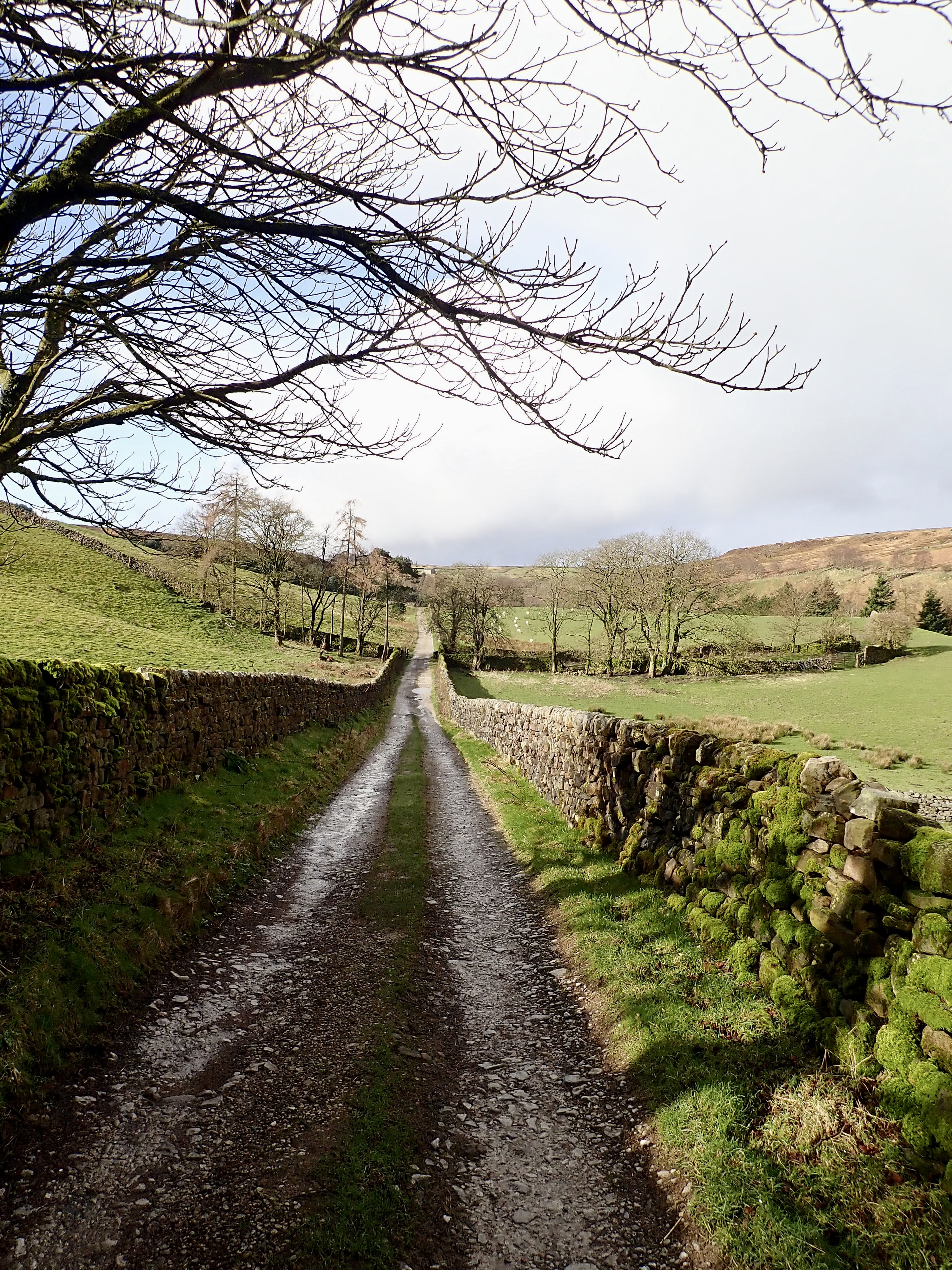
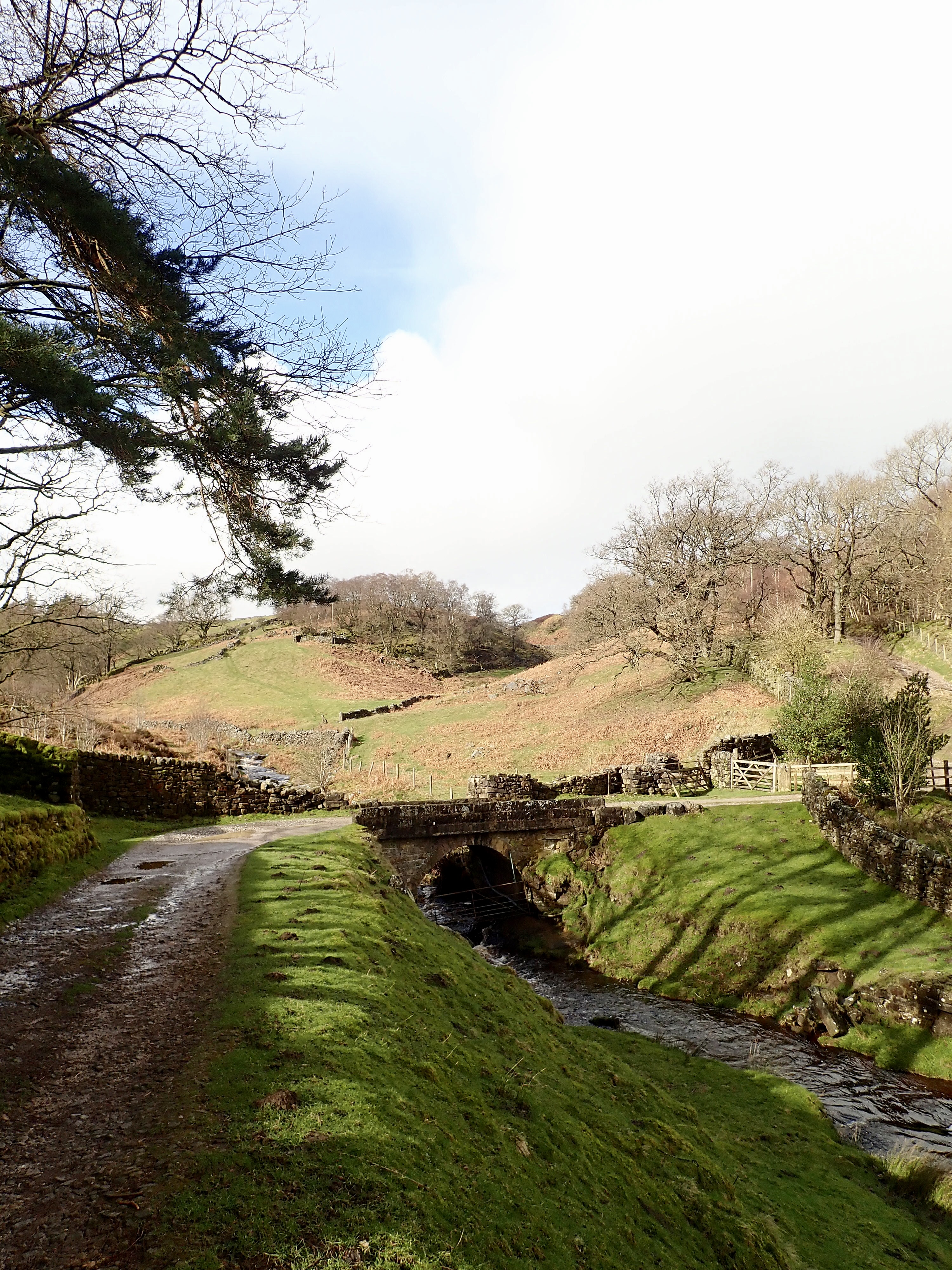
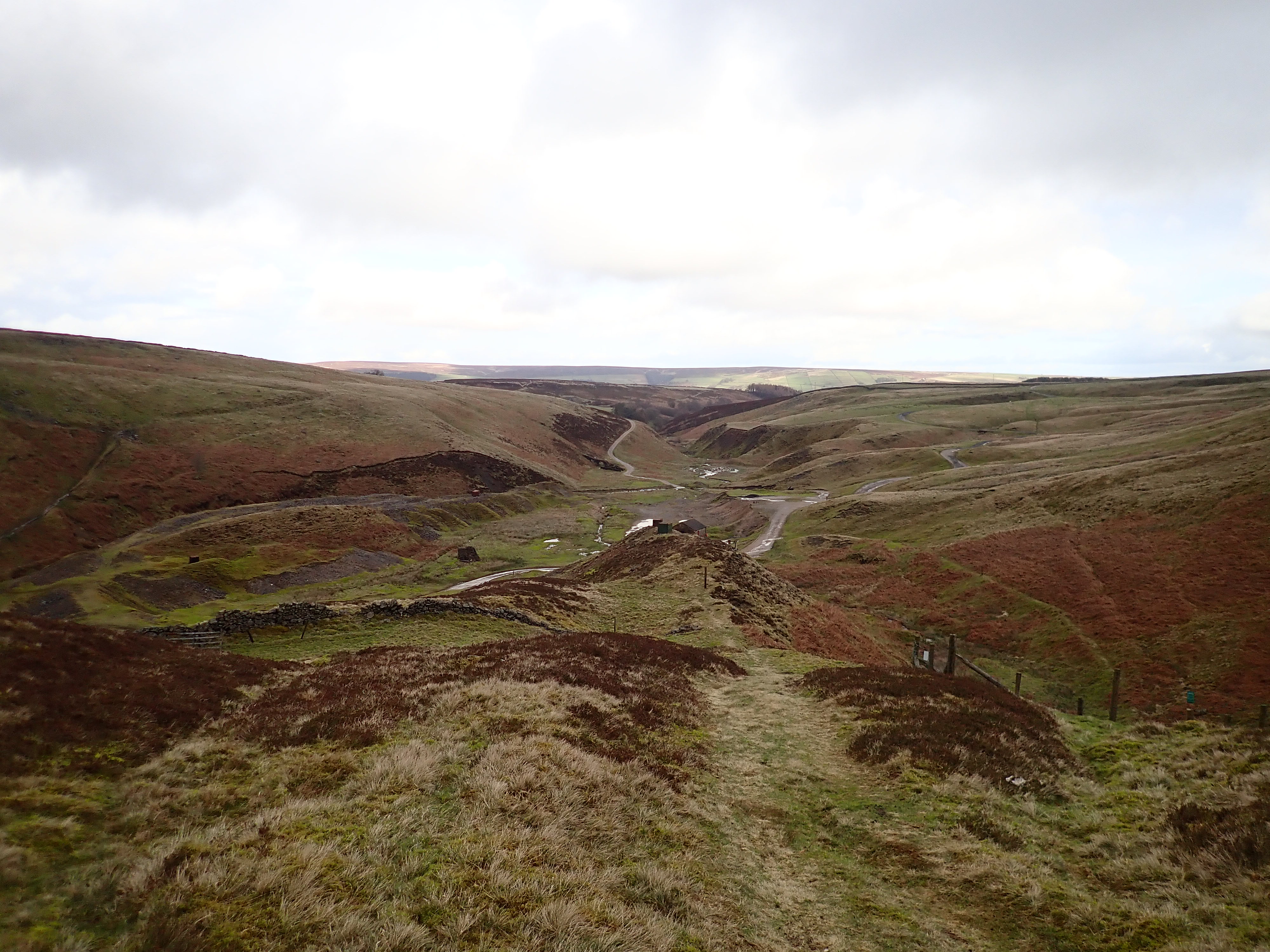
I walked up the other side of the small valley I had been following and then into another valley, where a track took me to the attractive Brandstone Dub Bridge and Brandstone Beck. The Nidderdale Way then climbed the side of the valley to a saddle, before gently descending into yet another valley. The tops of spoil heaps and the column that is the last standing part of the Providence mine engine house then came into view.
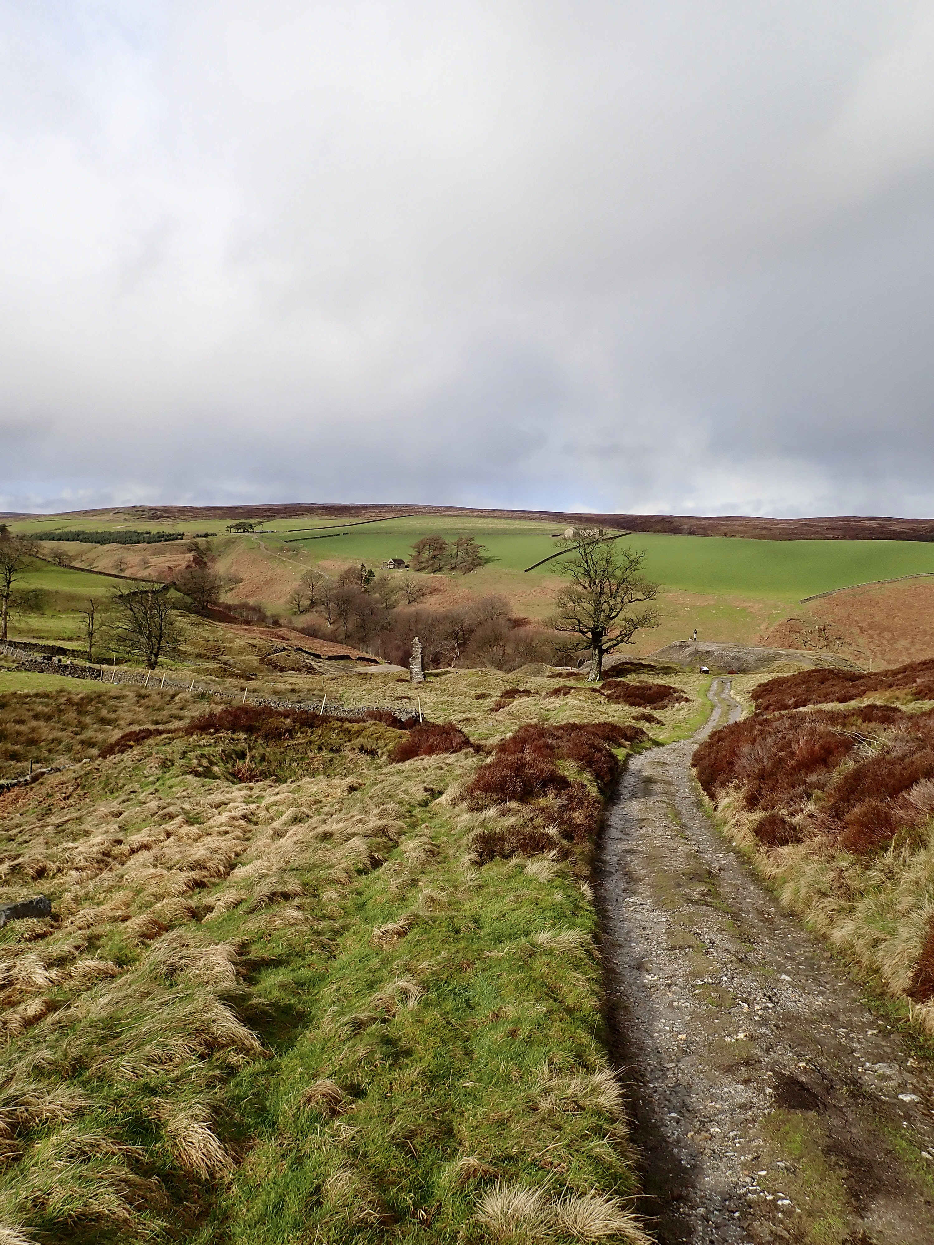
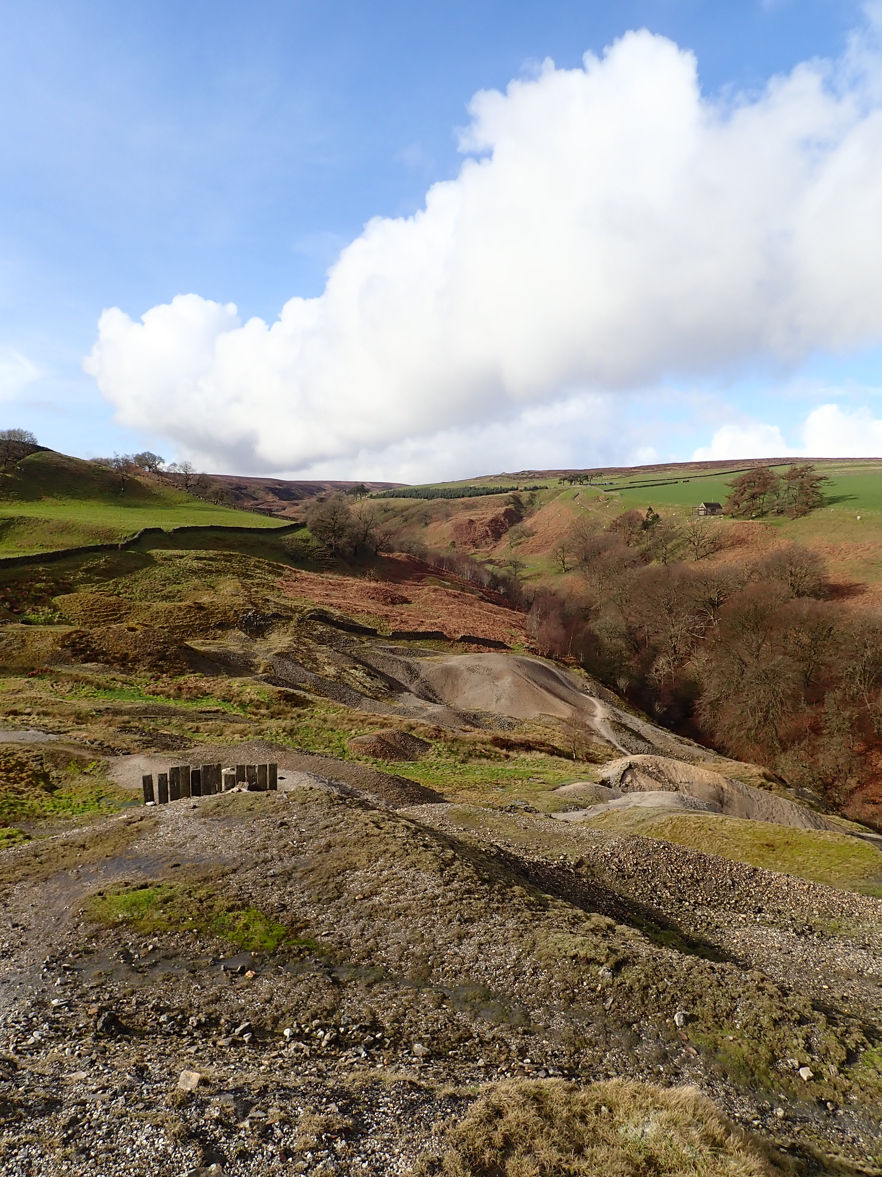
The remnants of the Prosperous and Providence lead mines sit next to each other on one flank of the valley of Ashfold Side Beck. Although the Providence mine operated from at least 1225, there is apparently no specific record of the Prosperous lead mine until the first lease was granted in 1781. The mines ceased activities in 1889 and were abandoned. However, there was apparently an unsuccessful attempt to reopen the mines in 1967.
What remains of this long history of mining are spoil heaps, bits of rusty machinery, covered or filled-in shafts, a collapsed flue, and the crumbled sandstone walls of buildings. There’s a beauty to these relics, particularly in the bright, winter sunshine that filled the valley when I was there.
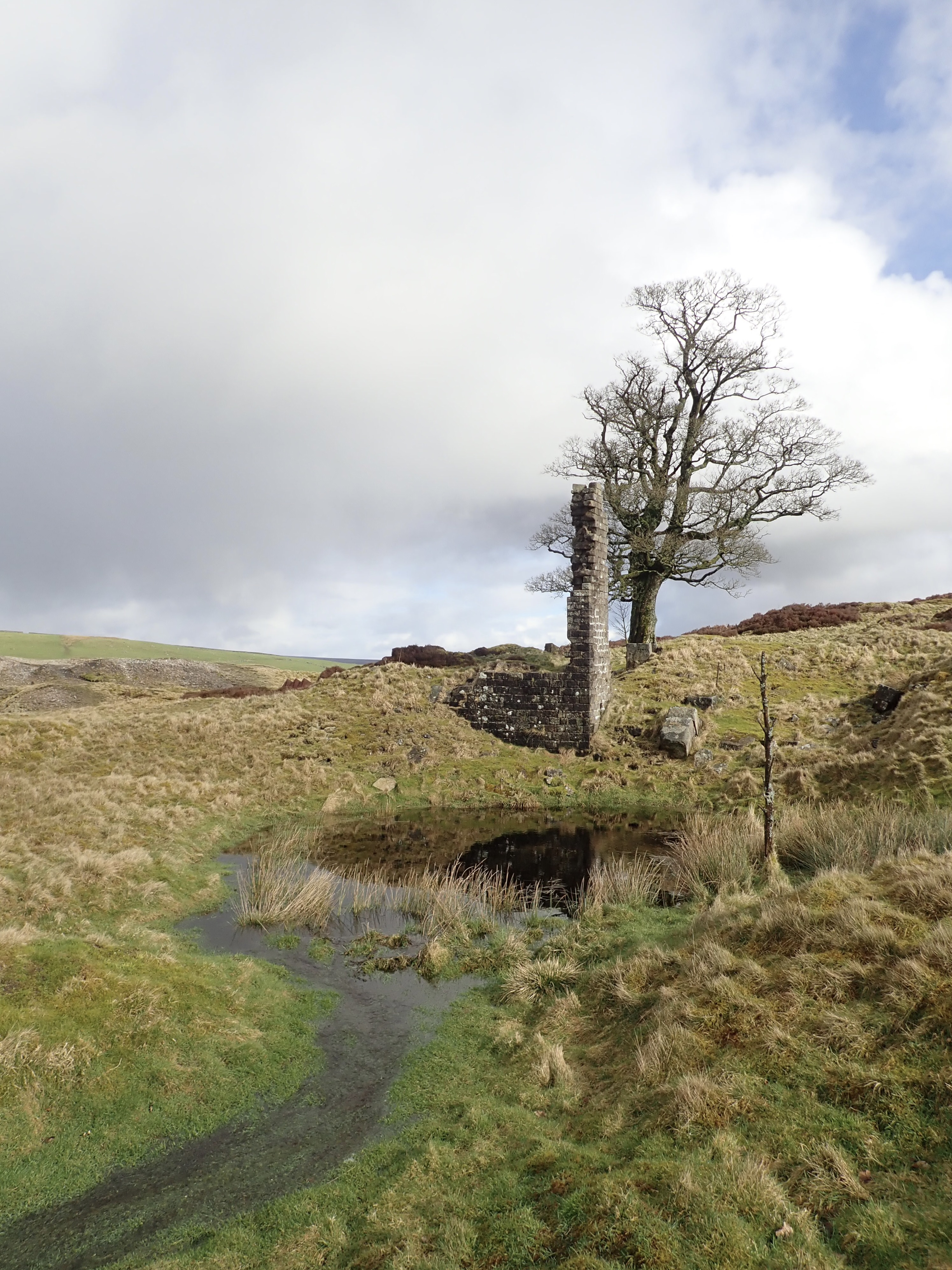
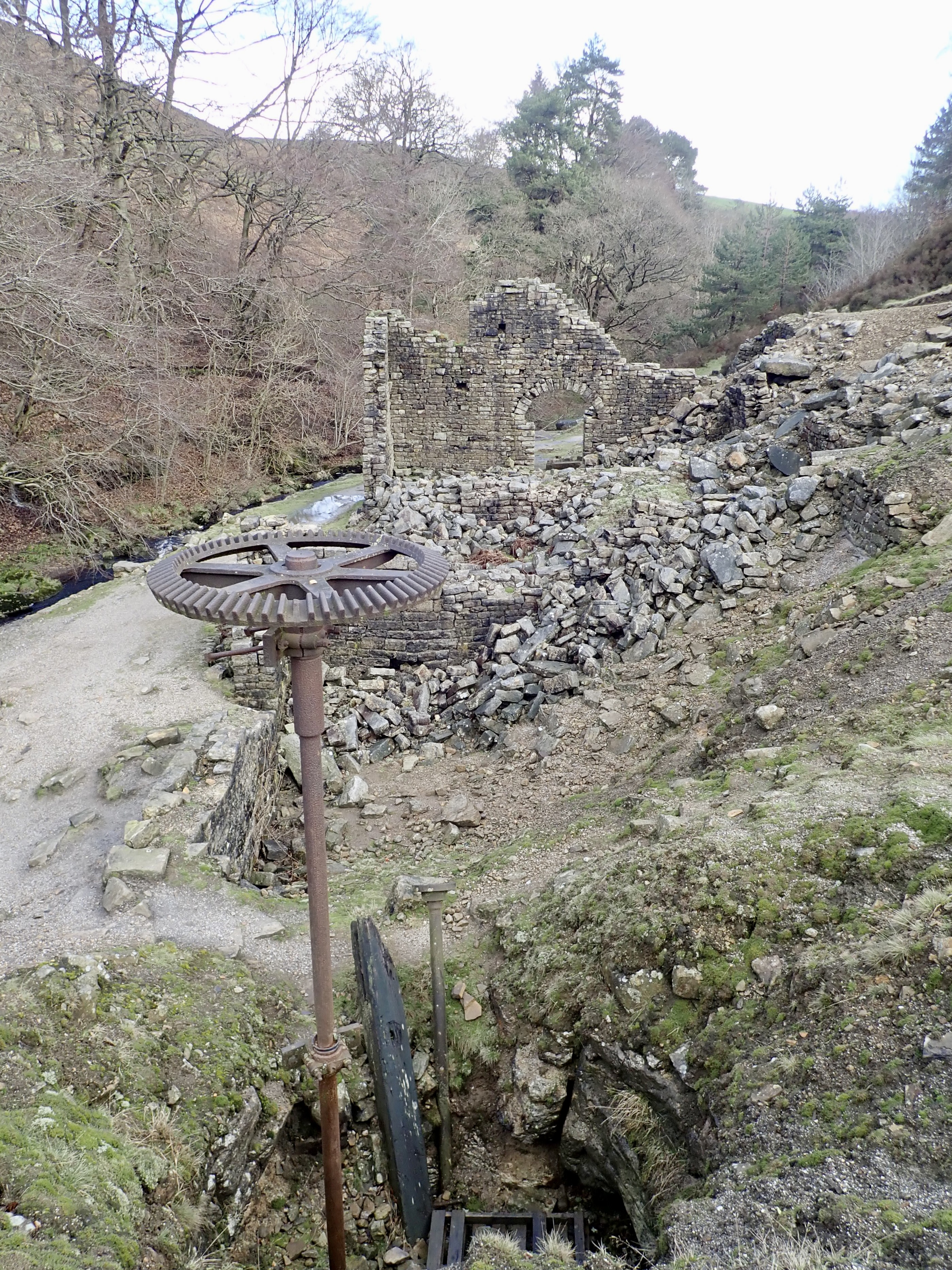
The most impressive remnant of the mine is the Prosperous smelt mill that sits by the beck. This was built between 1785 and 1814 (I’ve found references to various dates for its construction). The collapsed walls show the outline of the building, with the highest remaining wall containing an arched doorway. At one end of the smelt mill is a vertical metal pole crowned with a large cog. This is the top part of a mechanism that connected an underground waterwheel to machinery on the surface. I think it’s amazing and fascinating that the miners set up waterwheels underground in this way.
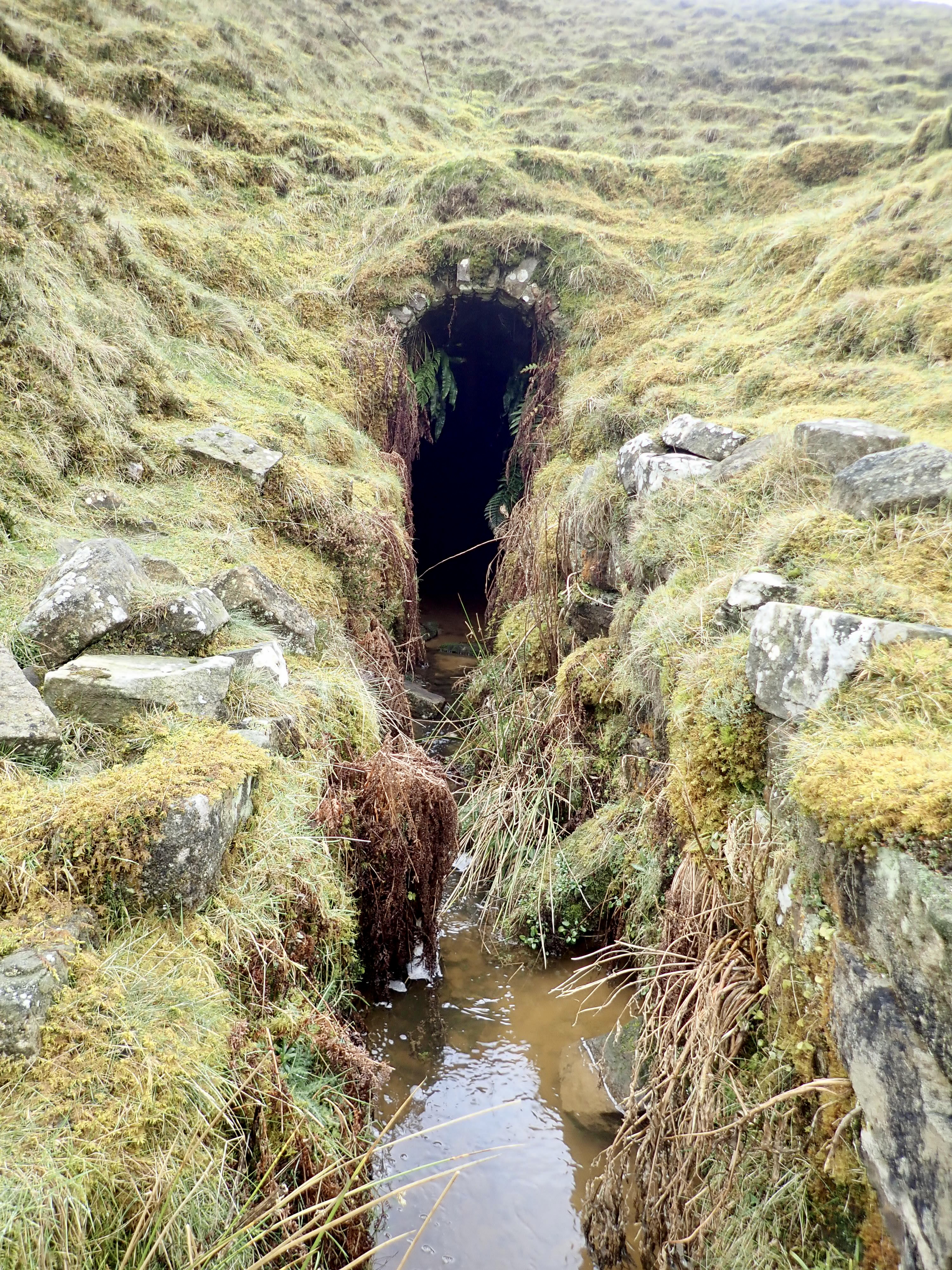
I retraced my steps along the Nidderdale Way until I returned to the saddle, then took a track on the right that turned and curved as it led me into the valley of Brandstone Beck. This area was heavily mined in the past, and the head of the valley is full of spoil heaps. However, the first thing I reached was the remains of a strange and intriguing construction of walls and arches that looked like it might have been a building at the end of a ramp.
Shortly after this I arrived at the ford over Brandstone Beck. Recent heavy rain had swollen the beck, and I decided it was too deep to wade across. I ended up crossing further upstream, using long strides and my walking poles to move from rock to rock.
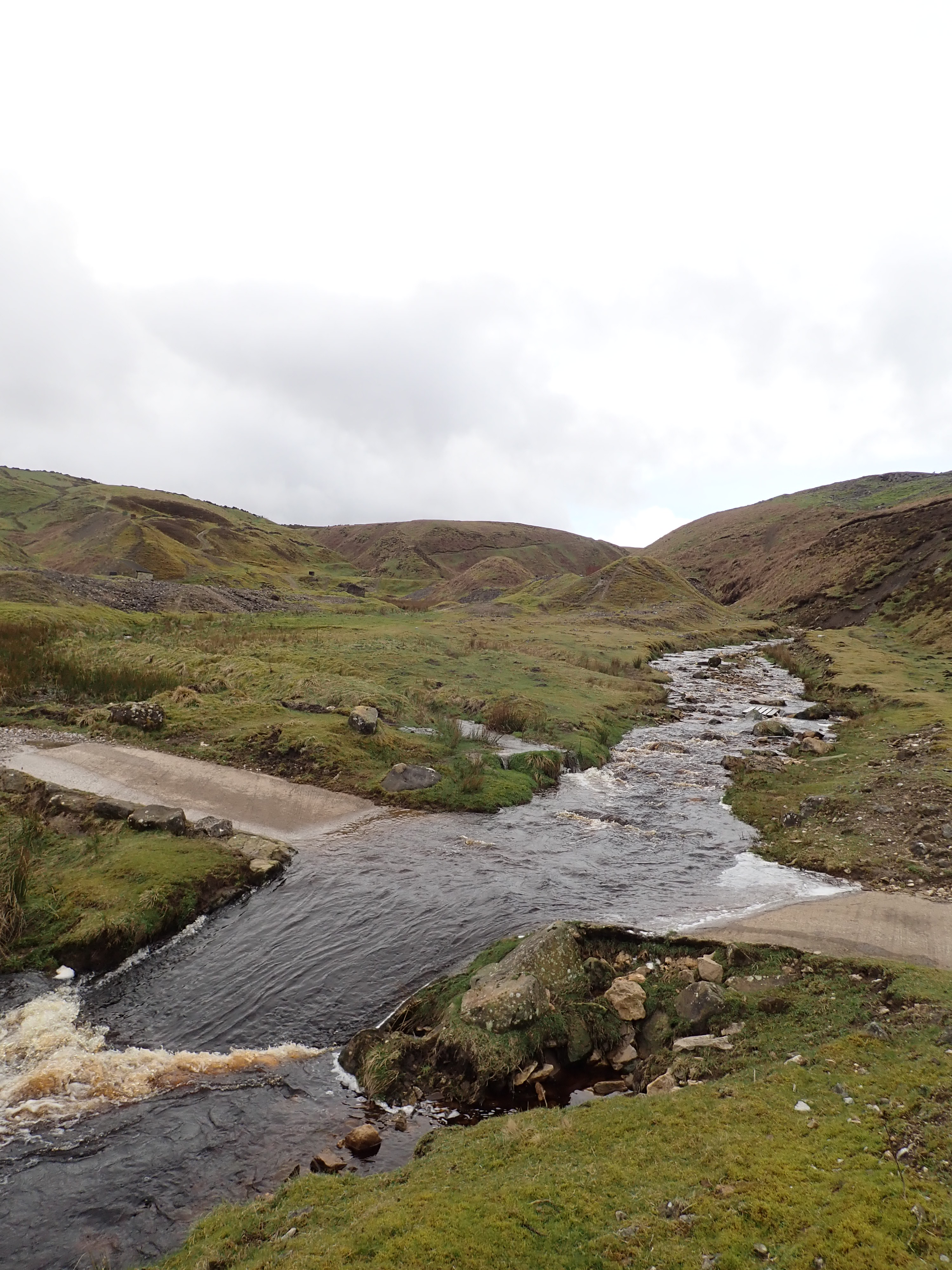
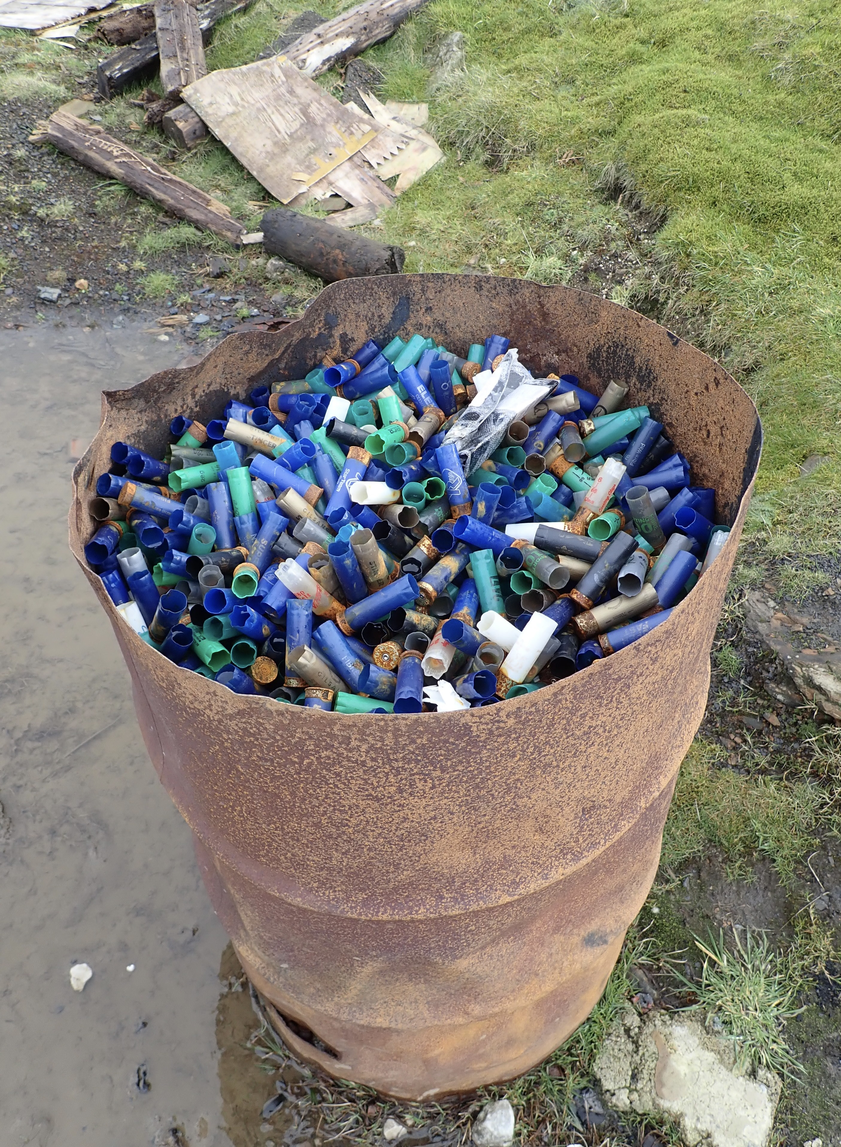
There were further mining remains on the other side of the beck, and I found walking through this landscape fascinating. There were pieces of rusted equipment and arched entrances to tunnels that led into miles of interconnected tunnels. The oddest thing I found was a metal barrel full of used shotgun shells. These seem to have come from people using the valley as a place to shoot clay pigeons, as I also found a few clay pigeons.
It’s around here that I picked up the Greenhow Geology Trail, and I enjoyed learning about the features around me from the pull-out information boards.
The trail went up onto a grassy ridge, and I followed it past the conical holes with raised rims of several disused mine shafts. The trail brought me to the dark stone cottages of Greenhow, where I turned to follow the road as it traversed the edge of the moor. At an altitude of between 400 and 420m (1,310ft and 1,380ft), Greenhow is one of the highest villages in Yorkshire. The village’s website describes Greenhow as “extremely exposed, and the fact that only a few houses have doors facing north and west speaks volumes for the climate.”
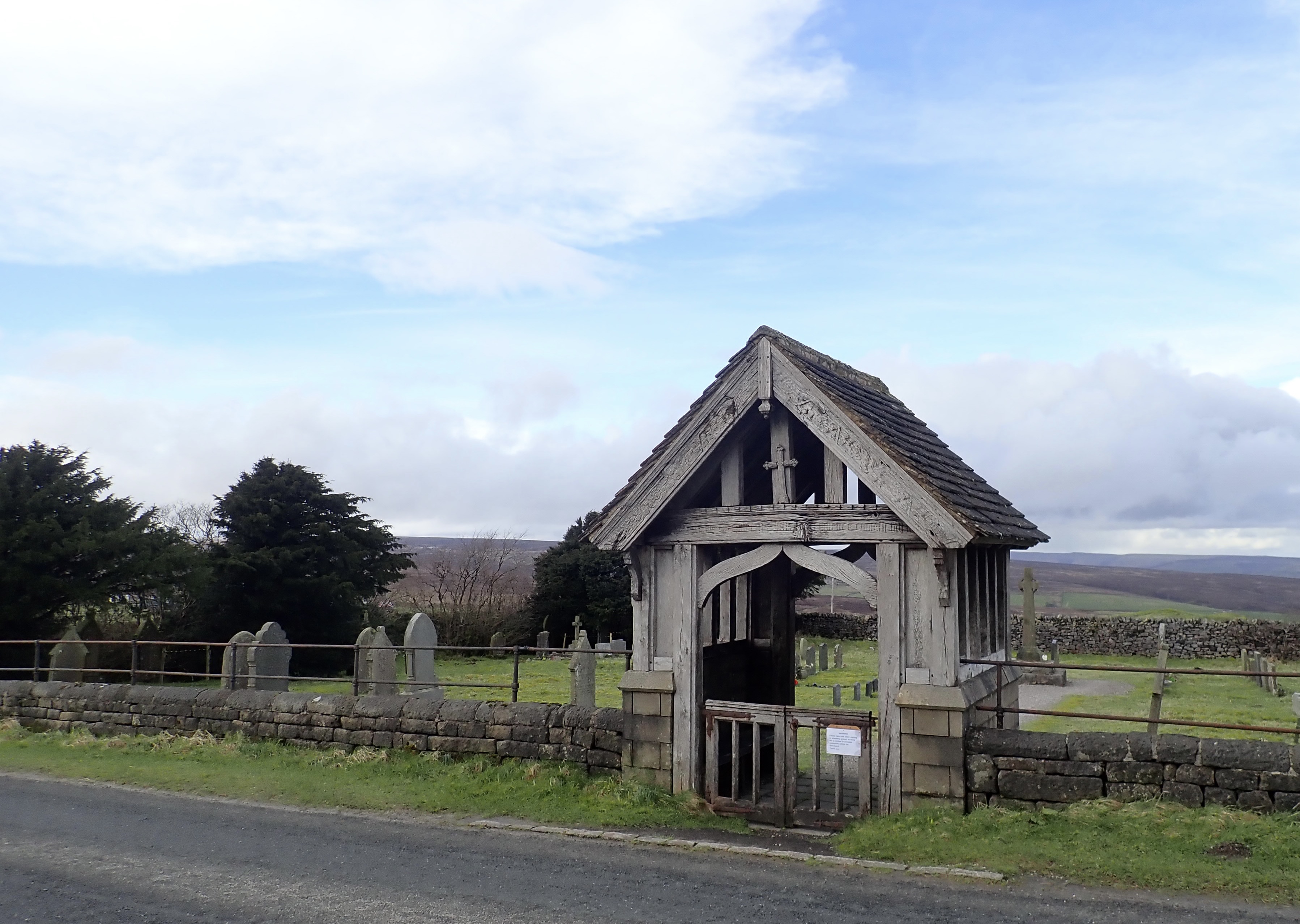
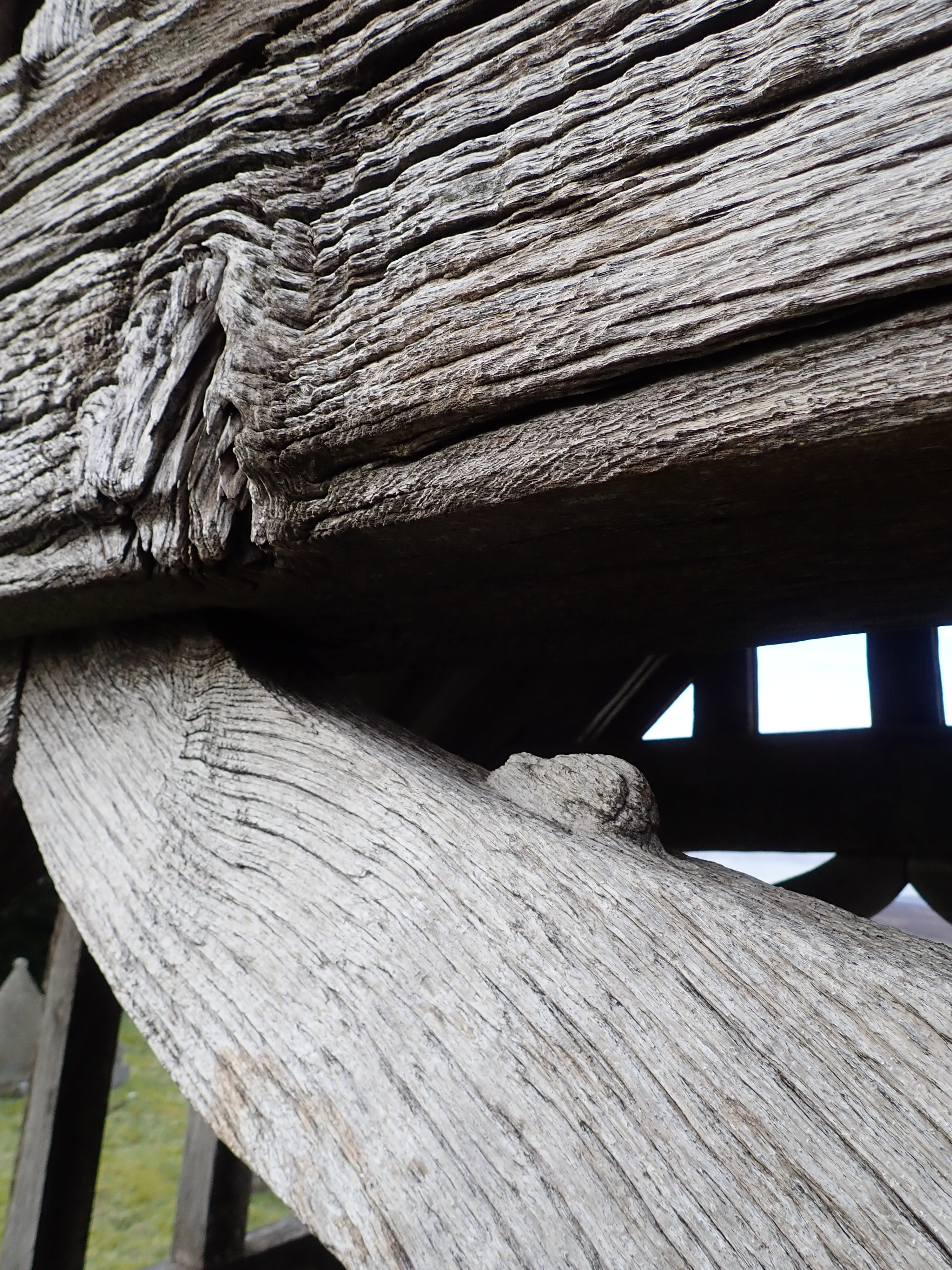
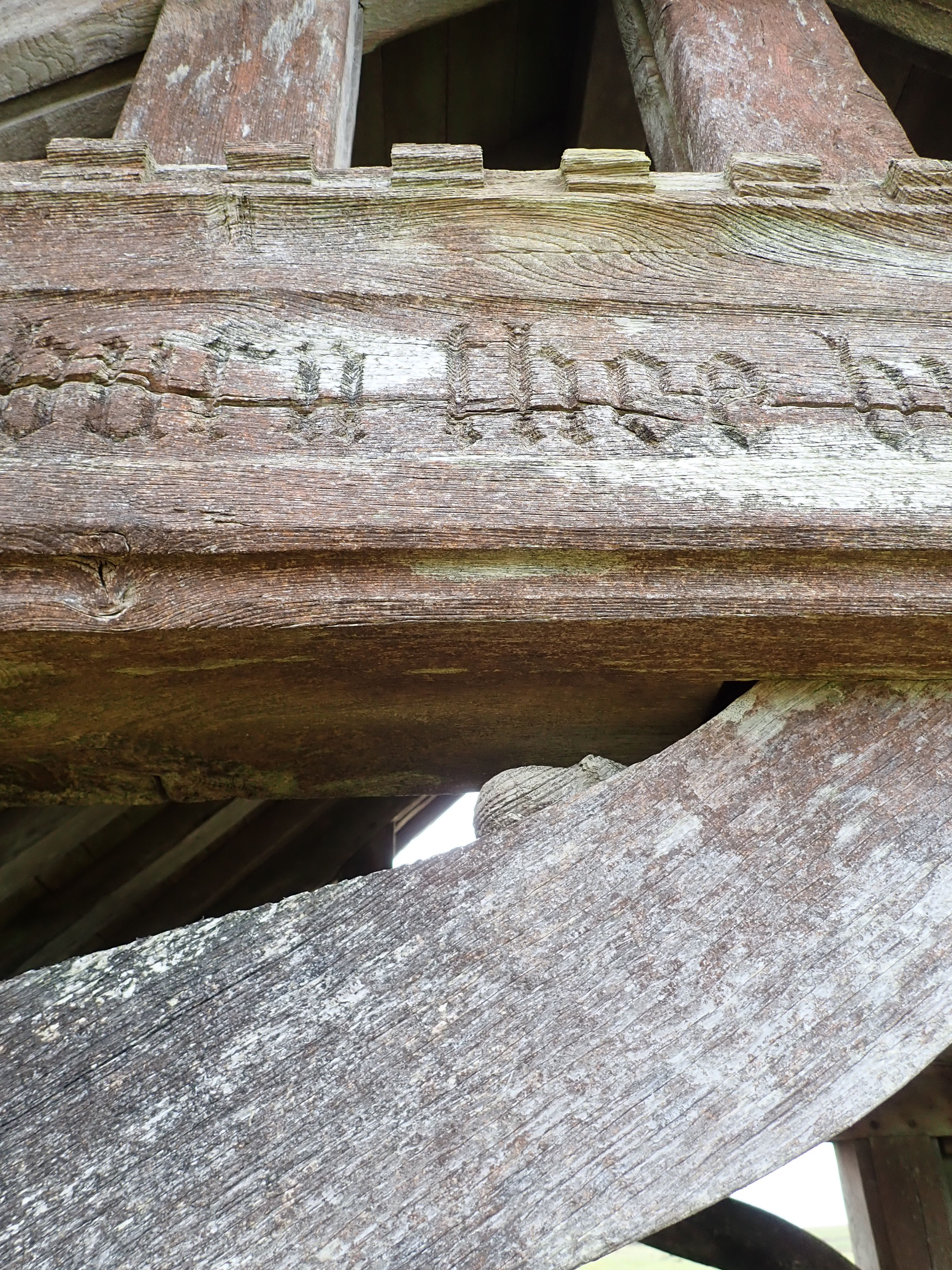
The road from Greenhow to The Coldstones Cut carpark passes the village graveyard. This has a beautiful lychgate, with wood that the weather has cracked and greyed. The lychgate was made by Robert Thompson in the 1940s. Thompson was born in 1876 in Kilburn in North Yorkshire, a furniture maker and craftsman who worked British oak using traditional techniques. Thompson was known as “the Mouseman” for signing his work with carvings of mice. He said that his use of a mouse as his mark was an accident that came about when he and another carver were making the cornice for a screen in 1919. The other carver apparently made a remark about being as poor as a church mouse, which prompted Thompson to carve a mouse into the cornice. He then decided that a mouse would be a good trademark. There are two Thompson’s mice on the lychgate at Greenhow. I also saw two of Thompson’s mice on the lychgate of the church in Hampsthwaite when I walked the Nidderdale Way. Thompson’s work is beautiful, and I enjoy trying to find the mice on his creations.
I left the graveyard to carry on walking along the road as cars and trucks zoomed past. The initial stretch following this road was on a pavement, but this ended before the graveyard, and a footpath on the other side of a wall from the road started several hundred metres after this. I normally don’t like road-walking, but the views across the dale during this part of the walk were lovely, and I enjoyed looking back to where I had been.
This was a walk that packed a lot into a short distance, and I felt happy as I arrived back at my car.
Further information
I did the shorter of the two walks described here.
There is a leaflet with information on the Greenhow Geology Trail, including a description of the geological and mining features of the area.

This is a great write up of a fascinating part of the country, I’ll have to head up there to see it for myself as it has all the things I’m interested in especially industrial heritage, i don’t think you needed to worry about the belted galloway bull too much, they’re usually quite chilled out beasties!
Thank you.
Chilled out is definitely the sort of bull I prefer.
Splendid photographs, as always! The Coldstones Cut is extraordinary – I have never seen anything like it elsewhere. It must have been a huge project, in terms of both labour & cost. How imaginative & unusual. Diana
Thank you.
The Coldstones Cut is amazing, and a great way of showcasing both the dale and the quarry. It apparently replaced a simple viewing platform – so The Coldstones Cut was clearly an upgrade.
Those are superb old mine workings you visited there – I haven’t been to any of those but I used to go up to Yarnbury above Grassington a lot. There is another long flue up the hill there but not in anything like as good condition as that one.
Belted Galloway cattle are one of the quietest and most peaceful cattle – they wouldn’t have bothered you. And beef bulls are just laaaazy!
I don’t think I’ve been to Yarnbury. I’ll have to check it out.
It’s good to know that those cows were the quiet and peaceful sort. It means that I can feel a bit more relaxed in their presence the next time I’m up that way. I don’t know much about different breeds of cow.
Best wishes,
Robin
Yarnbury is really nice – I used to walk up from Grassington to there, cross the moors to the top of Conistone Dib and come back under Grass Woods along the little road.
Most beef cows are pretty good – they’re mostly very afraid of us as they don’t get handled much. It’s the dairy girls who are more confident and give people a bit more trouble as they like to run at people across their field. They generally don’t mean anything by it – I’m pretty sure they just do it for fun. Almost any cow will stop if you face them though – even groups of them do.
Thanks.
I’ve added Yarnbury to be do list of walks.
A fascinating walk to an area I have mainly just driven past – time for a longer visit.
I’d certainly recommend a visit – It’s a great place to explore.
Suspect the water wheel was on the surface driving the pump at the bottom of the shaft
I was surprised when I discovered that the waterwheel was underground. It’s not what I was expecting. In fact, the mine apparently had several underground waterwheels. My guess is that the miners thought it easier to build waterwheels in the course of underground streams than to try to create a big enough mill pond on Ashfold Side Beck. However, I’m no mining engineer, and so there may have been other reasons for their decision.
There are references to these underground waterwheels in, for example, Historic England’s Official List Entry for the Prosperous Lead Mine (https://historicengland.org.uk/listing/the-list/list-entry/1017752?section=official-list-entry) and on the website of The Northern Mine Research Society (https://nmrs.org.uk/mines-map/smelt-mills/smelting/prosperous/).