
This last stage of the Nidderdale Way had old mills, the fantastic rock formations of Brimham Rocks, a moor, a beautiful, wooded valley, and brilliant views over the lovely Nidderdale. It was a great end to a wonderful walk.
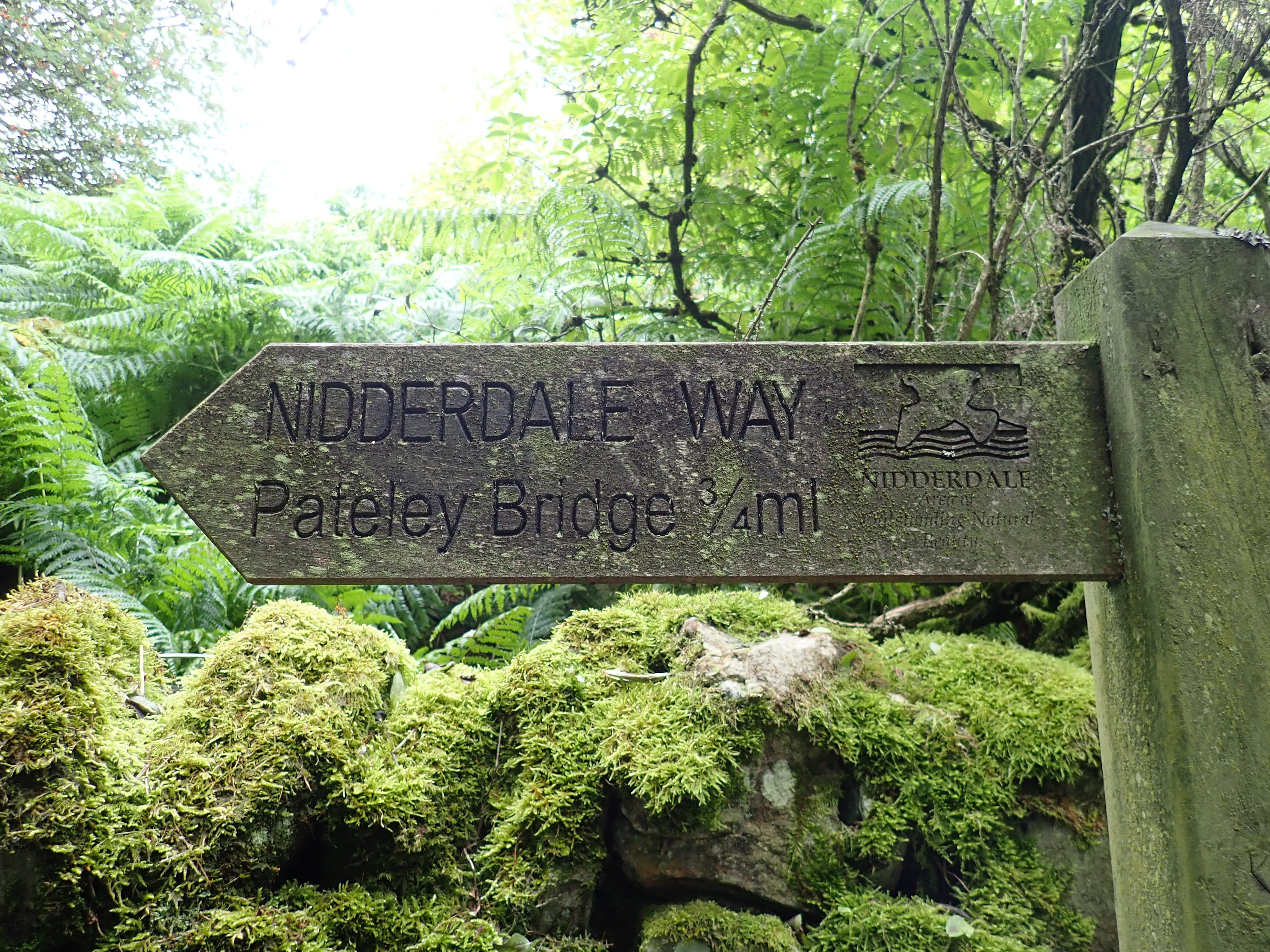
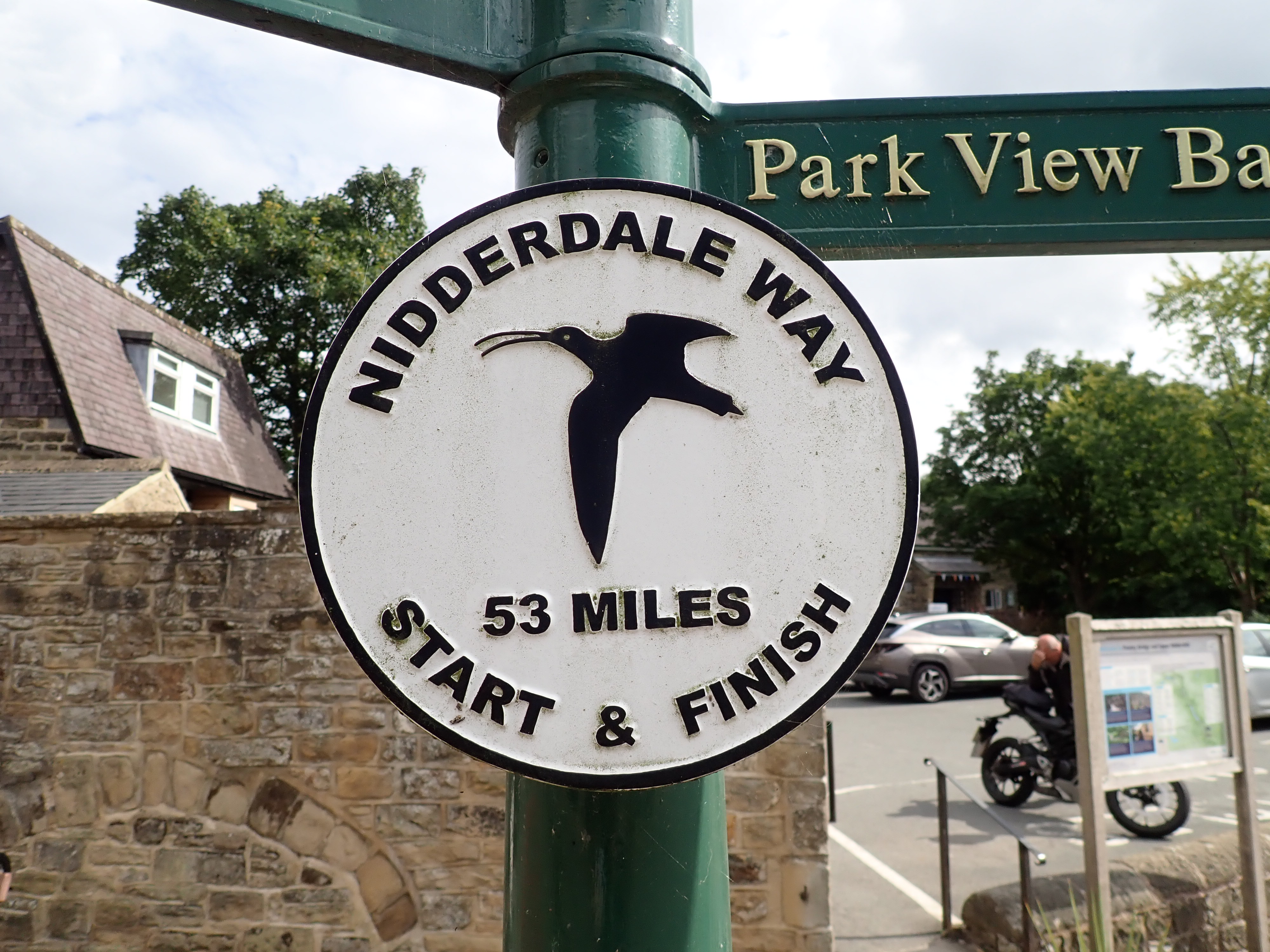
The sixth section of the Nidderdale Way goes from Shaw Mills to Pateley Bridge. It’s the third longest section of the walk at 9.6 miles (15.4km) and closes the loop that is the Nidderdale Way.
I had a bit of trouble getting home from Shaw Mills at the end of the last stage because it is a bit out of the way, and not a large place. There were no issues with getting a taxi to Shaw Mills for the start of this stage, although I did have to look up an address in Shaw Mills so that I had a specific destination to give the taxi dispatcher.
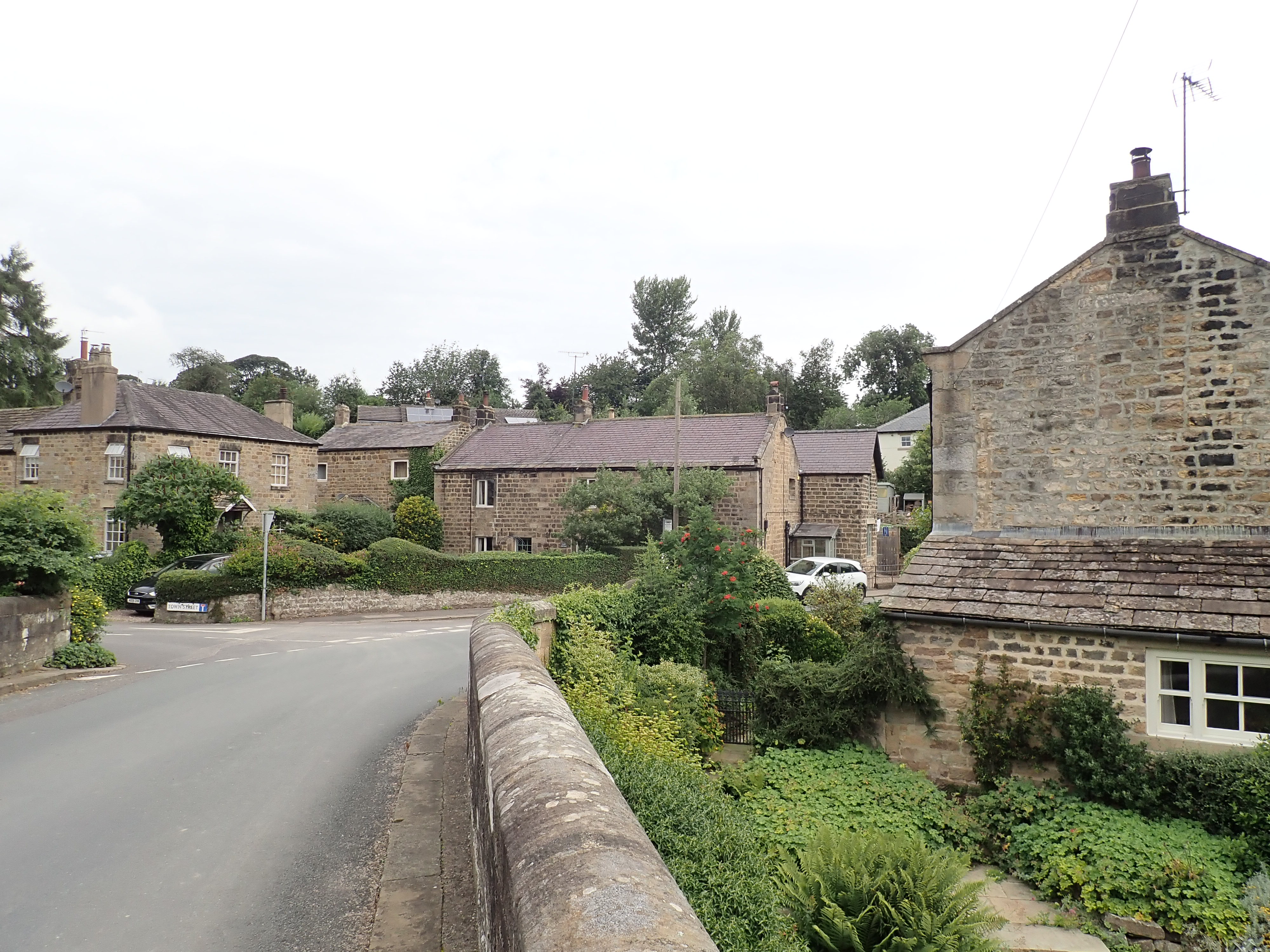
The taxi dropped me off at the bridge over Thornton Beck. It’s this stream that Shaw Mills, in some ways, owes its existence to. The hamlet is probably named after Robert Shaw, who built a corn mill by the beck in the 16thcentury. The mills began to spin flax in 1812, but both the High Mill and Low Mill closed in 1861. In 1890, they were restarted to spin silk. However, the mills closed permanently after World War 1. Shaw Mills is now a pretty village of cottages and mill buildings that have been converted into homes.
From Shaw Mills, the Nidderdale Way takes a somewhat zig-zag route through farmland along the valley of Thornton Beck, including crossing the Beck three times. It starts by going along a farm access road and through a farm. It then passes through attractive meadows and pastures, briefly into and out of a small wood, and by a corn field. Unfortunately, most of the rest of the way through this valley is a mundane walk along country lanes.
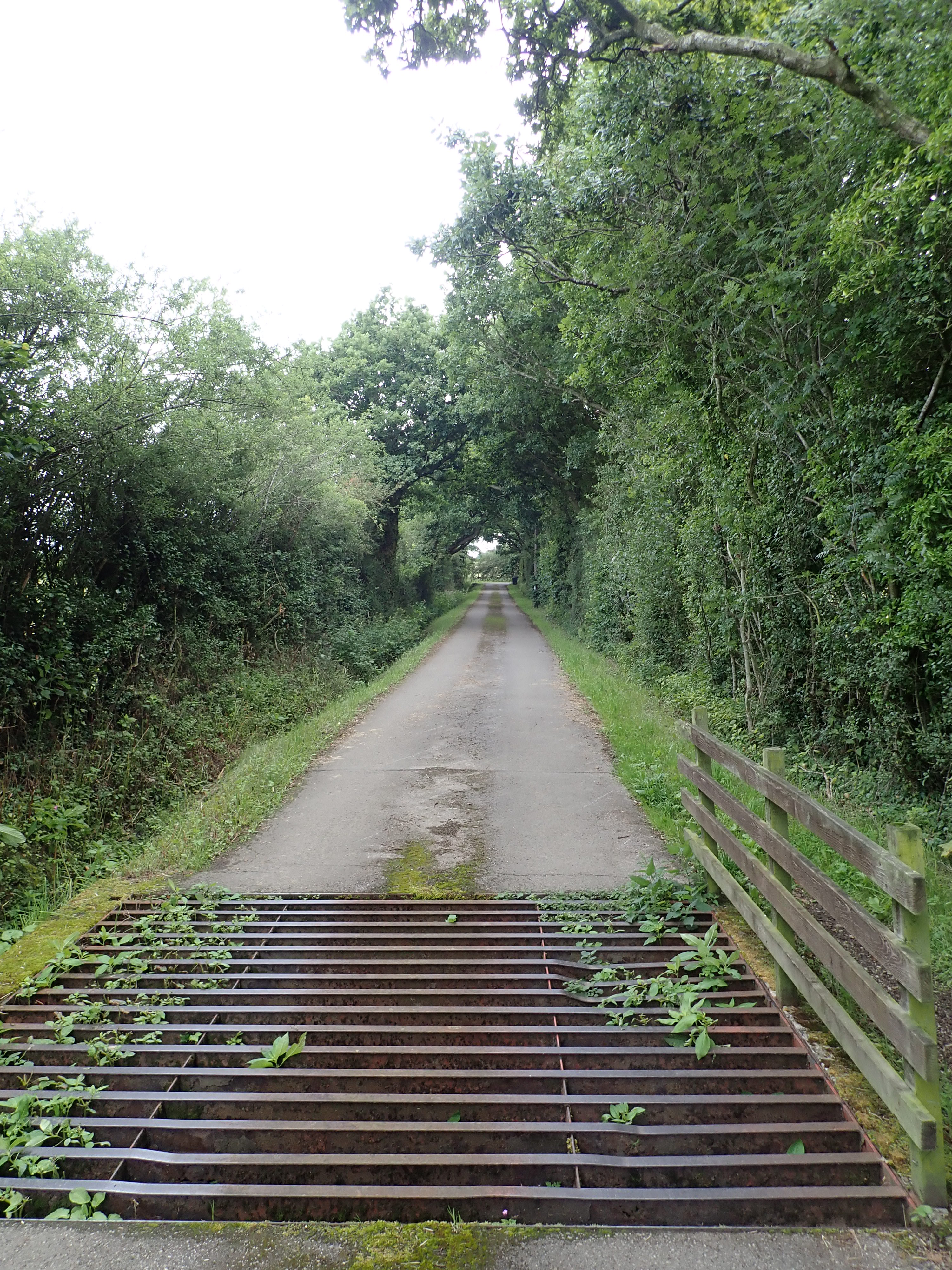
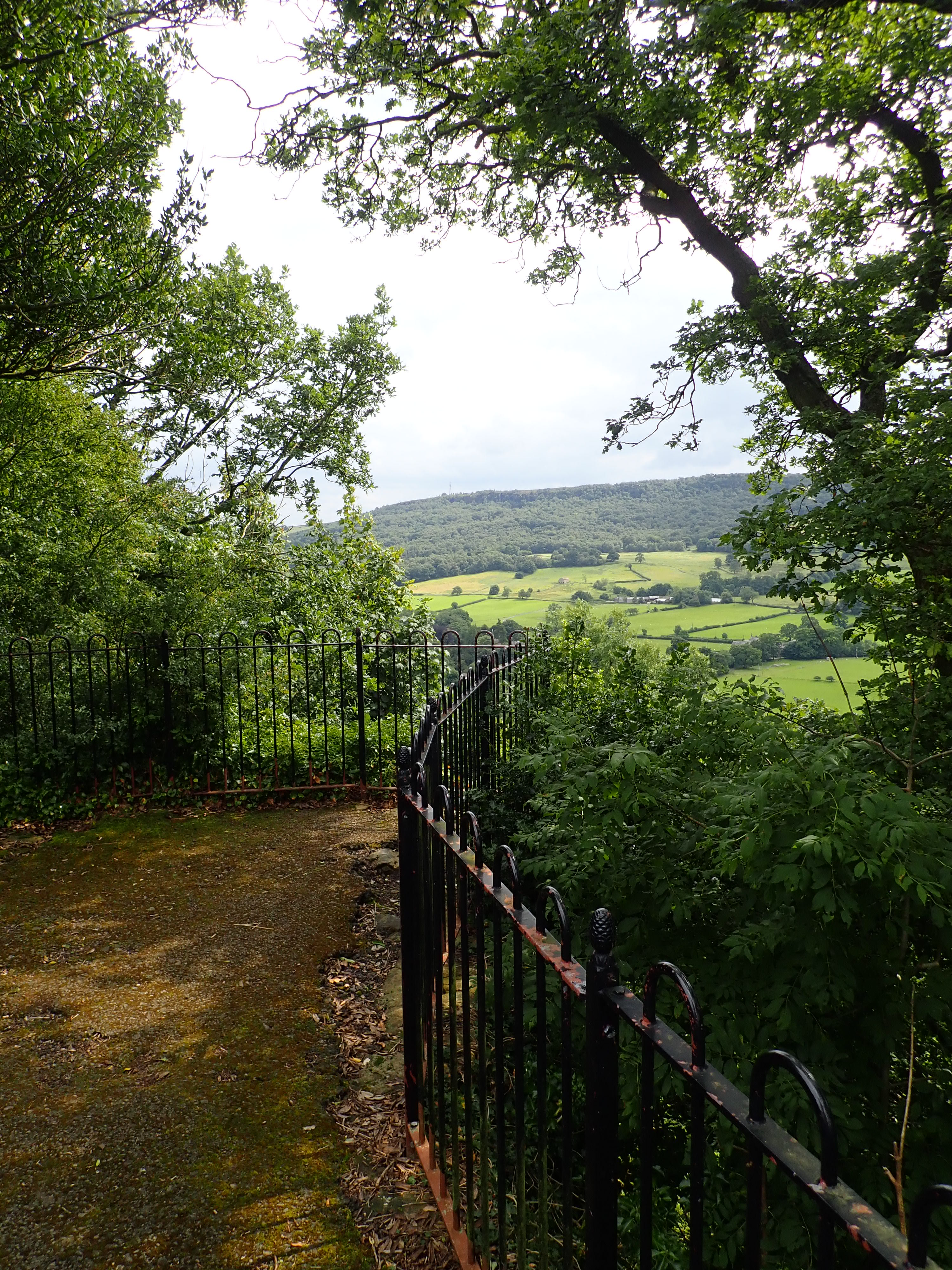
The Nidderdale Way gets more interesting as it gently climbs through fields and woods to the access track that runs into the rear of Brimham Lodge. This access track passes interesting farming remnants, including a dilapidated toilet portacabin that is gradually disappearing into the undergrowth, a graveyard of lichen-covered tyres, and a car that looks like it is gradually being eaten by grass. It’s a strange contrast with the attractive old stone buildings and modern barns of the farm that the Way then goes past. Brimham Lodge is an impressive building that was built in 1661 on the site of a former grange for Fountains Abbey. It has a commanding view over Lower Nidderdale, as well as a puzzling cluster of large masts and aerials sitting out front.

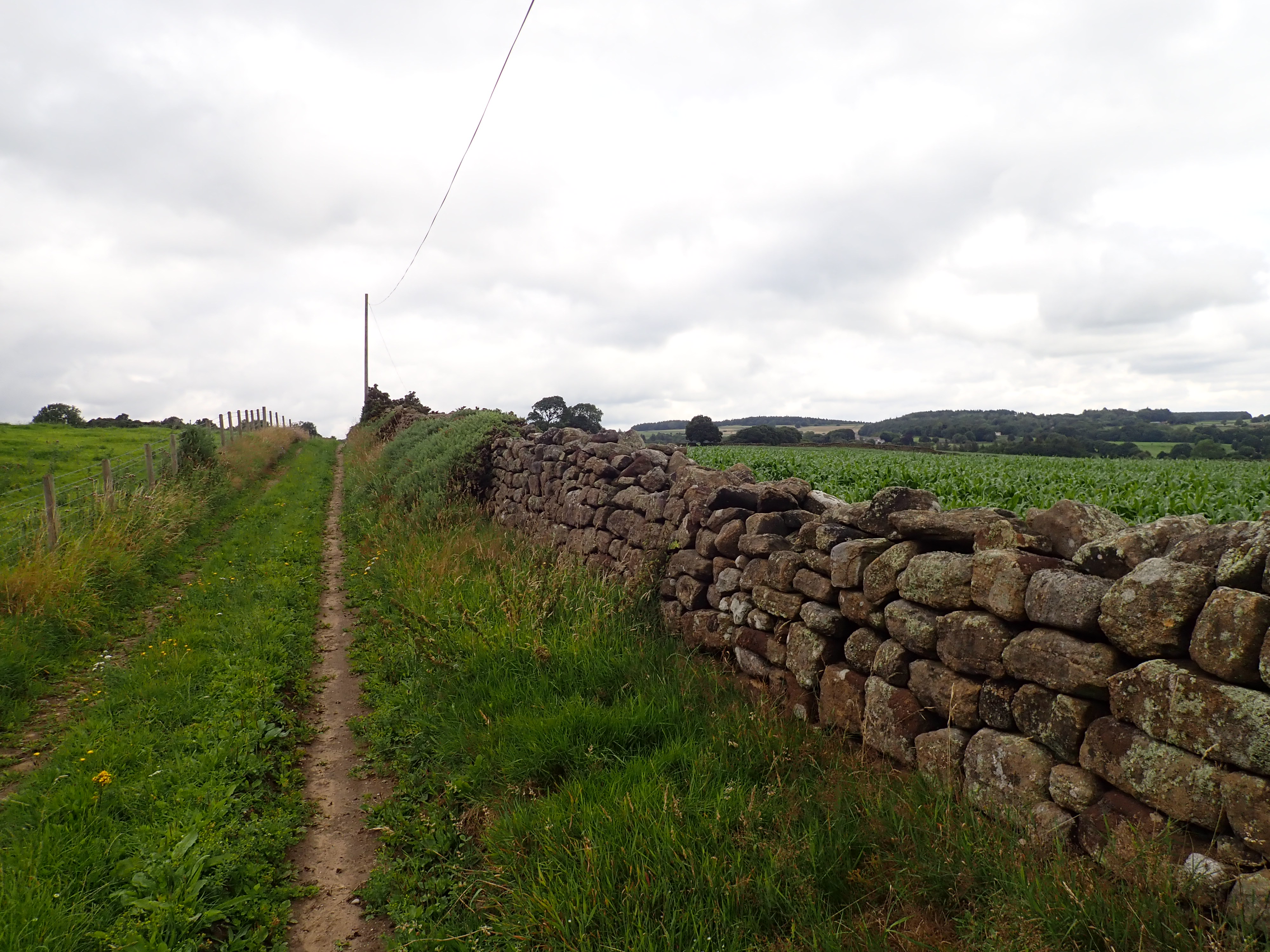
I left Brimham Lodge by its main access track to walk up to a lane. The Nidderdale Way almost immediately takes a right-angle turn to leave this road and follow a path running between fields. Alongside this path is a splendid section of drystone wall that my OS map labels as the “Monk Wall” in a script that indicates that this is an historic feature. This has made me curious to know what a monk wall is. The name implies it was built by and/or for monks, but my internet searches haven’t given me any information on whether a monk wall is more than this. If you know more, then please leave an answer in a comment below.
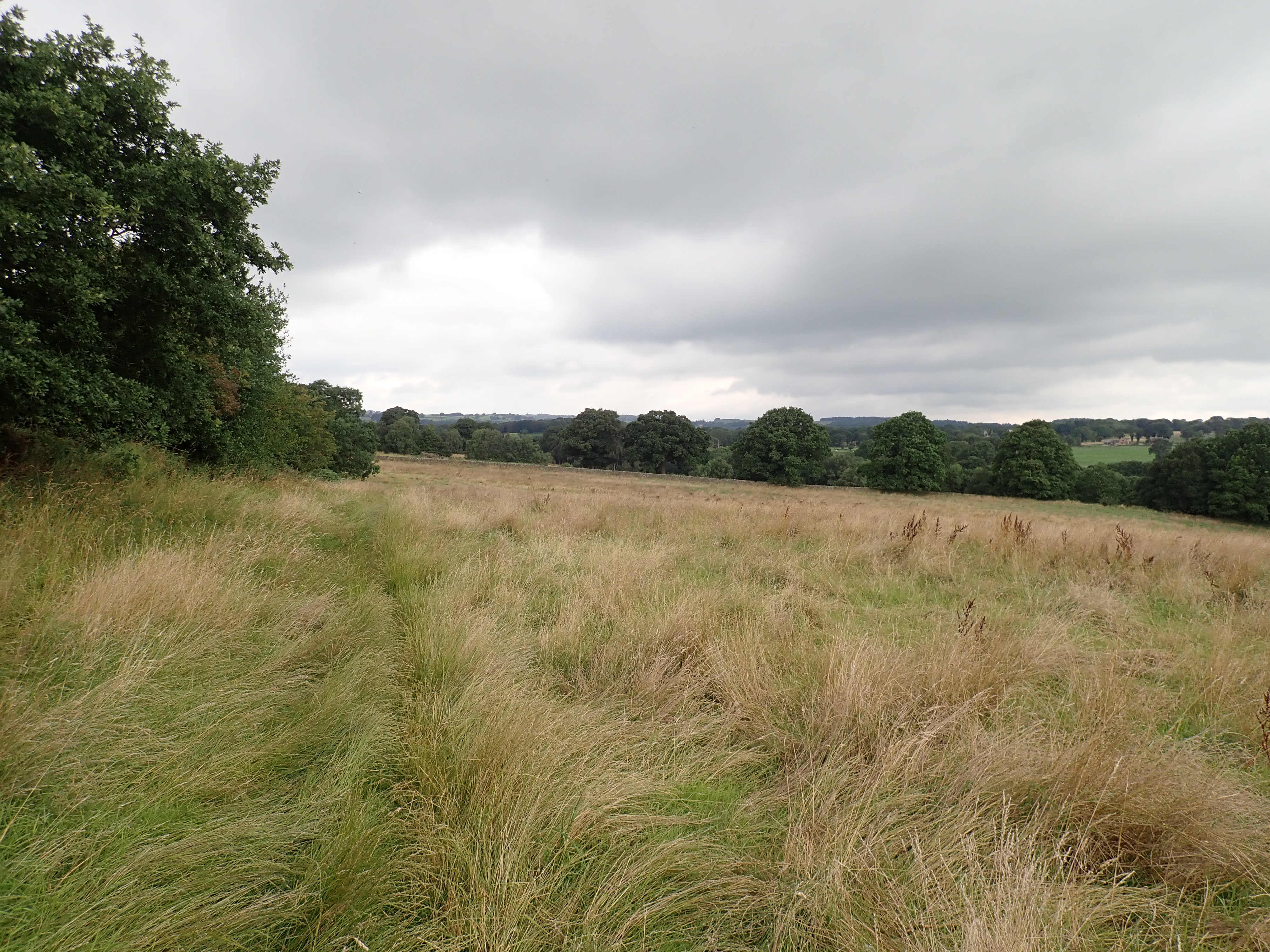
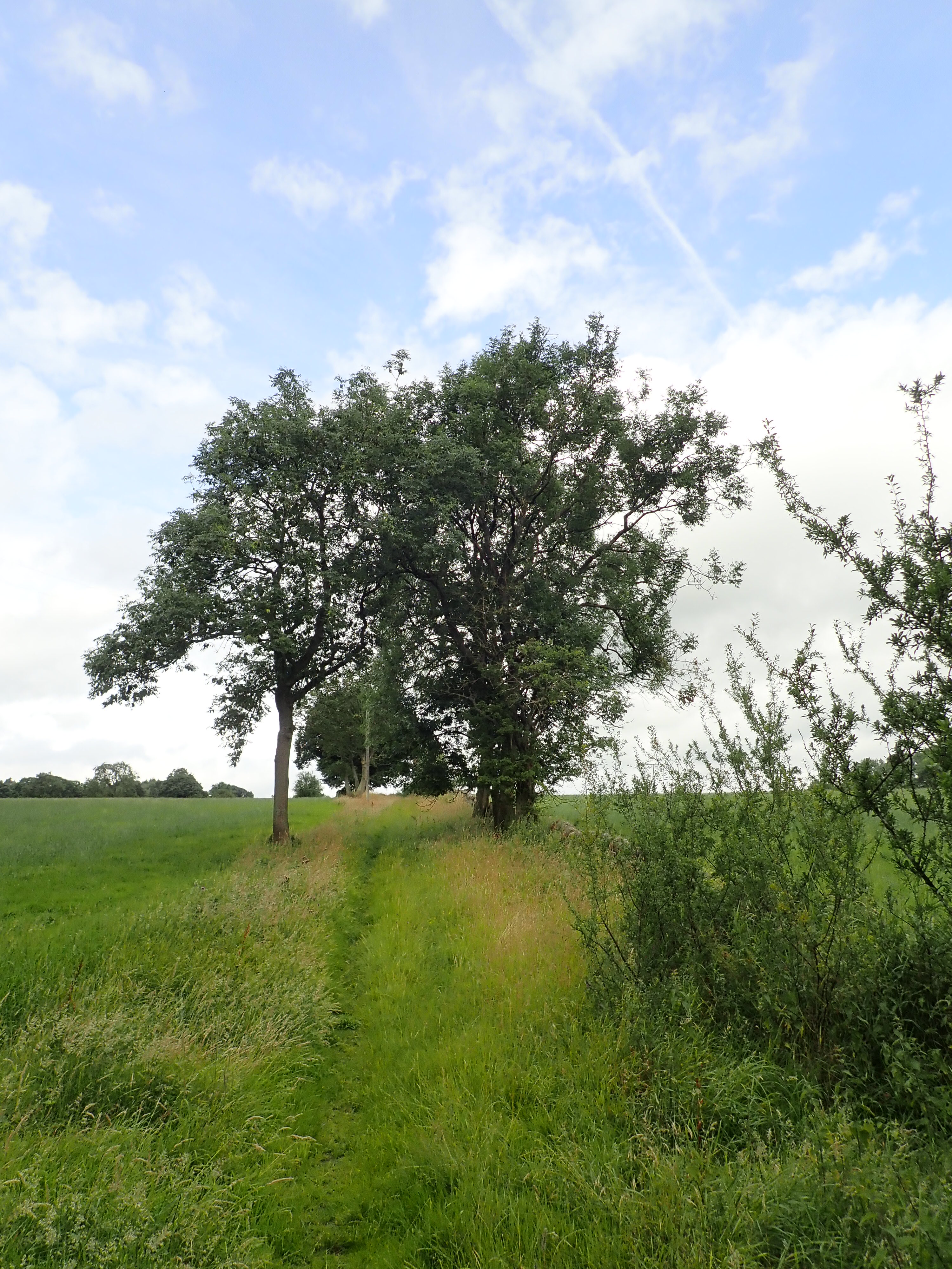
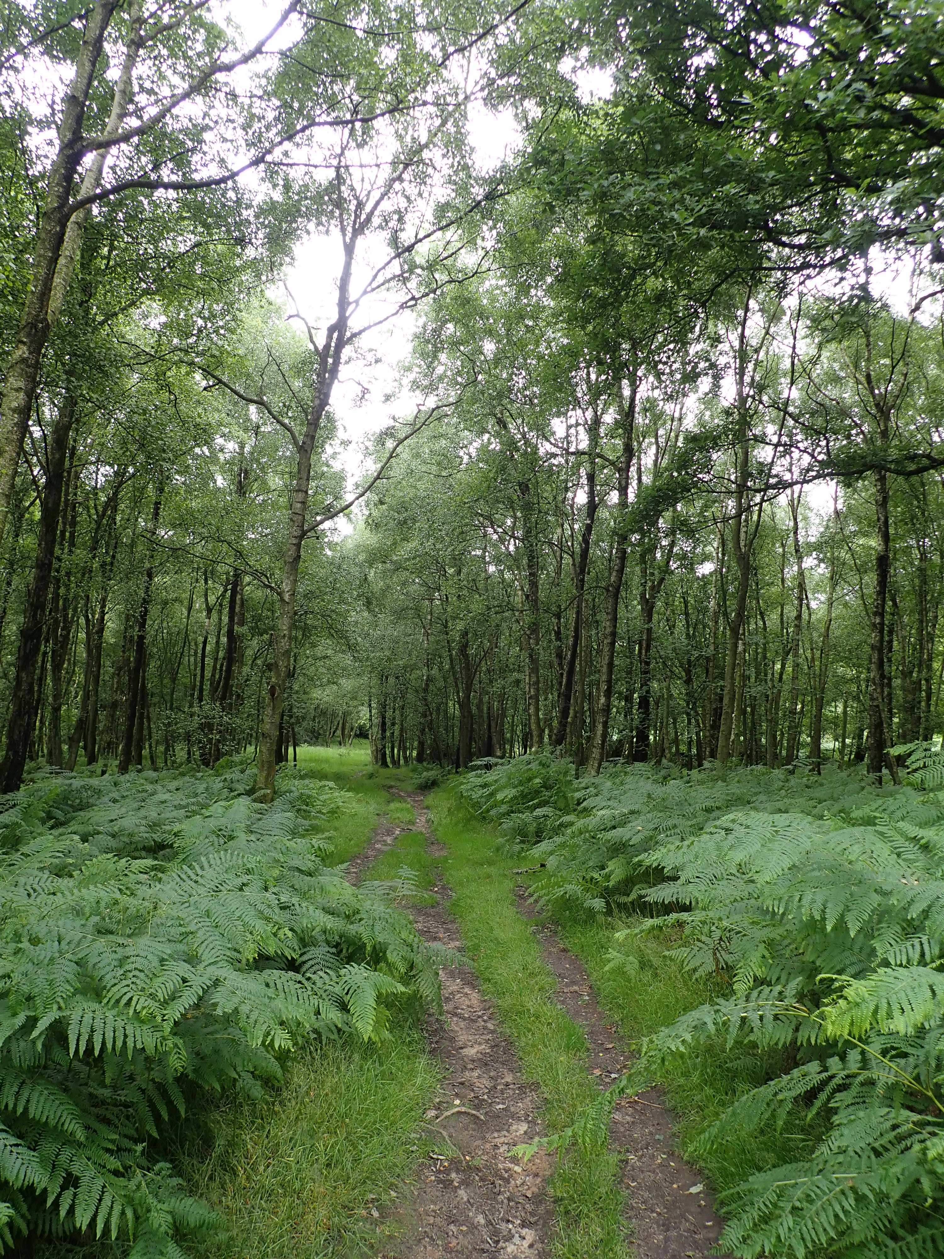
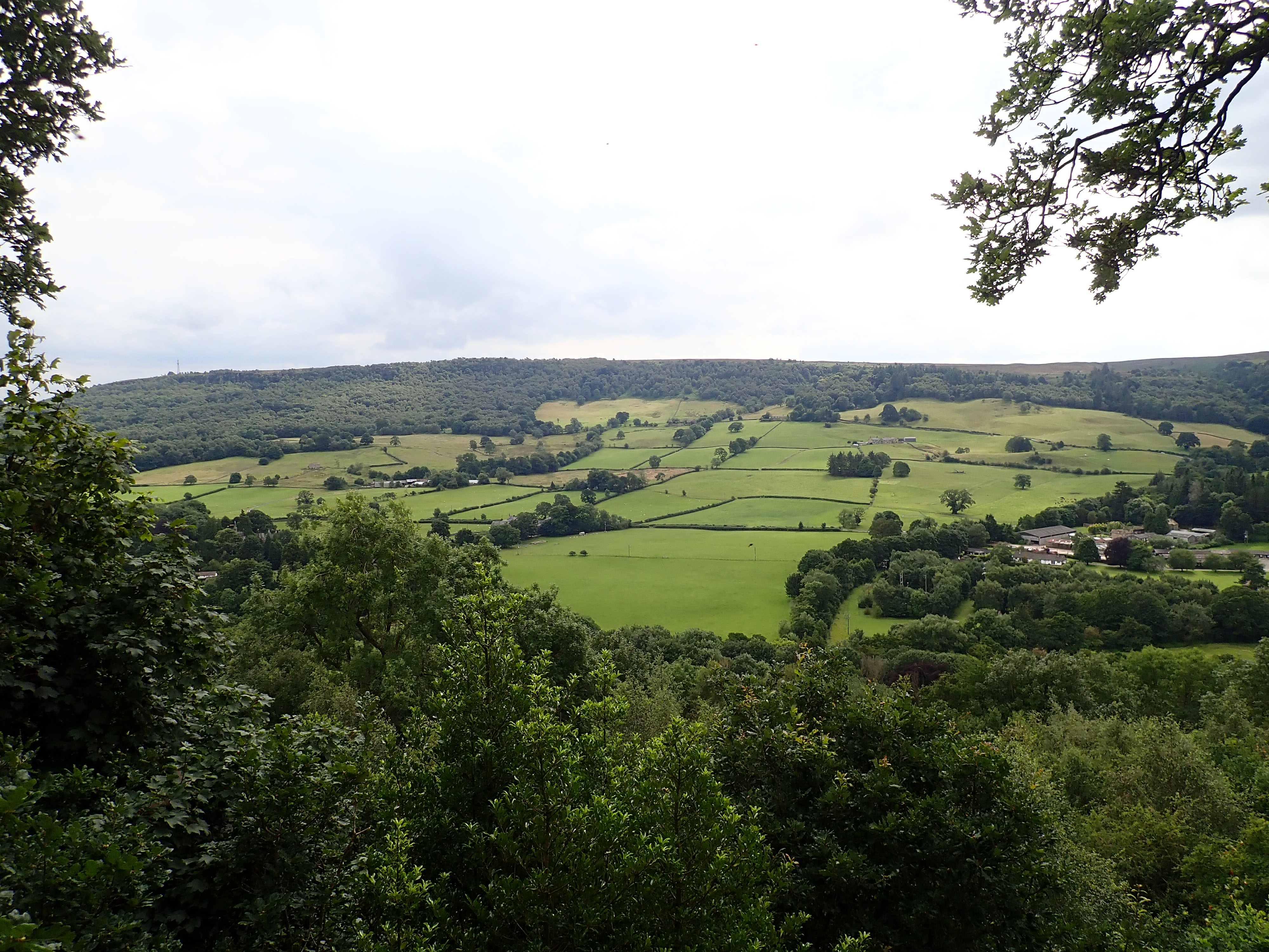
After leaving the Monk Wall behind, it was a short walk along a farm track and an overgrown path to Brimham Moor. I really enjoyed the walk over the Moor with its huge numbers of bilberries, heather coming into flower, and rocky outcrops.

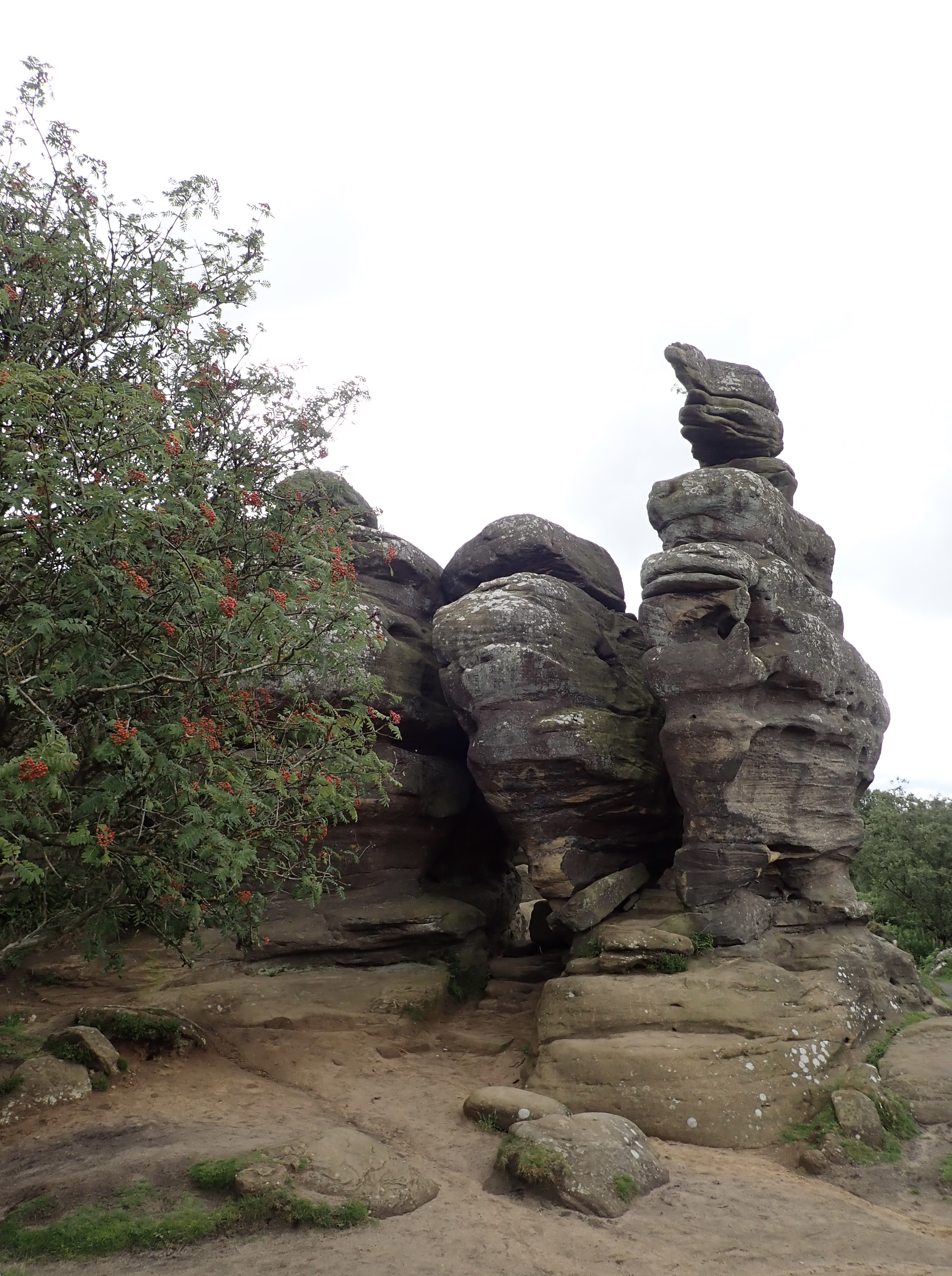
The Nidderdale Way passes to the south of the brilliant millstone grit formations of Brimham Rocks. I’ve been to Brimham Rocks many times to climb, and I’ve taken my son there so that he can explore and scramble about among the rocks. It is one of those places that you can visit countless times, and I like it a lot. I therefore I turned off the Nidderdale Way to follow a path through woods to Brimham Rocks.
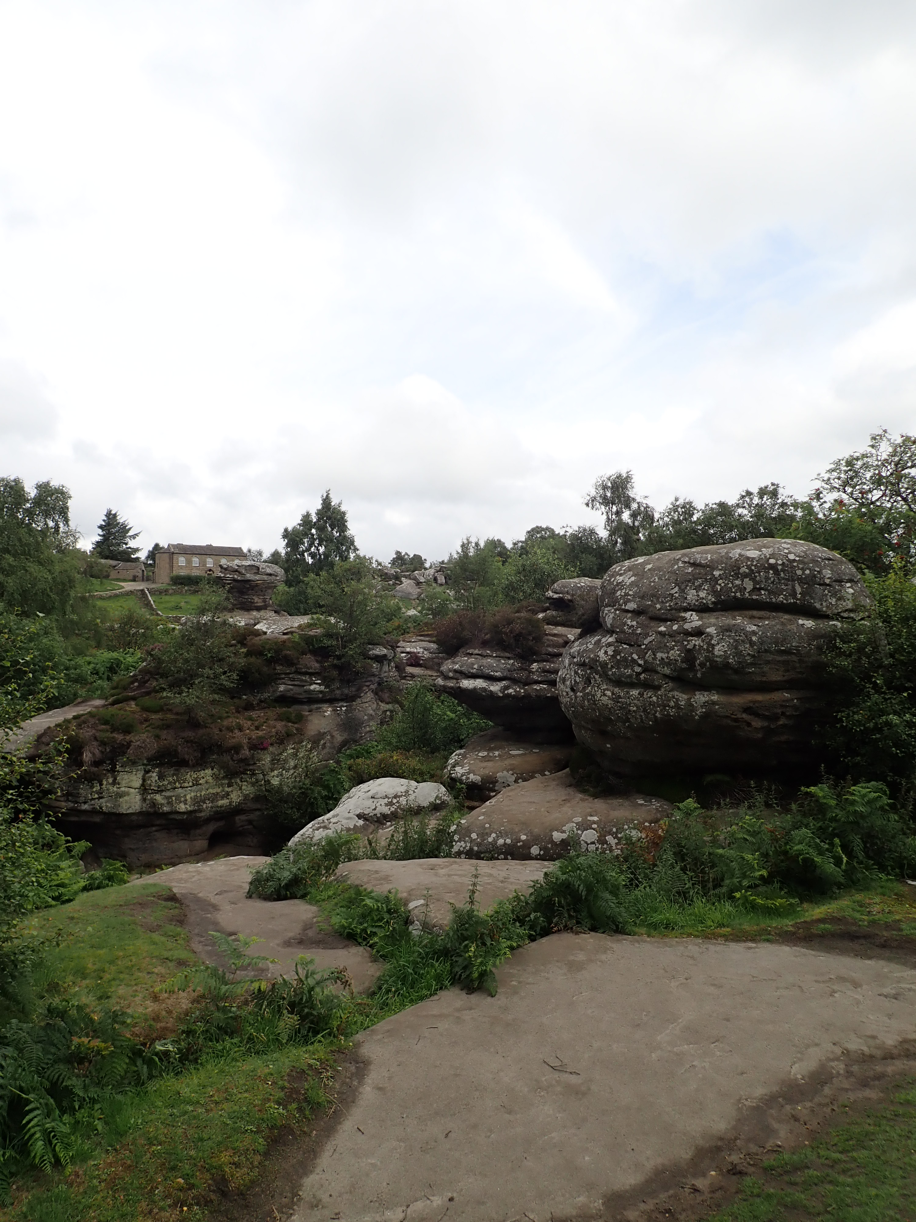
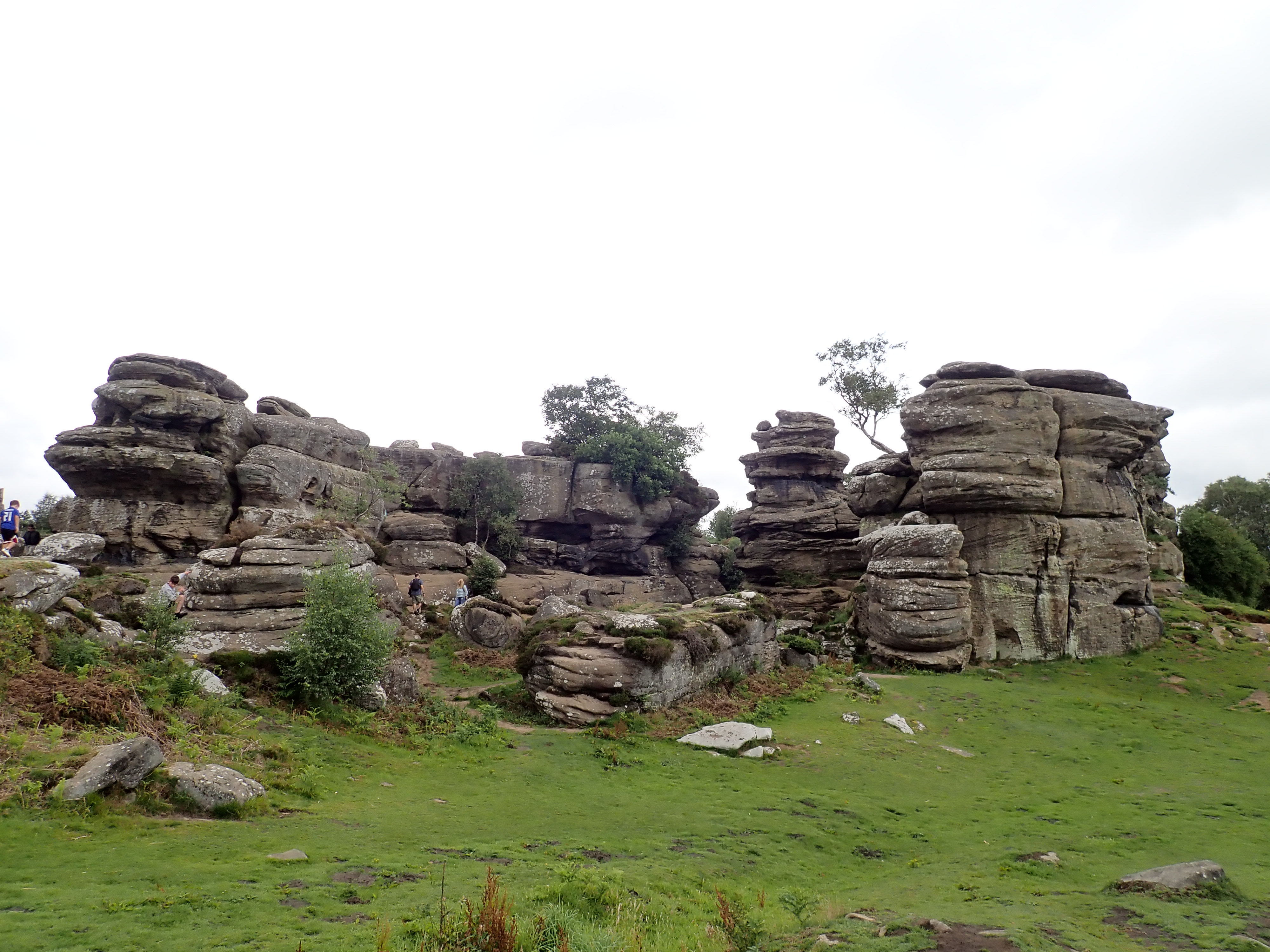
There was a theory in the 18th and 19th centuries that Druids had created Brimham Rocks’ weird rock towers and shapes. The reality is that around 317 to 320 million years ago, this area was located at the equator, where rivers carried silt, sand and pebbles that were washed down from mountains further north. This material included hard crystals of quartz and softer crystals of feldspar. Over time, these deposits were compressed and then hardened to form the rocks of Brimham. Nidderdale itself was carved out of this landscape by a glacier 18,000 to 30,000 years ago during the last Ice Age. This exposed the hard millstone grit of Brimham. Wind and water then eroded the weaker rock over time into fantastic shapes. You can read an interesting and more detailed explanation of the geological birth of Brimham Rocks on the website of the National Trust.
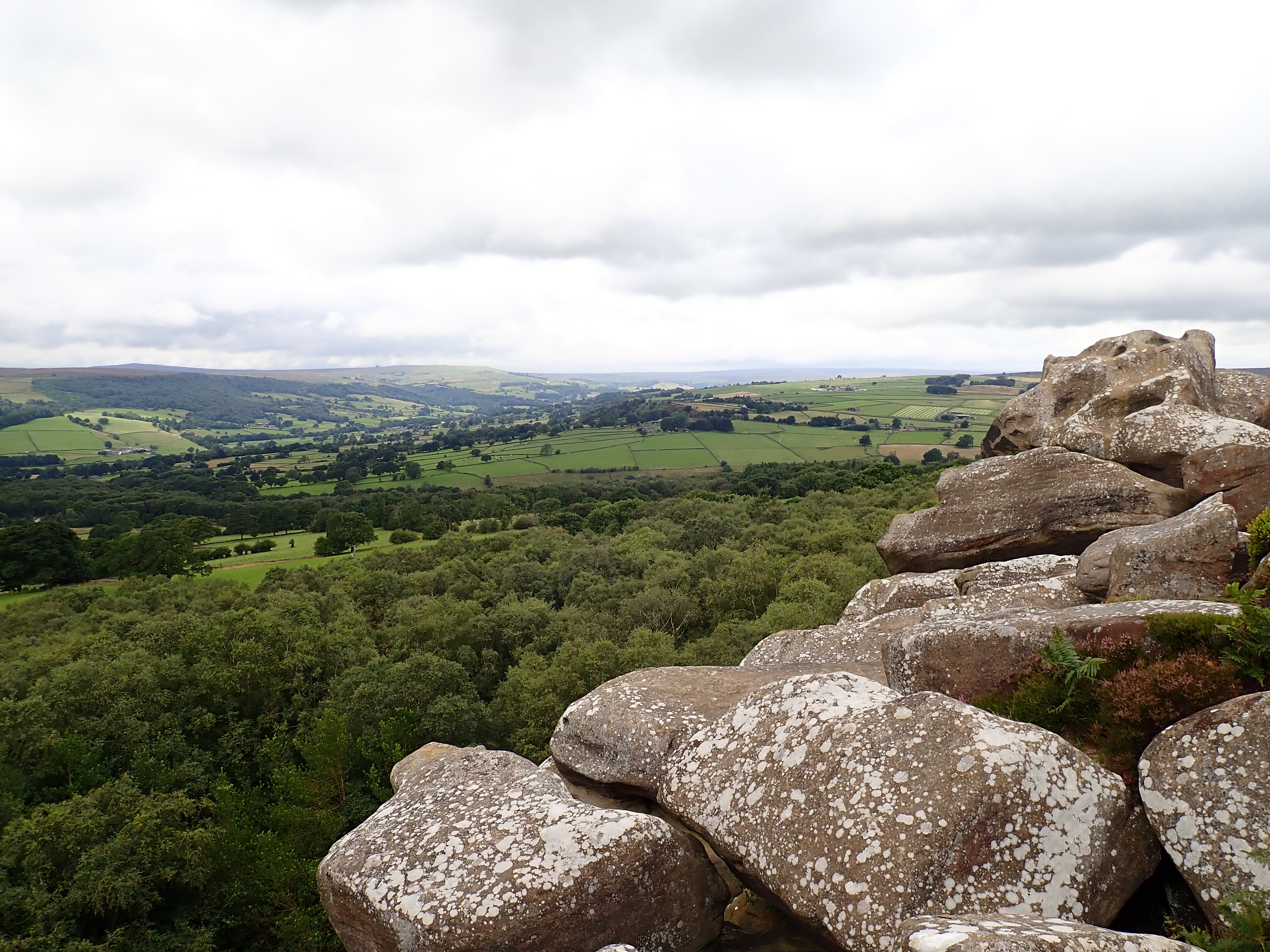
This website also sets out the history of Brimham. Like much of this area, the moor was given to Fountains Abbey in the Middle Ages. The monks used the moor as a pasture. After the dissolution of the monasteries in the 1530s, Brimham Moor reverted to the Crown. It was then granted to Sir Richard Gresham, and in 1780 became part of the Grantley estate and was used for hunting. It was Lord Grantley who built Brimham House in 1792 for use as a hunting lodge and as somewhere to go to admire the rock formations. Grantley recognised that visiting Brimham Rocks was becoming a popular activity, and the theory about the Rocks being shaped by Druids apparently helped in this increase in tourist numbers. The 19th century saw Brimham Rocks become a popular tourist destination, and this popularity has continued. Brimham Rocks was the busiest I have ever seen it when I arrived. The main car park was full, with a National Trust volunteer directing incoming cars to the overflow parking. People bustled around the ice-cream van and the information point, and I walked past scores of children having fun clambering around the rocks while their parents took photos. I managed to avoid the crowds by walking up to the Lovers Leap area close to Brimham House. I sat there to eat my lunch and enjoy looking across Lower Nidderdale to the places I had been on the Nidderdale Way.
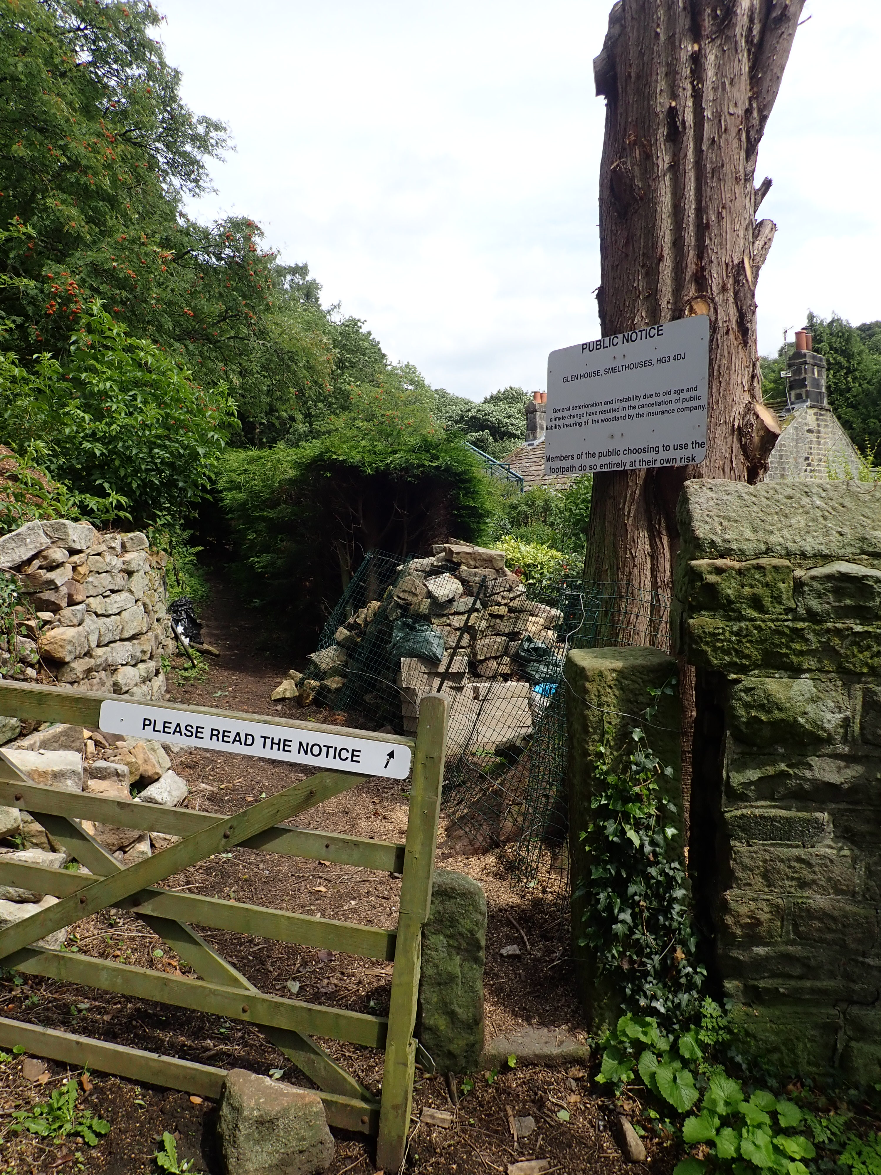
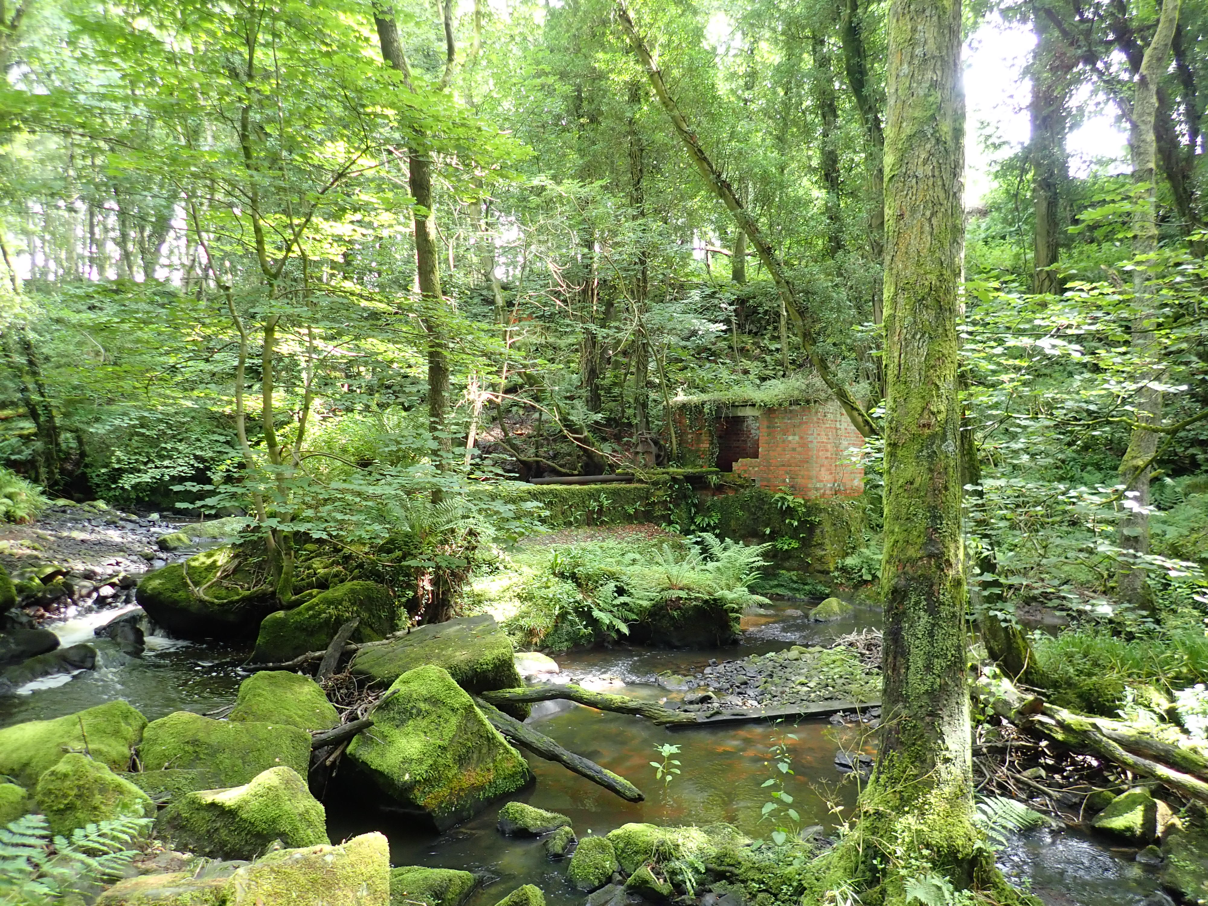
From Brimham Rocks, the Nidderdale Way essentially does a large U-turn. It heads South on a narrow path between trees and a wall, before turning West to go downhill on a path through the pretty High Wood. This led me to Smelthouses, which gets its name from the 15th century smelt mill built here by the monks of Fountains Abbey. It’s a hamlet of lovely cottages that sits on both sides of Fell Beck. At Smelthouses, the Nidderdale Way turns abruptly to go North to follow Fell Beck upstream through a wooded valley. The start of the path through this valley is a bit strange. It’s marked with a series of warning signs that made me watchful for dangers in the woods. It also runs between the garden of a magnificent cottage with a garden containing a large pond, and a huge stone wall. My guess is that the cottage was once a mill that was cut out of the side of the valley, and the impressive wall was built to stop the valley side sliding into the mill. After I was past these curiosities, the wooded valley was gorgeous, and my favourite part of this section of the Nidderdale Way.

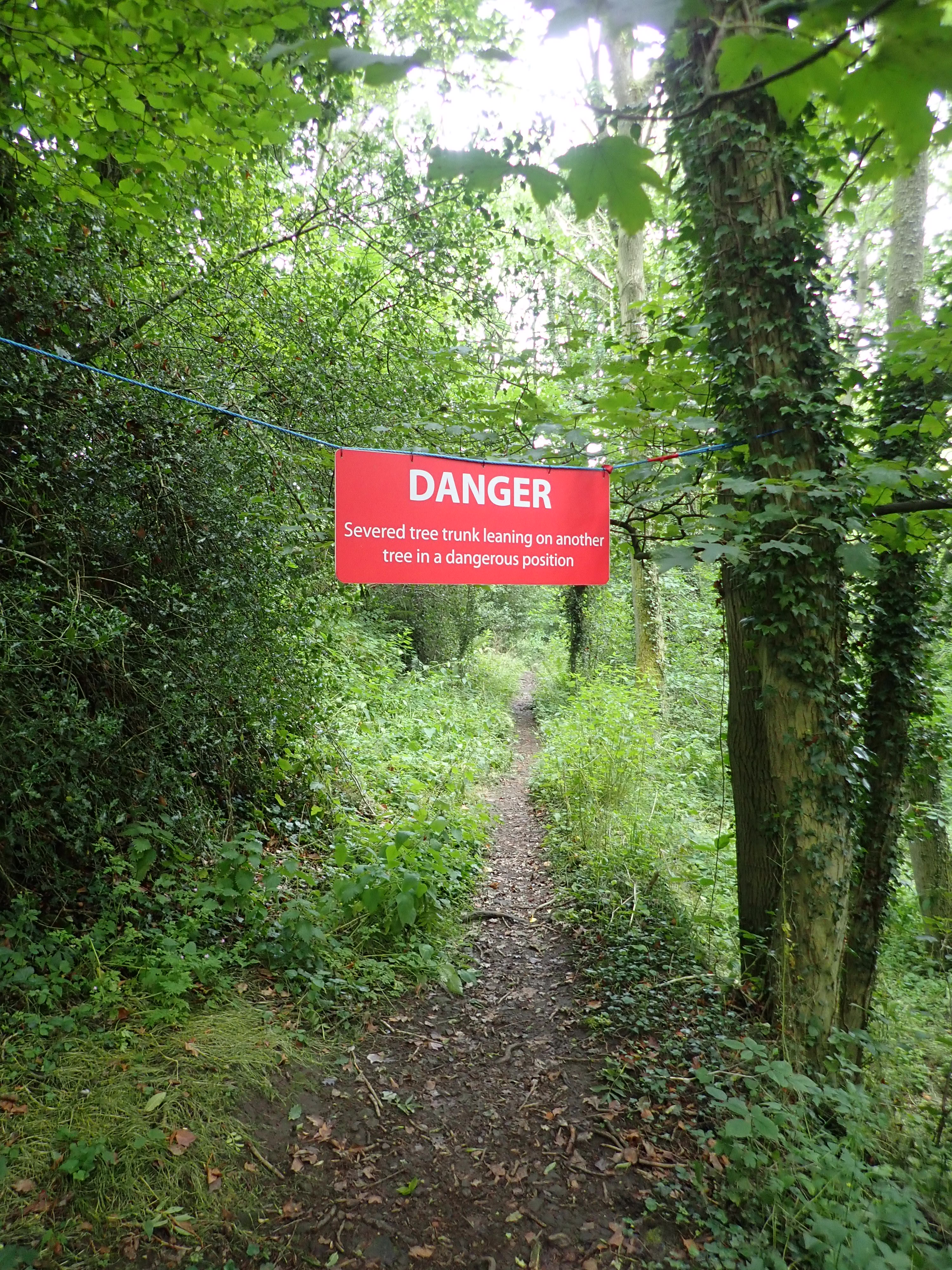

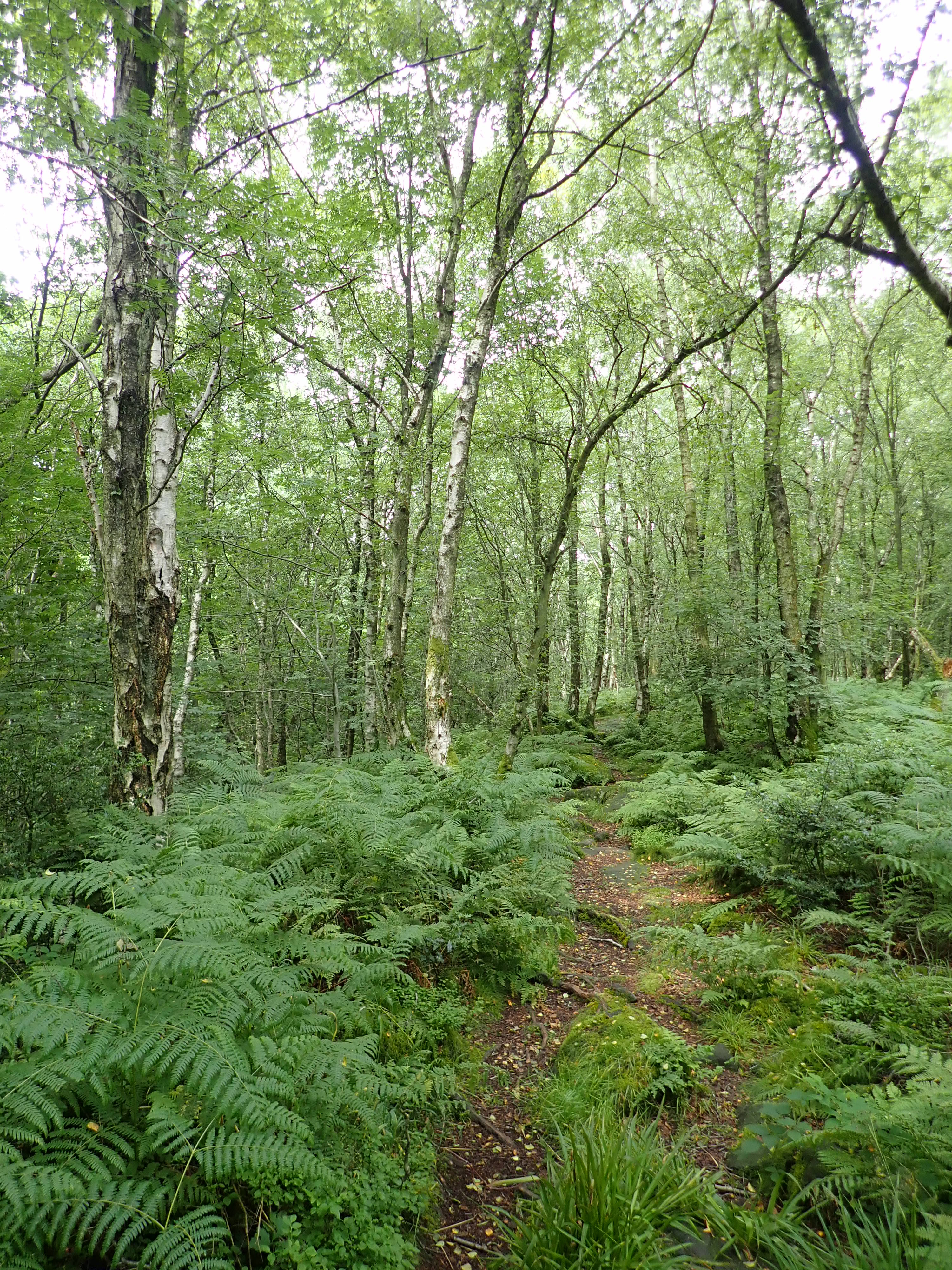
The narrow path followed the beck, passed the remnants of a dam, and then crossed a bridge. There were what looked like the remains of a mill on this bank, and a switchback took me past orange brick buildings swallowed by nature and decayed by time. This was followed by a lovely walk through a wood of Silver Birch. However, after passing an overgrown paddock, the woods changed to become more Brothers Grimm in character. The woods were dense, there was less light, and the trees were more twisted. The guidebook warned me that the path would become faint and not to head downhill, yet I headed downhill on a path that seemed clear before realising my error when the path became indistinct. I worked my way through the trees to pick up a clearer path next to a wall. I then arrived at a T-junction that wasn’t on my map or in the guidebook, and where there was no sign of the fingerpost described in the book. Feeling a bit frustrated, I decided to turn left as the map did show the path going downhill and I knew I was meant to cross the beck soon. A muddy path took me to a sturdy bridge over Fell Beck and a feeling of relief.
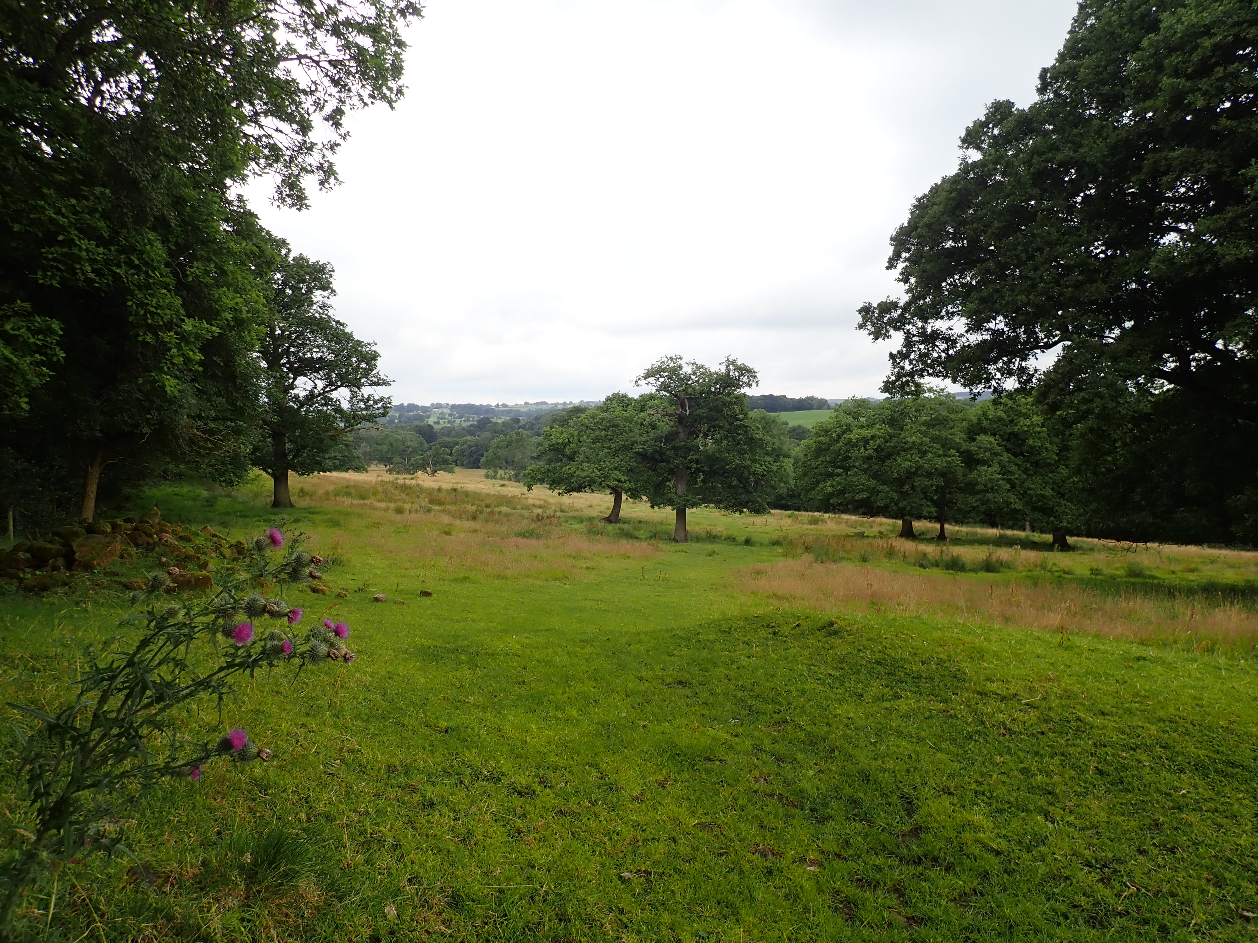
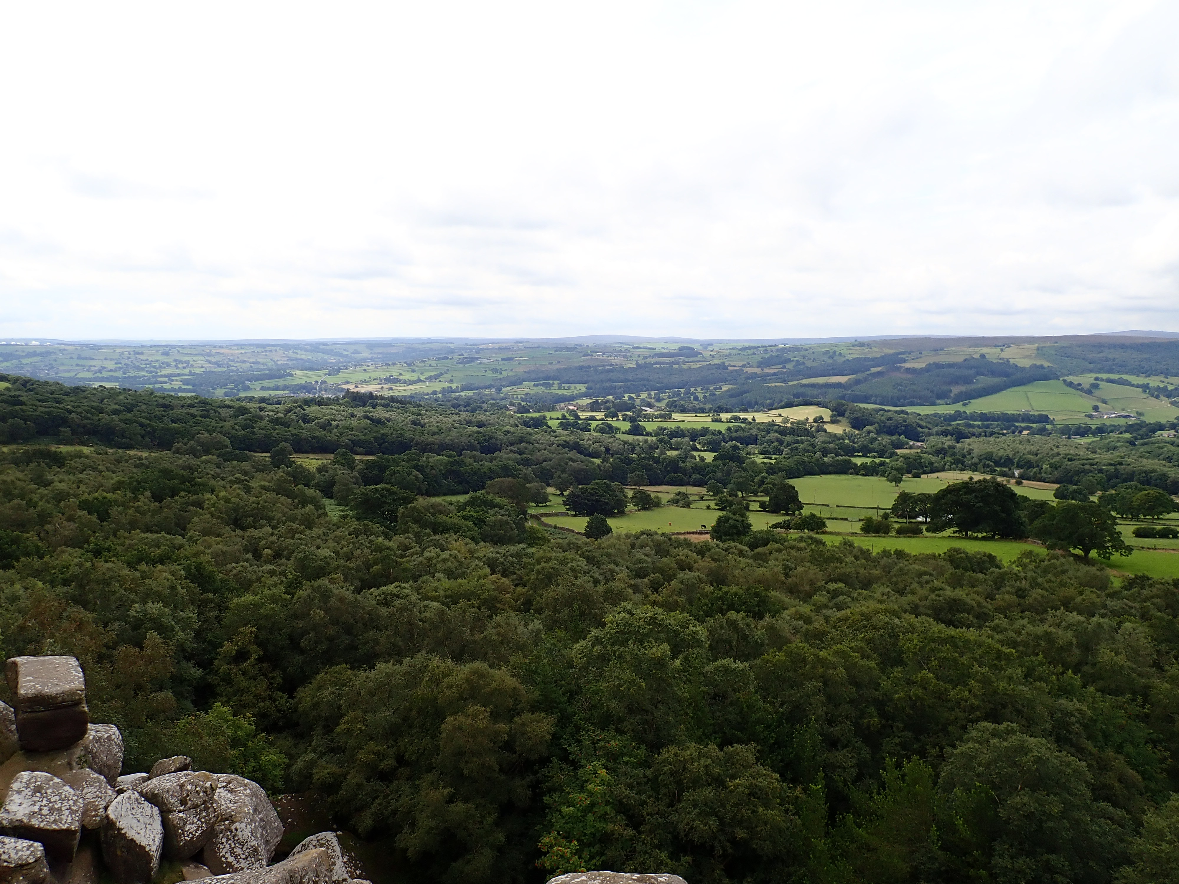
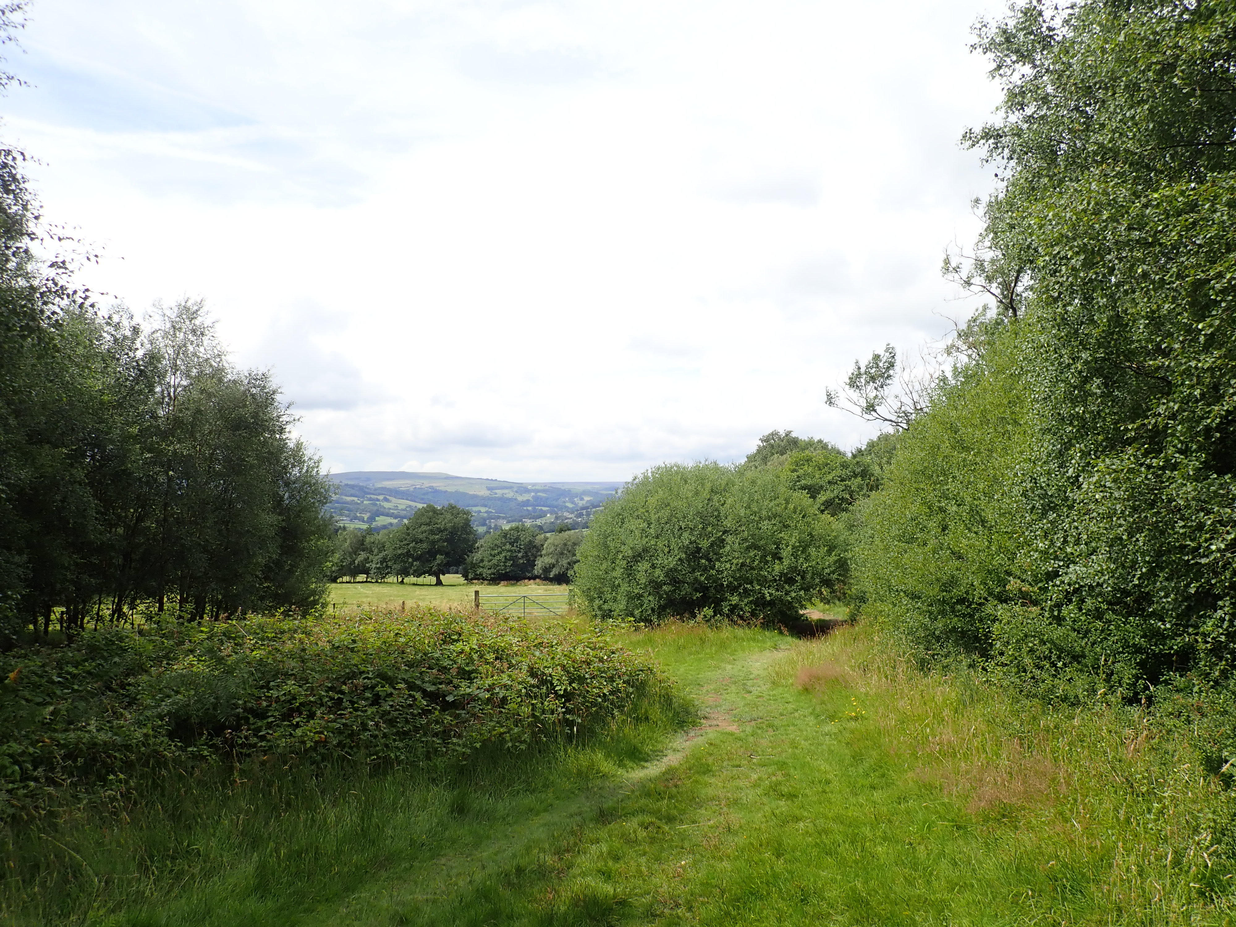
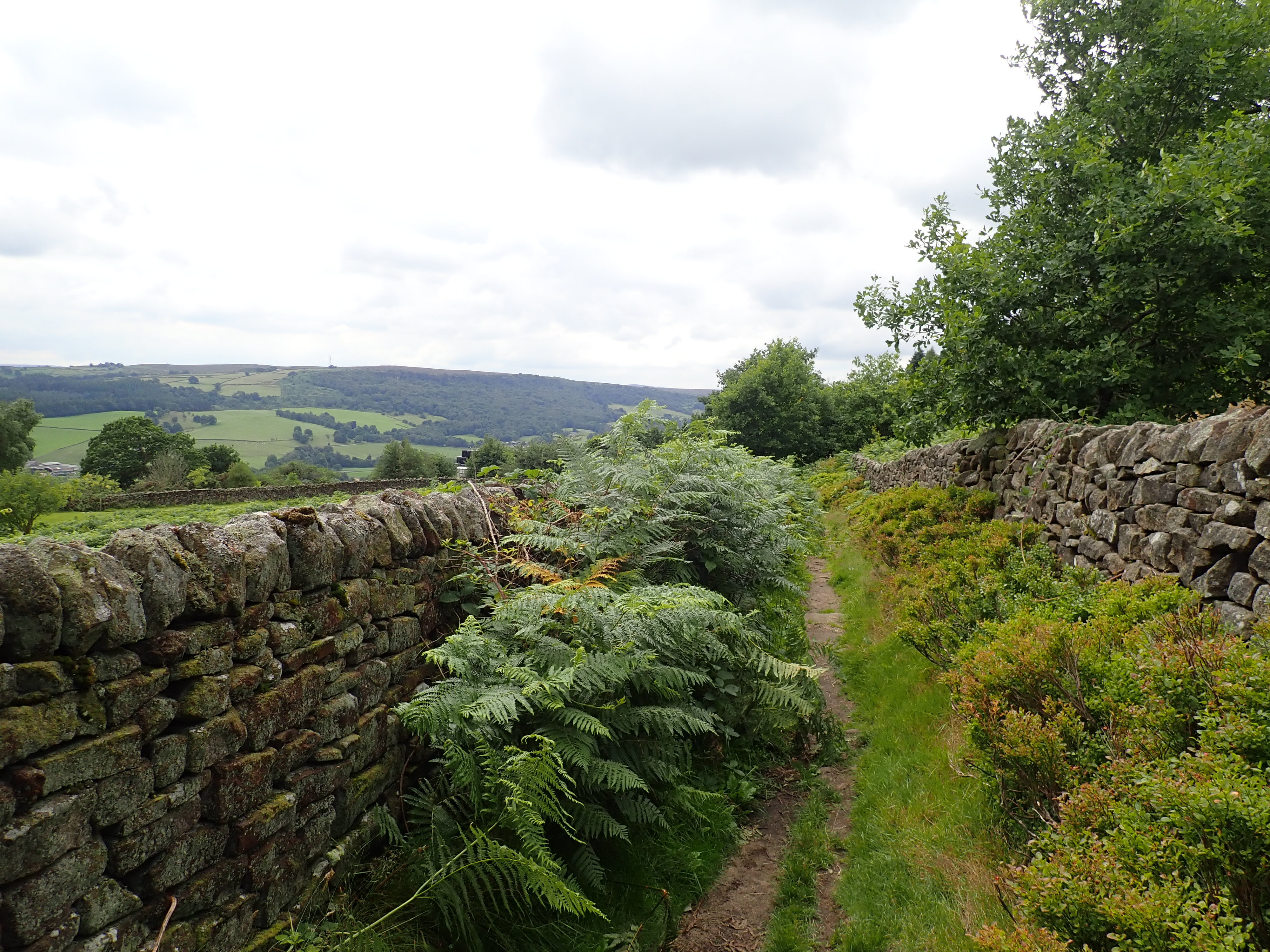
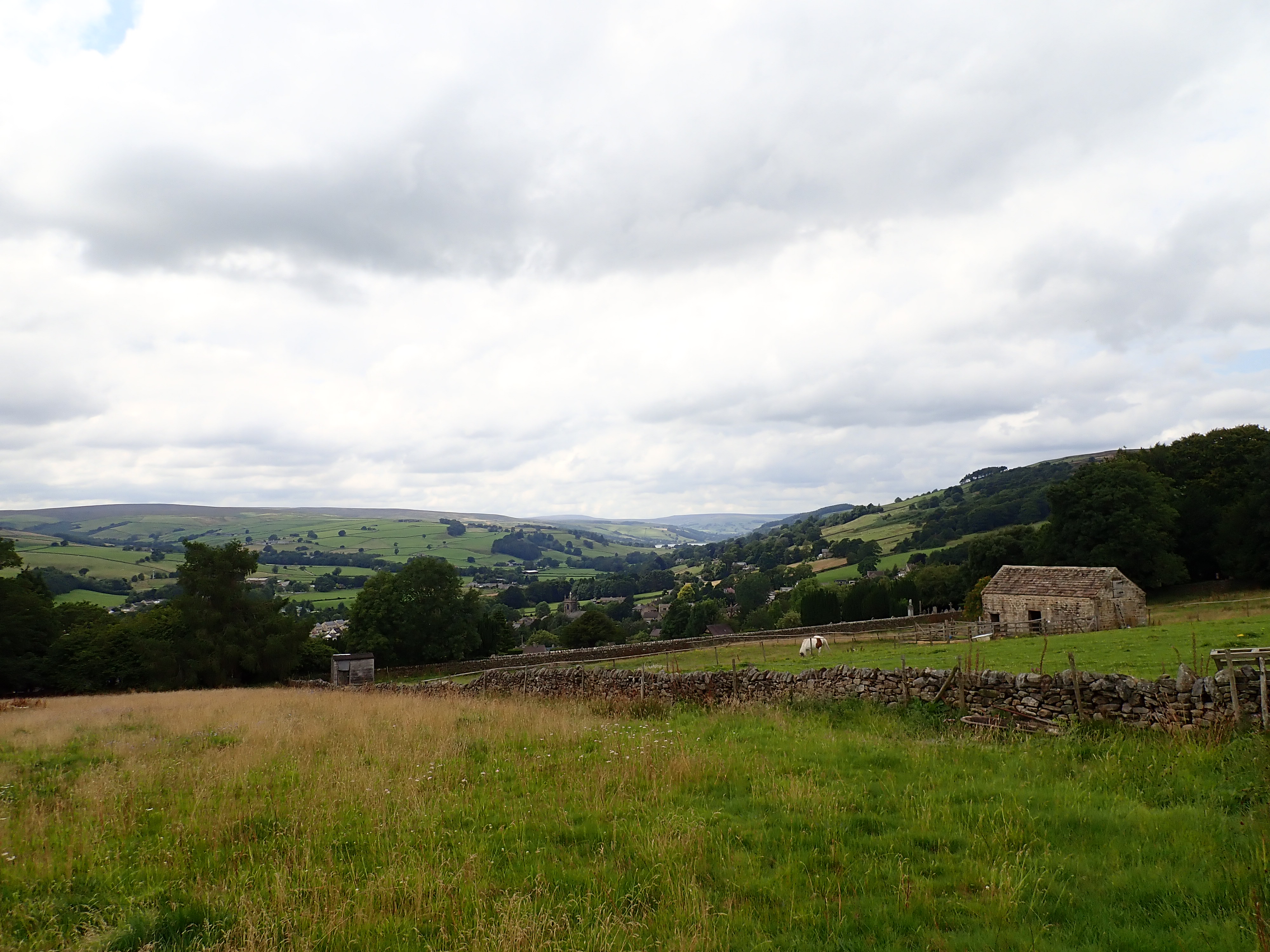
From here, I walked uphill through pastures to arrive at some houses and the start of the last part of the Nidderdale Way. This part traverses the side of the dale by paths, tracks, and some sections of road. It has great views of Guisecliff, where I was on stage four of the walk, and across the dale. I passed attractive cottages and a llama trekking centre, before arriving at one end of the Panorama Walk.
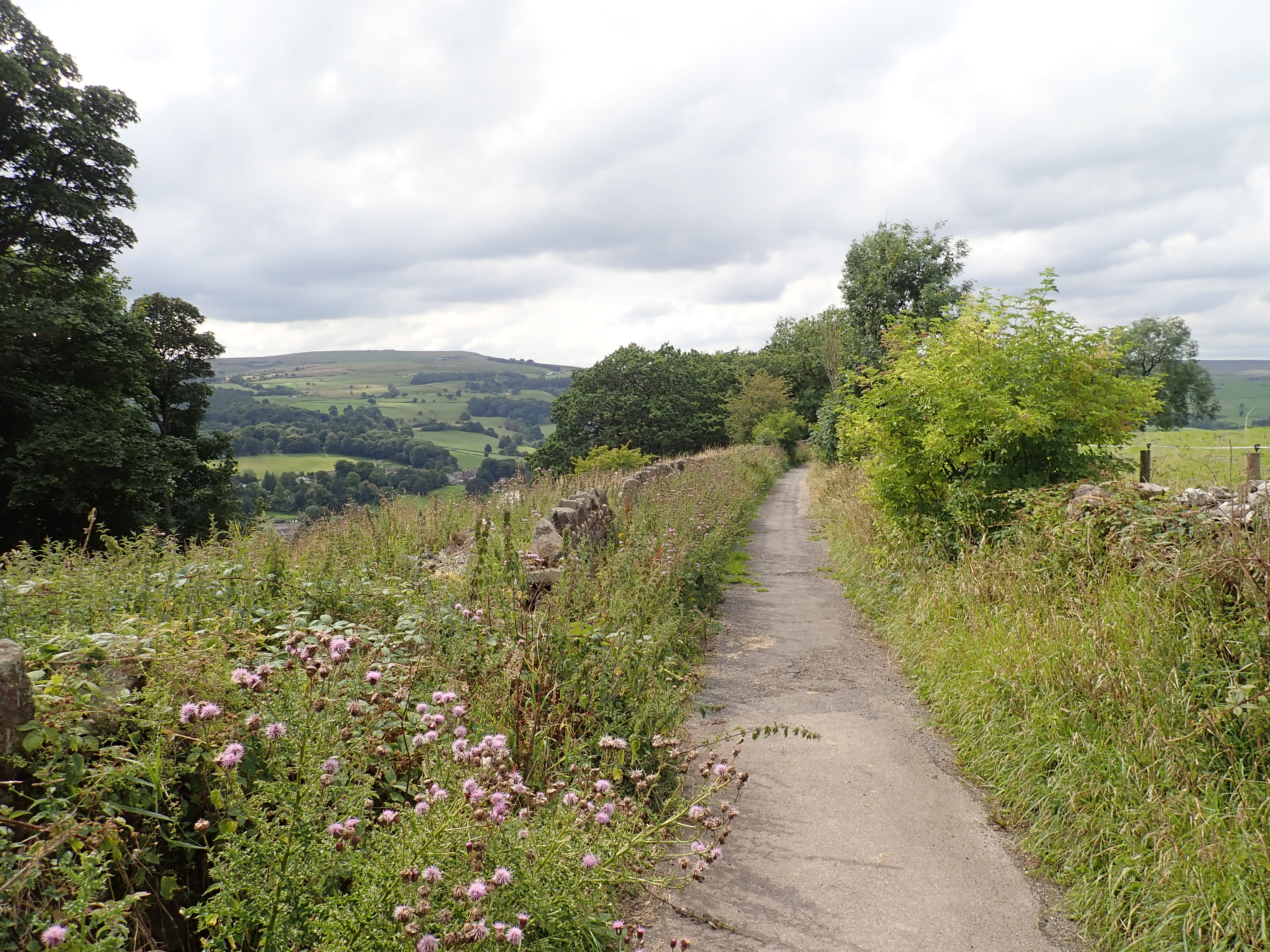
The Panorama Walk was originally called Nooking or Knott Lane and was part of a medieval packhorse route that connected Pateley Bridge to Ripon, Fountains Abbey and elsewhere. It was renamed in 1887. In the same year, the viewing point part way along it known as The Rock or Pulpit Rock was surfaced, and had railings and benches installed. These improvements were made as part of the celebration of Queen Victoria’s Golden Jubilee, and to attract tourists to Pateley Bridge. Both the Panorama Walk and The Rock have great views of Nidderdale, including Guisecliff and Yorke’s Folly.
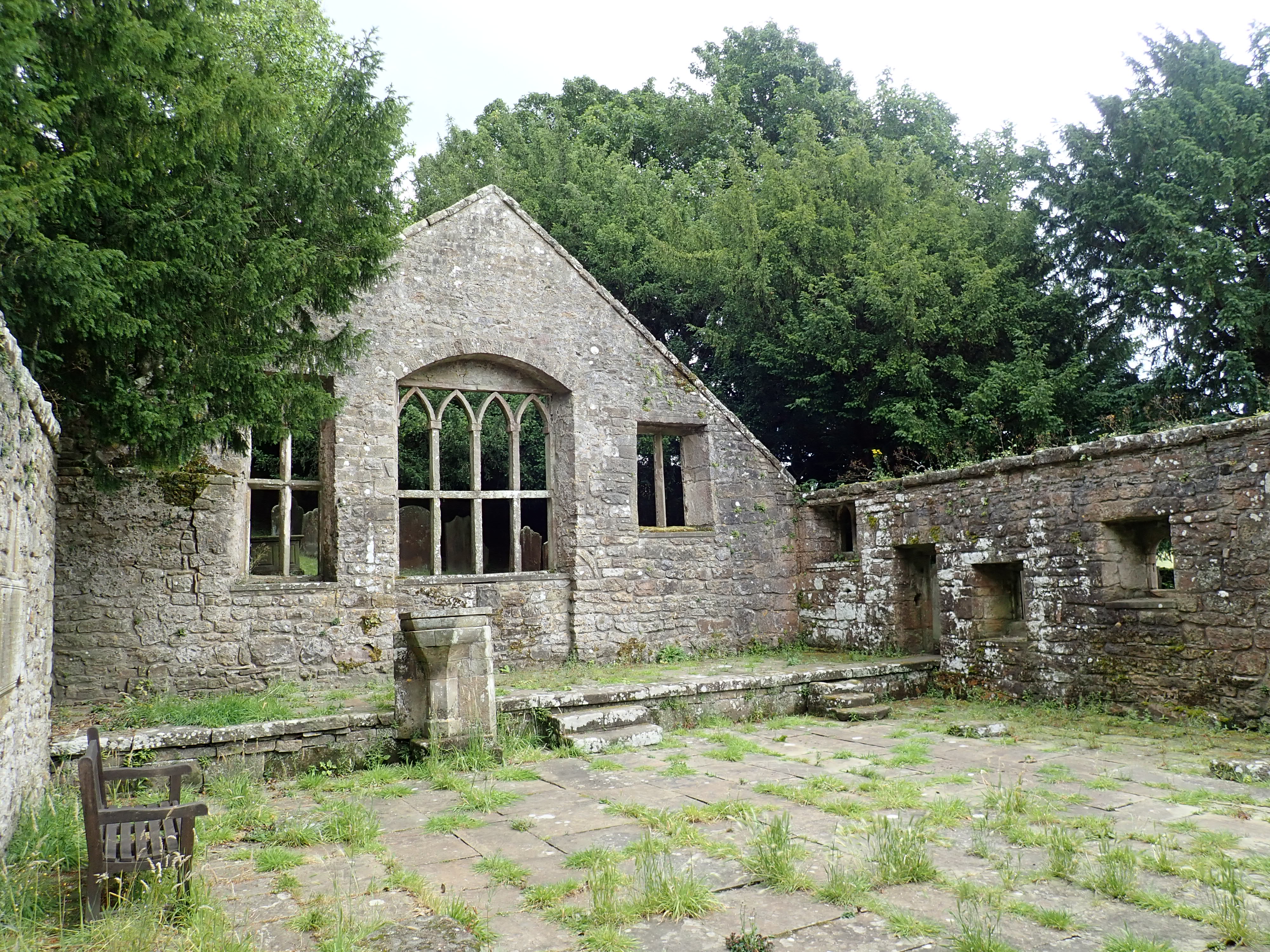
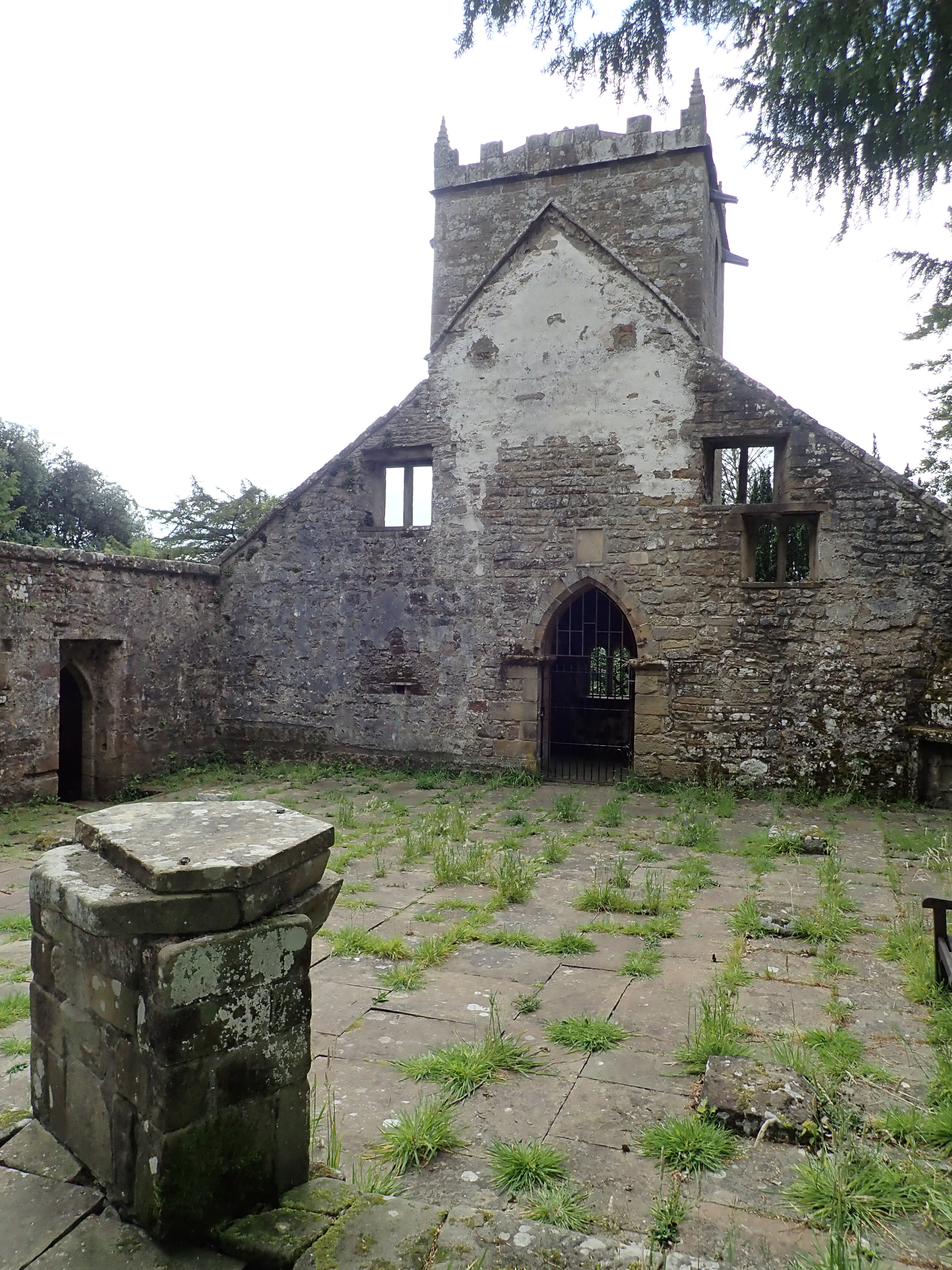
Walking along the Panorama Walk was a pleasing way to come to the end of the Nidderdale Way. But before finishing, I decided to take a detour across a meadow to see the atmospheric ruins of the Church of St Mary the Virgin.
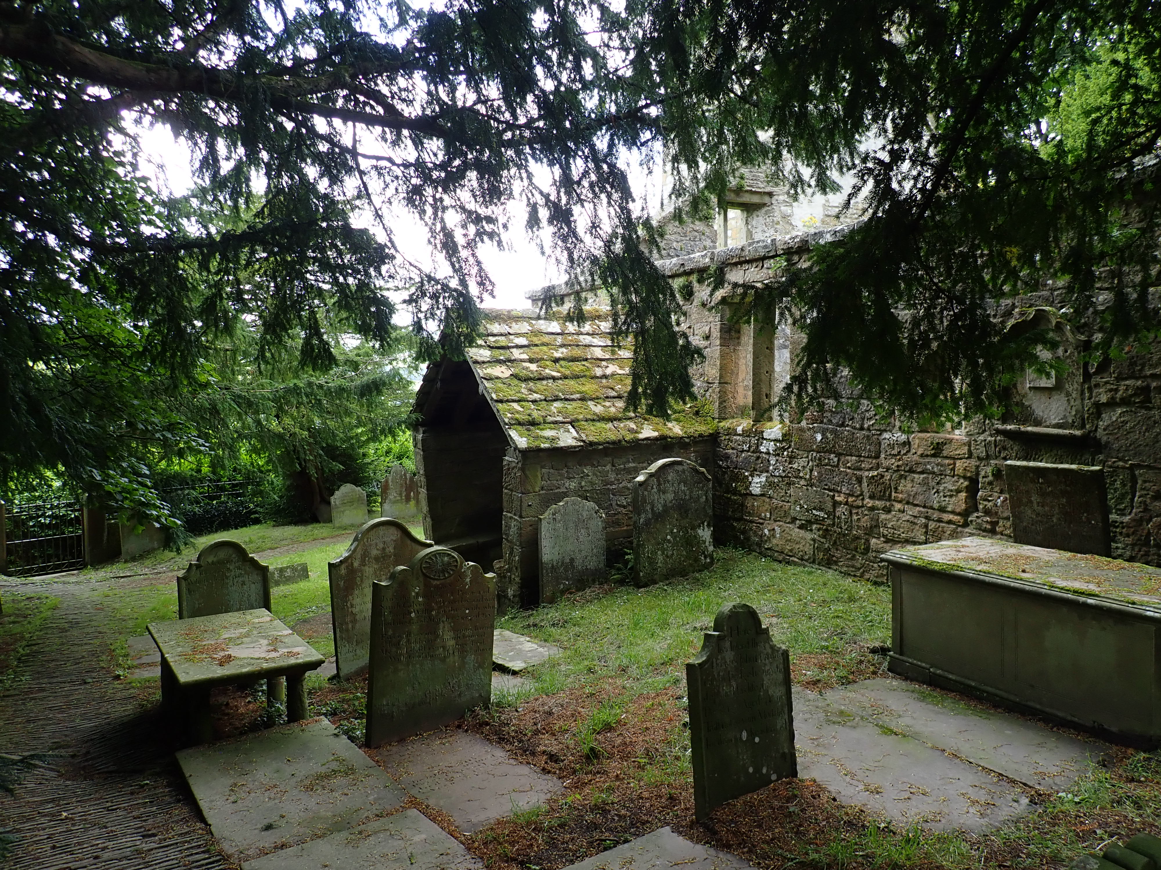
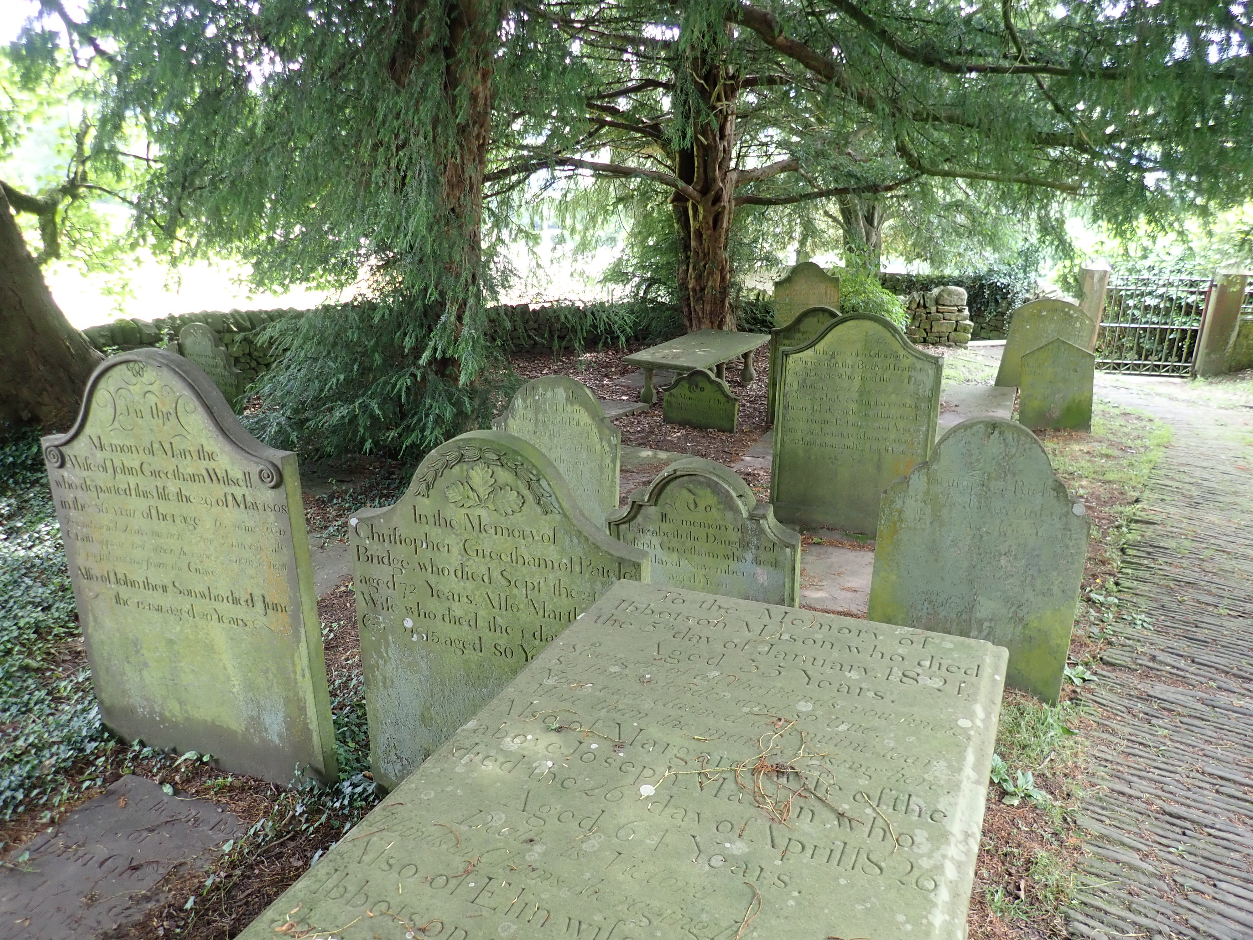
St Mary’s dates to the late 13th century but was probably built on the site of an earlier chapel. Unfortunately, the steep climb to the church, small size of the building, and the cost of repairing the church led to St Mary’s being closed in 1826. Its roof materials were sold to pay for a new, larger church located more centrally in the town. Although some of the roof was kept so a small area could be used as a burial chapel, this was demolished in 1880. What remains are the walls and tower of the church, and a churchyard of old gravestones shaded by yew trees. It’s an amazing and peaceful place.
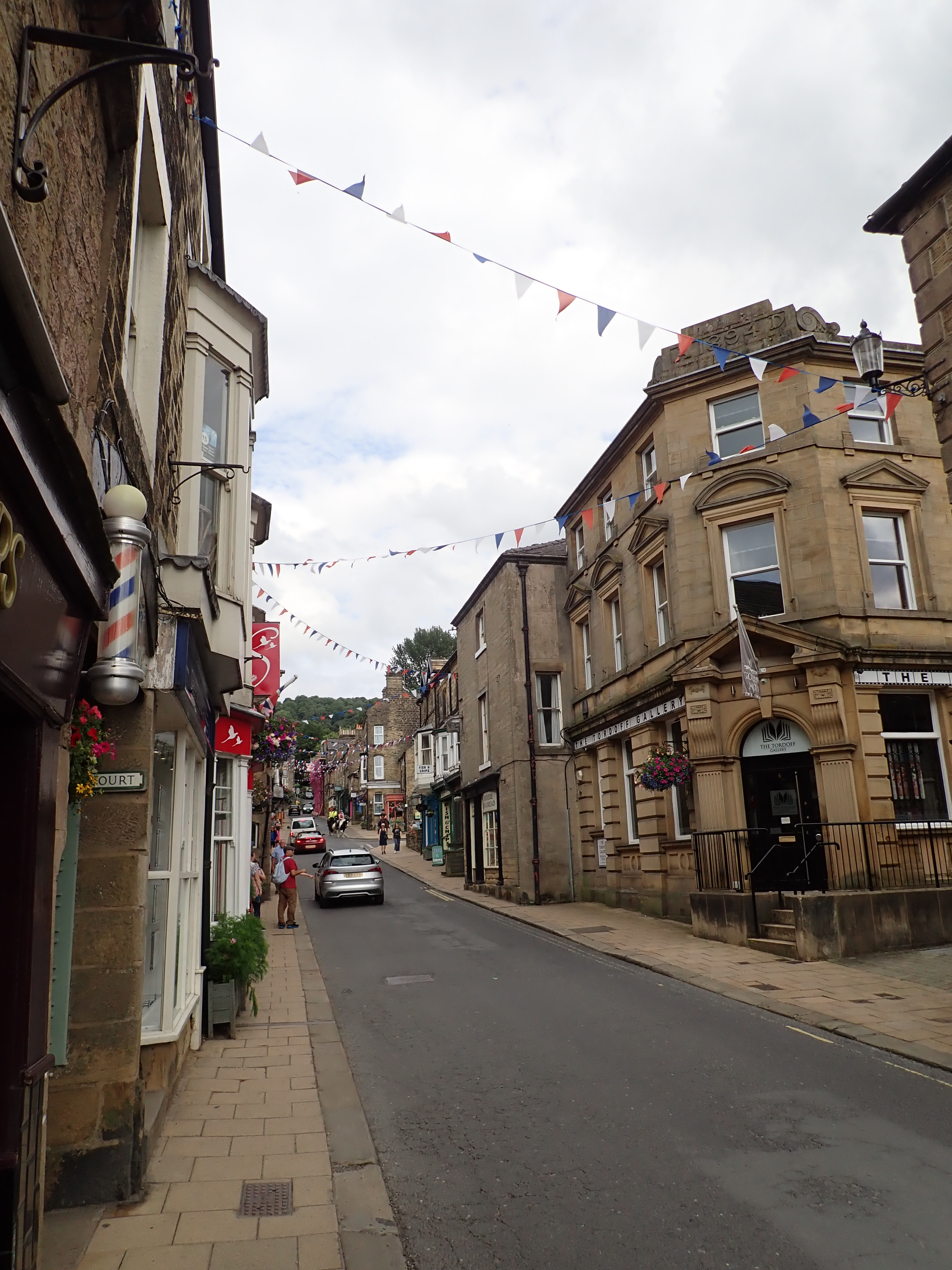
I looked around St Mary’s Church for a while, and then headed back to the Panorama Walk for the final stretch to Pateley Bridge High Street. I walked down the High Street to the bridge over the River Nidd, and the point where I had started the Nidderdale Way several weeks ago. It felt satisfying to have completed the walk and to have seen so much of a fascinating and pretty dale.

I remember bilberrying with my mother extensively in amongst Brimham Rocks and some woman pulling her child away and telling it not to eat ‘dangerous’ berries!
That’s funny. I suppose the general message the woman was giving her child was right. It’s just the specific application of that message that was wrong. It’s a little odd too – did she really think that a mother would be out picking poisonous berries with her child?
I agree kids need to be warned about berries/fungi etc. in general but we had to laugh. I wasn’t a kid exactly – it was post-Army days for me but I used to go about with my mother a lot in the outdoors. She was a great walker back then.
Have enjoyed your trip along the Nidderdale Way, makes me want to do it again to see the interesting places I seem to have missed.
Strange that there are no climbers visible on your photos of Brimham Rocks, used to be a very popular climbing venue.
Thanks. I’m pleased that you enjoyed it.
It’s possible that there were some climbers along the edges, on the Cubic Block, or otherwise tucked away. With it being the school holidays, Brimham Rocks was very busy with families and I guess that some climbers might have chosen to climb away from the central part of Brimham or go somewhere else entirely for that reason. I did pass a group of boulderers walking towards the car park as I headed away from Brimham Rocks – they might have been climbing down at Little Brimham.