
This was a walk that was not long in distance, but was full of the rich history of Nidderdale. The historic sights included a disused tramway, an abandoned quarry, a former railway line, and a unique, pentagon-shaped chapel. It was a varied and interesting route through a beautiful dale.
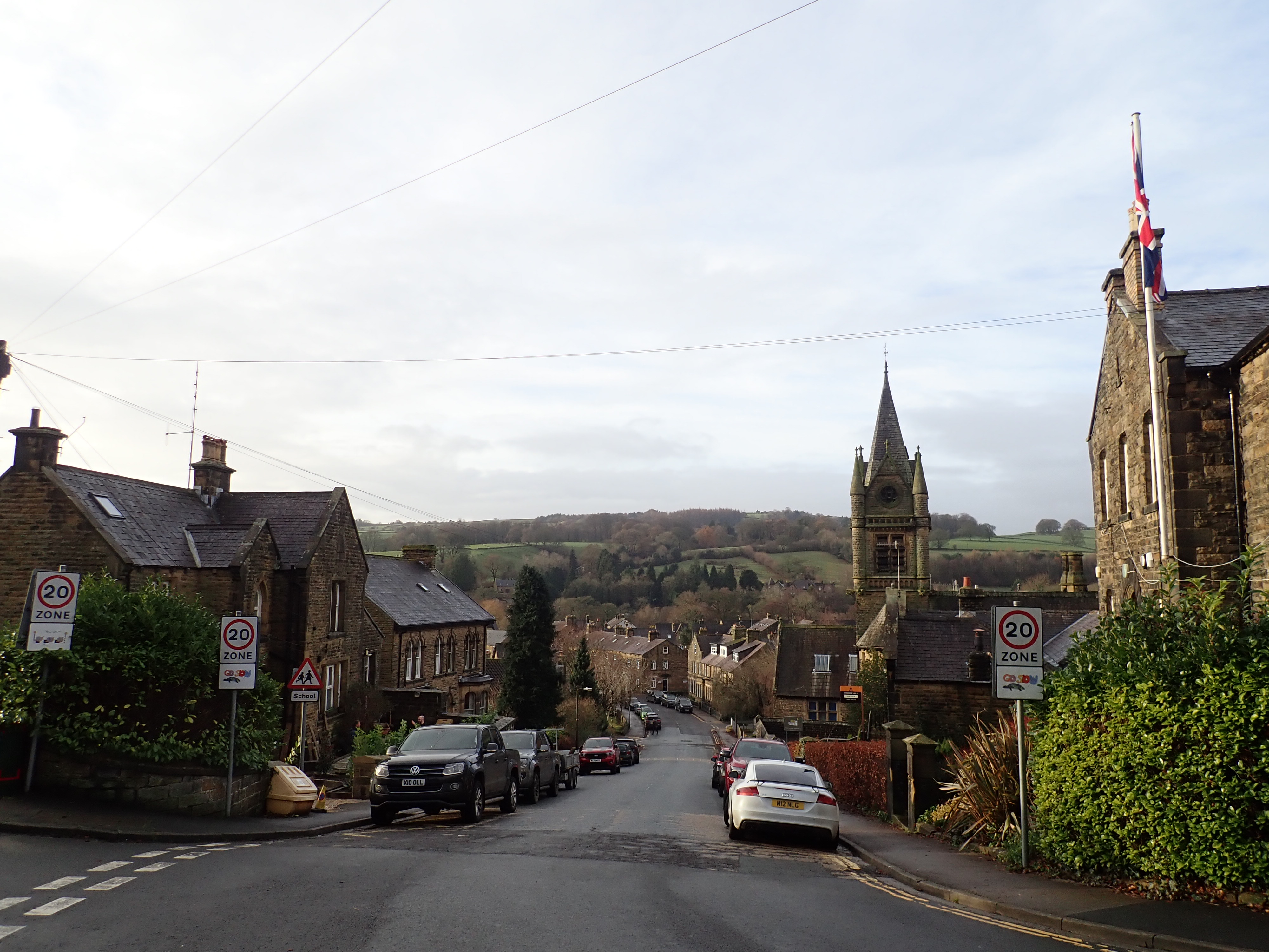
My wife and I started this walk in Pateley Bridge, roughly in the centre of Nidderdale. The walk encompasses a wealth of history within a short distance as it winds through this market town. It goes up the steep Pateley Bridge High Street, before taking a left just after The Oldest Sweet Shop in the World (est. 1827). As the walk then heads along the narrow Church Road, it passes the Pateley Bridge Playhouse (in a former Methodist Chapel), Odd Fellows Hall, St Cuthbert’s Church, and Nidderdale Museum (which is housed in what was the workhouse in Victorian times). From there, the walk went past houses until it felt like we were stepping out of Pateley Bridge. The houses ended abruptly at a grassy incline, flanked by drystone walls, that ran up the hill. We crossed this by a bridge, and then clambered over a stone stile, to set off up the incline.
This incline leads to the remains of Scot Gate Ash Quarry (AKA Scotgate Ash Quarry) on the slopes of the moor to the north of Pateley Bridge. This quarry has a history that runs from the 14th Century to its closure in 1915. It was a source of Delph Stone, a particular strong type of gritstone, and this strength made it ideal for uses where the stone would encounter a lot of wear. These included steps in public buildings, and as an edging stone in railway platforms, dockyards, and harbours. Delphstone from Scot Gate Ash Quarry was used in the platforms of Scarborough, York, Holyhead, London Victoria, and London Paddington stations. It was also used in the National Gallery in London and the Station Hotel in York.

In 1872, a standard gauge, inclined tramway was built to take the Delph Stone from the quarry to the goods sidings at Pateley Bridge railway station. A spur from this tramway also took stone to the Nidd Valley Light Railway, which would then carry it further up the dale to be used in the construction of Scar House reservoir. The tramway was operated by steel cables via a wheelhouse at the quarry. The weight of the loaded trucks descending the hill was used to assist in bringing the unladen trucks back up.

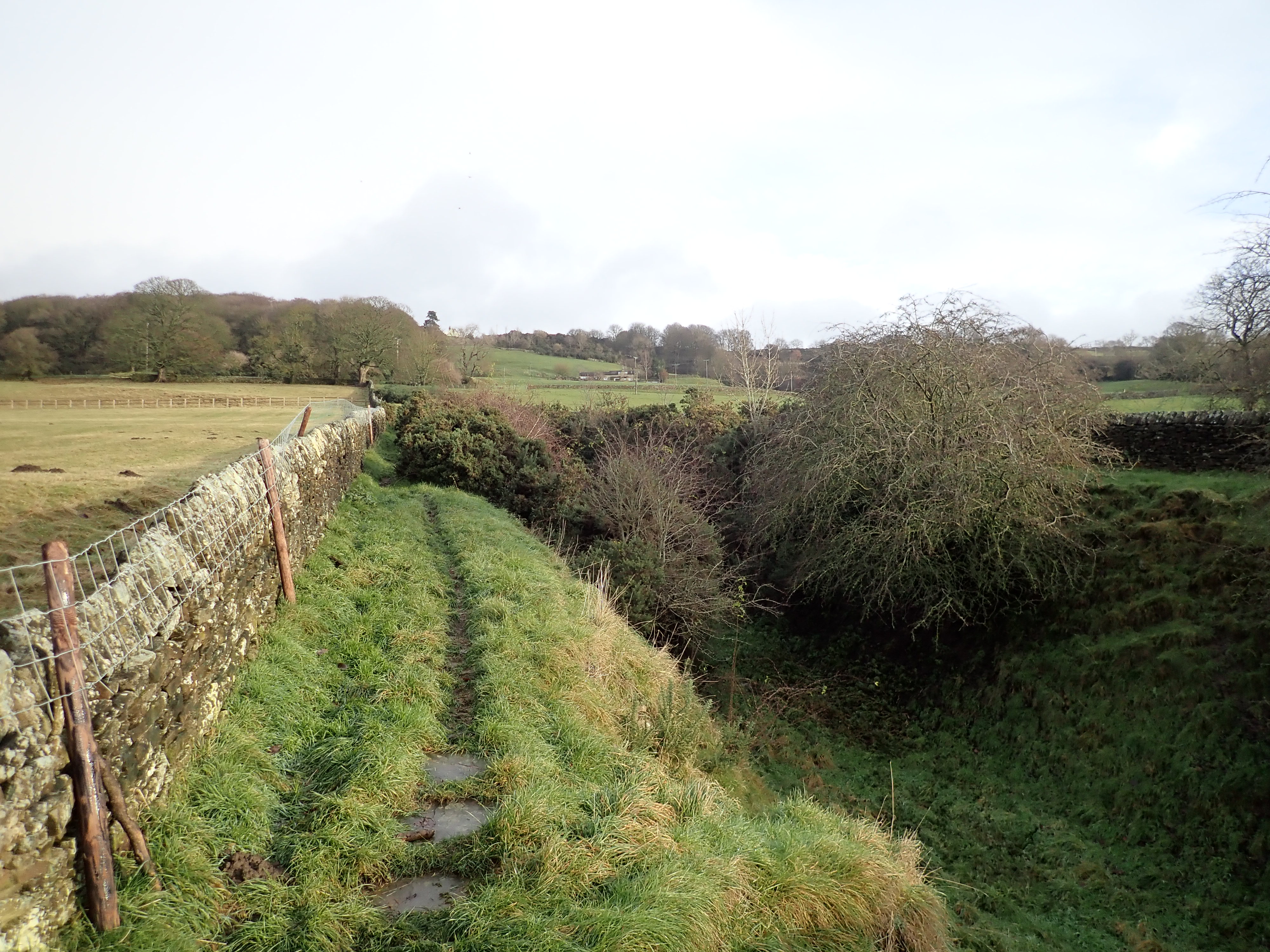
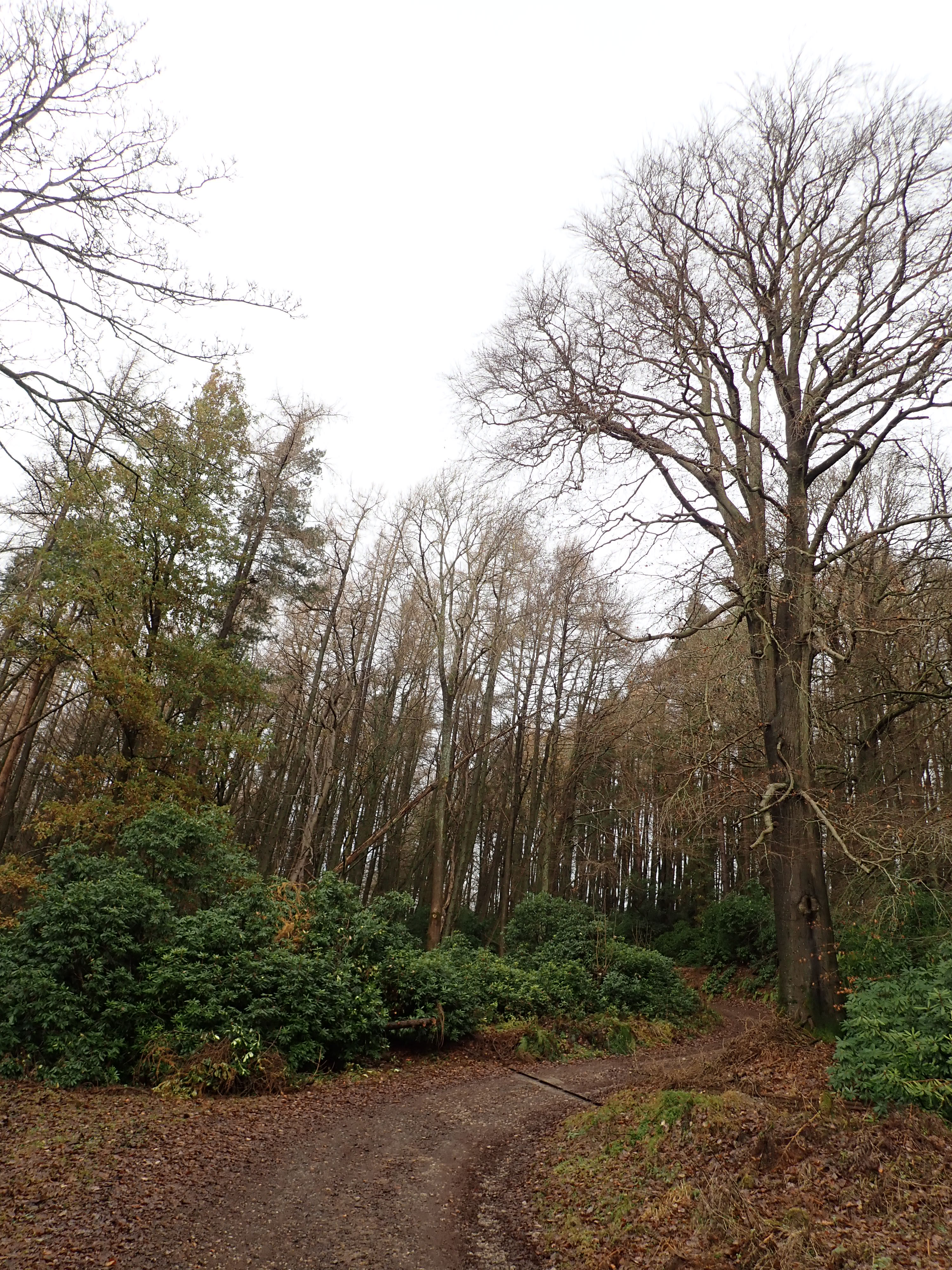
The clear line in the landscape made by the tramway’s incline is its most visible remnant. This incline was (unsurprisingly) a steep and direct way up the hill. The first section of the path goes along the top of the cutting for the incline, and involved our trying to squeeze past several vicious, encroaching gorse bushes. As the incline rose into an embankment, it approached a small wood, and we started getting good views of Pateley Bridge. The incline became steeper as it neared the top, and then ended abruptly at the edge of the remains of the quarry. Despite being a bit of an effort, the incline was an interesting way to climb the hill.

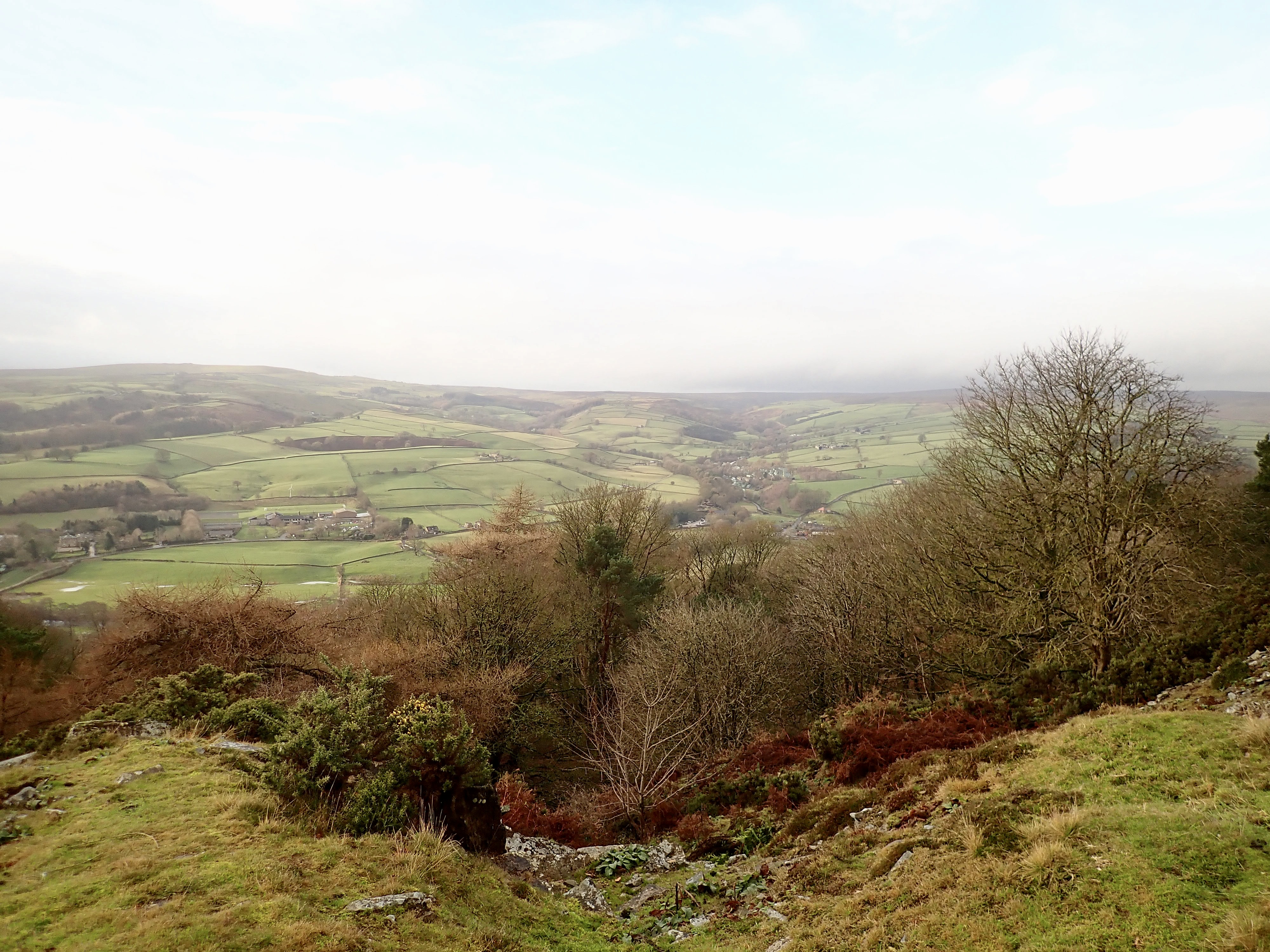
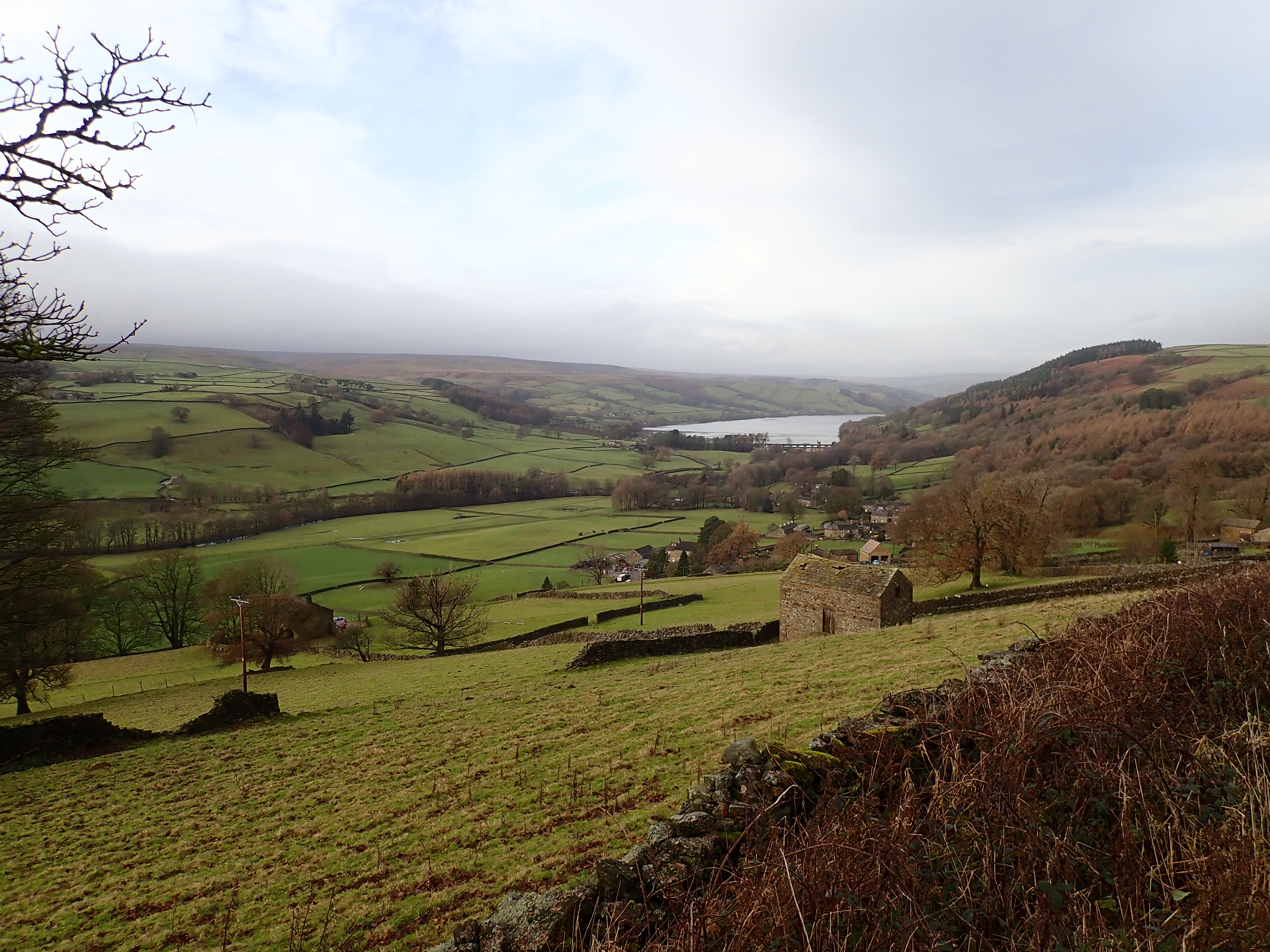
A little way back from the incline were the ruins of the tramway’s wheelhouse. Unfortunately, all that was left were a few sections of broken stone wall and rusted metal poles. Around this, the quarrying had taken large chunks out of the hill to form an area of flat ground and, behind this, broken steps and corners of rock and earth. Around the quarry’s downhill edge was a field of overgrown spoil heaps. We followed an interesting path through and over these mounds, with the broken-up land of the quarry on our right, and lovely views over Nidderdale on our left. After a few minutes, we left the quarry to cross a couple of fields and go onto Wath Lane.
This lane takes a slightly meandering, diagonal route across the side of the dale and down into the village of Wath. The views across Nidderdale and to Gouthwaite Reservoir from Wath Lane are fantastic. They are probably the reason for the surprisingly large number of benches along this quiet road.

The lane goes past a small group of cottages at the brilliantly named Pie Gill Green before entering the small village of Wath. Wath is Old Norse for ford, and the village probably takes its name from the nearby bridge over the River Nidd.
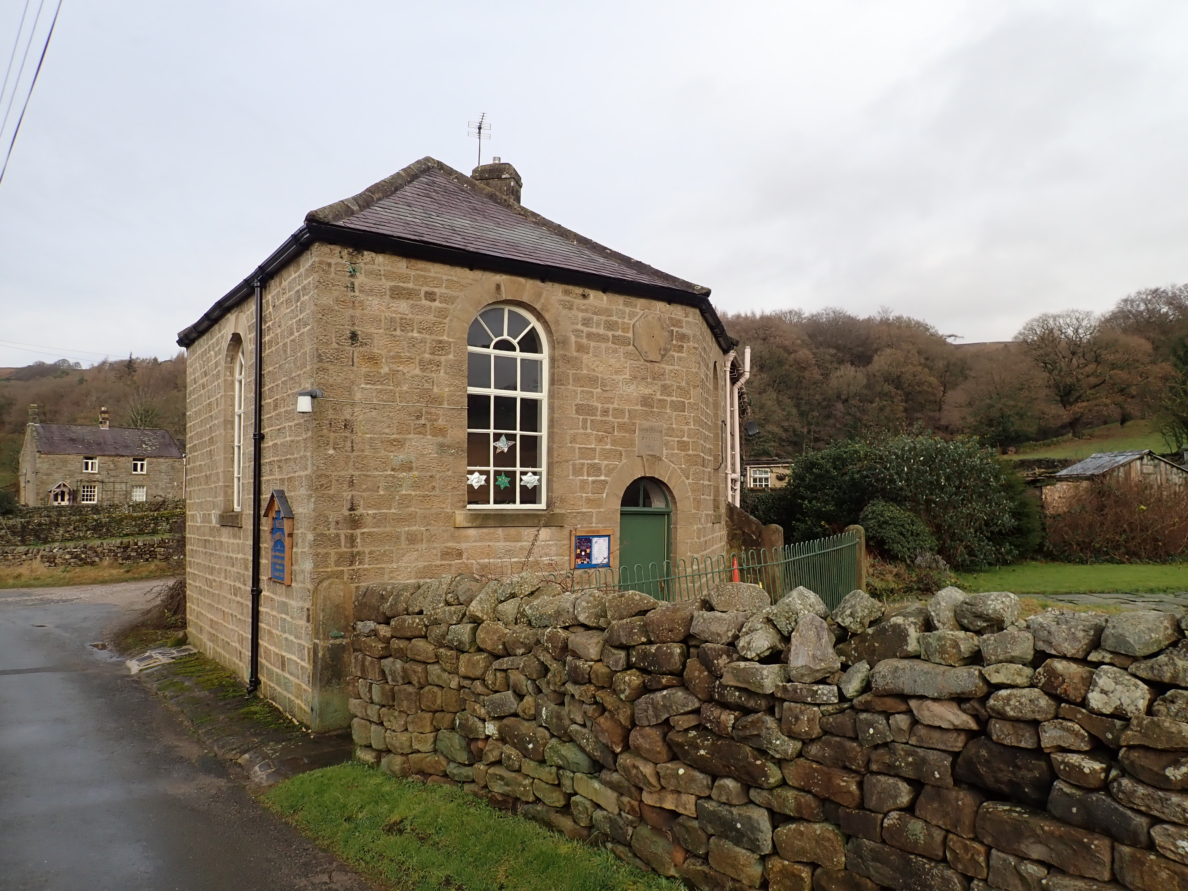
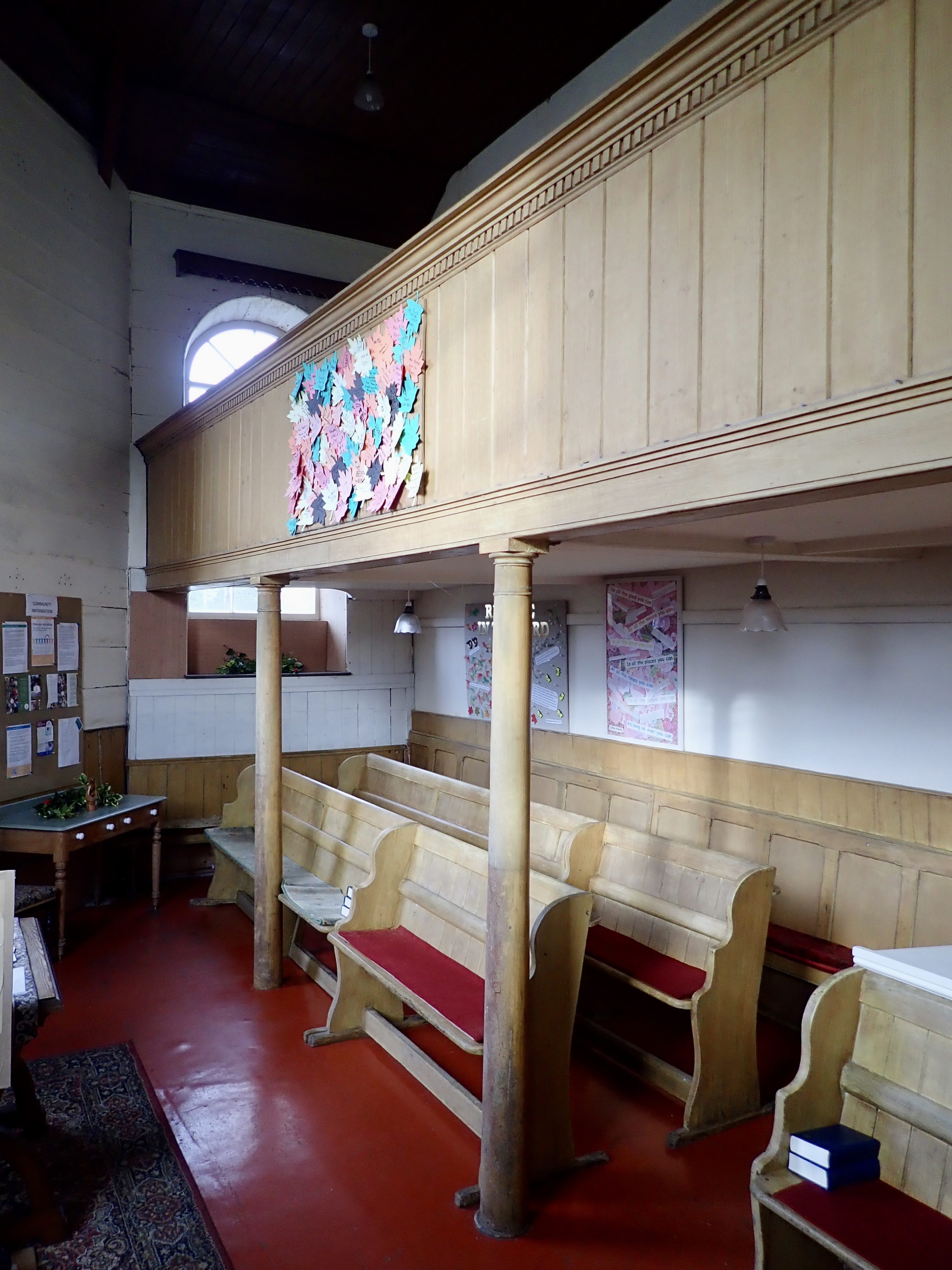
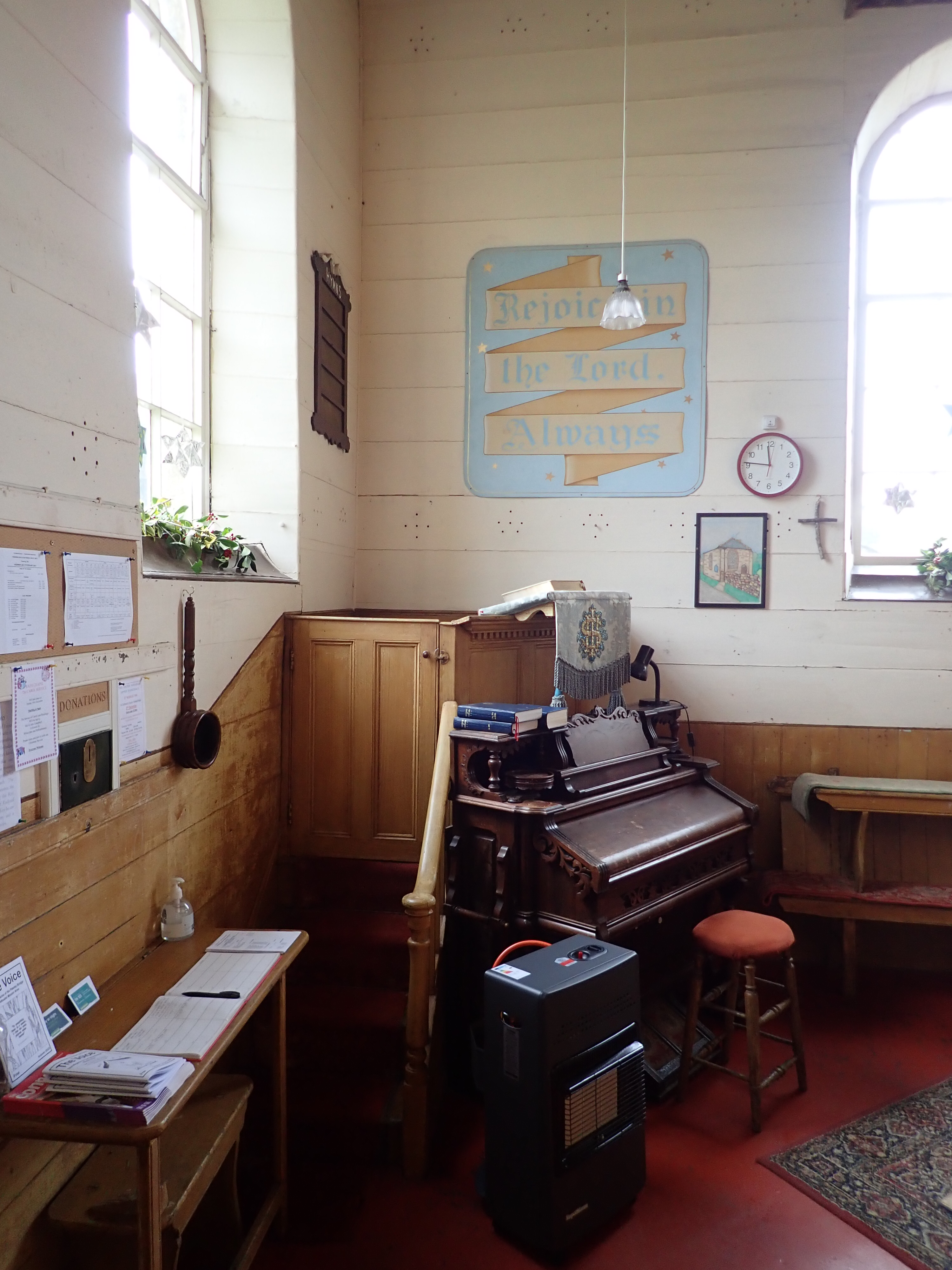
We stopped for a few minutes to visit Wath Chapel. This is a good example of how having to work within certain constraints can lead people to produce something unique and wonderful. To fit onto the land which had been given for its construction, Wath Chapel is small, with five unequal sides, and sits at the end of a terrace of cottages. Inside, its double-height single room has a pulpit and a miniature organ in one corner, facing this are three rows of closely set pews and another set of pews on a wooden balcony immediately overhead. This ingenious arrangement allows the chapel to seat over 100 worshippers.
After leaving the chapel, we continued through Wath until we turned off the lane to walk past a row of cottages and into Spring Wood. A curving track took us through this lovely wood before coming to small fields on the side of the hill. At the point where we entered the wood again, we passed the collection of tightly packed stone buildings that comprise the derelict Spring Wood Top farm.
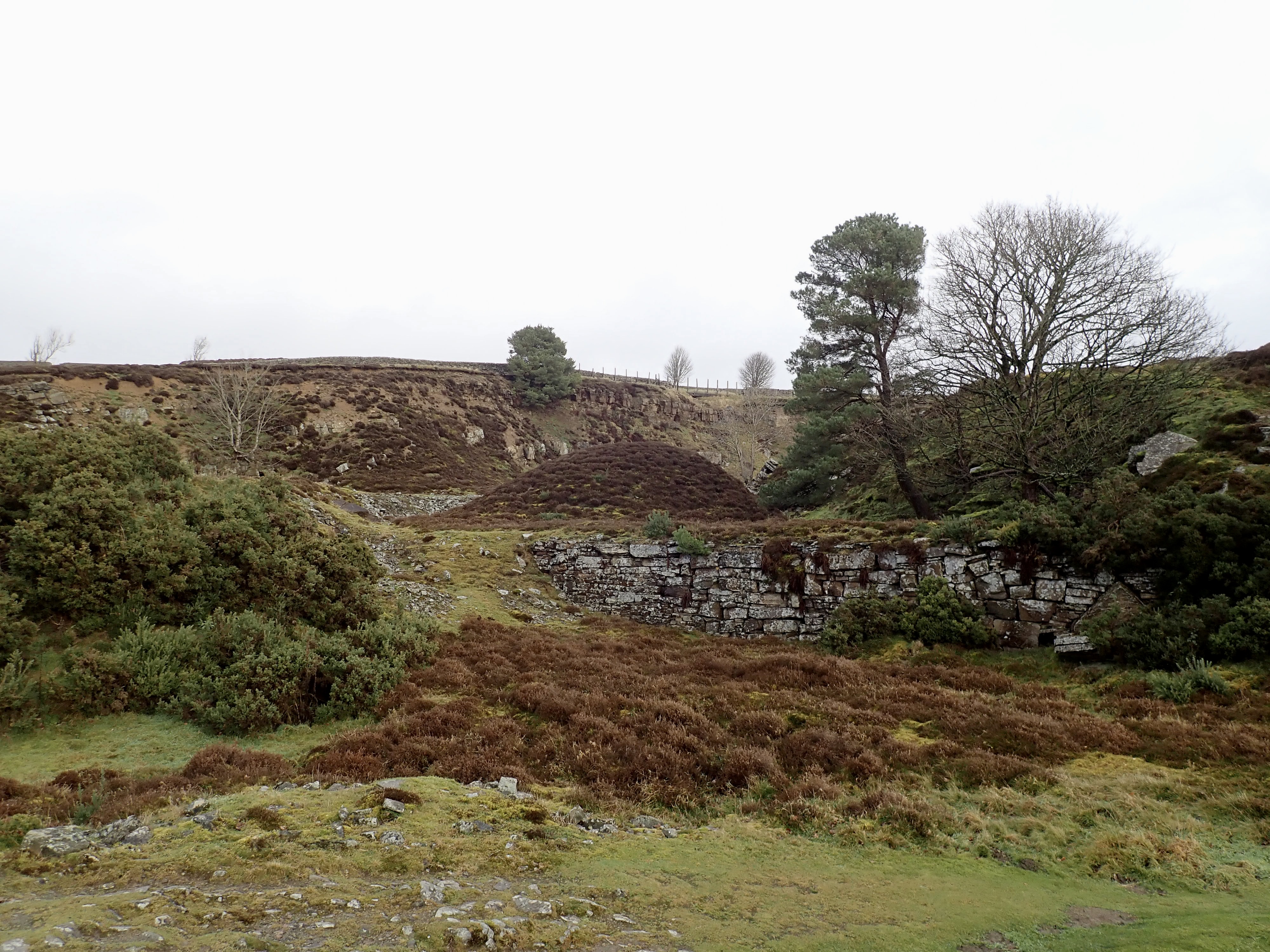
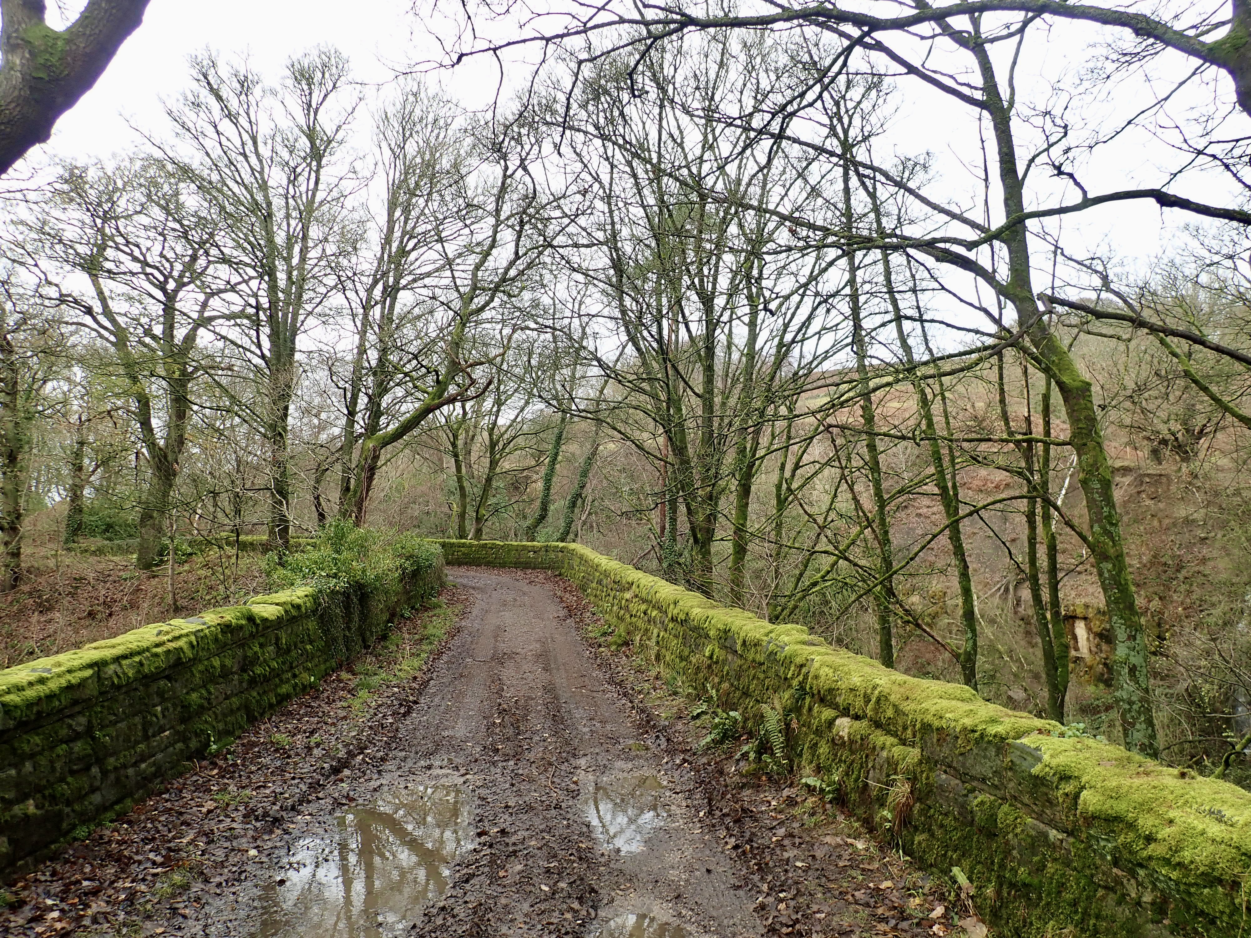
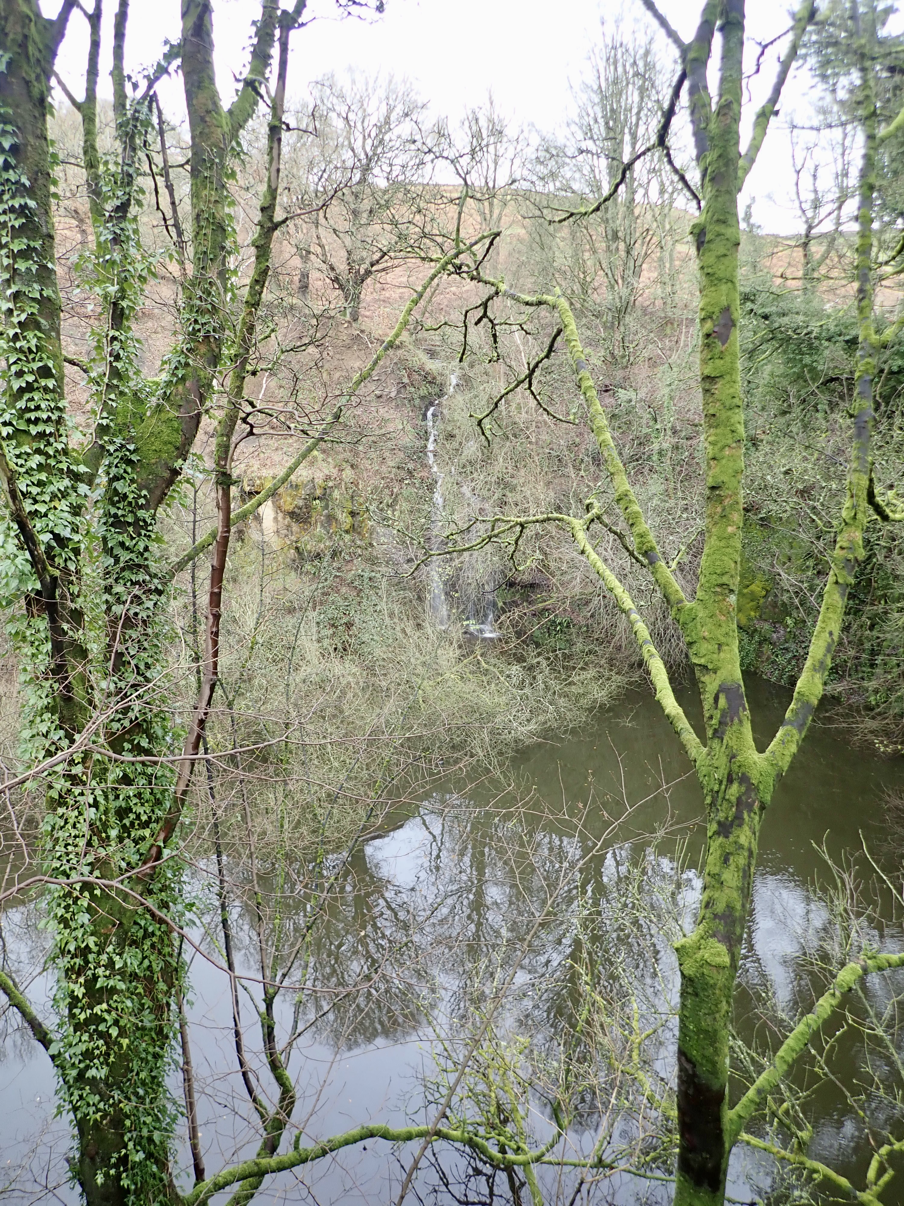
Just beyond the farm we went by the remains of Wood Top Quarry. This quarry was a source of stone used in the building of Gouthwaite Reservoir less than half a kilometre away as the crow flies. The extraction of this stone left a giant hole in the hill that is full of water and split by a ravine on the downhill side. A waterfall tumbling down one corner of the quarry feeds this large pond, and this is in turn fed by springs on the moor above. The trees that surround this hole were bare of leaves, but green with ivy, moss, and lichen. The track went over the ravine by an impressive, curved stone bridge that I guessed might have been connected with the building of the reservoir.
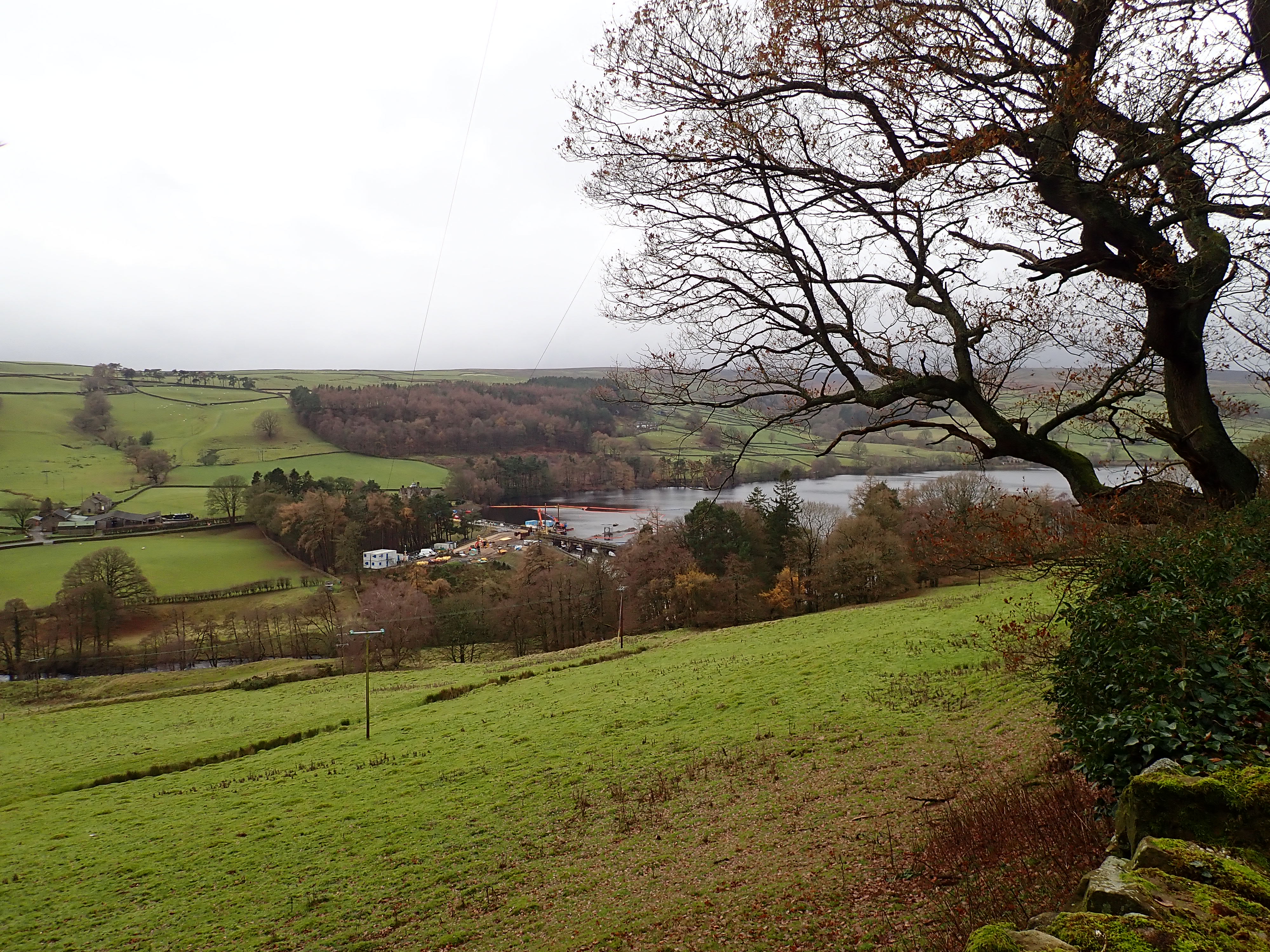
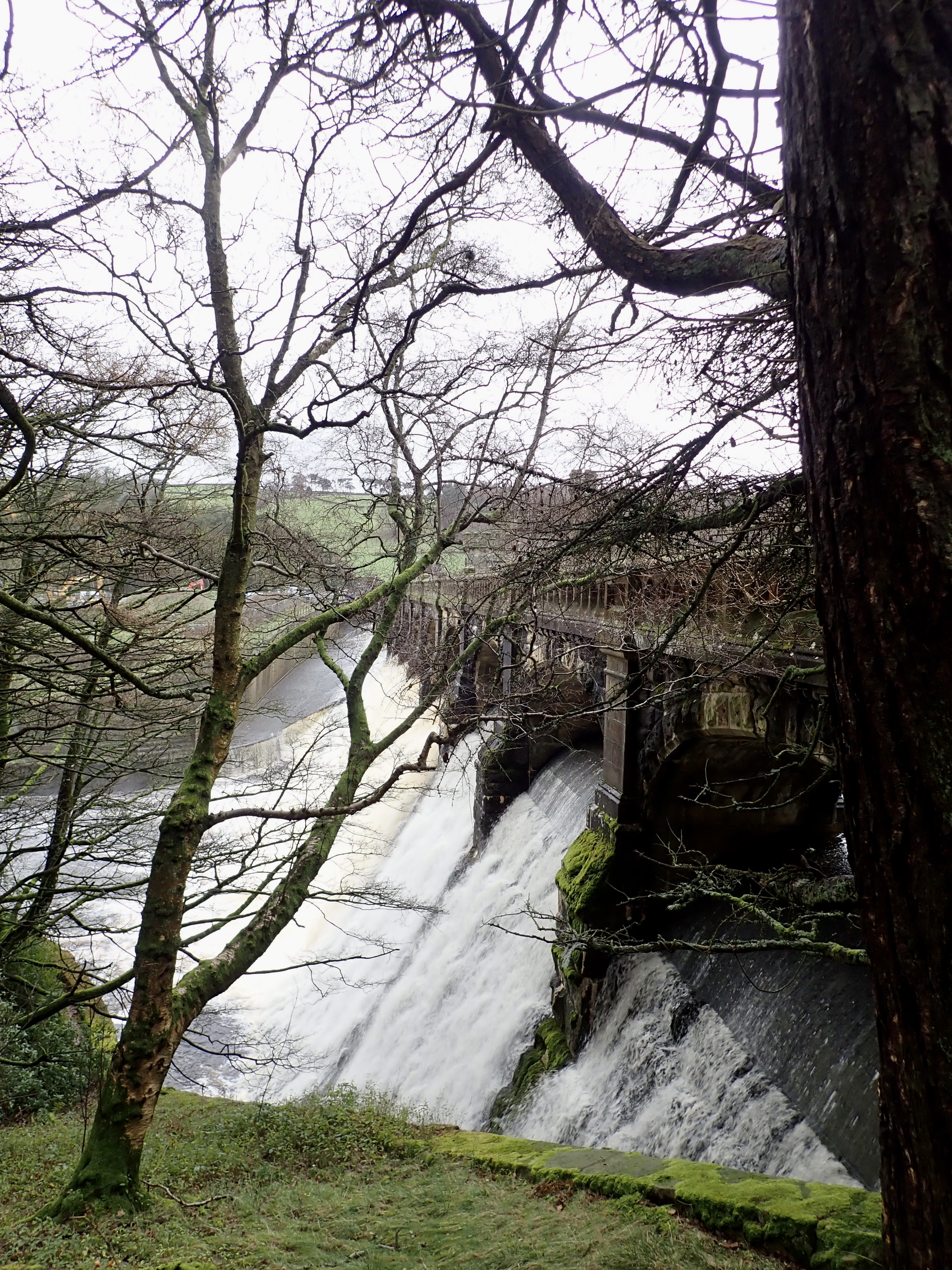
It was about here that we started to hear the roar of water coming from Gouthwaite Dam. This came into view as we moved out of the woods, as well as major building work being done around it. We continued down the dale along a wall-lined lane until, we took a sharp left to head downhill to the dam. I was familiar with this section of the walk because from here to Pateley Bridge it took the route of the Nidderdale Way, which I had walked earlier in the year.

Just as we reached the dam, we crossed the grassy trackbed of the dismantled Nidd Valley Light Railway. This was opened in 1907 to transport people and materials up Nidderdale for the building of the dams of Scar House reservoir. It closed in 1936 when the reservoirs were finished. From where we stood, the railway would have run down the dale to a station at Wath (now a home) and along to its terminus in Pateley Bridge. In the other direction, it followed the shore of the reservoir before crossing to the other side of the dale to head up to Scar House. The blog of the National Railway Museum has some great old photos of the Nidd Valley Light Railway when it was in use, including of the sections we followed on this walk.
We went past the top of Gouthwaite Reservoir and through a gate to walk downstream. The reservoir was constructed between 1893 and 1901 as a compensation reservoir, which means that its role is to maintain the steady flow of the River Nidd in periods of dry or wet weather.
As we moved further downstream, we had a stunning view of the fantastic amount of water that was thundering over the dam. Only a relatively gentle stream of water had been going through the central arch of the dam when I was last here in June. Now water was cascading through every archway and down the modern spillway to the side of the dam.
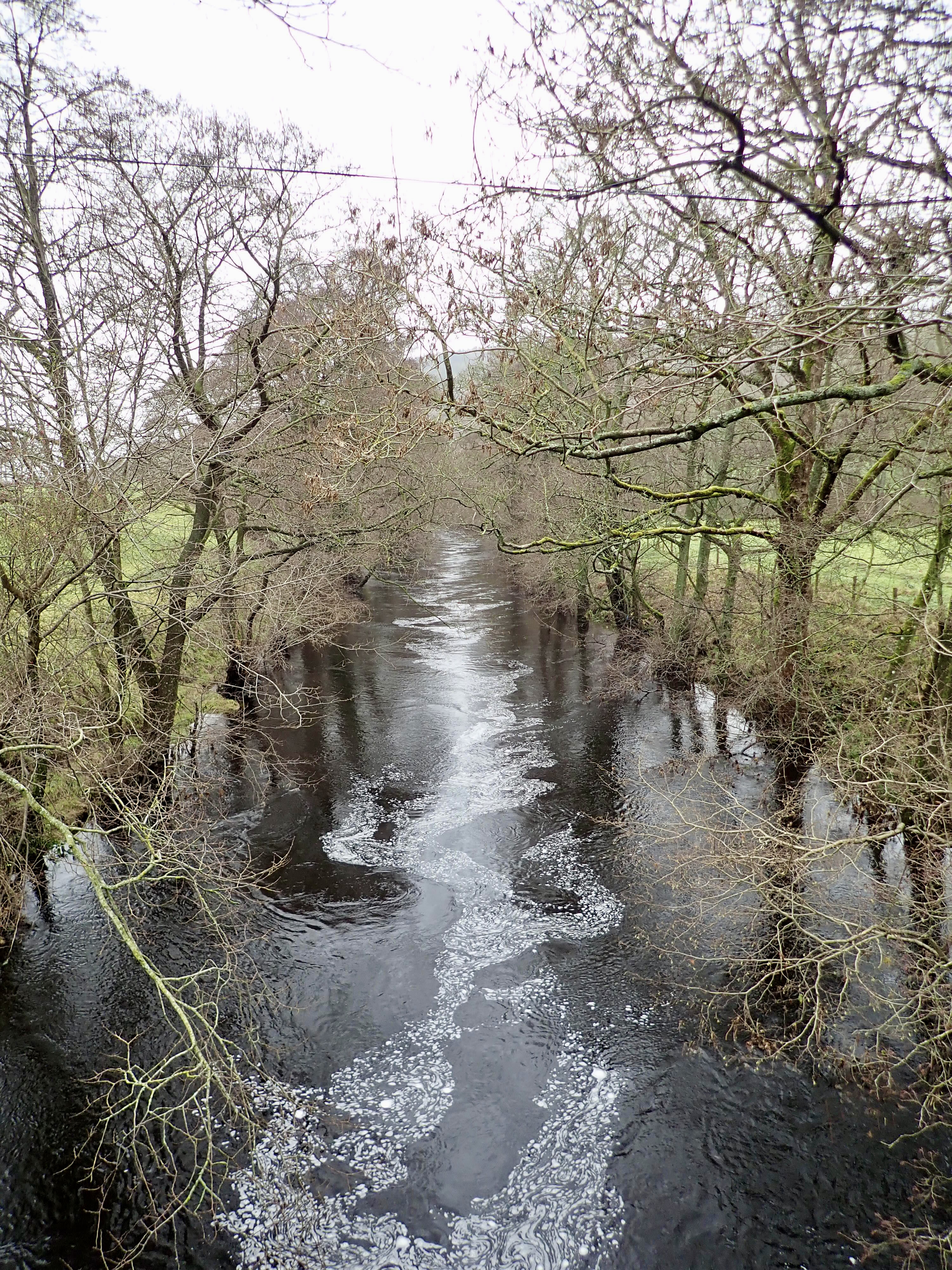
We then squelched through meadows until we reached Wath Bridge. I took a little detour to the rise of the bridge to look at the swollen Nidd and was delighted to see a kingfisher dart along the river. The kingfisher landed on a branch, and Valerie joined me to look at it. We both also watched the strange shapes made by a white, soapy substance as it seemed to dance down the centre of the Nidd. Although I guessed that this was probably some sort of pollution, and so wished it wasn’t in the river, I thought that how it was behaving in the water looked beautiful.
We picked up the embankment of the Nidd Valley Light Railway and walked along it through wet fields. Ducks were enjoying themselves where the fields had flooded. The path then kept close to the tree-lined Nidd, and we followed it into Pateley Bridge for a hot chocolate and a visit to the Oldest Sweet Shop in the World.


Further Information
I found this walk in the book Nidderdale & Ripon by Paul Hannon (2014), which is part of the Walking in Yorkshire Series by the publishers Hillside.

What a superb post and sounds a really great and interesting walk. I’d have liked to have seen the tramway, that chapel and also that dam in spate – that looked spectacular! Not sure I’ll be back in the Dales now though…
Thank you. I’m really pleased that you enjoyed it.
The water coming over the dam was amazing to see and surprisingly loud. I’ve never seen so much water spill over a dam.
If you’re ever up Strathfarrar Glen in Scotland, go up to the very road-end by the hydro station (not the Loch Monar road end – over the dams and round into a side glen). There’s a huge spray of water comes out of that and soaks all the area around it – I use it to get cool after hot walks!
That sounds fun and a good way to cool off. I think I might have found a few pictures of it through Google, and it’s impressive.
I don’t know when I might be up that way, but, when I am, I’ll look out for it.
There’s a photo of it on my An Riabhachan post:
Thanks. It’s good to see. Hopefully I’ll have a chance to see it in person at some point (and on a suitably hot day).
You are lucky to have Nidderdale on your doorstep. I have many happy memories of wandering its paths and bouldering its rocks. Have you been up to Jenny Twig and Sypeland crags?
No, I’ve not got around it. But they are on my to do list, and I really must get up there.