
A few weeks ago, I was puzzling over where to go for a walk. I wanted to do something new, but I’d ruled out doing several of the routes on my “to do” list of hikes in the Yorkshire Dales because I wanted to do them when the conditions were better. After looking over my maps for a while trying to decide which walk I might repeat, I realised that the most interesting option would be to bring together in one hike the highlights of a few different walks. It would be like doing a dot-to-dot puzzle of great limestone features in Wharfedale. This I could do by walking a loop that started and ended in the town of Grassington, and which took in a waterfall, a strid, a gorge, and plenty of limestone pavement.
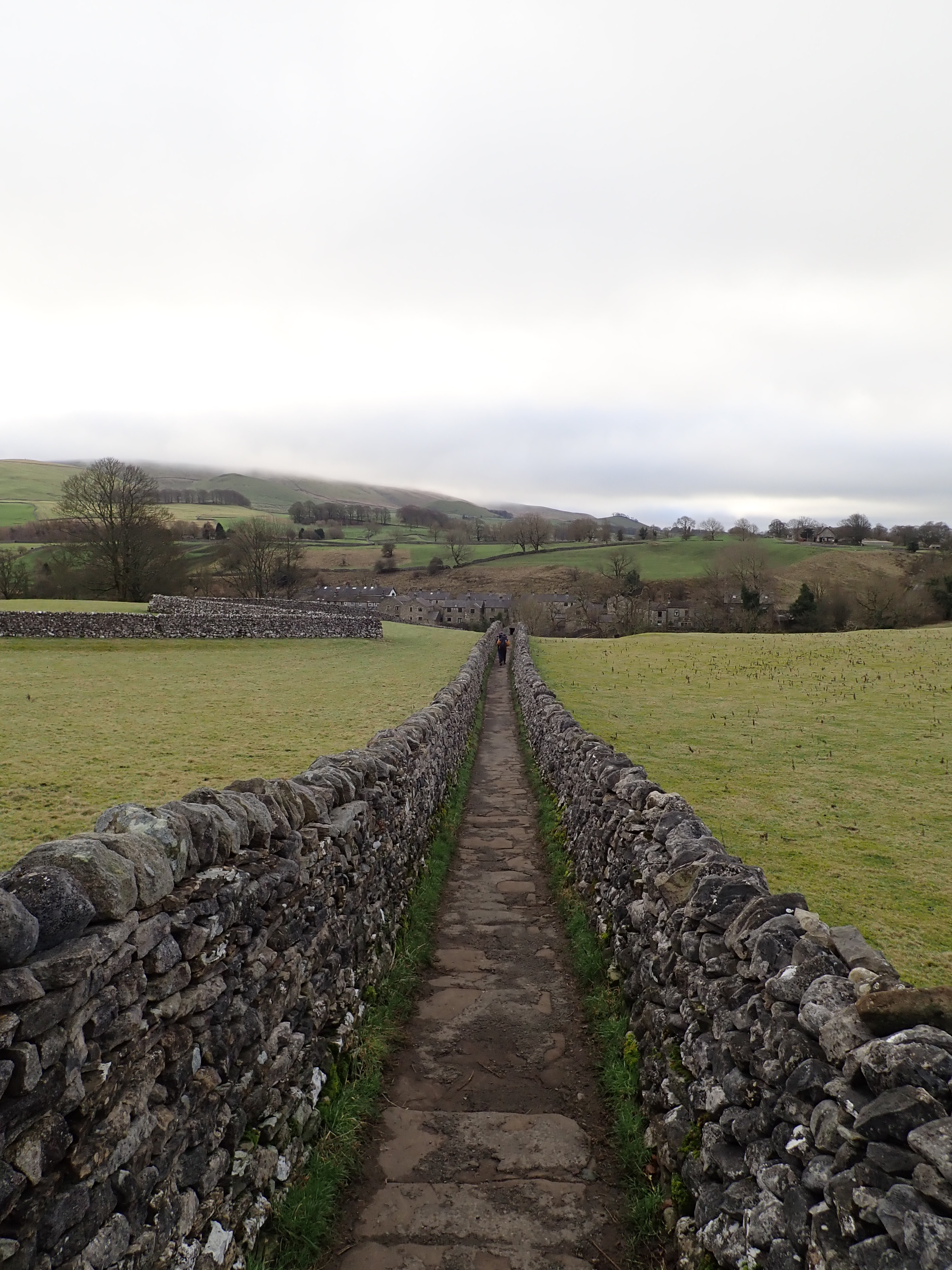
My walk started by taking a path that I’m particularly fond of. This is Sedber Lane, which runs downhill from the National Park carpark in Grassington to Linton Falls on the River Wharfe. It’s a stone-flagged path, flanked by drystone walls, that cuts through fields. I like the precision and beauty of the drystone walls, and the way that the path unequivocally leads you into the countryside. Those walls and the downhill gradient means that Sedber Lane feels like a path that I would have run down as a kid. It’s clear and purposeful, and so a good way to start on a walk.
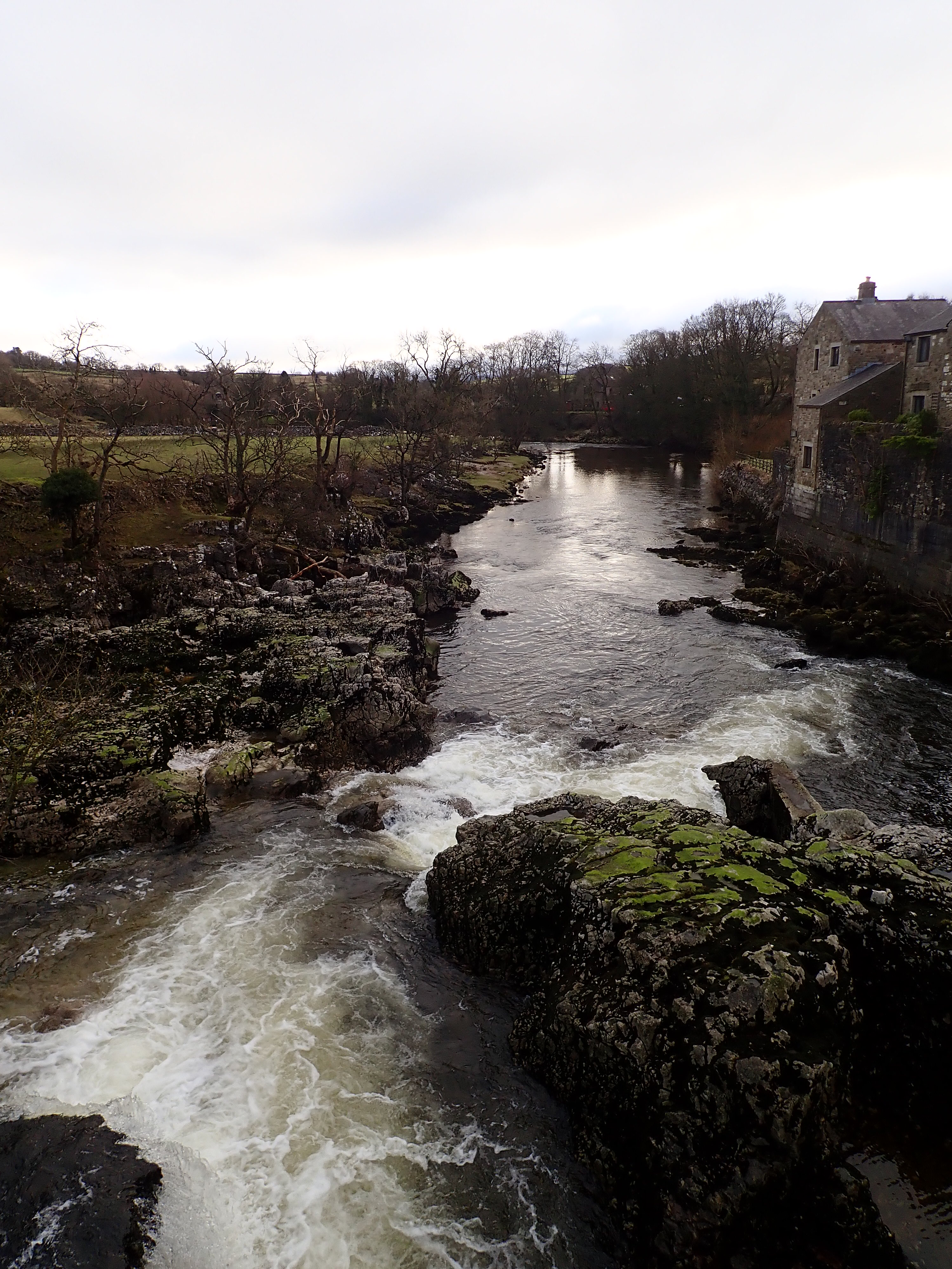
Sedber Lane leads to Tin Bridge – a footbridge over the River Wharfe that connects Grassington to the village of Linton. There are great views from Tin Bridge. On one side are the white water and rock steps of Linton Falls. On the other side is the attractive sweep of the lower Linton Falls weir. The two weirs over this section of the Wharfe were built for a textile mill, which is now demolished.
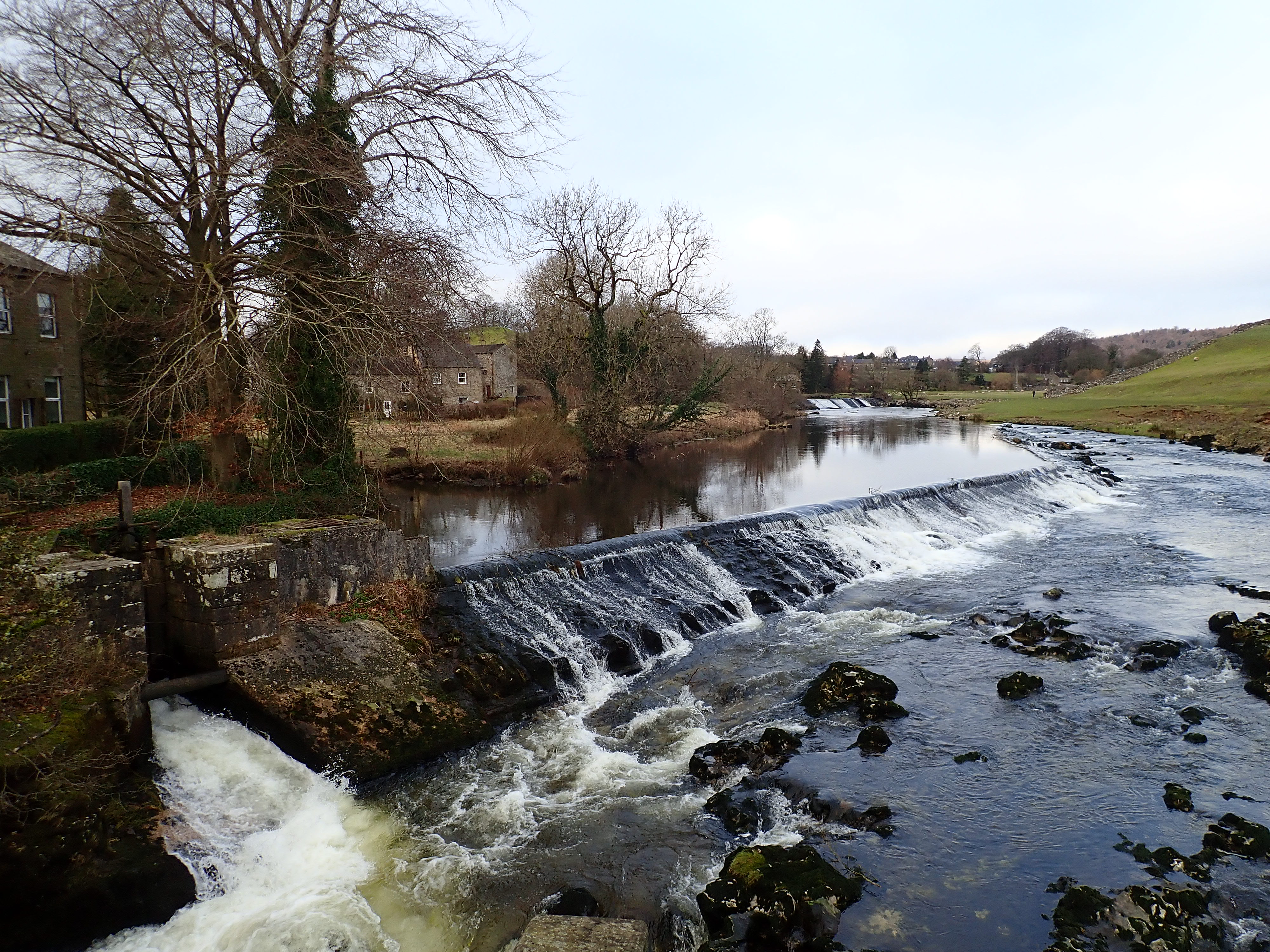
Within sight of Tin Bridge is Linton Falls Hydro. This is a hydroelectric power station sitting on the upper Linton Falls weir. The first hydroelectric power station on this site began operating in 1909, in an age when electricity had to be produced and used locally. This earlier power station distributed its electricity across Grassington using cables attached to the chimney stacks of the houses. It operated until 1948, when the nationalisation of electricity production and introduction of a national electricity grid made it redundant. However, in 2012, a new power station began generating electricity from the old building by diverting water over two Archimedean screws.
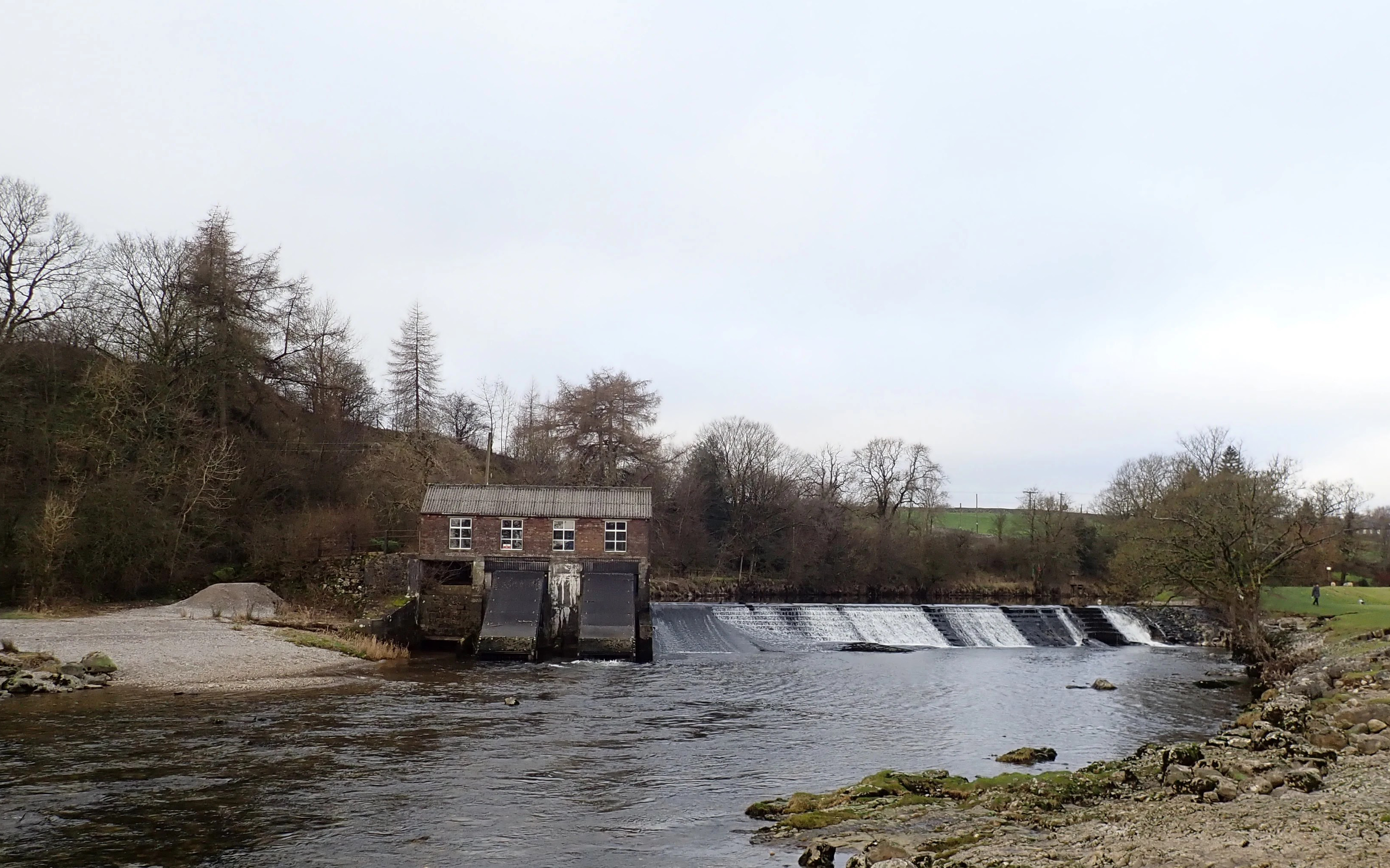
As I walked past the power station I could hear a faint hum of machinery, while I could see the water churning at the bottom of one of the dark ramps that exited the old brick building.

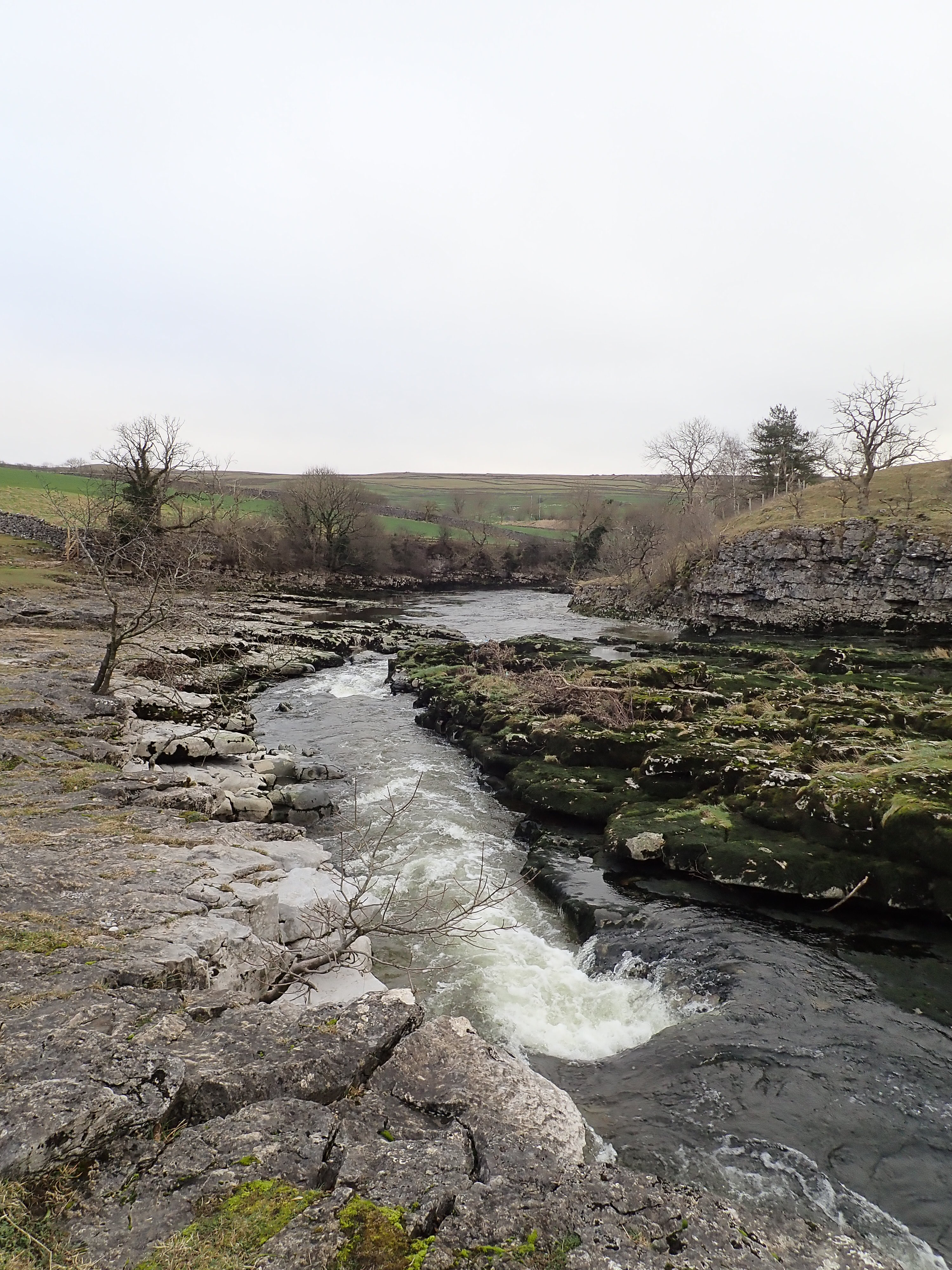
From the power station, I followed a muddy path between the Wharfe and the edge of Grassington until I came to Grassington Bridge. I crossed over the road and picked up a path that headed across a field to meet the Wharfe. Someone had dug a shallow trench into the mud to show where to walk through a sea of muddy footprints. On the other side of the river there was a line of houses sitting on a high bank, with gardens that sloped steeply down to the water. I soon left the houses behind as I followed a narrow path running by the river. This took me to one of the highlights of the walk – an area where the riverbed and shores became rockier, and where the Wharfe had cut a short gorge. The path heads above this gorge before dropping back to the riverside again. The last time I was here trees and bushes had blocked my view of the white water below, but they were now bare and so I got a good view of the Wharfe rushing over the limestone.
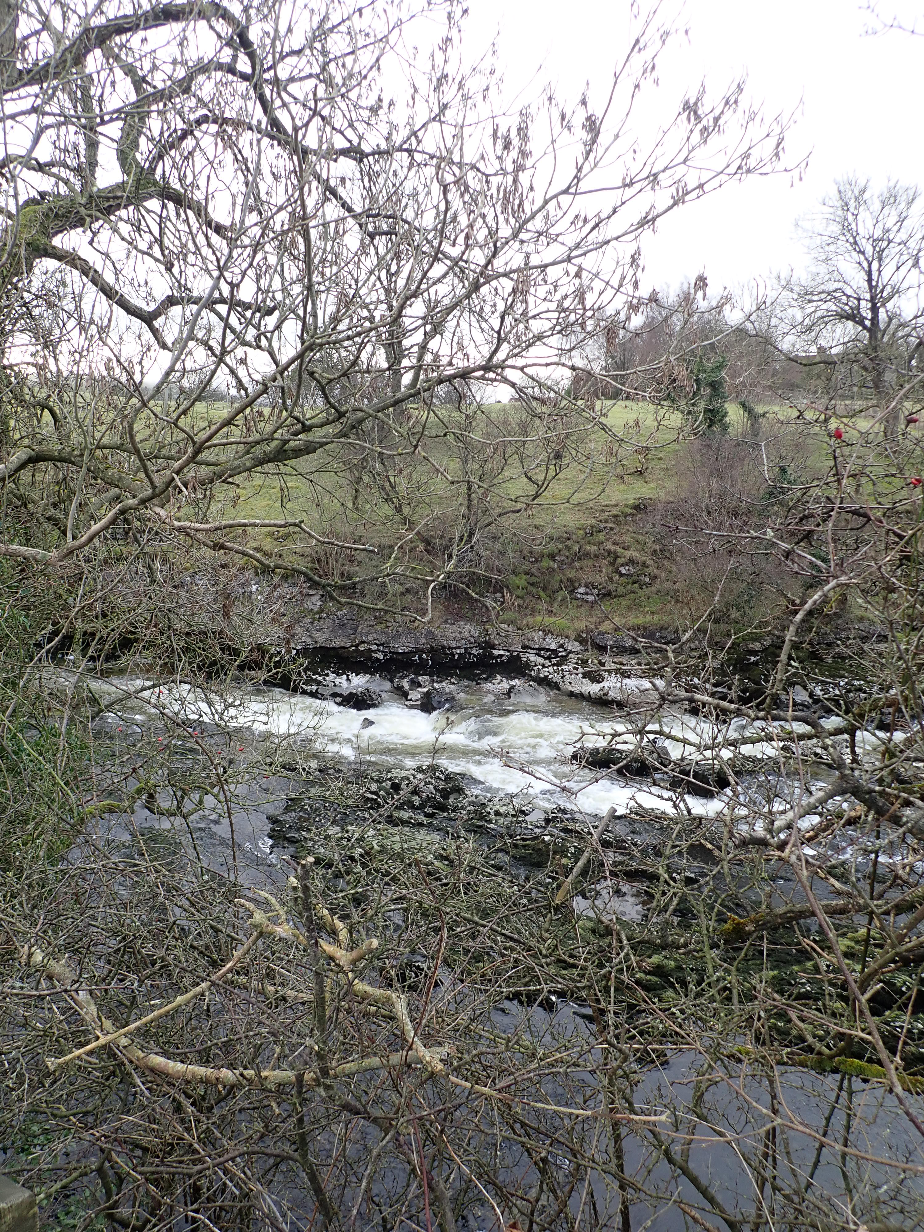
Just beyond the gorge is flat rock that pinches the river from either side and forces it into a trough. This is Ghaistrill’s Strid. The word “strid” is Old English for stride or step, the implication being that this is a section of the Wharfe that someone could stride over. Even with my long legs, I think that striding over Ghaistrill’s Strid is wildly optimistic. I’d want to take a good run up if I ever felt inclined to try to leap over this stretch of water and, even then, I’m not confident I would make it to the other side.
I really like Ghaistrill’s Strid. It’s a pretty spot, with the fast-flowing water, and the interesting shapes and colours of the limestone. After this, the Wharfe widens and becomes more sedate. I walked alongside the river, past fields and then into Grass Wood Nature Reserve.

This is a lovely, peaceful wood that sits on the slopes of a U-shaped valley moulded by the Wharfe. My favourite spot in this wood is a rocky beach sitting in the bed of the river, overhung by trees with twisting roots.


Not long after leaving the beach, I reached a road and walked along this for the next couple of kilometres, passing fields, sheep, and the occasional barn. In distance I could make out the dramatic overhang of Kilnsey Crag.
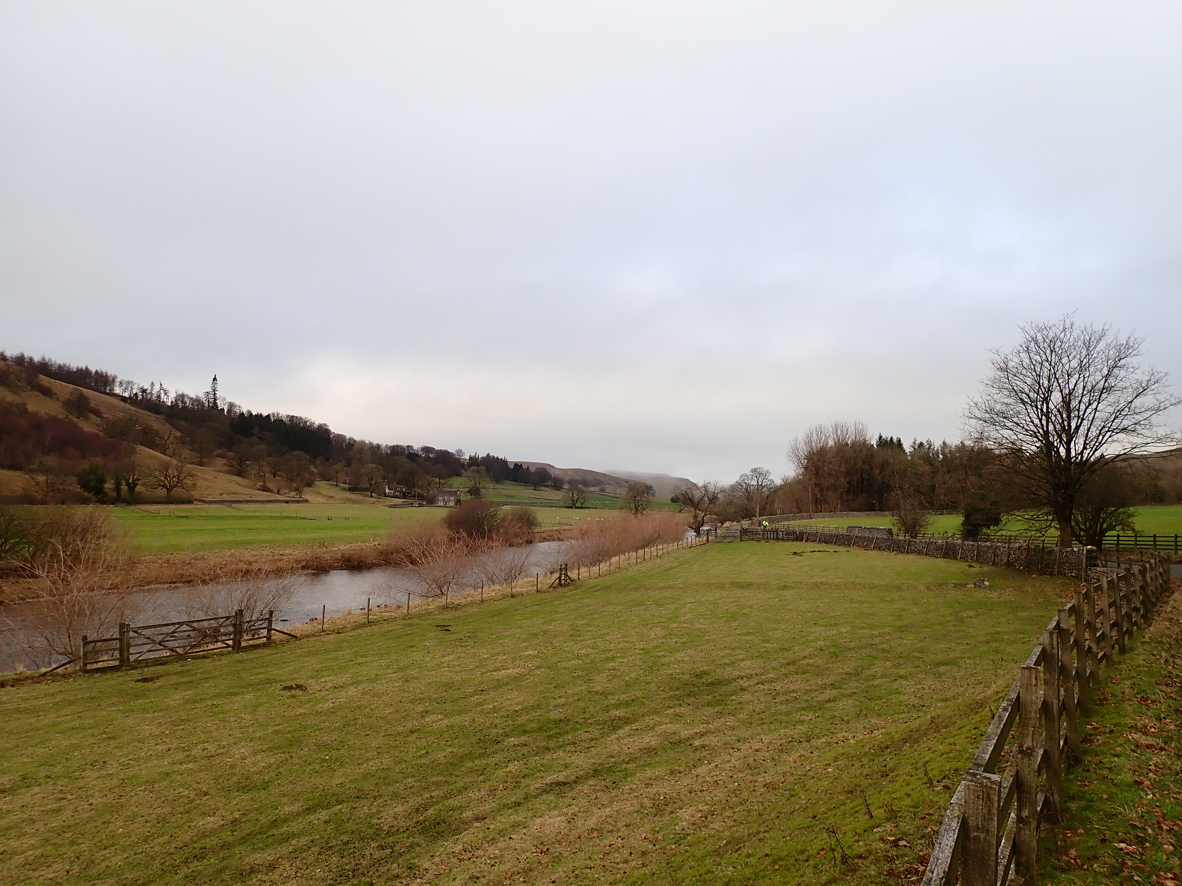
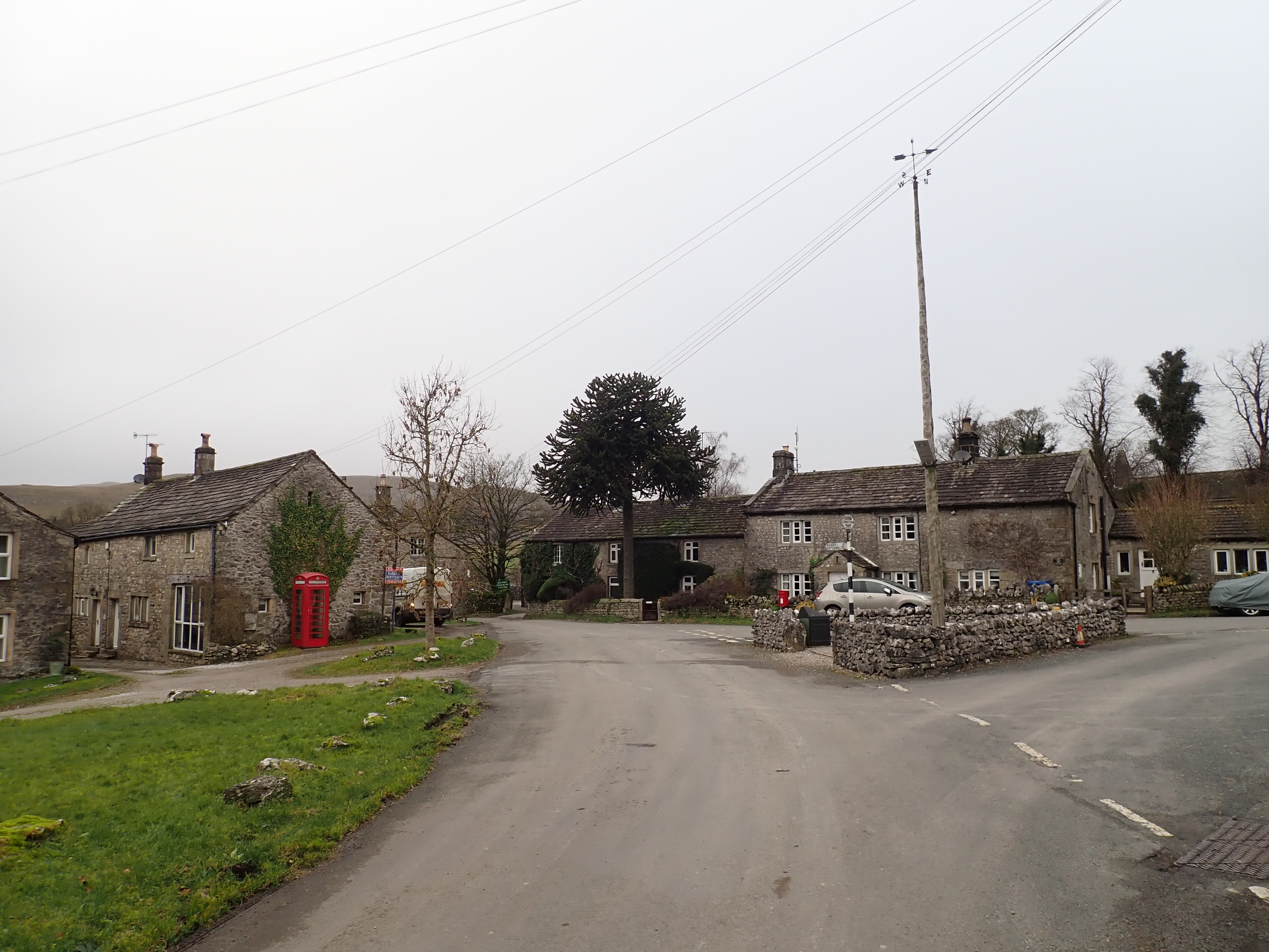
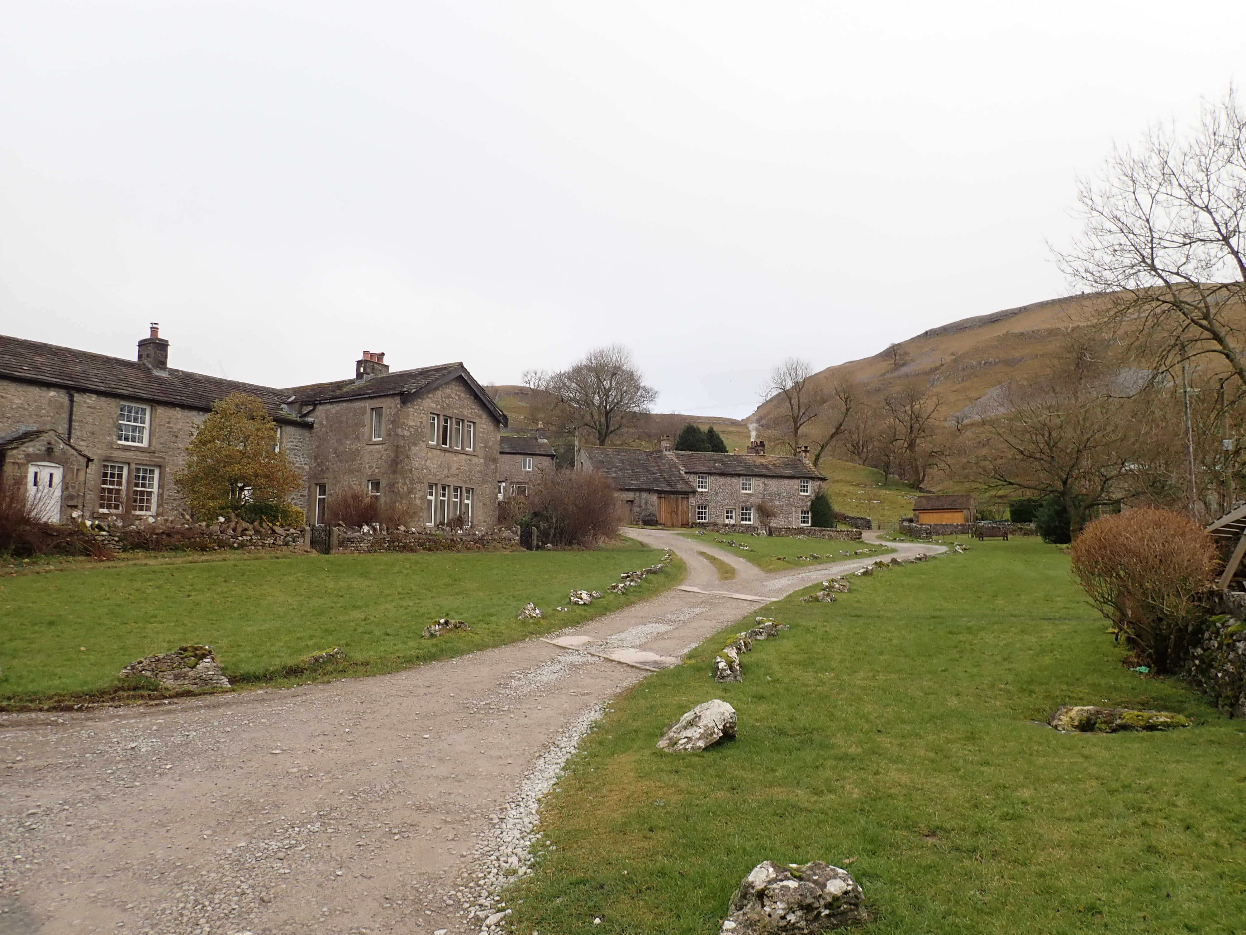
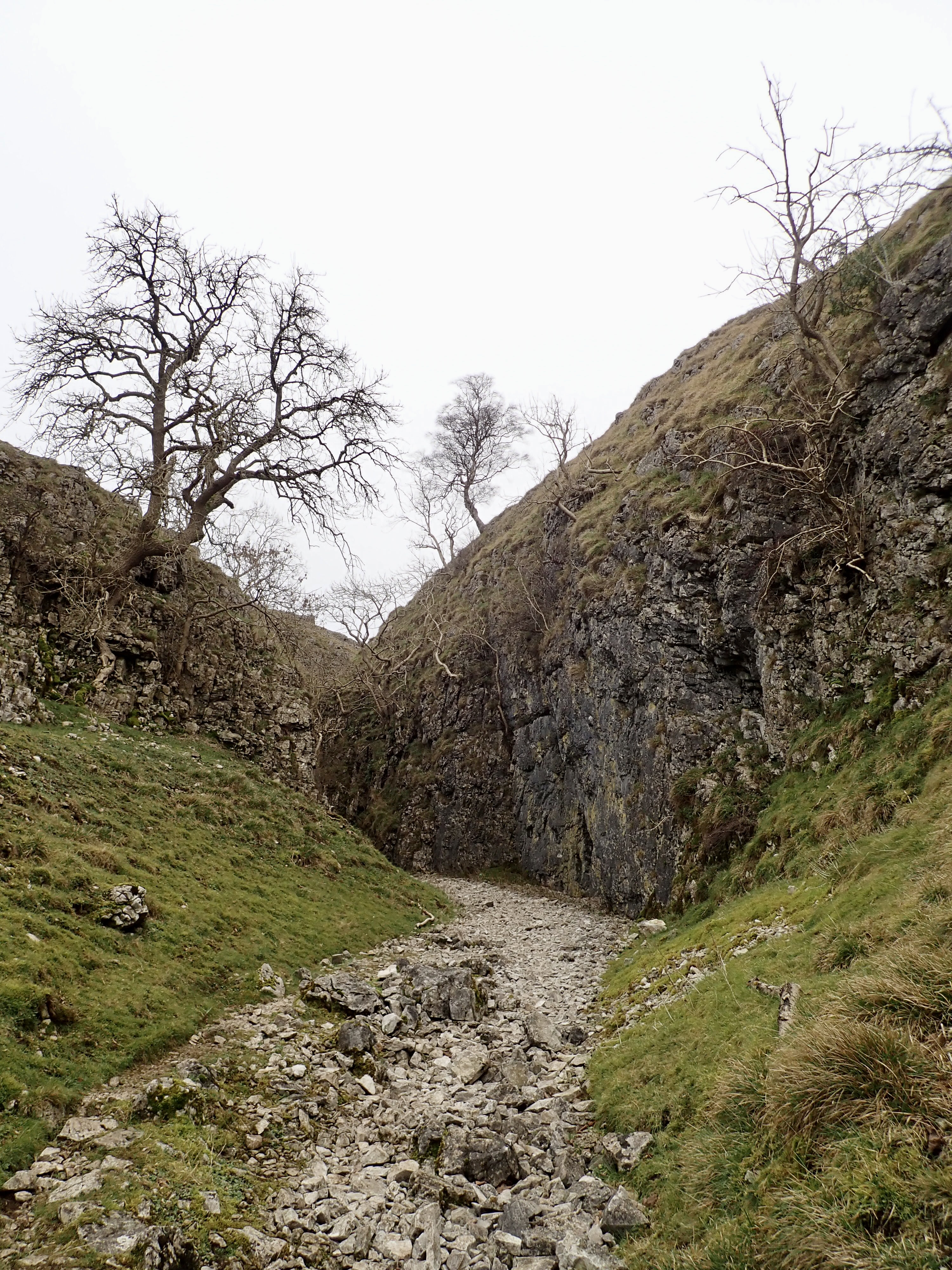
I eventually arrived in the small village of Conistone. It a village of pretty, limestone grey cottages and with a maypole topped by a weathervane in its centre. I turned right at the maypole to go along a track that led out of the village, and into the gorge and valley of Conistone Dib.
Conistone Dib was probably formed in the last ice age as a drainage channel for glacial meltwater. It’s now a fun way to get from Conistone to the top of the East flank of Wharfedale.
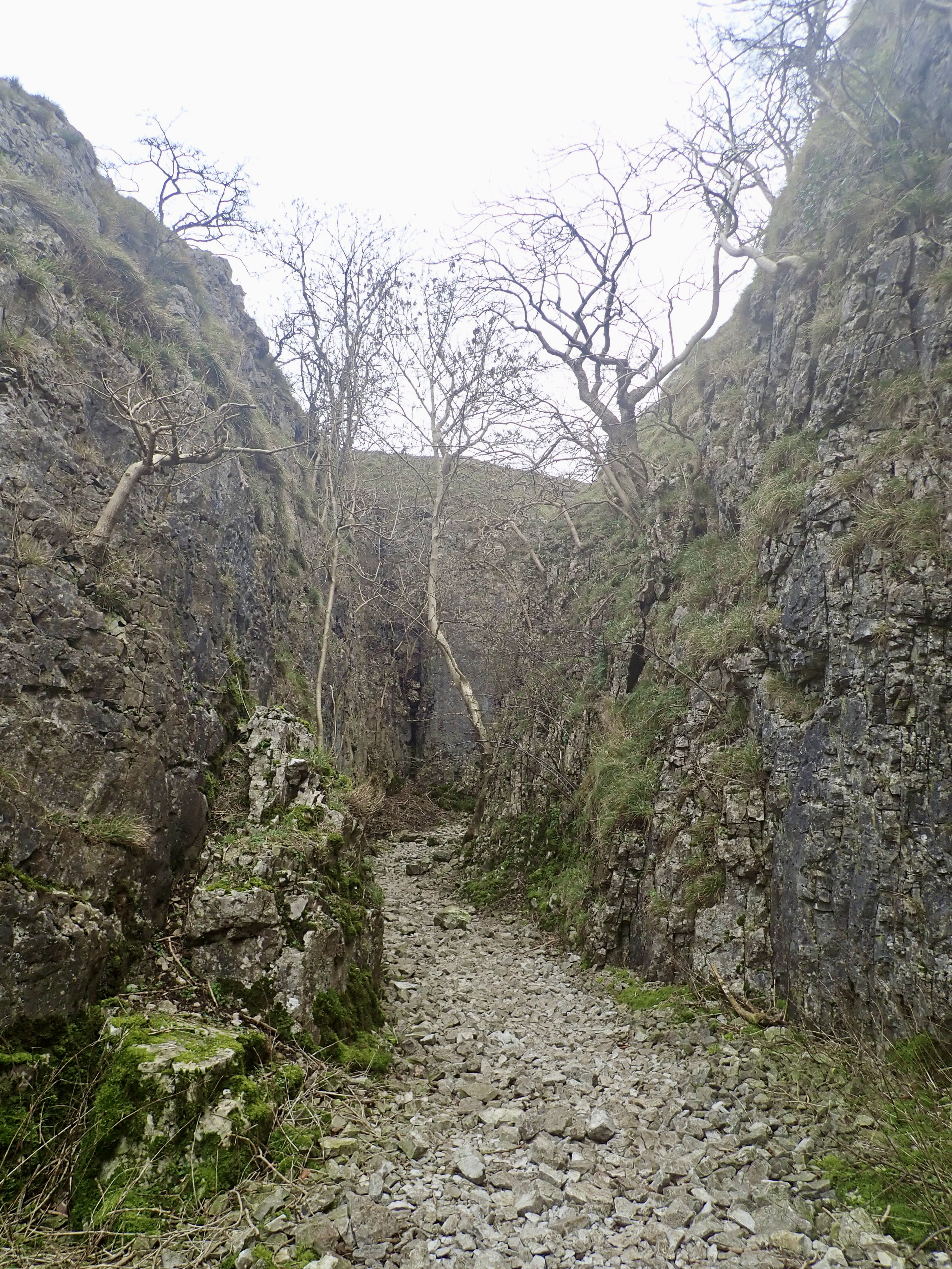
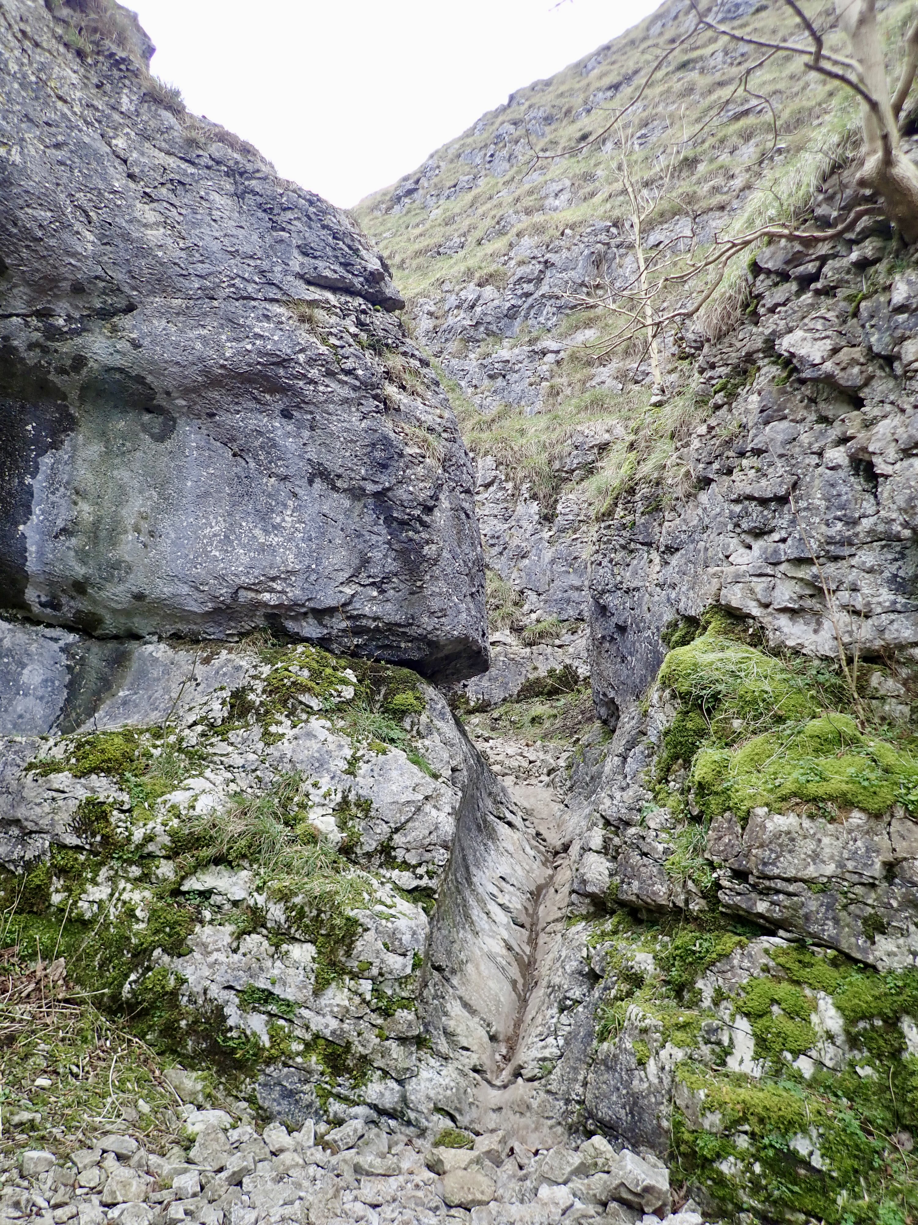
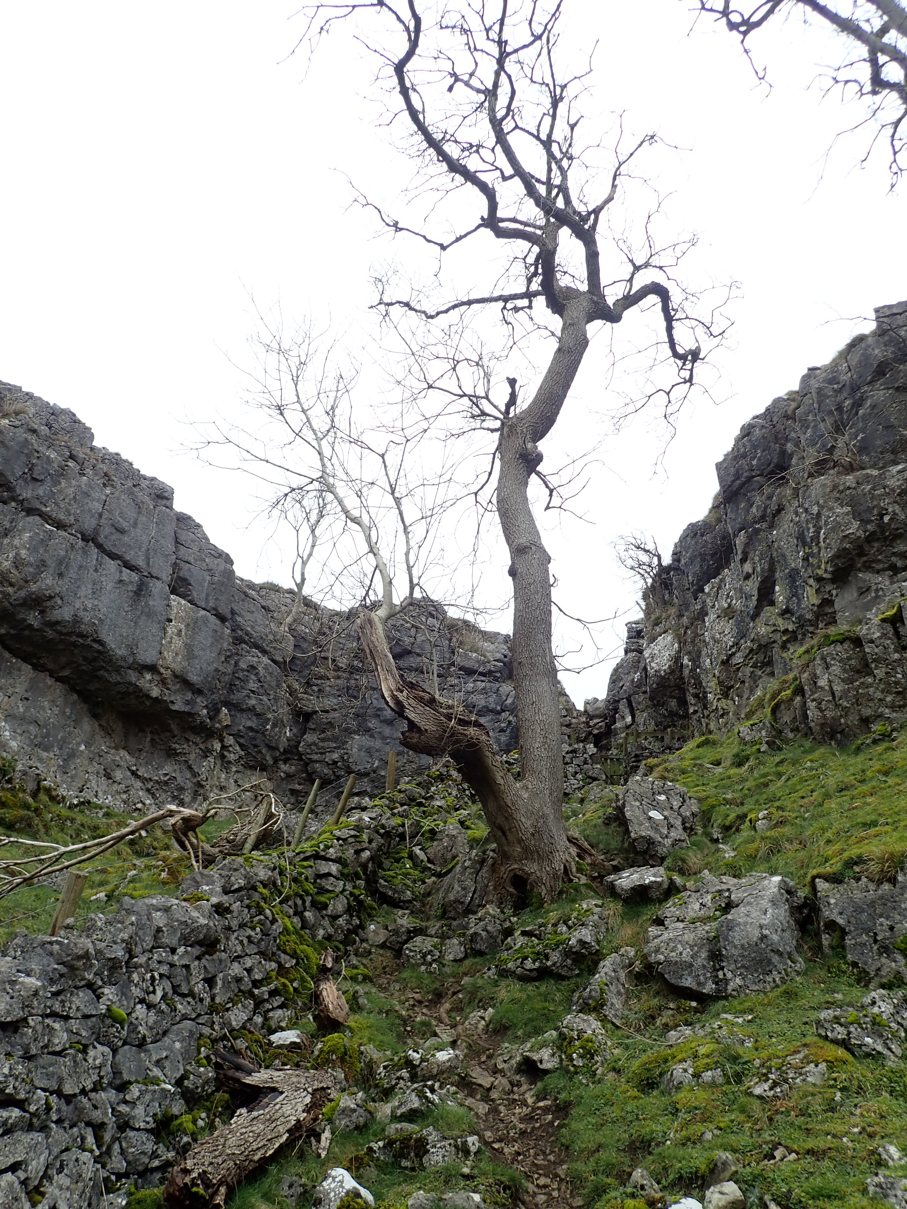
The start of Conistone Dib is via the large, stone steps of a dry waterfall. Shortly after this, the rock-strewn path goes through a twisting gorge, at the end of which the path goes up through a narrow gap where long-gone water has cut a half-pipe into the stone. This gap is my favourite section of Conistone Dib.

The gorge then gives way to a valley that gradually widens. The valley begins with scree covering its sides before it turns and becomes grassy. This is good place to see a phenomenon I’ve seen elsewhere in the Yorkshire Dales – mole hills running in lines along the edge of the footpath. This is probably because this is the easiest ground for moles to dig their tunnels in, but it looks as though they’re engaged in marking the footpaths in some sort of exercise in landscaping.
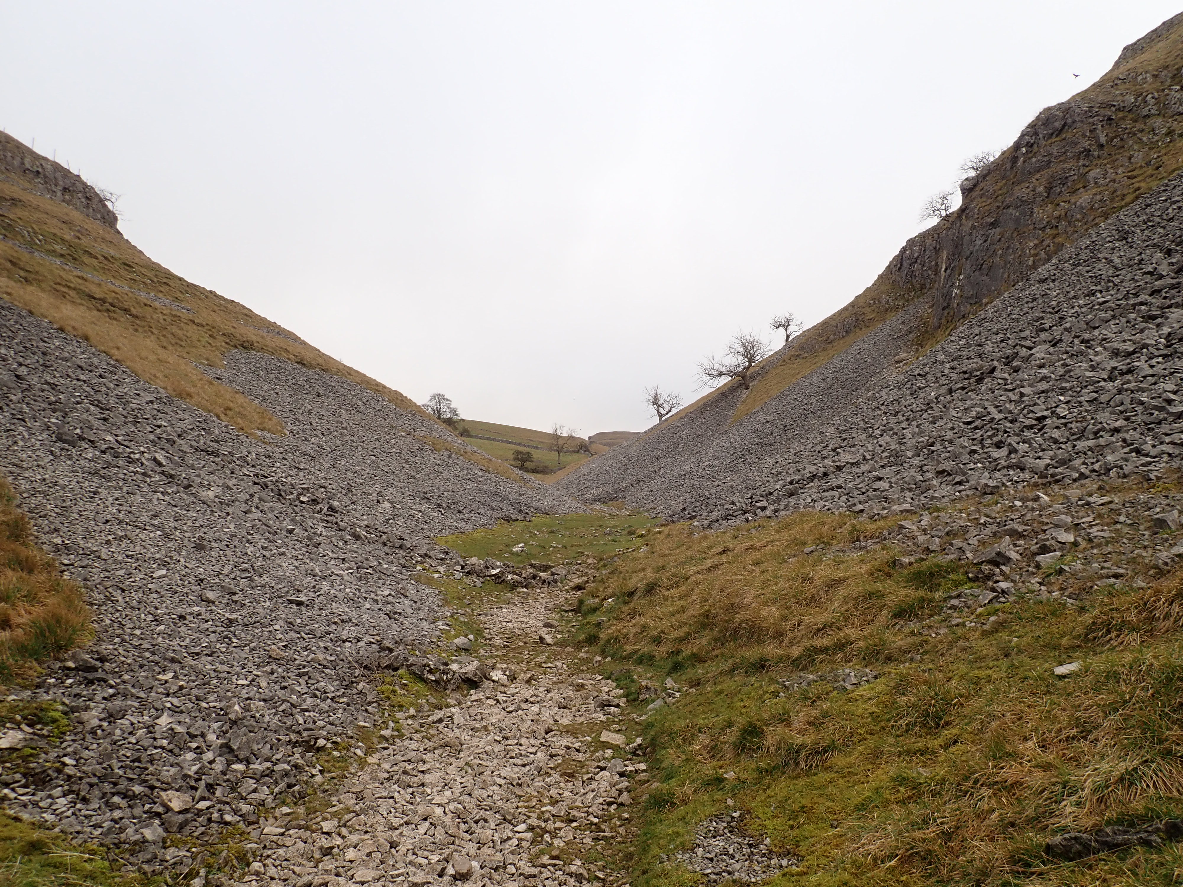


The valley eventually steepens, and its walls draw together until they meet in a V-shaped limestone scar. A rocky path leads to a wooden gate, and then the short scramble up the centre of the V which leads onto the tops. The way up Conistone Dib is a route that brings a smile to my face and was one of the highlights of this walk.

After enjoying the view, I set off along The Dales Way back towards Grassington. This route took me across moorland broken up by limestone pavement and outcrops. It also passes a dramatic 150-year-old limestone kiln that I think looks more like a remnant of some dark, medieval tower than an agricultural construction. Farmers would load limestone into the top of the kiln, and then burn it for three days. The resulting lime was then spread over the fields to reduce the acidity of the soil, and so improve the growth of the grass.


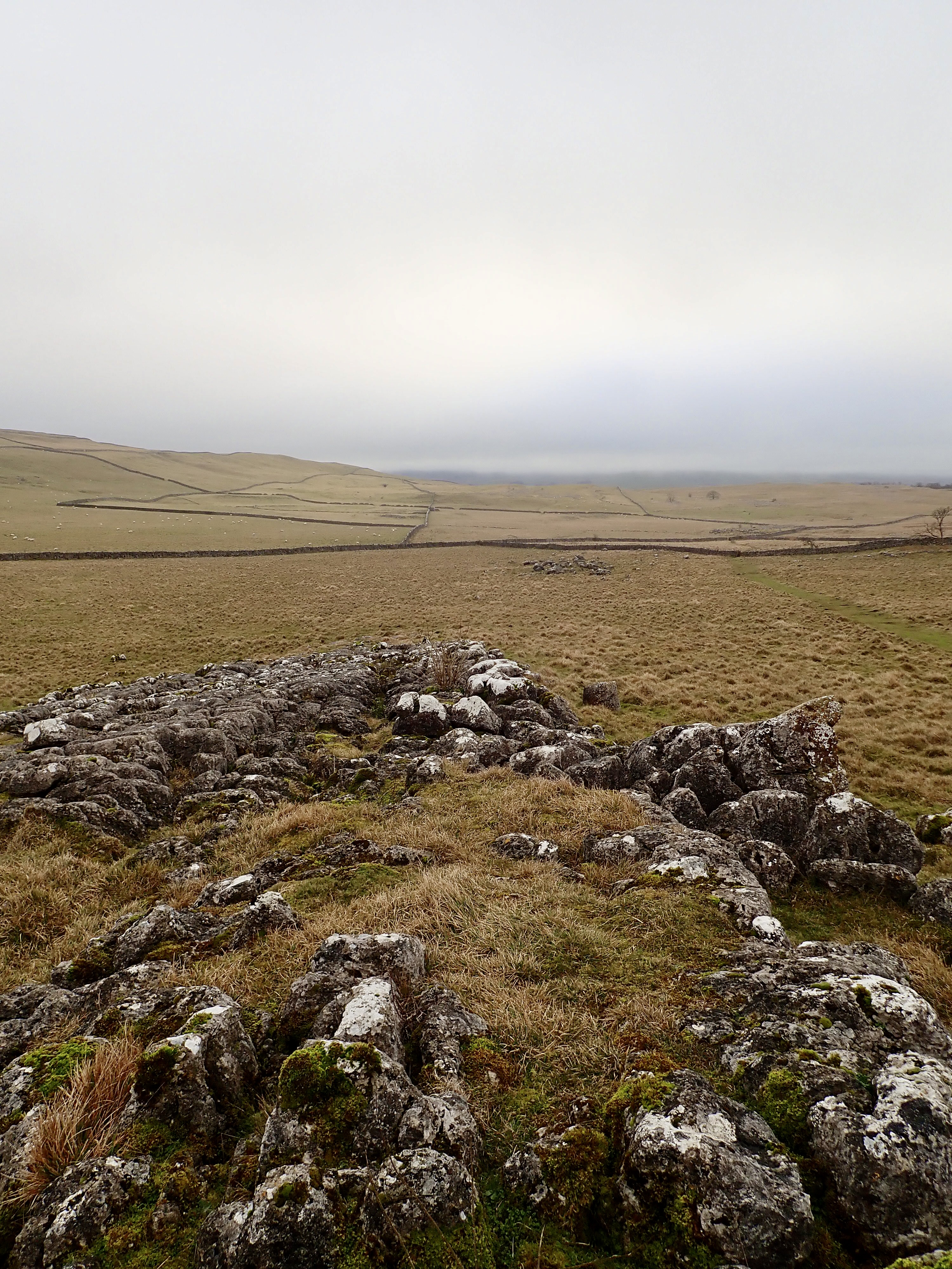

The last section of the walk gave me the chance to enjoy looking at the amazing shapes and features of limestone pavement. It was then a walk through fields back into Grassington.

VERY much my old stomping ground before I moved. We did Conistone Dib regularly from the age of first starting to walk right until just before I moved up here. Didn’t know about t’other strid though – I always thought there was just ‘our strid’ at Bolton Abbey. Yours looks VERY wide to jump! People do jump the Bolton Abbey one – and sometimes fail…
Also interesting to hear the probably meaning of the word strid too.
Conistone Dib’s certainly a good walk as a kid. I took my son up last year and then went on to Conistone Pie.
The Strid at Bolton Abbey is definitely more famous. I wouldn’t want to try jumping that one either.
I wouldn’t be daft enough to jump any of ’em – the landing rocks are way too slippery with all the spray and its quite a long way anyway.
I’m in complete agreement with you on that.
One nasty guy once jumped it and then tried to call his dog over to him. His dog knew how dangerous it was and really didn’t want to jump. The guy did it deliberately for a laugh! 😦
That’s terrible, cruel behaviour.
I think that how someone behaves to animals and what someone finds funny are fairly good indicators of their personality.
totally agree – it’s one indicator I use before deciding whether to be sociable with someone or not!
Definitely a walk worth seeking out. Lots of highlights for a short walk. Sedber Lane is a classic and you got a good photo of it.
I’ve just followed it on the map and realise I don’t think I have been right up Conistone Dib, though I remember climbing on Bull Scar one time.
Out of interest I was in Bradford’s Industrial Museum this week and they have recovered and preserved the steam engine from Linton Mill when it was demolished. It was named ‘Victor’
It’s a great walk. It’s easy to avoid/miss the final section of Conistone Dib by taking the footpath that heads out of the valley not long after Bull Scar. I saw a couple taking that route when I was up there.
I didn’t realise that there was climbing on Bull Scar. I’ll have to check it out the next time I’m there.
It’s nice to know that the Linton Mill engine was saved. I was surprised about how little I was able to find out about the mill. There’s not much online, and I didn’t see a sign by the Wharfe explaining what used to be there.
I remember being impressed by Sedber Lane when doing the Dales Way. Hats off to those dry stone wallers !
Absolutely. I’ve only ever been involved in building one drystone wall. It wasn’t very long, and it was certainly not elegant, but it increased my appreciation and admiration for the people who can build walls as perfectly as those at Sedber Lane.