
I felt a bit despondent as I read the sign saying that one of the bridges at the top end of Angram Reservoir was closed. No reason was given, but the reason didn’t really matter. If I couldn’t get over the River Nidd where it flowed into the reservoir, then I was not going to be able to complete my planned walk around Scar House and Angram Reservoirs. I thought about heading somewhere else, but decided that I would head out as I had intended, see what I found, and change my plan if I needed to. I was keen to do this walk, and the reasons I was keen didn’t change simply because a bridge was shut.
My main reason for wanting to do this walk was to see the most remote part of Nidderdale. Angram and Scar House Reservoirs sit at the top of this dale, where the peak of Great Whernside bookends the valley, and where empty moors rise from their shores. The homes and farms that are ubiquitous in Nidderdale are quickly left behind as you move away from Scar House Dam. The café, toilets, and car park just before Scar House Dam are reached by a 7km drive along a private road from Lofthouse. By going there on a weekday in early spring, I hoped to experience this relatively remote area at its quietest.

Nidderdale is full of history. From the 12th Century, this part of Upper Nidderdale was owned by the Cistercian monastery of Byland Abbey. They established several granges (farmhouses with outbuildings) where lay brothers and/or tenant farmers worked the land to provide the Abbey with resources and income. The granges of Angram and Westhouses are now below the waters of Angram Reservoir, while the grange of Haden Carr is submerged under Scar House Reservoir. Another grange was established at Lodge, and, while the remains of Lodge are above water, the building of the reservoirs still brought about the end of this hamlet. One of my reasons for wanting to do this walk was that I was curious to see its ruins.
The reservoirs themselves are also of historic interest. They were built by the Bradford Corporation to supply Bradford with water. The construction of Angram Reservoir began in 1904, but the First World War delayed its completion until 1919. Work on building Scar House Reservoir began a couple of years later and finished in 1936. I’d seen the impressive, castellated Scar House Dam when I walked the Nidderdale Way last year. I’d also used that visit to look at the remains of the temporary settlement of Scar Village which had housed the workers and their families while Scar House Reservoir was built. However, the Nidderdale Way goes no further up the dale and so I didn’t either. I now wanted to see the one part of Nidderdale I had not visited previously.
My last reason for wanting to do this walk was to see the source of the River Nidd. I feel an affinity with the Nidd after having followed its course while walking the Nidderdale Way, and I was curious to see where the river begins. This walk would not actually get me to this point, as the Nidd starts at Nidd Head Springs on the side of Great Whernside, several kilometres from the end of Angram Reservoir. However, my walk would get me close enough to view the source from a distance. This was something I could do even if the bridge was closed. In fact, I could fulfil my other reasons for this walk even if I had to turn around at that bridge. I therefore walked towards Scar House Dam and away from that sign in the carpark.
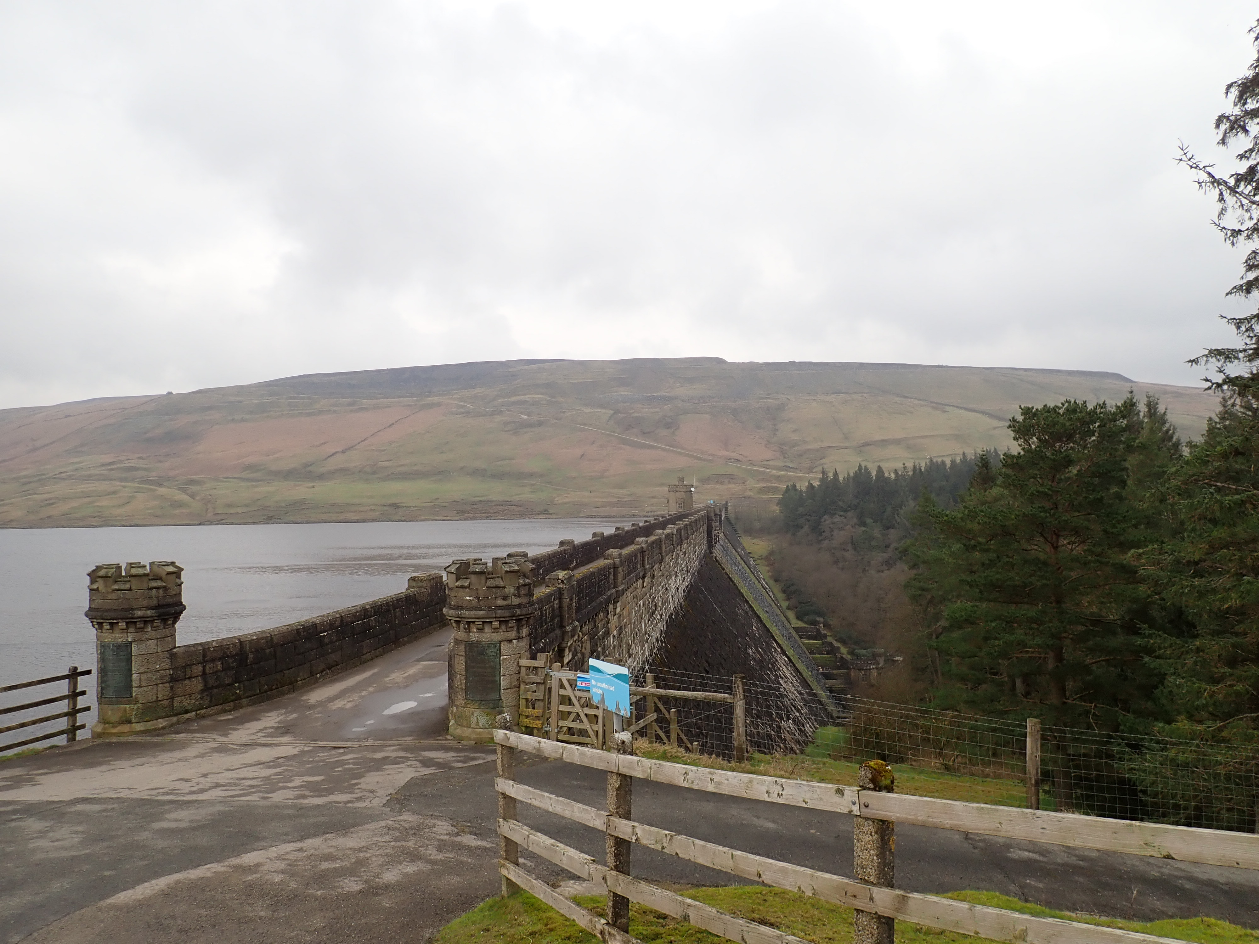
When I was last here, walking over Scar House Dam had been an uplifting experience as I listened to an orchestra of bird song coming from Scar Plantation, with house martins flying around me. Walking past Scar House Dam on a grey spring day several months later felt bleaker, with the sound of bird song replaced by the roars of a cold wind that was cutting up the dale. However, I was happy to be walking, and to see curlews and oystercatchers as I followed the track running above Scar House Reservoir.

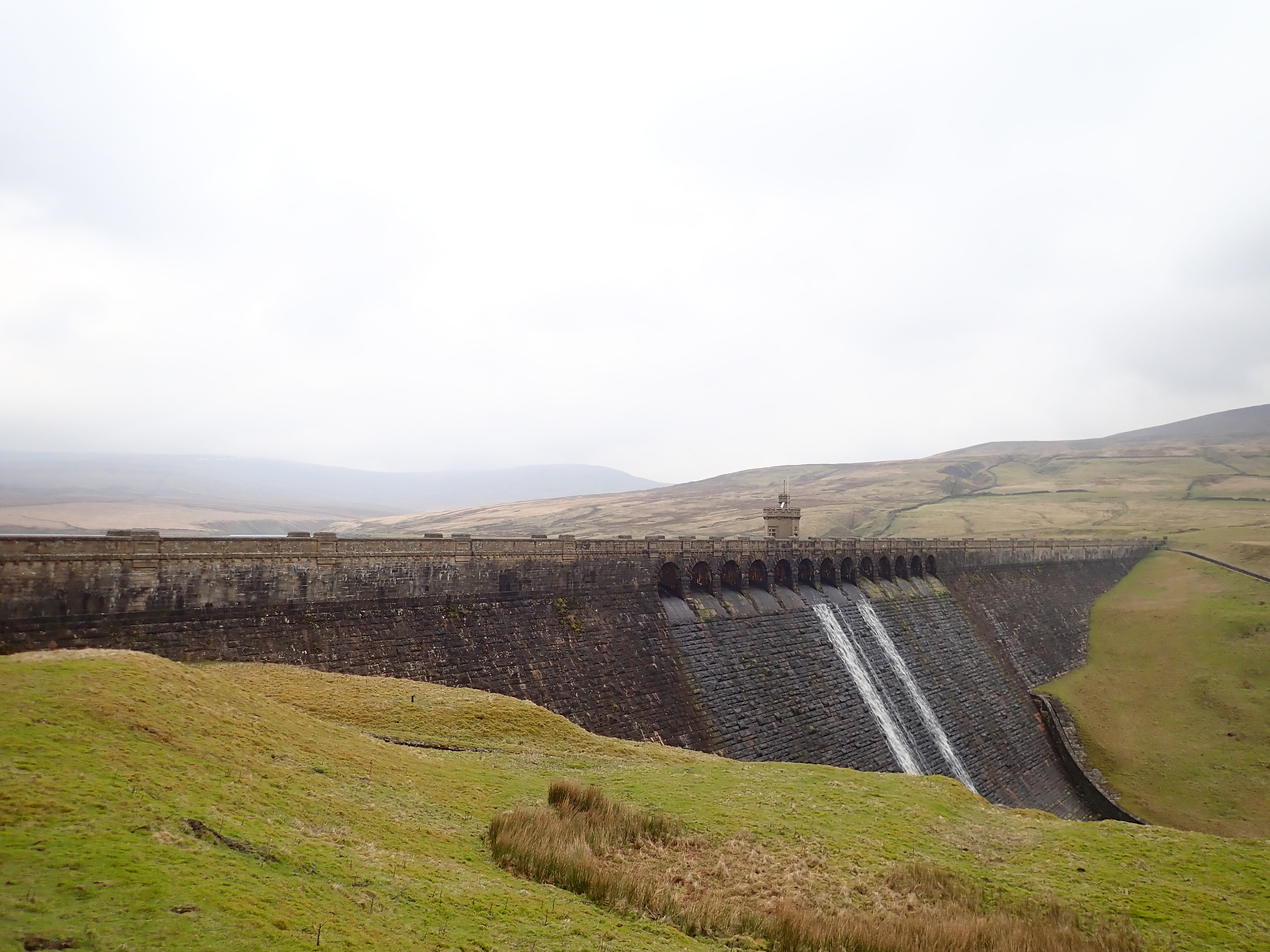
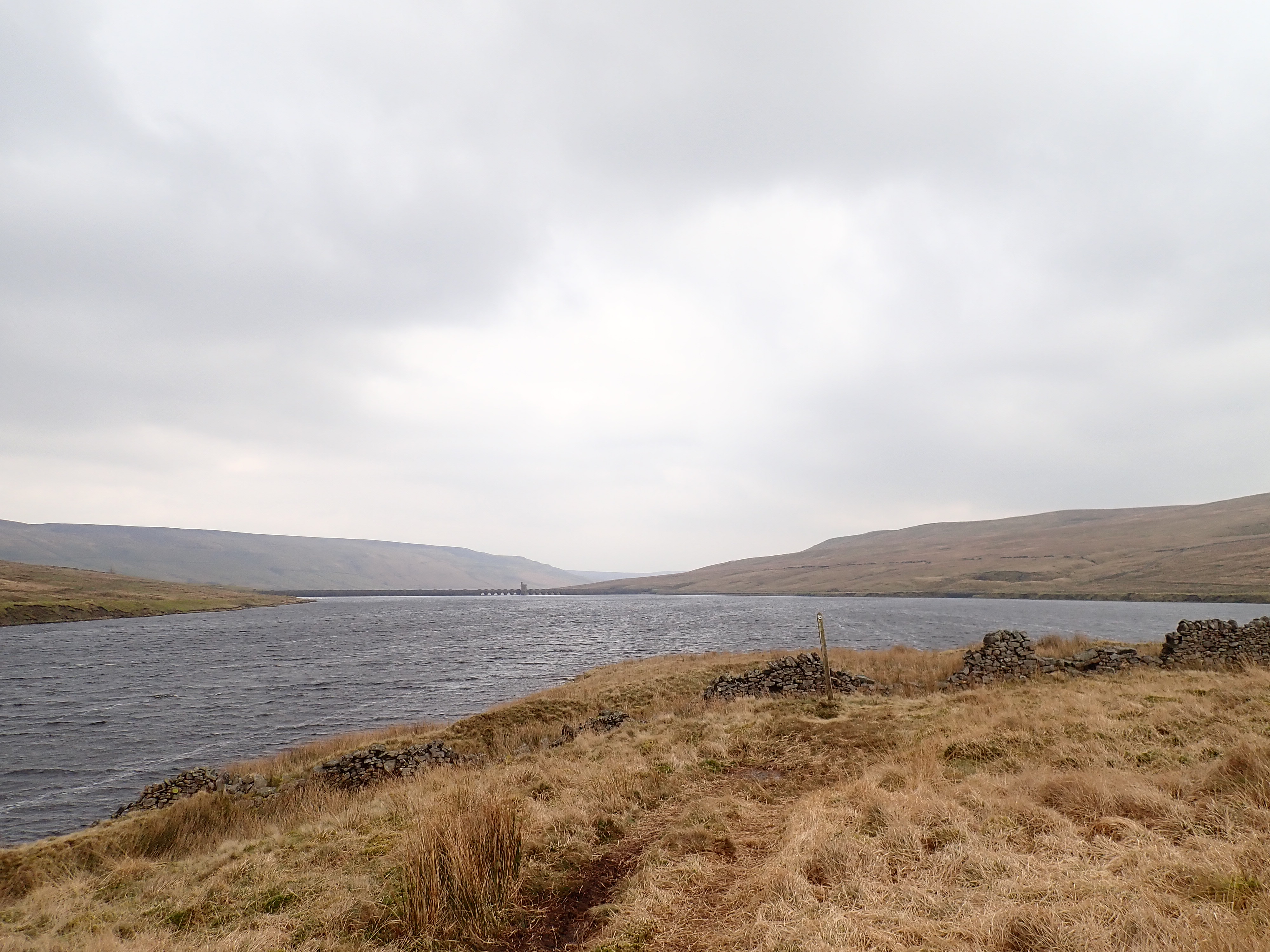
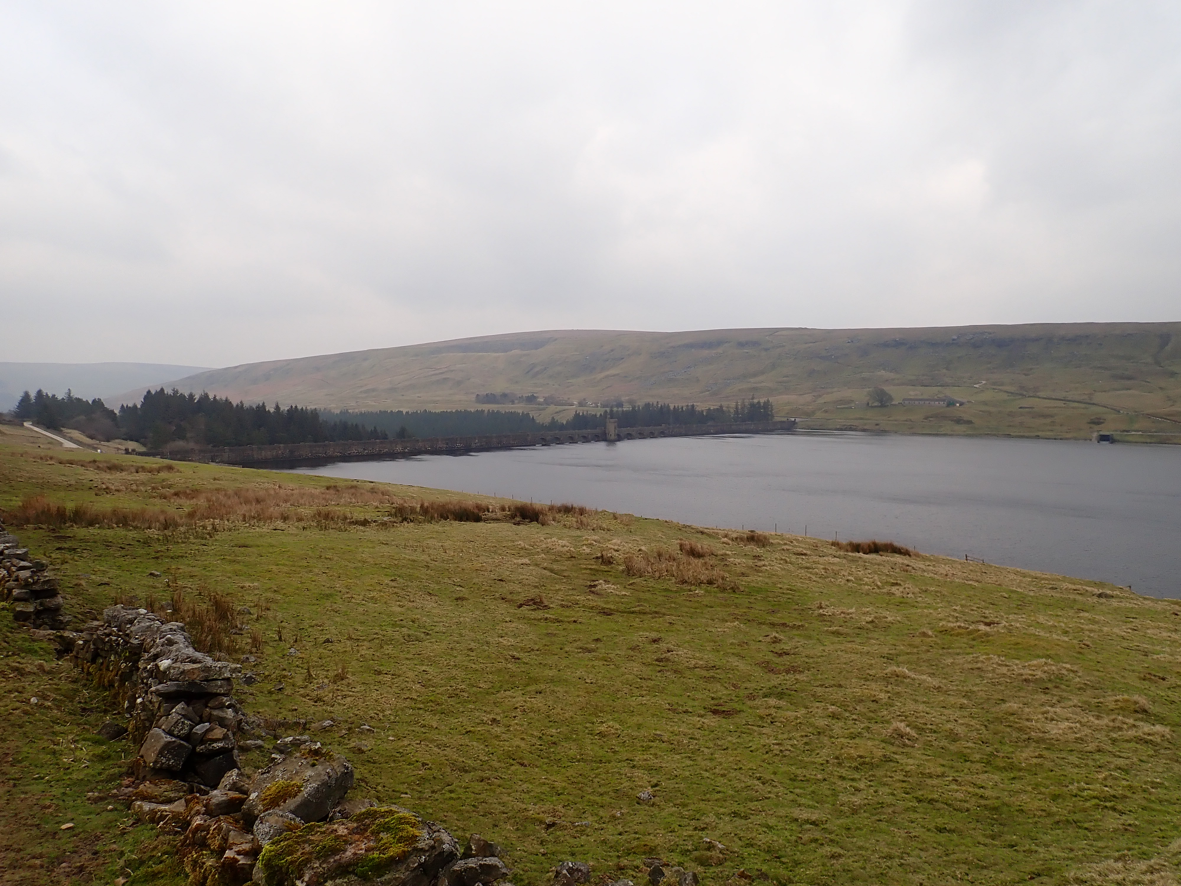
Across the dale was an isolated, lonely grove of trees that marked the site of Lodge, and I tried unsuccessfully to spot its remains. As the track curved to the left, the reservoir narrowed and the sides of the dale next to it steepened. The dark stone walls of Angram Dam came more and more into view as I continued along the track. Great Whernside sat in the distance behind the dam, with some patches of snow visible on its upper slopes. Angram Dam looked faintly ominous with its many blackened stones and in that cold, washed-out weather.
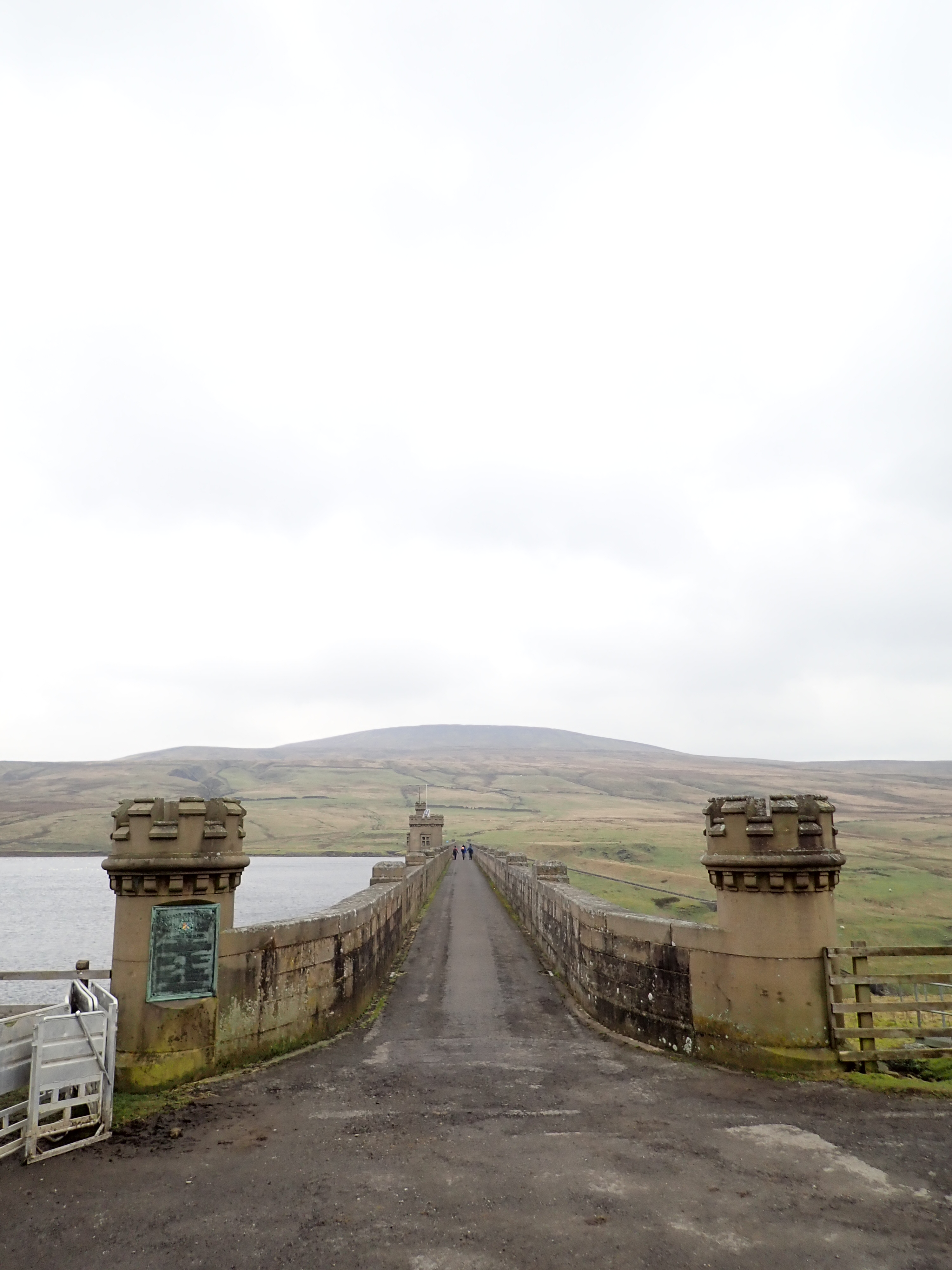
A group of walkers who had been keeping pace with me turned and headed over the dam. These were the last people I saw for a while, and I realised later that the only people I encountered all day were around Scar House Reservoir. I climbed a stile to take a track that hugged the shore of the quieter Angram Reservoir.
This track initially ran between the reservoir and a substantial stone-lined trench. This was one of two channels that run on each side of Angram Reservoir, and which were used to bypass the reservoir and maintain the level of the River Nidd during the construction of the reservoirs. These became obsolete once Scar House Reservoir was finished.

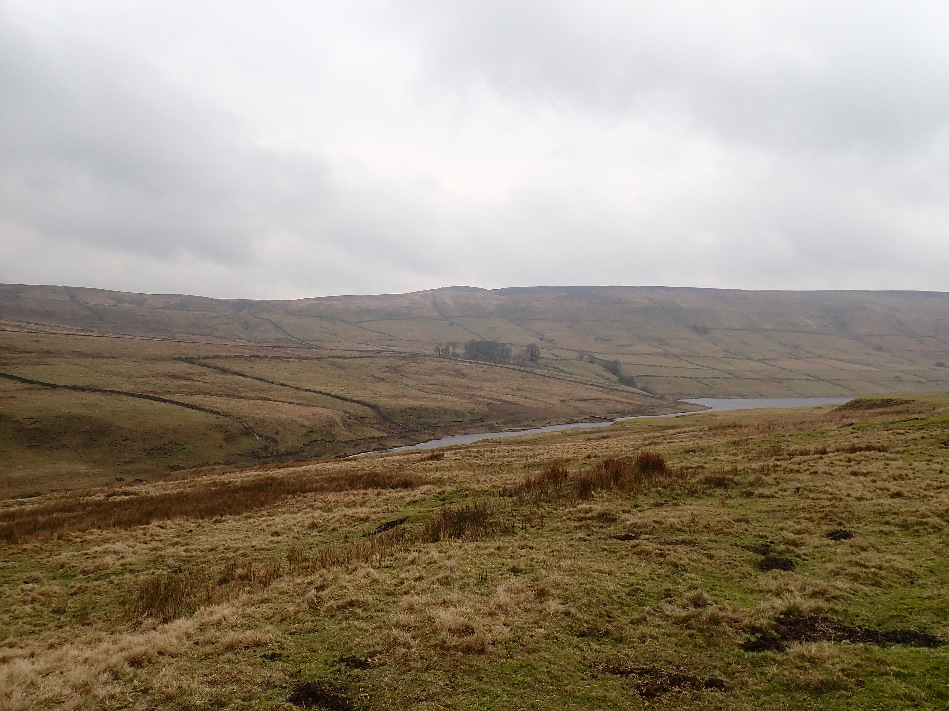
I crossed the channel by a modern, metal bridge, and continued along the track. This eventually led me to a heavily overgrown weir spanning a stream that fed the reservoir. I squelched up a side valley by a boggy path to reach a wooden bridge, crossed this, and then turned to go uphill. A rough and muddy path then followed the line of a promontory, gradually climbing as the land steepened away from the water. This formed one side of an inlet, at the head of which I could see another weir.


This was the most dramatic stage of the walk, and I was really enjoying myself. I was surprised by how remote and wild this place felt, considering that I was next to a man-made lake and probably only about 6km as the crow flies from the nearest village.

The path stayed high above the water until the inlet came to its narrowest point. It then dropped steeply down to the weir over which flowed the infant River Nidd. A wooden bridge ran across the top of the weir. I looked up this side valley to where the Nidd disappeared into the distance on the slopes of Great Whernside. I was pleased to have made it here, and headed down to the bridge.
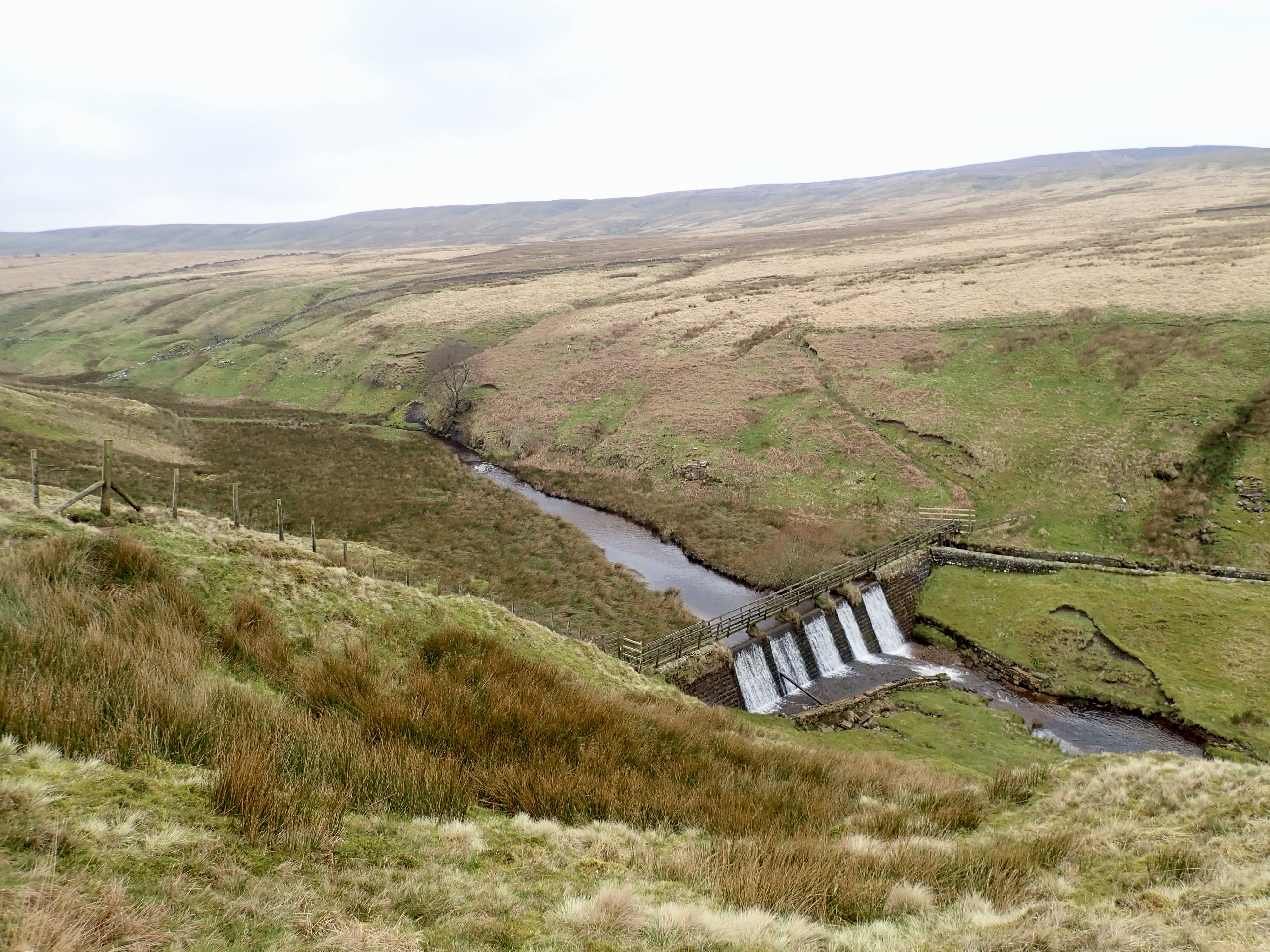
There was nothing obviously wrong with this bridge, but wooden fences attached at either end of it showed that Yorkshire Water were determined that people should not cross it. My guess was that the bridge had become rotten with age and exposure to the weather. I considered whether I could try to cross the river by the weir’s spillway but decided that its cobblestones were too deep in water, lichen-covered, and sloping for this to be a good idea. There would also be the issue of how to get across the bypass channel further up the slope on the opposite bank. I resigned myself to the idea that I was going to have to go back the way I had come and then cross Angram Dam to continue my route around Scar House Reservoir. I sat on the spillway wall and had lunch. Although a little disappointed, I was still happy because this was a glorious location, and I had seen the beginnings of the River Nidd.

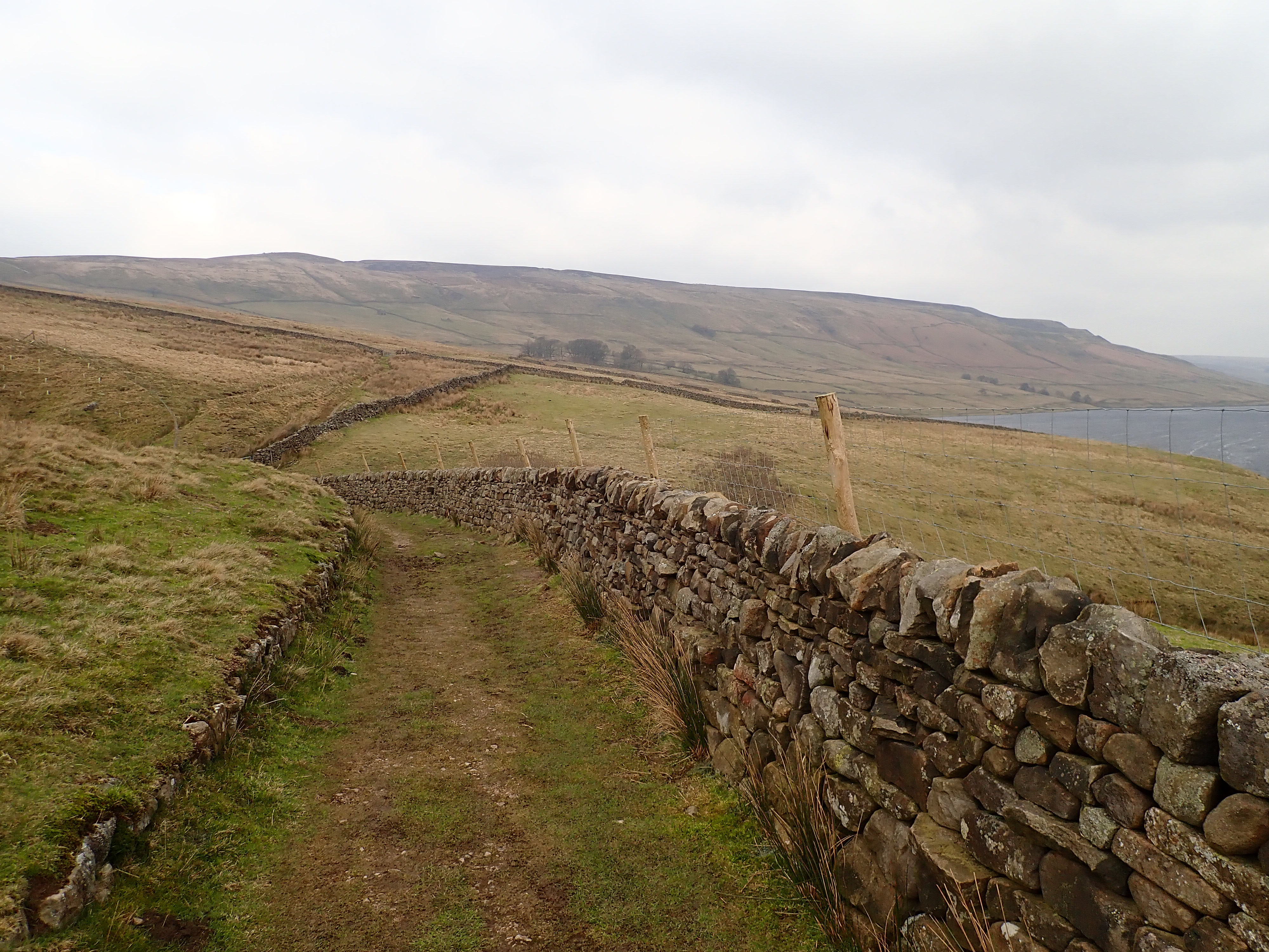
Once over Angram Dam, I followed a well-trodden path that traversed the dale and provided great views over Scar House Reservoir. This path came to a T-junction at a rough lane enclosed by drystone walls. I climbed over a stile before taking a left, and shortly after, a right, to carry on along a track down the valley. Off to one side of this was an attractive drystone arch over a gill, and in line with the course of a partially collapsed drystone wall. I’d never seen an arch like this before, and I stopped to wonder if the wall had once run over the top of it or if someone had built it with the rubble from the wall. It was a fun little construction, either way.


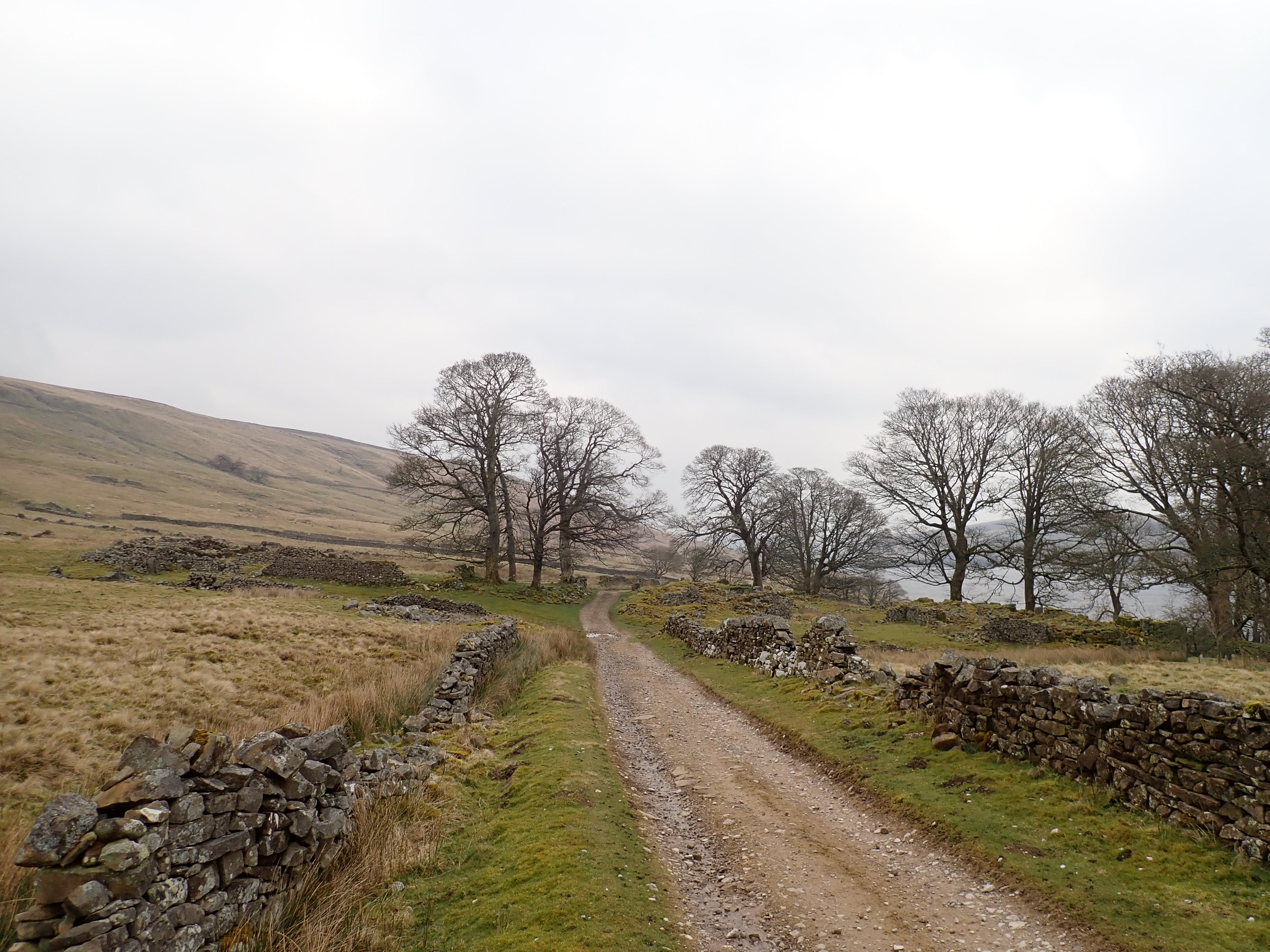
The track took me to a grove of sycamores that stood around and amongst the ruins of Lodge. This hamlet lay on what was a major packhorse route connecting England and Scotland and was probably founded in the 13thCentury. The dissolution of the monasteries in 1538 led to most of the land around Lodge being sold to wealthy local families, who had then rented the land out to yeoman farmers. Lodge then continued for several hundred years as a small, thriving community.
The Bradford Corporation bought Lodge in 1904 and then asked the residents to leave. I remember reading somewhere that this was because of concern that having this settlement so close to the reservoir would lead to the water being polluted, but I’ve not been able to find where I read that. In the end, the last inhabitant of Lodge left in 1929, when their lease expired.


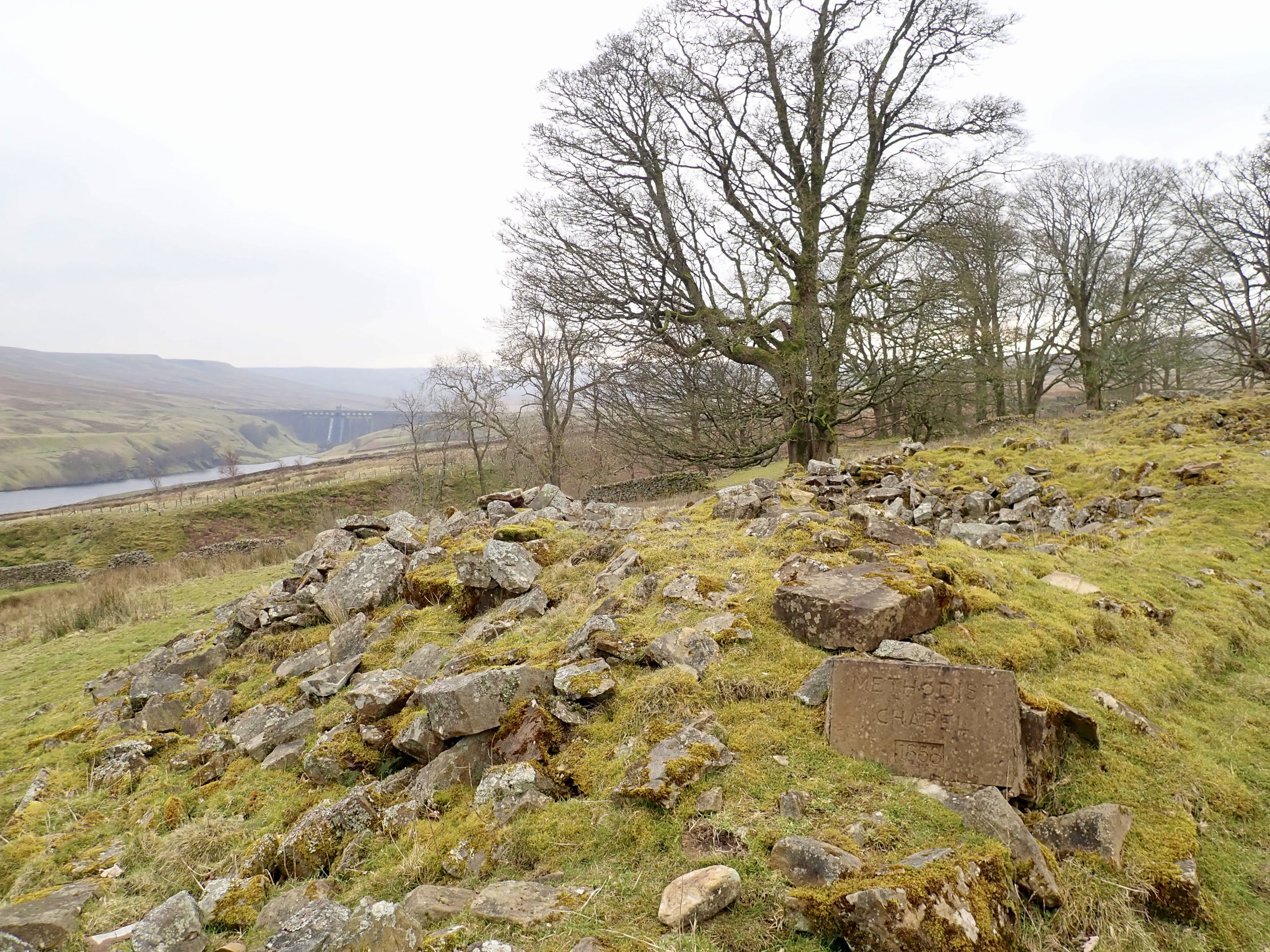
I felt sad walking around the ruins of Lodge, thinking of the people who had made this their home. This feeling was compounded by my surprise at how dilapidated Lodge now is. In less than a hundred years, several farmhouses and barns had been reduced to low, broken walls in which there are the traces of windows and doorways. Also visible were some floor slabs and the rusted shells of cooking ranges. Some of the buildings have collapsed so much that they are just piles of stones covered in moss. Most of these ruins are from the 1830s. The homes were traditional Yorkshire longhouses, which featured domestic accommodation at one end and housing for livestock at the other. There was also a Methodist chapel, which was built in 1858 by Moses Raynor with a loan of £77 and 8 shillings. It took the congregation 24 years to pay back this loan using money earned from renting the pews. The chapel is now a pile of stones, slowly being buried by grass.
A gentle track from Lodge traversed the side of the dale to Scar House Dam, giving great views back to Angram Dam and Great Whernside. I crossed the dam and headed back to my car, pleased that I had now walked the length of Nidderdale.

Further Information
This walk is described in the book Nidderdale & Ripon by Paul Hannon (2014), which is part of the Walking in Yorkshire Series by the publishers Hillside. It’s also described in a factsheet produced by Yorkshire Water (although the walk is described in an anti-clockwise direction rather than in the clockwise direction that I went).
For a shorter walk, it’s possible to just walk around Scar House Reservoir. This is described in this factsheet.

That looks a lovely and remote walk – I’m a big fan of desolation and wish I’d done that while I was still living in the Dales – don’t suppose I will now. The ruins of Lodge are so sad I think I’d have had to do the walk the other way around myself.
Love the little arch – really great find. And that upper weir is really pretty and in a great setting too.
It was a good walk. I’m hoping to repeat it at some point so that I can go the full way around Angram Reservoir. However, I might go in a different season so that I can see how the reservoirs look different then.
I hope you do get a chance to see that part of the Dales.
I really like that little arch too, and I do wonder about it. Even though it’s small, it seems to me that it would have taken time, effort, and consideration to build. I’m curious to know who built that arch, when they built it, and why. I’ll probably never find out, but I can still get enjoyment from seeing it.
That’s quite remote up there and yet not far from a carpark. Like you I never went farther when walking the Nidderdale Way.
It’s a nice compromise in that respect. A relatively accessible place with enables you to enjoy some solitude in nature.